Almost a month before Halloween is upon us again, so why not start a series of “world’s scariest” posts. Personally, things that scare me are things beyond my control. Take the weather, for example. Mother Nature can at once be both breathtaking beautiful and unspeakably terrifying (see tornado). Let’s run with the latter and examine the ten scariest weather scenarios…
10. The Northern Lights
Okay, so may be this is not a “weather event,” per se. But it’s an atmospheric phenomenon, so it’s close enough. It involves solar radiation and electrically charged particles and physics and what not. Contrary to popular belief, the lights can be seen throughout the United States depending on the conditions. One thing is for sure: If I walked out my door, glanced up at the sky and I saw what’s in that pic above, I would be seriously freaked out.
9. Ice storms
Little about winter weather is really that scary, but ice storms are the exception. Unpredictable, hard to forecast, devestatingly destructive, ice storms are among nature’s cruelest storms. The power company is never amused when one threatens. It has also led to the setting of, like, three Stephen King novels.
8. Raining animals
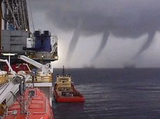
Some times, it literally rain’s cats and dogs. Well, fish at least. Some times, when especially power storms cross large bodies of water, updrafts and waterspouts can literally extract fish from the water, toss them into the atmosphere and rain them back down onto dry land. Again, if I walk out of my house and into a downpour of fish, I’m freakin’ out.
7. Derechos
From Wikipedia, a derecho is a widespread and long-lived, violent convectively induced windstorm that is associated with a fast-moving band of severe thunderstorms usually taking the form of a bow echo. Derechos are usually not associated with a cold front, but a stationary front within a highly buoyant, warm airmass. A warm weather phenomenon, derechos occur mostly in summer, especially July (in the northern hemisphere), but can occur at any time of the year and occur as frequently at night as in the daylight hours.
In other words, it’s a fast-moving, long-traveling, devastating wind that you can see coming at you on radar, but there’s nothing you can do about it. They produce widespread damage similar to that of tornadoes.
6. Gust fronts/Sand storms
These are lumped together because they look so similar. A gust front is a wall of clouds and ground debris preceding a severe thunderstorm. Also known as an outflow boundary, gust fronts can spawn weak tornado-like cyclones known as gustnados, which can cause significant damage. When a gust front, or sand storm for that matter (basically a wall of wind-driven sand) comes upon you, daylight can be totally obscured. It is easily one of the most eeriest sights in nature.
5. A supercell thunderstorm
A supercell is a singular, exceptionally powerful thunderstorm capable of producing vivid lightning, large hail, heavy rain and violent tornadoes. Supercells are characterized by exceptionally tall storm clouds, often exhibiting spirals or striations and form primarily in states where tornado activity is moderate to high.
4. Heat waves/drought
Heat waves and drought, lumped together because they so often happen in concert, are frightening since they are unpredictable year-to-year, season-to-season and because of their devastating short and long term effects. These two phenomenons can kill thousands immediately and destroy crop yields for decades, wiping out civilizations and causing everything from refugee crisis’ to civil wars (see, Darfur). Doesn’t help that Alabama has been through both this year, with the drought, unfortunately, continuing on.
4. Hurricanes/storm surge
These two events (the surge is a by-product of hurricane winds) make the largest storms on Earth some of the most frightening as well. Hurricanes are, in essence, complex thunderstorms, sometimes hundreds of miles wide, fed by warm ocean waters and producing widespread wind and water damage as well as spawning countless tornadoes. Hurricanes have plagued coastal regions for eons, most recently wiping parts of the U.S. Gulf Coast off the map with the landfall of Katrina in August 2005. The energy produced by the storms is equal to thousands of Hiroshima bombs and the fear that they have instilled within coastal residents is enough to spark mass evacuations, widespread hysteria, grocery store runs and hikes in insurance and gas prices. Storm surge is a phenomena caused when hurricane winds push a gigantic mound of water up and beyond the shoreline, flooding coastal areas with as much as 20 feet of seawater and effectively erasing miles of shoreline. After the initial flooding, waves on top of the rapidly rising waters batter buildings and roadways once hundreds of feet from the shoreline, reducing them to ruins.
2. Lightning/Ball Lightning
The most unpredictable and deadly weather phenomenon is lightning. It strikes with little to no warning, can single out people and buildings with randomness, affects every state in the U.S. regularly and causes hundreds of deaths each year. A bolt of lightning can travel at a speed of 100000 mph and can reach temperatures approaching 60000 °F, hot enough to fuse soil or sand into glass channels. There are over 16 million lightning storms every year.
As if that wasn’t scary enough, thousands of people have reported witnessing a phenomenon known as “ball lightning.” Here’s Wikipedia to explain: Ball Lightning refers to reports of a luminous object which varies in size from golf ball to several meters in diameter. It is sometimes associated with thunderstorms, but unlike lightning flashes arcing between two points, which last a small fraction of a second, ball lightning reportedly lasts many seconds. Ball lightning reportedly tends to rotate or spin and can possess odd trajectories such as veering off at an angle or rocking from side to side like a leaf falling. Fireballs can also move with or against the wind. Other motions include a tendency to float (or hover) in the air and take on a ball-like appearance. Its shape has been described as spherical, ovoid, teardrop, or rod-like with one dimension being much larger than the others. Many are red to yellow in colour, sometimes transparent, and some contain radial filaments or sparks. Other colours, such as blue or white occur as well. Pilots in World War II described an unusual phenomenon for which ball lightning has been suggested as an explanation. The pilots saw small balls of light “escorting” bombers, flying alongside their wingtips. Pilots of the time referred to the phenomenon as “foo fighters,” initially believing that the lights were from enemy planes. However there are other theories as to the identity of the foo fighters.
1. Tornadoes
Pretty easy call here: a menacing, roaring, dark column of wind rotating hundreds of miles an hour with the potential to debark trees, drive straw through tree trunks and skin animals alive. There is nothing about a tornado that isn’t scary, from the supercell thunderstorms that spawn them, to the sirens that wail upon their approach, to their serpent-like stature, to their incredible destructive power. Even better, they some times strike with little warning flying low enough below the clouds to escape detection on radar screens.
They have a penchant for spawning in the middle of the night when few people can hear the warnings. They tend to develop in mass, with some outbreaks totaling in the hundreds. They can move at highway speeds over great distances (the legendary Tri-State tornado) or they can sit over the same area for minutes on end (the legendary Jarrell, Texas tornado, which remained stationary for several minutes, ripping pavement off the ground, wiping homes clean off their foundations, and tearing the hide off of exposed livestock). They can be a few feet in diameter or up to two miles wide. Size, however, doesn’t determine strength, as some EF5 storms, the strongest of all, can be 40 feet wide or 400 yards wide.
RS


![Validate my RSS feed [Valid RSS]](valid-rss.png)