+ Play Audio | + Download Audio |
March 19, 2008: Did you know that there's a new breakfast food that helps meteorologists predict severe storms? Down South they call it "GrITs."
GrITs stands for Gravity wave Interactions with Tornadoes. "It's a computer model I developed to study how atmospheric gravity waves interact with severe storms," says research meteorologist Tim Coleman of the National Space Science and Technology Center in Huntsville, Alabama.
According to Coleman, wave-storm interactions are very important. If a gravity wave hits a rotating thunderstorm, it can sometimes spin that storm up into a tornado.
Above: Click on the image to watch a gravity wave roll over Tama, Iowa, on May 7, 2006. Credit: Iowa Environmental Mesonet Webcam.
What is an atmospheric gravity wave? Coleman explains: "They are similar to waves on the surface of the ocean, but they roll through the air instead of the water. Gravity is what keeps them going. If you push water up and then it plops back down, it creates waves. It's the same with air."
Coleman left his job as a TV weather anchor in Birmingham to work on his Ph.D. in Atmospheric Science at the University of Alabama in Huntsville. "I'm having fun," he says, but his smile and enthusiasm already gave that away.
"You can see gravity waves everywhere," he continues. "When I drove in to work this morning, I saw some waves in the clouds. I even think about wave dynamics on the water when I go fishing now."Gravity waves get started when an impulse disturbs the atmosphere. An impulse could be, for instance, a wind shear, a thunderstorm updraft, or a sudden change in the jet stream. Gravity waves go billowing out from these disturbances like ripples around a rock thrown in a pond.
When a gravity wave bears down on a rotating thunderstorm, it compresses the storm. This, in turn, causes the storm to spin faster. To understand why, Coleman describes an ice skater spinning with her arms held straight out. "Her spin increases when she pulls her arms inward." Ditto for spinning storms: When they are compressed by gravity waves, they spin faster to conserve angular momentum.
"There is also wind shear in a gravity wave, and the storm can take that wind shear and tilt it and make even more spin. All of these factors may increase storm rotation, making it more powerful and more likely to produce a tornado."
"We've also seen at least one case of a tornado already on the ground (in Birmingham, Alabama, on April 8, 1998) which may have become more intense as it interacted with a gravity wave."
Above: Click on the graphic to play an actual Doppler radar movie of a gravity wave interacting with a rotating thunderstorm and making it stronger in northwest Alabama on Jan. 22, 1999. Credit: NOAA.
Coleman also points out that gravity waves sometimes come in sets, and with each passing wave, sometimes the tornado or rotating storm will grow stronger.
Tim and his boss, Dr. Kevin Knupp, are beginning the process of training National Weather Service and TV meteorologists to look for gravity waves in real-time, and to use the theories behind the GrITs model to modify forecasts accordingly.
Who would have thought grits could predict bad weather? "Just us meteorologists in Alabama," laughs Coleman. Seriously, though, Gravity wave Interactions with Tornadoes could be the next big thing in severe storm forecasting.
Let’s prepare even further ahead. While the weather is placid, make a plan now for where you will go when the worst occurs. Should your home become unlivable after an event, you will need a money resource and ID to hold out until your home is restored. To avoid these things being lost in the storm, prepare now what you will collect enroute to your shelter. Know where these items are at all times so you don’t spend precious time looking for them. Keep a bag or satchel at the ready to collect them on the run. Some of these items should include any cash, your checkbook, charge cards, driver’s license, and your car keys in case your vehicle survives. This is your survival kit, the seed to putting your life back together.
The National Weather Service classifies “severe” thunderstorms as producing ¾ inch diameter hail or greater, strong wind downbursts of 58 mph or more, or a storm producing a tornado. National outlooks for the probability of severe storms will be issued days ahead of time with suspected trouble areas covering whole regions of the country. Severe Thunderstorm and Tornado Watches are usually issued hours before storms appear or blossom into severe stage and may cover several states. If you are included in a Watch area, this is a good time to gather your valuables or take note of where they are. Watches are in effect for many hours and are not specific when or where any one location will experience severe thunderstorms.
While most receive their alerts via siren or the television crawl, the quickest reception will be through NOAA weather radio. Technology has come a long way since the old weather band radios. You can now purchase crystal controlled weather alert radios from a local electronics store. These modern day weather radios can be programmed to a local frequency to alert you of any warnings issued in or near your community. In non-threatening weather, you can use them to keep abreast of current weather conditions and forecasts, commercial-free. Warnings will interrupt the regular forecasts within seconds of their issuance from the National Weather Service. And the faster you are aware of the danger, the more time you have to take cover.
Keeping food safe during an emergency
March 20, 2008
The U.S. Department of Agriculture is providing recommendations to the regions affected by severe weather and flooding in the Central United States. USDA is hopeful that this information will help minimize the potential for foodborne illnesses due to food spoilage from power outages and other problems that are often associated with severe weather events.
“Power outages can occur at any time of the year and it often takes from a few hours to several days for electricity to be restored to residential areas,” said USDA Under Secretary for Food Safety Dr. Richard Raymond. “Without electricity or a cold source, foods stored in refrigerators and freezers can become unsafe. Bacteria in food grow rapidly at temperatures between 40 and 140 °F, and if these foods are consumed, people can become very sick.”
Steps to follow to prepare for a possible weather emergency:
- Keep an appliance thermometer in the refrigerator and freezer. An appliance thermometer will indicate the temperature in the refrigerator and freezer in case of a power outage and help determine the safety of the food.
- Make sure the freezer is at 0 °F or below and the refrigerator is at 40 °F or below.
- Freeze containers of water for ice to help keep food cold in the freezer, refrigerator or coolers after the power is out.
- Freeze refrigerated items such as leftovers, milk and fresh meat and poultry that you may not need immediately — this helps keep them at a safe temperature longer.
- Plan ahead and know where dry ice and block ice can be purchased.
- Store food on shelves that will be safely out of the way of contaminated water in case of flooding.
- Have coolers on hand to keep refrigerator food cold if the power will be out for more than 4 hours. Purchase or make ice cubes and store in the freezer for use in the refrigerator or in a cooler. Freeze gel packs ahead of time for use in coolers.
- Group food together in the freezer - this helps the food stay cold longer.
Steps to follow after the weather emergency:
- Keep the refrigerator and freezer doors closed as much as possible to maintain the cold temperature.
- The refrigerator will keep food safely cold for about 4 hours if it is unopened. A full freezer will hold the temperature for approximately 48 hours (24 hours if it is half full) and the door remains closed.
- Discard refrigerated perishable food such as meat, poultry, fish, soft cheeses, milk, eggs, leftovers and deli items after 4 hours without power.
- Food may be safely refrozen if it still contains ice crystals or is at 40 °F or below when checked with a food thermometer.
- Never taste a food to determine its safety!
- Obtain dry or block ice to keep your refrigerator and freezer as cold as possible if the power is going to be out for a prolonged period of time. Fifty pounds of dry ice should hold an 18-cubic-foot full freezer for 2 days.
- If the power has been out for several days, check the temperature of the freezer with an appliance thermometer. If the appliance thermometer reads 40 °F or below, the food is safe to refreeze.
- If a thermometer has not been kept in the freezer, check each package of food to determine its safety. If the food still contains ice crystals, the food is safe.
- Drink only bottled water if flooding has occurred.
- Discard any food that is not in a waterproof container if there is any chance that it has come into contact with flood water. Discard wooden cutting boards, plastic utensils, baby bottle nipples and pacifiers.
- Undamaged, commercially prepared foods in all-metal cans and retort pouches (for example, flexible, shelf-stable juice or seafood pouches) can be saved. Follow the Steps to Salvage All-Metal Cans and Retort Pouches.
- Thoroughly wash all metal pans, ceramic dishes and utensils that came in contact with flood water with hot soapy water and sanitize by boiling them in clean water or by immersing them for 15 minutes in a solution of 1 tablespoon of unscented, liquid chlorine bleach per gallon of drinking water.
- When in Doubt, Throw it Out!
Asia: Satellites Help Manage Disasters
United Nations, Mar 20 (Prensa Latina) The UN Economic and Social Commission for Asia and the Pacific (ESCAP) calls to use satellites to predict and manage natural disasters in Asia.
Asia-Pacific have endured six of the worst natural disasters of the decades so the experts consider that an effective data collection from satellites may be effectively used for such end.
ESCAP said Disaster Management is the topic at a 72-hour seminar opened Wednesday in Bangkok, Thailand, with officials from 22 countries of Asia, host of 21,000 disaster victims in 2006, three fourth such events in the world.
Of the 53 member states of ESCAP, eight are among the 10 most affected by such natural calamities.
The specialists define as adequate disaster management an effective use of data supplied in time to assess risks, mitigate the impact, monitor the phenomena and issue early warning.
Shigeru Mochida, executive vice president of ESCAP, added that satellites may play a relevant role in rescue and assistance.
MARITIME NOTESDNV “CASUALTIES TWICE AS LIKELY AS 5 YEARS AGO”
Thursday, 21 February 2008
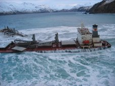
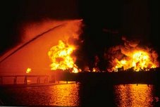
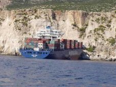
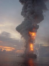
NORWEGIAN classification society DNV says the chances of a ship being involved in a serious casualty have doubled in five years. DNV, which monitors the annual frequency of serious accidents, says that over the past five years, there has been an increasing incidence of serious navigational accidents in several shipping segments.
Speaking at DNV seminar in Singapore yesterday. Helge Kjeøy, regional manager DNV Maritime South East Asia said: “The main factors explaining the negative developments over the past few years are - that the undersupply of crew worldwide results in reduced experience and that the high commercial pressure results in a high workload. Adding new and more complex equipment does not only help the situation. Avoiding accidents under such situations requires a good safety culture, something which the maritime industry evidently needs to focus more on.”
Torkel Soma, Principal Safety Consultant in DNV Maritime, said: “DNV’s statistics shows that a ship is twice as likely to be involved in a serious grounding, collision or contact accident today compared to only five years ago. In addition, estimates show that also the costs of these accidents have doubled. Since this is the general trend for the international commercial fleet, the maritime industry needs to act on this immediately.”
The boom in the shipping market and increased deliveries of newbuildings has resulted in pressure on crews. The shortage of officers has resulted in lower retention and faster promotion. As a result, the general level of experience is decreasing on board. At the same time new technical solutions have been introduced which might have increased the complexity of operations.
Dr. Soma pinpoint: “Reliable technology and complying manuals are no assurance against making errors. Collisions, groundings and contact accidents do almost always involve human acts.”
Ferry Riverdance decision due next weekBy Lisa Ettridge
Messing About In Ships Podcast Episode # 16
Filed under: Uncategorized | Tags: daily source code, lloyds list, london bridge, mais, maritime, merchant marine, podcast, queen of the north, severe weather, ships, twitter
Messing About In Ships podcast episode #16 has launched.
(54 minutes)
Download MP3 file: Messing About In Ships 16
Subscribe Via iTunes HERE
Spring has sprung, the grass has riz, wonder where all the flowers is?
HAPPY EASTER TO ALL!
Seafarers Prayers
RS




![Validate my RSS feed [Valid RSS]](valid-rss.png)