State hit again with storms, flooding
In January, people living along the Tippecanoe River were flooded out of their homes by a combination of snowmelt and heavy rain.
TORNADOES
More than two dozen tornadoes tore through the mid-South late last night, destroying homes, barns, and industrial buildings from Texas to Ohio. The severe thunderstorm outbreak, which included tornados, hail, heavy rain and lightning, killed nearly 50 people and injured 100 more.
"Tuesday's severe weather was caused by a strong, developing low pressure system that moved out of east Texas during the day," said Dr. Tim Doggett, senior research meteorologist at AIR Worldwide. "As the system moved into the Mississippi Valley, cold air from the plains was drawn southward. It clashed with the warm, humid air ahead of the system, triggering a cold front. The resulting cold front caused widespread thunderstorm formation in the middle of unstable air feeding in from the Gulf of Mexico. A dynamic jet stream located above the system provided the wind shear that fueled the numerous tornadoes."
The Storm Prediction Center has collected more than 70 reports of tornadoes, though the actual number of individual events is probably fewer. AIR meteorologists analyzed the SPC data and, based on time/space continuity of the reports, defined 25 individual tornados. In addition to the tornado reports, the SPC has recorded near 200 reports of straight-line winds and 112 reports of hail. There were several reports of hailstones the size of softballs (4.25").
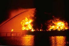
In Tennessee, which suffered the worst damage, 15 students at Union University were trapped in their dormitories as shattered window and ceiling debris from a hard-hitting tornado prevented their escape. Approximately 40 percent of student housing buildings were destroyed, and classes at the university have been canceled for the next two weeks for cleanup. In Jackson, Tennessee, collapsed wreckage trapped fifty residents inside a retirement home. Last night's tornadoes also pulled a roof off a hangar at the international airport in Memphis. Forty miles outside Nashville, a tornado that struck a compressor station set off a natural gas fire that could be seen in the sky for miles around. The blaze was put out early Wednesday morning.
In Arkansas, a tornado that touched down overturned trucks on Interstate 40. Thirty homes were destroyed in Atkins, prompting the Red Cross to put up shelters. Officials in Gassville sealed off the entire town after concerns that storm-related gas leaks would result in an explosion. A damaged hospital in Mountain View was forced to close its emergency room.
In Muhlenberg County in western Kentucky, storms killed at least three people at a mobile home park. Meanwhile, a downpour that started in Evansville last night at 9 p.m. flooded major roads, causing street crews to barricade road access. Officials in surrounding counties reported heavy rains, downed trees and additional flooding. To the west, in Lafayette, Missouri, two industrial buildings, several homes and a church were destroyed by tornado winds, and in Ozark, there were reports of softball-sized hail. Heavy downpours prompted officials in Indiana to open the floodgates on Carroll County's Oakdale Dam, freeing excess water at a rate of 18,000 cubic feet per second. In Mississippi, the Emergency Management Agency estimated that 20 to 30 tornadoes pummeled the state in areas above the state capital of Jackson. A tornado damaged more than 30 homes at Fort Riley in Kansas.
AIR is dispatching a team to survey the worst damage and will provide updates as information becomes available.
FROM NWS Indianapolis- Feb. 5 Storms, Damage Surveys Completed, 1 Tornado...
- DAMAGE SURVEYS ARE IN PROGRESS
- The Largest Flood of the Season for Much of Central and Southern Indiana
FROM NWS Louisville, Ky
- February 6, 2008 Tornado Tracks in Hardin County
- Ten Tornadoes Confirmed -- Updated 820pm EST
- Damage Survey Teams in Progress and More on Thursday
SNOW! AND WE MEAN SNOW!
FROM NWS Milwaukee, Wi
Updated 545 pm CST: Rusty Kapela, WCM
TIME LAPSE VIDEO OF Milwaukee Storm
I also recieved this report from a Milwaukee Spotter earlier this evening (1830hrs).
"EOC is activating in Milwaukee County.
This pix came in earlier today from Milwaukee Spotter Bob Wade
NWS Chicago Snow Reports
Storm Reports for February 5th and 6th Snow Storm
People who enter the exclusion zone around the stricken Riverdance ferry risk a fine or arrest, police said.
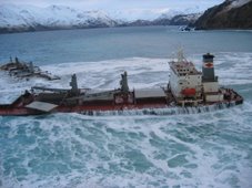
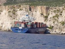
The ship, which is listing at about 50 degrees, has turned into a tourist attraction since running aground on Blackpool beach on Thursday.
HM Coastguard said onlookers straying too close during the salvage operation were putting themselves in danger.
Lancashire Police said they would step in to help the private security firm maintaining the 400m exclusion zone.
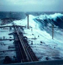
The Riverdance had been heading from Warrenpoint, County Down, to Heysham, Lancashire, last week when it was hit by a freak wave.
Twenty-three people were lifted to safety, including 19 crew and four passengers.
| | The area remains dangerous and unstable so people must remain cautious Insp Tim Newton, Lancashire Police |
A salvage team is still working to refloat the vessel, which is carrying almost 1,200 tonnes of freight in lorry trailers and containers.
Concerns have been raised after sightseers were seen posing for photographs next to the angled ferry.
"They're walking out along the sand at low water," a coastguard spokesman said.
A spokesman for Seatruck Ferries, which owns the ship, said the ship moved in high tide on Monday, causing about six containers to fall off.
Lancashire Police are providing assistance to the salvage operation and are warning the public to stay clear and use a section of the promenade set aside for people to watch from a safe distance.
Salvage continues
Insp Tim Newton, of Lancashire Constabulary, said: "We've had huge numbers of visitors over the last week to see the spectacle.
"We have been working closely with the Maritime and Coastguard Agency to facilitate the salvage operation and prevent people going onto the sand and out to the vessel.
"The area remains dangerous and unstable so people must remain cautious."
Anyone found in breach of the cordon will be asked to move on and if this request is refused, police say they could be issued with a fine.
If a person refuses to give details they will risk being arrested, the force said.
Salvage equipment is being lifted by crane on to the Riverdance in a bid to pump water into the empty ballast tanks to reduce the list.
The operation is likely to continue into Thursday when the prospects of refloating the vessel will be reviewed, said a spokesman for Seatruck Ferries.
Nautical Archaeology Workshop April 2008Sir, The recent bad weather affecting several ships off our coastline (report, Feb 4) has brought into sharp relief the extraordinary situations the seafarers who crew the merchant fleet face in order to keep us in the manner to which we have become accustomed.
The media have praised those involved in the dramatic rescue of the crew and passengers of the Horncliff (off the coast of Scilly) and the Riverdance (near Blackpool). However, no mention has been made of the crews that daily face heavy seas.
There are currently more than 1.2 million seafarers around the world manning the merchant fleet. The UK relies on shipping for more than 90 per cent of its daily needs. Seafarers bring us our food, our clothes, our petrol and our cars. We need them and they need us. Yet, because they are only in port for a few short hours, coupled with the long hours they work and the isolation they can feel while in a port miles from the nearest town, we push them to the backs of our minds.
As news breaks of possibly more foul weather to come, I urge all readers to remember the significant contribution seafarers make to the life of this country and to each and every one of us.
The Rev Canon Bill Christianson
Secretary General
The Mission to Seafarers
RS




![Validate my RSS feed [Valid RSS]](valid-rss.png)