ScienceDaily (July 11, 2008) — For three years, a new way to use data collected by NOAA weather satellites has been giving North Alabama short-term warnings of "pop-up" thunderstorms.
Developed by scientists at The University of Alabama in Huntsville, this new computer program is now spreading to other parts of the U.S. and the world. Later this summer a version of the UAHuntsville weather program will begin forecasting storms throughout Central America, Southern Mexico and the Dominican Republic.
The UAHuntsville Satellite Convection AnalySis & Tracking System (SATCASTS) monitors cumulus clouds as they develop, move and grow through time, according to the person who brainstormed the idea behind the program, Dr. John Mecikalski, an assistant professor of atmospheric science at UAHuntsville.
The program uses data from NOAA’s GOES weather satellites to provide 15-minute to one hour warnings of local thunderstorms. This is the first time forecasters anywhere have had a tool to forecast storms that develop locally. This differs from Doppler radar, which only tracks rain after it starts to fall.
"The radar tells you what's happening, but not what's going to happen," said Wayne MacKenzie, a research associate in UAHuntsville's Earth System Science Center and a member of the SATCASTS development team.
Operated by UAHuntsville scientists for the National Weather Service forecast office in Huntsville for about three years, SATCASTS has been accurate in its storm forecasts between 65 and 75 percent of the time. It has successfully identified hazards generated by thunderstorms, including lightning, hail, high wind, flash floods and turbulence.
Mecikalski got the idea for SATCASTS in 2001, when he was affiliated with NOAA’s Cooperative Institute for Meteorological Studies. He was looking for a way to determine which of the thousands of cumulus clouds present on any given summer afternoon will become thunderstorms. (One percent or less of clouds develop into rain clouds.) He has continued his research since joining the faculty at UAHuntsville in January 2004.
Using data from the GOES visible and infrared sensors, SATCASTS tracks changes in both cloud temperature (height) and water vapor. This data is updated every 15 minutes.
The UAHuntsville team has determined that one of the most important factors in predicting thunderstorms is temperature change. If the top of a cloud cools by 4 C (about 7.2 degrees Fahrenheit) or more in 15 minutes, that means the cloud is growing quickly and there is a growing probability of rain beginning within 30 minutes to an hour. A 4 C drop in temperature typically means a cloud top has climbed between 1/4 to 1/3 of a kilometer.
Based on its success in the Huntsville forecast office, scientists at UAHuntsville are working with the National Weather Service to transition SATCASTS into the storm prediction systems in forecast offices in Birmingham, AL, and Nashville, TN, as well as both Melbourne and Miami, FL.
The UAHuntsville team is also working with NASA and the Federal Aviation Administration (FAA) to test SATCASTS' possible utility in aviation and air traffic control. The system is being tested at the FAA’s New York City air traffic control center. If successful, SATCASTS might be used worldwide to warn pilots of storms, turbulence and other weather threats before they occur.
Other organizations evaluating the operational implementation of the SATCASTS algorithm include the European Meteorological Satellite agency and the South African Weather Service. Discussions are also under way to bring SATCASTS capabilities to East Africa.
While SATCASTS joins a sophisticated and extensive network of weather monitoring systems in the U.S., it is expected to have special value in regions where storm forecasting and monitoring have been limited or non-existent. The system is relatively inexpensive to install and operate, since it uses freely distributed weather data from existing satellite sensors.
NOAA-funded research at UAHuntsville will focus on expanding SATCASTS' capabilities. In areas where Doppler radar networks do not exist, SATCASTS might be used in the future to track frontal storm systems and provide severe weather warnings that are not presently available, Mecikalski said.
"This makes SATCASTS and satellite-based rainfall predictions very relevant in many developing countries, when ground-based radar is absent but high quality satellite data are in place."
The UAHuntsville SATCASTS team includes Mecikalski, two other scientists and three graduate students. The project has been supported by more than $1 million in funding from NOAA, NASA and the FAA.
Research on improving SATCASTS is ongoing and is expected to continue for at least five years. New areas of research include 30-to-90-minute lightning and flash flood forecasts.
The UAHuntsville team is also working on a next generation SATCASTS, which will take advantage of the improved sensing systems that will be available when NOAA launches it GOES-R series of satellites beginning in 2016. Sensors on those satellites will collect data in more channels, more often and at higher resolution.
WEATHER NOTE
NOAA's Office of Response and Restoration Poised to Respond as Hurricane Season Starts
"NOAA, through the Office of Response and Restoration, is part of the multi-agency response team providing oil spill trajectories and environmental data so that quick decisions can be made on where to collect oil and what measures can be taken to protect critical environmental resources" says Dave Westerholm, director of NOAA's Office of Response and Restoration. "The federal and state on-scene coordinators rely on NOAA's ability to provide accurate and timely on-scene scientific support, overflights, meteorological data and modeling."
Located around the country, OR&R's Scientific Support Coordinators work other divisions within NOAA, U.S. Coast Guard and other response organizations by providing on scene coordination and scientific support. The NOAA scientific team assists with spill
response, information management, search and rescue missions, vessel groundings, lost or sunken oil platforms, releases from coastal industrial facilities, and other impacts from hurricanes.
OR&R also addresses longer-term recovery efforts including assessment and removal of hazardous and non-hazardous marine debris, natural resource damage assessment, and restoration of coastal habitats.
"It is important to understand that as a natural resource trustee, NOAA has the added responsibility of assessing any coastal oil or hazardous material impact and developing an appropriate restoration strategy for that area," adds Westerholm. "Assessment and restoration extend well beyond the initial response and cleanup, and often involves all the response agencies and impacted communities."
During the 2005 hurricane season, NOAA OR&R staff responded to multiple storms and staffed nine command posts in four different states. One of these storms was Hurricane Katrina. Even before Hurricane Katrina hit land, OR&R was preparing for its impact, providing critical infrastructure assessments, discussing possible points of impact, and coordinating critical personnel in the region.
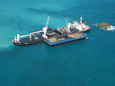
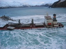
OR&R performed overflights to evaluate reports of numerous oil spills and vessel sinkings and provided environmental review to the U.S. Coast Guard to address more than 3,000 stranded or sunken vessels. OR&R is still working today to identify and develop abatement strategies for marine debris that was moved to the coastal waters from this hurricane.
The National Oceanic and Atmospheric Administration, an agency of the U.S. Commerce Department, is dedicated to enhancing economic security and national safety through the prediction and research of weather and climate-related events and information service delivery for transportation, and by providing environmental stewardship of our nation's coastal and marine resources. Through the emerging Global Earth Observation System of Systems (GEOSS), NOAA is working with its federal partners, more than 70 countries and the European Commission to develop a global monitoring network that is as integrated as the planet it observes, predicts and protects.
•Contact NOAA:
NOAA: http://www.noaa.gov
MARITIME NOTE
BEST OF gCaptain
Maersk Holyhead and Pequot
.
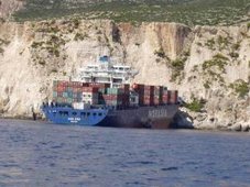
November 2005 - Two vessels are intending to pass one another during daylight hours, in the calm waters of Lake Maracaibo. They are the LNG carrier M/T Maersk Holyhead and bulk carrier M/V Pequot — large, modern vessels with the latest communications & navigational equipment.
RS




![Validate my RSS feed [Valid RSS]](valid-rss.png)