The 2008 Atlantic hurricane season outlook is an official product of the National Oceanic and Atmospheric Administration (NOAA) Climate Prediction Center (CPC), and is produced in collaboration with scientists from the NOAA National Hurricane Center (NHC) and Hurricane Research Division (HRD).
Interpretation of NOAA’s Atlantic seasonal hurricane outlook
1. Preparedness
- This outlook provides the public with a general guide to the expected overall nature of the upcoming hurricane season. It is not a seasonal hurricane landfall forecast, and it does not imply levels of activity for any particular region.
- Hurricane disasters can occur whether the season is active or quiet. Residents, businesses, and government agencies of coastal and near-coastal regions should prepare for every hurricane season regardless of the seasonal outlook. NOAA, FEMA, the NHC, Small Business Administration, and the Red Cross all provide important hurricane preparedness information on their web sites. It only takes one hurricane (or even a tropical storm) to cause a disaster.
- This outlook may serve as a guide for large businesses, corporations, financial markets, governments, and industries to better prepare for and manage the potentially significant risk posed by hurricanes.
2. NOAA does NOT make seasonal hurricane landfall predictions
- NOAA does not make seasonal hurricane landfall predictions. Hurricane landfalls are largely determined by the weather patterns in place as the hurricane approaches, which are not predictable more than 5-7 days in advance.
3. Nature of this Outlook and the “likely” ranges of activity
- This outlook is probabilistic, not deterministic. New this year, we are providing probabilities for the stated likely ranges of named storms, hurricanes, major hurricanes, and Accumulated Cyclone Energy (ACE).
- These likely ranges do not represent the total ranges of activity seen in past seasons having similar climate conditions to those expected this year, but are simply the most likely.
- The outlook is based on predictions of large-scale climate factors known to be strong indicators of upcoming seasonal Atlantic hurricane activity, and takes into account uncertainties inherent in such climate outlooks (see item 4 below).
4. Three major sources of uncertainty in the seasonal outlooks
- El Niño and La Niña forecasts are presently the biggest source of uncertainty for the hurricane outlook. The period between March - July is referred to as the “springtime forecast barrier”, a period when predicting these phenomena can be difficult because the atmosphere is in a state of transition.
- Many combinations of named storms and hurricanes can occur for the same set of climate conditions. One cannot know with certainty whether a given climate signal will be associated with several short-lived storms or fewer longer-lived storms with greater intensity.
- Weather patterns that are unpredictable on seasonal time scales can sometimes develop and last for weeks or months, possibly affecting seasonal hurricane activity.
2008 Atlantic Hurricane Outlook Summary
The Climate Prediction Center’s 2008 Atlantic Hurricane Season Outlook calls a 90% probability of a near-normal or above-normal hurricane season. An above-normal season is most likely (65% chance), but there is also a 25% chance of a near-normal season, and a 10% chance of a below-normal season. See NOAA’s definitions of above-, near-, and below-normal seasons.
This outlook is based on the analysis and prediction of two main climate signals:
1) The ongoing conditions that have been conducive to above-normal Atlantic hurricane seasons since 1995 (called the multi-decadal signal), which includes above-normal sea-surface temperatures in the eastern tropical Atlantic Ocean.
Even though the last two Atlantic hurricane seasons have been near-normal, there remains no indication the current active hurricane era has ended.
2) Possible lingering effects from La Niña or ENSO-neutral conditions.
Currently, La Niña seems to be waning, but its atmospheric impacts often persist even after Pacific Ocean temperatures have returned to normal. There is considerable uncertainty among the forecast models as to how strong the La Niña influence will be.
Climate patterns similar to those expected this year have historically produced a wide range of activity, and have been associated with both near-normal and above-normal seasons. Allowing for uncertainties, we estimate a 60%-70% chance of occurrence for each of the following ranges of activity:
- 12-16 named storms,
- 6-9 Hurricanes ,
- 2-5 Major Hurricanes,
- An ACE range 100%-210% of the median
These likely ranges have been observed in about two-thirds of past seasons having similar climate conditions to those expected this year. They do not represent the total ranges of activity seen in those past seasons.
Most of the 2008 activity is expected to take place during August through October (ASO), the peak months of the Atlantic hurricane season.
The Climate Prediction Center will issue an update to this outlook in early August, at the start of the peak months of the Atlantic hurricane season.
DISCUSSION
1. Expected 2008 Activity
This Outlook is a general guide to the expected overall activity for the 2008 Atlantic hurricane season. It is not a seasonal hurricane landfall forecast, and it does not imply levels of activity for any particular area
The expected conditions during the 2008 Atlantic hurricane season are related to two main climate signals: 1) the continuation of conditions (called the multi-decadal signal) that have been conducive to above-normal Atlantic hurricane activity since 1995 , including above-normal sea-surface temperatures in the eastern tropical Atlantic Ocean, and 2) a possible La Niña influence or ENSO-neutral conditions during the peak months (August-October) of the season.
Historically, seasons with climate patterns similar to those expected this year have produced a wide range of activity, and have been associated with both near-normal and above-normal seasons. This outlook considers the historical distribution of activity for these climate factors, uncertainties in the La Niña impacts, and the possibility of other unpredictable factors also influencing the season. Based on these factors, we estimate a 90% chance of a near-normal to above-normal 2008 Atlantic hurricane season. While an above-normal season is most likely (65% chance), there is a significant 25% chance of a near-normal season and a 10% chance of a below-normal season. See NOAA definitions of above-, near-, and below-normal seasons.
An important measure of the total seasonal activity is NOAA’s Accumulated Cyclone Energy (ACE) index, which accounts for the collective intensity and duration of named storms and hurricanes during the season. Based on the above factors, we estimate a 60%-70% chance the 2008 seasonal ACE range will be 100%-210% of the median. This range can be satisfied even if the numbers of named storms, hurricanes, or major hurricanes fall outside their likely ranges. If La Niña persists, the probability increases that the activity could be at or above the high end of the indicated ACE range.
The likely (60%-70% chance) ranges of activity for 2008 (each of which is seen in about two-thirds of similar seasons in the historical record): are 12-16 Named Storms, 6-9 Hurricanes, and 2-5 Major Hurricanes. Most of this activity is expected during August through October, the peak months of the Atlantic hurricane season.
2. Expected Climate Conditions – Active multi-decadal signal, La Niña impacts possible
a. Expected continuation of active Atlantic hurricane era
Atlantic hurricane seasons exhibit prolonged periods lasting decades of generally above-normal or below-normal activity. These fluctuations in hurricane activity result almost entirely from differences in the number of hurricanes and major hurricanes forming from tropical storms first named in the Main Development Region (MDR), which spans the tropical Atlantic Ocean and Caribbean Sea between 30oW-87.5oW and 10oN-21.5oN (Goldenberg et al. 2001).
The current active hurricane era began in 1995. Hurricane seasons during 1995-2007 have averaged 14.5 named storms, 8 hurricanes, and 4 major hurricanes, with an average ACE index of 167% of the median. NOAA classifies nine of the thirteen seasons since 1995 as above normal, with seven being hyperactive (ACE > 175% of median). Only four seasons since 1995 have not been above normal. These include the three El Niño years (1997, 2002, and 2006) and the 2007 season.
This high level of activity contrasts sharply to the 1971-1994 period of generally below-normal hurricane seasons (Goldenberg et al. 2001), which averaged only 8.5 named storms, 5 hurricanes, and 1.5 major hurricanes with an average ACE index of only 75% of the median. One-half of those seasons were below normal, only three were above normal (1980, 1988, 1989), and none were hyperactive. Time series of key atmospheric wind parameters highlight the dramatic differences between these above-normal and below-normal hurricane eras.
The regional atmospheric circulation anomalies that contribute to these long-period fluctuations in hurricane activity are strongly linked to the tropics-wide multi-decadal signal (Bell and Chelliah, 2006). A change in phase of that signal accounts for the transition in 1995 from the below-normal era to the above normal era. The multi-decadal signal is again a major factor guiding the 2008 outlook. Three key features of this signal associated with the current active hurricane era are: 1) a stronger West African monsoon system, 2) below-average convection in the Amazon Basin, and 3) warmer than average tropical Atlantic sea-surface temperatures.
Other ongoing regional features expected during the 2008 hurricane season include 1) lower surface air pressure and increased moisture across the tropical Atlantic, 2) an amplified ridge at upper levels across the central and eastern subtropical North Atlantic, 3) reduced vertical wind shear in the deep tropics over the central North Atlantic, which results from an expanded area of easterly winds in the upper atmosphere (green arrows) and weaker easterly trade winds in the lower atmosphere (dark blue arrows), and 4) weaker easterly winds in the middle and lower atmosphere, resulting in a configuration of the African easterly jet (wavy blue arrow) that favors hurricane development from tropical waves moving westward from the African coast.
b. Possible La Niña influence
The second key predictor for the 2008 Atlantic hurricane season is the possibility that the La Niña-related patterns of tropical convection and winds will persist, and therefore may be conducive to increased Atlantic hurricane activity. As discussed by Gray (1984), La Niña favors more Atlantic hurricanes and El Niño favors fewer hurricanes. The combination of La Niña and an active hurricane era increases the probability of an above-normal season.
Presently, La Niña is indicated by below average sea-surface temperatures across the central and east-central equatorial Pacific. La Niña is dominating the atmospheric convection and low-level winds in these regions as well, with suppressed convection over the central and eastern Pacific and enhanced convection over the western Pacific. There has been a tremendous tropics-wide response in the upper-level (200-hPa) atmospheric winds to this anomalous convection, with easterly anomalies extending across the eastern tropical Pacific Ocean, the tropical Atlantic Ocean, and northern Africa. If these anomalies persist through the summer, they would reinforce the multi-decadal signal and increase the probability of an above-normal and even hyperactive season.
In the latest ENSO Diagnostics Discussion released 8 May 2008, NOAA forecasters stated that La Niña has weakened since February, and that a transition to ENSO-neutral conditions is possible during June-July just prior to the peak months of the Atlantic hurricane season. This evolution is typical for La Niña, which often dissipates during the late spring or summer.
There is considerable spread and uncertainty among the climate models regarding how strong the La Niña influence will be on the Atlantic hurricane season. Most models are predicting ENSO-neutral conditions (neither El Niño nor La Niña) during the summer, with sea-surface temperature anomalies in the central and east-central equatorial Pacific between -0.5oC to 0.5oC. However, most of these models have historically shown little-to-no skill at this time of the year.
Historically, we have almost never (only once in 100 years) seen a La Niña transition from its current present strength to an El Niño by ASO. Therefore, there is a likelihood that the current La Niña patterns of tropical convection and winds will persist and affect the hurricane season, even if La Niña dissipates.
c. Atlantic Sea-surface temperatures (SSTs)
We also expect above-normal sea-surface temperatures (SSTs) in the eastern tropical Atlantic Ocean during 2008. SSTs are already well above average in that region and along the west coast of northern Africa.
In contrast, SSTs over the central and western MDR were below average during the last several months in association with the combination of La Niña and a persistent pattern of anomalous northeasterly and easterly surface winds. This wind pattern recently ended, and the SSTs quickly returned toward normal in these regions. Consistent with past La Niña episodes, and with the ongoing tropical multi-decadal signal, above-average temperatures are expected to return in the central and western MDR as the summer progresses.
3. Uncertainties in the Outlook, and a look back at 2007
The likely (60%-70% chance) ACE range for the 2008 Atlantic hurricane season reflects three inter-related sources of uncertainty: 1) When La Niña will dissipate, 2) the likelihood that the current La Niña patterns of tropical convection and winds will persist into ASO, even if La Niña dissipates, and 3) the likely strength of those patterns. These reflect the considerable spread in forecasts from the available ENSO prediction models.
Promising new climate models that can explicitly predict seasonal tropical cyclone activity in the Atlantic are also suggesting an active season. However, these new methods tend to have limited skill at this time of year because of the large uncertainties in the ENSO predictions being utilized.
Another uncertainty is the possibility of lesser climate factors also influencing the seasonal activity. Bell et al. (2008) identified two features that led to less-than-predicted seasonal hurricane activity in 2007. First, despite a strengthening La Niña during ASO 2007, the typical La Niña signal in the upper-tropospheric circulation was notably absent across the tropical North Pacific and MDR. As a result, La Niña did not weaken the upper-level trough and reduce the vertical wind shear in the MDR as expected. Second, that upper-level trough was enhanced in association with a very persistent ridge over eastern North America. This circulation led to increased vertical wind shear and anomalous mid-level sinking motion across the central and western MDR, two factors known to inhibit hurricane formation.
The analysis by Bell et al. (2008) shows that the lack of a La Niña signal was due in part to suppressed convection over Indonesia and the eastern tropical Indian Ocean. They state “These anomalies are opposite to the typical La Niña signal, and indicate that the total La Niña forcing and resulting upper-tropospheric circulation anomalies were much weaker than would normally be expected for the observed Pacific cooling. These conditions were associated with a record-strength pattern that also included enhanced convection over the western equatorial Indian Ocean, and enhanced convection across India and the Southeast Asian monsoon regions. This entire pattern is more typical of El Niño, as was seen in 2006. The observations suggest this climate signal may have overwhelmed the upper-tropospheric circulation anomalies normally associated with La Niña, thus negating La Niña’s normally enhancing influence on the 2007 Atlantic hurricane season. Conversely, this same pattern may have enhanced El Niño’s suppressing influence on the 2006 Atlantic hurricane season (Bell et al. 2007)
NOAA FORECASTERS
Climate Prediction Center
Dr. Gerry Bell, Meteorologist; Gerry.Bell@noaa.gov
Dr. Jae Schemm, Meteorologist; Jae.Schemm@noaa.gov
Dr. Tingzhuang Yan, Meteorologist; Tingzhuang.Yan@noaa.gov
National Hurricane Center
Eric Blake, Hurricane Specialist; Eric.S.Blake@noaa.gov
Todd Kimberlain, Meteorologist; Todd Kimberlain@noaa.gov
Dr. Chris Landsea, Meteorologist; Chris.Landsea@noaa.gov
Dr. Richard Pasch, Hurricane Specialist; Richard.J.Pasch@noaa.gov
Hurricane Research Division
Stanley Goldenberg, Meteorologist; Stanley.Goldenberg@noaa.gov
REFERENCES
Bell, G. D., and M. Chelliah, 2006: Leading tropical modes associated with interannual and multi-decadal fluctuations in North Atlantic hurricane activity. J. Climate. 19, 590-612.
Bell, G. D., and Co-authors 2007: The 2006 Atlantic Hurricane Season: A Climate Perspective. State of the Climate in 2006. A. M. Waple and J. H. Lawrimore, Eds. Bull. Amer. Meteor. Soc., 88, S1-S78.
Bell, G. D., and Co-authors 2008: The 2007 Atlantic Hurricane Season: A Climate Perspective. State of the Climate in 2007. A. M. Waple and J. H. Lawrimore, Eds. Bull. Amer. Meteor. Soc., 89, S1-S78.
Goldenberg, S. B., C. W. Landsea, A. M. Mestas-Nuñez, and W. M. Gray, 2001: The recent increase in Atlantic hurricane activity: Causes and implications. Science, 293, 474-479.
Gray, W. M., 1984: Atlantic seasonal hurricane frequency: Part I: El Niño and 30-mb quasi-bienniel oscillation influences. Mon. Wea. Rev., 112, 1649-1668.
WEATHER NOTE
The day after, meteorologists become storm chasers
Todd Krause's work began at 10 a.m. Monday in the parking lot of a Lowe's store in Coon Rapids, the westernmost point of Sunday's tornado outbreak.
From there, Krause and fellow meteorologist John Wetter would poke their way eastward in a white government van, comparing what happened on the ground to what forecasters detected on radar the day before.
Were utility poles tipped, or snapped? Did hardwood as well as softwood trees get damaged, and how extensively? How had the damaged houses been anchored to their foundations?
"I hope to learn something about the storm for the next time one comes along," said Krause, warning coordination meteorologist for the National Weather Service office in Chanhassen.
Though radar glimpses, eyewitness accounts and radar had left little doubt there was a tornado, Krause found proof right across the street from Lowe's. Small trees in a cluster had been bent, tipped and snapped inward, suggesting rotating forces of a tornado rather than straight-line wind.
Krause and Wetter, the weather service's coordinator of Skywarn radio operations, were noting and mapping damage but also taking close looks required by the new "EF" tornado damage scale, the rating that would become part of official weather history.
The process combines many elements: matching damage reports to locations, driving around fallen trees, taking pictures, waiting for escorts into high-damage zones and using diplomacy with homeowners whose homes and lives have been upended.
Krause and Wetter finally entered the most devastated part of Hugo at 3:15 p.m.
The sickening jumble of broken lumber, kitchen utensils, broken trees, a boat in a tree and pieces of glass lodged like knives in a soft foundation wall -- they all meant something to the assessors.
Where houses had been swept away, they noted that the structures had been made vulnerable by having attached garages facing the wind or walk-out basements away from the wind, or questionable ways of anchoring walls to foundations. Krause also noted that the peak of one house, otherwise wiped out, lay intact about 100 yards away. That lowered the damage rating.
In the end, Krause declared that Hugo had been hit by an EF3 tornado because the damage was consistent with winds between 138 and 167 miles per hour. But the Coon Rapids damage they'd seen earlier in the day was more consistent with an EF1, or winds of 86 to 109 mph. In between was an area of uncertainty -- an undeveloped area of Blaine from which there were no storm reports and no roads to get a closer look. So the official verdict Monday: two tornadoes, the first of Minnesota's 2008 season.
Krause said the weekend's tornadoes are no indication that the unusually destructive weather to the south this spring might be moving this way. Humidity levels might not stay high or the jet stream could leap suddenly northward, taking storm fronts away from Minnesota, he said.
From Hugo, Krause and Wetter were to continue east in Washington County on Monday night, then continue trying to confirm damage reports in Wisconsin today.
Before they left Hugo on Monday, Krause asked the owner of an obliterated house for permission to take pictures. The homeowner, Marcel Linders, gladly gave his permission.
"We heard your siren," Linders told the weather officials. "I think it saved our lives."
MARITIME NOTEEPIRB- THE FLAME WARS?
Since PANBO wants to play its little games here is another question for you Ellison? Besides the failure rate. What is the false alarm rate on EPIRBs? Can this be from both human error and as well shoddy mnfacturing by some in the industry? Go ahead Ellison make our day.... Tell us we have no clue? Oh yeah I keep forgetting you said that there isn't enough marine electronics on the market to establish failure or false alarm rates.....You should be ashamed of yourself......Some service you provide your readers...... How about it Ellison .... How about a report on EPIRB false alarms and there associated costs that waste millions of taxpayer dollars and Coast Guard resources? Or you afraid that your buddies will get mad at you?
As far as we are concerned closing the gaps in a system that provides a fantastic service to all mariners is very well worth the time, effort and your wrath!
KPT rescues Panama registered coal ship in open sea
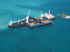
KARACHI, May 26 (APP): The karachi Press trust (KPT) rescued a Panama-registered ship ‘AI-Fullq-7” at open sea when she developed a hole in its forward hold and came towards Karachi seeking help.
A statement here on Monday said that the ship carrying 2,676 metric tons coal ash was on voyage to Doha.
Her last port of call was Kandla Port, India. Due to heavy weather her conditions deteriorated and worsened by creation of another hole in the same area threatening her and crew’s safety.
The ship has a crew of 13 Pakistani and four Indians with Captain Javed Baloch as Master.The Captain reported during early hours of the morning that the ship was listing and is likely to sink. The sinking could have spelled a material as well as environmental disaster. The KPT staff immediately came for rescue on the direction of Chairman KPT Vice Admiral Ahmad Hayat and mobilized resources to help the stricken vessel. A team of experienced officers and pilots reached the ship and assessed the situation.
The vessel was boarded by KPT Pilots at the fairway buoy and after employing necessary safeguards it was safely brought to the Port for repairs. The cargo is completely sealed and there exists no chance of its spillage in seawaters, the statement added.
RS









![Validate my RSS feed [Valid RSS]](valid-rss.png)