Showing posts with label heavy weather. Show all posts

Tuesday, July 29, 2008

NOAA Reminds Beachgoers That Rip Currents Can Be a Threat

NOAA Reminds Beachgoers That Rip Currents Can Be a Threat

Heading to the beach for summer vacation? NOAA is urging beachgoers to learn how to “Break the Grip” of rip currents before getting into the water. Rip currents are a deadly threat — accounting for more than 80 percent of lifeguard beach rescues.

Rip currents are narrow channels of fast-moving water that pull swimmers away from the shore. They can occur at any beach with breaking waves, including the Great Lakes.

Moving at speeds of up to eight feet per second, rip currents can move faster than an Olympic swimmer and can easily overpower a victim. Panicked swimmers often incorrectly swim straight back to shore — putting themselves at risk of drowning because of fatigue.

If caught in a rip current, don’t fight it! Swim parallel to the shore and then swim at an angle – away from the current – toward shore.

“We have a constant education campaign about rip currents since many people visit the beach infrequently and may be unfamiliar with this leading surf hazard,” said Timothy Schott, meteorologist with NOAA’s National Weather Service Marine and Coastal Branch in Silver Spring, Md. “This year, we have developed bilingual English-Spanish signs to reach a wider audience with life-saving instructions on how to break the grip.”

"Rip currents can be killers. The United States Lifesaving Association estimates that the annual number of deaths due to rip currents on our nation's beaches exceeds 100,” said Peter Davis, president of the Gulf Coast Region of the United States Lifesaving Association and chief of the Galveston Island Beach Patrol. “The greatest safety precaution that can be taken is to recognize the danger of rip currents and always remember to swim at beaches with lifeguards."

NOAA also offers the following safety tips:

  1. Swim at lifeguard-protected beaches.
  2. Never swim alone.
  3. Speak to on duty lifeguards about rip currents and other expected water hazards.

Many coastal National Weather Service offices issue what's known as Surf Zone Forecasts that provide a low, moderate or high description of rip current risk. All NOAA National Weather Service offices include moderate to high risk of rip currents in their Hazardous Weather Outlook. These forecasts are available online at www.weather.gov.

More safety tips and educational materials are free and available to download at http://www.ripcurrents.noaa.gov/.

The National Oceanic and Atmospheric Administration, an agency of the U.S. Commerce Department, is dedicated to enhancing economic security and national safety through the prediction and research of weather and climate-related events and information service delivery for transportation, and by providing environmental stewardship of our nation's coastal and marine resources. Through the emerging Global Earth Observation System of Systems (GEOSS), NOAA is working with its federal partners, more than 70 countries and the European Commission to develop a global monitoring network that is as integrated as the planet it observes, predicts and protects.
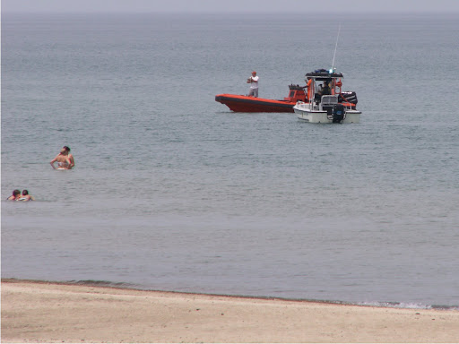
RIP CURRENTS FOR REAL

BunnyERabbit
On July 13th 2008, 15 year old Chicago youth Devant Jackson was swept away from Kimel Beach at the National Lake Shore Park in Indiana. On July 16th his body was recovered. Recovery Photo by Team Robin Storm.Delete caption

WEATHER NOTE

Extra 3 trillion gallons of water in Lake Michigan Lake Michigan's water level has risen 8 inches above the same period a year ago. Once just 6 to 12 inches above all-time lows, lake levels are up in response to the same downpours that caused many area rivers to flood. The U.S. Army Corps of Engineers, which monitors the Great Lakes, predicts the higher levels are to hold through the coming months, though, barring new waves of heavy rains, the biggest rises have probably already occurred. Interconnected Lakes Michigan and Huron are unlikely to change significantly in the next month.

The corps reports other Great Lakes have experienced increased levels as well, with Lake Superior 16 inches higher than a year ago. The rise in Lake Michigan means the lake has added approximately 3.12 trillion gallons since a year ago.

Blistering heat continues to grip the southern Plains. The heat has anchored northwest jet-stream winds over the area, which have slowed the eastward expansion of hot air in recent months.

MARITIME NOTE
FROM THE DECK OF gCAPTAIN.....

Windoc Incident - Story Behind YouTube’s Most Chilling Video

July 21st, 2008 ·

<span class=Windoc Damaged and at anchor after collision and fire"
The Windoc blocks the canal. Alex Howard

In August 2001 the Bulk Carrier Windoc was lined up on the Welland Canal’s Bridge 11 in Ontario Canada. After recieving the flashing amber approach light indicating that the bridge operator was aware of the vessel the captain lined up on the centerline and maintained a speed of 5 knots. Minutes later while the vessel was half way through the bridge started descending.

A Time for Restraint: Maritime Disasters Usually Not What They Seem… A Time for Restraint: Maritime Disasters Usually Not What They Seem…

Cosco Busan case and a new crisis on the Mississippi River attracting speculation and needless drama – and sometimes, grandstanding.

I briefly considered putting together a couple of news articles regarding either the latest Cosco Busan case developments or the Mississippi River for the online edition this week, but what passes for "fact" seems to change so fast that I am quite sure I'd get it wrong. Hence, I'm going to let others make suppositions and prognosticate about what happened, didn't happen or who is to blame. However, that won't stop me from wondering if those who have continuously excoriated Captain John Cota in the news might just be backpedaling a notch or two.

In the latest twist out west, the Cosco Busan operator is now accused of fabricating records to hinder the NTSB and DOJ probes of the November 2007 allision in San Francisco Bay (see the USDOJ press release elsewhere in this e-newsletter). I don't know who else can be charged for what else, but it is getting pretty hard to follow along without a scorecard. To say that this has been the most bizarre set of circumstances I have ever witnessed in relation to any maritime accident would be a gross understatement. I've said it once before and I'll reiterate for you again: I'm not going to make any suppositions or predictions in this case.

Too often, we in the maritime industry are collectively quick to come to conclusions in any matter brought before us. I know that I received scores of "submitted articles" in the months that immediately followed the Cosco Busan allision, each purporting to know what went wrong, how and who was to blame. I'm glad that, at least in this case, I largely refrained from piling on or providing a venue for these papers. The only thing that I am sure of right now is that a great deal went badly wrong on that day and that the end result of all of it is going to be painful for a lot of people, companies, the environment and the list goes on…

Further east, on the mighty Mississippi River, a Liberian-flagged oil tanker collided with a US-flagged fuel barge near downtown New Orleans on Wednesday morning. According to official sources, as much as 375,000 gallons (8928 barrels) of oil spilled from the barge into the river. The incident resulted in the partial closure of one of the nation's most important waterways as a massive response was organized. The NTSB announced that they had an investigative team on the way at about the same time that the Coast Guard reported, "Representatives from the tug boat, Mel Oliver, report that there were no properly licensed individuals on the vessel during the time that the incident occurred."

It is again tempting to write my own piece about the Mississippi River collision and related oil spill, but I think I'll pass again. For example, I'm quite sure that any number of people will now speculate about the absence of "licensed individuals" on the vessel at the time of the collision. Like the Cosco Busan casualty, however, you can be sure that the general public – like you and I – are only looking at the tip of the iceberg in terms of the facts. At this point, the best any of us can do is look at the official news releases and get out of the way. There is serious work to be done.

In his AM e-newsletter today, Holland & Knight's Dennis Bryant succinctly outlined events happening on the Mississippi River and also told his readers, "The pressure on the Coast Guard will be intense due to the economic impact of the closure. Please be assured that everyone will be working on completion of this mission will all due dispatch. Now is not the time to divert resources to respond to inquiries from the media and others that can await a more in-depth analysis." I think that's pretty good advice.

In contrast, another press release, this time from a well-known Washington politician, characterized the Mississippi River incident as "Nothing Less Than a Tragedy." This gem of wisdom came from Congressman Elijah E. Cummings (D-MD), who also reassured all of us that "…my colleagues on the Subcommittee and I will be thoroughly examining the causes leading up to this devastating event." Well, duh. Cummings also said that it was his hope that "the members of the U.S. Coast Guard will approach this incident with the same effectiveness and efficiency that was demonstrated in the aftermath of Hurricane Katrina, and I will be in close communication with them to ensure that this is the case."

I don't know about you, but I'm not going to sleep better tonight knowing that a Washington politician will be micromanaging the very people that are responding to this incident and spill. And, as others have said far better than I could do it, "Now is not the time to divert resources to respond to inquiries from the media and others…" The temptation to grandstand in these situations is enormous, especially when there are points to be scored. It's a little like having an aspiring presidential candidate fly into the middle of a disaster for a photo opportunity. Instead, I think we should all keep our eyes on the ball; and by that I mean, let the Coast Guard do their job unencumbered and the investigators sort out the mess.

Joseph Keefe is the Managing Editor of THE MARITIME EXECUTIVE. He can be reached with comments and/or questions on this or any other article in this newsletter at jkeefe@maritime-executive.com.


RS

Monday, July 21, 2008

Improved Tsunami Early Warning With New Software System

Improved Tsunami Early Warning With New Software System

ScienceDaily (July 14, 2008)
After completing their simulation component in the German-Indonesian Tsunami Early Warning System (GITEWS), the team for tsunami modelling of the Alfred Wegener Institute for Polar and Marine Research in the Helmholtz Association has presented the currently leading software system for tsunami events with the potential for catastrophe. It is now being integrated into the Decision Support System (DSS) of the German Aerospace Center in Oberpfaffenhofen. It is to resume its test mode in Indonesia in November.

"Within slightly more than two years, my team has developed, with the help of current software technology, the most modern and flexible simulation system for one of the most dreaded natural disasters of the world", explains Dr. Jörn Behrens, Head of the Tsunami Modelling Group of the Alfred Wegener Institute. "In contrast to other currently available Tsunami Early Warning Systems, it does not only use earthquake data for its ultra-fast situational analysis, but it combines various measurements to a robust, precise, and quick situation report."

Next to seismic data (earthquake parameters), also gauge and buoy data (wave heights), and GPS data (deformations of the earth's crust) can be incorporated into the calculations. All these data run together in the DSS, and the picture of the general situation supports decision-makers -- for example after a seaquake -- to evaluate more reliably and quicker than before, whether it poses a threat for residents of the bordering coastline in the form of rising water waves. Accordingly, warnings reach affected persons earlier than before, and it leaves more time to take disaster prevention measures.

Furthermore, simulation results from different institutes can seamlessly be integrated into the system. The team from the Alfred Wegener Institute will provide the warning system until November 2008 with already around 1500 high-resolution tsunami scenarios. The newly developed simulation system compares these scenarios with incoming real measurement data in a matter of seconds and deduces its forecast. The Indonesian partners work on the completion of the database at the same time.

Together with colleagues from the Indonesian "Institute of Technology Bandung", a connection to approximately 160.000 local tsunami scenarios they calculated is now being incorporated into the system developed at the Alfred Wegener Institute in Bremerhaven. They allow an essential expansion of the database."In regard to the interface to other programs, we adhere to open standards, which control the exchange of data in the world of computers. This way, external scenarios can seamlessly be integrated, and we can adapt the simulation model quickly to other marine areas of the world, for instance the Mediterranean Sea," says Behrens about the perspective for further early warning systems.

The Tsunami Modelling group consists of seven researchers and PhD students, among them one PhD student from Indonesia. It was established at the beginning of 2006, and has developed, next to the simulation system presented here, the simulation software TsunAWI, which is one of the bases for the computation of tsunami scenarios. The software has mastered its practical test: it computed the resulting wave heights precisely, when an earthquake of magnitude 7,9 near Bengkulu/Western Sumatra triggered a tsunami on September 13th 2007.

The aim of GITEWS is to minimize the consequences of natural disasters by means of an early warning system. Nevertheless, a natural phenomenon like the tsunami in the year 2004 cannot be prevented, and catastrophes of this kind will always cause casualties, regardless of a perfectly working alarm system. GITEWS is developed by several scientists and engineers from the Helmholtz Centre Potsdam German Research Center for Geosciences (GFZ), the Alfred Wegener Institute for Polar and Marine Research in the Helmholtz Association (AWI), the German Aerospace Center (DLR), the Research Center in Geesthacht (GKSS), the German Marine Research Consortium (KDM), the Leibniz Institute of Marine Sciences (IFM-GEOMAR), the United Nations University (UNU), the Gesellschaft für Technische Zusammenarbeit (GTZ), and the Federal Institute for Geosciences and Natural Resources (BGR), as well as Indonesian and international partners. The project is financed by the Federal Ministry of Education and Research (BMBF).

WEATHER NOTE

Twisters Hit Insurers With Worst Profit Dip Since '02 (Update3)

By Erik Holm

July 17 (Bloomberg) -- Record tornado damages, the weakening economy and a drop in premiums may reduce insurers' earnings by 30 percent, the steepest second-quarter decline since 2002.

The industry's slump in profits is worse than all 24 groups in the Standard & Poor's 500 Index except for banks, financial- services firms and automobile companies, analysts surveyed by Bloomberg said. Sixteen of 20 insurers in the S&P 500, led by American International Group Inc. and Allstate Corp., may report lower net income or a loss.

Losses from catastrophes, including the most tornadoes in the U.S. since at least 1950, were about $5.5 billion. At the same time, investment returns and opportunities to sell residential and corporate coverage declined as the economy slowed and home sales dropped.

``We're going to see amazingly bad numbers from the property insurers in the second quarter,'' said Meyer Shields, an analyst at Stifel Nicolaus & Co. in Baltimore. ``There are lots and lots of losses out there.''

The estimated decline in profit, the most since earnings per share fell about 45 percent in 2002, may be driven by tornado losses at insurers such as Allstate, lower investment returns for companies like AIG and falling rates at commercial insurers including Travelers Cos., said Paul Newsome, an analyst at Sandler O'Neill & Partners in Chicago.

``You rarely get all three of those factors at once,'' Newsome said.

Allstate Corp.

Second-quarter results typically include fewer catastrophe costs than the third and fourth quarters, when the Atlantic hurricane season peaks, he said. Researchers at Colorado State University and AccuWeather.com predict an above average number of hurricanes will form this year, driven in part by higher ocean temperatures.

Allstate, the largest publicly traded U.S. home and auto insurer, may report profit of $1.35 a share, down 23 percent from a year earlier, according to the average estimate of 20 analysts surveyed by Bloomberg. The insurer, based in Northbrook, Illinois, will report results on July 23.

``I'm kind of crossing my fingers for Allstate,'' said Jim Ryan, an insurance analyst at Morningstar Inc. in Chicago. ``They haven't said anything to give us a hint about what their catastrophe losses might be.''

Costs Double

Hartford Financial Services Group Inc., the insurer based in the Connecticut city of the same name, said yesterday in an e- mailed statement that it had $171 million of costs from natural disasters in the second quarter. That compares to $177 million in all of 2007.

Cincinnati Financial Corp. and Harleysville Group Inc. of Harleysville, Pennsylvania, said catastrophe costs more than doubled in the quarter as an estimated 1,164 tornadoes struck the U.S., hitting towns from Colorado to Minnesota to Texas and killing 49 people, including four boys at an Iowa scout camp in June.

In last year's second quarter, industrywide catastrophe costs were 60 percent less, according to Insurance Services Office Inc. in Jersey City, New Jersey.

As the U.S. economy slowed in the second quarter, foreclosures reached new peaks. Insurers, including Allstate, drop coverage when policyholders lose their houses and also have fewer opportunities to attract new clients. New home sales will fall 26 percent this year to 573,000, New York-based Fitch Ratings estimated on July 11.

``This seems to be the worst housing market I've ever seen,'' said George Ruebenson, the president of Allstate's home and auto unit, in a May 29 interview. ``Our ability to expand the homeowners business for Allstate is severely limited by this economy.''

Underestimated

Expenses also may rise as the economy sours, said Bill King, senior executive vice president at State Farm Mutual Automobile Insurance Co., the No. 1 home insurer.

``The slowing of the economy could put people in more desperate financial situations that might cause a difference in claim behavior,'' King said.

When the economy slows, policyholders are more likely to reduce the amount of coverage they buy, resort to fraud or submit claims for smaller-than-usual losses, he said. State Farm of Bloomington, Illinois, is owned by its policyholders and has no publicly traded debt.

Analysts' estimates may understate the industry's decline in net income because their predictions don't account for the falling value of securities tied to home loans. Insurers have written down more than $77 billion of holdings since last year, including mortgage-backed assets, equity investments tied to the housing market and contracts that protect fixed-income investors, according to data compiled by Bloomberg.

Investment Losses

Insurers may lower the value of the assets further as they announce second-quarter results, said Shields of Stifel Nicolaus.

Investment losses helped push down stock prices, with every insurer in the S&P 500 Insurance Index declining this year except auto insurer Progressive Corp. and Seattle-based Safeco Corp., which agreed in April to be purchased by Liberty Mutual Group Inc. of Boston.

AIG, the world's largest insurer by assets, has written down more than $39 billion, higher than any other company in the insurance business, Bloomberg data show. The New York-based insurer has dropped about 57 percent this year.

Prices Fall

AIG and business insurers including Travelers of St. Paul, Minnesota, and Warren, New Jersey-based Chubb Corp. are charging less for commercial coverage in an attempt to win market share. Prices for such coverage fell 11 percent in the U.S. during June from a year earlier, according to MarketScout, the Dallas-based electronic insurance exchange. Prices have fallen for 40 consecutive months, MarketScout reported.

Rates will continue to fall and U.S. property and casualty insurers may pay more in claims and expenses than they collect in premiums by the time 2008 is over, Fitch Ratings said last month.

``You usually see large catastrophe losses in the third quarter when the hurricanes hit,'' said Morningstar's Ryan. ``I think it only gets worse from here.''

To contact the reporter on this story: Erik Holm in New York at eholm2@bloomberg.net.

MARITIME NOTE

Cruise West already under Coast Guard watch
FLEET OPERATOR: Ships are being inspected and crew members questioned.

By JAMES HALPIN
jhalpin@adn.com

The Spirit of Glacier Bay's grounding July 7, 2008, is the latest in a series of problems on ships owned by Cruise West in Alaska.


(07/08/08 00:12:43)
The number of mishaps aboard Cruise West vessels so far this season has landed the company on a special program to review the ships' safety and maintenance procedures, according to the U.S. Coast Guard.

Seattle-based Cruise West ships have so far suffered three mechanical failures and two groundings, including the most recent that took place Monday morning when the Spirit of Glacier Bay ran aground in Tarr Inlet near its namesake bay.

The Coast Guard began talking to the company about the trend after its ships suffered the second mechanical failure of the season, said Capt. Scott Robert, Coast Guard sector Juneau commander.

Mechanical problems are common on ships, and the Coast Guard in Alaska responds to hundreds of such calls each season, he said. But the number specifically on Cruise West ships this season prompted the extra attention, he said.

"After the third mechanical failure and the (first) grounding is when we started to take a very proactive approach on looking at the safety systems on board those vessels," Robert said. "These safety stand-downs are above and beyond what we, the Coast Guard, typically do with this industry."

The Coast Guard frequently holds surprise spot inspections and evaluates vessels at the beginning of the season, Robert said. The "safety stand-downs" are an added layer of oversight to promote safety and prevent serious accidents, he said.

As part of the plan, all of Cruise West's ships are being inspected by Coast Guard personnel, who are examining safety plans, equipment and maintenance policies, Robert said. The boardings also entail talking to crew members to improve their awareness of safety conditions, he said.

Cruise West officials are working in partnership, with its vice president "actively participating" in the stand-downs, Robert said. The boardings are scheduled in advance and take about two or three hours on average, he said. They are being held wherever the ships are -- in Alaska and elsewhere.

"This is a Coast Guard-wide issue," Robert said. "This is a combined, overarching look (at) Cruise West across the entire Coast Guard."

The agency plans to continue with the stand-downs until it is convinced Cruise West vessels are being operated and maintained safely, Robert said.

Jerrol Golden, spokeswoman for Cruise West, which operates nine small cruise ships, would not comment on the Coast Guard program, though she said safety is a top priority for the company. She stressed none of the incidents this season involved any injuries.

"Each incident is different, and there's definitely lessons learned immediately," she said. "There's no doubt the management system is under review by us, for sure."

She would not elaborate.


RS

Monday, May 5, 2008

Wind Patterns Could Mask Effects Of Global Warming In Ocean

Wind Patterns Could Mask Effects Of Global Warming In Ocean

ScienceDaily (Feb. 15, 2008) — Scientists at the University of Liverpool have found that natural variability in the earth's atmosphere could be masking the overall effect of global warming in the North Atlantic Ocean.

Scientists have previously found that surface temperatures around the globe have risen over the last 30 years in accord with global warming. New data, however, shows that heat stored in the North Atlantic Ocean has a more complex pattern than initially expected, suggesting that natural changes in the atmosphere also play a role.

The Liverpool team, in collaboration with the University of Duke in the US, analysed 50 years of North Atlantic temperature records and used computer models to assess how the warming and cooling pattern was controlled. They found that the tropics and mid-latitudes have warmed, while the sub-polar regions have cooled.

Professor Ric Williams, from the University's School of Earth and Ocean Sciences, explains: "We found that changes in the heat stored in the North Atlantic corresponded to changes in natural and cyclical winds above the North Atlantic. This pattern of wind movement is called the North Atlantic Oscillation (NAO), which is linked to pressure differences in the atmosphere between Iceland and The Azores.

"The computer model we used to analyse our data helped us to predict how wind and heat exchange with the atmosphere affects the North Atlantic Ocean's heat content over time. We found that the warming over the mid latitudes was due to the wind redistributing heat, while the gain in heat in the tropics and loss in heat at high latitudes was due to an exchange of heat with the atmosphere.

"These local changes in heat storage are typically 10 times larger than any global warming trend. We now need to look at why changes are occurring in wind circulation, as this in itself could be linked to global warming effects."

Although natural variability appears to be masking global warming effects in the ocean, scientists still believe that global warming is occurring, as evident through a wide range of independent signals such as rising surface and atmospheric temperatures, reduced Arctic summer sea ice and the reduced extent of many glaciers showing changes in the environment.

The research is published in Science. This study was jointly supported by the UK Natural Environment Research Council (NERC) and the US National Science Foundation.

Adapted from materials provided by University of Liverpool, via EurekAlert!, a service of AAAS.

Total Lightning...What is it and why is it significant?

For years, information about Cloud to Ground lightning (CGs) has been available from the National Lightning Detection Network (NLDN). The NLDN network, along with the long range lightning detection network which detect CGs over a portion of the oceaninc regions is maintained by Vaisala. Other smaller companies also maintain lightning networks across the continental United States, and other parts of the globe.

However, we know from various field experiments (and human observations) that Cloud to Ground lightning strikes represent only a small portion of the complete electrical signal within a thunderstorms. In fact, cloud flashes comprise the largest percentage of the lightning spectrum in all storms.

Researches from NASA, academia, and the private sector have often longed for better methods to detect and track these cloud flashes. One such method is to develop a ground based lightning mapper which detects radiation sources emitted within the lightning channel. Networks such as these have been installed at several locations across the country by researchers at New Mexico Tech and Vaisala.

Specifically, the North Alabama Lightning Mapping Array (developed by New Mexico Tech) has been operational across the Tennessee Valley since early 2003 and provides forecasters with real-time total lightning information for forecast and warning operations. This information has proved critical in assessing the storm scale characteristics of developing thunderstorms including updraft trends and echo top growth. The ability to correlate these trends with the onset of severe weather has also proved vital to the warning and decision making process. The downside to these ground based networks are the limited range of detectability and the expenses involved in expanding an existing network or installing a new network.

With the launch of the next generation of GOES satellites beginning with GOES-R around 2014, the Geostationary Lightning Mapper (GLM) will provide total lightning information for a large area extending from New Zealand to the west coast of Africa. This will cover a large oceanic region where we now have limited information concerning convective procesess, and also provided greater detail over the severe weather rich region of the continental United States. In addition to the GLM, the GOES-R satellite (and beyond) will contain the Advanced Baseline Imager which will provide high resolution imagery (up to 500 meters in the visible spectrum) at 16 different channels. The temporal resolution will be as great as 30 seconds when the satellite is operation in mesoscale sector format.

For more information on total lightning applications or other collaborative activities ongoing between NASA, UAH, and WFO Huntsville see http://weather.msfc.nasa.gov/sport/

You can select the "Meetings" link for a view of various conferences and individual presentations.

WEATHER NOTE

Storms bring heavy downpours, 59 m.p.h. gusts

By Tom Skilling

May 3, 2008

Gusty thunderstorms raked the Chicago area in waves Friday, peppering some locations with pea-size hail while unleashing downpours so heavy in other areas that motorists were forced to the side of the road.

The 1.28 inches measured at O'Hare International Airport broke the record of 1.26 inches set in 1979 and included 0.43 inches that fell in just 7 minutes. An evening cloudburst that hit west suburban Elgin just before 7 p.m. swamped that city with 1.5 inches in only 15 minutes. Other heavy rain totals included 1.32 inches in Glenview, 1.2 inches in Lombard and 1.14 inches in Northbrook.

Powerful south winds topped 40 m.p.h. in and out of Friday's thunderstorms, and evening storm gusts were estimated at 50 m.p.h. in sections of Rockford while Weather Bug wind sensors clocked gusts of 59 m.p.h. at Marshall High School in Chicago and 56 m.p.h. gusts at Lansing Municipal Airport in southern Cook County. Storm winds toppled a 2-foot diameter tree in Kankakee.

MAYDAY STORMS 2008


From Stormer Chasers - Tony Perkins, Chris White and David Drufke

May 1st, 2008: Siouxland, IA/SD

Video of some crazy storm motions. About at the 45 second mark is the motion-iest:

Video Link (Xvid AVI)


Alternative formats: WMV

CONFERENCE IV -WASHINGTON DC

Welcome to the Eastern U.S. Weather conference website. For 2008, we have selected the Hyatt Regency Crystal City at Reagan National Airport as the location for our annual conference. You do not have to be a member of EasternUSwx.com to attend.The conference is open to all who have a passion for weather and want to learn more about the subject.

Highlights this year include: Three to Four workshops the day before the conference presentations and a Friday night get together/reception where you will have a chance to meet folks who share similar enthusiasm for a variety of weather-related topics, mingle and browse various weather exhibitions. Please take a moment, read through the site and be sure to register for what promises to be an unforgettable weekend.

MARITIME NOTE

New role for Riverdance ferry

German band Fotos in front of The Riverdance

IT has featured in countless newspapers, been shown on TV news around the world, attracted thousands of hits on YouTube and now the stricken ferry Riverdance has become the star of a pop video.

Blackpool's latest and most unusual tourist attraction has been picked as the location for the filming of a video by up-and-coming German band Fotos to accompany their single Explosion.

t was chosen as a set by director Uwe Flade, who had seen the wreck on various websites, and filming took place on the beach at Cleveleys yesterday.

Matt Cummins, producer from London-based production company Draw Pictures, said: " The director thought Riverdance would make a good, interesting backdrop.

"The band loved it, so we made some calls to the Blackpool tourist board and they were really helpful."

Mike Chadwick, from Blackpool Tourism, said: "Blackpool has been the setting for several pop videos over the years, including Simply Red and Robbie Williams.

"It just shows as well how famous Riverdance has become – making it into the world of pop."

A spokesman for the Maritime and Coastguard Agency said there was no progress on cutting up Riverdance –which was due to start this week.


RS

Thursday, May 1, 2008

Jet Streams Are Shifting And May Alter Paths Of Storms And Hurricanes

Jet Streams Are Shifting And May Alter Paths Of Storms And Hurricanes

ScienceDaily (Apr. 17, 2008) The Earth's jet streams, the high-altitude bands of fast winds that strongly influence the paths of storms and other weather systems, are shifting--possibly in response to global warming. Scientists at the Carnegie Institution determined that over a 23-year span from 1979 to 2001 the jet streams in both hemispheres have risen in altitude and shifted toward the poles. The jet stream in the northern hemisphere has also weakened. These changes fit the predictions of global warming models and have implications for the frequency and intensity of future storms, including hurricanes.

Cristina Archer and Ken Caldeira of the Carnegie Institution's Department of Global Ecology tracked changes in the average position and strength of jet streams using records compiled by the European Centre for Medium-Range Weather Forecasts, the National Centers for Environmental Protection, and the National Center for Atmospheric Research. The data included outputs from weather prediction models, conventional observations from weather balloons and surface instruments, and remote observations from satellites.

Jet streams twist and turn in a wide swath that changes from day to day. The poleward shift in their average location discovered by the researchers is small, about 19 kilometers (12 miles) per decade in the northern hemisphere, but if the trend continues the impact could be significant. "The jet streams are the driving factor for weather in half of the globe," says Archer. "So, as you can imagine, changes in the jets have the potential to affect large populations and major climate systems."

Storm paths in North America are likely to shift northward as a result of the jet stream changes. Hurricanes, whose development tends to be inhibited by jet streams, may become more powerful and more frequent as the jet streams move away from the sub-tropical zones where hurricanes are born.

The observed changes are consistent with numerous other signals of global warming found in previous studies, such as the widening of the tropical belt, the cooling of the stratosphere, and the poleward shift of storm tracks. This is the first study to use observation-based datasets to examine trends in all the jet stream parameters, however.

"At this point we can't say for sure that this is the result of global warming, but I think it is," says Caldeira. "I would bet that the trend in the jet streams' positions will continue. It is something I'd put my money on."

The results are published in the April 18 Geophysical Research Letters.

Weather Note

Here are three vidoes from the April 28th twister that struck Virginia...
As they say pictures can tell the story....


MARITIME NOTE

Fatigue Study - 27 April 2008

A new study has been released by the Centre for Occupational and Health Psychology, at Cardiff University, entitled "Fatigue and health in a seafaring population", by Emma J. K. Wadsworth, Paul H. Allen, Rachel L. McNamara and Andrew P. Smith.

Background Occupational fatigue is relatively common within the general population and has been linked to reduced performance, injury and longer term ill-health. Despite growing acknowledgement of this problem in the maritime sector, little research has been conducted into the risk factors, prevalence and consequences of seafarers' fatigue.

Aims To examine the prevalence of fatigue among seafarers, identify potential risk factors and assess possible links with poor performance and ill-health.

Methods Cross-sectional questionnaire survey of seafarers working in the offshore oil support, short-sea and deep-sea shipping industries. A number of tools were used including the fatigue subscale of the profile of fatigue-related symptoms, the Cognitive Failures Questionnaire, the General Health Questionnaire and the SF36 General Health scale.

Results In all, 1855 questionnaires were completed giving an overall response rate of 20%. Fatigue symptoms were associated with a range of occupational and environmental factors, many unique to seafaring. Reporting a greater number of risk factors was associated with greater fatigue [e.g. OR = 2.53 (1.90–3.35) for those with three or four risk factors and OR = 9.54 (6.95–13.09) for those with five or more risk factors]. There was also a strong link between fatigue and poorer cognitive and health outcomes, with fatigue the most important of a number of risk factors, accounting for 10–14% of the variance.

Conclusions Seafarers' fatigue could impact on safety within the industry and may be linked to longer term individual ill-health. It can only be addressed by considering how multiple factors combine to contribute to fatigue.


RS

Tuesday, March 25, 2008

Puzzling 'Eye Of A Hurricane' On Venus

Thought this might be of interest. Ever wonder what weather is like on another planet?

Puzzling 'Eye Of A Hurricane' On Venus

ScienceDaily (Mar. 17, 2008) — Venus Express has constantly been observing the south pole of Venus and has found it to be surprisingly fickle. An enormous structure with a central part that looks like the eye of a hurricane, morphs and changes shape within a matter of days, leaving scientists puzzled.

The eye of the hurricane is at the centre of a 2000 km-wide vortex. It was discovered in 1974 by the Mariner 10 spacecraft. There is a similar structure on the planet’s north pole, which was observed by the Pioneer Venus mission in 1979.

Venus Express scientists have been studying the structure in the thermal infrared, the wavelength range which reveals the temperature at the cloud-tops. Seen in this wavelength, the core of the vortex appears very bright, probably indicating that a lot of atmospheric gases are moving downward in the region, which creates a depression at the cloud-tops, making the region hotter.

“Simply put, the enormous vortex is similar to what you might see in your bathtub once you have pulled out the plug” says Giuseppe Piccioni, co-Principal Investigator for the Visible and Infrared Thermal Imaging Spectrometer (VIRTIS) on Venus Express, at IASF-INAF, Rome, Italy.

In June 2006, the vortex appeared hourglass-shaped, closely matching observations in the north polar region by Pioneer Venus. Now we know that it changes its shape within a matter of days, from orbit to orbit. The image taken on 26 February 2007 shows the 'classic' dipole shape at the centre of the vortex, similar to that which has been observed previously. But an image taken a mere 24 hours earlier shows the centre of the vortex to be almost circular, indicating that the shape of this feature can change very fast. At other times, it is typically oval.

The vortex is very complex, with atmospheric gases flowing in different directions at different altitudes.

Scientists are not sure what actually creates the vortex. Colin Wilson, at the University of Oxford, says, “One explanation is that atmospheric gases heated by the Sun at the equator, rise and then move poleward. In the polar regions, they converge and sinks again. As the gases moves towards the poles, they are deflected sideways because of the planet’s rotation.”

The dynamic nature of this vortex is similar to behaviour observed in other vortices on Earth, including those observed at the centre of hurricanes.

Investigators will keep a close watch on the polar region and its variability, in order to gain a better understanding of how it works.

Adapted from materials provided by European Space Agency.Weather notes

MARITIME NOTES

White House – conserving our oceans

The White House released a Council on Environmental Quality (CEQ) Fact Sheet on conserving our oceans through stewardship, volunteerism, and education. (3/24/08).

Bering Sea – four dead and one missing when fishing vessel sinks

The US Coast Guard issued a press release stating that it was responding to a Mayday issued by a 190-foot fishing vessel in distress in the Bering Sea. A second press release stated that four crewmembers were reported to have died and one crewmember was missing, but the other 42 crewmembers have been rescued through the combined efforts of the Coast Guard and a sister-ship of the one that sank. A third press release stated that the Coast Guard is continuing to search for the missing individual. A fourth press release states that the search for the missing crewmember has been suspended. (3/24/08).

Ship owners warned over non reporting of accidents

BUSINESS EDITOR

SHIP owners and harbour contractors have been warned by a maritime specialist that they face fines of up to R60000 or three years in jail if they do not stick to accident procedures covering employees injured on duty.

The alert has been issued by Tony Edwards, of Shepstone &0x0026; Wylie‘s International Transport, following the SA Maritime Safety Authority‘s (Samsa‘s) having circulated a special notice.

It was that ship owners, masters and shore contractors must report casualties, accidents and serious injuries to them in terms of Section 259 of the Merchant Shipping Act of 1951.

Edwards said that in terms of the Act a fine of up to R5000 or imprisonment not exceeding three months could be imposed for a failure to report an accident.

“Increased penalties apply to a failure to report loss of life or serious injury, in which case the punishment may be a fine of up to R 60000 or imprisonment not exceeding three years.”

The requirement to report accidents applies to both South African-flagged and foreign- flagged ships. “Where a South African-flagged ship is involved, the accident must be reported to Samsa irrespective of where it occurred.

“An event involving a foreign-flagged ship need only be reported to Samsa if it occurred during a voyage to a South African port or within its territorial waters, or within a local port.

An accident must be reported to Samsa within 24 hours of a ship‘s arrival in a South African port. If it occurred in a South African port, it must be reported before the ship sails.


RS

Friday, March 21, 2008

Gravity Waves Make Tornados

see caption

+ Play Audio | + Download Audio |

March 19, 2008: Did you know that there's a new breakfast food that helps meteorologists predict severe storms? Down South they call it "GrITs."

GrITs stands for Gravity wave Interactions with Tornadoes. "It's a computer model I developed to study how atmospheric gravity waves interact with severe storms," says research meteorologist Tim Coleman of the National Space Science and Technology Center in Huntsville, Alabama.

According to Coleman, wave-storm interactions are very important. If a gravity wave hits a rotating thunderstorm, it can sometimes spin that storm up into a tornado.

Above: Click on the image to watch a gravity wave roll over Tama, Iowa, on May 7, 2006. Credit: Iowa Environmental Mesonet Webcam.

What is an atmospheric gravity wave? Coleman explains: "They are similar to waves on the surface of the ocean, but they roll through the air instead of the water. Gravity is what keeps them going. If you push water up and then it plops back down, it creates waves. It's the same with air."

Coleman left his job as a TV weather anchor in Birmingham to work on his Ph.D. in Atmospheric Science at the University of Alabama in Huntsville. "I'm having fun," he says, but his smile and enthusiasm already gave that away.

"You can see gravity waves everywhere," he continues. "When I drove in to work this morning, I saw some waves in the clouds. I even think about wave dynamics on the water when I go fishing now."

Gravity waves get started when an impulse disturbs the atmosphere. An impulse could be, for instance, a wind shear, a thunderstorm updraft, or a sudden change in the jet stream. Gravity waves go billowing out from these disturbances like ripples around a rock thrown in a pond.

When a gravity wave bears down on a rotating thunderstorm, it compresses the storm. This, in turn, causes the storm to spin faster. To understand why, Coleman describes an ice skater spinning with her arms held straight out. "Her spin increases when she pulls her arms inward." Ditto for spinning storms: When they are compressed by gravity waves, they spin faster to conserve angular momentum.

"There is also wind shear in a gravity wave, and the storm can take that wind shear and tilt it and make even more spin. All of these factors may increase storm rotation, making it more powerful and more likely to produce a tornado."

"We've also seen at least one case of a tornado already on the ground (in Birmingham, Alabama, on April 8, 1998) which may have become more intense as it interacted with a gravity wave."

see caption

Above: Click on the graphic to play an actual Doppler radar movie of a gravity wave interacting with a rotating thunderstorm and making it stronger in northwest Alabama on Jan. 22, 1999. Credit: NOAA.

Coleman also points out that gravity waves sometimes come in sets, and with each passing wave, sometimes the tornado or rotating storm will grow stronger.

Tim and his boss, Dr. Kevin Knupp, are beginning the process of training National Weather Service and TV meteorologists to look for gravity waves in real-time, and to use the theories behind the GrITs model to modify forecasts accordingly.

Who would have thought grits could predict bad weather? "Just us meteorologists in Alabama," laughs Coleman. Seriously, though, Gravity wave Interactions with Tornadoes could be the next big thing in severe storm forecasting.

Weather Notes

Spring Yields Tame To Tempest

The long awaited spring will arrive none too soon. With it comes more tolerable temperatures and those flower sprouting showers you hear songs about. But the core of this season’s rain activity isn’t portrayed as gentle showers as much as in pounding thunderstorms. The contrast in temperature between the receding grip of winter and summer’s northward advance will determine their intensity. Storms can vary from a distant annoyance to a raging overhead fury. Your best defense is to hope for the best while preparing for the worst. Your first line of defense when threatening weather approaches is not to panic. Cooler heads prevail. Should you hear sirens alerting you of impending danger, or you personally see damage occurring from advancing storms, seek shelter along the wall of your basement. If you have no basement, retreat to a central first floor room with no outside walls. This could be a bathroom or closet.

Let’s prepare even further ahead. While the weather is placid, make a plan now for where you will go when the worst occurs. Should your home become unlivable after an event, you will need a money resource and ID to hold out until your home is restored. To avoid these things being lost in the storm, prepare now what you will collect enroute to your shelter. Know where these items are at all times so you don’t spend precious time looking for them. Keep a bag or satchel at the ready to collect them on the run. Some of these items should include any cash, your checkbook, charge cards, driver’s license, and your car keys in case your vehicle survives. This is your survival kit, the seed to putting your life back together.

The National Weather Service classifies “severe” thunderstorms as producing ¾ inch diameter hail or greater, strong wind downbursts of 58 mph or more, or a storm producing a tornado. National outlooks for the probability of severe storms will be issued days ahead of time with suspected trouble areas covering whole regions of the country. Severe Thunderstorm and Tornado Watches are usually issued hours before storms appear or blossom into severe stage and may cover several states. If you are included in a Watch area, this is a good time to gather your valuables or take note of where they are. Watches are in effect for many hours and are not specific when or where any one location will experience severe thunderstorms.

Warnings are issued when a severe thunderstorm or tornado has been reported or determined by local radar to be imminent. A warning will be cause for local authorities to sound the sirens for your area. These are issued for a period of an hour or less, covering parts of an individual county. A Severe Thunderstorm Warning implies the large hail and/or high winds, as defined above, with the possibilities of tornadoes. A Tornado Warning implies specifically that a tornado has been spotted in or near your area.

While most receive their alerts via siren or the television crawl, the quickest reception will be through NOAA weather radio. Technology has come a long way since the old weather band radios. You can now purchase crystal controlled weather alert radios from a local electronics store. These modern day weather radios can be programmed to a local frequency to alert you of any warnings issued in or near your community. In non-threatening weather, you can use them to keep abreast of current weather conditions and forecasts, commercial-free. Warnings will interrupt the regular forecasts within seconds of their issuance from the National Weather Service. And the faster you are aware of the danger, the more time you have to take cover.

Keeping food safe during an emergency

March 20, 2008

The U.S. Department of Agriculture is providing recommendations to the regions affected by severe weather and flooding in the Central United States. USDA is hopeful that this information will help minimize the potential for foodborne illnesses due to food spoilage from power outages and other problems that are often associated with severe weather events.

“Power outages can occur at any time of the year and it often takes from a few hours to several days for electricity to be restored to residential areas,” said USDA Under Secretary for Food Safety Dr. Richard Raymond. “Without electricity or a cold source, foods stored in refrigerators and freezers can become unsafe. Bacteria in food grow rapidly at temperatures between 40 and 140 °F, and if these foods are consumed, people can become very sick.”

Steps to follow to prepare for a possible weather emergency:

  • Keep an appliance thermometer in the refrigerator and freezer. An appliance thermometer will indicate the temperature in the refrigerator and freezer in case of a power outage and help determine the safety of the food.
  • Make sure the freezer is at 0 °F or below and the refrigerator is at 40 °F or below.
  • Freeze containers of water for ice to help keep food cold in the freezer, refrigerator or coolers after the power is out.
  • Freeze refrigerated items such as leftovers, milk and fresh meat and poultry that you may not need immediately — this helps keep them at a safe temperature longer.
  • Plan ahead and know where dry ice and block ice can be purchased.
  • Store food on shelves that will be safely out of the way of contaminated water in case of flooding.
  • Have coolers on hand to keep refrigerator food cold if the power will be out for more than 4 hours. Purchase or make ice cubes and store in the freezer for use in the refrigerator or in a cooler. Freeze gel packs ahead of time for use in coolers.
  • Group food together in the freezer - this helps the food stay cold longer.

Steps to follow after the weather emergency:

  • Keep the refrigerator and freezer doors closed as much as possible to maintain the cold temperature.
  • The refrigerator will keep food safely cold for about 4 hours if it is unopened. A full freezer will hold the temperature for approximately 48 hours (24 hours if it is half full) and the door remains closed.
  • Discard refrigerated perishable food such as meat, poultry, fish, soft cheeses, milk, eggs, leftovers and deli items after 4 hours without power.
  • Food may be safely refrozen if it still contains ice crystals or is at 40 °F or below when checked with a food thermometer.
  • Never taste a food to determine its safety!
  • Obtain dry or block ice to keep your refrigerator and freezer as cold as possible if the power is going to be out for a prolonged period of time. Fifty pounds of dry ice should hold an 18-cubic-foot full freezer for 2 days.
  • If the power has been out for several days, check the temperature of the freezer with an appliance thermometer. If the appliance thermometer reads 40 °F or below, the food is safe to refreeze.
  • If a thermometer has not been kept in the freezer, check each package of food to determine its safety. If the food still contains ice crystals, the food is safe.
  • Drink only bottled water if flooding has occurred.
  • Discard any food that is not in a waterproof container if there is any chance that it has come into contact with flood water. Discard wooden cutting boards, plastic utensils, baby bottle nipples and pacifiers.
  • Undamaged, commercially prepared foods in all-metal cans and retort pouches (for example, flexible, shelf-stable juice or seafood pouches) can be saved. Follow the Steps to Salvage All-Metal Cans and Retort Pouches.
  • Thoroughly wash all metal pans, ceramic dishes and utensils that came in contact with flood water with hot soapy water and sanitize by boiling them in clean water or by immersing them for 15 minutes in a solution of 1 tablespoon of unscented, liquid chlorine bleach per gallon of drinking water.
  • When in Doubt, Throw it Out!

Asia: Satellites Help Manage Disasters

United Nations, Mar 20 (Prensa Latina) The UN Economic and Social Commission for Asia and the Pacific (ESCAP) calls to use satellites to predict and manage natural disasters in Asia.

Asia-Pacific have endured six of the worst natural disasters of the decades so the experts consider that an effective data collection from satellites may be effectively used for such end.

ESCAP said Disaster Management is the topic at a 72-hour seminar opened Wednesday in Bangkok, Thailand, with officials from 22 countries of Asia, host of 21,000 disaster victims in 2006, three fourth such events in the world.

Of the 53 member states of ESCAP, eight are among the 10 most affected by such natural calamities.

The specialists define as adequate disaster management an effective use of data supplied in time to assess risks, mitigate the impact, monitor the phenomena and issue early warning.

Shigeru Mochida, executive vice president of ESCAP, added that satellites may play a relevant role in rescue and assistance.

MARITIME NOTES

DNV “CASUALTIES TWICE AS LIKELY AS 5 YEARS AGO”

Thursday, 21 February 2008

NORWEGIAN classification society DNV says the chances of a ship being involved in a serious casualty have doubled in five years. DNV, which monitors the annual frequency of serious accidents, says that over the past five years, there has been an increasing incidence of serious navigational accidents in several shipping segments.

Speaking at DNV seminar in Singapore yesterday. Helge Kjeøy, regional manager DNV Maritime South East Asia said: “The main factors explaining the negative developments over the past few years are - that the undersupply of crew worldwide results in reduced experience and that the high commercial pressure results in a high workload. Adding new and more complex equipment does not only help the situation. Avoiding accidents under such situations requires a good safety culture, something which the maritime industry evidently needs to focus more on.”

Torkel Soma, Principal Safety Consultant in DNV Maritime, said: “DNV’s statistics shows that a ship is twice as likely to be involved in a serious grounding, collision or contact accident today compared to only five years ago. In addition, estimates show that also the costs of these accidents have doubled. Since this is the general trend for the international commercial fleet, the maritime industry needs to act on this immediately.”

The boom in the shipping market and increased deliveries of newbuildings has resulted in pressure on crews. The shortage of officers has resulted in lower retention and faster promotion. As a result, the general level of experience is decreasing on board. At the same time new technical solutions have been introduced which might have increased the complexity of operations.

Dr. Soma pinpoint: “Reliable technology and complying manuals are no assurance against making errors. Collisions, groundings and contact accidents do almost always involve human acts.”

Ferry Riverdance decision due next week
By Lisa Ettridge

The Riverdance

A DECISION on the future of stranded ferry Riverdance has been deferred again as coastguards say more information is needed.

It was hoped the fate of the stricken ship could be made at a meeting today but now discussions will not be taking place until next week. A spokesman for the Marine and Coastguard Agency said: "No decision about Riverdance is going to be made until next week at the earliest. "We had hoped the future of the vessel could be decided this week but we are still exploring our options at this stage. "We need to gather more information so we can make a properly informed choice and all parties concerned will meet probably in the middle of next week." Companies who lost property aboard the stranded ferry are cutting their losses one businessman said today. Steve Slater of SJ Slater Transport which is based in Cockerham, near Lancaster says he does not believe he will get his trailer back. He said: "I suppose what has happened to Riverdance is just one of those things, there is nothing that can be done about it."

Messing About In Ships Podcast Episode # 16

Messing About In Ships podcast episode #16 has launched.

(54 minutes)

Download MP3 file: Messing About In Ships 16

Subscribe Via iTunes HERE


Spring has sprung, the grass has riz, wonder where
all the flowers is?

HAPPY EASTER TO ALL!
Seafarers Prayers

Globe by Mimi


RS

Monday, March 17, 2008

Using synthetic aperture radar data to detect and identify ships

Using synthetic aperture radar data to detect and identify ships

Vassilis Tsagaris, Giorgos Panagopoulos, and Vassilis Anastassopoulos

A novel approach shows the value of polarimetric Envisat data for a range of important security and environmental applications.
Synthetic aperture radar (SAR) systems are active sensors offering unique high spatial resolution regardless of weather or other conditions, with wide area coverage over swaths up to 500km across. Furthermore, SAR data can be acquired with great reliability to enable precision monitoring of Earth's surface. These properties make SAR data the first candidate for operational, near-real-time applications like natural crisis monitoring and surveillance of extensive areas. In the field of Earth observation, SAR is a useful tool for operational or pilot services related to security and the environment. For example, ship detection and identification based on SAR data is a key part of any service or system dealing with maritime traffic, illegal fishery, or sea border activity, or with ocean and coastal management issues such as oil spill detection and monitoring.

SAR images have high spatial resolution, so they can be used in sea surface ship monitoring. Ships are typically constructed from large flat metal sheets and hence are usually radar bright and detectable in SAR imagery.1 Oceangoing ships tend to be larger and made of metal, whereas coastal boats are smaller and may be made of wood or fiberglass. Moreover, when oil slicks occur, they are typically associated with ships.

A ship detection system generally consists of five stages, shown in Figure 1. After the image is registered, the land is masked, since most ship detectors produce false alarms when applied to land areas. In some cases, a preprocessing step is necessary to provide more accurately calibrated SAR data. The third step is the actual detection process, which uses constant false alarm rate (CFAR) or other detectors. Then a discrimination step is used to reject false alarms where target measurements or characterization of oceanographic or meteorological phenomena are available. Finally, the estimation algorithm provides information about the parameters of the detected ships for classification.


Figure 1. The steps required for a generic ship detection and identification scheme.

Methods of ship detection using SAR data are usually based either on CFAR detectors2,3 or on image transformation and, typically, the wavelet transform. Benchmarking for operational detection systems was carried out in the Detection and Classification of Maritime Traffic from Space project.4

The detection module of the system we developed5 is based on a modification of the Search for Unidentified Maritime Objects (SUMO) detector introduced by the Joint Research Center of the European Community. In our approach, the detection process is applied to small parts (1500(×)400 pixels) of a SAR image from Envisat, one of the European Earth observation satellites. The mean brightness and standard deviation are calculated for each tile, and its value is compared with three different thresholds to determine whether it can be characterized as a target. In the SUMO detector, three region-dependent factors are used, and these need to be calculated for the sea area of interest. In our work we use data from the Automatic Identification System (AIS), operating at the University of Patras, as ground truth data in order to calculate these factors for the sea region of the Patraikos Gulf, as illustrated in Figure 2.

The AIS provides information about the length, width, speed, and latitude and longitude coordinates of each ship in the area covered. Thus we can form a vector with the ground truth information for each ship, and use the vectors to test the entire ship detection system.


Figure 2. A screen from the AIS and the corresponding advanced synthetic aperture radar image from the Patraikos Gulf acquired in VH polarization.

A key stage in our team's research is the development of the feature extraction process. To form a reliable and robust feature vector, the information contained in both vertical transmitted, vertical received (VV) and vertical transmitted, horizontal received (VH) polarizations should be used. The characteristics that we used and tested were the total area of the ship, the eccentricity, the γ ratio, the pecstrum (pattern spectrum), the length of the largest ship's axis, the ratio of the image intensity in the center and edge points of the ship, and the ratio of the total intensity in VV and VH polarizations.

These features are tested in order to assess their robustness in the thresholding and detection process. The length of the ship's axis and the ratio of the image intensity have been shown to be the most effective features in different threshold levels. This is because these features describe the ship's silhouette, which remains almost invariant at different threshold levels. On the other hand, the eccentricity, pecstrum, and γ ratio are very sensitive to different threshold levels. The feature vector we use for vessel identification is

From the available scenes from the Patraikos Gulf, 92 vessels were identified and stored in our vessel database as the signature data set. Based on AIS information, the 92 ships were separated into seven categories. Classification experiments were carried out using a simplified Bayesian classifier (Euclidean distance) and the leave-one-out method. The results revealed that only 16% of the available ships were misclassified.

A prototype of the ship detection system described here is currently under development, and extensions to conventional ship detection systems are being made. A new feature of this work is the inclusion of an automated procedure for evaluating the SUMO detector factors in cases where AIS data is available. Furthermore, the proposed feature vector incorporates in compact form information from the available polarizations when it is proven to be invariant under rotation. This feature vector will be extended in the case of fully polarimetric SAR data, and the detection system will also include a decision fusion step in the case of identification in different polarizations.


Vassilis Tsagaris, Giorgos Panagopoulos, Vassilis Anastassopoulos
Electronics Laboratory
University of Patras
Rio, Greece

Vassilis Tsagaris is a postdoctoral researcher. His research interests include remote sensing, pattern recognition, SAR data processing and classification, and data fusion. He is a reviewer for the International Journal of Remote Sensing and IEEE Transactions on Geoscience and Remote Sensing.

Giorgos Panagopoulos is currently pursuing a PhD in image processing for remote-sensing images in the Department of Physics. His main research interests include ship detection and remote sensing.

Vassilis Anastassopoulos is a professor with research interests in digital signal processing, image processing, radar signal processing, data fusion, and pattern recognition and classification. He is a member of IEEE and a reviewer for several scientific journals.


References:
5. G. Panagopoulos, V. Tsagaris, V. Anastassopoulos, A novel ship identification system based on polarimetric ASAR data, Proc. SPIE 6748, pp. 67480X, 2007.

doi:10.1117/12.737570

WEATHER NOTES

Cyclone disrupts Vladivostok-Russky isle ferry service

VLADIVOSTOK, March 13 (Itar-Tass) - A cyclone that came to Russia's Primorsky (maritime) Territory (or Primorye, for short) from the Amur Region disrupted the ferry service between Vladivostok and the Russky Island on Thursday. It is raining heavily here now, with storm wind gusts of up to 22 metres per second.

According to the Territorial hydrometeorological center, it is overcast weather in Primorye. It is currently raining in the western part of the Territory. Rainy weather is expected to spread over to the rest of the Territory later in the day. In the evening the atmospheric front is expected to move to the eastern areas of Primorye and it will be raining there throughout the night.

The cyclone that brought rains is the first one in more than two months. Full lack of precipitations was recorded in January and February, for the first time over the entire period of meteorological observations throughout the Territory. Such phenomenon had been recorded in Vladivostok only once -- in 1947.

The rainfall is also expected to ease the forest fire situation. Owing to dry and warm weather, a fire-hazard season began in Primorye one month and a half earlier than usual


National Flood Safety Awareness Week March 17-21, 2008

Northern Illinois and northwest Indiana experienced record and near record flooding over portions of the Kankakee, Iroquois, and Vermilion Rivers this past winter. Ice jam flooding occurred along the Kankakee, Fox, and Rock Rivers. Flooding is a coast to coast threat to the United States in all months of the year.

National Flood Awareness Week is intended to highlight the many ways floods can occur, the hazards associated with floods, and what you can do to save life and property. Flooding in northern Illinois and northwest Indiana can include flash flooding especially in the highly urbanized areas, ice jam flooding, and river flooding. During Flood Safety Awareness Week, a different threat will be discussed each day. A Public Information Statement will be issued each morning during Flood Safety Awareness Week and aired on NOAA All Hazards Radio. (continued)

MARITIME NOTES

A new plan has been put together to move the stricken ferry Riverdance from a Blackpool beach.

Storms and high tides have delayed hopes of refloating the ferry, which has been on the sands at Cleveleys since the end of January.

An action plan is now being put forward for Hugh Shaw, the Secretary of State's Representative for Maritime Salvage and Intervention, (SOSREP) to look at.

The vessel is now on its side and has sunk into the sand.

The ferry had been heading from Warrenpoint, County Down, to Heysham, Lancashire, when it was hit by a freak wave on 31 January.

Trade boost

But high winds, rain and spring tides have thwarted efforts to get the Riverdance moving.

It has now become a tourist attraction with an estimated 100,000 onlookers having visited it, boosting local trade.

Mr Shaw said the priority was moving the vessel.

"I look forward to receiving a revised outline plan with options early next week for my consideration," he said.

FROM HOLLAND AND KNIGHT

St. Patrick’s Day

Today, March 17th, is celebrated as St. Patrick’s Day. There are numerous legends surrounding this day, as you learn from any Irishman. All are true!

HAPPY ST. PAT'S DAY!

RS










