Showing posts with label tsunami. Show all posts

Wednesday, January 7, 2009

NOAA models tsunami warning system

NOAA models tsunami warning system

High-resolution computer models of Oregon’s coastline that simulate tsunamis and floods have been developed by scientists at the National Oceanic and Atmospheric Administration, the agency announced Dec. 10.

Emergency managers will use the models to create evacuation and rescue plans for potential incidents, agency officials said, adding that the digital elevation models were developed by NOAA’s National Geophysical Data Center and the Cooperative Institute for Research in Environmental Science.

The models cover the Oregon coastal area from Port Orford to the Columbia River.


The digital elevation models provide a framework that allows scientists to forecast the magnitude and extent of coastal flooding caused by a tsunami or storm surge with greater accuracy than older models, NOAA said. Since 2006, scientists have created 28 digital elevation models of U.S. coastal areas and an additional 45 digital elevation models are planned for the future.

The coastal digital elevation models are part of the U.S. Tsunami Forecast and Warning System and the new Oregon models will assist the Oregon Department of Geology and Mineral Industry map tsunami evacuation zones, the agency said.

NOAA’s Pacific Marine Environmental Laboratory in Seattle incorporated the models into distant tsunami model scenarios, the agency said, adding that the scenarios simulate offshore earthquakes, the resulting tsunami that travels across the Pacific Ocean, and the potential floods when the tsunami reaches the coast.

With that information, NOAA's Tsunami Warning Centers can issue more accurate flooding forecasts if an earthquake triggers an actual tsunami, agency officials said.

WEATHER NOTE

Insurers' natural disaster losses rise in 2008
Overall losses from Gustav and Ike were about twice the insured losses.


By Geir MoulsonASSOCIATED PRESS
Tuesday, December 30, 2008

Insurers' losses from natural disasters rose by about 50 percent in 2008, with Caribbean hurricanes Ike and Gustav powering the increase and climate change increasingly becoming a factor, a leading reinsurer said Monday.

Munich Re AG said in an annual review that insured losses came in at $45 billion this year, up from nearly $30 billion in 2007. It said total economic losses, including losses not covered by insurance, leapt to $200 billion from last year's $82 billion.

That increase was due in part to the devastating earthquake that hit China's Sichuan province in May. Munich Re said the quake caused overall losses of $85 billion — by far the year's biggest — but insured losses of only $300 million.

Munich Re said the year was marked by high losses from weather-related natural disasters, continuing a long-term trend.

"Climate change has already started and is very probably contributing to increasingly frequent weather extremes and ensuing natural catastrophes," board member Torsten Jeworrek said in a statement.

"These, in turn, generate greater and greater losses because the concentration of values in exposed areas, like regions on the coast, is also increasing further throughout the world." The company noted that six named storms — Dolly, Edouard, Fay, Gustav, Hanna and Ike — reached the U.S. coast this year after two years in which the American mainland was largely spared.

The year's most expensive event for insurers was Hurricane Ike, which hit the Caribbean and the southern United States in September, causing insured losses of $15 billion. In second place was Gustav, which hit shortly before and caused losses of $5 billion.

In both cases, the overall losses were about twice the insured losses.

Munich Re said an unusually severe snow- and ice-laden cold spell in China in January and February, which hit roads, railways and electricity supplies, cost insurers $1.6 billion. That's well short of the overall economic losses, which it estimated at $21.1 billion.

A winter storm that hit central Europe in early March cost insurers some $1.5 billion. Munich Re said an unusually severe U.S. tornado season, with a total of 1,700 tornadoes, also proved costly. A series of tornadoes that killed 12 people in late May generated insured losses of more than $1.3 billion.

The year's deadliest disaster was Cyclone Nargis, which devastated coastal areas in Myanmar in early May, killing nearly 85,000 people. Munich Re put overall economic losses at $4 billion but gave no figure for insured losses in the isolated country.

Though they rose sharply for the second consecutive year, this year's insured losses were still well short of the $99 billion Munich Re recorded in 2005, when losses were swollen by claims from Hurricane Katrina in New Orleans.

The company said that year also saw a record overall economic loss of some $232 billion, adjusted for inflation.

As a reinsurer, Munich Re offers backup policies to companies that write primary insurance policies.

Reinsurance helps spread risk so that the system can handle large losses from natural disasters.

Top News of the Day from NWS Chicago!

Top 10 Weather Events for 2008 for Northern Illinois and Northwest Indiana (pdf)
End of Year Climate Summaries for Chicago OHare and Rockford (pdf)
Headed to Washington DC for the Presidential Inaugural? Click Here for Weather Information


MARITIME NOTE

Can other vessels see you on radar?

http://images.aad.gov.au/img.py/20ae.jpg

It is important that skippers of radar-equipped vessels know the capability of their own radar to detect other vessels in order to avoid collisions. However, it is critical for skippers of all vessels to know if radar on another vessel can detect their own vessel. This is especially important as weather deteriorates and visibility decreases. The range at which a vessel can be detected by radar depends on many variables, such as the radar power, antenna, the vessel’s radar cross section (how strongly it reflects radar), and the environmental conditions (weather, waves, rain, fog, etc.) Nominal detection range in ideal conditions

Keeping a sharp eye on the radar for other vessels is key, but making sure your boat can be seen by the radars of other vessels is important too. (Beau Rogers) Marine radar encompasses small recreational systems transmitting at between 2 kW and 4 kW, to professional systems transmitting between 12 kW and 50 kW. Radar cross section (RCS), expressed in square meters (m2), measures how strongly a target reflects radar pulses. Radar detects larger RCS targets with less power, at longer range, and in more severe weather conditions.

Targets addressed in this article range from one square meter RCS (1 m2) for a person or small inflatable to about 10 m2 for a large recreational vessel, with 5 m2 being representative of pleasure boats. The accompanying table summarizes maximum detection ranges in clear weather for typical marine radars and targets. While detection may occur at greater ranges than shown in certain circumstances, most of the time environmental conditions and weather limit detection to shorter ranges. The table indicates that low-power radar on a pleasure vessel will usually not detect another pleasure craft at much more than one mile, whereas a commercial ship will not detect a pleasure boat at more than four to five miles, in good weather.

Large, ocean-going ships with powerful scanners might double this. If these detection ranges seem short, remember that recreational vessels are small, both physically and as reflectors of radar pulses. For example, the radar cross section of a Navy cruiser, which is not an especially large ship, is about 160,000 m2. It is huge compared with the typical 5 m2 pleasure boat.

Other things being equal, radar that detects a cruiser at 10 miles will not detect a pleasure sailboat at more than one mile. The table also shows the difference between the typical 48-mile recreational radar (4 kW) and the typical 16 or 24-mile radar (2 kW). The greater maximum range is useful only for detecting high cliffs when far out at sea, or storm clouds at altitude, as anything on the surface beyond 16 miles would be well below the radar horizon and undetectable. The main difference is that greater power usually comes with a better antenna and more sensitive electronics, resulting in a three-fold improvement in detection range (everything else being the same).

Flat seas decrease range Detecting a vessel in perfectly calm water is more difficult than detecting it in moderately rough seas. Although this is counter-intuitive, detection in a seaway is complicated because every pulse transmitted by the scanner goes to the target over two paths. One path is direct from the antenna to the target; the other path includes reflection from the water. The two pulses combine at the target with the result that power delivered to the target may be quite different from what would be the case in the absence of reflection from the water.

One effect of this multipath pulse cancellation is to reduce maximum detection range for targets on the surface of the water. Since most of the radar-reflecting elements of a small boat are in the hull, close to the water, maximum detection range for a pleasure vessel in smooth water is much shorter than given in the table; roughly a third. Multipath pulse cancellation decreases as the seas build and the ranges shown in the table become more accurate as seas reach about seven feet. The thing to remember is that flat-sea maximum detection ranges are much shorter than shown in the table. Fog attenuates radar

Rain, fog and sea state all affect your ability to see other vessels. In poor conditions, detection range can be significantly reduced. (Beau Rogers) Fog attenuates the radar signal and reduces detection range. How much the fog reduces detection range depends on the visibility distance, scanner power, and the extent of fog between scanner and target. Here we assume that fog extends over the entire distance between scanner and target vessel. When the maximum detection range in clear weather is short to begin with, for example, the target vessel is small, or the radar on the other vessel is a low-power recreational system, percentage reduction in detection range does not mean much in absolute terms.


For example, fog with six-meter visibility reduces detection range of two miles in clear weather to 1.5 miles, an absolute reduction of half a mile. On the other hand, when the maximum detection range in clear weather is long, for example, the target vessel’s RCS is large, or the radar on the other vessel is a high-power professional system, percentage reduction in detection range is far more significant. Fog with six-meter visibility reduces 10-mile detection range in clear weather to less than four miles, a six-mile reduction. Sea-clutter limits detection Waves produce target-masking clutter. Since waves cover a large area of the sea, they produce numerous blips covering a large area of the display.

These mask returns from useful targets like your vessel by filling up, or cluttering the display with blips due to waves. While the radar operator can adjust controls to minimize the visual cluttering effect, reliable target detection is possible only if the target produces a stronger return than the nearby waves. The operator simply decreases the gain until the clutter disappears, leaving blips representing desired targets. Of course, this works only if the target is stronger than the clutter.

That is, the target must stand out against the background clutter. Scanner power is irrelevant, since increasing power simply increases both clutter return and target return the same amount. Waves reflect radar pulses when the wave face is perpendicular to the radar beam. The distance from the scanner at which the waves are perpendicular to the radar beam is proportional to wave height and to the height of the scanner.

The strength of the reflection, i.e. the effective RCS of the sea surface, depends on the wave height and distance from the scanner. It peaks at a certain sea-clutter limit distance, which depends on the antenna height and sea state. The radar return from more distant waves becomes insignificantly small. At shorter distance, the radar return from waves remains roughly constant. Usually the wave clutter appears in the direction from which the waves approach, generally to windward. Five-foot waves produce a sea-clutter limit of about a half mile around a scanner 10 feet above the waterline. Doubling the wave height or doubling the antenna height each doubles the clutter limit. The same five-foot waves that produce a half-mile clutter limit around a pleasure powerboat might produce a two-mile clutter limit around a small ship with scanner 30 feet above the water, and out to six miles for a very large ship.

Skippers of radar-equipped pleasure boats used to seeing a small area of sea-clutter on their radar display must understand that a large ship experiences a much larger clutter limit due to the scanner height. Summarizing the effect of sea-clutter on detection range is difficult because of the dependence on antenna height and wave height. Generally, the larger radar systems are generally on larger ships and are higher, so the clutter ring is larger. Consequently, you will disappear into the clutter at greater range from a large ship than from a recreational vessel. You should remember that detection of your vessel outside the sea-clutter limit ring is determined by signal power (i.e. RCS, transmitter power, distance, and attenuation from fog and rain). Sea-clutter limits detection inside the clutter ring.

Waves can cause shadows Since most of the reflecting material in a pleasure boat is in the hull, waves larger than a vessel’s freeboard can shadow the vessel whenever it is in the trough between waves. The vessel can be detected only when it is on the crest of a wave; it will be masked and undetectable when in a trough. The resulting intermittent detection makes it difficult for a human radar operator to see the vessel’s radar blip and virtually impossible for automated systems like ARPA to detect and track it. Rain attenuates radar pulses Rain and other precipitation such as snow and sleet reduce detection range in two ways.

First, rain attenuates the radar pulses just as fog does. The difference being that the amount of rain is described as rainfall rate in millimeters per hour (mm/h), rather than as visibility range. Second, rain produces clutter return similar to wave clutter. When rain surrounds the target, clutter is invariably the dominant factor rather than attenuation. Since the clutter return is proportional to the amount of rain (and the rainfall rate) in the volume of space covered by the beam, and the beam fans out with range, there is always a rain-clutter-limited-detection-range that depends only on the rainfall rate and target RCS. Beyond this limit, you will not be detected. Closer than this limit, you may be detected if range and attenuation don’t prohibit it. The key concept is that detection is possible only at ranges shorter than the rain-clutter limited detection range, which depends only on the rate of rainfall.

The classic radar reflector for smaller yachts is the corner reflector mounted in the “catch rain” orientation in the rigging often from a spreader. (John Snyder) Consider a large recreational vessel target and a small professional 12 kW radar. In clear weather, the target may be detected at five and a half miles. If rain surrounds the target, detection range is clutter-limited to slightly less than three and a half miles by drizzle and to slightly more than one mile by light rain. Moderate or heavier rain limits detection to less than half a mile. Rain surrounding the vessel severely restricts detection. Even light rain will limit detection in most cases to little more than a mile. A high-power professional radar will do better, because the beam width is narrow and it is less affected by rain-clutter.

You should remember that detection of your vessel inside the rain-clutter limit ring is determined by signal power (i.e. RCS, transmitter power, distance, and attenuation from fog and rain). Rain-clutter limits detection outside the clutter ring. Pleasure vessels are not strong radar targets, multipath pulse cancellation limits detection range in calm sea conditions, shadowing limits detection when the waves are larger than the freeboard, and the radar horizon is limited because the target is on the surface. Fog and rain attenuate the signal and reduce the probability that a pleasure vessel is detected.

Clutter from waves and rain may make detection impossible regardless of the scanner power. As skipper of a pleasure vessel in good weather and calm seas, you may think in terms of being detected by low-power recreational radar at half a mile or so and by professional radar on a large ship at four miles or so. Detection range improves about three to one as the seas build to seven feet or if a good radar reflector is mounted on the vessel. Other than that, darkness, light drizzle, moderate fog, and waves up to three feet have little effect on detection range.

This reflector on the stern will provide some reflectivity, but won’t greatly increase radar visibility. (John Snyder) Detection in bad weather is problematic. Thick fog and drizzle extending over large areas may attenuate the radar signal greatly and reduce detection range severely. If the rain surrounds your vessel, clutter restricts detection to ranges shorter than the rain clutter limit range, which is about one mile in light rain, half a mile in moderate rain, and even shorter in heavier rain.

This is independent of the radar. Detection range may be better if your vessel is large, or if you have a good radar reflector, but the skipper of a recreational vessel should not count on being detected at more than half a mile in moderate rain. Waves generate a clutter limit. Outside the clutter limit, wave clutter has little effect on detection. Inside, detection is possible only if the target is larger than the wave clutter. Three-foot waves are not much of a problem. Five-foot waves require a moderately large radar reflector; eight-foot waves require about 10 m2; 10-foot waves probably preclude detection entirely. The sea-clutter limit is proportional to antenna height and sea state; the larger ships, i.e. higher antennas, experience the larger clutter rings, up to several miles. Detection range may be better if your vessel is large or if you have a good radar reflector, but the skipper of a recreational vessel should not count on being detected at less than a mile in eight-foot waves. It does not take much in the way of rain or waves to limit detection of a pleasure boat to a mile or less.

A vessel approaching at 20 knots would have no more than three minutes to detect you, identify you, track you and determine risk of collision, and decide on a course of action. A large vessel wouldn’t be able to avoid you under these constraints.

Your best option is to proceed with caution in bad weather.

RS

Monday, December 1, 2008

Scientists find evidence of tsunamis on Indian Ocean shores long before 2004

Scientists find evidence of tsunamis on Indian Ocean shores long before 2004

A quarter-million people were killed when a tsunami inundated Indian Ocean coastlines the day after Christmas in 2004. Now scientists have found evidence that the event was not a first-time occurrence.

A team working on Phra Thong, a barrier island along the hard-hit west coast of Thailand, unearthed evidence of at least three previous major tsunamis in the preceding 2,800 years, the most recent from about 550 to 700 years ago. That team, led by Kruawun Jankaew of Chulalongkorn University in Thailand, included Brian Atwater, a University of Washington affiliate professor of Earth and space sciences and a U.S. Geological Survey geologist.

A second team found similar evidence of previous tsunamis during the last 1,200 years in Aceh, a province at the northern tip of the Indonesian island of Sumatra where more than half the deaths from the 2004 tsunami occurred.

Findings from both teams are published in the Oct. 30 edition of Nature.

Sparse knowledge of the region's tsunami history contributed to the loss of life in 2004, the scientists believe. Few people living along the coasts knew to heed the natural tsunami warnings, such as the strong shaking felt in Aceh and the rapid retreat of ocean water from the shoreline that was observed in Thailand.

But on an island just off the coast of Aceh most people safely fled to higher ground in 2004 because the island's oral history includes information about a devastating tsunami in 1907.

"A region's tsunami history can serve as a long-term warning system," Atwater said.

The research will reinforce the importance of tsunami education as an essential part of early warning, said Jankaew, the lead author.

"Many people in Southeast Asia, especially in Thailand, believe, or would like to believe, that it will never happen again," Jankaew said. "This will be a big step towards mitigating the losses from future tsunami events."

The team found evidence for previous tsunamis by digging pits and auguring holes at more than 150 sites on an island about 75 miles north of Phuket, a Thai tourist resort area ravaged by the 2004 tsunami. That tsunami was generated 300 miles to the west when the seafloor was warped during a magnitude 9.2 earthquake.

At 20 sites in marshes, the researchers found layers of white sand about 4 inches thick alternating with layers of black peaty soil. Witnesses confirmed that the top sand layer, just below the surface, was laid down by the 2004 tsunami, which ran 20 to 30 feet deep across much of the island.

Radiocarbon dating of bark fragments in soil below the second sand layer led the scientists to estimate that the most recent predecessor to the 2004 tsunami probably occurred between A.D. 1300 and 1450. They also noted signs of two earlier tsunamis during the last 2,500 to 2,800 years.

There are no known written records describing an Indian Ocean tsunami between A.D. 1300 and 1450, including the accounts of noted Islamic traveler Ibn Battuta and records of the great Ming Dynasty armadas of China, both of which visited the area at different times during that period. Atwater hopes the new geologic evidence might prompt historians to check other Asian documents from that era.

"This research demonstrates that tsunami geology, both recent and past tsunamis, can help extend the tsunami catalogues far beyond historical records," Jankaew said.

The new findings also carry lessons for the northwest coast of North America, where scientists estimate that many centuries typically elapse between catastrophic tsunamis generated by the Cascadia subduction zone.

"Like Aceh, Cascadia has a history of tsunamis that are both infrequent and catastrophic, and that originate during earthquakes that provide a natural tsunami warning," Atwater said. "This history calls for sustained efforts in tsunami education."

WEATHER NOTE

FROM NWS CHICAGO

River Ice Spotters Wanted

The National Weather Service (NWS) in Chicago/Romeoville, IL is looking for individuals that live or work along rivers to become part of our river ice spotter network. The river ice spotter network was created last year and was a great success. It consisted of ice spotters living primarily along the Kankakee River that provided valuable data on ice cover and ice jam flooding to our office. We would like to expand our network this season to include ice spotters along other rivers in northern Illinois including the Fox and Rock rivers.

Kankakee River Ice Jam January 2008Ice jams can result in rapid and devastating flooding. Although the NWS does monitor automated river gages, they typically do not accurately reflect the current conditions upstream and downstream due to the isolated nature of ice jams. It is also important to know the extent of the current ice cover and other conditions. That kind of information can only be obtained from visual observations. Under no circumstances are river ice spotters to actually go out on the ice! Your safety is important to us. Observations should be made from a safe location only.

River ice spotters will receive basic training that will cover ice formation and ice reporting procedures.

If you are interested please contact Bill Morris, Hydrologist at the National Weather Service Chicago/Romeoville office. Please include your name, address, phone number, and email.

Thank you!

MARITIME NOTE

Maritime Transportation And Shipping Talk

Maritime Transportation In North Atlantic - Winter Time

http://www.marine.tmd.go.th/images/bforce12.jpg

North Atlantic Ocean can be an unforgiving place to be in the winter. Any seafarer that works in this area knows that firsthand. More than likely they have seen how ruffs this area can be. Nerves are stretched and senses are on high alert. Leaving port, a last check on all lashing, weather-doors and hatches. Forecast looks ok at the moment but things can change in a hurry up here in the North Atlantic wintertime.

Modern equipment for weather and navigation has made things easier for preparation but it should not make you complacent. I guess that a few hours of steaming should be enough time to see if all is ok with cargo lashings etc. Making rounds and verifying lashings and other security is routine on most cargo ships but the North Atlantic makes for heightened security inspections and attention to details become more important than ever. Your life might just depend on it. Stress on ship and men are extreme this time of the year.

So what are some of the factors involved?


From a safety point of view onboard the ship, nothing should really change but it does. Maximum safety precautions should be taken no matter what time of the year it is but wintertime a few is added and some of the others are simply strengthened. Winter brings with it freezing condition in addition to the bad weather so ice build up becomes a great concern. Any build up of ice on deck will change the stability of the ship and therefore has to be watched very carefully and removed before it becomes a problem.

One thing I have found is that a couple of good fan heaters mounted under the forecastle can be of great help in reducing the amount of ice build-up. Use of ice mallets by the crew in order to physically remove the ice is almost guaranteed this time of the year. I prefer the hardwood type myself, as I seem to get more of an impact with it. I have tried the rubber ones and also the plastic but they don’t give same effect on the ice. One positive thing about the rubber/plastic ones is that it doesn’t damage the paint as much as the hardwood ones.

Wintertime storms make the sea a bit ruff and the movements of the ship makes for possible movement of cargo onboard. One inch to start can become 1 foot in a hurry if it gets the room to play. This is one of the reasons for the inspection rounds as we talked bout earlier on. To verify and tighten lashings are a part of regular routine onboard.

Cargo lashing gears are strengthened and some are doubled up for maximum effect. A Container Ship is typical for this type of arrangement and also a very exposed type of ships as it usually carries a lot of containers on deck. A Tank Ship is somewhat less exposed as all cargo is liquid and below deck in tanks. However it can be rolling quiet a bit more than the container ship. It all depends on the cargo and how it’s loaded.


RS


Friday, November 21, 2008

Tsunami could cripple nuclear reactors, NRC says

Tsunami could cripple nuclear reactors, NRC says

Doesn’t that teeny weeny nuclear power plant on the bluff look like our very own San Onofre Nuclear Generating Station?!

This illustration, from a recent Nuclear Regulatory Commission report soberly titled “Tsunami Hazard Assessment at Nuclear Power Plant Sites in the United States of America,” says that those rogue waves most often caused by big earthquakes “can result in a severe hazard to safety-related cooling-water systems as well as other structures, systems and components important to safety of a nuclear power plant.”

“The primary effect of the tsunami waves on a plant site is flooding … and loss of cooling water (due to dry intakes during drawdown caused by receding tsunami waves).”

“However, there are also several other effects, mainly from hydrodynamic forces that can cause severe damage to structures and the foundations of these structures.”

The NRC last updated its construction guidelines for this type of thing more than 30 years ago - in 1977.

GEE, THANKS. ONE MORE THING TO WORRY ABOUT.

OK, so, the economy is crumbling beneath our feet and must we ponder a tsunami hitting the local nuclear power plant and sucking away cooling water and producing radioactive chaos?

“In the wake of the December 26, 2004, Sumatra earthquake and its accompanying tsunami that resulted in widespread loss of life and property in the Indian Ocean region, hazards posed by tsunamis have emerged as some of the most severe caused by natural phenomena,” the NRC’s report says. ”One operating nuclear power reactor was shut down during this tsunami, and, therefore, international nuclear power plant operators and reviewers felt the need to review the approach towards tsunami-hazard assessment for existing and proposed sites.”

Since dozens of new nuclear plants are in the pipeline to be built, the NRC is reworking regulations to be more confident plants can weather such rare but crippling crises. Like, specifically, making sure cooling water intake pipes are far enough off shore - and in deep enough water - that they won’t be left high and dry if water recedes.

WE’LL BE FINE


There’s not much to worry about here, says Gil Alexander, the very good-natured spokesman for Southern California Edison, which runs San Onofre.

“San Onofre was engineered to meet the Nuclear Regulatory Commission’s stringent safety design standards plus provide a large margin of safety beyond those standards,” Alexander said in an email (on his day off, after reading through the report and contacting company mucky-mucks). “The plant’s two operating units are designed to safely shutdown during natural disasters including major earthquakes and tsunamis.”

The NRC is accepting comments on its draft report through Dec. 5, and new regulations are expected to emerge some time after that.

WEATHER NOTE


'It's a tornado' cry terrified Suffolk residents


Powerful winds and a cold front in southern Britain created ideal tornado conditions

The 200 residents of a usually hushed East Suffolk village were left terrified and bewildered when a “twister” roared into Pettistree, near Woodbridge.

Trees and electricity lines were ripped out and homes and schools damaged as the freak weather system barrelled towards the East Anglian coast.

The Met Office and storm experts confirmed today that extreme weather fronts in South-East England yesterday afternoon created the perfect conditions for tornadoes.

“It was horrendous,” said Maureen Stollery, 67, who watched open-mouthed from her home in the village at about 2pm. “Everything was going round and round. It was spinning the top of a 35ft tree in our garden until it was ripped off. It was actually pulled clean off and the top spun round in the air.“The sound of the wind and the rain was like an apache helicopter. It went very dark and it was raining so much – it was lashing the house. It was much worse than the 1987 storm.”

Fellow villagers Dom and Cherry White agreed that it was the sound that warned them of the approaching storm.

“It was as if the walls were going to fall in,” Mrs White told the East Anglian Daily Times. “It was like a twister coming through the garden. We could see it and it was quite extraordinary. We heard the noise first.”

About 20 miles nearer the coast, the town of Leiston felt the same powerful force a few minutes later as the storm system swept across Suffolk. Paul Knightley, a severe weather expert from Torro, which monitors the British climate, said: “It’s almost certainly a tornado, there aren’t really any other phenomena that would have left such a narrow path of damage.”

Mr Knightley explained that tornadoes can form when a cold front is moving with a narrow ribbon of rain along its leading edge forcing warm air upwards very quickly. Dramatic air turbulence forming tornadoes can be created by wind shear, which sees wind speed and direction changing with altitude.

In the aftermath of a tornado, rotational damage can usually be observed - most often through signs of twisting in trees.

At Leiston High School by the Suffolk coast, a window was blown out, smashing to the ground in a courtyard between classrooms. Ian Flintoff, the headmaster, said: “The tornado came across the front of the school. I was talking to another teacher and it took my breath away. It stopped what we were doing - it was very eerie inside.”

He told the East Anglian Daily Times: “Very suddenly there was a major gust of wind in an extreme way I have not experienced before. Trees were moving around quite violently and the building shook.

“It caused damage to the roof, ripping off a sky light, and lifted bins off the ground. It was a very short lived but violent episode.

“It happened when school was in session so luckily there were no students about. It was really disturbing and lasted for about 30 seconds - no more than that. As a geographer I have seen it on the television but I have never experienced weather like it before.”

Weather fronts in the rest of southern Britain yesterday left two dead as roads were flooded and one powerful gust knocked over a crane in Essex, killing a man.

Strong winds have continued today, particularly in northwest Scotland. The worst of the weather is then expected to ease with sunny spells predicted for tomorrow and Thursday

Australia opens national tsunami warning center

CANBERRA, Australia – Australia became an integral link in a network of tsunami warning hubs across the Indian and Pacific oceans with the official opening of a national monitoring center Friday.

The Joint Australian Tsunami Warning Center that opened in the southern city of Melbourne joins India as a "tsunami watch provider" for 29 countries on the Indian Ocean rim that are prone to the killer waves, said Ray Canterford, head of the Australian Bureau of Meteorology's disaster mitigation office.

Work on the 69 million Australian dollar ($46 million) center developed by the government was launched six months after the catastrophic 2004 tsunami.

It will provide essential sea level and seismic data to the Pacific warning network to Southwest Pacific island nations. This data is critical to the Pacific Tsunami Warning Center in Hawaii and the Japanese Meteorological Agency in Tokyo, Canterford said.

Eventually, there will be a network of several countries on the Indian Ocean rim with their own tsunami warning centers sharing scientific data, he said.

"We're actually enhancing the capabilities of other countries in the Pacific and in the Indian Ocean," he said.

The center relies on high-tech deep sea buoys, five of which are located northwest of Australia below Indonesia, one in northeast of Australia in the Coral Sea and two in the Tasman Sea off the southeast coast.

Indonesia, which bore the brunt of the 2004 tsunami that killed more than 230,000 people, is expected to have its own national warning center fully operational by the end of the year, Canterford said.

MARITIME NOTE

Report on Napoli Beaching Incident


On Nov. 6, The Maritime and Coastguard Agency delivered its in-depth 103 page Report to the Chairman of Devons local Inquiry into the circumstances leading to the beaching of the MSC Napoli off the East Devon coastline.

The Report summarises the Agencys activities from the moment the incident broke on the18th January 2007, when the MSC Napoli was on passage in the English Channel, loaded with 2,318 containers and bound for South Africa and when she suffered a catastrophic hull failure and got into severe difficulties.

A number of possible locations were assessed by both the French and British authorities for a place of refuge on both sides of the Channel; however, the south coast of England provided better options for a place of refuge. The conclusion was that the least environmentally risky option was to tow the vessel to a place of refuge in UK waters.

Working with the French authorities, the Secretary of States Representative for Maritime Salvage and Intervention (SOSREP) decided that the ship was in danger of breaking up and polluting the English Channel and should be towed to Portland Harbor.

The SOSREP consulted with local authorities and environmental bodies to the fullest extent possible within the time available. With the condition of the ship deteriorating rapidly, it was necessary for the salvors and the SOSREP to make a fast decision in order to avert a potential environmental catastrophe.

During towing, the weather deteriorated and the salvors and the SOSREP decided to beach the ship in Lyme Bay to minimize the pollution threat.

The MSC Napoli was beached in Lyme Bay on 20 January 2007. Over the next six months the 3,500 tonnes of fuel oil and the containers were systematically removed. The final container was removed on 17 May 2007. Explosives were used to split the MSC NAPOLI into two sections. On 20 July, the ship was successfully split into two pieces and the bow section was towed a short distance away.

The bow section of MSC NAPOLI was removed from Lyme Bay and taken to Harland and Wolffs dismantling facility in Belfast in mid-August 2007. The remaining stern section was left in situ in Lyme Bay, to be cut up and taken away to a recycling facility.

Toby Stone, Head of the Agencys Counter Pollution Unit said, “The successful way in which the MSC NAPOLI was handled demonstrates the effectiveness of the UKs arrangements for handling incidents at sea and the professionalism of all of those involved.”

“We also hope that our submission to the Inquiry will set the record straight on several issues, including of course, the overriding practical reasons for beaching the vessel at Branscombe, and the function of a Shoreline Response Centre. In this case there was no need for such a Centre to co-ordinate the shoreline clean-up operation because the third party insurers retained the services of contractors to do the necessary clean-up work.”

The finalized report will not only be published for general consumption but is intended also to form the Governments contribution to Devon County Councils MSC Napoli Public Inquiry, for which public hearings started on 3 November 2008 and will finish on 7 November 2008.

The report is a factual account of the response to the incident, with conclusions, lessons learned and recommendations. In addition to the response by the MCA, it includes coverage of the actions of other relevant authorities.

(Source: The Maritime & Coastguard Agency Press Office)

SCI Announces the Christmas at Sea Gala & Auction 2008

Event Opens 175th Anniversary Celebration

October 9, 2008. The Seamen’s Church Institute (SCI) announces its annual holiday party, the Christmas at Sea Gala & Auction on Tuesday, December 2, 2008, at the New York Yacht Club in midtown Manhattan. A party aimed at fundraising for the Institute, this event evokes a very warm sentiment. During the cold month of December, SCI celebrates the Christmas at Sea knitting program, the volunteer knitting program of SCI. It has, for 110 years, been collecting and distributing warmth in the form of scarves and hats to mariners working at Christmastime. This year’s event also marks an important year milestone in the history of the entire organization. The party jump-starts the Institute’s celebration of its 175th Anniversary in 2009.

Jennifer Koenig, Director of Special Events and Donor Relations at SCI, has been planning this event for months. “What I really like about this annual event is that the holiday spirit of goodwill and peace harmonizes with the mission of the Institute.” Koenig points out that SCI’s history of serving the maritime industry is a history filled with generous gifts in support of SCI’s mission to mariners. “People who come to this event are a part of spreading holiday cheer, and it means that we can continue the Institute’s various service programs to mariners.”

In addition to peace and goodwill, there is another aspect of the holiday which features prominently in the evening’s festivities, says Koenig—presents. The Christmas at Sea Gala & Auction includes, as its name suggests, an auction of various donated items. All of the proceeds go to the Seamen’s Church Institute. Auction items in the past have included tropical cruises, ski vacations, and historic maritime memorabilia. Koenig says of this year’s auction, “We will have some great items up for bid this year, and because the holiday is an atmosphere for fun surprises, we will have some of those too.”

Invitations for the Gala & Auction will go out next week. If you would like to receive an invitation, email Special Events Associate Carrie Brennan at cbrennan@seamenschurch.org. Koenig hopes that the event will be well attended. She says, “As with all parties, the more the merrier. In the case of the Christmas at Sea Gala & Auction, with more people attending, we will be able to make merrier the Christmases of many mariners.”

NY Yacht Club Model Room CAS Gala

The Model Room at the New York Yacht Club, host to the 2008 Christmas at Sea Gala and Auction.


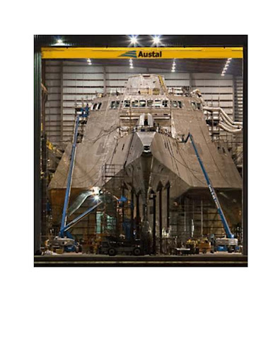
THE NEW USS INDEPENDAN
CE


Messing About In Ships Podcast


Have a really great weekend..Snow and all!
RS

Tuesday, November 18, 2008

A new approach in tsunami-early warning

A new approach in tsunami-early warning

The newly implemented Tsunami Early Warning System for the Indian Ocean, GITEWS, goes into operation today and with this, the system enters its final phase of optimisation.

As foreseen, the system was officially handed over to the BMKG (Meteorological, Climatology and Geophysical Agency of Indonesia) by the President of Indonesia, Susilo Bambang Yudhoyono, in the Indonesian capital Jakarta, slightly less than four years after the catastrophe of 2004.

"We are very pleased to put the Tsunami Early Warning System into operation today, exactly on schedule", explains Professor Reinhard Huettl, Chair of the Scientific Executive Board of the responsible GFZ - German Research Centre for Geosciences. "All partners have, through enormous effort and dedication, contributed to achieving today's result. And for this, I would like to sincerely thank all those involved".

This system differs from previous Tsunami Warning Systems through new scientific procedures and technologies. Due to the unique geological situation in Indonesia it turned out that the systems used up to now, such as the Pacific Tsunami Warning System, for example, are not at all optimal for Indonesia. Earthquakes in the Indian Ocean off the coast of Indonesia occur along a subduction zone, the Sunda Arc, which extends in the form of an arch from the north western corner of Sumatra to Flores in the east of Indonesia. Should a tsunami occur here, the waves, in an extreme case, will reach the coast within 20 minutes, so that only very little time remains to warn the areas at risk. This prevailing situation formed the basis when developing the concept for the entire system.

So new procedures for the fast and reliable determination of strong earthquakes, the modelling of tsunamis and the assessment of the situation have been applied in the Warning System. In particular, the direct incorporation of abroad variety of different sensors for a secure determination of a tsunami is a big challenge.

Progress in the scientific seismology


More than 90% of all tsunamis result from strong earthquakes. The catastrophe of December 2004 was, with a magnitude of 9.3, the second largest earthquake ever registered. One quarter of an hour after the quake, the tsunami reached the province of Banda Aceh and resulted alone here in the death of more than 140,000 people. In total approximately a quarter million people lost their lives.

A fast and accurate determination of the earthquake parameters (location, magnitude, source depth) is, therefore, essential for a fast Tsunami Early Warning System. A compact measuring network shortens, on the one hand, the time for the shock wave to reach the measuring instrument. On the other hand, however, it is extremely difficult to register and to evaluate the signals of strong earthquakes in the near field. New measuring and evaluation procedures were, therefore, developed for GITEWS.

SeisComP3 is the name of the software programme developed by scientists at the GFZ which, within minutes, determines the location and the magnitude of an earthquake. In this way several strong earthquakes and their individual parameters could already be determined within a good two minutes. The entire seismological network in Indonesia currently avails of over 120 stations. This evaluation software sets new standards worldwide. SeisComP3 is also meanwhile used by other neighbouring states of the Indian Ocean, for example in the Indian Early Warning System. And in addition this software is further applied on the Maldives, in Pakistan, in Thailand and in South Africa with other countries ready to follow.

Tide gauge measurements and deformation


In deep water a tsunami spreads at the speed of jet aircraft. The tsunami first slows down in shallow water and, in coastal areas, can swell to waves of up to 30 metres high. It is, therefore, extremely important to detect a tsunami in advance, for example at an offshore island, before the wave reaches the mainland. Through the GITEWS-Project, within the framework of UNESCO's Intergovernmental Oceanographic Commission (IOC) a total of 9 measuring stations have been erected in the Indian Ocean. Thus, not only reliable sea level data are available for the coast of Indonesia, but also for the neighbouring states of the Indian Ocean. The data are freely accessible in data bases.

During the catastrophic earthquake of 2004 a horizontal and vertical displacement of several decimetres to meters was evident even at a distance of some hundred kilometres from the quake. The direction of this resulting shift gives reference to the mechanism of the earthquake break and thus to the possible tsunami potential and the expected hazard. In order to determine the vertical and horizontal displacement immediately, all tide gauges within GITEWS have been additionally equipped with GPS receivers - this too is a completely new component of a Tsunami Early Warning System.

GPS Buoys: A new measuring instrument for Tsunamis


Not every earthquake generates a tsunami. For this reason it must be determined at sea whether or not an earthquake has actually triggered the deadly wave. For this purpose underwater measuring units are usually used where a pressure gauge is employed to record a tsunami. If a tsunami passes the pressure gauge the data are sent to buoys at the surface and passed on from there to a the central warning centre.

If the ocean bottom units lie too closely to quake source, the instruments cannot differentiate between an earth quake and a tsunami wave and could possibly release a false alarm. Consequently, the buoys do not only function as a relay station but also as an independent measuring instruments for tsunami detection. GFZ scientists already used GPS-antenna on buoys to determine sea motion and sea levels. In the GITEWS this new development is also used to detect tsunami waves which with speeds of up to 800 km/h and wavelengths of 200 kilometres in the open sea, are still relatively low. Innovative measuring and filter procedures allow the normal sea motion data to be suppressed. A centimetre-exact determination of the rise in the sea level remains and herewith also the early detection of a tsunami wave.

Currently 2 of the planned 10 buoy-systems are installed and a further 4 buoys are waiting in the port of Jakarta for installation.

Simulations


As the sensor network supplies data at some few points only, simulations are needed, in order to synthesize an overall picture of the situation. In this way, with the help of computer model for the ascertainment of arrival times and wave heights as well as information on the inhabitants and infrastructure, fast risk estimations can be reached which in turn support the decision to issue a warning.

On the basis of the extremely short advance warning time the computer simulations are pre-calculated with the help of the new software TsunAWI which is based on unstructured triangle lattices. This modelling system developed at the Alfred-Wegener Institute for Polar and Marine Research depicts the wave propagation and flooding in a, to date, unique way. A multitude of scenarios covers the possible tsunami events, so that in the case of an emergency a pre-computed scenario serves to help depict the actual real situation.

The data base, which evaluates the different measuring data with mathematical methods putting this, in turn, in relation to possible scenarios (so-called matching), represents a world-wide innovation. Since data from the different measuring systems complement each other, a precise matching can be made within seconds, and an exact description of the position can be given. The ever improving data availability during a tsunami event continuously stabilizes and completes the picture of actual prevailing condition.

Warning Centre and Decision-making Support


All available data, information and modelling flow finally together into a Decision Support System (DSS). The German Aerospace Center, DLR, has developed this system, which is used in reaching a decision on whether a tsunami warning is to be disseminated or not.

All sensor data are gathered within the DSS, all instruments are controlled and steered from here and it is also here that the synthesis of all data follow with the pre-computed simulations as well as the creation of the warning. The responsible person on-duty can on the basis of the available information, very quickly get an overview of the situation and generate suggestions on how to reach a decision. The depiction of the situation together with the recommendations for action is shown on several monitors.

DSS is geared to application in a crisis situation and is arranged in such a way that, also, under high time pressure and stress, fast and reliably decisions can be made. Extensive data bases hold, in addition to general geo-data, advanced processed risk information and hazard maps. This system developed here, is unique in its conception and complexity and is not comparable with any other system world-wide.

GITEWS has, from the beginning on, been developed as an integrating system, incorporating not only the data of the German sensor systems, but also sensor data from Indonesia and the other donor countries. Therefore, all interfaces to the sensor- and dissemination system are based on international standards, in order to guarantee for an interlaced and at the same time open system.

Capacity Building


For the technical operation, maintenance of the instruments and the advancement of the system, scientists and technical personnel need to be further educated. This has already been done parallel to the construction of the system through training of Indonesian scientists and engineers in Germany, as well as through various training programs on the part-components of the Early Warning System in Indonesia.

GITEWS cooperates closely with the authorities responsible for early warning, in order to convert the warnings into a clear decision-making basis, decision-making aids and instructions to handle and to pass these onto the population as quick as possible (warning and reaction chain). This interface is crucial for an Early Warning System and represents an enormous challenge in particular for the local governments at the district level, in whose hands the responsibility lies. Within the framework of the national responsibility in the case of natural catastrophe Indonesia has begun to create a suitable legal framework.

The introduction of a Tsunami Early Warning System at the local level requires the development of preparation plans. Their development, in particular for urban centres such as in Padang or in South Bali must be based on scientifically founded risk analyses, but also on political decision processes. Activities of the disaster prevention and preventive measures such as building standards or the creation of area utilisation plans are included here.

The probably most important aspect of early warning is the actual target group for the early warning, i.e. the population in the endangered regions. In order to allow effective measures to be taken at all with extremely short early warning times, the consciousness of the people with respect to the latent endangerment and possible preventive measures must be awakened and strengthened (Awareness), and it must be assured for that in the case of emergency the population reacts correctly (Preparedness). This is achieved by regular evacuation exercises and information sessions as well as by the constant teaching of facts in schools.

International consortium


For the construction of the Early Warning System in Indonesia different cooperations with donor countries such as Japan, China, France and the USA were incorporated so as to not only integrate the data of the German and Indonesian components, but to avail of all available sensors. The German activities essentially concentrated on Indonesia, but also in neighbouring states such as Sri Lanka, the Maldives, Yemen, Iran, Kenya, Tanzania and South Africa components and sensor technology as well as software have already been installed.

The integration of the German-Indonesian contribution and the contributions of further neighbouring states into an overall system for the Indian Ocean takes place under the coordination of the Intergovernmental Oceanographic Commission (IOC) of the UNESCO.

Additionally there are efforts to form a Global Early Warning System in which not only working groups from the Indian ocean participate, but also from the Northeast-Atlantic, the Mediterranean Sea, the Caribbean and the Pacific Ocean. Tasks in the coming two-year optimisation phase

The construction and employment of the complex GITEWS in a tectonically complicated area was and is scientifically, technically and organizationally an enormous challenge. In the now to follow two-year phase of the project the most important steps of the system optimisation will take place. "All components are assembled, even if the sensor network still has to be further consolidated", says Reinhard Huettl, "and only in the daily operation with the interplay of the different components will it become clear where and how individual elements need to be adjusted."

As with the launching of a newly constructed ship, now the interaction of the component parts need to be optimised, the personnel needs to be trained and eventual problems in the daily operation need to be dealt with. To date individual components (for example the earthquake module) in the provisional Warning Centre of the BMG in Jakarta have been used. With the completion of a new building, the subsequent installation of the necessary communication and computing hardware, and the implementation of the software components during the past weeks, the system is now available, for the first time, in its designed form.

Directly after the catastrophe of 26. December 2004, the German Federal Government commissioned the Helmholtz-Association, represented by the Helmholtz-Centre Potsdam - GFZ German Research Centre for Geosciences, with the development and implementation of an Early Warning System for Tsunamis in the Indian Ocean. Funds amounting to a total of 45 Million Euro represent the contribution of the Federal Government within the framework of the Tsunami Victim Aid.

Even with a perfectly working warning system a natural occurrence such as the tsunami of 2004 cannot be prevent and such catastrophes will continue to cause victims. However, with an Early Warning System the impact of such a natural catastrophe can certainly be minimised. And that is the goal of GITEWS.

WEATHER NOTE

NOVEMBER TORNADO AWARENESS MONTH

Sep 25th, 2005- Tornado on the north side of Carthage, Leake Co.

Governor Haley Barbor has declaired that November is "Tornado Awareness Month" for the state of Mississippi. Mississippi Emergency Management Agency (MEMA) and the National Weather Service will team up and conduct tornado safety programs across the state during the first two weeks of November. The purpose of this is to call attention to the secondary peak severe weather season that begins in the late fall and to review preparedness measures. November historically has been a very active month for severe weather and tornadoes. The graph below shows the two peaks in tornadoes across Mississippi.

Below is a list of several significant November tornado events which have occurred in the recent past:

  • November 21-22, 1992 - Large tornado outbreak, 14 total tornadoes with 1 long track F4 (128 miles), 5th longest. This tornado is more widely known as the Brandon Tornado. A total of 12 fatalities occurred during that horrific night
  • November 24, 2001 - Large tornado outbreak, 14 total tornadoes, 2 F4s and 2F3s. One of the F4s was the Fairfield Tornado. A total of 7 fatalities occurred across the region that early morning -Event Summary
  • November 10-11, 2002 - Veterans Day Outbreak, MS was on the southern end of the event but still had 7 total tornadoes - Event Summary
  • November 24, 2004 - Large tornado outbreak, 21 total tornadoes, 1 fatality - Event Summary
  • November 15, 2006 - Tornado event across southeast MS, 2F3s - Event Summary
  • If a tornado warning is issued for your area:

  • Go to the lowest level of your home and take shelter in an inner hallway or smaller inner room without windows, such as a closet or bathroom.
  • If you are in a mobile home or other portable structure, evacuate the structure, even if it is equipped with tie-downs. Take shelter in a building with a strong foundation, or if one is not available, lie in a ditch or low-lying area a safe distance away from the structure. Tornadoes cannot change elevation quickly enough to pick someone up out of a ditch, especially a deep ditch or culvert.
  • If you are in a vehicle or driving a vehicle, seek shelter immediately. Do not continue driving. Tornadoes can change direction very quickly and can lift a vehicle and toss it in the air. Get out of the vehicle and take shelter in a nearby building or lie in a ditch or low-lying area away from the vehicle.
  • Because many tornadoes occur at night, check your local weather forecast before going to bed and have a source of receiving weather warnings that will wake you whenever there is a severe-weather threat.

    National Oceanic and Atmospheric Administration (NOAA) weather radios sell for approximately $30 to $70 and sound an alarm whenever severe weather is approaching. The radios broadcast severe weather watches and warnings directly from the National Weather Service. Some of these radios can also be programmed to receive emergency information for specific counties. If you do not have a weather radio or cannot purchase one, it is recommended that you keep a battery-powered radio to be able to hear weather watches and warnings as local radio stations broadcast them.

    You are also invited to contact the National Weather Service for interviews, information, or answers to any questions you may have. In many instances, we are also able to present severe weather awareness programs to civic and industrial organizations, schools, amateur radio clubs, and hospital staffs.

    For more information, contact any of the following listed below.
    Or click HERE for a map indicating the contact for each service area.

    • Stephen Wilkinson, Warning Coordination Meteorologist
      National Weather Service Office Jackson, MS
    • 601-965-4638 ext 223
    • Richard Okulski, Warning Coordination Meteorologist
      National Weather Service Office Memphis, TN
    • 901-544-0405 or 0401 ext 223
    • Gary Beeler, Warning Coordination Meteorologist
      National Weather Service Office Mobile, AL
    • 251-633-5456 ext 223
    • Frank Revitte, Warning Coordination Meteorologist
      National Weather Service Office New Orleans/Baton Rouge, LA
    • 985-645-0899 ext 223<
    • Greg Flynn
      MEMA External Affairs
    • 601-933-6652

    MARITIME NOTE

    Houston port director named 2008 Maritime Person of the Year

    The Greater Houston Port Bureau and the Marine Exchange of the West Gulf have chosen Tom Kornegay, executive director of the Port of Houston Authority, to be their 2008 Maritime Person of the Year. He will be honored at a gala event scheduled for Nov. 15.

    Kornegay has served as executive director of the Port of Houston Authority since April 1992. Prior to that, he was the PHA’s managing director for five years. Kornegay joined the port in 1972 and worked his way up through the ranks, serving in the engineering department for 15 years before being appointed managing director.

    Kornegay learned on the job, consulting with port people on the East and West coasts who were building the first generation of true container terminals.

    When he first arrived at Houston, Kornegay said, “We had a ship at every dock every day,” filling something more than 30 berths at the port’s general cargo docks, also called City Docks. Now, although the port handles far more tonnage, it sees perhaps six to 10 ships on any given day. Much of that tonnage and those ship calls go to the container terminals at Barbours Cut and Bayport rather than the general cargo docks, although steel and other breakbulk cargoes are still handled there.

    “Over the years containerization has just completely changed the way we do business,” Kornegay said.

    The port began planning its second major container terminal, Bayport, in 1997, 25 years after beginning Barbours Cut. Kornegay has overseen this project too, although he now works with consultants and a staff of engineers.

    When he moved into the ranks of port management the American Association of Port Authorities was an important resource for him, Kornegay said, and he still works with friends and colleagues he met at port management seminars early on. The International Association of Ports and Harbors played a similar role.

    Since those days, Kornegay has been the chairman of AAPA and the president of IAPH, and he has served on many other committees and boards over the years. Among many other honors, Kornegay was named 2008 Houston Area Engineer of the Year.

    “The thing that has kept me here is the fact that my job changes all the time. I’m not doing the same thing that I was three years ago. I’m one of those crazy guys that likes change,” Kornegay said.

    Containerization is not the only profound change Kornegay has witnessed in the maritime industry. For example, “two decades ago,” he said, “we didn’t have an environmental department.”

    Once Houston accepted the role of environmental steward, he said, “we went from zero to the head of the pack pretty fast,” beginning with a decades-long widening and deepening project in the Houston Ship Channel over the course of which the port pledged not to do anything that would degrade Galveston Bay. The port strove to use every cubic yard of material from that project in a beneficial way, Kornegay said.

    Houston worked with resource agencies such as the National Marine Fisheries and the Environmental Protection Agency and came up with a plan to dispose of the dredged material by building marshes that eventually totaled about 4,000 acres. The actual widening and deepening has been finished but marsh creation will continue, Kornegay said.

    “From there, we went to our environmental management system. Our maintenance people have become ingrained into the system. They recycle; they do things to prevent spills; they follow the environmental management system principles. Through that program we became the first port in the U.S. to reach ISO 14001 standards,” Kornegay said.

    The port’s central maintenance facility and Barbours Cut Terminal have also joined the EPA’s Performance Track program, in which members pledge to go above and beyond environmental regulation requirements. Members include industrial manufacturers, government entities and many other organizations. A search of the Performance Track Web site did not reveal any ports listed other than Houston.

    The next challenge to the maritime trade, Kornegay believes, will stem from capacity constraints: Both import and export cargo will grow faster than U.S. facilities can handle. Economic downturns such as the current one are a temporary blip. “I am talking about the long term,” he said. “In my opinion, we are very close to reaching a stage where we don’t have enough cargo facilities. Not just containers, all kinds — but containers are going to be the first to hit the wall, so to speak.”

    Another crucial issue, one that will compound capacity problems, is the industry’s long-standing problem getting adequate federal funding for waterway maintenance. “The federal government has been cutting funding for many years. We have been deferring maintenance. We are at the point where it is about to catch up with us,” he said. “People in the U.S. just don’t understand how much they rely on trade by water.”

    Ports last decades, even centuries, and cost millions of dollars; decisions made today will affect many lives and have repercussions far into the future.

    “You have to put yourself in the position of asking ‘what’s best for the port, and what’s best for the community?’” Kornegay said. “That is the only way to make those decisions. People forget that we are really an economic development engine, if you will.” Many of the port’s decisions help it financially, but some do not; they are intended to help economic development rather than the port’s bottom line. For example, Kornegay said, the port has been involved in developing a freight rail district that will help rail cargo get through the Houston region more efficiently and will ease road congestion by removing many at-grade rail crossings that now tie up Houston-area roads.

    “We are largely responsible for getting (the freight-rail district) created,” he said. It has cost the port time and money “and gets us nothing in return, but it’s the right thing to do for this region.”

    The Harris County Ship Channel Security District is another example, he said. The port needed a mechanism to get the public and private terminals along the ship channel to come together and work on security issues that affect the whole area, rather than simply focusing on their own terminals. “So we created this entity, the Houston Ship Channel Security District, and we are now trying to get that approved and up and running. And again, we are not going to get anything for doing that. It’s just something that needed to be done.”

    TAFB Radiofax Schedule Changes

    On November 3, 2008 several radiofax charts produced by the National Hurricane Center which are broadcast from New Orleans, Pt. Reyes and Honolulu be based on information from different model run times. A 36 hour wind/wave chart will be added to the New Orleans broadcast. This change is to better align workflow to model production.

    The new broadcast schedules are listed on the TAFB Radiofax page.

    The schedules may also be found at http://weather.noaa.gov/fax/marine.shtml.

    Ceremony held for crewmen lost

    By JESSE DUNSMORE
    Times Herald

    Choppy waters, angry-looking rainy skies and gusts of wind up to 36 mph provided what Capt. Brian Eickel called “perfect background” for a Saturday memorial ceremony for crewmen lost on the Great Lakes.

    The second annual ceremony was held at the Great Lakes Maritime Center in Port Huron, and included several captains from the International Shipmasters’ Association.

    The event opened with a prayer led by Rev. Peggy Konkel of the Unity Church of Blue Water in Port Huron.

    Then a brass ensemble made up of students from Port Huron High School played “The Saints’ Halleluja.”

    Eickel read a poem composed by Danice Fleming, the chaplain of the Veterans of Foreign Wars May-O’Brien Post in Port Huron.

    Peter Werle, operations manager of the Maritime Center, introduced the segments of the program.

    “No man has ever served at sea without knowing each day could be his last,” Werle said before turning the podium over to Capt. Bill Cline to read off the names of 16 shipping vessels lost on the lakes since 1913.

    Among the losses were the 29-member crew of the Edmund Fitzgerald in 1975, and 30 from the S.S. James Carruthers in 1913.

    After each vessel was named, Capt. Bill Barnhardt rang a bell as Capt. Jerry Knox stood by.

    The band then played Pachelbel’s Canon, and Konkel led a closing prayer.
    After the ceremony, Eickel praised the crews of shipping vessels.

    “All those merchant mariners had to brave the bad weather,” he said. “It’s really just (about) not forgetting the merchant mariners that do this.”

    He said that while working in Duluth, Minn., he saw a freighter leaving the harbor and disappearing into darkness.

    “I thought to myself, God, how brave those people must be.”

    RS

    Wednesday, November 12, 2008

    Scientists find evidence of tsunamis on Indian Ocean shores long before 2004

    Scientists find evidence of tsunamis on Indian Ocean shores long before 2004

    A quarter-million people were killed when a tsunami inundated Indian Ocean coastlines the day after Christmas in 2004. Now scientists have found evidence that the event was not a first-time occurrence.

    A team working on Phra Thong, a barrier island along the hard-hit west coast of Thailand, unearthed evidence of at least three previous major tsunamis in the preceding 2,800 years, the most recent from about 550 to 700 years ago. That team, led by Kruawun Jankaew of Chulalongkorn University in Thailand, included Brian Atwater, a University of Washington affiliate professor of Earth and space sciences and a U.S. Geological Survey geologist.

    A second team found similar evidence of previous tsunamis during the last 1,200 years in Aceh, a province at the northern tip of the Indonesian island of Sumatra where more than half the deaths from the 2004 tsunami occurred.

    Findings from both teams are published in the Oct. 30 edition of Nature.

    Sparse knowledge of the region's tsunami history contributed to the loss of life in 2004, the scientists believe. Few people living along the coasts knew to heed the natural tsunami warnings, such as the strong shaking felt in Aceh and the rapid retreat of ocean water from the shoreline that was observed in Thailand.

    But on an island just off the coast of Aceh most people safely fled to higher ground in 2004 because the island's oral history includes information about a devastating tsunami in 1907.

    "A region's tsunami history can serve as a long-term warning system," Atwater said.

    The research will reinforce the importance of tsunami education as an essential part of early warning, said Jankaew, the lead author.


    "Many people in Southeast Asia, especially in Thailand, believe, or would like to believe, that it will never happen again," Jankaew said. "This will be a big step towards mitigating the losses from future tsunami events."

    The team found evidence for previous tsunamis by digging pits and auguring holes at more than 150 sites on an island about 75 miles north of Phuket, a Thai tourist resort area ravaged by the 2004 tsunami. That tsunami was generated 300 miles to the west when the seafloor was warped during a magnitude 9.2 earthquake.

    At 20 sites in marshes, the researchers found layers of white sand about 4 inches thick alternating with layers of black peaty soil. Witnesses confirmed that the top sand layer, just below the surface, was laid down by the 2004 tsunami, which ran 20 to 30 feet deep across much of the island.

    Radiocarbon dating of bark fragments in soil below the second sand layer led the scientists to estimate that the most recent predecessor to the 2004 tsunami probably occurred between A.D. 1300 and 1450. They also noted signs of two earlier tsunamis during the last 2,500 to 2,800 years.

    There are no known written records describing an Indian Ocean tsunami between A.D. 1300 and 1450, including the accounts of noted Islamic traveler Ibn Battuta and records of the great Ming Dynasty armadas of China, both of which visited the area at different times during that period. Atwater hopes the new geologic evidence might prompt historians to check other Asian documents from that era.

    "This research demonstrates that tsunami geology, both recent and past tsunamis, can help extend the tsunami catalogues far beyond historical records," Jankaew said.

    The new findings also carry lessons for the northwest coast of North America, where scientists estimate that many centuries typically elapse between catastrophic tsunamis generated by the Cascadia subduction zone.

    "Like Aceh, Cascadia has a history of tsunamis that are both infrequent and catastrophic, and that originate during earthquakes that provide a natural tsunami warning," Atwater said. "This history calls for sustained efforts in tsunami education."

    Note: This story has been adapted from a news release issued by University of Washington

    WEATHER NOTE

    Reburying the dead a grim task in Ike's wake

    IN THE MARSH OF CAMERON PARISH, La. (AP) — Joe Johnson craned his neck from the airboat as it circled a patch of brown marsh grass. The runaway coffin was not where it was supposed to be.

    Johnson pulled up to a pile of rocks, killed the motor and hopped out. After a few minutes of scouring along the tall, reedlike grass, he flagged down two fishermen.

    "Can you possibly take me along the shoreline?" Johnson asked. "I'm looking for a casket."

    Beyond the usual, dismal rebuilding, Hurricane Ike left another grim task when it struck last month: Its 13-foot storm surge washed an estimated 200 caskets out of their graves, ripping through most of Cameron Parish's 47 cemeteries and others in southwest Louisiana and coastal Texas. Some coffins floated miles into the marsh.

    At Hollywood Cemetery in Orange, Texas, Ike unearthed about 100 caskets. Dozens more were disgorged in hard-hit Galveston.

    Officials in coastal areas have long struggled with interring the dead, as caskets buried in low-lying areas are susceptible to being belched up by floodwaters. Some areas — most notably New Orleans — house the dead in above-ground crypts to keep them from drifting away in storms.

    For many of the dead forced up by Ike, it wasn't their first disturbance. About 80 percent of the caskets in southwest Louisiana displaced by Ike were rousted by Hurricane Rita just three years earlier, said Zeb Johnson, the Calcasieu Parish deputy coroner who's headed casket recovery efforts for Rita and Ike.

    Of the caskets ejected by Rita in September 2005, 335 were found and reburied, he said. Eighteen were never found.

    "Our mother came out for Rita, and now she came out for Ike," said Debra Dyson, a commercial fisher whose house in Cameron was destroyed by Ike.

    Dyson said coffins holding her brother-in-law and cousin also were heaved out by Rita. Ike was worse — the storm thrust out caskets containing her mother, brother-in-law, cousin, niece, three uncles and two aunts.

    The one containing Dyson's mother floated to the same spot it came to rest after Rita, 22 miles from the cemetery. Only this time, it didn't take nine months to find it.

    "It's hard to lose your home, but the first stop you make is that cemetery just to make sure they're still there, and it's heartbreaking when they're not," said Marilyn Dyson Elizondo, Dyson's sister who lives in Dayton, Texas.

    Zeb Johnson helms a team of two employees, volunteer boat pilots and state prisoners to search hundreds of miles of marsh with loaned equipment and haul coffins back to shore. The work is backbreaking, with caskets weighed down by mud in swampy areas teeming with alligators and snakes and the stench of rotting marsh grass.

    "It's a job that has to be done," said Joe Johnson, a funeral director and embalmer from Lake Charles who is not related to the deputy coroner.

    Joe Johnson's half-hour ride with the fishermen didn't turn up the pink casket reported to the coroner's office, like so many other tips that don't pan out. An hour later, however, he returned with another coffin found in thick grass near a canal bank.

    A hole was drilled into the silver metal container to drain out marsh muck and lighten the load for the airboat. Prisoners pulling the casket from the boat tipped it again to empty out more of the fetid water.

    The coffin was trucked to the city coliseum in Lake Charles, where the Federal Emergency Management Agency was providing refrigerated trucks to hold caskets until reburial arrangements could be made.

    "It's a slow process," Zeb Johnson said.

    The Calcasieu Parish Coroner's Office is footing most of the search and recovery bill, which hasn't been tallied. But reburying the dead is estimated to cost as much as $100,000 on top of the recovery costs, with much of the money needed for new caskets and vaults. Zeb Johnson wasn't sure who'll cover that price tag, so he wasn't sure when reburial could begin.

    More than 140 coffins had been found by Wednesday, and about 20 others that didn't stray far from their burial sites were quickly reburied. Zeb Johnson doesn't expect to find all of the two dozen or more that remain missing.

    "The first day we found caskets that had floated 30 miles from their cemeteries," he said. "You just have caskets floating out in the marsh. At least seven of these caskets ended up in Texas, kind of like boats, they just got out in the currents from the high waters and carried them to Texas."

    The identification work in many instances is easier this time around. Bodies found after Rita were tagged with special markers, as were the silver metal coffins in which they were reburied. The coffins include a scroll with the deceased's name, where they were buried and other information.

    A few families are considering reburials on higher ground. Cameron Parish's government has proposed requiring deeper burials.

    Elizondo, whose family awaits word on the missing Dyson caskets, said her brother was buried in January in a deeper vault than those that housed her missing relatives. Ike didn't disturb her brother, so Elizondo wants to rebury her mother the same way, though it is more expensive.

    "It's worth it. That way we have the peace of mind that mom won't be gone again," Elizondo said. "We've even offered to do the backhoe ourselves. We just don't want her coming back up again."

    MARITIME NOTE

    Napoli bill put at staggering £120m

    THE grounding of the MSC Napoli off the Westcountry coast is the second most expensive shipping incident ever, it has emerged.

    Insurers of the 62,000-tonne container ship, beached off East Devon in January 2007, have estimated the total bill for the wreck at £120 million.

    It means the clean-up, salvage, vessel and cargo costs from the Napoli are second only to the Exxon Valdez – the tanker which spilt 10.8 million gallons of crude oil into the sea at Prince William Sound, Alaska, in 1989.

    One of the biggest environmental disasters to occur at sea, its costs have run into hundreds of millions of pounds. News of the vast bill emerged as the Maritime and Coastguard Agency released a report into the grounding, making 11 recommendations.

    Charles Hattersley, a Plymouth- based marine law expert, said the huge costs were "understandable" given the nature of the incident. But he said the scale, and cost, of the incident had not been matched by the Government's response.

    "In my view, the Government should have instigated its own public inquiry into what happened," said Mr Hattersley, a partner at Ashfords solicitors. "Instead, Devon County Council has had to step up to the plate."

    The cost of the Napoli grounding was revealed by the London Steam-Ship Owners' Mutual Insurance Association Limited, otherwise known as the P&I (Protection and Indemnity) Club. It is managed by London-based A Bilbrough and Company Limited.

    In its annual report, chief executive Paul Hinton confirmed the Napoli's £120 million estimated bill was the "second most expensive claim ever".

    He said the beaching of the vessel had avoided "a potentially very grave environmental disaster". He described the aftermath as "an enormous challenge in technical, regulatory and legal terms".

    Mr Hinton added: "The salvage and removal of the wreck of the ship and her containers, as well as the disposal of cargo within the containers, has been a unique experience in a number of respects, but importantly, it is the first occasion on which a large container ship has foundered in a recoverable condition off the coast of a European state.

    "Other container ships have been salvaged following fire or explosion (resulting in the loss of a relatively small proportion of their cargo) or have sunk in deep water (with the total loss of ship and cargo). "The MSC Napoli represents the first occasion when almost the totality of a ship's container cargo has been brought ashore in both sound and extensively wetted condition, for forwarding and disposal.

    "This huge undertaking has also taken place under the watchful eye of one of the most robust environmental regulatory regimes in the world and every aspect of the waste cargo handling and disposal operation, involving the disposal of some 30,000 tonnes of cargo, has been scrutinised by the Environment Agency."

    He said the total cost of recovering the cargo and removing the ship had escalated to some £53 million. Yesterday, the MCA's 103-page report into the incident was submitted to the Devon County Council-led inquiry into the grounding.

    It concedes that lessons can be learned to improve communication between organisations and streamlining the jurisdiction between land and sea.

    The report highlights 11 recommendations which include improving communications between salvagers and land-based response organisations, and educating other agencies on marine emergency procedures.

    It says the next Marine National Contingency Plan should assess who is best-placed to take responsibility for protecting and cleaning the shoreline, and also how various response centres could be merged to offer more effective communication and partnerships.

    But the professionalism of those involved in the operations at sea meant the risk of years of oil pollution along the coasts of Devon was averted.

    The report summarises the MCA's activities from January 18 last year when the Napoli, bound for South Africa, "suffered a catastrophic hull failure" when she was 50 miles south of Cornwall's Lizard peninsula, and the 26-strong crew was rescued after taking to life-rafts.

    It addresses the controversial issue of why the Napoli was towed to British waters instead of French, when its position was between the two. "The conclusion was that the least environmentally risky option was to tow the vessel to a place of refuge in UK waters," it says.

    The Secretary of State's Representative for Maritime Salvage and Intervention, Robin Middleton, decided the ship was in danger of breaking up and polluting the English Channel and should be towed to Portland. But, during the operation, the weather deteriorated and the salvors and Mr Middleton decided to beach her in Lyme Bay to minimise the pollution threat.

    The report says the only option was to ground the ship on shallow waters to avoid "almost certain" break-up. The Napoli had 3,664 tonnes of fuel oil and marine diesel on board.

    "The spilled oil would have escaped and found its way on to many beaches, possibly on both sides of the Channel, for many years," says the report.

    The report accepts that the "understandable" confusion over the legislation governing salvage had been exploited by salvagers who descended on Branscombe's beaches after 50 containers washed ashore.

    RS