Showing posts with label M/V Napoli. Show all posts

Friday, November 21, 2008

Tsunami could cripple nuclear reactors, NRC says

Tsunami could cripple nuclear reactors, NRC says

Doesn’t that teeny weeny nuclear power plant on the bluff look like our very own San Onofre Nuclear Generating Station?!

This illustration, from a recent Nuclear Regulatory Commission report soberly titled “Tsunami Hazard Assessment at Nuclear Power Plant Sites in the United States of America,” says that those rogue waves most often caused by big earthquakes “can result in a severe hazard to safety-related cooling-water systems as well as other structures, systems and components important to safety of a nuclear power plant.”

“The primary effect of the tsunami waves on a plant site is flooding … and loss of cooling water (due to dry intakes during drawdown caused by receding tsunami waves).”

“However, there are also several other effects, mainly from hydrodynamic forces that can cause severe damage to structures and the foundations of these structures.”

The NRC last updated its construction guidelines for this type of thing more than 30 years ago - in 1977.

GEE, THANKS. ONE MORE THING TO WORRY ABOUT.

OK, so, the economy is crumbling beneath our feet and must we ponder a tsunami hitting the local nuclear power plant and sucking away cooling water and producing radioactive chaos?

“In the wake of the December 26, 2004, Sumatra earthquake and its accompanying tsunami that resulted in widespread loss of life and property in the Indian Ocean region, hazards posed by tsunamis have emerged as some of the most severe caused by natural phenomena,” the NRC’s report says. ”One operating nuclear power reactor was shut down during this tsunami, and, therefore, international nuclear power plant operators and reviewers felt the need to review the approach towards tsunami-hazard assessment for existing and proposed sites.”

Since dozens of new nuclear plants are in the pipeline to be built, the NRC is reworking regulations to be more confident plants can weather such rare but crippling crises. Like, specifically, making sure cooling water intake pipes are far enough off shore - and in deep enough water - that they won’t be left high and dry if water recedes.

WE’LL BE FINE


There’s not much to worry about here, says Gil Alexander, the very good-natured spokesman for Southern California Edison, which runs San Onofre.

“San Onofre was engineered to meet the Nuclear Regulatory Commission’s stringent safety design standards plus provide a large margin of safety beyond those standards,” Alexander said in an email (on his day off, after reading through the report and contacting company mucky-mucks). “The plant’s two operating units are designed to safely shutdown during natural disasters including major earthquakes and tsunamis.”

The NRC is accepting comments on its draft report through Dec. 5, and new regulations are expected to emerge some time after that.

WEATHER NOTE


'It's a tornado' cry terrified Suffolk residents


Powerful winds and a cold front in southern Britain created ideal tornado conditions

The 200 residents of a usually hushed East Suffolk village were left terrified and bewildered when a “twister” roared into Pettistree, near Woodbridge.

Trees and electricity lines were ripped out and homes and schools damaged as the freak weather system barrelled towards the East Anglian coast.

The Met Office and storm experts confirmed today that extreme weather fronts in South-East England yesterday afternoon created the perfect conditions for tornadoes.

“It was horrendous,” said Maureen Stollery, 67, who watched open-mouthed from her home in the village at about 2pm. “Everything was going round and round. It was spinning the top of a 35ft tree in our garden until it was ripped off. It was actually pulled clean off and the top spun round in the air.“The sound of the wind and the rain was like an apache helicopter. It went very dark and it was raining so much – it was lashing the house. It was much worse than the 1987 storm.”

Fellow villagers Dom and Cherry White agreed that it was the sound that warned them of the approaching storm.

“It was as if the walls were going to fall in,” Mrs White told the East Anglian Daily Times. “It was like a twister coming through the garden. We could see it and it was quite extraordinary. We heard the noise first.”

About 20 miles nearer the coast, the town of Leiston felt the same powerful force a few minutes later as the storm system swept across Suffolk. Paul Knightley, a severe weather expert from Torro, which monitors the British climate, said: “It’s almost certainly a tornado, there aren’t really any other phenomena that would have left such a narrow path of damage.”

Mr Knightley explained that tornadoes can form when a cold front is moving with a narrow ribbon of rain along its leading edge forcing warm air upwards very quickly. Dramatic air turbulence forming tornadoes can be created by wind shear, which sees wind speed and direction changing with altitude.

In the aftermath of a tornado, rotational damage can usually be observed - most often through signs of twisting in trees.

At Leiston High School by the Suffolk coast, a window was blown out, smashing to the ground in a courtyard between classrooms. Ian Flintoff, the headmaster, said: “The tornado came across the front of the school. I was talking to another teacher and it took my breath away. It stopped what we were doing - it was very eerie inside.”

He told the East Anglian Daily Times: “Very suddenly there was a major gust of wind in an extreme way I have not experienced before. Trees were moving around quite violently and the building shook.

“It caused damage to the roof, ripping off a sky light, and lifted bins off the ground. It was a very short lived but violent episode.

“It happened when school was in session so luckily there were no students about. It was really disturbing and lasted for about 30 seconds - no more than that. As a geographer I have seen it on the television but I have never experienced weather like it before.”

Weather fronts in the rest of southern Britain yesterday left two dead as roads were flooded and one powerful gust knocked over a crane in Essex, killing a man.

Strong winds have continued today, particularly in northwest Scotland. The worst of the weather is then expected to ease with sunny spells predicted for tomorrow and Thursday

Australia opens national tsunami warning center

CANBERRA, Australia – Australia became an integral link in a network of tsunami warning hubs across the Indian and Pacific oceans with the official opening of a national monitoring center Friday.

The Joint Australian Tsunami Warning Center that opened in the southern city of Melbourne joins India as a "tsunami watch provider" for 29 countries on the Indian Ocean rim that are prone to the killer waves, said Ray Canterford, head of the Australian Bureau of Meteorology's disaster mitigation office.

Work on the 69 million Australian dollar ($46 million) center developed by the government was launched six months after the catastrophic 2004 tsunami.

It will provide essential sea level and seismic data to the Pacific warning network to Southwest Pacific island nations. This data is critical to the Pacific Tsunami Warning Center in Hawaii and the Japanese Meteorological Agency in Tokyo, Canterford said.

Eventually, there will be a network of several countries on the Indian Ocean rim with their own tsunami warning centers sharing scientific data, he said.

"We're actually enhancing the capabilities of other countries in the Pacific and in the Indian Ocean," he said.

The center relies on high-tech deep sea buoys, five of which are located northwest of Australia below Indonesia, one in northeast of Australia in the Coral Sea and two in the Tasman Sea off the southeast coast.

Indonesia, which bore the brunt of the 2004 tsunami that killed more than 230,000 people, is expected to have its own national warning center fully operational by the end of the year, Canterford said.

MARITIME NOTE

Report on Napoli Beaching Incident


On Nov. 6, The Maritime and Coastguard Agency delivered its in-depth 103 page Report to the Chairman of Devons local Inquiry into the circumstances leading to the beaching of the MSC Napoli off the East Devon coastline.

The Report summarises the Agencys activities from the moment the incident broke on the18th January 2007, when the MSC Napoli was on passage in the English Channel, loaded with 2,318 containers and bound for South Africa and when she suffered a catastrophic hull failure and got into severe difficulties.

A number of possible locations were assessed by both the French and British authorities for a place of refuge on both sides of the Channel; however, the south coast of England provided better options for a place of refuge. The conclusion was that the least environmentally risky option was to tow the vessel to a place of refuge in UK waters.

Working with the French authorities, the Secretary of States Representative for Maritime Salvage and Intervention (SOSREP) decided that the ship was in danger of breaking up and polluting the English Channel and should be towed to Portland Harbor.

The SOSREP consulted with local authorities and environmental bodies to the fullest extent possible within the time available. With the condition of the ship deteriorating rapidly, it was necessary for the salvors and the SOSREP to make a fast decision in order to avert a potential environmental catastrophe.

During towing, the weather deteriorated and the salvors and the SOSREP decided to beach the ship in Lyme Bay to minimize the pollution threat.

The MSC Napoli was beached in Lyme Bay on 20 January 2007. Over the next six months the 3,500 tonnes of fuel oil and the containers were systematically removed. The final container was removed on 17 May 2007. Explosives were used to split the MSC NAPOLI into two sections. On 20 July, the ship was successfully split into two pieces and the bow section was towed a short distance away.

The bow section of MSC NAPOLI was removed from Lyme Bay and taken to Harland and Wolffs dismantling facility in Belfast in mid-August 2007. The remaining stern section was left in situ in Lyme Bay, to be cut up and taken away to a recycling facility.

Toby Stone, Head of the Agencys Counter Pollution Unit said, “The successful way in which the MSC NAPOLI was handled demonstrates the effectiveness of the UKs arrangements for handling incidents at sea and the professionalism of all of those involved.”

“We also hope that our submission to the Inquiry will set the record straight on several issues, including of course, the overriding practical reasons for beaching the vessel at Branscombe, and the function of a Shoreline Response Centre. In this case there was no need for such a Centre to co-ordinate the shoreline clean-up operation because the third party insurers retained the services of contractors to do the necessary clean-up work.”

The finalized report will not only be published for general consumption but is intended also to form the Governments contribution to Devon County Councils MSC Napoli Public Inquiry, for which public hearings started on 3 November 2008 and will finish on 7 November 2008.

The report is a factual account of the response to the incident, with conclusions, lessons learned and recommendations. In addition to the response by the MCA, it includes coverage of the actions of other relevant authorities.

(Source: The Maritime & Coastguard Agency Press Office)

SCI Announces the Christmas at Sea Gala & Auction 2008

Event Opens 175th Anniversary Celebration

October 9, 2008. The Seamen’s Church Institute (SCI) announces its annual holiday party, the Christmas at Sea Gala & Auction on Tuesday, December 2, 2008, at the New York Yacht Club in midtown Manhattan. A party aimed at fundraising for the Institute, this event evokes a very warm sentiment. During the cold month of December, SCI celebrates the Christmas at Sea knitting program, the volunteer knitting program of SCI. It has, for 110 years, been collecting and distributing warmth in the form of scarves and hats to mariners working at Christmastime. This year’s event also marks an important year milestone in the history of the entire organization. The party jump-starts the Institute’s celebration of its 175th Anniversary in 2009.

Jennifer Koenig, Director of Special Events and Donor Relations at SCI, has been planning this event for months. “What I really like about this annual event is that the holiday spirit of goodwill and peace harmonizes with the mission of the Institute.” Koenig points out that SCI’s history of serving the maritime industry is a history filled with generous gifts in support of SCI’s mission to mariners. “People who come to this event are a part of spreading holiday cheer, and it means that we can continue the Institute’s various service programs to mariners.”

In addition to peace and goodwill, there is another aspect of the holiday which features prominently in the evening’s festivities, says Koenig—presents. The Christmas at Sea Gala & Auction includes, as its name suggests, an auction of various donated items. All of the proceeds go to the Seamen’s Church Institute. Auction items in the past have included tropical cruises, ski vacations, and historic maritime memorabilia. Koenig says of this year’s auction, “We will have some great items up for bid this year, and because the holiday is an atmosphere for fun surprises, we will have some of those too.”

Invitations for the Gala & Auction will go out next week. If you would like to receive an invitation, email Special Events Associate Carrie Brennan at cbrennan@seamenschurch.org. Koenig hopes that the event will be well attended. She says, “As with all parties, the more the merrier. In the case of the Christmas at Sea Gala & Auction, with more people attending, we will be able to make merrier the Christmases of many mariners.”

NY Yacht Club Model Room CAS Gala

The Model Room at the New York Yacht Club, host to the 2008 Christmas at Sea Gala and Auction.


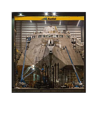
THE NEW USS INDEPENDAN
CE


Messing About In Ships Podcast


Have a really great weekend..Snow and all!
RS

Wednesday, November 12, 2008

Scientists find evidence of tsunamis on Indian Ocean shores long before 2004

Scientists find evidence of tsunamis on Indian Ocean shores long before 2004

A quarter-million people were killed when a tsunami inundated Indian Ocean coastlines the day after Christmas in 2004. Now scientists have found evidence that the event was not a first-time occurrence.

A team working on Phra Thong, a barrier island along the hard-hit west coast of Thailand, unearthed evidence of at least three previous major tsunamis in the preceding 2,800 years, the most recent from about 550 to 700 years ago. That team, led by Kruawun Jankaew of Chulalongkorn University in Thailand, included Brian Atwater, a University of Washington affiliate professor of Earth and space sciences and a U.S. Geological Survey geologist.

A second team found similar evidence of previous tsunamis during the last 1,200 years in Aceh, a province at the northern tip of the Indonesian island of Sumatra where more than half the deaths from the 2004 tsunami occurred.

Findings from both teams are published in the Oct. 30 edition of Nature.

Sparse knowledge of the region's tsunami history contributed to the loss of life in 2004, the scientists believe. Few people living along the coasts knew to heed the natural tsunami warnings, such as the strong shaking felt in Aceh and the rapid retreat of ocean water from the shoreline that was observed in Thailand.

But on an island just off the coast of Aceh most people safely fled to higher ground in 2004 because the island's oral history includes information about a devastating tsunami in 1907.

"A region's tsunami history can serve as a long-term warning system," Atwater said.

The research will reinforce the importance of tsunami education as an essential part of early warning, said Jankaew, the lead author.


"Many people in Southeast Asia, especially in Thailand, believe, or would like to believe, that it will never happen again," Jankaew said. "This will be a big step towards mitigating the losses from future tsunami events."

The team found evidence for previous tsunamis by digging pits and auguring holes at more than 150 sites on an island about 75 miles north of Phuket, a Thai tourist resort area ravaged by the 2004 tsunami. That tsunami was generated 300 miles to the west when the seafloor was warped during a magnitude 9.2 earthquake.

At 20 sites in marshes, the researchers found layers of white sand about 4 inches thick alternating with layers of black peaty soil. Witnesses confirmed that the top sand layer, just below the surface, was laid down by the 2004 tsunami, which ran 20 to 30 feet deep across much of the island.

Radiocarbon dating of bark fragments in soil below the second sand layer led the scientists to estimate that the most recent predecessor to the 2004 tsunami probably occurred between A.D. 1300 and 1450. They also noted signs of two earlier tsunamis during the last 2,500 to 2,800 years.

There are no known written records describing an Indian Ocean tsunami between A.D. 1300 and 1450, including the accounts of noted Islamic traveler Ibn Battuta and records of the great Ming Dynasty armadas of China, both of which visited the area at different times during that period. Atwater hopes the new geologic evidence might prompt historians to check other Asian documents from that era.

"This research demonstrates that tsunami geology, both recent and past tsunamis, can help extend the tsunami catalogues far beyond historical records," Jankaew said.

The new findings also carry lessons for the northwest coast of North America, where scientists estimate that many centuries typically elapse between catastrophic tsunamis generated by the Cascadia subduction zone.

"Like Aceh, Cascadia has a history of tsunamis that are both infrequent and catastrophic, and that originate during earthquakes that provide a natural tsunami warning," Atwater said. "This history calls for sustained efforts in tsunami education."

Note: This story has been adapted from a news release issued by University of Washington

WEATHER NOTE

Reburying the dead a grim task in Ike's wake

IN THE MARSH OF CAMERON PARISH, La. (AP) — Joe Johnson craned his neck from the airboat as it circled a patch of brown marsh grass. The runaway coffin was not where it was supposed to be.

Johnson pulled up to a pile of rocks, killed the motor and hopped out. After a few minutes of scouring along the tall, reedlike grass, he flagged down two fishermen.

"Can you possibly take me along the shoreline?" Johnson asked. "I'm looking for a casket."

Beyond the usual, dismal rebuilding, Hurricane Ike left another grim task when it struck last month: Its 13-foot storm surge washed an estimated 200 caskets out of their graves, ripping through most of Cameron Parish's 47 cemeteries and others in southwest Louisiana and coastal Texas. Some coffins floated miles into the marsh.

At Hollywood Cemetery in Orange, Texas, Ike unearthed about 100 caskets. Dozens more were disgorged in hard-hit Galveston.

Officials in coastal areas have long struggled with interring the dead, as caskets buried in low-lying areas are susceptible to being belched up by floodwaters. Some areas — most notably New Orleans — house the dead in above-ground crypts to keep them from drifting away in storms.

For many of the dead forced up by Ike, it wasn't their first disturbance. About 80 percent of the caskets in southwest Louisiana displaced by Ike were rousted by Hurricane Rita just three years earlier, said Zeb Johnson, the Calcasieu Parish deputy coroner who's headed casket recovery efforts for Rita and Ike.

Of the caskets ejected by Rita in September 2005, 335 were found and reburied, he said. Eighteen were never found.

"Our mother came out for Rita, and now she came out for Ike," said Debra Dyson, a commercial fisher whose house in Cameron was destroyed by Ike.

Dyson said coffins holding her brother-in-law and cousin also were heaved out by Rita. Ike was worse — the storm thrust out caskets containing her mother, brother-in-law, cousin, niece, three uncles and two aunts.

The one containing Dyson's mother floated to the same spot it came to rest after Rita, 22 miles from the cemetery. Only this time, it didn't take nine months to find it.

"It's hard to lose your home, but the first stop you make is that cemetery just to make sure they're still there, and it's heartbreaking when they're not," said Marilyn Dyson Elizondo, Dyson's sister who lives in Dayton, Texas.

Zeb Johnson helms a team of two employees, volunteer boat pilots and state prisoners to search hundreds of miles of marsh with loaned equipment and haul coffins back to shore. The work is backbreaking, with caskets weighed down by mud in swampy areas teeming with alligators and snakes and the stench of rotting marsh grass.

"It's a job that has to be done," said Joe Johnson, a funeral director and embalmer from Lake Charles who is not related to the deputy coroner.

Joe Johnson's half-hour ride with the fishermen didn't turn up the pink casket reported to the coroner's office, like so many other tips that don't pan out. An hour later, however, he returned with another coffin found in thick grass near a canal bank.

A hole was drilled into the silver metal container to drain out marsh muck and lighten the load for the airboat. Prisoners pulling the casket from the boat tipped it again to empty out more of the fetid water.

The coffin was trucked to the city coliseum in Lake Charles, where the Federal Emergency Management Agency was providing refrigerated trucks to hold caskets until reburial arrangements could be made.

"It's a slow process," Zeb Johnson said.

The Calcasieu Parish Coroner's Office is footing most of the search and recovery bill, which hasn't been tallied. But reburying the dead is estimated to cost as much as $100,000 on top of the recovery costs, with much of the money needed for new caskets and vaults. Zeb Johnson wasn't sure who'll cover that price tag, so he wasn't sure when reburial could begin.

More than 140 coffins had been found by Wednesday, and about 20 others that didn't stray far from their burial sites were quickly reburied. Zeb Johnson doesn't expect to find all of the two dozen or more that remain missing.

"The first day we found caskets that had floated 30 miles from their cemeteries," he said. "You just have caskets floating out in the marsh. At least seven of these caskets ended up in Texas, kind of like boats, they just got out in the currents from the high waters and carried them to Texas."

The identification work in many instances is easier this time around. Bodies found after Rita were tagged with special markers, as were the silver metal coffins in which they were reburied. The coffins include a scroll with the deceased's name, where they were buried and other information.

A few families are considering reburials on higher ground. Cameron Parish's government has proposed requiring deeper burials.

Elizondo, whose family awaits word on the missing Dyson caskets, said her brother was buried in January in a deeper vault than those that housed her missing relatives. Ike didn't disturb her brother, so Elizondo wants to rebury her mother the same way, though it is more expensive.

"It's worth it. That way we have the peace of mind that mom won't be gone again," Elizondo said. "We've even offered to do the backhoe ourselves. We just don't want her coming back up again."

MARITIME NOTE

Napoli bill put at staggering £120m

THE grounding of the MSC Napoli off the Westcountry coast is the second most expensive shipping incident ever, it has emerged.

Insurers of the 62,000-tonne container ship, beached off East Devon in January 2007, have estimated the total bill for the wreck at £120 million.

It means the clean-up, salvage, vessel and cargo costs from the Napoli are second only to the Exxon Valdez – the tanker which spilt 10.8 million gallons of crude oil into the sea at Prince William Sound, Alaska, in 1989.

One of the biggest environmental disasters to occur at sea, its costs have run into hundreds of millions of pounds. News of the vast bill emerged as the Maritime and Coastguard Agency released a report into the grounding, making 11 recommendations.

Charles Hattersley, a Plymouth- based marine law expert, said the huge costs were "understandable" given the nature of the incident. But he said the scale, and cost, of the incident had not been matched by the Government's response.

"In my view, the Government should have instigated its own public inquiry into what happened," said Mr Hattersley, a partner at Ashfords solicitors. "Instead, Devon County Council has had to step up to the plate."

The cost of the Napoli grounding was revealed by the London Steam-Ship Owners' Mutual Insurance Association Limited, otherwise known as the P&I (Protection and Indemnity) Club. It is managed by London-based A Bilbrough and Company Limited.

In its annual report, chief executive Paul Hinton confirmed the Napoli's £120 million estimated bill was the "second most expensive claim ever".

He said the beaching of the vessel had avoided "a potentially very grave environmental disaster". He described the aftermath as "an enormous challenge in technical, regulatory and legal terms".

Mr Hinton added: "The salvage and removal of the wreck of the ship and her containers, as well as the disposal of cargo within the containers, has been a unique experience in a number of respects, but importantly, it is the first occasion on which a large container ship has foundered in a recoverable condition off the coast of a European state.

"Other container ships have been salvaged following fire or explosion (resulting in the loss of a relatively small proportion of their cargo) or have sunk in deep water (with the total loss of ship and cargo). "The MSC Napoli represents the first occasion when almost the totality of a ship's container cargo has been brought ashore in both sound and extensively wetted condition, for forwarding and disposal.

"This huge undertaking has also taken place under the watchful eye of one of the most robust environmental regulatory regimes in the world and every aspect of the waste cargo handling and disposal operation, involving the disposal of some 30,000 tonnes of cargo, has been scrutinised by the Environment Agency."

He said the total cost of recovering the cargo and removing the ship had escalated to some £53 million. Yesterday, the MCA's 103-page report into the incident was submitted to the Devon County Council-led inquiry into the grounding.

It concedes that lessons can be learned to improve communication between organisations and streamlining the jurisdiction between land and sea.

The report highlights 11 recommendations which include improving communications between salvagers and land-based response organisations, and educating other agencies on marine emergency procedures.

It says the next Marine National Contingency Plan should assess who is best-placed to take responsibility for protecting and cleaning the shoreline, and also how various response centres could be merged to offer more effective communication and partnerships.

But the professionalism of those involved in the operations at sea meant the risk of years of oil pollution along the coasts of Devon was averted.

The report summarises the MCA's activities from January 18 last year when the Napoli, bound for South Africa, "suffered a catastrophic hull failure" when she was 50 miles south of Cornwall's Lizard peninsula, and the 26-strong crew was rescued after taking to life-rafts.

It addresses the controversial issue of why the Napoli was towed to British waters instead of French, when its position was between the two. "The conclusion was that the least environmentally risky option was to tow the vessel to a place of refuge in UK waters," it says.

The Secretary of State's Representative for Maritime Salvage and Intervention, Robin Middleton, decided the ship was in danger of breaking up and polluting the English Channel and should be towed to Portland. But, during the operation, the weather deteriorated and the salvors and Mr Middleton decided to beach her in Lyme Bay to minimise the pollution threat.

The report says the only option was to ground the ship on shallow waters to avoid "almost certain" break-up. The Napoli had 3,664 tonnes of fuel oil and marine diesel on board.

"The spilled oil would have escaped and found its way on to many beaches, possibly on both sides of the Channel, for many years," says the report.

The report accepts that the "understandable" confusion over the legislation governing salvage had been exploited by salvagers who descended on Branscombe's beaches after 50 containers washed ashore.

RS


Friday, September 26, 2008

"Freak" Hurricane Ike Will Cost $22 Billion

"Freak" Hurricane Ike Will Cost $22 Billion

Hurricane Ike will be entered into the record books for the severe damage it inflicted in and around Galveston, Texas, experts say.

"This one's going to be famous for a long time, if for no other reason than it hit Texas, which hadn't gotten a strike by a damaging hurricane in 25 years," said Jeff Masters, director of Weather Underground, a private commercial forecasting service.

Masters also noted that the cost of Ike's rampage along the Gulf Coast could reach U.S. $22 billion, which would make it the third costliest hurricane on record behind Hurricane Katrina in 2005 and Hurricane Andrew in 1992.

The center of Hurricane Ike made landfall around 3 a.m. EDT Saturday at Galveston. The storm's peak winds were clocked at 110 miles (177 kilometers) an hour, making it just short of a major Category 3 hurricane. (See photos of the hurricane's aftermath.)

But the storm's enormous size—nearly as large as the state of Texas—spread its destruction from eastern Louisiana to Texas.

"Freak" Storm

The worst of Ike's damage was caused by its huge storm surge, a mound of water pushed ashore by the storm's winds. (Watch video of Ike's waves crash over buildings in Cuba.)

Because of Hurricane Ike's huge size, its storm surge of 10 to 15 feet (3 to 4.6 meters) above normal tides was much bigger than a Category 2 hurricane usually would create.

When Hurricane Ike struck eastern Cuba last week, it was a very powerful Category 4 hurricane with peak winds of about 145 miles (233 kilometers) an hour.

But the storm's long trip across Cuba caused the hurricane to weaken and spread out.

Ike stayed large when it moved off the western tip of Cuba and into the Gulf of Mexico, said James Franklin, a forecaster at the National Hurricane Center in Miami.

"One of the issues with Ike was how long it took for the core of the hurricane to recover from its passage over Cuba, Franklin said. "At one time, it was forecast to be a Category 4 hurricane at landfall [in the U.S.].

"I think we were anticipating that it might have intensified a little faster over the Gulf. But very often, you see storms that never recover after they have had interaction with land."

Masters said Ike became a "freak" over the Gulf of Mexico because its barometric pressure started dropping, which is usually an indication that a hurricanes winds are strengthening. Ike's winds did strengthen some, but not as much as forecasters expected.

Still, Ike was so large that its winds set most of the Gulf of Mexico into motion, and that's why its storm surge became so large and destructive.

Killer Storm

The hurricane has killed at least 34 people in the U.S.

Rescue workers are still trying to reach some coastal residents who did not heed the National Weather Service's dire warning to evacuate in advance of the storm.

Among the residents who did not leave were about 500 people on the Bolivar Peninsula just north of Galveston.

When Ike made landfall, the peninsula was hit by the storm's front-right quadrant, which carries a hurricane's peak winds and maximum storm surge.

Masters noted that 80 percent of the homes on Bolivar Peninsula were destroyed.

Dan Reilly, a meteorologist at the Houston-Galveston National Weather Service office, said Ike's storm surge combined with large pounding waves caused the damage on the peninsula.

The arrival of a storm surge is gradual as the hurricane approaches land and pushes the edges of the surge ahead of its center. But the surge steadily increases as the center of the hurricane gets closer.

When the hurricane's eye arrives, the powerful winds can create large breaking waves riding atop the surge, and these waves are very destructive as they crash down on buildings.

Reilly said the surge and pounding waves caused heavy damage on Bolivar Peninsula and the southwestern end of Galveston Island. But the surge did not top the city's 17-foot (5.2-meter) seawall, built after a devastating hurricane in 1900. (See scenes of the devastation left behind after the 1900 hurricane.)

Masters added that although the 2008 Atlantic hurricane season still has more than two months remaining, the rampage of Hurricane Ike and earlier storms that formed in the same area this summer may prevent future storms in the Gulf of Mexico and the Straits of Florida from becoming as powerful as they might otherwise have been.

"They all acted to cool down the ocean in the Gulf and around the Bahamas," Masters said. "So the next storm that comes through will not have as much heat."

WEATHER NOTE

Lessons from disasters like Ike

America has tightened building codes in danger zones, but it also needs to stop building.

Nearly a week after Galveston Island took a severe beating from hurricane Ike, a Kroger grocery store has finally opened for business, grilling up fajitas for its employees. With the Texas island still not ready to take back evacuees, the open store is at least one encouraging sign of normalcy.

For that is the aim of rescue and relief workers, government officials, neighbors, and perfect strangers who all assist in the aftermath of any disaster – to help residents return to as normal a life as possible.

But normalcy has its downside in America's hazard-prone areas. If it means rebuilding exactly as everything was before the hurricane, fire, or earthquake, then business-as-usual is itself hazardous.

The country has learned to do some key things differently in the wake of several years of weather whammies. One of them is to adopt stricter building codes that save lives and money.

New building and landscaping standards spared five communities from San Diego's fierce fires last year. In 1992, when the worst mainland hurricane in US history slammed into Florida, 27 Miami-area houses built to hurricane-resistant standards suffered no structural damage, while other homes nearby were flattened.

Florida now has the most stringent hurricane building codes in the country. After Katrina and Rita in 2005, Gulf states caught on, with Louisiana, for instance, passing a statewide code. Structures along the Mississippi coast are being rebuilt on stilts.

Good job, except for this huge oversight. The rebuilding, with few exceptions, is taking place in the same spots that were wiped out. As naturally as snow falls, people want to build in warm places with beautiful beach vistas – no matter that they're on a vulnerable barrier island such as Galveston.

One thing that would discourage the pounding of pylons in obvious danger zones is market-priced property insurance. It's telling that private insurers have for the most part pulled out of the Gulf coastal areas. As of Nov. 30, State Farm won't renew even existing policies for customers within 1,000 feet of the shoreline.

Customers have therefore swarmed to subsidized state insurance programs, and, of course, should these fail, there is always the National Flood Insurance Program. Or not. Congress is wrangling over renewal of the program, which expires Sept. 30. Sadly, both House and Senate bills perpetuate low-cost insurance that only encourages more building in dangerous zones.

In the absence of correcting market forces, populations along the coastal counties of the Atlantic and Gulf coasts have popped up like beach umbrellas. In 1980, about 67 million people lived in these counties, according to the US Census Bureau. In 2006, just over 88 million. And little has discouraged developers – at least before the housing bust – from marching up the tinder-dry hills of California.

State and local governments should either wean themselves from taxpayer-subsidized, low-cost insurance – or block off the most vulnerable areas. It is possible. After the 1977 Red River flood, Grand Forks, in North Dakota, marked off a "no build" zone near the river. Two decades ago, South Carolina began a gradual retreat from the sea – redrawing its baseline at the shore every 10 years.

Now in Texas, the land commissioner, Jerry Patterson, is proposing that new coastal construction be set back at 60 times the erosion rate – for example, 60 feet for every foot of erosion. Before Ike, he was blasted by local officials who said the restrictions would erode development and resulting tax revenue.

With so much washed out to sea or piled up as debris, Galveston – and other communities – should be welcoming Mr. Patterson's proposal. To prepare for disasters, America should not just batten down, but step back.

IAFC Recommends Hurricane Responses

The International Association of Fire Chiefs has produced a list of model procedures for responding to hurricanes and tropical storms. The guidelines can help chief officers establish a policy for response that minimizes the risk to fire/EMS personnel and protects the department’s human, physical and cyber-infrastructure critical to safeguard a community before, during and after a storm.

Some of the guidelines for creating a safe environment for personnel are:

  • Review the fire department’s standard operating guide, update as needed and review with all members. Obtain and review the most recent version of the fire department’s continuity of operations plan.
  • Update target occupancies list. A target occupancy might be an occupancy with a high probability of trapped victims or a structure that stores a large amount of hazardous materials or is susceptible to structural failure, such as schools, hospitals, health-care facilities and factories.
  • All companies familiarize themselves with the topography of their response area to become aware of flood-prone areas.
  • Inventory all equipment.
  • Ensure apparatus readiness.
  • Check the physical condition of each department building and facilitate repairs of any damaged roof areas, windows or doors that could contribute to increased damage in a hurricane. Check and service as needed any sump pumps for basement areas. Be sure all surface-area drains around the exterior of buildings are free and clear of all debris to allow for proper drainage.
  • Ensure all fire department generators have been serviced and are working.
  • Inventory and check batteries and chargers for portable equipment and be sure all are in working order and that there is an adequate number available.
  • Maintain all apparatus fuel tanks at no less than three-quarters full.
These procedures should be conducted at least two months prior to hurricane season.

The full report, are available at www.iafc.org.

MARITIME NOTE

By David Wilcock

All work on salvaging the remaining part of the MSC Napoli will be halted until next year because of bad weather, it was announced yesterday.

All that remains of the vessel, which was grounded off East Devon, is the rusting stern section, which was expected to be removed by the end of October, marking the conclusion of an estimated pounds50 million salvage operation.

However, the Secretary of State's representative for maritime salvage and intervention, Hugh Shaw, has agreed with environmental groups, the salvors and insurers representing boat owner Metvale that autumnal storms make the work too dangerous to continue.

It means the wreck could still be off Branscombe beach two years after it was grounded there in January 2007.

Mr Shaw said: "The decision to suspend salvage operations for the MSC Napoli was necessary to lessen the risks that the onset of harsher autumnal weather would have presented to the safety of the salvors involved and the local environment.

"The conditions under which salvors are operating are now becoming increasingly treacherous. During the initial incident, no lives were no lost and my aim is to lessen the risks to anyone involved in the operation during this final phase."

He said 2,800 tonnes of the aft section of the 60,000 tonne vessel have been removed. But the remaining section is heavily constructed and "proving difficult to dismantle", especially the 1,400 tonne engine.

"The vessel's location and exposure to the elements has not helped salvage activities," he said. "There is also an estimated 3,000 tonnes of silt and clay trapped inside the ship and adding substantial weight to the overall structure.

"My goal continues to be the removal of as much of the remaining aft section, as is practicably possible, balanced against the environmental sensitivities of the Lyme Bay area."

The news was met with dismay by some villagers in Branscombe.

Guy Bentley, who runs the Old Baker Tea Shop, said the continued presence of the wreck and the workers was affecting village life. "As a general rule for the locals, we cannot wait for everything to get back to normal again," he said.

"It will be nice to see the back of it. I live down by the beach and I go out there every night and you cannot see the night sky for the lights from the workers' camp.

"It ruins the whole beachfront and I'm sure it destroys the character for regular visitors."

A 500m temporary exclusion zone remains in place around what remains of the wreck off Branscombe beach.

Additional navigational marks will be deployed around the wreck, while counter-pollution response measures including personnel and equipment will remain in place.

The Maritime and Coastguard Agency will continue its regular flights over the site.

Another villager, Anthony Sellick, said it might not be a bad thing for the recovery and teams to stay for another winter.

"The wreck isn't doing any harm and the teams patrolling the beach are doing a good job of recovering things," he said.

"There is going to be a certain amount of stuff on the sea bed which will wash up over the winter.

"Bits of steel and other material are still washing up on the shore which isn't good. But we are not suffering as much as we first feared."

Coast Guard Crew Sickened Surveying Damage

A U.S. Coast Guard crew that stumbled upon a group of washed-away chemical tanks on Sunday evening was taken to the hospital, KPRC Local 2 reported.

Coast Guard Lt. Steve Morris said the crew maneuvered their boat next to the chemical tanks that had washed up under the hull of several barges, and they began feeling sick when they returned to shore.

The crew of six went to the hospital complaining of watering eyes, scratchy throats and dizziness.The Coast Guard dispatched its Maritime Safety Security Team from Boston and other cities to comb through the Houston Ship Channel to look for damage and inspect for dangers. Along with the floating tanks, they encountered large equipment floating in the water after having broken away from various petrochemical plants and refineries. Coast Guard crews bumped their boats up against some of the large debris to push it into areas where it can remain until cleanup can be organized.

Other damage along the channel spotted by the Coast Guard teams included several barges and at least one oil tanker that had run aground after breaking free from docks, large oil tanks pushed and bent at the Magellan facility dock, overturned trucks and other equipment onshore, and one large door caved in on a warehouse structure. The Coast Guard reported it has not found any widespread oil slick or other spill similar to what it saw with Hurricane Katrina.Only tugboats were cleared for travel through the Ship Channel, and no decision had been made on Sunday night as to when tankers and freighters would resume.

To the end of the world, in Magellan's wake

Though safer and more luxurious, voyages still face uncertain weather and treacherous waters
Passengers gather on deck as the ship rounds Cape Horn.

TIERRA DEL FUEGO, Chile - At 7:45 a.m. on a Sunday in early January, several hundred passengers aboard the Celebrity Infinity huddled with cameras along the starboard railings on the ship's decks, poised for the rounding of Cape Horn. The roughly 2,000-mile journey from Buenos Aires to the tip of South America had taken a week, some of it through treacherous seas, and anticipation was high.

As if on cue, bitter-cold wind hurled tiny daggers of ice crystals at the mariners, sending many of the less-stalwart scuttling for the nearest doorway. Others weathered the onslaught and hoped for the best.

Suddenly, the roiling skies cleared, and a rainbow appeared, glancing off the craggy granite rock face of Cape Horn.

"This is what we came all this way to see," exclaimed passenger Bobbi Sorensen of Atlanta. "It was a real thrill!"

Her husband, Tom, a seasoned sailboat captain, marveled at the blackness of the granite rocks and the isolation of the continent's southernmost outcropping. "Cape Horn is literally the punctuation mark at the end of the world," he said.

Author and on-board historian James W. Reid proclaimed this particular rounding of the Cape the best he'd seen in 100 voyages. "Travel is very uncertain in this part of the world, and the unpredictable weather makes you stop and think: How did [Ferdinand] Magellan . . . do it?" he said.

Reid presented slide shows and lectures on South American history, ports of call, and points of interest throughout our 14-day cruise to Valparaíso.

"Here, the magic of the past has not faded with time," he said. "You can still relive the days of these early navigators and see the same things they saw as you sail around the Horn and through the Strait of Magellan and the Beagle Channel ."

Today, cruising around the tip of South America is much safer, more luxurious, and far more affordable than ever. Celebrity, Princess, Norwegian Cruise Lines, Silversea, and other cruise companies offer a variety of sailings, with multiple ports of call in Argentina, Chile, and Uruguay. Some itineraries also include Rio de Janeiro during Carnival, the Falkland Islands, or Antarctica. The best time to cruise is during our winter months when it is summer in the Southern Hemisphere. But be forewarned: High winds and cold temperatures in Patagonia and Tierra del Fuego can make for wintry conditions, even in summer.

Like many Cape Horn passengers, Mary and Dennis Murphy of Groton were eager to chart a new course. "We haven't been to South America and wanted to get a general feeling for the area, so we can decide whether to return and explore it in greater depth," said Mary. "We also were attracted to this cruise itinerary by the prospect of seeing beautiful natural features and unusual animals, such as penguins and sea elephants."

Although the couple had sailed on smaller ships, this was their first cruise aboard a 2,500-passenger liner. "It's a great value for the money," Mary said. "There are tons of choices in excursions and activities - something for everybody. The ship also has great food and amenities. If you are interested in rounding Cape Horn, you couldn't do it on a smaller vessel for the same price."

Passengers traveled from 38 countries to sail aboard the Infinity, creating what Allan King , the cruise director and a native of Scotland, likes to call a "floating United Nations." Evening entertainment featuring Argentinian gauchos and Latino singers, afternoon tango lessons and optional rodizio dinners (where meat is grilled on skewers) added a south-of-the-equator flair.

"Anybody approaching South America has to look with open eyes and expect the unexpected," King said. To get the most from the voyage, he recommended passengers research the ports of call and book excursions well in advance. "This is a different type of cruise vacation than you will experience in the Caribbean or Alaska," King explained. "In South America, the port cities are gateways to places of interest."

On the morning the Infinity arrived in Montevideo, Uruguay, our first port of call after leaving Buenos Aires the day before, thick sides of beef, pork, and lamb were sizzling on wood-fire grills at small bistros inside the cavernous Mercado del Puerto near the port terminal. A pleasant walk through the Old City took us past timeworn Parisian-style buildings, open-air fruit markets, and vendors' stalls to the immense Plaza Independencia. In the center of the square, a regal bronze statue of General José Gervasio Artigas on horseback honors the "father" of Uruguay.

That afternoon, we traveled 45 minutes by bus north from Montevideo to the Juanico Winery in Uruguay's principal wine-producing region for a leisurely drive through the estate's 600 acres of lush vineyards and a tour of their oak-barrel aging cellar. Inside the wood-beamed tasting room we sampled six wines, including a 2002 Preludio Barrel Select, an elegant blended red. Many passengers in our tour group purchased bottles to take back to the ship.

A sea lion bobbing in choppy waters was the first to greet the Infinity at Puerto Madryn, a rather drab Argentinean town founded in 1865 by Welsh settlers. Despite its lackluster appearance, the area is a jumping-off point for rich nature areas. To the east, the Valdes Peninsula, one of South America's finest wildlife reserves, is home to immense southern sea elephants, sea lions, seals, and flocks of sea birds. One hundred miles to the south, the Punta Tombo Penguin Rookery hosts the largest penguin nesting ground on the continent and is the best place to rub elbows with an estimated 2 million Magellan penguins.

"Part of the attraction of South America for nature lovers is the opportunity to sail the southern oceans and encounter distinct populations of sea creatures, birds, and land-dwelling animals that you don't see in the Northern Hemisphere," explained Milos Radakovich, our on-board naturalist.

Our often bumpy, dusty three-hour ride to Punta Tombo took us through arid scrub land, reminiscent of Baja California. Sparse herds of fuzzy brown guanacos, or wild llamas, munched dry grass far from the roadside.

At the rookery, a pebble pathway led through pocked rolling hills, where fluffy gray penguin chicks snoozed in shallow burrows or peeped incessantly for their parents. The handsome black-and-white adult birds paraded single-file across the path. From a lofty viewing area atop a precipice on the seacoast, we gazed down at thousands of penguins, bobbing in the chilly waters for fish and sprawling on the sandy shore.

"We saw the march of the little, or fairy, penguins in Australia," said Judith Goldstein of South Windsor, Conn. "We loved it and selected this tour because it enabled us to view penguins in their natural habitat."

The fierce winds of Patagonia kicked up a blinding dust storm when we returned to the Infinity, delaying boarding for two hours. At times the thick dust nearly obliterated the shoreline and another cruise ship nearby. This blustery send-off from Puerto Madryn proved to be the initial salvo of a major gale that packed sustained winds of 60 miles per hour with gusts up to 90 miles per hour, and sent 30 foot waves crashing against the ship's hull. For the next two days, sailing was rough.

The Infinity's public-address system chimed early on the morning we were scheduled to drop anchor off Stanley, the capital of the Falkland Islands. Captain Athanasios G. Peppas, a veteran of 10 Cape Horn voyages, explained that heavy seas would prevent the ship's tenders from transporting passengers to shore and, therefore, the visit to the Falklands was canceled.

Later that day Peppas told us it is not uncommon for foul weather to scuttle disembarkation plans in the Falklands. "This is not just a cruise; it's an adventure," he said.

Fortunately, the seas calmed as we neared Tierra del Fuego ("land of fire"), assuring us our memorable rounding of Cape Horn, which was named after the Dutch town of Hoorn, the birthplace of navigator Willem Schouten. In 1615, the prominent Dutch merchant Isaac Le Maire raised money and hired Schouten to lead an exploratory voyage in search of an alternate route from the Atlantic to the Pacific, south of the Strait of Magellan, which was charted a century earlier. Schouten succeeded in finding that southerly route, known as the Strait of Le Maire, in 1616.

After leaving Cape Horn, the Infinity sailed up the Beagle Channel to Ushuaia, Argentina, which calls itself the southernmost city in the world. Nestled along a small, boat-studded harbor, this frontier town exudes a slightly Bavarian flavor, with its peaked clock tower and Alpine-style buildings. On San Martin Street, we shopped for jewelry, sheep's wool throws, and leather jackets while checking the menu offerings of local restaurants for king crab and grilled steaks. Our afternoon excursion took us through dramatic vistas in Tierra del Fuego National Park aboard the rather touristy and pricey "train at the end of the world."

The remaining days of our cruise included stops at two Chilean ports of call. Punta Arenas, the oldest and largest city in Chilean Patagonia, offered a spectacular view from atop Hill of the Cross Lookout and an opportunity to walk through the lavish mansion, now a cultural center, built by Patagonian pioneer Mauricio Braun in 1905. Puerto Montt, originally a German settlement and now the gateway to the southern lake area, featured the area's largest artisan market, with a tremendous selection of handcrafted clothing, jewelry, and leather goods, just a few minutes walk from the passenger terminal.

The highlights were our evening sail past the five ice-blue glaciers glittering like crown jewels along the Beagle Channel west of Ushuaia and the full day we spent wending our way through the Chilean fiords. At times snow-etched peaks loomed above the Infinity, casting long shadows on passengers sunbathing below on the ship's top deck.

Before disembarking in Valparaíso, each passenger received a certificate commemorating the voyage. For Harvey and Harriet Ellis of Warminster, Pa., completing the nearly 4,000-mile cruise was a triumph.

"We're living in a time when middle-class people can travel to exotic places that were impossible to reach, except for the very well-to-do, even a century ago," Harriet said. "Cape Horn is literally the world's last outpost, and we decided that if Magellan could do it, so could we."

Salvors to produce Casualty Management Guidelines

Marine salvage companies meeting in Malta this week decided unanimously to progress a project to produce best practice guidelines for Marine Casualty Management.

The AHTS 'Boulder' responded earlier this year when the general cargo vessel 'B Prus' had engine problems in severe weather some 160 miles west of La Corunna.

The AHTS 'Boulder' responded earlier this year when the general cargo vessel 'B Prus' had engine problems in severe weather some 160 miles west of La Corunna.

The guidelines will assist governments, shipowners and managers, port authorities and other interests directly involved in ship salvage operations.

For several years the International Salvage Union (ISU) has proposed the production of best practice guidelines for Marine Casualty Management (MCM Guidelines). At its Annual General Meeting in Malta, ISU members endorsed the project to complete guidelines for circulation and use by salvors, shipowners and coastal states worldwide. The intention is to complete the guidelines during 2009.

Commenting on the initiative, President of the ISU Arnold Witte said, 'There is existing International Maritime Organization (IMO) guidance on the issue of places of refuge. There is also very general IMO guidance on general issues relating to the control of ships in emergency situations. What is missing is specific, comprehensive guidance on best practice throughout the entire casualty management process. The MCM Guidelines will fill that gap and, in doing so, will sharpen and enhance marine emergency response capabilities worldwide. Our intention is to consult with our maritime industry partners when finalising the guidelines.'

Read the full story in the October issue of Maritime Journal.

Injury on ship transiting to OCS facility controlled by general maritime law

The US Court of Appeals for the Fifth Circuit ruled that an action for personal injury brought by an offshore platform worker injured while being transported by a vessel on the high seas is controlled by general maritime law, rather than the Outer Continental Shelf Lands Act (OCSLA). The dispute in the instant case was between the worker’s employer and the owner of the vessel on which he was injured. The employer and the owner had entered into an indemnity agreement regarding such claims. Such indemnity agreements are disfavored under the OCSLA, but are generally permissible under general maritime law. Grand Isle Shipyard v. Seacor Marine, No. 07-31019 (5th Cir., September 22, 2008).

UK – report on deaths by asphyxiation

The UK Marine Accident Investigation Branch (MAIB) issued the report of its investigation of the death by asphyxiation of two crewmembers on board a bulk carrier approaching Dover Strait on 18 January 2008. A cargo of steel turnings had been loaded, without clear notice of the specific nature of the cargo as dangerous and subject to self-heating. At some time in the past, a direct air path had been inadvertently created between the cargo hold and the forward store. When the two crewmembers entered the cargo store, they succumbed to the lack of oxygen. It has been recommended that improvements be made with regard to cargo notifications and enclosed space management. Report No. 15/2008 (9/23/08).

NOAA – marine debris

The National Oceanic and Atmospheric Administration (NOAA) issued a news release stating that the Interagency Report on Marine Debris has been completed. The report was prepared at the request of Congress and focuses on marine debris sources, impacts, and strategies. Among other things, it notes that approximately 49% of marine debris originates from land-based sources, approximately 18% originates from ocean-based sources (ships, offshore structures, etc.), and approximately 33% was classified as general source debris because it could have come from land- or ocean-based sources. The Environmental Protection Agency (EPA) issued similar news release. (9/22/08).

'Princess' hull cut open on Day 2 of salvage operations

Divers from Titan Salvage and Harbor Star have successfully cut a small hole through the hull of the capsized M/V Princess of the Stars on Thursday, the second day of retrieval operations for the chemical cargo inside the ship.

The Task Force Princess of the Stars, in a statement, said the salvors first surveyed the capsized ferry to determine where the toxic cargo is located - first by using a ROVO, remote operated videocamera, which surveyed the inside of the ship, and then via the divers. The divers were then able to cut an opening close to the target container.

"On our 2nd full working day, we managed to cut a 1 meter by 1.5 meters opening at the starboard (right) side of the ship, 1 meter away from the container of the endosulfan. If the good weather holds till tomorrow (Friday), we will be able to make the opening 2 x 2.5 meters, allowing divers to go in," Capt. Roberto Aris of Harbor Star was quoted as saying.

The task force said the divers will survey the cargo hold and determine the best way to extract the toxic cargo, which was shipped by Del Monte Philippines and Bayer Philippines.
"Once a full survey of the cargo hold area has been done by the divers, we will have a concrete plan on how best to remove the target cargo identified to be toxic," Aris
added.
The task force also said the water around the container and inside the cargo hold tested negative for endosulfan.

The Philippine Coast Guard also said marine life under the ship was also reported as normal by the divers, citing the presence of numerous fish in the area.
The Coast Guard also said Titan's divers have not yet encountered any dead bodies during their dive.

The salvors are speeding up their retrieval operations for fear that an oncoming typhoon might affect the weather in the area and hamper their operations anew.
Delays due to bad weather

The retrieval operations for the chemical cargo entombed inside the capsized M/V Princess of the Stars commenced Wednesday, after almost a week of delays due to bad weather.

Titan Salvage, the salvaging company contracted by the ship's owner Sulpicio Lines, and its local counterpart Harbor Star on Wednesday started surveying the capsized ferry, located off the coast of San Fernando, Romblon.

The survey is part of retrieval operations for the chemical cargo inside the ship, which include the pesticide endosulfan and several other containers of dangerous chemicals.

The survey was done to study where the divers and their equipment would best pass through to get to the ship's cargo hold, where the chemicals are located.

Titan and Harbor Star said they will work faster to be on schedule after almost a week of delays due to rough seas.

On Tuesday, retrieval operations were delayed due to heavy downpour that also caused the collapse of two bridges connecting the town of San Fernando to the site of the shipwreck.

The only activity performed Tuesday was to check the moors connecting the "Big Time" barge, the salvaging firms' working platform beside the capsized ship, to see if these were still intact and the anchors secure.

NEW RIVER AND HURRICANE IKE

Tanker 150 nm NE of Hurricane IKE on Sept 11, 2008.


Messing About In Ships Podcast


STAY SAFE
RS

Tuesday, September 23, 2008

Hurricane Ike Tracked By European Space Agency's Envisat

Hurricane Ike Tracked By European Space Agency's Envisat

ScienceDaily (Sep. 12, 2008)

Residents along the Gulf Coast are bracing for Hurricane Ike as it travels over the Gulf of Mexico after ripping through Cuba and Haiti. ESA’s Envisat satellite is tracking the storm, which is forecast to make landfall on the Texas coast by 13 September.

Knowing the strength and path of hurricanes is critical for issuing timely warnings. Earth observation (EO) satellites are key means of providing synoptic data on the forces that power the storm, such as cloud structure, wind and wave fields, sea surface temperature and sea surface height.

Thanks to Envisat’s unique capability to acquire optical and radar imagery over the same area of the Earth simultaneously, the top and bottom of a hurricane can be viewed at the same time. The unique view of Hurricane Ike on the left is an example of combined optical and radar images, showing the swirling cloud-tops and the shape of the wind-driven sea surface.

Moreover, satellite-based radar instruments have the capability of penetrating heavy clouds and precipitations and can provide day and night high-resolution observations of critical ocean parameters, such as local wind, waves and currents over a 400-km-wide region.

Using these capabilities specific to radar satellites, Dr Bertrand Chapron of IFREMER, the French Research Institute for Exploitation of the Sea, and Dr Fabrice Collard of France's CLS radar application division in Brest, have developed sets of algorithms that allow data from the Advanced Synthetic Aperture Radar (ASAR) instrument aboard Envisat to be processed in Near-Real Time (NRT) and to produce state-of-the-art ocean parameters.

Taking advantage of the broad availability of Envisat ASAR wide swath acquisitions taken over the hurricane region, the corresponding sea surface roughness map, wind speed map and surface current are made widely available on the SOPRANO ocean products demonstration website developed with ESA.

"The knowledge of hurricane eye details, the radius of very high winds, details on the swell fields, and the new information on atmosphere feedback to ocean surface velocity will certainly help coupled ocean-atmosphere models to better predict hurricane track and intensity," Dr Chapron said.

As clearly revealed for Hurricane Ike, wind speeds around the hurricane’s eye can far exceed 40m/s (about 80 knots).

The sea surface roughness map clearly shows a minimum in the well-delineated eye where the conditions are relatively calm. Around the eye of the storm, the sea surface velocities also capture the circular direction of the prevailing wind and waves, as visible in this image over Great Inagua Island in the Bahamas on 7 September.

This analysis of the residual Doppler from the radar echoes allows for the retrieval of radial velocities which are used to provide systematically and in Near Real Time a map of the radial component of sea surface velocity.

The colour of the graphics shown in the ‘current’ section is representative of a very strong eastward motion in the southern part of the hurricane and a symmetrical strong westward motion in the northern part. These observations are clearly in line with the hurricane winds turning counter clockwise.

In the future, these combined instantaneous wind speed, wave heights and surface velocity maps will be integrated into models to improve storm track and intensity forecasts.

"Sentinel-1, the follow on to Envisat’s SAR mission, will have an improved instrument capability with dual polarisation and higher imaging resolution, and will benefit from this demonstration to achieve better winds accuracy in extreme conditions," Dr Collard said.

WEATHER NOTE

My good friend at Freaque Waves has an outstanding write on the BBC Freaque Waves progem.

BBC video on freaque waves On November 14, 2002 BBC first shown the long awaited program "Freak Wave" on BBC Two in U.K. I am not certain if it was ever shown in the U.S. But I had an opportunity of watching the video version of the program at a conference in the spring of 2003. For some reason the video was not released for wider commercial distribution. I just realized that the program is now available on YouTube in 5 parts as posted in the following. My sincere appreciation to the one that made these available:

Rest of the post

Demolition team works to clear barges from Texas 73

By
RYAN MYERS
September, 21, 2008

PORT ARTHUR - The stretch of Texas 73 between Port Arthur and Winnie could open by mid-week after two barges dropped on the highway by Hurricane Ike are cut apart and removed.

"We're ripping them apart, one chunk at a time, and then we'll haul away the pieces on trucks," said Jeff Fuller with Xtreme Demolition, an Oak Island-based marine salvage company.

Ike's storm surge pushed the tethered barges almost 10 miles from near Sabine Pass, dropping them across the highway near Englin Road. At Sabine Pass, storm surge reached almost 14 feet.

The barges, each about 200 tons and 200 feet in length, were owned by a construction company and used for moving cargo up and down the Intracoastal Waterway, Fuller said. The construction company's insurer is paying for the demolition and removal.

To move the barges, Fuller's team is using a large demolition machine that looks like a tank fitted with a giant can opener.

After gripping a section of steel hull, the machine twists and pulls, slowly ripping the ships into shreds.

To preserve the highway surface, the machine first cuts a hole inside the first ship, Fuller explained, standing beside the demolition project Sunday morning.

"That way, we can cut from the inside out, with our machine actually resting on the floor of the barge, and not on the highway surface," Fuller said.

Once the barges are removed, transportation officials will inspect the highway for damage before it can be reopened, said Marc Shepherd, a spokesman with the Texas Department of Transportation.

Shepherd said he did not anticipate any significant damage.

"We got started tearing them apart this morning about 9 or 9:30," Fuller said. "I'm hoping we'll be done in two or three days at the most."

Hurricanes, Hanna and Haiti: What Natural Disasters Illustrate

The storm brought massive destruction. Flooding was considerable.... Houses collapsed on themselves. The roofs of those that did not became the last refuge for desperate men, women and children. With no food or water, they prayed for help, but it did not arrive.

Katrina is still burned in my psyche as one of the most catastrophic events in recent memory. The harsh divides of class and race and their connection to access were clear. Yet, what I just described is the scene unfolding in Haiti in the aftermath of Hurricane Gustav and Hanna.

The death toll in Haiti to date well exceeds 100, with thousands displaced and stranded, and President René Préval has called the crisis a "catastrophe." Aid agencies cannot reach the most desperate.

Due to the fierceness of the storm and soil erosion, "lakes" have formed all over the rural areas, making roads impassable for aid trucks. Eyewitness reports state the aftermath is worse than Hurricane Jeanne of 2004.

Reports of the impact of natural disasters on world's most neglected communities always read a bit ironic to me.

Haiti's failing infrastructure is a well-known certainty. For more than 25 years the US and the World Bank gave millions of dollars to dictators for infrastructure creation. Urban roads continued to crumble.

Rural roads remained unpaved. Yet in recent years, the world has withheld money from the democratically elected government to accomplish the same goal. Repeatedly, the Haitian government, community groups and human rights advocates stated that the any major storm would be catastrophic given years of neglect and de-funding coupled with soil erosion caused by deforestation.

Slow to act, the U.S. government has promised a mere $100,000.00 for relief from these hurricanes. While I hope that they will provide more emergency relief dollars and the planning and transport to reach the neediness, once again the long-term impacts of the neglect of Haiti is not acknowledged.

Damage to Haiti's already inadequate food crops will only serve to further amplify the food crisis affecting millions across Haiti. Because roads remained unpaved, the water creates impassable mud lakes. Standing water will only serve to spread water borne infectious diseases. Unlike with Katrina, the displaced have nowhere to go. The U.S. government's policy to return fleeing Haitians to Haiti with little to no due process remains unchanged throughout these disasters.

The paradox of Gustav's appearance on our Gulf Shores was not lost among those fleeing three years ago from Katrina. Yet the entire Diaspora is vulnerable to nature's wrath and humanity's neglect. While Gustav spared the Gulf Coast of the horrors we have experienced and can imagine, more storms are on the way. While many are skeptical of the infrastructure in place in the U.S. for such storms, we know that in countries like Haiti no such systems exist.

No doubt that each day that passes without assistance Haitians and other Caribbean people will suffer alone wondering if anyone will eventually come to help them. Many of them will not survive.

As we invest in our early warning systems and programs, the US also must make investments in the infrastructures of our closest neighbors. Paving roads, planting trees, and sustainable economic development would have a significant impact on the impact of hurricanes in Haiti.

When we see fellow Americans suffering and desperate, it is difficult to turn away and yet we turn away from the suffering of our people only a couple hundred miles away from our shore.

Katrina and Rita illustrated that we can all be vulnerable to need and injustice. In the aftermath of Gustav, Hanna, and now with Ike and Josephine on the way, can Americans address the issues highlighted by natural disasters and demand action?

Nicole C. Lee is the Executive Director of TransAfrica Forum.

GUSTAV and IKE PIX's

Stormer Chaser Steve Miller (TEXAS TAILCHASER'S STORMPAGE!) has just updated his site with pix's of Hurricanes Gustav and Ike. Take a look...Ike Here and Gustav here.....

Warnings as super storm rolls across NSW (AUSTRALIA)

Geostationary Image File


HUGE storm heading for the New South Wales eastern seaboard, including Sydney, has cut a path of destruction in western NSW with winds over 100km/h tearing roofs off buildings and felling trees.

Emergency crews across NSW are on high alert as the severe thunderstorm from the northwest engulfs most of NSW and moves towards the NSW coast.

The Bureau of Meteorology at 7pm (AEST) said: "Thunderstorms are likely to produce large hailstones and damaging winds over the next several hours.

"Locations which may be affected nclude Port Macquarie, Armidale, Tamworth, Moree, Narrabri and Mungindi.

"A severe weather warning for damaging wind remains current for Sydney Metropolitan and Hunter Districts, Upper Western, Southern and Central Tablelands, ACT, South and Central West Slopes and Plains, South Coast and Illawarra, however, conditions are expected to ease through the night."

Wind gusts of 115km/h were recorded today at Fowlers Gap, near Broken Hill, and wind speeds are surpassing 60km/h in western Sydney, a Bureau of Meteorology (BOM) spokesman said.

"It's not one small cell, it's a great large area of strong winds and thunderstorms,'' BOM duty forecaster Peter Zmijewski said earlier today.

"Winds in Sydney have already picked-up in the west.''

NSW Maritime has issued a gale-force wind warning with a forecast of 4m swells off the coast of Sydney and Hunter regions.

NSW Emergency Services Minister Tony Kelly said residents should not underestimate the conditions heading for metropolitan and regional areas.

"This is an unfortunate but timely warning that now is the time for residents and businesses to be prepared."

The State Emergency Service (SES) has had 90 calls for assistance across far-west NSW.

Strong winds and some rain caused a large tree to fall and crush a car at Broken Hill, SES spokesman Phil Campbell said.

Further south at Hay the damage was more severe.

"There, we've had winds gusting up to 104km/h that have totally unroofed one property and have brought down the verandah at the Terminus Hotel,'' Mr Campbell said.

The SES is bracing for much greater damage once the brunt of the storm reaches the coast.

"The biggest risk will come this evening as we do have more populated areas such as the eastern seaboard impacted by these severe weather warnings and destructive winds,'' Mr Campbell said.

He said rain has been less of a factor in the state's west but could be disastrous later on.

"Generally when the rain is falling, it's only very quick according to our volunteers out in the field,'' he said.

"But there is heavier rain due in tonight and if properties get some damage due to wind, rain will exacerbate that damage.''

The SES recommends people secure loose items around houses and properties, keep clear of fallen power lines and unplug computers and appliances.

People should also stay away from windows and keep children and pets indoors.

NSW Maritime is urging boat owners to check their moorings and exercise caution while on the water.

MARITIME NOTES


New study highlights present and future maritime traffic flows in the Mediterranean

The Mediterranean Sea is amongst the world’s busiest waterways accounting for 15 per cent of global shipping activity by number of calls and 10 per cent by vessel deadweight tonnes (DWT), says new study. Overall vessel activity within the Mediterranean has been rising steadily over the past 10 years and is projected to increase by a further 18 per cent over the next 10 years.

Transits through the Mediterranean are expected to rise by 23 per cent. Increases in vessel activity will be coupled with the deployment of ever larger vessels. Chemical tanker and container vessels will show the highest rates of growth in respect of port callings within the Mediterranean over the next ten years whilst increases in transits will be most pronounced in the product and crude tanker sector.

The full report can be accessed here: REPORT

Storms delay final stages of MSC Napoli salavge

SALVAGE operations for the remaining stern section of the MSC Napoli have been suspended until next year in an effort to cut costs, writes Liz McCarthy.

The decision has been agreed by the ship’s insurers and the Environment Group due to the onset of autumnal storms, in a pragmatic approach to save money.

The MSC Napoli was beached in Devon after taking on water in the English Channel in January last year.

The remaining section of the ship is heavily constructed, and, according to the Secretary of State’s Representative Hugh Shaw, is proving difficult to dismantle.

The engine weighs approximately 1,400 tonnes and an estimated 3,000 tonnes of silt and clay has become trapped inside the ship, adding substantial weight to the structure.

A large cutter that the MCA has been looking to obtain is not available until late October, when the weather is due to become unsuitable.

With many specialist divers on site, long delays caused by bad weather could have cost the insurers a significant amount of money. Other specialist equipment is also needed, but is not due to be available until the spring.

Exact details of when salvage operations will commence are not yet known, but it is thought that the insurers and salvors will have changed the salvage contract accordingly by today.

MARITIME ALERT! MARITIME ALERT! MARITIME ALERT!

USCG – Safety Alert – counterfeit EEBDs

The US Coast Guard issued a Safety Alert stating that counterfeit Unitor model UNISCAPE 15h emergency escape breathing devices (EEBDs) are being sold to ship operators and placed onboard commercial vessels. As explained in the Safety Alert, there are physical differences between the authentic and the counterfeit devices. If in doubt regarding your EEBD, contact the manufacturer. (9/19/08).

On a boat in the middle of Hurricane Ike


Here is another one...


RS