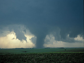
Showing posts with label torando. Show all posts

Friday, January 16, 2009

The day a F4 tornado hit Wallingford Conneticut

The day a F4 tornado hit Wallingford Conneticut

AMERICAN STANDARD - BOSTON, MA - AUGUST 15TH 1878

( FROM THE HISTORY CELLAR BLOG )

Greetings. In this 1878 paper I found a article on a tornado disaster that I was not aware of. In 1953 a massive tornado hit Worcester MA which is now the deadliest tornado to hit New England. This Connecticut tornado had that title until then.

If you look at this chart from the USA TODAY, it is not unusual when tornado's hit this area, but it is at this magnitude. The article below is slightly difficult to read - it is transcribed below at the end of this post. Also there are some interesting photos and engravings below of the disaster.

The Wallingford Tornado was the deadliest tornado ever to strike the state of Connecticut, and the second deadliest ever in New England. It struck the town of Wallingford, Connecticut on August 9, 1878. The violent tornado destroyed most of the town, killing 34 people and injuring at least 70, many severely.[1] The tornado started as a waterspout over Community Lake, just west of town.

It then moved through the center of town along Christian Street, damaging almost every structure as it went. The tornado tore houses from their foundations, throwing some more than 600 feet (180 meters).

A receipt from the town was later found 65 miles (105 km) east in Peacedale, Rhode Island.[2]A district schoolhouse was converted into a temporary morgue immediately after the storm; 21 bodies were discovered and placed there that night. One person was found dead 3300 feet (1 km) from where he had been standing.[3]More than 50 special police were sworn in to prevent looting, and to control the crowds of curious onlookers who had come by train from surrounding cities.[4]

DESTRUCTIVE STORM!

Great Loss of Life and ProperlyHouses, Barns and Trees Hurled tothe Ground.Wallingford, Conn, AUG 9, A terribletornado passed over Wallingford about sixo'clock this afternoon, and blew overhouses, uprooted trees, and caused thegreatest devastation. It is estimated thatthe killed will number at present at leastwhile the wounded will reach twicethat number.

Telegraph wires and poleswere blown down, making it impossible; tocommunicate with New Haven or thesouth or Meriden or Hartford to the north.Word was finally sent by the up 7 o'clocktrain to the two latter places, and on thenext down express, which leaves Meridenat 7:30 o'clock. came physicians and help.

The greatest excitement prevails, and thewildest rumors are afloat as to the loss oflife. The tornado was confined to a belt ofterritory about half a mile wide, and thewhole loss of life took place on the sandplains about a quarter mile north of therailroad station, near the line of the NewYork, New Haven and Hartford Railroad.At 6 o'clock, while the men were leaving the factory, a gentle rain began to fall, andsoon increased to a perfect deluge, whilealmost continuous arid vivid lightningilluminated the darkened sky as bright asday, and the thunder rolled with an unceasingand deafening roar.

Without warning,the tornado, with hail and rain, sweptacross the northern part of the town, fromwest to cast, anti everything movable in itscourse was carried away. It seemed to lastbut a moment, but the results were fright-ful.

Afterward a light rain fell, and thissoon ceased, and at 8 o'clock the moonshone brightly down upon a scene of desolation.By actual count, forty dwellinghouses were demolished, and at least fifty barns.

WEATHER NOTE

What the storm has wrought’
By Paulita RoaPast Speaks


THE recent flood that hit Cagayan de Oro in the early morning of Saturday, January 3, 2009 brought back stories that old families had of a bigger deluge that happened 93 years ago on January, 1916. A strong typhoon brought continuous heavy rain for three days (some said that it rained for 16 days) to the town. The Kagay-anons found this unusual for Cagayan then was never visited by typhoons.

Arroyo Watch: Sun.Star blog on President Arroyo [1]

In that 1916 typhoon, the Cagayan River overflowed its banks. The waters entered the cogon areas of Macasandig, past the coconut grooves till it reached Camaman-an and the present site of the Cogon public market. In the Poblacion, all of Divisoria and Pabayo St. (then known as Calle Nueva), were underwater. Residents had to navigate around that area by boats. Many people died or went missing during the flood including a great number of animals. Farmlands were leveled and crops destroyed.

When the flood waters receded, the town smelled from the stench of the rotting animal carcasses. There was a severe lack of potable drinking water and sanitation was a big problem.

Then cholera came and spread throughout Cagayan.

At that time, a young 32 year old American named Dr. Frank Laubach was living in Cagayan with his wife Effa, a nurse, and their sons in Calle Burgos near the river. He was the first missionary sent to establish a mission station here by the American Presbyterian Board. The two chapels that he built in Bonbon and in Barra were washed away by the flood. The Laubachs did all they can to help the sick and the grieving families. He also dispatched his group of young people to the Municipio to assist in sending information on ways to sanitize their houses to prevent cholera from spreading.

Cholera then turned into epidemic proportions and many people were dying daily. A relative recalled that his granduncle attended the funeral of a cholera victim and 24 hours later, he also died of the same disease and was buried at once. The death count was so high that corpses were placed in carromatas and were buried on mass graves far away from Cagayan. A pall of heavy grief could be felt for each family lost a relative or two from cholera. It is said that after witnessing the twin tragedies, Dr. Laubach, known as a man of piety and prayer, got on his knees and dedicated the town to the most Almighty God.

Ninety three years later, another big flood visited Cagayan de Oro. Rev. Alex Eduave told his congregation that they still have to be thankful to the Lord for the deluge came early in the morning and the damage was not as massive as the 1916 flood. Had this happened at night, the calamity would have been of tragic proportions for hundreds would have died or gone missing. Many agreed with the observation of Mayor Constantino Jaraula that since much of our forests have been converted to farmlands, there are now very few big trees that can protect the city from the floods.

We need to take the necessary steps now in order to prevent a tragedy similar to the one that befell Ormoc years ago from happening here. Though the recent flood was traumatic to many of us, it was also a way of reminding us that we have to do something about our almost denuded forests before it is too late. We need to have a viable environmental program with the active participation of the citizenry so our lives, and our city as well, can be saved from another big natural disaster.

MARITIME NOTE

Fishermen question rescue response
Gloucester tragedy remains a mystery

By Stephanie Ebbert and Brian R. Ballou, Globe Staff January 9, 2009

GLOUCESTER - As Gloucester lay to rest two fishermen who died in a mysterious accident at sea, their fellow seamen raised concerns about a published report that said the Coast Guard did not launch a search-and-rescue mission for more than 2 1/2 hours after it was alerted that the vessel was in trouble.

The Coast Guard command in Boston did not begin searching for the missing boat, called the Patriot, until nearly 4 a.m. on Saturday, the Gloucester Times reported yesterday. The Fire Department had responded to a 1:17 a.m. fire alarm broadcast by the boat, discovered that the Patriot was not at port, and contacted the wife of one of the fishermen, who said he was out at sea. She then contacted the Coast Guard for help.

Coast Guard Captain Gail Kulisch, commander of the Coast Guard Sec tor in Boston, would not confirm the timeline at a news conference last night, where she said repeatedly that the Coast Guard had responded immediately but had to follow an established protocol for its response. Though the Coast Guard is conducting a case study of its response - as is routine in fatalities - the command was ready and reacted quickly, she said.

"They are always poised. They are guardians," Kulisch said. "We joined to save lives. That's what we do and we take this business very, very seriously."

The Coast Guard has learned that another vessel was in the area at the time of the accident and is investigating whether there was a collision or whether anyone witnessed what happened to the Patriot, she said.

Kulisch said the case was unusual because it was triggered by a fire alarm on the vessel and reported by a fisherman's wife. The Patriot had a device that sends out a signal in an emergency showing its location, but it did not work until hours later, when the Coast Guard was already at the scene, she said.

A Coast Guard commander told the Gloucester Times on Wednesday that the agency could not launch a response effort without knowing the boat's approximate location. But the Patriot was equipped with a vessel-monitoring system that lets the Coast Guard track its location. Since November 2006, fishermen have been required to use those tracking devices so the government can keep tabs on their whereabouts and guard against overfishing. The Patriot had broadcast signals of its location as recently as 12:30 a.m. Saturday, the Times reported.

Kulisch said that whatever happened to the Patriot appeared to have been quick: The men, both experienced fishermen, were not wearing survival gear they had on board.

Yesterday, fishermen and a lawyer who represents them questioned whether the technology used so readily by the Coast Guard to penalize fishermen for straying into protected waters could have been used more effectively to try to save the two fishermen lost at sea.

"It's kind of like wearing an ankle monitoring bracelet, so they know where you are at all times," said Stephen M. Ouellette, a lawyer whose primarily represents fishermen. "It's always tough to second-guess these people, but they spend so much time and energy chasing fishermen down for violations."

It was unclear yesterday whether the time lost would have made a difference to the fishermen in the frigid water of the Middle Bank, 15 miles off Gloucester. But some fishermen said they found the Coast Guard's response time troubling.

"The whole sinking is a mystery to begin with, but the response is rather distressing for those of us who have to rely upon the system," said Paul Cohan of Beverly, who fishes out of Gloucester.

Investigators have not determined what caused the Patriot, a well-kept, 54-foot, steel-hulled trawler, to founder. The owner, Matteo Russo, was killed along with his father-in-law and fishing partner, John Orlando. Kulisch said the Coast Guard is trying to restrict the area around the sunken boat, but the family wants to hire its own divers to investigate.

At the fishermen's funeral yesterday in Gloucester, the close-knit fishing community filled Saint Ann Church, leaving only standing room. Several men with gray facial stubble and in heavy winter jackets sat among the crowd and whispered in Italian, shaking their heads from side to side as they looked at the coffins.

Family, friends, and well-wishers paid respects to Russo, a 36-year-old father whose wife is expecting a second child, and Orlando, a 58-year old father of two.

The Rev. Ronald Gariboldi told the approximately 700 mourners that he was approached by Russo's mother moments before the funeral began. Josephine Russo looked at him with teary eyes and said her son's death was a mystery.

The service was laden with references to the industry that has characterized Gloucester. A prayer was made for those who go out to sea and those who wait for them on shore. The Gloucester Times reported that the Coast Guard in Boston, before launching a search, ordered its Gloucester station to double-check the Fire Department's conclusion that the boat was not in the port. That cost an hour, the newspaper reported.

The Times also reported that the search was delayed while officials at the Coast Guard command in Boston tried to contact the crew of the Patriot by phone and e-mail, after the wife of one of the men said he was not answering calls. A dispatcher also called the boat's former owner, who told him it had been sold, according to the Times.

Study Evaluates U.S. Maritime Policies

The Maritime Administration has issued a new study that evaluates the adequacy of current U.S. maritime policy to meet the commercial, economic, security and environmental needs of the nation over the next three decades.The report titled, ìAn Evaluation of Maritime Policy in Meeting the Commercial and Security Needs of the United States,î was researched and prepared by IHS Global Insight, Inc., of Lexington, Mass.

The 72-page report finds that current U.S. maritime policy only supports Americaís domestic maritime trades and is not supportive of U.S. participation in the international trades. However, the study also advises that possible reforms in national policy may lend more support to the U.S. maritime industry.Maritime Administrator Sean T. Connaughton said, It is clear that marine transportation is the most important mode of transportation for future growth of the U.S. economy; but current U.S. policy does not seem to reflect the importance of this modeóand for America to succeed, it must.

To help create a more robust marine transportation system, Administrator Connaughton continues to advise U.S. policymakers that government support of the freight transport system must anticipate and respond to potential shipping bottlenecks that cause delays and undermine regional and national economic growth.

The main task for policymakers, he says, is to ensure that the maritime system will have adequate capacity and reliability to transport ever increasing volumes of cargo and numbers of people in an efficient and environmentally sound manner.

The full report and its findings are available online at Maritime Administration web site, http://www.blogger.com/www.marad.dot.gov.

FROM HOLLAND AND KNIGHT

Bill introduced re ocean and coastal observations

Senator Snowe (R-ME) introduced the Coastal and Ocean Observation System Act of 2009 (S. 171) to develop and maintain an integrated system of coastal and ocean observations for the Nation's coasts, oceans, and Great Lakes, to improve warnings of tsunami, hurricanes, El Nino events, and other natural hazards, to enhance homeland security, to support maritime operations, to improve management of coastal and marine resources, and for other purposes. (1/8/09).


Messing About In Ships Podcast


Have a really super weekend and ...STAY WARM!

RS

Monday, December 8, 2008

Computers Determine When To Stop Searches For Missing People At Sea

Computers Determine When To Stop Searches For Missing People At Sea

ScienceDaily (Nov. 27, 2008) British researchers are developing a new computer model to predict how long someone will survive when lost at sea, which will in turn determine when a search and rescue operation may be stopped.

The Search and Rescue Survival Model is being developed by the University of Portsmouth’s Sports Science and Mathematics departments and the US Coast Guard.

It aims to support the US Coast Guard target of saving 93 per cent of victims annually - between 3000-6000 people - whose lives are in danger at sea.

“Using this new computer model will take pressure off humans making very emotional and sensitive decisions about when to end a search,” said Professor Mike Tipton, human and applied physiologist, from the University of Portsmouth.

“When the model predicts that a victim can no longer survive, the search and rescue team can stop or redeploy the search.

“It will ensure that Coast Guard personnel are not exposed to the high risks associated with search and rescue operations any longer than necessary and will also help to save time and resources,” he said.

The US Coast Guard currently uses a software system known as SAROPS (Search and Rescue Optimal Planning System) to calculate how far a person will have drifted and how large the search area should be.

Data such as wind speed, sea state and water temperature is entered into SAROPS along with information about the victim’s sex, height, weight and what they were wearing to determine exactly how the search should be conducted.

“Calculating survival time will add another layer to SAROPS; it will be able to predict not only where a search should be conducted but when it should be stopped,” said Professor Tipton.

Chris Turner, Ocean Engineer and Manager for the project for the US Coast Guard in Groton, Connecticut, sought the help of the university because of its international reputation for expertise in the area of survival in the sea.

“The University of Portsmouth has been able to tap into and analyze data held by the Institute of Naval Medicine and the Royal National Lifeboats Institution, both critical to the development of this survival model. To our knowledge no other similar repository of this information exists - even in the US.

“The development of this technology is very exciting. It will be trialled in American waters in late 2009 and once thoroughly tested, the aim is to roll it out to the whole of the US,” he said.

WEATHER NOTE

Weather disasters claimed 15,000 lives, report says

Stevie Emilia, The Jakarta Post, Poznan, Poland

More than 15,000 people across the world died last year from extreme weather, which also caused US$80 billion in damages, a report released Thursday at the ongoing UN climate change talks here revealed.

The Global Climate Risk Index 2009 by the environment and development group Germanwatch puts Bangladesh at the top of the list of countries most affected by weather-related disasters last year.

Bangladesh, which suffered heavily from cyclone Sidr that killed more than 4,000 people and caused $10 billion in damages, was followed by North Korea and Nicaragua.

Sven Harmeling, the group's senior advisor for climate and development, and author of the study, said many people had been severely affected by storms, floods and other weather extremes.

"People in less-developed countries have a far harder time coping with such events compared with their peers in industrialized countries," he said.

Hurricane Katrina caused $215 billion in damages when it devastated the U.S. Gulf Coast three years ago, making it the most expensive storm in history.

While no single weather disaster can be directly attributed to global warming, Harmeling warned the changing climate would most certainly lead to an increase in their frequency and intensity in many parts of the world.

The UN's Intergovernmental Panel on Climate Change earlier warned that climate change this year was likely to make extreme weather events more frequent and possibly more intense too.

Germanwatch, which first calculated the global climate risk in 2006, derived data for the present study from a database compiled by German insurance giant Munich Re.

The report analyzes how severely countries were affected in 2007 and in the past decade, or from 1998-2007, by weather-related events, including floods, heat waves and storms. It excluded droughts or sea-level rises -- long-term events that are harder to evaluate.

In the latest report, a total of 1,066 disasters were registered last year, causing 15,240 fatalities and economic losses of over $70.1 billion.

Indonesia came in at seventh place on the Down 10 list of countries with the highest death tolls, recording 470 deaths last year, and was ranked eight in the list of Down 10 countries with highest absolute losses, with a total of $3.09 billion.

"We're witnessing a strong increase in disasters, particularly the climate-related ones, in terms of the number of disasters, economic damage and people affected," said Maarten van Aalst, associated director of the Red Cross/Red Crescent Climate Center in The Hague.

"This is partly due to rising vulnerability, partly already reflecting global climate change, a trend which is bound to continue."

Apart from providing assistance when disaster strikes, van Aalst said the most effective response was disaster mitigation, stressing that "reducing the impact of the increasing hazards is crucial. Practical risk reduction options include better early warning, drought resistant crops or reforestation to prevent floods."

The report, which aims to give pointers about a country's vulnerability to climate change, proposes the inclusion of insurance instruments in the post-2012 regime.

In the Bali conference last December, the Bali Action Plan called for the "consideration of risk sharing and transfer mechanisms such as insurance" to deal with loss and damage in developing countries particularly vulnerable to climate change.

The ongoing Poznan conference serves as a bridge to the next conference, in Copenhagen, Denmark, to agree on a new deal to replace the climate treaty Kyoto Protocol, which expires in 2012.

"The Copenhagen treaty can introduce the necessary support mechanism with both prevention and insurance pillars," said Germanwatch executive director Christopher Bals.

"It is very positive that concrete proposals for risk management and insurance are today discussed in detail in Poznan."

Tornado confirmed in Palm Bay

BY KIMBERLY C. MOORE
FLORIDA TODAY

PALM BAY — National Weather Service meteorologists confirmed today that the windstorm that damaging more than a dozen homes in Palm Bay on Sunday was a tornado.

“It was kind of hopscotching,” National Weather Service meteorologist Scott Kelly said. “It did touch down, but it was very spotty. It was not a continuous track.”

Palm Bay residents spent Monday cleaning up their yards and dragging tree branches to the curb. Some homes had blue tarps on roofs. And contractors already were out, giving homeowners estimates to repair the damage.

Palm Bay officials did not yet have a dollar estimate of how much damage the tornado did.

No one was injured.

Keith Rittscher, 63, found the roof of his plastic shed near a neighbor’s home about 25 yards away from his Holiday Park house.

“That’s my roof,” he said, pointing to a tangled web of aluminum wedged into Australian pines behind his house.

Nearby, a collection of plastic pieces rested against his home’s back wall.

“This is my shed,” Rittscher said.

Rittscher estimated that damage to the home, which is uninsured for property damage, probably is about $20,000. He said he and his wife have enough to cover the cost.

“We’re OK,” he said.

The roof of one home on Emerson Drive at Consumer Street had several shingles ripped off.

Along Velvet and Ritter avenues on the east side of Interstate 95, residents picked up branches torn from trees and propped up trees knocked over by the powerful winds.

It was the same story east of Babcock Street, along Edith Street and Cambridge Avenue.

Kelly said Palm Bay got lucky. A stronger storm might have claimed lives.

“There could’ve been more chance for fatalities if trees had fallen on those homes,” he said.

In Holiday Park, a community of manufactured homes, Don Clark spent the morning with two contractors, getting bids for his roof.

A blue tarp now is tied in place to shield their home.

In the backyard, the doors of his shed remain, but the rest of the structured vanished in the whirlwind. In addition, the storm ripped off the slats of his hurricane shutters.

“They were all twisted up in knots,” he said.

But, he said, he is grateful.

“We’re doing good,” Clark said. “We’re just happy to be safe.”

MARITIME NOTE

Loading is first area to probe in ship sinking: experts

Updated Fri. Dec. 5 2008 1:50 PM ET

The Canadian Press

HALIFAX -- Experts say the loading of a cargo vessel that sank off Newfoundland, with the loss of four sailors, should be the first area investigators probe to unravel the mystery of its sudden capsizing.

The Cap Blanc stopped communicating with the coast guard at 8:30 p.m. local time on Monday as it crossed Placentia Bay.

Ten hours later, aircraft discovered a portion of the sinking hull of the vessel from the French islands of St-Pierre-Miquelon.

None of the four sailors on board was found, and the joint rescue co-ordination centre declared the active sea search over late Thursday.

In St-Pierre-Miquelon, the father-in-law of the captain says a full inquiry is needed into the sinking of the ship, which was carrying a load of road salt.

Eric Snow, who spent 30 years doing marine investigations for Canadian government agencies, says "the first thing you have to do" is go to the companies involved and ask how the vessel was loaded, and how the cargo was secured.

The lead investigator in the accident is a French transportation safety agency, which is being assisted by the Transportation Safety Board of Canada.

Floods knock out Port of Itajaí

The Brazilian port has been devastated by flash floods. Ironically, the controversial PortoNave container terminal, on the other side of the river, has been the least affected facility

Brazil’s President Luiz Inácio Lula da Silva has visited the flood stricken port of Itajaí to see for himself the damage caused by floods that have now taken the lives of 99 people in the state of Santa Catarina (and the numbers and extent of the damage are rising almost by the hour).

Reports suggest that 12 people have perished in the floods in the port city itself, and the raging torrent of the River Itajaí -Acu – flowing at more than 24 kmh when the average is normallya round 2 kmh – have destroyed much of the infrastructure of the country’s number two port for containers.

Lula has declared Itajaí and the state of Santa Catarina a disaster zone and met the president of Itajaí Port Authority (API) Arnaldo Schmitt to discuss rescue and various reconstruction plans, and how best to divert federal resources to the port.

Ports Minister Pedro Brito has sent a special task force of military and civilian engineers to Itaja to work out the best way to repair damages and get the port open as soon as possible. Latest news is that Lula has promised at least US$150M to reconstruct the port.

Two of the port’s three berths have been completely destroyed and the port is now shut to all commercial traffic. In the state of Santa Catarina some 76,000 people are homeless and 160,000 homes are still without power supplies, according to the state energy company Celesc.

API spokeswoman Patrícia Barcelos told WorldCargo News: “We had 90% of the city of Itajaí under 2m of water, it’s an absolute catastrophe. It has barely stopped raining for two months and we are supposed to be entering the summer period.

“The number one Berth has been washed away by the river, as has half of number three berth. We think number four berth is intact but cant get the divers down to inspect until the water flow reduces.”

The APM Terminals’ container terminal in Itajaí, Teconvi, has suffered very heavy damage with Pier One mostly disappearing into the river torrent. However, no personnel were hurt.

Teconvi’s commercial manager Patrício Júnior said: “The port of Itajaí will receive emergency funding for dredging and that will allow us to clear the river and hopefully start dredging berth zero. Dredging is of the utmost priority and works are expected to be finished only by mid December.” Berth zero is a new berth that had almost entered into service for Teconvi.

With many quay and paved back-up areas at the port seriously damaged, carriers such as Maersk Line, CMA CGM and Hamburg Süd are seeking alternative ports of call, including Santos, Rio Grande and Paranaguá. However, many of these “alternatives”are already seriously congested. The port of São Francisco do Sul – some 60 km away from Itajaí- has also been closed due to the weather but may open within the next few days, according to API officials.

Ironically, the controversial Portonave facility – just a short hop across the river from Itajaí in Navegantes – has escaped from the calamity relatively unscathed and could open for business within a week or two once the strong currents recede and a link road to the terminal is re-opened.

Henrik Simon, the director of reefer services for Hamburg Süd, ECSA trades, said: “The whole shipping community of Brazil is in a state of shock. Our 10 employees in Itajaí are safe but are homeless. I have never seen anything like this in 20 years of working in Brazil.

"With so much silting up, it will take at least three weeks to get dredging arranged. In the meantime we are diverting to Paranaguá.”

Bathometric tests carried out on 28th November show that the quantity of sand has reduced the depth of the channel from 10 metres down to just 7m.


RS

Friday, September 12, 2008

IKE!

Hurricane Ike Aims at Houston; Evacuations Called

By Brian K. Sullivan

Sept. 11 (Bloomberg) -- Hurricane Ike tripled in size in the central Gulf of Mexico on a weekend collision course with the 5.6 million residents of the Houston area.

Traffic jammed highways as Texas coastal communities evacuated.

The system's strongest winds extend as far as 115 miles (185 kilometers) from the eye, up from 35 miles yesterday, the Miami- based National Hurricane Center said today. Ike's wind field is now larger than that of Katrina, the storm that devastated New Orleans in 2005, said Jeff Masters, the director of meteorology at private forecaster Weather Underground Inc.

``The total amount of energy is more powerful than Katrina, so we could be seeing a storm surge that could rival Katrina,'' Masters said. The storm is so large ``the location doesn't matter much; it is going to inundate a huge part of the Texas coast.''

Three houses away from Galveston Bay in LaPorte, Jamie and April Ybarra packed their two children, two dogs and cat into a Chevy sports utility vehicle and prepared to leave.

``I think the call for evacuation came a little late,'' Jamie Ybarra, a 32-year-old safety coordinator, said. ``You hear the roads are crowded; you hear people are losing their cool.''

This is the third time the family has evacuated in three years, April Ybarra said. And ``we may not be coming back here for awhile.''

Galveston, parts of southern Houston and areas south of the city and near the Texas coast were under a mandatory evacuation order that started at noon today. Hurricane Ike is following a track similar to the 1900 Galveston hurricane that killed 8,000 people, the deadliest storm in U.S. history.

Felt Before Landfall

Ike was a Category 2 hurricane with sustained winds of 100 mph, up from 80 mph yesterday, the center said in an advisory at 4 p.m. Houston time. Its central pressure is more like that associated with a Category 3 or 4 storm, Masters said.

``It is a massive storm; it is impacting in terms of its scope 40 percent of the Gulf,'' said Michael Chertoff, U.S. secretary of Homeland Security, in a conference call from Washington. ``The most important message I can send is, do not take this storm lightly. This is not a storm to gamble with. It is large and powerful and carries a lot of water with it.''

The storm is 400 miles east-southeast of Galveston and moving west-northwest at 10 mph, with landfall south of Galveston forecast for early Sept. 13. Because of its size, Ike will be felt along the Texas coast long before its eye makes landfall.

Strengthening Likely

The center's forecasters said Ike may strengthen to at least a major hurricane with Category 3 intensity, meaning sustained winds of at least 111 mph, before landfall. Other forecasters predict Ike may become a Category 4 storm, the second-strongest on the five-step Saffir-Simpson scale, packing winds from 131 to 155 mph.

The storm is forecast to sweep through the center of the Gulf, missing the offshore Louisiana oil and natural gas fields. The Gulf is home to about a quarter of U.S. oil production.

Even so, about 96 percent of all oil production in the Gulf has been shut in along with 73.1 percent of natural gas facilities, according to the Minerals Management Service, a bureau of the Interior Department. Some facilities have been closed since Hurricane Gustav struck Louisiana last week.

Exxon Mobil Corp.'s Baytown facility, 17 miles east of Houston, is the country's biggest, with a capacity of 586,000 barrels a day. The Louisiana Offshore Oil Port, which is the largest U.S. oil-import terminal and handles 13 percent of imports, said it closed marine operations because of Ike.

Chemical Plants Closed

Dow Chemical Co., the largest U.S. chemical maker, and competitors such as DuPont Co., LyondellBassell Industries and Texas Petrochemicals Inc. are closing plants in the Houston area. The Texas Gulf Coast produces two-thirds of the nation's ethylene, used in products from plastic bags to auto parts.

President George W. Bush declared an emergency for Texas, his home state, and Governor Rick Perry readied 1,350 buses to evacuate residents in preparation for Ike's landfall. As many as 7,500 Texas National Guard members are on standby.

Houston's population is 2.2 million, making it the fourth- biggest U.S. city, according to the U.S. Census Bureau, and its metropolitan area, with a population of 5.6 million, is the sixth-largest in the U.S.

Officials in Harris, Brazoria, Chambers, Matagorda and Galveston counties ordered about 564,063 people to leave homes that are now in Ike's path. Television news reports showed miles- long traffic jams in the area.

Governor Urges Prudence

``My message to Texans in the projected impact area is this: finish your preparations because Ike is dangerous and he's on his way,'' Perry said in a statement. ``If your local officials tell you to evacuate, follow their instructions.''

Jim Rouiller, a meteorologist with Planalytics Inc. in Wayne, Pennsylvania, said he's particularly worried about storm surge damage around Galveston Bay, on the coast southeast of Houston, which may be in the top right quadrant of the storm field where rains and winds are most powerful.

Galveston's seawall is 17 feet high and the forecast storm surge is 20 feet high.

``If that's breached, a whole refinery complex goes under water,'' Rouiller said.

Some parts of the Texas-Louisiana coast may get as much as 15 inches of rain, the hurricane center said.

Ike could inflict between $5 billion and $15 billion of insured damage depending on how much it intensifies, said Steve Smith, atmospheric physicist for the Carvill reinsurance broker.

NASA Center Closed

NASA's Johnson Space Center heeded the evacuation order, preparing to shut its 1,600-acre facility in Houston that houses Mission Control and the training ground for astronauts.

In July, Hurricane Dolly, with winds of 100 mph, struck the Texas coast at South Padre Island, about 35 miles northeast of Brownsville.

Crude oil for October delivery fell $1.68, or 1.6 percent, to $100.90 a barrel at the 2:30 p.m. close of floor trading on the New York Mercantile Exchange. Futures touched $100.10, the lowest since April 2. Prices are up 31 percent from a year ago.

Morphed Integrated Microwave Imagery at CIMSS (MIMIC)


IKE TRACK

tab Eastern Pacific tab tab Atlantic tab
tab
Click for Eastern Pacific
TC Activity

WEATHER NOTE

NOAA Historical Hurricane Tracks Web Site Helps Users Prepare for Big Storms

As the U.S. coastal population continues to grow, so do the hazards when big storms approach. Now, an on-line tool, Historical Hurricane Tracks, helps users get a quick picture of coastal areas with the greatest frequency of hurricanes and tropical storms�and that historical "snapshot" can help community members and local emergency managers develop better plans for storm preparation and recovery.

NOAA's Historical Hurricane Tracks Web site, http://maps.csc.noaa.gov/hurricanes/, includes data on storm strikes through 2007. Current hurricane activity can be followed at http://www.nhc.noaa.gov.

"When you know the history of hurricane landfalls in your community, you are better prepared to protect yourself from these potentially devastating storms," says Margaret Davidson, director of the NOAA Coastal Services Center. "Historical Hurricane Tracks is part of a suite of products developed by the center to help coastal residents, planners, and emergency managers prepare for�and reduce�the affects of coastal storms."

The website allows users to generate customized maps showing the path of storms that have made landfall in the United States in years past. Users can search by U.S. ZIP code, state or county, latitude and longitude, or a storm's name or year. Searches can be narrowed to specific storm categories.

Developed by NOAA's Coastal Services Center in partnership with NOAA's National Hurricane Center, the site contains more than 150 years of Atlantic hurricane data and nearly 60 years of eastern north Pacific Ocean data, which may be downloaded for use in geographic information system applications. The site also links to detailed reports on the life history and effects of U.S. tropical cyclones since 1958.

NOAA understands and predicts changes in the Earth's environment, from the depths of the ocean to the surface of the sun, and conserves and manages our coastal and marine resources. Visit www.noaa.gov.

On the Web:

NOAA Coastal Services Center: http://www.csc.noaa.gov
NOAA National Hurricane Center: http://www.nhc.noaa.gov

Tornado Occurs on September 4 2008

During the afternoon hours of Thursday September 4, the remnants of what was once Hurricane Gustav continued to move northeast passing over far southern Lake Michigan during the evening hours on September 4th. Several bands of rain moved through northeast Illinois and northwest Indiana with one band eventually producing small areas of convective cells that moved through northern Jasper County Indiana.

One of these convective cells produced a tornado approximately 5 miles northwest of Wheatfield, IN near the Oak Heritage Estates. This torando caused structural damage to one mobile home, damage to multiple trees and corn fields. The damage track began southwest of the Heritage Estates near the intersection of north 450 West and Hawthorn Rd. where a 10 yard diameter wide area of corn stalks were completely flattened in a convergent manner. Damage continued northeast from there where a roof was lifted off a mobile home and thrown into the yard. Also at this residence were two large trees that were completely uprooted. These were two or four trees that were uprooted by this tornado, with many trees having branches from their tops sheared off. Also, there was other debris scattered about, including kids toys and trach bins.

The tornado was on the ground for approximately 1/4 mile wth a maximum path width of 20 yards. The maximum winds with this tornado were estimated to be around 90 mph, which is consistent with EF-1 damage on the Enhanced Fujita scale.

Tornado Location

Tornado Location.

MARITIME NOTE

Crew error blamed for grounded ship

A report has blamed crew error and management principles for the grounding of a bulk carrier in Gladstone Harbour, off central Queensland, last year.

The Endeavour River ran aground at the entrance to Auckland Channel on December 7 last year while trying to berth at South Trees Wharf on a flood tide.

The master of the ship was battling a tail wind and even with the use of two attending tugs, was unable to counteract the tidal influence.

Five days later, the ship was eventually refloated and manoeuvred to the wharf by tugs.

The Australian Transport Safety Bureau report has stated bridge resource management principles were not practised by the bridge team and that no monitoring of the passage took place.

The report has also identified a number of safety issues which are being addressed by ASP Ship Management and Maritime Safety Queensland.


storm pulse


Messing About In Ships Podcast


STAY SAFE

RS

Thursday, September 11, 2008

Fewer buoys means less storm-tracking data

As Tropical Storm Hanna menaces the Southeast, federal funding cuts mean fewer buoys and other instrument platforms are in place to track the storm’s strength and local impacts as it moves closer to shore.

Ground-zero for the reduction in marine observing assets is the nearly 250 miles of shoreline stretching from Sunset Beach to Hilton Head, S.C., – close to Hanna’s projected path, according to forecast late Wednesday from the National Hurricane Center.

Three of the program’s five buoys and all three water-level/weather stations operated by the Carolinas Coastal Ocean Observing and Prediction System (Caro-COOPS) were pulled or decommissioned earlier this year because of “reductions in funding,” according to program’s Web site.

That list includes two buoys off Sunset Beach and a weather station at the end of the town’s pier.

The gap won’t keep forecasters from predicting the track and overall intensity of storms such as Hanna. But more precise information such as the magnitude of any storm surge and the heights of waves generated as it approaches or passes will be more difficult to come by.

“We get calls about it every day,” pier manager Marty Allen said of the now-departed weather station. “People want to know what happened to it or if it’s broken because they can’t find the readings.

“We even get calls from people who come down for the same week every year because they’re looking for it, wanting to known what conditions are like here before they set off from home.”

“An erosion of our funding”

So far near-shore monitoring systems in the Cape Fear Region have escaped the financial hatchet. But the disappearance of stations and buoys that monitored the near-shore ocean environment is rippling up and down the Southeast, including off the Outer Banks.

The decision to mothball some instruments and scrap others is largely due to a shift in how federal funding for the regional ocean-observation programs is doled out.

Gone are the earmarks by friendly politicians that funded most of the projects earlier this decades, replaced by a competitive grant program run by a new office in the National Oceanic and Atmospheric Administration.

Federal officials defend the move as a better, more focused way of spending limited financial resources to meet regional and national priorities.

Suzanne Skelley, chief of staff for the Integrated Ocean Observing System (IOOS), said centralizing the funding efforts also allows standardization of formats to make the enormous amounts of data generated by the different programs more accessible to researchers and the public.

But the result also has been a substantial cut in overall funding for the nation’s offshore observation programs.

“As this transition has occurred, the amount of money made available at this base-budget approach is not even close to keeping equal to what was provided by the earmarks,” said Rick DeVoe, director of S.C. Sea Grant and chairman of the board that represents programs stretching from Virginia through Florida. “So we have seen an erosion of our funding support during this transition period.”

According to NOAA officials, funding for the nation’s observation programs dropped from $26.3 million in 2006 – when the reduction in political earmarks was already under way – to $20.4 million this federal fiscal year.

For the 2009 fiscal year, which starts Oct. 1, The House has proposed $19.5 million for the IOOS program and the Senate $30 million.

The final amount will be split among 11 regional groups that monitor the waters around all U.S. states and territories ranging from Alaska and America’s Pacific Islands to the Florida Keys and New England.

The Coastal Ocean Research and Monitoring Program (CORMP) manages a series of buoys and pier stations in Southeastern North Carolina.

Based at the University of North Carolina Wilmington, CORMP received nearly $2.4 million in federal funding in 2004-05 as it expanded its programs and installed new buoys.

But this year ocean-observing programs from Virginia to Florida received a total of $3.25 million in competitive grant awards.

“We achieved pretty good coverage for a period of years, and now it looks like all of that is going to be lost,” said Harvey Seim, a marine scientist with the University of North Carolina-Chapel Hill.

Lynn Leonard, a UNCW geologist, is director of CORMP. She said the program, one of the few to win federal funding this year, hasn’t had to decommission assets like many of its sister programs.

But unless something dramatic happens on the financial front, she’ll have to look at pulling some buoys or decommissioning pier stations next year.

“This year we’re treading water,” Leonard said. “But next year we’ll have to start cutting back. I don’t see any way to avoid that.”

Used by forecasters and fishermen

The buoys do more than help gauge storm impacts. The National Weather Service have found the proliferation of ocean-observing platforms useful in helping fine tune its maritime forecasts. The buoys fit in nicely between NOAA’s deep-sea buoys and shore-based monitoring stations and have helped improve rip-tide forecasting, storm tracking and storm surge modeling.

“As sparse as our marine observation platforms were, it was a big plus to have them out there,” said Steve Pfaff, a meteorologist with the National Weather Service in Wilmington, ticking off their numerous uses, including validating and improving forecast model performance.

Surfers and fishermen also are regular users of the ocean-observing programs, many of which offer real-time weather conditions like CORMP’s buoys off Wrightsville Beach and Camp Lejeune.

“I check it all the time,” Bart Bradshaw said Tuesday on Wrightsville Beach as he prepared to head back into the surf churned up by Hanna. “It’s my marine ‘Weather Channel.’ ”

So far this year through July, the CORMP Web site had recorded nearly 2.5 million page views.

Officials locally and in Washington stressed that other agencies have monitoring instruments along the Carolina coast. Even so, they admitted, the removal of the marine platforms leaves a hole in the region’s observation coverage.

Finding ways to fill gap

Some states have stepped up to keep their observation programs going. Florida last fiscal year contributed $1.25 million to keep some systems operating.

But that was a one-time financial injection, something the cash-strapped state is unlikely to repeat.

“It’s a shame because we’re not holding the line,” said Jyotika Virmani, executive director of the Florida Coastal Ocean Observing Systems consortium. “We’re going backwards.”

Like most Southern states, North Carolina historically hasn’t provided funding for ocean research or monitoring projects. A new multi-state initiative called the South Atlantic Alliance, however, could change that.

“These are shared problems and we really should look at developing shared solutions,” said Jim Leutze, former UNCW chancellor and a proponent of the new initiative.

But whether the alliance will produce any additional state dollars for ocean monitoring is still to be determined.

In the meantime, the region’s ocean-observing programs are treading water, looking at developing new partnerships and merging with each other to keep assets afloat.

“We’ll do our best,” said CORMP’s Leonard. “But it’s getting harder and harder.”

WEATHER NOTE

By GILES BRUCE

When tornado sirens begin to sound, most people seek shelter or go to a basement. But not Paul Sirvatka - he heads straight to the storm.

“I know this tornado really well because we drove through it,” Sirvatka said while pointing at a picture of a tornado. He gave a lecture entitled “Tornadogenesis and the Nature of Tornadoes”
Friday at Davis Hall.

Besides being a professor of meteorology at College of DuPage, Sirvatka is a storm chaser. When conditions are right for a tornado, he is off on the road finding out how tornadoes come to
be.

Among his conquests is the 1990 Plainfield tornado, the only F5 tornado to ever hit the Chicago area. The storm killed 29, injured 350 and caused $165 million in damage along a 16 mile path through Plainfield, Crest Hill and Joliet, according to the National Weather Service (NWS).

“It was intense,” Sirvatka said. “It was intense to be in.”

He remembered 80 to 90 mph winds at the Aurora airport and driving through DeKalb, which was battered by hail as kids ran for shelter, to I-88, where he was forced to blow the toll.

“They didn’t have I-Pass then,” he joked.

One quote summed up a major theme of the lecture.

“I don’t know why there was a tornado in the first place,” he said of the Plainfield tornado.

The theme: There are still many unknowns surrounding tornadoes. To make this point, Sirvatka began his lecture with a famous quote from Donald Rumsfeld, former secretary of defense:

“[T]here are known knowns ... there are known unknowns ... there are also unknown unknowns,” Rumsfeld said at the time.

“Can we know the unknowable unknowns?” Sirvatka asked the group of about 45, consisting mainly of graduate students majoring in geography.

While pointing out that most tornado outbreaks are well-forecasted, Sirvatka criticized the “groupthink” used at many organizations, including the NWS.

“We need to be cynical about tornado reports,” he warned, which freshman meteorology major Robert Niesen heard loud and clear.

“I learned that you can’t always rely on the radar,” Niesen said, who is studying to be a weather forecaster at NWS.

Graduate biogeography major Matt Kwit was required to attend the lecture but enjoys the diversity in topics of these graduate lectures, which take place weekly, he said.

Storm chasing has really taken off in the 20 years since he started, Sirvatka said, but there is one thing he has that many of the newbies don’t: experience.

“I’ve done it so often, I can look at a storm and say, ‘This is what’s going to happen,’” he said.

NWS Media and Emerg Mgmt Workshops

Every fall the Seattle Office of the National Weather Service hosts briefings for the local news media and emergency managers.

This year's invitation provides the details and how to register. Please note that these are not open to the general public, but only professionals from the media and all levels of emergency management. I'm sure they would like to have private sector business continuity professionals also attend if you are interested.

I've attended in other years and it provides an opportunity to see what their projections are for the "wet season" here in the NW (it never ended this year in the NW), plus better understand their weather products.

IKE TRACK


tab Eastern Pacific tab tab Atlantic tab
tab
Click for Eastern Pacific
TC Activity

DENVER DEM TWISTER


RS

Tuesday, August 26, 2008

Scientists: U.S. not prepared for severe weather, climate change

Scientists: U.S. not prepared for severe weather, climate change

Heavyweights in the scientific community are not waiting until the November election.

Tornadoes are forming at a record setting pace this year. This twister touched down near Hebron, Nebraska in 2004. Photo by Bob Henson, UCAR

They are warning the next residents of the White House and Congress that the U.S. needs to just about double its budget on weather and climate change research, research they say impacts everything from health and safety to transportation and national security.

Scientists cannot fully understand or deal with the impacts of climate change without the proper political leadership, and without funding for scientific observation and computing. That was the message from the University Corporation for Atmospheric Research, the American Meteorological Society, and the Weather Coalition in a teleconference with reporters today.

In a document aimed at the next crop of political leaders, the scientists said “Science is key to understanding these impacts, but weather and climate research and operations budgets have been flat or declining for years due to the budget wars in Washington.”

John Snow, co-chair of the Weather Coalition and dean of the College of Atmospheric and Geographic Sciences at the University of Oklahoma, said there may have been a lot of good intentions in Washington in recent years, “But the reality is they’ve been unable to deliver.”

“The science budget has barely been keeping up with inflation, and in some cases has suffered actual cuts,” said Snow.

The National Science Foundation got a 2% increase, not keeping up with inflation, and the weather and climate research got 0%, effectively a strong cut,” he said.

The scientists are making five recommendations they say will improve the country’s resilience to severe weather and climate change:

Observations: Fully fund the earth observing system from satellite and ground-based instruments.
Computing: Greatly increase computer power available for weather and climate research and predictions.
Research and Modeling: Support a research program in earth sciences to advance understanding of weather and climate and their impact on society.
Societal Relevance: Support education, training and communication efforts for the maximum benefit of society.
Leadership and Management: Implement effective leadership to ensure that these investments are done in the best interest of the nation.

The price tag? The group says lawmakers will need to add about $9 billion to the current $10 billion that is budgeted over the next five years.

Whether it is hurricanes, tornadoes, fires, floods, snow, or drought, 75% of natural disasters around the world are triggered by weather and climate. That translates to billions of dollars in weather related losses every year in the United States.

“What we have put forward in the transition document is what we think is needed to prepare the nation for climate change, to be able to continue to improve our knowledge,” said Jack Fellows, vice president of the University Corporation for Atmospheric Research.

“Frankly, we think this is one of the most pressing problems facing humankind, but it just happens to be on a longer scale than a lot of problems our country faces,” said Fellows.

The other five organizations that wrote the document are the American Geophysical Union, the Consortium of Universities for the Advancement of Hydrologic Science, the National Association of State Universities and Land-Grant Colleges, the Consortium for Ocean Leadership, and the Alliance for Earth Observations.

WEATHER NOTE


Virtual hurricane disaster helps train responders

The software simulation creates realistic catastrophes to help emergency planners get ready for the worst situations.

By MATTHEW STURDEVANT

August 7, 2008

SUFFOLK— Garage-door-sized television monitors showed a sexy, virtual cable-news anchor reading a breaking news alert about the effects of Hurricane Nerissa that had crashed ashore east of Norfolk about 10 hours earlier.

"Removal of traffic congestion is especially challenging," the news anchor said.

As the computerized voice spoke, people sitting behind monitors had to react to that data as well as the constantly updating information about the storm. Some of it was good news, some of it bad.

In a room dimly lit by blue lights made to resemble a command-and-control center, a number of "role players" tried to orchestrate an emergency response to the simulated hurricane. Meanwhile, a separate group of engineers looked down on the players from a terrace where they made sure the fake hurricane was performing as it should, and that the role players' actions were working to fix the effects of the natural disaster.

Lockheed Martin, perhaps best known as a defense contractor, invited about a dozen emergency management officials to the company's Center for Innovation in Suffolk to show off a new software system that can simulate various types of catastrophes ranging from wildfires in California to a nuclear explosion.

The presentation comes just as Hampton Roads is about to enter the peak of the hurricane season from mid-August through the end of September.

The software simulation creates a virtual world based on real demographic information for the people who oversee police, fire, rescue and other emergency responders during a disaster. It could be used to train emergency officials in a city, county or regional agency on how to react if a real hurricane rolls up the shore.

How a storm would knock out power lines, damage buildings or injure people is the purpose of the simulation. Local and state agencies would then be better prepared for the real thing. Lockheed Martin wants communities to buy the simulation program that uses information from the U.S. Census Bureau and Federal Emergency Management Agency to construct disasters.

The goal is to make it real enough that the people getting trained act quickly and appropriately, from the computer command center to dispatch instructions to rescue people, get supplies where they need to go, open up closed roadways, get stranded people into shelters and make sure problems are solved or contained, for example, rerouting traffic as streets flood or power lines get knocked down across roads.

Predicting the behavior of a storm can be done via computer. Predicting what people will do is something else. But Lockheed Martin officials say their new program is detailed enough to show how people might react to a hurricane. For example, some people who work minimum-wage jobs may not evacuate because they are worried they'll lose their jobs, said David J. Macannuco, software engineering manager for Lockheed Martin.

The program can be customized for any geographic area, and the depth of its realistic effects depends on the amount of data put into it, said Michael J. Mulleavey, communications manager for the Center for Innovation.

TWISTER NAILS A BUS


MARITIME NOTE


Freighters dump waste directly into Great Lakes

By SooToday.com Staff
SooToday.com
Friday, August 22, 2008

For seven decades, Great Lakes freighters - including those passing through the Soo Locks with coal, taconite and other loads - have been legally dumping cargo wastes overboard.

And the practice could continue well into the future, according to an article in the Duluth News Tribune.

The U.S. Coast Guard wants to finalize a new regulation that would allow ships to “sweep” two million pounds of load residue into the water each year.

Washing away wastes in this fashion prevents the contamination of future cargoes and allows crews to keep their equipment clean.

In response to criticisms, shippers claim unloading cargo residue on land is too costly.

Besides, they argue, materials thrown into the water are harmless and small in volume.

But objectors say the wastes may contain mercury and other heavy metals.

Three states - Michigan, Minnesota and Pennsylvania - are actively opposing the continuation of cargo sweeping.

Several environmental groups are also speaking out against the proposed regulation.

The Coast Guard is expected to post an environmental impact statement Friday in the Federal Register.

Doing so will start a 30-day response period.


RS

Thursday, August 7, 2008

Changing Jet Streams May Alter Paths of Storms and Hurricanes

Changing Jet Streams May Alter Paths of Storms and Hurricanes

The Earth’s jet streams, the high-altitude bands of fast winds that strongly influence the paths of storms and other weather systems, are shifting—possibly in response to global warming. Scientists at the Carnegie Institution determined that over a 23-year span from 1979 to 2001 the jet streams in both hemispheres have risen in altitude and shifted toward the poles. The jet stream in the northern hemisphere has also weakened. These changes fit the predictions of global warming models and have implications for the frequency and intensity of future storms, including hurricanes.

Christina Archer and Ken Caldeira, of the Carnegie Institution's Department of Global Ecology at Stanford, tracked changes in the average position and strength of jet streams using records compiled by the European Centre for Medium-Range Weather Forecasts, the National Centers for Environmental Protection, and the National Center for Atmospheric Research. The data included outputs from weather prediction models, conventional observations from weather balloons and surface instruments, and remote observations from satellites. The results are published in the April 18 Geophysical Research Letters.

Jet streams twist and turn in a wide swath that changes from day to day. The poleward shift in their average location discovered by the researchers is small, about 19 kilometers (12 miles) per decade in the northern hemisphere, but if the trend continues the impact could be significant. “The jet streams are the driving factor for weather in half of the globe,” says Archer. “So, as you can imagine, changes in the jets have the potential to affect large populations and major climate systems.”

Storm paths in North America are likely to shift northward as a result of the jet stream changes. Hurricanes, whose development tends to be inhibited by jet streams, may become more powerful and more frequent as the jet streams move away from the sub-tropical zones where hurricanes are born.

The observed changes are consistent with numerous other signals of global warming found in previous studies, such as the widening of the tropical belt, the cooling of the stratosphere, and the poleward shift of storm tracks. This is the first study to use observation-based datasets to examine trends in all the jet stream parameters, however.

“At this point we can’t say for sure that this is the result of global warming, but I think it is,” says Caldeira. “I would bet that the trend in the jet streams’ positions will continue. It is something I’d put my money on.”

WEATHER NOTE

Tracking Tornado Damage From Space

HUNTSVILLE, Ala. (Ivanhoe Newswire) -- This year, dozens of communities around the U.S. are recovering from devastating tornadoes -- storms that have caused millions of dollars worth of damage to homes, businesses and crops. After every reported tornado, it’s the job of the weather service to track its path, and estimate the damage, but since tornadoes can travel hundreds of miles and touch down multiple times, that’s not always easy. Now, there may be a solution -- from space!

NASA meteorologist Gary Jedlovek, Ph.D., studies tornadoes and their devastation from pictures taken hundreds of miles away. He’s discovered that high-resolution satellite data that can help forecast tornadoes can also track the damage they leave behind.

“What we’ve discovered in the process of analyzing the satellite data is that we can also see the damage path of scars from where severe weather events such as tornadoes have occurred,” Dr. Jedlovek told Ivanhoe.

Using satellite images of Earth’s surface, land use and vegetation, Dr. Jedlovek developed a mathematical model to identify storm damage on the computer. The result, high definition images that track a tornado’s path of destruction, whether it’s in a city or a forest far off the beaten path -- areas where damage can go undetected.h

“We can help the National Weather Service forecasters understand the length, the width and the intensity of the tornado that produced that particular damage path,” Dr. Jedlovek said.

Information that can help communities clean up and rebuild, and help forecasters get a better understanding of the storms themselves.

“Obviously the more we know about tornadoes the better job we can do about understanding what forms them and predicting them,” Dr. Jedlovek noted.

The NASA satellite technology has now been incorporated into weather service computer systems to help the weather service improve their damage estimates, and measure the magnitude of tornadoes after they occur.

The American Geophysical Union and the American Meteorological Society contributed to the information contained in the TV portion of this report.


MARITIME NOTE

Underwater, a disturbing new world

A Tribune team follows researchers to the bottom of Lake Michigan as they try to explain the rapidly shifting ecosystem

By James Janega

Chicago Tribune reporter

July 30, 2008

OFF ATWATER BEACH, Wis.—This place should be an underwater desert.

But as the three researchers wearing scuba tanks and lead weights drop through the water, the landscape of rounded stones 30 feet below is disturbingly full of strange, new life.

In just a few years, the gravel and white boulders that for centuries covered the bottom of Lake Michigan between Chicago and the Door County, Wis., peninsula have disappeared under a carpet of mussels and primitive plant life.

The change is not merely cosmetic. In the last three years or so, scientists say, invasive species have upended the ecology of the lakes, shifting distribution of species and starving familiar fish of their usual food supply.

Signs of the shift have been hard to ignore. Mats of dead, smelly algae wash ashore on Lake Michigan from Chicago to the Straits of Mackinac, castoffs of a vast underwater expanse seen from boat decks and from hilltops at Sleeping Bear Dunes in Michigan. Fishermen haul it up in their nets, dubbing it "lake moss."

Multiple strains of E. coli bacteria and botulism spores thrive in the new underwater garden, leading scientists to suspect they are contributing to beach closings and the widespread deaths of migratory birds. Meanwhile, fishermen notice the lake trout, salmon and whitefish are getting skinnier each season.

The rapid shift has researchers scrambling to understand what is happening and how widely the impact will be felt.

"The lake is changing faster than we can study it," said University of Wisconsin-Milwaukee researcher Harvey Bootsma, whose small team of researchers hunts explanations from this new lake bottom in weekly dives off the Wisconsin shore.

Adaptation possible

Some ecologists and fishery managers say the Great Lakes may adapt, noting that some fish seem to be eating the most common invasive species. But experts also say the species are fueling change in the lakes at a rate far faster than they have ever seen.

"We don't necessarily know all the impacts, but we know enough to know that they are being catastrophic," said Cameron Davis, president of the Alliance for the Great Lakes. "The ecological balance of the Great Lakes is at a tipping point. And the question is: Can they recover? Or can we act quickly enough to help them recover?"

None of the key species leading the change—mussels, algae and round gobies—are new arrivals. The zebra mussel famously invaded Lake Michigan two decades ago, and its cousin, the quagga mussel, wasn't far behind.

But in the last handful of years the quagga has taken off with alarming speed, exploding across the lake floor.

While zebra mussels like to attach themselves to rocks and man-made structures, the quaggas can colonize sandy bottoms deeper in the lakes. Between them, the species filter lake water ceaselessly, making it so crystal clear that light can penetrate far deeper than before.

That change has allowed a native species of algae called cladophora to run rampant. It now can grow in 30 feet of water, twice as deep as a decade ago, and its waving tendrils cover vast offshore areas.

Round gobies, an invasive fish species from the Black Sea willing to eat the mussels, love this new environment. They breed prolifically and are now the most abundant fish species found in many parts of the lake.

Together, these species have not only altered the clarity of the water but also devoured and filtered out the nutrients that used to sustain plankton and shrimplike diporeia at the base of the lake's food chain, starving what larger fish are left.

To be sure, the Great Lakes ceased to be a wholly native ecosystem long ago. Atlantic alewives sneaked into the lakes in 1873. People began stocking rainbow trout and chinook salmon shortly after the alewives, and added brown trout and coho salmon to the mix by 1933.

By the 1950s, the most important fish in the native food chain—lake trout, ciscoes and spiny sculpins—were nearly gone in the lower lakes and severely reduced in Lakes Michigan and Huron. Still, scientists say perch, salmon and the alewives on which they foraged formed a relatively stable ecosystem until the invasive mussels began devouring key microscopic nutrients.

"Now all the forage fish are way down in Lake Michigan and Lake Huron," said Henry Vanderploeg, a Great Lakes ecologist for the National Oceanic and Atmospheric Administration. "There's a crisis. The mussels are really messing up the food chain."

It's possible fish will weather the changes. Fishermen have caught lake trout that had gobies in their stomachs, and smallmouth bass in Lake Erie have doubled their size in 10 years by feasting on gobies, said Marc Gaden, spokesman for the Great Lakes Fisheries Commission.

There also are signs Lake Michigan whitefish have been eating zebra and quagga mussels. "That's now the new food source," Gaden said.

Fishermen worry about catches, said Dan Thomas, president of the Great Lakes Sportfishing Council.

"They're one half the size they were in the 1970s and 1980s," he said. Big chinook might be a dozen pounds now instead of 30, he said. Coho are 10 pounds, not 18. Whitefish are numerous enough, but still much skinnier.

New aquatic order


Even alewives, a once-plentiful invasive species eaten by stocked salmon, have retreated to the north end of Lake Michigan, Thomas said. He blames mussels for chasing them off. "The food chain is gone," Thomas said.

To be exact, a new food chain has settled, said Brenda Moraska Lafrancois, aquatic ecologist in Minnesota with the National Park Service.

The changes are easy to see. From 20 deep feet of water out to 40 feet or more, mussels cover the lake floor in a crunching layer as brittle as breakfast cereal. On their shells fronds of algae wave in the water, forming a carpet the lush green of a tropical forest. Darting sand-colored gobies complete the picture.

"The first time that I dove in Lake Michigan, I was shocked at the amount of biomass down there," said Moraska Lafrancois. It just "wasn't native. Nearly everything I looked at was an invasive species in and of itself, or was facilitated by one."

A half-mile from the Wisconsin shore, Bootsma dove into 30 feet of water from his research boat, the R/V Osprey, to visit experiments on the lake floor with marine biology students Julie Barker of Niles and Jim Weselowski of Winnipeg, Canada.

The gray-green water is a strange world suffused in a swaying glow; Barker said the team learned last year that cladophora followed the light. Now they want to know what feeds the algae. Nourishment from phosphorous may pour into the lake from rivers, or it may come from the mussels, which produce waste like any living thing.

There is urgency to learn.

"Every year we have new species," Bootsma said. "That changes the way the lake works."


RS