Showing posts with label pollution. Show all posts

Monday, November 17, 2008

Can Pollution Cause Tornadoes?

Can Pollution Cuase Tornadoes?

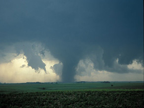
Dust particles pumped out by industry, agriculture and transport could be the catalyst that makes a nasty thunderstorm switch into a spawning ground for tornadoes.


Researchers from Colorado State University who have been seeking a greater understanding of the twisters that plague the American Midwest each year believe that particulate matter could be partly to blame for the devastating problem.

Their research was based on computer modelling rather than field observations and sampling and could shed some light on the mystery of why some so-called supercell thunderstorms blow themselves out while others crank up the extreme weather a notch and generate twisters which rip through the landscape.

The team compared two computer models - one with clear air and the other with a high level of fine particulate matter.

In the clear-air model, tornadoes never quite formed, while in the pollution-heavy model, they did with some frequency.

David Lerach, leader of the research team, admits it is still unclear as to why exactly this might be but says it could be that the dust prevents water in the atmosphere from condensing into big enough droplets to fall as rain, thus stopping the storm from breaking.

Instead of falling as rain, he believes that warm air carries the tiny water droplets high into the cloud where they freeze and this process effectively leaves the way clear below for the rotating air currents that are the precursor to tornadoes.

WEATHER NOTE
TORNADOES.....TORNADOES......TORNADOES..........

Super cell on brink of tornado

A STORM chaser says a 130km/h 'super cell' that hit the northern Gold Coast and Hinterland yesterday almost turned into a tornado.

Houses and cars were severely damaged in the small rural community of Wonglepong and roofs were damaged when trees landed on cars at Mount Tamborine, Canungra and in the Ormeau and Wongawallan areas.

The Scenic Rim SES unit received more than 20 calls for jobs mainly relating to roof damage as storms moved through from the southwest about 4pm.

At one stage police told motorists to avoid travelling to Mount Tamborine due to severe storm damage and road closures throughout the area.

Powerlines were brought down on Main Western Road, Hartley Road and Lahey Road, blocking access for several hours.

A large tree fell on to the northbound lane of the M1 at Robina about 6.30pm.

A severe weather expert said the super cell had produced winds of at least 130 km/h.

Gold Coast member of the Australian Severe Weather Association Jeff Higgins, who chases storms on a regular basis, said the cell was close to becoming a tornado.

"Conditions were ripe for the formation of a tornado and this particular cell went close to producing one," he said.

"Even though a tornado didn't form, it had the same strength of being a tornado."

He said at 3pm he recorded 161 lightning strikes per minute and 70ml of rain in just 10 minutes.

"That storm was life-threatening due to the trees going down and powerlines," said Mr Higgins, who predicted similar storms on Wednesday and Thursday this week.

Scenic Rim SES local controller Brendan Guy said the Mount Tamborine area was hit hardest by the storm.

"Most of the jobs were on the mountain, they were for trees falling on roofs and skylights being damaged," he said. "There are a lot of trees down, powerlines down, it's a big mess.

"Two homes in Wongle-pong lost their roofs.

"They were on the same property.

"The family were able to go to a third house on the property for shelter for the night."

The Vonda Youngman Community Centre on Mount Tamborine was damaged when a tree fell on its roof.

Mount Tamborine resident Chris Watts reported hail the size of golf balls.

"It was pretty full on, and the wind was pretty wild," he said.

SES volunteers were expected to work through to midnight, clearing roads blocked by trees felled by the storm and repairing roofs.

Wonglepong resident Peter Brown watched as trees were blown down in his property, one narrowly missing his house before it demolished his fence and brought down powerlines.

"It sounded like a bomb going off. We thought it was lightning," he said.

"Hail was hitting the windows, I thought they were going to crack.

"We've had storms but nothing like this. It's never been this scary before."

For all the storm's fury, Mr Brown said it was over in 15 minutes, but the power was out for four hours.

Next door, Colleen Brown had the fright of her life when a large branch speared through the side of her house.

"I've never seen anything like it. We were lucky I suppose," she said.

North Carolina storm kills 2, destroys homes

KENLY, N.C. --As a tornado ripped through his North Carolina neighborhood, Curt Jernigan huddled in his bathroom, praying for the raging winds to spare him.

When Jernigan emerged from the home, he met a neighbor, his face covered in blood, who pleaded with him to help search for his wife. She had gone missing in the confusion of the storm. The 41-year-old Jernigan agreed to help out, but said he knew the effort to find the woman alive would be fruitless.

"When I saw what he had in his yard, I knew it wasn't going to be a rescue -- it was a recovery. It's just devastation," Jernigan said.

His grim thought proved correct. State police said his neighbor, Maryland Gomez, who was in her 60s, was one of two people killed by tornadoes and severe weather that swept across central North Carolina early Saturday.

Gomez's body was found amid the rubble that was once her home in Kenly, a community about 35 miles southeast of Raleigh, said state police spokeswoman Patty McQuillan. In neighboring Wilson County, authorities said a child also was killed. Several people were injured in the cluster of strong storms that hit some six counties.

The only thing left standing of Gomez's home was her front porch, one of at least a half-dozen houses destroyed by the storms that also knocked down trees and power lines. Residents emerged at daybreak to find their homes in ruins, cars flipped over and debris strewn about.

"It was pretty massive destruction," Johnston County emergency management coordinator Derrick Duggins said. "It goes to show the magnitude of what natural weather can do.

In Kenly, family and friends piled up mattresses, took pictures of the damage and filled garbage bags with trash from Mark Stephenson's one-story brick home, leveled by the storm.

Winds tossed family portraits into the woods some 200 yards away and the skeleton of a new camper the Stephensons had just bought sat nearby.

One half of Stephenson's home was flattened, while a tree had fallen through the other half, on top of his 19-year-old daughter's bedroom. She was taken to a hospital with non-life-threatening injuries.

"It's hard to believe, it's hard to take in," Stephenson said. "We've got our lives and our health, so we're good to go."

His 14-year-old son, Hunter, pointed to what used to be his bedroom -- now just a pile of bricks and beams. The room was being remodeled, so Hunter had been sleeping in the living room.

"I'm lucky," he said. "It's crazy, if I would have been in there, I would have been dead."

U.S. Rep. Bob Etheridge, who represents the area, surveyed the damage Saturday, describing beams in the home where the woman was found as spaghetti-like. Gov. Mike Easley planned to tour the area Sunday or Monday after local officials have assessed the damage.

A Red Cross shelter was opened at a church and National Weather Service officials were sending crews out to survey the damage.

The Huntsville Tornado

On the morning of Wednesday, November 15, 1989, it appeared that a significant severe weather outbreak was likely. The early morning convective outlook called for a moderate risk for severe weather over much of Alabama, Mississippi, southern Tennessee, western Georgia and the Florida Panhandle, warning that there could be significant tornadoes. The NWS Birmingham called the system impressive.

By midmorning, the risk category was upgraded to high. The system was becoming more impressive according to forecasters. All Weather Service offices in Alabama were urged to review staffing levels and bring in additional personnel for the event. Huntsville was short staffed, so an intern was dispatched from Birmingham.

PDS (Particularly Dangerous Situation) tornado watches were issued; the first coming just after noon for Northwest Alabama. At 1:20 p.m., it was noted that storms were intensifying over Northeast Mississippi. At 1:35 p.m., a tornado watch was issued for the rest of Alabama. Lifted indices over Mississippi were as low as -9. Very strong upper level winds associated with a jet max were moving into position over Alabama and Mississippi. Winds were divergent in the upper atmosphere and there was a strong dry punch moving across Mississippi.

At 2 p.m., I sat at my desk at the Sheraton Perimeter Hotel with a late lunch and plotted the latest surface observations. I drew this surface map. The dewpoint at Birmingham was an impressive 68F. As I connected the pressure plots in isobars, I gasped at the sight of a strong mesolow over Northeast Mississippi.

This meant trouble. That low would provide the backing winds at the surface that could help spin up tornadoes. I packed my things and headed home so that I could watch the situation unfold on television as the impressive squall line appraoched Northwest Alabama.

The first severe thunderstorm warning was issued for Northwest Alabama’s Colbert, Franklin and Lauderdale Counties at 2:43 p.m. It was extended to Lawrence County just after 3 p.m. At 3:40 p.m., the warning was upgraded to a tornado warning based on a hook echo indication.

Just before 4 p.m., the warning was moved over to include Limestone and Morgan Counties. At 4:13 p.m., a warning was issued for Limestone, Madison and Morgan Counties, but it was a severe thunderstorm warning since the hook had disappeared on radar.. The text did state that severe thunderstorms can and occasionally do produce tornadoes. Large hail was falling at Decatur. At 4:15, a wall cloud was observed from the NWS office at the Huntsville International Airport, but it dissipated.

At 4:20 p.m., a wall cloud was reported by NASA meteorologists at redstone Arsenal. At 4:25, rotation was observed.

By 4:27, the radar became useless as the storm moved overhead, its beam attenuated by heavy rain and hail.

The tornado was forming over the Arsenal, however, near Fowler Road and Mills Road. It touched down and started moving northeast.

The amateur radio network was up and operating in Huntsville with an operator at the NWS. At 4:30 p.m., conflicting reports came in from spotters about a tornado on the ground in the old Airport area of Huntsville.

By 4:33 p.m. as the sunset, the sky over Huntsville was ominously black. And the tornado reports were starting to pour in. The tornado had hit the Police Academy.

A deadly situation was developing, right in the middle of rush hour.

At 4:35 p.m., a meteorologist began creating a tornado warning in the SRWarn program on a PC. This allowed for rapid composition of messages. At the same time, the warning was given live on the NOAA Weatheradio with the tone alert. The location was incorrectly given. It would be corrected in the formal warning.

There was a short delay as the warning was transmitted over the AFOS computer, the backbone of the Weather Service automation at the time. The warning was sent out at 4:39 p.m.

But on WAAY, CHannel 31, meteorologist Gary Dobbs was live. He reported that there had been damage in Leighton in Colbert County, including a building collapse, as well as other damage. He have the severe thunderstorm warning for Limeston, Morgan and Madison County. He mentioned reports of funnel clouds.

A producer handed him a report of a tornado on the ground at the Huntsville Golf Course. A few seconds later, the producer told him that a tornado was on the ground at the Municipal Golf Course near the Armory.

The tornado was moving into a heavily populated area. It immediately crossed Memorial Parkway, which was highly congested with rush hour traffic.

The City of Huntsville was ensconced in an inky blackness as the 55,000 foot thunderstorm knocked out the electricity. Eerie bright flashes of light punctuated the darkness as the tornado ripped down power lines and tranformers blew.

Dobbs relayed the frightening reports to his audience as they were given directly to him. “The tornado is over the Parkway at Airport Road. Lots of damage.”

Between the Parkway and Whitesburg Road, the F4 tornado found plenty to detsroy, including apartment complexes, office buildings, churches and shoppng malls. Nineteen of the 21 fatalities occurred in this short stretch of the path, including eleven people in cars. Another fatality occurred in an automobile on Garth Road. Many never saw the tornado, and had no chance to escape.

At Jones Valley Elementary School, thirty seven students and 12 adults were present. An extended daycare program was in progress.

Principal Marilyn Dawson was concerned about the weather. Dawson was very weather aware. She had attended an emergency preparedness seminar in Birmingham in the spring.

The principal had been monitoring the NOAA Weatheradio all day. She gave the Weatheradio to lead teacher Penny Cato before leaving at 4:15 p.m.

Ms. Cato and the four other teachers led the students from their second floor classrooms to a stairwell on the lowest floor. She took the Weatheradio outside at 4:20 p.m., and heard the severe thunderstorm warning. It was raining heavily and there was lots of ligthning.

The lights flickered at 4:33. At 4:36, the tornado struck the school. The seven painters and teachers threw themselves over the kids, as glass and concrete rained down on them.

The actions of Ms. Dawson, Ms. Cato, the teachers and the painters likley saved several lives.

The tornado caused lots of destruction in the Jones Valley subdivision.

The Huntsville Tornado was on the ground for 18.5 miles. It destroyed 259 homes, 80 businesses and two schools. Twenty one people died and 463 people were injured.

Oh yeah....and a waterspout in Aussieland!

TOWERING: NEWSBREAKER Jason Rogers snapped this stunning water spout in Darwin Harbour after an early morning fishing trip to the Tiwi Islands

Water spout snakes through Darwin Harbour

DANIEL BOURCHIER

A TERRITORY fisherman has stumbled on a natural spectacle - a water spout rising from Darwin Harbour into the clouds.

NEWSBREAKER Jason Rogers spotted the towering wonder as he was returning to Darwin from an early morning fishing trip to Melville and Bathurst Islands.

Mr Rogers, 39, spotted the phenomena at 6.50am Thursday. The seasoned fisherman, who visits Darwin regularly from Brisbane, could count on one hand the times he has seen a water spout.

"It was pretty cool," Mr Rogers told the Northern Territory News.

"It went right up to the clouds.

"I would have liked to have been a bit closer - I was actually getting photos of the sunrise when I spotted it."

Weather bureau severe weather forecaster Todd Smith said the water spout was not too out of the ordinary, but they were usually only seen in the morning.

"A water spout is generally a rotating column of air that often forms under a thunderstorm," he said.

"Sometimes they move over land and can be particularly damaging.

"They can pull up mangrove trees and there have been reports of them coming ashore and tipping boats over."

Mr Smith said water spouts tend to last for as little as a few minutes.

There have been reports of water spouts dropping fish when they come over land, but Mr Smith said that sounded unlikely.

"I haven't heard of that," he said "There is potential for a bit of suction, but I imagine it would be a bit of water from the top and only for a few minutes."

Well if Waterspouts in Ausieland ain't enough?

Lightning storm 'skips' Darwin

STRIKING DISTANCE: Newsbreaker Jacci Inham captured this amazing shot of the storms from the Arnhem Highway.

THE skies over the Top End staged a lightning show a la extravagancy on Saturday night.

NEWSBREAKER Jacci Ingham captured a glimpse of the storms from the Arnhem Highway in Darwin's rural area.

The 27-year-old storm chaser and amateur photographer said the line of storms approached Darwin from the east.

"It started in the evening over Kakadu," she said.

"It was a big line of storms, but it sort of skipped Darwin."


Striking lightning images from across the Territory

Darwin airport recorded 108 lightning strikes within a 50km radius Saturday night.

The storm spent a couple of hours around Darwin, before hitting the sea where it became active again.

Despite the lightning show, most of the Top End remained dry.

Ms Ingham, of Wagaman, has lived in the Territory all her life.

She said she loved the wet season.

One last thing.....Here comes .....WINTER!

Ready or not, here it comes!

Winter is coming. Whether you love it, hate it, or just tolerate it, winter is coming. The best way to survive winter in northern Illinois and northwest Indiana is to be prepared.

November 16 through 22 is Winter Weather Preparedness Week in Illinois and Indiana

MARITIME NOTE

Members voice concern about the future of IACS


MUMBAI: Is the august body of International Association of Classification Societies (IACS) cracking up? This seems to be the dominating thought running through not only among the 10 - member group and the majority 60 odd other such societies spread across the world but also a whole lot of ship owners and shipping professionals.

Even though the reasons that led to the January raids by the European Union (EU) on IACS and its members are still a mystery, the resultant anxieties and worries are now finding expressions in the world media.

Anti-trust inspectors of EU launched dawn raids on the offices of IACS and European classification societies in January, seeking evidence of them working together to reduce competition. It has since become apparent that the societies were under instruction not to comment on the aftermath of the raids.

The murmurs that followed the dawn raids became loud with, what one newspaper reported as, 'Clash of titans' when Det Norske Veritas (DNV) maritime chief operating officer and immediate past chairman of IACS Tor Svensen refuted American Bureau of Shipping (ABS) boss Robert Somerville's observations about 'sustained campaign against class threatening safety.'

It started off with Mr Somerville telling a recent IUMI insurance conference in Vancouver that the EU campaign would erode safety at sea and Brussels' competition authority DG Competition may turn IACS into a fairly loose trade association. "EU wanted to change or end the marine classification system," he said, adding, "The campaign against the IACS will erode safety at sea by turning it into a loose trade association... so diluted as to be largely irrelevant." Mr Somerville fears that the moves from Brussels amount to an attack on the independence of the quality system, while any attempt to open up IACS to all-comers will see the association lose all of its effectiveness.

"If IACS dies, the de facto technical division of the international maritime organization closes down," said Mr Somerville. It is an argument, which many suggest, points to the kind of clout the IACS group wields over a large number of shipping companies across the maritime nations.

It also displays the skewed perception that at least some of the IACS members have about the 60 odd classification societies which are not members of the world body. Over the years some of them have proved that they are as good as if not better than some of the members of IACS.

A former IACS chairman and as someone who has been in the survey of ships for the last 38 years, Mr Somerville is not willing to see it happen. He also said there are other members who would take hard line on any dilution of IACS safety mandate as ABS.

His counterpart at DNV, Tor Svensen, labelled Somerville's remarks as "unjust" and called Somerville's observation 'wrong in approach and wrong in content'.

In fact, over the months, many classification societies have started being outspoken about communications between themselves and IACS, even at a time when all are under European investigation.

While some members within IACS want to ensure that they reach a compromise with EU authorities so as to avoid possible costly penal clauses, others are opposing the EU efforts to 'clean the stables of cartels' by tooth and nail.

According to reports, class societies found guilty under the EC's anti-trust regulations can be fined up to 10% of their turnover. However, some IACS members, like BV have said that the fines may not be that heavy.

The ongoing war of words between different members of the IACS seems to suggest that there are substantial developments happening behind the scene.

In fact, according to reliable sources, the September 19 meeting between IACS and EU competition officials, the former came under tremendous pressure.

They said, a committee of IACS has been formed along with lawyers to come to a compromise with the investigating authorities.

The panel comprising legal and industry experts, besides some IACS members has been formed to review the membership criteria of IACS, which has been a controversial subject for quite sometime. It is expected to submit its recommendations to EC shortly.

As we await the EU verdict on its probe, which is expected to take some more time, it would be interesting to see how the international institution and its members progress through the nail-biting suspense over the likely future of the world organisation.


RS

Friday, October 31, 2008

Progress reported in UN-backed efforts to reduce pollution, emissions from ships

Progress reported in UN-backed efforts to reduce pollution, emissions from ships

The United Nations International Maritime Organization (IMO) has reported major progress on efforts to cut polluting and global warming emissions from ships, achieve more environmentally friendly recycling of vessels and prevent contamination from harmful organisms in ballast.

Under amendments to the so-called MARPOL (marine pollution) accords unanimously adopted by IMO's Marine Environment Protection Committee (MEPC) earlier this month, emissions of sulphur oxide (SOx), nitrogen oxide (NOx) and particulate matter from ships will be progressively reduced.

"The MEPC maintained momentum on the issue and made substantive progress in developing technical and operational measures to address such emissions, including the development of an energy efficiency design index for new ships and an energy efficiency operational index, with associated guidelines for both," the agency said in a news release.

According to a consensus estimate for 2007, CO² emissions from international shipping amounted to 843 million tons, or 2.7 per cent of global CO² emissions, as compared to the 1.8 per cent estimate in 2000. In the absence of regulation, such emissions were predicted to increase by a factor of 2.4 to 3.0 by 2050.

MARPOL Annex VI Regulations for the Prevention of Air Pollution from Ships entered into force in May 2005 and has so far been ratified by 53 countries, representing some 81.88 per cent of the gross tonnage of the world's merchant shipping fleet.

The MEPC discussed whether the application of measures to reduce or limit greenhouse gas emissions from ships should be mandatory or voluntary for all States. Several delegations spoke in favour of limiting mandatory reductions to those countries, mainly the more developed industrial nations countries listed in Annex 1 of the UN Framework Convention on Climate Change (UNFCCC).

But several other delegations said the regulatory framework should be applicable to all ships, irrespective of the flags they fly, noting that as three-quarters of the world's merchant fleet fly the flag of countries not listed in Annex I, any regulatory regime would be ineffective if it were made applicable only to Annex I countries.

On the issue of harmful aquatic organisms in ballast water, the MEPC adopted guidelines for ballast water sampling and approval of ballast water management systems as well as arrangements for responding to emergency situations involving ballast water.

It also agreed on a guidance document on minimizing the risk of ship strikes with cetaceans, such as whales. With regard to recycling, ships will be required to carry an inventory of hazardous materials, specific to each ship.

WEATHER NOTE

Emergency preparedness: Best-laid plans for worst-case disaster

By James Dowd

The message was simple and direct: Plan now to act later.

For about 150 business professionals at the second annual Emergency Preparedness and Incident Conference, the program couldn't have been more timely.

"In difficult economic times like these, companies try to stretch their dollars as far as possible and unfortunately, that means some don't invest in an emergency continuity plan," said Billy Freeman, communications specialist with Tennessee Task Force 1, an urban search-and-rescue team sponsored by the Memphis/Shelby County Emergency Management Agency.

"If it seems daunting to think about training people and implementing a comprehensive response program, then just take it a bit at a time. Just be sure to start somewhere."

That includes training employees how to respond in the event of disasters such as earthquakes, fires, floods and tornadoes, Freeman said. Companies should also maintain recovery plans with regular updates about how to resume business following a crisis.

The daylong conference, held recently at the FedEx Institute of Technology on the University of Memphis campus, featured a variety of disaster-preparedness booths and more than a dozen crisis-management and response seminars.

Organizers of the event, which was coordinated by the Mid-South Association of Contingency Planners, stressed that the best time to address an emergency is before one occurs, particularly in a region situated along the New Madrid fault line.

"In the best-case scenario, disaster planning is like insurance and you hope you never have to use it," said Ron Smith, the organization's vice president. "But you can't just close your eyes and hope for that. We don't preach gloom and doom; instead, we encourage responsibility and preparedness."

Shelby County Mayor AC Wharton, who delivered opening remarks at the conference, agreed.

"It used to be that contingency planning was something you stumbled into when there was nothing else to do," Wharton said. "Now more people are starting to plan for the unexpected and the question is not what if something happens but what might happen and what will we do when it does?"

Association leaders promote that discussion and hope more businesses -- especially smaller ones -- will join the conversation.

Founded in 2004, the group is the local chapter of the International Association of Contingency Planners. From the original 20 members, the group has more than tripled in size and is stepping up efforts to heighten public perception of disaster and emergency awareness.

"It's about having a strategy," said Damian Walch, one of the conference speakers and a nationally recognized expert in continuity and disaster planning. "We have to react differently from the way we did 10 or 15 years ago. The business supply chain is increasingly complex and it requires greater resiliency."

Gary Patterson, geologist and information-services director at the Center for Earthquake Research and Information at the UofM, praised the efforts.

"People don't like to think about this subject because it's something they can't control, but what they can control is being as prepared as possible," Patterson said. "We're doing a lot to inform people, but we've got a long way to go. Events like this help get the message across."

Most of the group's programs, such as the recent conference, are free. Annual dues are $80. The group's next meeting will be Nov. 12.

MARITIME NOTE

A ship graveyard


by JANET HOWITT of the ESG


The ESG would first like to commend the efforts of emergency and rescue teams whose efforts secured the lives of the crew from the stricken vessel, Fedra in unbelievably difficult conditions.

The sight of the massive metal structure brought to its knees at Europa Point, in what is fast becoming a ship graveyard has shocked and horrified all who have seen her split in two.

The area is in fact one of Gibraltar's most important ecological and historical sites and the ESG hopes that Govt plans to designate this area as an exclusion zone to all ships will go some way in avoiding certain types of accidents in the future. However that measure would not have avoided Fedra'66s crash and hopefully the ongoing police and maritime investigation will reveal some reason for this latest tragedy.

What is also of concern and has been raised by the ESG with Govt recently is the large number of vessels anchored in an off-limits zone on the eastern side of the Rock. This potential problem was also highlighted in the report into the Samothraki accident by the Maritime Administration. Several recommendations were made within that report into how ship movements and monitoring could be improved both from the Gibraltar port side and at cross border level. It is understood that the Gibraltar Govt will be applying all recommendations made.

It is hoped that authorities from both sides of the border will address the serious environmental challenges posed by the dense level of shipping activity in the Bay and avoid an ecological disaster.

Finally, the ESG has already notified the Minister for the Environment's offices that a growing number of volunteers are signing up to help clean the beaches of oil- it is a reminder yet again that there are many in the community who care and are willing to lend a hand in a time of crisis. We are now waiting for their call.

BACKGROUND:

THE REPORT INTO THE GROUNDING OF THE OIL TANKER 'SAMOTHRAKI' ON 17 MARCH 2007 MADE THE FOLLOWING RECOMMENDATIONS:

The Gibraltar Port Authority is recommended to:

1. Consider a port control policy aimed at providing a navigational assistance service.

2. Consider establishing a Southerly limit to the Eastern anchorage

3. Consider requiring all vessel anchoring within 3 miles of Gibraltar on the Eastern side to report to GPA with anchor position and basic ship information

4. Consider establishing an exclusion zone in the vicinity of Europa Point, up to 1 n.mile from the shore. 5. Consider requiring off-port limits transfers to be completed further offshore, and to the South East of Europa Point.

Managing Maritime Emergencies
Download Brochure

Identifying risk, planning and managing emergencies, crisis communication

Monday 24th - Wednesday 26th November 2008
Bonhill House, London, UK

Register Now Buy Papers


Messing About In Ships Podcast


Have a safe and enjoyable weekend!
RS

Wednesday, October 22, 2008

How Many Earthquakes Are There?

How Many Earthquakes Are There?

ScienceDaily (Oct. 8, 2008) — A new method for estimating the capability of a network to detect earthquakes suggests that the seismic monitoring network for Southern California, as an example, does not accurately reflect all earthquakes that register a magnitude of 3.3 or smaller within southern California, thereby giving seismologists an incomplete picture of recent and current seismicity.

The study, published in the October issue of the Bulletin of the Seismological Society of America, provides a new empirically-based approach for seismologists to understand the detection capabilities of seismic networks.

While today's improved seismic networks detect earthquakes down to low magnitudes in regions of the densest coverage, seismologists need to estimate the completeness magnitude which varies in space and time. This magnitude of completeness indicates the magnitude below which the earthquake catalog does not contain all events that occurred..

D. Schorlemmer of the University of Southern California (USC) and J. Woessner of the Swiss Seismological Service present a new approach to estimate the magnitude of completeness which will enable scientists to develop a richer understanding of the distribution of smaller earthquakes. The authors' new approach uses an analysis based on the actual performance of seismic stations rather than a theoretical assessment based on sampling of earthquakes.

This advancement is important because one way scientists estimate the number of large, damaging earthquakes is to study the distribution of small earthquakes. Without an accurate understanding of how likely the seismic networks are detecting earthquakes of different magnitudes, scientists may obtain incorrect seismic hazard estimates for an area.

WEATHER NOTE

Researchers study global warming impact on hurricanes

Florida Today

BREVARD COUNTY, Florida -- Federal researchers hope a supercomputer that crunches 76 trillion equations per second can shed light on whether global warming might lead to fewer, yet more powerful hurricanes.

The federal government has launched an intensive study of how global warming might impact hurricanes in coming decades.

The goal of the study is to better warn coastal communities, offshore Gulf of Mexico oil drilling operations, and other interests that could be affected by increased hurricane activity.

The National Center for Atmospheric Research (NCAR), will conduct the study, along with other federal agencies, universities, as well as the insurance and energy industries.

The Georgia Institute of Technology and several other universities are also collaborating on the research.

The project will use global climate and regional weather models, run on one of the world’s most powerful supercomputers. The models will examine future hurricane activity “in unprecedented detail,” according to a press release issued Wednesday by NCAR.

The study, which centers on the Gulf of Mexico and the Caribbean Sea, is part of a larger study of regional climate change between 1995 and 2055. Researchers will look at three decades in detail: 1995-2005, 2020-2030, and 2045-2055.

The simulations will run on NCAR’s flagship bluefire supercomputer. Manufactured by IBM, it is ranked as one of the 30 most powerful computers on Earth and can solve up to 76 trillion equations every second.

Researchers will analyze changes in hurricane frequency, intensity, and paths from now to the middle of the century. A major goal is to examine how several decades of greenhouse-gas buildup could affect regional climate and influence hurricanes and other critical weather patterns.

Preliminary results are expected early next year.

“It is clear from the impacts of recent hurricane activity that we urgently need to learn more about how hurricane intensity and behavior may respond to a warming climate,” NCAR scientist Greg Holland said in the release.

“The increasingly dense development along our coastlines and our dependence on oil from the Gulf of Mexico leave our society dangerously vulnerable to hurricanes,” said Holland, who is leading the project.

The new study follows reports by the U.S. Climate Change Science Program and Intergovernmental Panel on Climate Change, that found evidence for a link between global warming and hurricane activity.

MARITIME NOTE

Maritime Organization Seeks to Cut Air Pollution From Oceangoing Ships

The International Maritime Organization on Thursday adopted stringent new controls on airborne pollution from the world’s 300,000 oceangoing vessels.

Emissions from ships steaming into ports from Rotterdam to Shanghai to Long Beach, are blamed for about 60,000 premature deaths around the world annually.

The new rules, which differ little from proposals the group approved in April, would cut the sulfur content of the fuels ships use in controlled areas along coasts by 63 percent as of July of 2010, and by more than 95 percent as of January 2015.

Oceangoing ships are largely propelled by bunker fuel, which is one of the most cost-effective — it provides more energy per gallon than the distilled products used in other diesel and gasoline engines — and environmentally destructive fuels in use anywhere.

Sulfur emissions are a major source of airborne fine particulates, which have been associated with pulmonary and cardiovascular disease. In some ports in Europe and in the United States, environmental groups, using the courts, and local governmental bodies have required ships to shut off their engines and plug in to the local electrical grid to keep ship operations functioning while in port.

The international group approved the measure with little discussion late Thursday at its meeting in London, according to Janea Scott, a lawyer with the Environmental Defense Fund who attended the meeting. Ms. Scott spoke by telephone from London.

Both shipping interests and environmental groups had been unsure if any major last-minute changes would be made, but with the exception of changes of a few months in two of the deadlines, the original proposals were approved.

Now individual countries must set the boundaries of the so-called emission control areas in which the new, stringent fuel standards apply. This sets the stage for a renewed tug of war as environmental advocates are likely to seek to include as much of a country’s offshore waters as possible in the emission control areas, while shipping interests are likely to call for far more limited boundaries.

Andreas Chrysostomou, the chairman of the Marine Environment Protection Committee, hailed the decision as “an historical moment,” Ms. Scott said.

T. L. Garrett, vice president of the Pacific Merchant Shipping Association, an industry trade group, said Thursday: “This is good news — we are fully supportive of this. We think the international approach that creates uniformity is the way to approach the issues.”

Ms. Scott of the Environmental Defense Fund said, “It’s really impressive when 168 nations can come together and agree on protective measures for the environment.” She added that the Environmental Protection Agency, which will propose the boundaries of the emission control areas, “should apply as soon as possible.”

In addition to setting limits for the offshore areas, the organization also cut the allowable standards for midocean operation. Currently, even though the average sulfur content of bunker fuel is about 27,000 parts per million, the rules allow fuel with up to 45,000 parts per million. This will be reduced to 35,000 parts per million in 2012 and to 5,000 parts per million in 2020, providing that a review demonstrates that there will be enough of the fuel available.


RS

Friday, October 10, 2008

Marine Debris Will Likely Worsen In The 21st Century

Marine Debris Will Likely Worsen In The 21st Century

ScienceDaily (Sep. 21, 2008)Current measures to prevent and reduce marine debris are inadequate, and the problem will likely worsen, says a new congressionally mandated report from the National Research Council.

The United States and the international maritime community should adopt a goal of "zero discharge" of waste into the marine environment, and a system to assess the effectiveness of existing and future marine debris prevention and reduction actions should be implemented. In addition, better leadership, coordination, and integration of mandates and resources are needed, as responsibilities for preventing and mitigating marine debris are scattered across federal organizations and management regimes.

"The committee found that despite all the regulations and limitations over the last 20 years, there are still large quantities of waste and litter in the oceans," said Keith Criddle, chair of the committee that wrote the report and the Ted Stevens Distinguished Professor of Marine Policy at the Juneau Center for Fisheries and Ocean Science, University of Alaska, Fairbanks. "We concluded that the United States must take the lead and coordinate with other coastal countries, as well as with local and state governments, to better manage marine debris and try to achieve zero discharge."

A National Research Council committee was convened at the request of Congress to assess the effectiveness of international and national measures to prevent and reduce marine debris and its impact. Marine debris, man-made materials that intentionally or accidentally enter and pollute the ocean, can cause significant harm. For instance, birds, fish, and marine mammals ingest debris, especially plastics, which can lead to digestive problems and uptake of toxic compounds.

Animals can also suffer injuries or die after becoming entangled in fishing-related debris such as plastic net fragments, rope, and packing straps. Marine debris also poses a health and safety hazard to beachgoers and divers, and could impact coastal recreation and tourism revenue. While marine debris comes from sources both on land and at sea, the committee focused on debris discharged at sea for the purposes of this report.

Although Congress previously called for federal interagency coordination to address the marine debris problem, leadership and governance remain inefficient and current mitigation efforts are episodic and crisis driven, the committee found. A national framework to identify priorities for dealing with marine debris and its removal efforts should be established. Additionally, Congress should designate a lead agency to expand programs to comprehensively address the problem, including land-based marine litter, derelict fishing gear, shipborne waste, and abandoned vessels.

Under the International Convention for the Prevention of Pollution from Ships (MARPOL) Annex V, which entered into force in 1988, many discharges from ships are permissible at sea. The committee said this approach does not encourage innovation or measures to minimize waste. It suggested that MARPOL Annex V be amended to include a prohibition on discharge of garbage at sea, allowing for limited exceptions based on specific vessel-operation scenarios. In order to discourage waste disposal at sea, ships also need to have access to adequate shoreside waste reception facilities for garbage and should be provided incentives, such as low disposal fees to use them, the report adds.

Nevertheless, some ships have already adopted zero or minimal discharge practices. The U.S. Coast Guard (USCG) and U.S. Environmental Protection Agency should disseminate best management practices for how vessels can attain zero discharge, source reduction, and waste minimization, the committee urged. EPA should also take the lead to work with academia, industry, and nongovernmental organizations to develop industry standards and guidelines for source reduction, reuse, and recycling for solid wastes that are generated during ship operations.

The committee was specifically asked to address the challenges surrounding derelict fishing gear. While regulated under MARPOL Annex V and domestic implementing laws, it is a persistent problem because of accidental losses and legal loopholes. Also, current regulations do not include accountability measures for commercial and recreational fishing vessels for loss of their fishing gear, offering few incentives to take responsibility for cleanup.

Effective marking of fishing gear is critical for identifying the sources or fisheries that may have deployed the gear, and NOAA should develop marking protocols, the report claims. Fishery management organizations should also adopt a "no fault" policy regarding the documentation and recovery of lost fishing gear. Under this policy, local fishermen, state officials, and the public should develop cost-effective derelict fishing gear removal and disposal programs, and fishermen participating in removal efforts could receive financial credit or be exempted from landfill fees.

Moreover, the high costs and difficulty in providing adequate reception facilities, particularly in remote areas, discourages proper disposal of used fishing gear and can also be a disincentive to retrieval. Therefore, EPA, NOAA, and the U.S. Army Corps of Engineers should help fishing communities explore alternative strategies and technologies for management, disposal, and recycling of used and recovered gear.

Within the issue of derelict fishing gear, the committee also addressed the growing concern about a specific type of gear known as fish aggregating devices, which are man-made floating objects designed to simulate natural debris and attract fish. These devices pose a threat as they are allowed to float freely and are often made of waste fishing net. The committee concluded that abandoned fish aggregating devices become derelict fishing gear when the captain of the vessel does not retrieve them. Under MARPOL Annex V, this should be considered an illegal disposal if the devices contain synthetic ropes, webbing, or other plastics. NOAA should modify the federal regulations to clarify the circumstances under which abandoned fish aggregating devices become illegal discharge. The committee also indicated that international and domestic fisheries organizations should do more to regulate these devices and prevent them from becoming debris.

The report was sponsored by the U.S. Coast Guard. The National Academy of Sciences, National Academy of Engineering, Institute of Medicine, and National Research Council make up the National Academies. They are private, nonprofit institutions that provide science, technology, and health policy advice under a congressional charter. The Research Council is the principal operating agency of the National Academy of Sciences and the National Academy of Engineering.

WEATHER NOTE

NASA data show Arctic saw fastest August sea ice retreat on record

Following a record-breaking season of arctic sea ice decline in 2007, NASA scientists have kept a close watch on the 2008 melt season. Although the melt season did not break the record for ice loss, NASA data are showing that for a four-week period in August 2008, sea ice melted faster during that period than ever before.

Each year at the end of summer, sea ice in the Arctic melts to reach its annual minimum. Ice that remains, or "perennial ice," has survived from year to year and contains old, thick ice. The area of arctic sea ice, including perennial and seasonal ice, has taken a hit in past years as melt has accelerated. Researchers believe that if the rate of decline continues, all arctic sea ice could be gone within the century.

"I was not expecting that ice cover at the end of summer this year would be as bad as 2007 because winter ice cover was almost normal," said Joey Comiso of NASA's Goddard Space Flight Center in Greenbelt, Md. "We saw a lot of cooling in the Arctic that we believe was associated with La Ni�a. Sea ice in Canada had recovered and even expanded in the Bering Sea and Baffin Bay. Overall, sea ice recovered to almost average levels. That was a good sign that this year might not be as bad as last year."

The 2008 sea ice minimum was second to 2007 for the record-lowest extent of sea ice, according to a joint announcement Sept. 16 by NASA and the University of Colorado's National Snow and Ice Data Center (NSIDC) in Boulder, Colo. As of Sept. 12, 2008, the ice extent was 1.74 million square miles. That's 0.86 million square miles below the average minimum extent recorded from 1979 to 2000, according to NSIDC.

Contributing to the near-record sea ice minimum in 2008 was a month-long period in the summer that saw the fastest-ever rate of seasonal retreat during that period. From August 1 to August 31, NASA data show that arctic sea ice extent declined at a rate of 32,700 square miles per day, compared to a rate of about 24,400 square miles per day in August 2007. Since measurements began, the arctic sea ice extent has declined at an average rate of 19,700 miles per day at the point when the extent reaches its annual minimum.

Observations of changes to sea ice over time are possible due to a 30-year record of data from NASA and other agency satellites, including Nimbus-7, Aqua, Terra and the Ice, Cloud, and land Elevation Satellite (ICESat).

Researchers say that the recent seasonal acceleration could be in part due to conditioning going on in the Arctic. For example, research by Jennifer Kay of the National Center for Atmospheric Research in Boulder, Colo., and colleagues reported this April in Geophysical Research Letters that reduced cloud cover in 2007 allowed more sunlight to reach Earth, contributing to a measureable amount of sea ice melt at the surface. Reduced cloud cover also contributed to warmer ocean surface temperatures that led to melting of the ice from below.

"Based on what we've learned over the last 30 years, we know that the perennial ice cover is now in trouble," Comiso said. "You need more than just one winter of cooling for the ice to recover to the average extent observed since the measurements began. But the trend is going the other way. A warming Arctic causes the surface water to get warmer, which delays the onset of freeze up in the winter and leads to a shorter period of ice growth. Without the chance to thicken, sea ice becomes thinner and more vulnerable to continued melt."

MARITIME NOTE

Cargo sweeping allowed to continue on lakes

By JOHN FLESHER
AP Environmental Write

TRAVERSE CITY -- Great Lakes freight haulers will continue sweeping residues of iron ore, coal, limestone and other cargo overboard under a new federal policy that rejects environmentalists' pleas to end the practice.

But the Coast Guard said it was adopting its rule on an interim basis and was opening a new study phase that could lead to tougher requirements, including mandatory use of residue control methods.

For many years, ship crews have used high-powered hoses to wash their decks after loading or dropping off dry bulk cargo in port. They're believed to sweep about 1 million pounds of waste material into the lakes every year.

The regulation, published Monday in the Federal Register, lets cargo sweeping continue but encourages shippers to find ways to discharge less waste material.

It also sets new reporting and record-keeping requirements and adds more locations to a list of ecologically sensitive places where sweeping is off-limits, such as fish spawning areas, wetlands and wildlife refuges.

"Congress expected us to strike an appropriate balance between maritime commercial and environmental protection needs," the Coast Guard said.

The Lake Carriers' Association, which represents U.S.-flagged vessels on the Great Lakes, praised the decision Tuesday. The trade group says cargo sweeping does no environmental harm, and prohibiting it could impose huge costs while creating hazards for crew members.

But spokesman Glen Nekvasil said shippers already have reduced the volume of bits and pieces left on decks and in tunnels as cargo is moved on conveyor belts between a ship's hold and onshore storage facilities. It's unclear what more could be done, he said.

"It is in the companies' best interest, and the docks' best interest, to minimize residues. The customer is paying for that cargo to be delivered," Nekvasil said.

The Coast Guard listed a number of possibilities, such as enclosing or redesigning conveyors; spreading tarps to collect residues; using water mist to limit dust; and training crews on reducing cargo waste.

An environmental impact study found that ship residues can be seen on lake bottoms in small concentrations, but the effects are "barely detectable."

But the Coast Guard said in a news release it "remains concerned that the potential risk from the practice of washing dry cargo residue into the Great Lakes, no matter how benign it appears, may increase over time."

Rear Adm. Peter Neffenger, commander of the 9th District based in Cleveland, invited public comments as the study moves forward.

"The outcome of the final regulatory phase is not predetermined," he said.

Environmental groups contend dry cargo waste is just another form of garbage, which cannot legally be dumped into the lakes, and may do more harm to bottomlands than presently known.

Michael Murray, a staff scientist with the National Wildlife Federation, said he was encouraged that the study would continue and hoped for an eventual phaseout of cargo sweeping.

"We recognize that politically or even logistically it might be a little hard to adopt what we were hoping for at this point," Murray said.

With the prohibitions on cargo sweeping in sensitive areas, "we've at least gotten to the point where the agency is acknowledging this isn't an innocuous practice," said Joel Brammeier, vice president for policy with the Alliance for the Great Lakes. "That's progress."

MTS

HAVE A SAFE WEEKEND

RS

Tuesday, August 26, 2008

Scientists: U.S. not prepared for severe weather, climate change

Scientists: U.S. not prepared for severe weather, climate change

Heavyweights in the scientific community are not waiting until the November election.

Tornadoes are forming at a record setting pace this year. This twister touched down near Hebron, Nebraska in 2004. Photo by Bob Henson, UCAR

They are warning the next residents of the White House and Congress that the U.S. needs to just about double its budget on weather and climate change research, research they say impacts everything from health and safety to transportation and national security.

Scientists cannot fully understand or deal with the impacts of climate change without the proper political leadership, and without funding for scientific observation and computing. That was the message from the University Corporation for Atmospheric Research, the American Meteorological Society, and the Weather Coalition in a teleconference with reporters today.

In a document aimed at the next crop of political leaders, the scientists said “Science is key to understanding these impacts, but weather and climate research and operations budgets have been flat or declining for years due to the budget wars in Washington.”

John Snow, co-chair of the Weather Coalition and dean of the College of Atmospheric and Geographic Sciences at the University of Oklahoma, said there may have been a lot of good intentions in Washington in recent years, “But the reality is they’ve been unable to deliver.”

“The science budget has barely been keeping up with inflation, and in some cases has suffered actual cuts,” said Snow.

The National Science Foundation got a 2% increase, not keeping up with inflation, and the weather and climate research got 0%, effectively a strong cut,” he said.

The scientists are making five recommendations they say will improve the country’s resilience to severe weather and climate change:

Observations: Fully fund the earth observing system from satellite and ground-based instruments.
Computing: Greatly increase computer power available for weather and climate research and predictions.
Research and Modeling: Support a research program in earth sciences to advance understanding of weather and climate and their impact on society.
Societal Relevance: Support education, training and communication efforts for the maximum benefit of society.
Leadership and Management: Implement effective leadership to ensure that these investments are done in the best interest of the nation.

The price tag? The group says lawmakers will need to add about $9 billion to the current $10 billion that is budgeted over the next five years.

Whether it is hurricanes, tornadoes, fires, floods, snow, or drought, 75% of natural disasters around the world are triggered by weather and climate. That translates to billions of dollars in weather related losses every year in the United States.

“What we have put forward in the transition document is what we think is needed to prepare the nation for climate change, to be able to continue to improve our knowledge,” said Jack Fellows, vice president of the University Corporation for Atmospheric Research.

“Frankly, we think this is one of the most pressing problems facing humankind, but it just happens to be on a longer scale than a lot of problems our country faces,” said Fellows.

The other five organizations that wrote the document are the American Geophysical Union, the Consortium of Universities for the Advancement of Hydrologic Science, the National Association of State Universities and Land-Grant Colleges, the Consortium for Ocean Leadership, and the Alliance for Earth Observations.

WEATHER NOTE


Virtual hurricane disaster helps train responders

The software simulation creates realistic catastrophes to help emergency planners get ready for the worst situations.

By MATTHEW STURDEVANT

August 7, 2008

SUFFOLK— Garage-door-sized television monitors showed a sexy, virtual cable-news anchor reading a breaking news alert about the effects of Hurricane Nerissa that had crashed ashore east of Norfolk about 10 hours earlier.

"Removal of traffic congestion is especially challenging," the news anchor said.

As the computerized voice spoke, people sitting behind monitors had to react to that data as well as the constantly updating information about the storm. Some of it was good news, some of it bad.

In a room dimly lit by blue lights made to resemble a command-and-control center, a number of "role players" tried to orchestrate an emergency response to the simulated hurricane. Meanwhile, a separate group of engineers looked down on the players from a terrace where they made sure the fake hurricane was performing as it should, and that the role players' actions were working to fix the effects of the natural disaster.

Lockheed Martin, perhaps best known as a defense contractor, invited about a dozen emergency management officials to the company's Center for Innovation in Suffolk to show off a new software system that can simulate various types of catastrophes ranging from wildfires in California to a nuclear explosion.

The presentation comes just as Hampton Roads is about to enter the peak of the hurricane season from mid-August through the end of September.

The software simulation creates a virtual world based on real demographic information for the people who oversee police, fire, rescue and other emergency responders during a disaster. It could be used to train emergency officials in a city, county or regional agency on how to react if a real hurricane rolls up the shore.

How a storm would knock out power lines, damage buildings or injure people is the purpose of the simulation. Local and state agencies would then be better prepared for the real thing. Lockheed Martin wants communities to buy the simulation program that uses information from the U.S. Census Bureau and Federal Emergency Management Agency to construct disasters.

The goal is to make it real enough that the people getting trained act quickly and appropriately, from the computer command center to dispatch instructions to rescue people, get supplies where they need to go, open up closed roadways, get stranded people into shelters and make sure problems are solved or contained, for example, rerouting traffic as streets flood or power lines get knocked down across roads.

Predicting the behavior of a storm can be done via computer. Predicting what people will do is something else. But Lockheed Martin officials say their new program is detailed enough to show how people might react to a hurricane. For example, some people who work minimum-wage jobs may not evacuate because they are worried they'll lose their jobs, said David J. Macannuco, software engineering manager for Lockheed Martin.

The program can be customized for any geographic area, and the depth of its realistic effects depends on the amount of data put into it, said Michael J. Mulleavey, communications manager for the Center for Innovation.

TWISTER NAILS A BUS


MARITIME NOTE


Freighters dump waste directly into Great Lakes

By SooToday.com Staff
SooToday.com
Friday, August 22, 2008

For seven decades, Great Lakes freighters - including those passing through the Soo Locks with coal, taconite and other loads - have been legally dumping cargo wastes overboard.

And the practice could continue well into the future, according to an article in the Duluth News Tribune.

The U.S. Coast Guard wants to finalize a new regulation that would allow ships to “sweep” two million pounds of load residue into the water each year.

Washing away wastes in this fashion prevents the contamination of future cargoes and allows crews to keep their equipment clean.

In response to criticisms, shippers claim unloading cargo residue on land is too costly.

Besides, they argue, materials thrown into the water are harmless and small in volume.

But objectors say the wastes may contain mercury and other heavy metals.

Three states - Michigan, Minnesota and Pennsylvania - are actively opposing the continuation of cargo sweeping.

Several environmental groups are also speaking out against the proposed regulation.

The Coast Guard is expected to post an environmental impact statement Friday in the Federal Register.

Doing so will start a 30-day response period.


RS

Friday, February 15, 2008

CODAR And Marine Operations.

CODAR stands for Coastal Ocean Dynamics Applications Radar, or in short, Coastal RADAR.

What is CODAR?

According to the CoolRoom, CODAR is a High Frequency (HF) radar system that remotely measures ocean surface currents. The system allows one to get a complete map of ocean currents (left) without stepping foot aboard a boat or deploying an expensive array of current meters. Each map has a range of about 50 kilometers (about 30 miles) from the coast with a measurement every 1.5 kilometers ( 0.9 miles). The Rutgers University CODAR system, deployed along the New Jersey coast, is the only operational HF-Radar system of its kind in the entire eastern United States. It consists of two remote sites, located in Brant Beach and Brigantine New Jersey, and a central site in Tuckerton, New Jersey.

How does it all work??
Each remote site contains two antennas and a small 6'x 8' shed. One antenna (left) transmits a radio wave out across the ocean surface. The power of this transmitted signal is only 40 watts. Therefore this antenna behaves like a household lamp with a 40 watt light bulb. Unlike radio stations that only transmit a signal, CODAR uses the second antenna (far left) to listen for and measure the transmitted signal. So that the part of the transmitted signal that is reflected back toward the site by the ocean waves can be recorded and processed. It is this returned signal that is used to measure the moving ocean surface.

The shed (right) contains a weatherproof box (lower right) that houses all of the equipment necessary for transmitting, receiving and processing the radio signal. Within this box (from top to bottom) there is a Macintosh computer, responsible for processing the incoming signal, a transmitter and a receiver.

How can we get ocean currents from the beach?
CODAR uses the theories of the Doppler Shift to determine the surface current from the backscattered radio wave. The Doppler shift explains the change in frequency of a signal scattered off a moving object. For example, a train whistle or ambulance siren sounds different depending on the speed and direction of the vehicle. Doppler theory can be used to determine if a scattering object is moving toward or away from an observer as well as the speed at which it is moving. These theories also apply to the ocean surface.

By measuring the return signal, the CODAR system can determine the speed of the ocean waves that scattered the signal. From this wave speed a surface current can be calculated. One limitation to Doppler theory is that it only explains the velocity of the train in the direction of the observer.

Consequently, a remote site can only measure how fast the water is moving toward or away from the antennas (left). The net movement of the water (shown in red) can only be determined using information collected from each of the two sites (shown in green and yellow), as illustrated in the figure to the left.

CODAR Applications

  • Safe and efficient navigation and marine operations
  • Efficient oil and hazardous material spill trajectory prediction and clean up
  • Monitoring, predicting and mitigating coastal hazards
  • Military operations
  • Education
  • Scientific research
  • Search and rescue

The Future of CODAR along the New Jersey Coast
The future of the CODAR system along the New Jersey coast involves plans to increase the present area of coverage. To accomplish this, several adaptations will be made to the present system. The first will add two additional transmit antennas offshore. In addition to extending the coverage in both the along-shore and cross-shore directions, this improved system will be able to measure surface currents right to the beach (left). By measuring these currents, one can begin to examine storm effects on beach erosion as well as complicated inlet dynamics influencing commercial traffic.

The second adaptation changes the frequency of the transmitted radio wave so that the signal will travel further offshore resulting in a much larger coverage area. The figure to the right illustrates the present configuration in yellow. Using three of these new long-range systems, the coverage area will be extended to include those areas shaded in red, blue and green. Also shown in the illustration is the location of three recent ship sinkings off the New Jersey coast. One can easily see that with the larger coverage area perhaps current maps could have been used by the Coast Guard to more efficiently aid those in distress.

CODAR Ocean Systems website.

CODAR surface current maps powered by Google™

Underwater glider studies the sea

A seafaring glider that draws its energy from the ocean has become the first so-called "green" robot to monitor the undersea environment. The glider powers itself by harnessing the temperature difference felt at different depths. It has crisscrossed a deep undersea basin near Puerto Rico more than 20 times for a study on ocean circulation, say researchers at Woods Hole Oceanographic Institution and Webb Research Corp. in Massachusetts. The glider should be able to work around the clock in all weather conditions.

Weather spotter classes offered
Henderson Gleaner - Henderson,KY,USA
The training sessions are offered throughout the region, mostly during January through March to prepare for peak severe weather season.


MARITIME NOTES:

Ocean Dead-Zones May Be Linked To Global Warming (February 15, 2008) -- A review of all available ocean data records concludes that the low-oxygen events which have plagued the Pacific Northwest coast since 2002 are unprecedented in the five decades prior to that, and may well be linked to the stronger, persistent winds that are expected to occur with global warming. In a new study in Science, researchers outline a "potential for rapid reorganization" in basic marine ecosystems and the climatic forces that drive them, and suggest that these low-oxygen, or "hypoxic" events are now more likely to be the rule rather than the exception. ... full story

EMSA – report on pollution preparedness and response

The European Maritime Safety Agency (EMSA) issued its annual report for 2007 on Pollution Preparedness and Response. The report focuses on the network of stand-by oil recovery vessels around Europe and the European satellite oil spill monitoring and detection service – CleanSeaNet. (1/31/08).

SEA EMPRESS casualty

On February 15, 1996, the tanker SEA EMPRESS grounded off the mouth of the Cleddau Estuary as it was making its way to Milford Haven, Wales to offload a cargo of crude oil. The ship eventually spilled an estimated 73,000 tons of crude oil in an event that was widely televised around the UK and the world. The primarily cause of the casualty was found to be an error in judgment by the pilot. A root cause was found to be inadequate training and examination of pilots by the Milford Haven Port Authority. This casualty was a significant factor in the subsequent enactment of legislation in the UK clarifying the authority for overseeing spill response and salvage. Further information may be found in the MAIB Report.

Live NewsCarmeras.com

TV stations are streaming various in-house news feeds live on the 'net, and the network has decided to experiment to let you see them all on a real-time basis. Some of them are just test patterns or dark screens when nothing is going on; others are web feeds of their radar, and some are live video streaming tower cams. Several are from "Tornado Alley", including Denver, CO and Dallas and Austin, TX. All of it is raw, so anything goes; whatever they decide to spit out, you see it. Live NewsCarmeras.com

READERS COMMENTS:

Jim C, asks.

"Robin,

I am baffled by the fact that in tornado alley each house or permanent structure doesn't have a tornado shelter, storm cellar, or basement.

I live in Denver Colorado and cannot imagine not having a basement to go to when the weather turns severe. We are not even as prone to it as some areas of the country.

To me, not having a storm shelter in tornado alley makes about as much sense as not having a snow shovel here in Denver."

Jim, good question. So I posed this to my peers on the WX-Chase listserve. The response was across the board. Most folk do not have basements in tornado alley because of either the geology ( either poor soil or heavy rock) or very high water table, while the cost of putting one in would be excessive. Though one experienced storm spotter/chaser did correct me when I exempted mobile homes, by saying nope, if the ground is doable they can have mobile homes mounted over basements.

FINALLY

Ferry mess mired in myopic decision-making


COUPEVILLE, Washington (STPNS) -- I am a former officer with the National Oceanic and Atmospheric Administration, having sailed the Pacific from Alaska to Midway to Hawaii to Tahiti to Chile. I have sailed in storms with 50-foot swells and 80-mph winds in which all one can do in a 300-foot ship with twin screws and a bow thruster is keep the bow into the swells to prevent being rolled over and pray the engines don't quit.

I am not sure why the US Coast Guard considers the waters of Admiralty Inlet "protected waters" unless it is simply because it is not the open ocean. This is the same Coast Guard that failed to detect, during numerous inspections, the massive pitting in the hulls of the 80-year-old boats from the Keystone-Port Townsend run. (STORY)


HAVE A GREAT A ENJOYABLE WEEKEND!

RS