Showing posts with label climate change. Show all posts

Thursday, January 29, 2009

Great Lakes Water Levels Sensitive To Climate Change

Great Lakes Water Levels Sensitive To Climate Change

ScienceDaily (Jan. 14, 2009) — The water level in the Great Lakes has varied by only about two meters during the last century, helping them to play a vital role in the region's shipping, fishing, recreation and power generation industries.

But new evidence by scientists from the University of Rhode Island and colleagues in the U.S. and Canada, published recently in the journal Eos, indicates that the water level in the lake system is highly sensitive to climate changes.

"In the distant past, there were great fluctuations in the water level of the Great Lakes, but it was thought to have been related entirely to the advance and retreat of the glaciers," said URI geological oceanographer John King, who led the study with URI visiting scientist Michael Lewis, emeritus scientist with the Geological Survey of Canada. "But the last time lake levels fell dramatically – down to 20 meters below the basin overflow outlets – it was due to dry climate conditions."

That event, which occurred between 7900 and 7500 years ago in the early Holocene period, caused the lakes to become disconnected as their overflow rivers, including the Niagara River, ran dry.

"People used to say that the oceans are so big, we can dump whatever we want in them and nothing will happen," said King. "They thought of the Great Lakes in the same way, that the system is too large to be sensitive to climate variations. But now we know that to be untrue. We've demonstrated that at least once in the last 10,000 years, climate drove the lake levels down pretty substantially."

Researchers had long assumed that the Great Lakes had been "hydrologically open" and connected since their formation 16,000 years ago during the retreat of the last ice sheet, but recent evidence has found this to be false. Ancient shorelines, submerged beaches, and tree stumps on the floor of some lakes indicate that the water line had been as much as 20 meters below the present lake level."We had a multi-proxy approach to this study, and through many lines of evidence we identified this as a dry interval with a climactic cause as opposed to a glacial-related cause," King said.

The climate and water levels in the Great Lakes region are determined by the interplay of three air masses: dry, cold Arctic air from the North, dry warm Pacific air from the West, and warm, moist tropical air from the Gulf of Mexico. The scientists found that during the period when lake levels receded significantly, the dry air from the Arctic and Pacific was dominant. Later, when precipitation from the tropical air mass became more frequent, the Great Lakes began to flow from one to another as they do today.

King worries about the economic impact to the Great Lakes region if the present climate changes lower water levels significantly. Navigation, water usage and hydropower would be severely affected.

"The climate interval that occurred back then is different from what we're going through now," King said. "It would take a pretty big change to close the basins again. But the sorts of temperatures and precipitation amounts that happened then are within the range of what is predicted for 2100. In the worst-case scenarios, a lot of things become possible.

"The range of lake-level changes that are likely to happen in the next 100 years is probably larger than the range of levels observed during the last century," he added.

WEATHER NOTE

Study links swings in North Atlantic oscillation variability to climate warming

Using a 218-year-long temperature record from a Bermuda brain coral, researchers at the Woods Hole Oceanographic Institution (WHOI) have created the first marine-based reconstruction showing the long-term behavior of one of the most important drivers of climate fluctuations in the North Atlantic.

The North Atlantic Oscillation (NAO) is a wide-ranging pressure seesaw that drives winter climate over much of North America, Europe and North Africa. Past reconstructions of the NAO have relied mainly on terrestrial, or land-based records, such as tree ring chronologies combined with ice cores and historical climate data. Those records do not fully capture oceanic processes linked to NAO variability, and short instrumental records from relatively few locations limit the understanding of ocean-atmosphere dynamics with regard to NAO behavior.

"By analyzing the coral, we were able to look at changes in the ocean relative to changes on land," said Nathalie Goodkin, lead author of the study published in the December issue of the journal Nature Geoscience. "Because they are slow growing and have long life-spans, corals can provide high resolution records that are well dated and centuries long."

As they grow, corals accrete seasonal and annual growth layers, similar to tree rings. The proportions of trace elements versus the major element (calcium) found in the layers of the skeleton largely depend on the temperature of the seawater in which it was formed. By analyzing the strontium to calcium ratio in the Bermuda brain coral, Goodkin and colleagues - WHOI scientists Konrad Hughen, Scott Doney and William Curry - were able to reconstruct monthly changes in ocean temperatures and evaluate variability of the NAO during both cold and warm periods from the Little Ice Age (1800�) to modern day.

The research team found the variability of the NAO decade-to-decade (multi-decadal scale) has been larger, swinging more wildly, during the late twentieth century than in the early 1800s, suggesting that variability is linked to the mean temperature of the Northern Hemisphere. This confirms variability previously reported in past terrestrial reconstructions.

"When the Industrial Revolution begins and atmospheric temperature becomes warmer, the NAO takes on a much stronger pattern in longer-term behavior," said Goodkin. "That was suspected before in the instrumental records, but this is the first time it has been documented in records from both the ocean and the atmosphere."

Safe driving in severe weather

The recent heavy frost will no doubt return again and again over the winter and early spring. Here is some advice for safer driving in severe weather:

* Drivers are reminded that rain and spray can reduce visibility and when the road is wet it can take up to twice as long to stop, so it makes sense to slow down when it's raining.

* Surface water may affect motorways and major A roads so we advise drivers to move slowly through any standing water and test their brakes once they're through before continuing to drive.

* High-sided vehicles are particularly affected by windy weather but strong gusts can also blow any vehicle, cyclist, motorcyclist, or horse rider off course. This can happen on open stretches of road exposed to strong crosswinds, or when passing bridges and high-sided vehicles.

* Plan journeys. Check the weather forecast, road conditions, and the route for delays before leaving home and delay travelling if the weather becomes severe.

* Drivers are also advised to carry warm clothing and an emergency pack, which includes food and water, boots, de-icer, a torch, a spade if snow is forecast, and to make sure they have plenty of fuel for the journey.

MARITIME NOTE

Time to reboot maritime’s image, retired New Orleans port exec says

Retired port executive Ron Brinson said the Charleston maritime community should take the rapt attention that Maersk’s decision to leave has thrust on the port and turn it into a better understanding of the industry.

“The public does not understand and does not appreciate the value of the port,” Brinson said Thursday to a crowded room at the Charleston Motor Carriers Association’s monthly luncheon at the Sheraton in North Charleston.

Because of that misunderstanding, Brinson said, “we have a port that has been competing with one hand tied behind its back.”

Brinson, now living in Charleston, retired from the business in 2003 after more than 15 years as president and CEO of the Port of New Orleans. A former newspaper editor and reporter in Charleston, Brinson also worked for the S.C. State Ports Authority before leaving for Louisiana.

Much of Brinson’s talk focused on the fallout caused by Maersk Line’s announcement that it would begin pulling services out of Charleston early this year and completely leave town when its contract expires at the end of 2010.

Although the Danish company’s business is extremely important to Charleston and the entire state, the community should not take the news personally, Brinson said.

“These are unemotional business decisions that we sometimes tend to make emotional,” Brinson said.

Charleston, he noted, isn’t the first community to deal with the loss of Maersk, the world’s largest steamship line and the S.C. State Ports Authority’s largest customer.

In 1999, Maersk left the Port of Long Beach in California because officials there could not or would not agree to concessions the shipping company said it needed.

It took about three years, but Long Beach recovered after losing 25% of its business to competitor Los Angeles.

Brinson also warned the group not to heap blame on the International Longshoremen’s Association. Anti-union sentiment seems to have grown stronger nationally in the wake of Detroit’s struggles, he said, and seems even more intense in Southern states, including South Carolina.

The Maersk decision also compounded those feelings because the company said it was moving because the ILA refused to let the company operate from the common-user yard at the Wando Welch Terminal, a move that would have eliminated several dozen union jobs.

People, especially in South Carolina, tend to perceive unions as a four-letter word, he said. “The reality is that unions are a four-letter word at our port, and that word is F-A-C-T.”

In Charleston, he said, union labor has a good reputation. The SPA has a good reputation also, he said, and offered this advice: “Ease up; give the ports authority a little breathing room.”

He had some advice for port executives as well. Brinson said they should be willing to try new operating models and not wait for changes — potentially misguided changes — to be forced upon the port by the General Assembly and governor.

And he suggested that the entire maritime community, including SPA staff members, spend time “rebooting” relationships with the public. If the state is giving off the perception that it does not support its port operations, steamship lines might take the cue and send their business elsewhere.

“Maybe we South Carolinians are sending the wrong message to the marketplace,” he said.

RS

Wednesday, January 28, 2009

NOAA: 2008 Global Temperature Ties as Eighth Warmest on Record

NOAA: 2008 Global Temperature Ties as Eighth Warmest on Record

The year 2008 tied with 2001 as the eighth warmest year on record for the Earth, based on the combined average of worldwide land and ocean surface temperatures through December, according to a preliminary analysis by NOAA’s National Climatic Data Center in Asheville, N.C.

For December alone, the month also ranked as the eighth warmest globally, for the combined land and ocean surface temperature. The assessment is based on records dating back to 1880.

The analyses in NCDC’s global reports are based on preliminary data, which are subject to revision. Additional quality control is applied to the data when late reports are received several weeks after the end of the month and as increased scientific methods improve NCDC’s processing algorithms.

NCDC’s ranking of 2008 as the eighth warmest year compares to a ranking of ninth warmest based on an analysis by NASA’s Goddard Institute for Space Studies.

The NOAA and NASA analyses differ slightly in methodology, but both use data from NOAA's National Climatic Data Center – the federal government's official source for climate data.

Global Temperature Highlights – 2008

The combined global land and ocean surface temperature from January-December was 0.88 degree F (0.49 degree C) above the 20th Century average of 57.0 degrees F (13.9 degrees C). Since 1880, the annual combined global land and ocean surface temperature has increased at a rate of 0.09 degree F (0.05 degree C) per decade. This rate has increased to 0.29 degree F (0.16 degree C) per decade over the past 30 years.

Separately, the global land surface temperature for 2008, through December, was sixth warmest, with an average temperature 1.46 degrees F (0.81 degree C) above the 20th Century average of 47.3 degrees F (8.5 degrees C).

Also separately, the global ocean surface temperature for 2008, through December, was 0.67 degree F (0.37 degree C) above the 20th Century average of 60.9 degrees F (16.1 degrees C) and ranked tenth warmest.

Global Temperature Highlights – December 2008

The December combined global land and ocean surface temperature was 0.86 degree F (0.48 degree C) above the 20th Century average of 54.0 degrees F (12.2 degrees C).

Separately, the December 2008 global land surface temperature was 1.22 degrees F (0.68 degree C) above the 20th Century average of 38.7 degrees F (3.7 degrees C) and ranked 14th warmest.

For December, the global ocean surface temperature was 0.74 degree F (0.41 degree C) above the 20th Century average of 60.4 degrees F (15.7 degrees C) and tied with December 2001 and December 2005 as sixth warmest.

Other Global Highlights for 2008

The United States recorded a preliminary total of 1,690 tornadoes during 2008, which is well above the 10-year average of 1,270 and ranks as the second highest annual total since reliable records began in 1953. The high number of tornado-related fatalities during the first half of the year made 2008 the 10th deadliest with a 2008 total of 125 deaths.

Northern Hemisphere snow cover extent in December was 16.95 million square miles (43.91 million square kilometers). This was 0.17 million square miles (0.43 million square kilometers) above the 1966-2008 December average. Northern Hemisphere snow cover extent was below average for most of 2008.

Arctic sea ice extent in 2008 reached its second lowest melt season extent on record in September. The minimum of 1.80 million square miles (4.67 million square kilometers) was 0.80 million square miles (2.09 million square kilometers) below the 1979-2000 average minimum extent.

NOAA understands and predicts changes in the Earth's environment, from the depths of the ocean to the surface of the sun, and conserves and manages our coastal and marine resources.

WEATHER NOTE

Officials send letter to Coast Guard asking for thorough investigation

Gloucester - The following letter was sent on Jan. 9 to Rear Admiral Dale Gabel, First Coast Guard District, Boston:

Dear Rear Admiral Gable,

We are writing to seek your assistance with an urgent request regarding the recent tragic loss of the Gloucester fishing vessel Patriot. In the wake of this incident, which claimed the lives of experienced fishermen Matteo Russo and Giovanni Orlando, thorough answers to many questions are necessary.

We are award that the Coast Guard has initiated an investigation into this incident, and that the First District and Sector Boston personnel are continuing to examine available information regarding all of the factors involved in the loss of the Patriot. We urge you to maintain and intensify this effort, and to expedite it as much as possible.

Yet we firmly believe that the information surrounding the loss must be significantly expanded to include the position, condition and all other pertinent facts available from examination of the Patriot in its present position. We thus request, in the strongest possible terms, that the Coast Guard undertake an underwater investigation of the vessel as soon as possible, utilizing either professional divers and/or submersible vehicles.

We are aware that this request is extraordinary, but yet this incident is as well. Thorough answers, to the extent possible must be developed to the haunting questions that remain.

Among those questions are how a sound vessel, with an experienced crew could so suddenly be lost in the sea and weather state that existed on Jan. 1 and 2. Understanding what led to the loss of the Patriot and Matteo Russo and Giovanni Orlando is critical, and conducting a subsurface investigation will yield answers that are vital for investigators, other Coast Guard personnel, the families of those who have been lost, those who must return to sea as fishermen, and the public.

Accordingly, please initiate such an investigation as soon as it may be undertaken. Thank you for your consideration of this request, and please do not hesitate to contact us if we may be of any further assistance, or to discuss this matter further.

Sincerely
State Sen. Bruce Tarr
State Rep. Ann-Margaret Ferrante
Mayor Carolyn Kirk

Cc: Sen. Kennedy, Sen. Kerry, Rep. Tierney


MARITIME NOTE

Coast Guard reminds mariners to prepare, exercise caution in high surf

HONOLULU — The U.S. Coast Guard warns boaters and beach goers to exercise caution in all Hawaiian waters for the next few days due to potentially high winds and coastal area flooding.
The Coast Guard reminds all who work and play in island waters that conditions may be more dangerous during potentially high surf conditions.

In addition, marinas and boaters are reminded to check that boats in port are properly secured, bilge pumps are functional, and all loose items are removed from decks. Report any boats adrift, pollution or other maritime emergencies to the Coast Guard Sector Honolulu Command Center at 808-842-2600 or to the National Response Center at 800-424-8802.

The National Weather Service — www.noaa.gov — has posted hazardous weather outlooks for the entire state of Hawaii to include gale force wind warnings, small craft advisories and high surf advisories. The boating public is strongly encouraged to pay close attention to local weather forecasts before leaving port.

Here are some tips for those who choose to go out on the water during the potentially heavy weather:

Leave a float plan with a responsible individual who knows your intentions, location and who they should call if you do not return as scheduled.

Wear a Coast Guard-approved life jacket and set the example for your passengers or paddling partners.

Carry a marine band VHF radio and/or other reliable means of communication.

Be prepared for the shock of sudden immersion and the disabling effects of cold water. Plan for the worst: dress as though you are going to get wet and be cold.

Maintain awareness on the water — be aware of activity around your vessel including changing weather, and always know your location.

Be responsible — know that alcohol and drugs cause accidents and sometimes death.

Don’t boat alone — boating alone is not recommended. Recreational paddlers canoeists and kayakers often travel with a single craft and one partner, or even solo, but it is recommended you canoe, kayak or boat with at least three people or two craft.

Know your limitations paddle — be honest with yourself and your companions. Your life and the lives of those in your party may depend on how everyone understands each other’s capabilities.

Tags: , ,

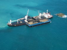
M.V. New Carissa Wreck Removal TITAN


RS

Tuesday, December 30, 2008

Oscillation Rules as the Pacific Cools

Oscillation Rules as the Pacific Cools

PASADENA, Calif. -- The latest image of sea-surface height measurements from the U.S./French Jason-1 oceanography satellite shows the Pacific Ocean remains locked in a strong, cool phase of the Pacific Decadal Oscillation, a large, long-lived pattern of climate variability in the Pacific associated with a general cooling of Pacific waters. The image also confirms that El Niño and La Niña remain absent from the tropical Pacific.

The new image is available online at: http://www.nasa.gov/topics/earth/features/20081209.html.

The image is based on the average of 10 days of data centered on Nov. 15, 2008, compared to the long-term average of observations from 1993 through 2008. In the image, places where the Pacific sea-surface height is higher (warmer) than normal are yellow and red, and places where the sea surface is lower (cooler) than normal are blue and purple. Green shows where conditions are near normal. Sea-surface height is an indicator of the heat content of the upper ocean.

The Pacific Decadal Oscillation is a long-term fluctuation of the Pacific Ocean that waxes and wanes between cool and warm phases approximately every five to 20 years. In the present cool phase, higher-than-normal sea-surface heights caused by warm water form a horseshoe pattern that connects the north, west and southern Pacific. This is in contrast to a cool wedge of lower-than-normal sea-surface heights spreading from the Americas into the eastern equatorial Pacific. During most of the 1980s and 1990s, the Pacific was locked in the oscillation's warm phase, during which these warm and cool regions are reversed. For an explanation of the Pacific Decadal Oscillation and its present state, see: http://jisao.washington.edu/pdo/ and http://www.esr.org/pdo_index.html .

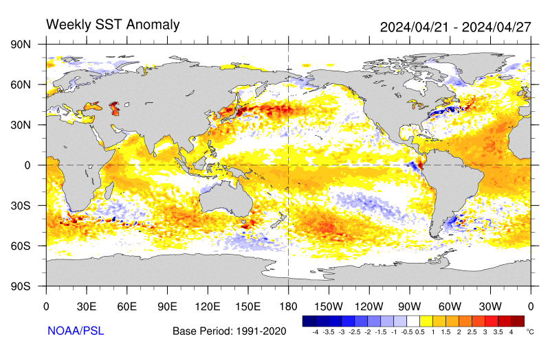
Sea-surface temperature satellite data from the National Oceanic and Atmospheric Administration mirror Jason sea-surface height measurements, clearly showing a cool Pacific Decadal Oscillation pattern, as seen at: http://www.cdc.noaa.gov/map/images/sst/sst.anom.gif.

"This multi-year Pacific Decadal Oscillation 'cool' trend can cause La Niña-like impacts around the Pacific basin," said Bill Patzert, an oceanographer and climatologist at NASA's Jet Propulsion Laboratory, Pasadena, Calif. “The present cool phase of the Pacific Decadal Oscillation will have significant implications for shifts in marine ecosystems, and for land temperature and rainfall patterns around the Pacific basin.”

According to Nathan Mantua of the Climate Impacts Group at the University of Washington, Seattle, whose research contributed to the early understanding of the Pacific Decadal Oscillation, "Even with the strong La Niña event fading in the tropics last spring, the North Pacific's sea surface temperature anomaly pattern has remained strongly negative since last fall. This cool phase will likely persist this winter and, perhaps, beyond. Historically, this situation has been associated with favorable ocean conditions for the return of U.S. west coast Coho and Chinook salmon, but it translates to low odds for abundant winter/spring precipitation in the southwest (including Southern California)."

Jason's follow-on mission, the Ocean Surface Topography Mission/Jason-2, was successfully launched this past June and will extend to two decades the continuous data record of sea surface heights begun by Topex/Poseidon in 1992. The new mission has produced excellent data, which have recently been certified for operational use. Fully calibrated and validated data for science use will be released next spring.

JPL manages the U.S. portion of the Jason-1 mission for NASA's Science Mission Directorate, Washington. JPL is managed for NASA by the California Institute of Technology in Pasadena.

For more information on NASA's ocean surface topography missions, visit http://sealevel.jpl.nasa.gov/ . To view the latest Jason-1 data, visit http://sealevel.jpl.nasa.gov/science/jason1-quick-look/ .

WEATHER NOTE

Wave surge hits PNG


A huge wave has hit a Papua New Guinea island, submerging buildings and causing widespread damage but no casualties.

The giant wave hit Kavieng, on the New Ireland province, late on Tuesday and there were reports of a similar surge hitting PNG’s north-eastern coast province of East Sepik.

Details remain sketchy but one witness told AAP the water surge hit late this afternoon and disaster teams are now working through the damage.

“The wave took out the hospital and the east coast road of New Island,” local resident Nessie Amos said.

“The hospital’s equipment was washed out but patients were saved and taken to another hospital,” she said.

“There were no casualties but major damage was caused to the hospital and everything was washed out.”

Amos said one small island off Kavieng, Tents, is mostly under water and villagers have been moved to the neighbouring island of Emirau.

Government officials held a press conference in Wewak earlier this evening.

MARITIME NOTE

Report on Collision Death off Pt. Reyes

On Dec. 10, the U.S. Coast Guard released the results of two investigations. One report outlines the causes of the July 13, 2007 fatal collision between a cargo ship and a small fishing boat which occurred in heavy fog off Pt. Reyes, and the other is an internal review of the service's handling of the incident.

The incident involved the 291 ft motor vessel Eva Danielsen, a Bahamian-flagged cargo ship, and a 28 ft wooden fishing vessel, the Buona Madre, home ported in Santa Cruz, California. A collision between the two vessels resulted in the destruction of the fishing boat and the death of Mr. Paul Wade.

A Coast Guard Marine Casualty Investigation, which was conducted by San Francisco-based investigators and reviewed and released from Coast Guard headquarters in Washington D.C., found numerous factors contributing to the cause of the collision including: failure to ensure proper manning of the respective vessels in light of the prevailing weather conditions (heavy fog); and the freighter proceeding at an unsafe speed based upon the weather conditions, failing to follow applicable Navigational Rules of the Road (i.e., fog signals), and negligence with respect to the operation of the vessel.

An internal administrative investigation was also conducted by the 11th Coast Guard District to evaluate how Coast Guard policies and procedures were followed. The internal investigation found that some internal briefing requirements and communications processes were not followed. Several recommendations of the report have been adopted to improve management of communications among Coast Guard units including: Revision of Command Center Standard Operating Procedures to include recent CG policy changes; review and revision of all Quick Response Sheets (QRS) to ensure proper notifications are made in a timely fashion; Introduction of Search and Rescue fundamentals in the Coast Guard Vessel Traffic Service (VTS) training program; and cross training among various watch positions in the Coast Guard Sector Command Center and VTS.


RS

Monday, December 22, 2008

JPL says: FORGET LA NINA: OSCILLATION RULES AS THE PACIFIC COOLS

JPL says: FORGET LA NINA: OSCILLATION RULES AS THE PACIFIC COOLS

PASADENA, Calif. —
The latest image of sea-surface height measurements from the U.S./French Jason-1 oceanography satellite shows the Pacific Ocean remains locked in a strong, cool phase of the Pacific Decadal Oscillation, a large, long-lived pattern of climate variability in the Pacific associated with a general cooling of Pacific waters. The image also confirms that El Niño and La Niña remain absent from the tropical Pacific.
he image is based on the average of 10 days of data centered on Nov. 15, 2008, compared to the long-term average of observations from 1993 through 2008. In the image, places where the Pacific sea-surface height is higher (warmer) than normal are yellow and red, and places where the sea surface is lower (cooler) than normal are blue and purple. Green shows where conditions are near normal. Sea-surface height is an indicator of the heat content of the upper ocean.

The Pacific Decadal Oscillation is a long-term fluctuation of the Pacific Ocean that waxes and wanes between cool and warm phases approximately every five to 20 years. In the present cool phase, higher-than-normal sea-surface heights caused by warm water form a horseshoe pattern that connects the north, west and southern Pacific. This is in contrast to a cool wedge of lower-than-normal sea-surface heights spreading from the Americas into the eastern equatorial Pacific. During most of the 1980s and 1990s, the Pacific was locked in the oscillation’s warm phase, during which these warm and cool regions are reversed. For an explanation of the Pacific Decadal Oscillation and its present state, see: http://jisao.washington.edu/pdo/ and http://www.esr.org/pdo_index.html

Sea-surface temperature satellite data from the National Oceanic and Atmospheric Administration mirror Jason sea-surface height measurements, clearly showing a cool Pacific Decadal Oscillation pattern, as seen at: http://www.cdc.noaa.gov/map/images/sst/sst.anom.gif

“This multi-year Pacific Decadal Oscillation ‘cool’ trend can cause La Niña-like impacts around the Pacific basin,” said Bill Patzert, an oceanographer and climatologist at NASA’s Jet Propulsion Laboratory, Pasadena, Calif. “The present cool phase of the Pacific Decadal Oscillation will have significant implications for shifts in marine ecosystems, and for land temperature and rainfall patterns around the Pacific basin.”

According to Nathan Mantua of the Climate Impacts Group at the University of Washington, Seattle, whose research contributed to the early understanding of the Pacific Decadal Oscillation, “Even with the strong La Niña event fading in the tropics last spring, the North Pacific’s sea surface temperature anomaly pattern has remained strongly negative since last fall. This cool phase will likely persist this winter and, perhaps, beyond. Historically, this situation has been associated with favorable ocean conditions for the return of U.S. west coast Coho and Chinook salmon, but it translates to low odds for abundant winter/spring precipitation in the southwest (including Southern California).”

Jason’s follow-on mission, the Ocean Surface Topography Mission/Jason-2, was successfully launched this past June and will extend to two decades the continuous data record of sea surface heights begun by Topex/Poseidon in 1992. The new mission has produced excellent data, which have recently been certified for operational use. Fully calibrated and validated data for science use will be released next spring.

JPL manages the U.S. portion of the Jason-1 mission for NASA’s Science Mission Directorate, Washington. JPL is managed for NASA by the California Institute of Technology in Pasadena.

WEATHER NOTE

New hurricane chief restores the calm after in-house storm

Bill Read didn't ride into town with both guns blazing. But in his own quiet way, he did restore order.

For much of last year, the National Hurricane Center was in turmoil, following a staff revolt against then-director Bill Proenza. Congress feared the discord might hurt forecasts, and the normally staid institution was thrust into controversy.

Today, that episode has all but subsided, and the center has refocused on tracking tropical systems. Insiders credit Read, the new director, with soothing frayed nerves and rebuilding chemistry.

"Bill knows it's not all about one man, it's not all about the director," said Max Mayfield, the popular former director of the center. "In that way, he's very much like me."

Senior hurricane specialist Lixion Avila described the atmosphere inside the hurricane center these days as "very nice."

"The most important thing is that every time we make a decision, we make it together as a team," Avila said. "He listens to the specialists, and we listen to him."

Intimidation and warning

Read, 59, a National Weather Service veteran forecaster and manager, was recruited to be the center's acting deputy director in August 2007.

That was after Proenza alienated the staff, both by intimidating employees and warning that the demise of a weather satellite would hurt storm predictions, according to an independent report.

Top management at the National Oceanic and Atmospheric Administration, which oversees the hurricane center, removed him as director in July 2007. Proenza was returned to his former job as director of the Southern Region of the National Weather Service.

NOAA officials named Read as the hurricane center's director in January.

As a result of the Proenza ordeal, the center still is making adjustments, Read said. The management structure is being organized and consultants are working with employees to address lingering morale problems.

"That was a pretty traumatic event for the folks who worked here," Read said. "I don't think everyone's totally moved on from that event."

For the most part, he added, operations have returned to normal and forecasts were never compromised. That was evident over the course of the 2008 season, when specialists generated several on-target storm predictions, for instance with Hurricane Gustav, which hit near New Orleans.

"I'm happy with where we're at," Read said of his forecasting team's performance. "I'm very satisfied with the work ethic and the attention to detail."

Noting that his management style is rather low key, Read said he doesn't intend to make any major changes in the way the hurricane center does business. Rather, he is trying to restore a sense of calm at the center in southwest Miami-Dade County.

"More and more I'm going to be working on inputting my management style, which tends to be a calming influence," he said.

Boosting morale

In the past season, whenever storms emerged, Read made a point of watching over the shoulders of his forecasters as they worked up tropical predictions. He did so to learn the intricacies of hurricane forecasting as well as to boost the morale of his specialists.

"That way I know what's going on," he said. "They know I'm interested in what they're doing."

The ultimate goal, he said, is to improve forecast accuracy, particularly with intensity predictions, an area where the center has struggled. Considering no hurricanes pulled any major surprises, he said his first season as the hurricane center's director was a good one.

"We didn't have one of those Mother Nature gotcha moments, where the storm threw a curve at us in close," he said. "I got a good break-in year."

MARTIME NOTE


Back in 2005, the Norwegian Dawn was cruising off the coast of Georgia when it was hit with a shock. A 70-foot wave crashed into the bow of the ship, flooding about 60 cabins and injuring about four passengers. The damage "was not extensive and the ship was quickly repaired," according to Wikipedia. Five years earlier, a 70-foot wave slammed into the cruise ship Oriana, destroying windows.

Dangerous waves like those aren't common, thankfully. A study of radar data from oil platforms estimated that merely 10 waves more than 75-feet-high appeared around the globe during one recent three-week period.

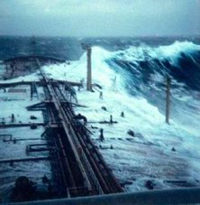
The bad news is that there's almost nothing that a cruise ship captain can do to either predict or avoid these waves, which rise up to five times as high as the waves around them. These rogue, or freak, waves appear to come from an angle that's out of sync with the wind and other sea waves. You'll occasionally find these waves out in the sea but also in near-beach areas, both in sandy and rocky shores. Lots of tragedies occur yearly all around the world.

To learn more about these waves, I did an e-mail interview with Paul C. Liu, who retired last year from his post as research physical oceanographer for NOAA and who blogs at Freaque Waves.

What should cruise passengers know about the frequency of dangerous waves, and exactly what type of waves are likely on the open seas?
I guess all kinds of waves are likely on the open seas, including freaque waves. They are not always happening. Most of the time they are not! But we just cannot rule out the fact that freaque waves can happen at any time and at any place. Cruise passengers should just be mindful that the possibility is there and continue to enjoy the cruise. Even if an encounter does happen, the damage will likely to be not extensive. The kind of fiction as shown in the movie Poseidon will not ever happen in real life!

What is a "freaque wave", what is its most typical origin or cause, and why do you use that nomenclature of "freaque" instead of using the term "rogue" or something more scientific sounding?
Freaque is a portmanteau word formed by the two frequently and synonymously used words of rogue and freak in describing the kind of unexpected and unpredictable waves. Many people in the scientific literature are fond of using the expression "freak or rogue waves." I choose to use "freaque waves" instead.

Are there any particular waters in particular regions that are known to be prone to freaque waves?
The short answer is no. Because of the conjecture that when ocean waves propagating into oncoming strong ocean current field might lead to the forming of large waves, regions along the Gulf stream in the North Atlantic, along the Agulhas currents in South Indian Ocean, and along the Kuroshio in Northwest Pacific, are thought to be prone of freaque waves. But areas that don't have strong ocean currents, such as the North Sea, can also have frequent freaque waves. So the talk of regional proneness is at most covering a part of the story.

What's the essential dispute about freaque waves in the scientific community? And is there something that makes scientists groan when they read accounts of waves striking cruise ships because the statements are misleading or hyperbolic or inaccurate?
Because the study of freaque waves is still relatively new, I don't think there is as yet any "essential dispute" per se in the scientific community. Lack of general consensus, maybe! Different scientists may have different concept of what "rare" or "frequent" means or using relatively different definitions for freaque waves. And there are may be different approaches to the problem. Some treats freaque waves as a part of the study of extreme waves whereas some others do not. (Freaque waves are always extreme waves, but not all the extreme waves are freaque waves!)

What's the most typical misunderstanding of the freaque wave issue, as you've encountered it when reading media reports or talking with others?
Oh yes, the media! I don't have much respect for the present day, so called, "main-stream" media. Here's an example—a paragraph from a New York Times article about freaque waves a couple of years ago:

Enormous waves that sweep the ocean are traditionally called rogue waves, implying that they have a kind of freakish rarity. Over the decades, skeptical oceanographers have doubted their existence and tended to lump them together with sightings of mermaids and sea monsters.

Rogue waves are known to happen momentarily. They appear out of nowhere. A wave takes place, and then disappears like nothing has happened. Waves like that never, yes, never, "sweep" the ocean. There is no such thing as "traditionally called rogue waves." Rogue wave is a fairly recent term. The use of the term "freak wave" was started by U.K. scientist Laurence Draper in 1964. There was no firmly established term before 1964. The existence of unusually large, great waves was nevertheless very much on the minds of every seagoing oceanographer. I don't think anyone in their right mind would "lump them together with sightings of mermaids and sea monsters." I just hope your readers beware of this kind of irresponsibility.


3 More days til Christmas!http://library2.nalis.gov.tt/Portals/0/601/christmas%20tree.jpg

RS

Thursday, December 18, 2008

It Could be Possible to Stop Hurricanes with Supersonic Jets

It Could be Possible to Stop Hurricanes with Supersonic Jets

Hurricanes, as we've seen, can wreak serious havoc when they strike populated areas. We've never had control over them before, but one researcher thinks they could be broken up with F-4 fighter jets.

In theory, sending in a pair of the jets to do loops around the eye of the hurricane while it's still out over the ocean, creating sonic booms, would break it up before it hits the shore.

Jet fighters flying at supersonic speeds along special trajectories with a hurricane/typhoon at various altitudes would create supersonic booms. In one such embodiment, the trajectories for the supersonic booms of the present invention are counter to the rotational component of the hurricane and/or typhoon being targeted. As such, supersonic booms can be tailored and/or designed to partially and/or fully -negate the basic rotational contribution in a hurricane by slowing down a hurricane's/typhoon's rotation. Additionally, when supersonic booms propagate downward to the surface of the ocean they also destabilize a hurricane's/typhoon's structure by increasing the pressure in the central part of a hurricane's/typhoon's eye.

WEATHER NOTE

Storm planners reflect on hurricane season

Lessons learned after Katrina and Rita may have saved lives in 2008

NEW ORLEANS - In New Orleans, a dire warning to flee emptied the city before Hurricane Gustav in early September. In Houston less than two weeks later, a plea to "hunker down" might have kept evacuation routes from clogging before Hurricane Ike struck.

The strategies were different but the results largely the same: Both cities avoided repeating disastrous evacuations that cost lives during the deadly 2005 hurricane season.

Many Gulf Coast cities overhauled their disaster plans after hurricanes Katrina and Rita three years ago. With another destructive storm season ending Sunday, emergency planners are reflecting on lessons learned from Gustav and Ike to get ready for next year.

Retired Lt. Col. Jerry Sneed, New Orleans' emergency preparedness director, said residents deserve much of the credit for a successful Gustav evacuation.

"The number-one reason we succeeded for Gustav is that our citizens listened to us," he said.

Following catastrophic failures in evacuating people before and after Katrina, Louisiana emergency planners developed a model system using public transportation. It paid off for Gustav, the first time it was used.

'Mother of all storms'
Two days before Gustav made landfall, New Orleans Mayor Ray Nagin ordered a mandatory evacuation for what he called the "mother of all storms" and warned residents they wouldn't get emergency services if they stayed.

In a mass migration orchestrated by state officials, an estimated 2 million residents of coastal Louisiana evacuated before Gustav crashed ashore 90 miles southwest of the city Sept. 1.

The number of people left behind was minimal compared to Katrina, when thousands sought shelter at the Louisiana Superdome and New Orleans convention center and were stranded for days without food and water.

Gustav was blamed for 46 deaths in Louisiana and caused $1.9 billion in insured losses, numbers dwarfed by Katrina's death toll of more than 1,600 and $41.1 billion in property damage.

"To our knowledge," Sneed said, "no city has ever evacuated their entire population, and we feel 97 percent of the city's population did evacuate."

There were some flaws: Evacuees were taken to shelters without showers or adequate medical care; a state contractor who was supposed to provide 700 buses for the evacuation only delivered 311; and victims endured long lines for disaster food stamps.

Thomas Sanchez, a University of Utah professor who studies evacuation planning, said cities can't plan for disasters in a vacuum.

"This kind of planning really has to happen on a regional basis, and that's not what we're finding," Sanchez said. "It's more than about a city figuring out how to take care of itself."

‘Hunker down’
Texas learned that the hard way. In 2005, before Hurricane Rita struck, its evacuation plan required Houston to wait until 2 million people on the Gulf Coast had moved past the city, which sits 50 miles inland. But city leaders ordered Houston to evacuate early anyway.

Hundreds of thousands jammed the freeways in sweltering late September, stalled for days. Some 110 people died in accidents or from exposure or heart attacks. Only a handful died in the storm itself, which missed the Houston area and hit mostly rural southeast Texas.

By the time Hurricane Ike's path was apparent — a direct hit on Galveston Island and Houston — mandatory evacuations were ordered for coastal counties and a few Houston ZIP codes along waterways sure to flood. Everyone else was ordered to stay put.

"We are still saying: Please shelter in place, or to use the Texas expression, hunker down," Harris County Judge Ed Emmett, the county's chief administrator, said at the time.

This time, the freeway was jammed leading away from Galveston immediately after the order, but by late afternoon on Sept. 12, the day before Ike arrived, many evacuees had made it north of Houston.

"'Hunker down' definitely got the message across," said Francisco Sanchez, a spokesman for the Harris County emergency management office.

Still, in part because of the direct hit on Galveston and Houston, Ike was blamed for at least 72 deaths, including 37 in Texas, and caused $8.1 billion in insured losses, eclipsing the $5.6 billion in damage attributed to Rita.

The 2008 hurricane season was one of the most active on record, with 16 named storms, including eight hurricanes, forming in the Atlantic. Five of the eight hurricanes were at least Category 3 strength.

MARITIME NOTE

When the Great Lakes Aren't So Great Anymore

Rise in Pollution, Carp Could Signal Trouble for Freshwater Lakes

By GEORGE TOMBS

Dec. 6, 2008—

On a starry night, the 730-foot Canadian Leader, the last bulk-carrying steamship built on the Great Lakes, slips silently past illuminated buoys near Montreal on a five-day voyage up to Thunder Bay, Ontario, on Lake Superior.

After unloading titanium ore at the St. Lawrence River port of Sorel, the ship is proceeding empty toward the upper lakes. With the recent economic downturn, there is less demand for her typical upbound cargo of iron ore pellets. Capt. George Wheeler, a 40-year veteran of the sea originally from Northern Ireland, has taken on freshwater ballast from the river, to maintain the ship's stability and maneuverability.

Taken together, the Great Lakes are a vast inland sea representing over one-fifth of all surface fresh water on the planet. More than 40 million Canadians and Americans draw their drinking water from the lakes, which play a vital role in public health, the environment, industry, commerce, and leisure.

But there are causes for concern: invasive species, declining water levels, uncertain quality of drinking water, and pressures to divert water from and into the Great Lakes-St. Lawrence basin. Signed into law by President George W. Bush Oct. 3, the Great Lakes Compact takes effect Dec. 8. The binational agreement, the fruit of regional initiatives, obliges eight American states and two Canadian provinces to work together to protect the lakes system.

"The Great Lakes Compact is an awesome victory," says Jeff Skelding, national campaign director for Healing Our Waters  Great Lakes Coalition. "No one predicted it could have happened so quickly. We can't protect the Great Lakes if there's no water in them. The cocktail of assaults may be pushing the Great Lakes toward a tipping point, an irreversible change in the food web."

Part of this assault is the introduction of 182 invasive species such as the zebra mussel, which began disrupting the food web on Lake St. Clair in 1988 and has clogged many water intake pipes since, at an annual cost running in the billions of dollars.

Typically, "salties" (oceangoing ships) reaching the Great Lakes from overseas via the St. Lawrence River have discharged invasive species along with their saltwater ballast once they reached lake ports. Lakers have unwittingly transported these invasive species in their freshwater ballast, from one point on the lakes to the next.

Zebra mussels have made lake water look cleaner than before. But for Mr. Skelding, the clarity of water is a problem. "Sure, zebra mussels filter water," he says, "but when the water is clearer, sunlight penetrates deeper, and organic material proliferates and absorbs much-needed oxygen in the water that is needed by fish and microorganisms." The result: "Dead zones."

Now a new pest is closing in on the lakes: Asian carp from the Mississippi and Illinois Rivers have nearly found their way through the Chicago River to Lake Michigan.

"What gets into the Great Lakes can work through the country like a computer virus and dismantle the biology of systems," says Cameron Davis, president of the Chicago-based Alliance for the Great Lakes (AGL), a citizens' group of 6,000 professionals and volunteers working for clean water in the Great Lakes. The choke point is a 10-mile stretch of the Chicago River, the Chicago Sanitary Ship Canal. "The bad news is," Mr. Davis continues, "even if we know where the choke point is, we are having a hard time taking action."

The Great Lakes Compact is expected to give federal, state, and provincial governments more muscle to take preventative action against invasive species.

Storms and Surges a Danger

Venturing "light ship" (without cargo) across the stormy lakes of autumn can be unsettling. When 50-knot northerly winds lash the surface of Lake Erie, sending some lakers into sheltered anchorages, Captain Wheeler decides to maintain course. Lake Erie is shallower than the other great lakes and more likely to be whipped up by storms. Ships at anchor off Toledo, Ohio, may suddenly find themselves aground when a short-term natural effect called "seiching" (pronounced "SAY-shing") drives surface water towards Buffalo, N.Y., at the eastern end of Lake Erie.

Despite a few seasonal blips, a 30-year trend shows that water levels are declining. This is one of the main reasons the Great Lakes Compact was rushed into law. Canadian and American entrepreneurs alike had been seeking ways to commercialize the freshwater resources of the Great Lakes, hoping to send it by pipe or ship to thirsty markets in the US Southwest and overseas.

Still, the Healing Our Waters  Great Lakes Coalition predicts that lake levels could drop this century by one foot on Lake Superior, three feet on Lakes Michigan and Huron, 2.7 feet on Lake Erie, and 1.7 feet on Lake Ontario.

Water levels are also a challenge for American ship operators, the largest of whose vessels are "1,000 footers" designed to carry 70,000 tons. The largest Canadian bulk carriers, like the Canadian Leader of the Upper Lakes Group, carry only half that much.

"Water levels are very important to us," says Glen Neksavil, vice president of the Lake Carriers Association, a trade association based in Rocky River, Ohio, which represents 16 American companies operating 63 vessels exclusively on the lakes. "When water levels were high back in 1997, some of our ships were carrying 70,000 tons of cargo per trip. This year, they are carrying 66,500 tons&. Our largest ships lose 270 tons of cargo for each inch in draft caused by lower water," he says.

"The US Army Corps of Engineers estimate they have a backlog of 17 million cubic yards of sediment in virtually every US port on the Great Lakes," says Mr. Neksavil. "That would cost $230 million to dredge. The Harbor Maintenance Trust Fund is funded by a tax on cargoes, and currently has a surplus of $4.8 billion, which I think the government is using to balance its books."

Drinking-Water Safety an Issue

The Canadian Leader slows at Ambassador Bridge, on the Detroit River between Lake Erie and Lake St. Clair, long enough to pick up mail for the crew. Tundra swans and snow geese laze on the sparkling water.

Detroit draws its drinking water from the river, and the concentration of ships, steel mills, and car plants here reminds one how dependent Great Lakes communities are on freshwater resources.

"Drinking water from the Great Lakes is the envy of the world," Davis says.

But a series of scientific reports has raised concerns about drinking water in Detroit and other communities. Trace amounts of pharmaceuticals flushed down toilets have found their way into river water. Byproducts of chlorine treatment and disinfection, coliform bacteria, and lead also pose health risks. Canadian petrochemical plants at Sarnia on the St. Clair River are also a concern.

Sewage overflows are a major problem. "During heavy rainstorms," Davis says, "it's easy for treatment plants to risk being overwhelmed. There are two things we can do to help: conserve water, so that we're not using as much, and use 'green infrastructure,' like rooftop gardens, to cut the amount of stormwater that needs to be treated."

On to Thunder Bay, Ontario

Under cover of night, the Canadian Leader transits the Soo lock on the St. Mary's River between Michigan and Ontario, passing a huge windfarm on the Canadian side. Then it's 18 hours of steaming out of sight of land, across glittering Lake Superior, before docking at a grain elevator in Thunder Bay to pick up a 28,000-ton load of durum wheat.

Lake Superior's temperature is rising, says Jay Austin, an oceanographer at the Large Lakes Observatory of the University of Minnesota at Duluth. "Temperature is the most important environmental variable" in a lake, he says. It determines "the chemical reaction rates, the metabolism rates of fish, phytoplankton, and zooplankton, and the spawning rates of fish."

Mr. Austin and his colleague Steve Colman are deploying an array of moorings at different depths in Lake Superior, from just below the surface to some 1,300 feet down, just above the lake bottom. "Surface water in Lake Superior is warming faster than the air temperature," he says. "Lakes Michigan and Huron also seem to be experiencing the accelerated warming phenomenon, although not Lake Erie."

Less ice cover in winter means more evaporation, which in turn lowers water levels, stressing ecosystems. Austin says change on this scale is hard to ima¬gine, much less control. The warming of the Great Lakes is its latest challenge, he says  perhaps its most serious one.

U.S. Coast Guard Responds To Healy Tragedy, Opens Regional Dive Facilities; 'We Will Not Accept Preventable Loss Or Injury'

Underwatertimes.com News Service

December 11, 2008 16:22 EST

San Diego, California -- On Aug. 17, 2006, two active duty military members' lives were cut short during a cold water familiarization diving accident in the Arctic aboard U.S. Coast Guard Cutter Healy.

The Coast Guard initiated an immediate administrative and safety investigation into the circumstances which contributed and ultimately led up to the regrettable deaths.

In a statement included in the investigation report, Adm. Thad Allen, Commandant of the U.S. Coast Guard, said, "We cannot prevent every Coast Guard casualty. Despite the professionalism, bravery and dedication of our workforce, in rare cases we suffer serious injury or death in the line of duty. As Coast Guard men and women we accept this risk, but we will not accept preventable loss or injury.

The investigation into this accident revealed failures in oversight at every level aboard Healy, as well as numerous departures from standard Coast Guard policy. This mishap further highlighted the need to improve diving expertise at units with dive capabilities and missions, address shortfalls in training and experience, and elevate program managements and oversight on par with other high-risk, training-intensive Coast Guard operations such as aviation."

Another goal of the Coast Guard's study was to initiate several new policies and procedures to prevent future diving mishaps while finding a cost-effective method for increasing the safe execution and reducing the risks of such a dangerous operation.

Consequently, the Coast Guard established regional dive lockers on the East and West coasts of the USA, staffed with highly-trained, professional divers capable of responding to apportioned or emergent operations.

"After tragically losing two of our shipmates and fellow divers, it was important to set up the regional dive lockers to provide the management, oversight and inspection process needed to meet all Coast Guard diving missions in the safest manner possible," said Lt.j.g. Andrew Younkle, deployable operations group(DOG) diving force manager in Arlington, Va.

Not only will the regional dive lockers help the Coast Guard execute vital diving missions more safely, but the missions are also expected to assist in the war on terrorism.

"The dive lockers are going to make America safer by deterring terrorists and smugglers who look at sub-surface operations as a means to hurt our country," emphasized Younkle.

Younkle also said the dive lockers and teams will be supporting the Coast Guard's Polar Class Icebreaker missions, District 14 buoy tender missions, maritime security missions and provide needed services to the captains of the ports in all major U.S. cities.

"During ice breaking missions, divers can provide pitch calibrations and emergency services to assist in keeping the polar class icebreakers at peak performance. When the cutter is performing well, it opens key shipping lanes thus improving our economy. Also, when requested by Coast Guard Buoy Tenders, the dive lockers can augment the collateral-duty divers currently serving aboard the buoy tenders. The Dive Locker personnel can help with in-water inspections and maintenance of aids to navigation in District 14," he said referring to the Coast Guard's operational area in Hawaii and surrounding Pacific Islands.

The dive lockers, which became fully operational Oct. 1, 2008, are staffed with a dive officer supervisor who is responsible for three primary-duty, six-person dive teams that focus solely on dive operations.

"Prior to the dive lockers, we were running minimally manned dive teams," said Lt. Trevor Hare, command diving officer stationed at regional dive locker west in San Diego.

Hare said the old diving units had the collateral-duty divers doing so many things at different times that when it was time to execute a dive the divers were too tired from other missions and not focused on the dive.

"Another safety concern was that the collateral duty divers weren't staying current on their qualifications, and even if they did, they weren't really used to diving. Now, with the lockers, we have enough personnel to man the dive site optimally instead of minimally," said Hare, who has been diving for three years.

Aside from the safety aspect the dive lockers bring to the Coast Guard, dive teams will be able to focus on the mission and complete a dive in a timelier manner.

"Having more personnel on site is going to enable us to knock out a mission much quicker than before. These are guys who dive all the time - the focus on diving every day - and that's all they do for the Coast Guard, so you know they do it professionally, efficiently and safely," Hare said.

The dive teams are comprised of Coast Guard members from all rates whose minimum qualification is the 88-day Second Class Diver Course at the Naval Diving Salvage Training Center (NDSTC).

"We have about every rate you can imagine, and they are coming from every single unit via maritime safety and security units, polar divers and buoy tender divers. It gives us such a wide range of experience, and it's good diversity for our unit," said Hare, referring to the dive team in San Diego.

Hare also said divers must maintain diver currency by completing 13 annual and 13 semi-annual training tasks, complete at least four re-qualification dives and pass two physical fitness tests annually.

"The training tasks and re-qualification dives were determined by the Coast Guard to be the minimum necessary items to maintain proficiency and certification in the Coast Guard diving community. We dive to serve America, and we train and PT to serve as safely and effectively as possible," he said.

Hare said the training is crucial because the classroom, dive side and physical training tasks keep divers sharp with respect to dive side protocol, diving medicine, diving physics, practical diving performance, in-water proficiency and physical conditioning pertinent to military diving.

The Coast Guard is creating a process for selecting potential candidates for the regional dive lockers. Until that process is established, a Coast Guard member can compete for diver selection by sending his or her dive package to NDSTC after obtaining command approval.

"The dive billets are typically three years," said Younkle. "However, many of our divers seek follow-on assignments to buoy tenders, NDSTC or the DOG to continue diving for the Coast Guard."

According to the final action memo from the Coast Guard cutter Healy's mishap investigation, Allen identified areas of the dive program management that needed improvement and reevaluation.

The establishment of the regional dive lockers improves the Coast Guard dive program and enables the mission to be accomplished.


RS

Wednesday, December 17, 2008

Satellites Flying In Formation To Help Improve Understanding Of Earth

Satellites Flying In Formation To Help Improve Understanding Of Earth

ScienceDaily (Dec. 5, 2008) — Based on the outstanding success of the first tandem mission between ERS-2 and Envisat last year, ESA has paired the two satellites together again to help improve our understanding of the planet.

ERS-2, ESA’s veteran spacecraft, and Envisat, the largest environmental satellite ever built, both carry Synthetic Aperture Radar (SAR) instruments that provide high resolution images of the Earth's surface.

By combining two or more SAR images of the same site, slight alterations that may have occurred between acquisitions can be detected. This technique, known as SAR interferometry or InSAR, has proven to be very useful for applications such as glacier monitoring, surface deformation detection and terrain mapping.

ESA engineers configured the first SAR tandem mission, which took place from September 2007 to February 2008, and the current one, which began on 23 November, to ensure that the satellites both acquire data over the same area just 28 minutes apart.

This short time separation allows for changes that occur quickly to be detected. Fast-moving glaciers, for instance, move more than 200 m per year and can move as much as 1 cm in 30 minutes. The ability to detect these small changes occurring on the ground between acquisitions is also allowing scientists to understand better and improve the quality of the SAR interferometry technique.

The current tandem mission, scheduled to run until 27 January 2009, is continuing the work of the first tandem mission with respect to measuring the velocity of fast-moving glaciers, detecting land-ice motion and developing elevation models over flat terrain.

However, based on the first mission’s proven ability to provide precise elevation information over flat regions, data from the current mission will also be used to identify natural carbon sources and sinks in Kazakh Steppe and wetlands in permafrost regions.

A challenging configuration

ESA engineers had to overcome many challenges in order to put Envisat and ERS-2 into a tandem flight configuration. For instance, in 2001 ERS-2 lost the ability to be manoeuvred in the usual way by onboard gyroscopes, navigational tools that allow mission controllers to maintain the correct position of satellites.

The operational lifetime of satellite missions is normally determined by the functioning of onboard gyroscopes. Without them, the ESA team had to work out a way of positioning the spacecraft by operating onboard sensors in a new way.

Part of their creative solution involved using a device called the Digital Earth Sensor (DES), which is designed to provide the horizon line to allow basic checks on the spacecraft’s position, and analysing Doppler frequency shifts in the signals of ERS-2’s radar instruments.

ERS-2, launched in 1995, and Envisat, launched in 2002, have exceeded the time they were intended to stay in orbit. Since they remain operational and continue to provide quality data about our planet, engineers are trying to use as little fuel as possible so as not to shorten their lifetimes.

"The strategy is to align the tandem start date with an Envisat manoeuvre. Therefore, there is no need to spend extra hydrazine for Envisat. For ERS, the manoeuvre to place it in tandem position is such that the satellite drifts back to its nominal orbit without additional manoeuvre after the tandem campaign," ESA Mission Planner Manager Sergio Vazzana said.

WEATHER NOTE

StormZone Simulation 2008

The Miami-Dade County Department of Emergency Management & Homeland Security (DEM&HS) recently hosted approximately 60 students and teachers from South Dade Senior High School in Homestead and Eugenia E. Thomas Middle School in Doral to participate in a simulated activation of the County's Emergency Operations Center (EOC).

The students, who are involved in a magnet program to study emergency management, role-played elected officials, emergency management coordinators and other key personnel during a fictional Category 3 hurricane that struck Miami-Dade. Three DEM&HS coordinators assisted the students during the exercise. The simulation was coordinated by StormZone, a Miami-based non-profit organization that teaches emergency management to middle and high school students.

Historic September (KLOT) Flooding – Lessons Learned

A series of heavy rain events, partially caused by the remnants of three tropical storms, produced serious and widespread flooding across northern Illinois and northwest Indiana in September.

The first heavy rain occurred on September 4 and 5 when remnants of hurricane Gustav brought two to four inches of rain to the region. Because of dry conditions through much of August, this rain didn’t cause any significant flooding. However, it saturated the ground, increased flows on area streams, and set the stage for more serious flooding later in the month. Moisture from a Pacific tropical storm, Lowell, moved along a stationary front producing a wave of heavy rain across northern Illinois and northwest Indiana on the 13th.

This was followed by a second wave of heavy rain on the 14th, as the remnants of Hurricane Ike moved up from Texas. Rainfall totals on September 13 and 14 were 7 to 11 inches, with the heaviest totals in Lake and Porter Counties in northwest Indiana. The total September rainfall for the area was 12 to 16 inches.

The image shows rainfall across the entire Midwest from September 12-15, 2008. This image is courtesy the Midwestern Regional Climate Center in Champaign, IL.

The result of the heavy rain was widespread flooding of roads, creeks, drainage areas, open fields, low lying areas and basements. Small streams such as the North Branch of the Chicago River, Salt Creek, the DuPage River, the Little Calumet River and its tributaries rapidly rose to record or near record levels. These small streams fed larger rivers including the Des Plaines, Fox, Kankakee, and Illinois Rivers. The Des Plaines reached the second highest crest on record at Des Plaines and Riverside, while the Illinois set records at Morris and LaSalle.

Downtown Des Plaines. Photo courtesy CLTV.

Flooding in downtown Des Plaines. Photo courtesy of CLTV.

Flooding at O'Hare Airport

Flooding at O'Hare International Airport.

Despite two significant tornado outbreaks, on January 7 and June 7, and an intense wind and tornado event on August 4, the flooding of mid September was by far the biggest weather event in the Chicago area for 2008. This event impacted more people and resulted in more damage and fatalities than any event in this area in the last several years. Total estimated damages from the flooding are around 100 million dollars. There were four flood related fatalities, making this the most deadly storm-related weather event in northern Illinois and northwest Indiana since eight people were killed by a tornado in Utica in April, 2004.


Illinois River flood

Flooding on the Illinois River at Peru.

Historically, about half of all flood fatalities occur in vehicles, when people drive into flooded roads, or get swept off a road by fast moving water. While there were several incidents where people in vehicles were swept away by flood water and had to be rescued, none of the four fatalities in the September flooding occurred in vehicles. Hundreds of cars were also stranded in deep standing water, fortunately with no loss of life. Here is a review of the four fatalities;

· A 28 year old man drowned in a retention pond in Arlington Heights.
· An 83 year old man drowned in a flooded window well at his home in Oak Lawn.
· A 48 year old man and 78 year old man drowned trying to save a boy in a flooded culvert in Chesterton, IN. The boy survived.
Our sympathies go out to the families.

Lessons learned;

· Everyone should have a hazardous weather plan – at home, at work, and at school. The plan should encompass all hazards, not just tornadoes. Chicago area weather hazards include flooding, lightning, damaging wind and large hail, extremes of heat and cold, and winter storms. Make sure everyone in your care is familiar with the plan. Practice the plan by conducting periodic drills.
· A key part of any hazardous weather plan is to have a reliable method of receiving watches, warnings and other weather information. One of the best methods is to use a NOAA Weather Radio. For more information click here; http://www.crh.noaa.gov/lot/?n=nwr
· Heed warnings. A flash flood warning means heavy rain will lead to rapid flooding of roads, creeks, small streams, drainage areas, low lying areas, and basements. Stay home. Remove valuables from basements and flood-prone areas before the flood.
· Do not drive through flooded roads, especially if the water is flowing swiftly. Even heavy pickups and SUVs with four wheel drive can be swept away by fast moving water that is only one to two feet deep. Turn Around, Don’t Drown! For more information, visit http://tadd.weather.gov/
· Do not let children play near flooded creeks, ditches, or drainage retention ponds. Fast moving water that is only ankle deep can sweep a child away. Victims can be pinned against grates or storm drains by powerful currents.
· Do not swim, wade, or boat in flooded areas. In addition to the potential for drowning, flood water may be contaminated by oil from roadways, chemicals from farm fields, and backup from overflowing storm sewers. Sometimes flood swollen streams are tempting to adventurers in canoes and kayaks, but these streams can be extremely dangerous.
· Do not venture into flooded basements unless power to the building is shut off. There may be an electrical hazard.

Illinois River flooding

Record flooding along the Illinois River at Morris. Photo by Don Lyon.

Finally, the National Weather Service would like to thank everyone involved in the flood event.
· Volunteer weather spotters, amateur radio operators, Cooperative observers, and other volunteers who measure and report rainfall and storm reports.
· State, county, and local government agencies including emergency management, police, fire, and public works/highway departments.
· Partners in the broadcast media, who help disseminate the watches and warnings and keep the public informed.
· Print media, whose news stories provide much of the information that goes into the final StormData publication.
· School administrators who insist on developing sensible, comprehensive hazardous weather plans and conduct periodic drills.
· People who head the warnings and encourage family, neighbors, and coworkers to also take precautions

Have a happy and SAFE holiday season, and rest assured that the men and women at your National Weather Service office in Romeoville are on guard 24/7, watching out for you.

The National Weather Service office in Romeoville has completed the StormData summary of the September flooding in northern Illinois and northwest Indiana. StormData is a monthly publication that documents all hazardous weather occurrences. It is available online at http://www.crh.noaa.gov/lot/?n=stormdata.

MARITIME NOTE

Issues You Should Be Aware of on Travel Safety

Travelling is always a fun experience as you get to explore a lot of new destinations and take part in various activities. In fact there is countless number of people on the surface of the earth who consider travelling to be their favourite hobby and go out exploring new places whenever they get time. There are some other people who need to travel a lot not because they are fond of it but they have some professional requirements.

Travelling with family or for education are other two important reasons why people do travel extensively. Whatever be the reason for your travel, you need to extremely careful about the safety while you are not at the home town. The foreign places can at times be very risky. Accidents, robberies and disease are the reasons why you need to take adequate safety measures while travelling.

If you are a frequent flyer and is not aware of the precautions and steps that you need to take while an air journey the n this is time to charge up yourself with all the mishaps that can take place in the sky. Before you board a plane you should make sure that the airlines you have chosen to fly with is a reputed one. This is important because the general ones often do not have ample safety arrangements for their passengers.

They do not carry adequate number of oxygen masks, life jackets and life belts. This is the reason why at the time of any emergency they are not able to help you out. In fact you need to be careful about your health conditions as any negligence can take your life. If you feel that as you are travelling by a ship or a train, you do not need to take care of the travel safety arrangements than you are quite wrong. Because accidents can take place anytime and anywhere.

There are other safety measures that you need to take in order to make sure that you travel safely. If you are going for international tours then never forget to fetch enough information about the rules and restrictions of that country. This will help you to keep away from many unwanted troubles. If this is the first time you are visiting the place then a travel agency can be of help to you.

Always make sure that you have a travel insurance that will cover all sorts of medical expenses abroad. You should be extremely careful about the identity documents you are carrying like the passport and visa loosing which can land you up in jail as this is a criminal offence to intrude into a foreign country without official proof. So be conscious about your safety while going for a tour.


RS

Tuesday, December 16, 2008

Are Rising CO2 Levels And The Increase In Atlantic Major Hurricanes Since 1995 Related?

Rising CO2 Levels & Hurricane Activity

[Editor's Note: The following is a research article by Dr. William Gray, otherwise known as the "Hurricane Doctor," at Colorado State University. Dr. Gray was the first researcher to regularly forecast the number and intensity of tropical cyclones with accuracy, and continues to lead the way in hurricane research in the Atlantic Basin.]

The official end of the 2008 Atlantic basin hurricane season occurred last Sunday (November 30). This year was an active and destructive season. My colleague, Phil Klotzbach and I were very happy to see that our forecasts for this year’s activity worked out well, as did NOAA’s seasonal hurricane forecast. See our website for a 53-page summary of this season’s activity. Although this is my 25th year of making these seasonal forecasts, Klotzbach should get most of the credit for the success of this year’s forecast.

President-Elect Barack Obama said last week that “storms are growing stronger with each passing hurricane season” (implying that this is due to CO2 increases). He is repeating what Al Gore has been saying for years and what was implied by thousands of media reports after the damaging Atlantic seasons of 2004-2005. Polls have shown that a relatively high percentage of US citizens think that human-induced global warming has increased hurricane activity.

Yes, the Atlantic has seen a very large increase in major hurricanes during the 14-year period of 1995-2008 (average 3.9 per year) in comparison to the prior 25-year period of 1970-1994 (average 1.5 per year). But, have rises in CO2 been, in any way, been responsible for the recent large upswing in Atlantic basin major hurricanes since 1995?

I and a number of my colleagues believe that this large increase in Atlantic major hurricanes is primarily due to the multi-decadal increase in the Atlantic Ocean Thermohaline Circulation (THC) that is driven by Atlantic salinity variations. These Atlantic multi-decadal changes have also been termed the Atlantic Multidecadal Oscillation (AMO). These increases are not a result of global surface temperatures or CO2 increases.

In the quarter-century period from 1945-1969 when the globe was undergoing a weak cooling trend, the Atlantic basin experienced 80 major (Cat 3-4-5) hurricanes and 201 major hurricane days. By contrast, in a similar 25-year period from 1970-1994 when the globe was undergoing a general warming trend, there were only 38 major hurricanes (48% as many) and 63 major hurricane days (31% as many). Atlantic sea surface temperatures and hurricane activity is related to but does not necessarily follow global mean temperature trends.

graycycles.thumbnail  Rising CO2 Levels & Hurricane Activity
Multi-decadal Hurricane Cycles

The active hurricane season in 2008 lends further support to the belief that the Atlantic basin remains in an active hurricane cycle associated with a strong thermohaline circulation and an active phase of the Atlantic Multidecadal Oscillation (AMO). This active cycle is expected to continue for another decade or two at which time we should enter a quieter Atlantic major hurricane period like we experienced during the quarter-century periods of 1970-1994 and 1901-1925. Atlantic hurricanes (particularly major hurricanes) go through multi-decadal cycles. Cycles in Atlantic major hurricanes have been observationally traced back to the mid-19th century, and changes in the AMO have been inferred from Greenland paleo ice-core temperature measurements going back thousand of years.

The influence of rises in atmospheric CO2 on hurricane activities is likely to be very small and within the noise level of our measurement capability or of any reliable numerical model output. There is no way of telling whether CO2 rises might have a miniscule positive or a miniscule negative effect on hurricane frequency or intensity. It would be unwise for our society to reduce atmospheric CO2 gases under the naïve belief that we would in any way be reducing the damage from these storms.

WEATHER NOTE

Study Finds Weather Conditions Have Significant Effect on PM Concentrations

5 December 2008

Dry winter weather and a low mixing layer height (MLH) for pollutants from vehicle exhausts lead to the highest concentrations of PM10 in cities, according to a team of German scientists writing in the January 2009 issue of the International Journal of Environment and Pollution. Their findings suggest that traffic controls, other than an outright ban for several days at a time, would have little effect on pollution concentrations.

The mixing layer is the portion of the atmosphere close to the surface layer where air pollutants get diluted, without leaving this layer. The height of the mixing layer is a gauge of the vertical dilution of air pollution, and is affected by vertical temperature and moisture profiles in the lower atmosphere.

Jutta Rost of the Meteorological Institute, at the University of Freiburg, and colleagues there and at the Fraunhofer Institute for Transportation and Infrastructure Systems, in Dresden, and the Federal State Institute for Environmental Protection, in Baden-Wuerttemberg, carried out a retrospective analysis of the atmospheric conditions that affected PM10 levels in four cities (Freiburg, Karlsruhe, Mannheim and Stuttgart) in South-West Germany during the period from 2001 to 2005.

The four cities exhibit different emission conditions, particularly various levels of traffic load. For each city, the team obtained PM10 data from roadside stations and urban background (UB) stations within the official air quality monitoring network in the Federal State of Baden-Wuerttemberg (South-West Germany. This provided them with two distinct types of official urban air quality data against which they could validate their findings.

They then looked at atmospheric exchange conditions as represented by sunlight levels, air temperature, wind speed, rainfall, and the height at which PM10 particles and other pollutants are mixing with the atmosphere.

The results of the statistical analysis indicate that precipitation and mixing layer height are the two main meteorological variables that influencing concentrations of PM10 particles at road level within cities. The data from both types of measuring stations gave the same results.

Extremely high PM10 concentrations were recorded during stable stratification and low turbulent exchange during stagnant synoptic situations. The highest PM10 concentrations were observed on days with low hML [mixing layer height] values. These situations occurred most commonly in the winter half year, whereas PM10 concentrations only seldom exceeded the short-term PM10 standard of 50 µg m-3 in the summer half year.

In winter, high pressure situations are characterized by a negative net radiation balance and hence stable stratification even during day-time, while in summer the net radiation balance is negative in the night-time, but positive during day-time. Therefore turbulent exchange is present during summer high-pressure situations leading to moderate PM10 concentrations.

...The impact of the weather conditions on PM10 concentrations is larger than the roadside increment due to the site-specific emission from vehicular traffic. On the basis of these results, it seems to be unlikely that local traffic limitations will have a significant influence on PM10 concentrations. To protect from a potential violation of the short-term PM10 standard at the roadside stations, large areas need to be banned from traffic a few days in advance at certain synoptic situations. These measures would be effective only for short periods of time under stable atmospheric conditions, but most effective contemporaneously to precipitation events.

—Rost et al. 2009

The team hopes to develop a forecasting model of PM10 levels that could be used to advise people at most risk of breathing problems on when to avoid city centres and other urban areas. The work also has implications for ensuring that air quality in urban environments is maintained at levels safe for public health.

Resources

  • Jutta Rost, Thomas Holst, Elke Sähn, Matthias Klingner, Katja Anke, Dieter Ahrens, and Helmut Mayer (2009) Variability of PM10 concentrations dependent on meteorological conditions. International Journal of Environment and Pollution, 36, 3-18

  • S Emeis, K Schäfer, C Münkel (2008) Long-term observations of the urban mixing-layer height with ceilometers. IOP Conf. Series: Earth and Environmental Science 1 doi: 10.1088/1755-1307/1/1/012027

MARITIME NOTE

2008 Safety at Sea Awards

Earlier this year Lloyd's Register Fairplay hosted the annual Safety at Sea International Awards in conjunction with Safety at Sea and Marine Electronics Exhibition and Conference in Brighton, United Kingdom.

Safety at Sea Magazine has long supported the Amver award and 2008 was no different. This year the Motor Vessel Prabhu Yuvika was the recipient of the Safety at Sea International Amver Award.

Mr. Benjamin Strong, Director of Marketing and Public Relations, received the award on behalf of the master and crew of the Prabhu Yuvika from Mr. Peter Cardy, Chief Executive of the United Kingdom Maritime and Coast Guard Agency, during the awards dinner.

The Amver participating ship Prabhu Yuvika rescued 11 crew members of the bulk carrier Unicorn Ace which sank in the South China Sea. The Unicorn Ace was carrying lumber products from Malaysia to Taiwan when it encountered bad weather.

The Prabhu Yuvika, an Indian flagged bulk carrier, was diverted at the request of the Hong Kong maritime rescue coordination center. Upon arriving on the scene they discovered a life raft from the sunken vessel and immediately rescued the 11 crew members.

Captain Gurvinder Singh, following instructions from rescue aircraft on scene, continued to carry out search and rescue operations until released by the Hong Kong rescue coordination center, he stated in a message to the United States Coast Guard Amver center. Captain Singh poses (center photo) with surivors of the sunken Unicorn Ace.

The Prahuh Yuvika sailed to Manila where the Chinese survivors were met by Philippine Coast Guard authorities.

U.S. Coast Guard Issues Marine Safety Alert (13-08)

Thursday, December 11th, 2008

Newest advisory concerns ventilation closures for fixed gas fire extinguishing systems on small passenger vessels.

This Safety Alert addresses the importance of ensuring proper operation and adequacy of ventilation closure devices for spaces protected by fixed gas fire extinguishing systems on small passenger vessels. Properly operating ventilation closures ensure the effectiveness of the vessel firefighting systems and minimize the spread of fire to other areas of the vessel.

Recent vessel casualty investigations conducted by the U.S. Coast Guard and the National Transportation Safety Board (NTSB) into fires aboard small passenger vessels have raised awareness for the need to properly inspect and test ventilation closures for spaces protected by fixed gas fire extinguishing systems.

Federal Regulations require provisions for closing all supply duct cowls or scoops and exhaust duct discharge openings in spaces protected by fixed gas extinguishing systems. All closure devices must be readily available and mounted in the vicinity of the vent. As part of each annual inspection, attending marine inspectors should ensure the adequacy and serviceability of these closure devices in accordance with the CG 840 inspection guide. While observing fire drills in spaces covered by fixed gas systems, marine inspectors should ensure the vessel crews are familiar with these devices and ensure they are utilized properly during the conduct of the drill.

Small passenger vessels built on or after March 11, 1996 and small passenger vessels constructed of wood or fiber reinforced plastic (FRP) must have approved fixed fire extinguishing systems in certain machinery, fuel tank, and storage spaces which are described in 46 CFR 181.400 and 46 CFR 118.400. Vessels of other than wood or FRP construction built prior to March 11, 1996 must have a fixed system in machinery and fuel tank spaces using gasoline or other fuels having a flash point of 110° F or lower, paint and oil rooms, and cargo spaces which are inaccessible during a voyage and used for combustible cargo.

The U.S. Coast Guard strongly recommends that owners and operators, as well as marine inspectors, ensure the adequacy and test the operation of all ventilation closures for spaces protected by a fixed fire extinguishing system including both manual and automatic devices. Automatic closures should be tested and serviced by a qualified servicing facility in conjunction with the servicing of the fixed fire extinguishing system.

The regulations governing ventilation closures for spaces protected by a fixed gas fire extinguishing systems are contained 46 CFR Parts 182.465(h) and 119.465(h). These regulations are available through the U.S. Government Printing Office (GPO) and may be downloaded without cost from the GPO's internet website http://www.gpoaccess.gov/index.html. A fixed gas fire extinguishing system installed but not required by regulation must still function properly including the operation of ventilation closure devices.
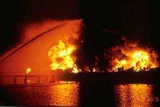
This safety alert is provided for informational purposes only and does not relieve any domestic or international safety, operational or material requirement. Developed by the Office of Vessel Activities, Domestic Compliance Division (CG-5431), United States Coast Guard Headquarters, Washington, DC. Questions should be directed to Lieutenant Commander David Webb at (202) 372-1216 or David.M.Webb@uscg.mil


RS