Seems we have another media report out of Port Townsend, Washington (article below) of a freak wave striking the M/V Snohomish a fast ferry last Friday, February 1, 2008 on the Port Townsend to Keystone route.
After checking with NWS Seattle, it seems they had a Wind Advisory out for the sector.
The weather this time of year in the Port Townsend area is always rough and plays havoc on small ferries. Especially on the Port Townsend to Keystone run. While as reported if the M/V Snohomish was struck by a wave cause by a passing container ship it is not a true freak wave and very possibility a navigation error by the ferry. But I don't think so....
Checking on the vessels particulars there is a ADA note that states:
"The Snohomish is a high-speed passenger vessel that is equipped with accessible restrooms, adequate shelter, and wheelchair tie downs. There is no food service available on this vessel. At this time, access from street level to vessel passenger decks for passenger-only ferries may be difficult for some disabled customers. The slope of the ramps leading to the decks can be dramatically affected by tides and weather. Please ask for assistance or call ahead for tidal information."
The questions are, was the weather system or container ship powerful enough to create such a large wave? Or is the vessel's construction not capable of taking on large waves?
11:32 AM PST on Tuesday, February 5, 2008
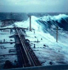
Passenger recall rogue wave during ferry route PORT TOWNSEND, Wash. - A big wave caused panic on board the ferry Snohomish last Friday after it pushed part of the boat underwater on the route between Port Townsend and Keystone.
The frightening incident was caught on video and passengers described what happened."This was nothing like we've ever experienced out there before," said Bob Rowth, ferry passengers. Video caught on a passenger's cell phone shows the lower cabin of the Snohomish in the aftermath.
The ceiling collapsed to the right and again to the left when a series of waves hit the bow of the boat and water came crashing into the cabin. "The water came through the front doors and the window, and then busted through the overhead, so the ceiling collapsed in on us," said Rowth.
The passenger ferry Snohomish was sailing from Port Townsend to Keystone ferry dock last Friday when passengers say a huge wave hit the front of the ship.
"All the windows in the front were covered with dark green water," said Janice Eklung, passenger. "And we were pitched going down and we stayed down."
"The jet in back was out of the water, so it was totally nose down," said Rowth "And from the side window all we could see was green water - no daylight."
Rowth was on board in the lower cabin with about 30 others. He said after the first wave hit, the boat's bow dipped about 20 degrees down underwater. Passengers started sliding forward to the front of the ship as water rushed inside.
"People were screaming, there was no direction from the crew about life vests or anything, so we all ran away from those windows because we thought they were going to break," said Janice Eklung, passenger.
Passengers say about six to eight inches of water flooded the lower cabin. A big wave caused panic on board the ferry Snohomish last Friday after it pushed part of the boat underwater on the route between Port Townsend and Keystone.
Some passengers called it a rogue wave while the others believe it was a wake from a passing container ship.
The ferry service was forced to cancel the next two runs on the Snohomish.
The state ferry service did not return calls by KING 5. On Friday, it released a simple statement that the run was cancelled due to weather.
Now many wonder whether the 54-car Steilacoom, which was in trial runs for the Keystone route Monday will be able to sustain a similar incident.
MEMPHIS, Tenn. (WHBQ FOX13 myfoxmemphis.com)
Deaths, Looting Blamed on Tornadoes in South
Last Edited: Tuesday, 05 Feb 2008,
11:43 PM EST Created: Tuesday, 05 Feb 2008, 10:43 PM EST
Tornadoes have been blamed for five deaths in Arkansas and for looting at a mall in Memphis, as parts of the South were hit by severe storms Tuesday.
About a half million dollars in merchandise has been stolen from Hickory Ridge Mall in Memphis that was hit by a possible tornado, according to a report by MyFOXMemphis.com.
Several people were trapped in the mall when the storm knocked part of the roof down, but no one was seriously injured, police said. Crews continued to battle poor light conditions in their rescue attempt as of 9 p.m. CT, MyFOXMemphis.com reports.
Meanwhile, police in Jackson, Tenn., about 75 miles of northeast of Memphis, say storms damaged Union University.
Arkansas Gov. Mike Beebe said five people were killed by tornadoes in Atkins, Clinton and Gassville.
In Atkins, storms hit about 20 homes and resulted in at least three deaths, according to the Pope County Sheriff's Department told KLRT-TV.
The tornado touched down near Highways 324 and 105, then stayed on the ground and passed into Conway County to the east, according to Renee Preslar, spokeswoman for the Arkansas Department of Emergency Management.
Authorities say a tornado touched down northeast of Memphis as part of a storm front that swept across west Tennessee as voters headed to the polls on Super Tuesday. No injuries were immediately reported.
Authorities confirmed a tornado touchdown near Arlington, about 25 miles northeast of downtown Memphis. The twister knocked out a radio tower for the Tennessee Highway Patrol.
Power outages, downed trees and other storm damage were reported across Shelby County.
And at least two tornadoes hit north Mississippi on Tuesday, tearing through buildings and ripping down power lines.
The Associated Press contributed to this report.
Officials: At least 2 tornadoes hit Mississippi
There were no immediate reports of injuries or deaths.
"We did have a tornado touch down and several buildings have major damage," said Desoto County Sheriff's Department Cmdr. Steve Atkinson.
Officials were on the scene assessing the damage.
Latrice Maxie, a meteorologist with the National Weather Service in Jackson, said the tornado in Southaven was the same one that hit near Memphis, Tenn., just north of the state line Tuesday evening.
Authorities in Tennessee confirmed that a tornado touched down about 25 miles northeast of downtown Memphis, knocking down a radio tower for the Tennessee Highway Patrol.
Another tornado formed over Panola and Lafayette counties in Mississippi and hit near an industrial complex outside of the city of Oxford, officials said. Witnesses said at least one metal building was flattened and others were damaged.
A dispatcher with the Lafayette County Sheriff's Department said officials were "still trying to get to people" but there had been no reported injuries or deaths.
What officials called an unconfirmed tornado in Bolivar County ripped the roof off a mobile home and blew over a gas pump, Maxie said. There were also reports of hail and strong gusts in several north Mississippi counties.
Calls to the Mississippi Emergency Management Agency went unanswered Tuesday night.
Tornado watches were posted for much of Mississippi as warm temperatures and an approaching frontal system churned up powerful thunderstorms.
The thunderstorms moved into the state during the early afternoon after causing tornadoes and hail in Arkansas and Tennessee, officials said. The National Weather Service said the possibility of violent weather would continue well into the night in Mississippi, including the threat of damaging wind gusts and large hail.
The greatest threat appeared to be the Delta and northwestern counties but the watch area included counties down into the Jackson area.
A warning was issued for areas of Bolivar and Washington counties shortly after 4 p.m. when weather service meteorologists detected a possible tornado. The Bolivar County Sheriff's Department in Cleveland said there were no immediate reports of damage.
WAIT! HOW ABOUT A SPOUT IN THE UK?
‘Twister’ spins off the coast and more may be on the way
by Sally Williams, Western Mail
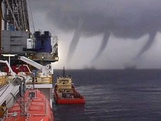
A SPECTACULAR “twister” was spotted off the west coast yesterday, prompting Welsh weather forecasters to warn of more on the way today.
The stunning weather phenomenon, a type of tornado known as a “waterspout” when it occurs over the sea, was seen heading towards Aberystwyth.
But the coastal town, with its population of about 20,000, suffered no damage as the twister fizzled out after just three minutes without hitting land.
Mike Wallwork, who works for the Wales Screen Commission in Aberystwyth, managed to capture the foreboding sight on camera as it cast a dark shadow over the Ceredigion coast at 10.55am.
He said, “I was on my tea break when I noticed what I thought was an odd-shaped cloud moving west to east.
“The cloud looked like it had spikes dropping down to the horizon and a funnel was sucking wind up into it at the same time.
“I wasn’t frightened because it was a long way off and I knew I wasn’t in danger, but I couldn’t believe my eyes.
“I had never seen anything like it before – apart from tornadoes on television.
“It seemed to be near the residential area of Penparcau and the Morfa Bychan caravan site but I couldn’t work out if it was on land or out at sea.
“It lasted around three minutes and when it lifted I could see the cloud sucking up quite quickly. It would have had a substantial windspeed.”
Derek Brockway, BBC Wales meteorologist, explained that some waterspouts can reach speeds of 64-80km/h.
“Waterspouts are funnel- shaped vortices of water associated with extremely low atmospheric pressure,” he said.
“They are very similar in appearance to tornadoes but are usually on a smaller scale.
“They can form anywhere where there are strong winds over the water, and usually occur during periods of instability.
“For instance, where cold front boundaries pass over the ocean, or over warm ocean currents, the instability and low pressure causes air and water to spiral rapidly inward and upward.
“This produces a spectacular funnel that extends from the ocean to the clouds.”
He warned that the air was likely to be unstable again today, adding, “So there could be more reports of waterspouts or tornadoes – the conditions are likely to be right again for them.”
He explained that because waterspouts form over the ocean, they do not pick up much debris.
But he added, “Although they are far less dangerous than the tornadoes, they can still cause considerable damage to yachts and small cruising craft.
“For instance in 1879, two or three waterspouts were reported to have caused the Tay Bridge rail disaster in Scotland. And they can sometimes suck up small animals from water below and later drop them when it can appear to be ‘raining frogs or fish’.”
A Met Office spokesman said there are an average of 33 reports of tornadoes in the UK each year but they are especially rare in built-up areas.
Just miles from the site of yesterday’s waterspout, more than 20 houses were damaged in 2006, with roofs and chimneys blown off, when a tornado hit the village of Bow Street, Ceredigion, on November 28, at 1.15am.
Residents at the time said houses shook before the storm hit, describing it as sounding “like a train crashing”.
Commercial and residential premises, vehicles and caravans were damaged by falling debris but no-one was injured.
The previous day, a tornado striking a Hampshire village threw two ponies into the air and left a trail of destruction.
In July 2005, 19 people were injured – three seriously – as a tornado ripped through the streets of Birmingham.
The sudden storm damaged buildings, uprooted trees and trapped people in their homes and the wind speed was estimated to have reached as high as 130mphNWS CHICAGO (LOT)
Chicago’s Top Ten Snowstorms and 2007 to 2008 Snowstorms
Yeah Chicago is getting blasted by a winter storm again!
RS




![Validate my RSS feed [Valid RSS]](valid-rss.png)
No comments:
Post a Comment