ScienceDaily (Apr. 15, 2008) — A new technique that helps forecasters continuously monitor landfalling hurricanes, giving them frequent and detailed images of a storm's location, will be implemented this summer.
(Picture Left -VORTRAC will provide hurricane forecasters with detailed updates on hurricanes as storms approach land. (Credit: Michael Bell, NCAR)
The new system, developed by National Science Foundation (NSF)-funded researchers at the National Center for Atmospheric Research (NCAR) in Boulder, Colo., and the Naval Research Laboratory (NRL) in Washington, D.C., will be implemented at the National Hurricane Center (NHC).
The technique, known as VORTRAC (Vortex Objective Radar Tracking and Circulation), was successfully tested by the hurricane center last year.
"VORTRAC is an excellent example of the application of basic research to help improve short-term hurricane warnings," says Steve Nelson, program director in NSF's Division of Atmospheric Sciences.
The system, which relies on existing Doppler radars along the U.S. coast, provides details on hurricane winds and central pressure every six minutes, indicating whether the storm is gathering strength in the final hours before reaching shore.
"We are very gratified by the decision of the National Hurricane Center to adopt this new now-casting tool," says NCAR scientist Wen-Chau Lee. "VORTRAC will enable hurricane specialists, for the first time, to continuously monitor the trend in central pressure as a dangerous storm nears land. With the help of VORTRAC, vulnerable communities can be better informed of sudden changes in hurricane intensity."
Lee, NRL's Paul Harasti, and NCAR's Michael Bell led the technique's development. Funding came from NSF and the National Oceanic and Atmospheric Administration (NOAA).
One of VORTRAC's strengths is that it can use radar data to calculate the barometric pressure at the center of a hurricane, a key measure of its intensity.
"VORTRAC allows us to take the wind measurements from the radar, turn the crank, and have a central pressure drop out of a calculation," says Colin McAdie, a meteorologist at NHC. "This will be a valuable addition to the tools available to the forecaster."
Rapidly intensifying storms can catch vulnerable coastal areas by surprise. Last year, Hurricane Humberto struck near Port Arthur, Texas, after unexpectedly strengthening from a tropical depression to a hurricane in less than 19 hours. In 2004, parts of Florida's southwest coast were caught unprepared when Hurricane Charley's top winds increased from 110 to 145 miles per hour in just six hours as the storm neared land.
Lee and his collaborators applied VORTRAC retroactively to the two hurricanes and found that the technique would have accurately tracked their quick bursts in intensity.
"VORTRAC has demonstrated that it can capture sudden intensity changes in potentially dangerous hurricanes in the critical time period when these storms are nearing land," Bell says.
VORTRAC uses the Doppler radar network established by NOAA in the 1990s.
About 20 of these radars are scattered along the Gulf and Atlantic coastlines from Texas to Maine. Each radar can measure winds blowing toward or away from it, but no single radar could provide an estimate of a hurricane's rotational winds and central pressure until now.
The VORTRAC team developed a series of mathematical formulas that combine data from a single radar near the center of a landfalling storm with general knowledge of Atlantic hurricane structure in order to map the approaching system's rotational winds. VORTRAC also infers the barometric pressure in the eye of the hurricane, a very reliable index of its strength.
"By merging several techniques, we can now provide a missing link in short-term hurricane prediction," Harasti says.
Forecasters using VORTRAC can update information about a hurricane each time a Doppler radar scans the storm, which can be as often as about every six minutes. Without such a technique, forecasters would need at least two coastal radars in close proximity to each other in order to obtain the same information. But most of the network's radars are too far apart to qualify.
Each radar can sample conditions out to about 120 miles. This means VORTRAC can track an incoming hurricane for at least several hours, and possibly even as long as a day or more, depending on the storm's speed, trajectory, and size.
To monitor the winds of a landfalling hurricane, forecasters now rely on aircraft to drop instrument packages into the storm that gather data on winds and pressure. But due to flight logistics, the aircraft can take readings no more than every few hours, which means that coastal communities may not be swiftly alerted to changes in approaching hurricanes.
VORTRAC may also help improve long-range hurricane forecasts by using data from airborne Doppler radars or spaceborne radars to produce detailed information about a hurricane that is far out to sea.
Forecasters could input the data to computer models to improve three- and five-day forecasts
WEATHER NOTE
EARTHQUAKE IN SOUTHEAST ILLINOIS FELT ACROSS CHICAGOLAND
The U.S. Geological Survey reported that a magnitude 5.4 earthquake occurred at approximately 437 AM CDT Friday morning in southeast Illinois. It was centered 7 miles east of West Salem Illinois. This is 41 miles north-northwest of Evansville Indiana and 128 miles east of St. Louis Missouri. The earthquake was felt across northern Illinois and northwest Indiana including at the National Weather Service Forecast Office in Romeoville.
According to the USGS web site www.earthquake.usgs.gov this earthquake equalled the magnitude of the largest historical earthquake in that region, which damaged southern Illinois in 1968.
U.S. Geological Survey National Earthquake Information Center (24 hours): 303-273-8500
Award flagged for Pasha Bulker rescuers

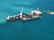
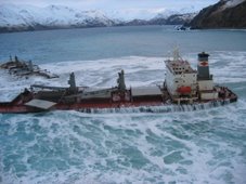
A helicopter team from the NSW Hunter region has been nominated for a bravery award for the rescue of 22 people from the stranded bulk carrier, the Pasha Bulker.
The federal government nominated the Westpac Rescue Helicopter Service (Hunter Region) for the International Maritime Organisation's (IMO) Award for Exceptional Bravery at Sea, Leader of the House Anthony Albanese said in a statement on Monday.
In gale force winds and heavy seas, the Pasha Bulker became stranded at Nobby's Beach off Newcastle in June last year.
The night-time helicopter rescue involved the winching of each crew member from the stranded ship in severe weather conditions, with all safely evacuated without injury, Mr Albanese said.
On board the helicopter were pilots Ian McFadden and Ian Osborne, and crew members Graham Nickisson, Peter Praniess, Glen Ramplin and Nathan Langham.
Each man "risked their own lives" during the operation, believed to be the largest-scale rescue from a bulk carrier in recent maritime history, Mr Albanese said.
Nominations for the bravery awards closed last Wednesday and winners will be judged by an international panel selected by the IMO.
Winners will be announced in September.
Accident investigators say the Kotuku which sank off Bluff two years ago with the loss of six lives should never have gone out to sea.
And they say the fact it had been given a safety clearance is a warning for hundreds of other similar vessels around the country.
The Transport Accident Investigation Commission report says those who died and their families have been failed by the maritime inspection system.
Hours into the Kotuku's voyage six people were dead and investigators say the boat was not seaworthy.
"Simply put, the Kotuku shouldn't have been issued with a Fit for Purpose Certificate," says Doug Monks, chief investigator.
When two big waves tipped over the Kotuku, the Topi family's kaumatua, Peter Topi, his daughter Tania and nine-year-old grandsons Shane topi-Tairi and sailor Trow Topi were all trapped inside.
The skipper's friend, Shorty Hayward, died in the water and deckhand Clinton Woods later succumbed to hypothermia.
After raising the wreckage, investigators found it should not have passed inspection because of the poor state of its hull, unknown stability capability and poor deck drainage.
"The vessel wasn't seaworthy and that was proven by the fact it was unable to negotiate its way out of the conditions," says Pauline Winter, Deputy Chief Commissioner.
But an angry skipper disagrees. John Edminson says the report is full of errors, he stands by his boat and is waiting to read the Maritime New Zealand report.
He has plenty of support in Bluff.
"It's rubbish. She a very good sea boat and she was very well maintained," says Alex Mullinder, Bluff resident.
"If it was a warrant of fitness for a car, and they got it wrong, heads would roll," says a local woman.
The wife of one of the passengers who died that day, Judy Hayward, says her husband would never have gone out on the muttonbirding trip if he thought the boat was unsafe.
Hayward says Edminson did all he could to support the survivors and her family will be always grateful to him for that.
Hayward says her husband had all the faith in the world in his friend and in the trip he was going on.
But the report says the Kotuku in fact was not approved for passengers. There weren't enough lifejackets onboard and the life raft was wedged in and didn't float free.
All these issues pointed to problems with the maritime inspections.
"The commission really hopes, the commission expects that future practice will change significantly. says Winter.
The commission says it's not about blame and is just trying to stop tragedies like this happening again.
Maritime safety investigator Tom Sawyer says the lessons learned from the tragedy should be a monument to the six people who died. He says the report into the sinking needs to be read by the right people and acted on.
Sawyer says the Kotuku should not have been given a fit for purpose certificate. But he says like people with a car, you trust the people who give you a warrant of fitness.
Professional Skipper magazine editor Keith Ingram says it really is up to the owners to ensure their boats are seaworthy. Ingram says the reality is that there are at least 200 boats in New Zealand waters that shouldn't be.
Maritime New Zealand, the organisation responsible for regulating the industry, says the commission's recommendations have been accepted and progress is well under way in implementing them.
Director Catherine Taylor says a number of factors combined to cause the accident and MNZ accepts that elements of the Safe Ship Management (SSM) system needed improving.
Introduced in 1996, SSM requires vessel owners to be responsible for the day-to-day safety of their vessels and covers all aspects of safety, including occupational safety and health systems, crew qualifications, hazard identification, condition of the vessel and its fitness for purpose.
Taylor says the vast majority of the 3200 vessels in its SSM system are operating safely and older commercial wooden vessels like Kotuku make up only a very small proportion of vessels in the system.
She says MNZ took immediate steps after the accident to ensure important safety messages arising out of it were communicated to others in the industry.
"MNZ issued safety bulletins about the importance of keeping vessel freeing ports clear to allow water to drain off the deck, and of ensuring that life raft cradles were properly fitted so that the life raft can release in the event of an emergency," she says.
"MNZ is also continuing to work closely with representatives from the Bluff fishing community and local Iwi prior to the muttonbird seasons to raise awareness of these issues and help foster a good safety culture."
From Holland and KnightCaribbean Sea – tanker rescues mariners after sinking
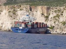
The US Coast Guard issued a press release stating that a nearby tanker diverted to rescue the 11-man crew of a Korean freighter that sank in the Caribbean Sea. The freighter sank after its cargo shifted in a storm. (4/16/08).
Messing About In Ships podcast episode 19
Episode 19 of Messing About In Ships has launched.
(49 minutes)
Download MP3: Messing About In Ships Episode 19 - April 17, 2008
Shownotes: coming soon
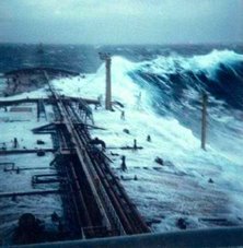
Finally... The Research Ship James Cook in a Atlantic storm!Enjoy your weekend!
RS




![Validate my RSS feed [Valid RSS]](valid-rss.png)
1 comment:
This is definitely a great post! You seem to have bunch of information here! Thanks for all the infos i gathered on your post... :)
Keep them coming.. :)
Post a Comment