Once a long time ago in Greece, hurricanes and violent storms were thought to come from the Hecatoncheires. These were three gods, each wielding one hundred hands and fifty heads. They were believed to use this menagerie of body parts to create the destructive powers of a severe storm.
Combined with the Kyklopes brothers, who were the gods/artists who painted the skies with thunder and lightning, the Greeks thought that these severe storms were a punishment of sorts when the gods were angry, or even the results of a battle going on between multiple gods.
It is easy to see how such a story could be believed when you have seen the ultimate destructive capabilities of a hurricane. While the development of an actual hurricane storm is not near as dramatic, it is actually just as interesting.
The Atlantic ocean hurricane season is from June 1 to November 30, while the Eastern Pacific hurricane season is from May 15 to November 30. Tropical hurricanes form only over warm ocean waters of 80 degrees Fahrenheit and above. This is why hurricanes always begin nearest the equator.
Interestingly, the storm's original direction from the equator predicts the direction of the spin of the hurricane. Storms starting in the North spin counterclockwise, while storms starting in the South clockwise. This is all due to how the Earth is rotating on its axis.
The formation of a hurricane is quite simple and complex. It involves the warm moist air from the ocean, which naturally rises upward, much the same as it does in your home when you are trying to heat in the winter. This transference of warm air into the sky creates a low pressure scenario just above the oceans surface.
The warm air that has risen to the sky eventually cools, creating clouds. The continuous motion of warm air rising and cooling creates a swirling motion as new air molecules begin to get pulled into the warm stream. This is where things become a little unknown, or unpredictable if you will.
This occurrence sometimes can create a huge storm in a matter of hours, days, or just fizzle out and have no repercussion at all. This is what makes predicting a hurricane so difficult. Currently we can predict semi-successfully within a two or three day warning to residents within the hurricanes path, but many storms still take us by surprise.
The key to improving early prediction lies within the storms inner-core, and thankfully we are getting closer and closer everyday to cracking that code!
WEATHER NOTE
La. 1 to be closed to traffic if hurricanes approach
HOUMA -- In the event of a threatening hurricane or tropical storm, La. 1, the only road out of both Grand Isle and Port Fourchon, must be closed off in Golden Meadow where the highway exits the levee system, officials said.
A combination of heavy traffic on the road, sinking land and the rush to raise south Lafourche’s levees have left the vulnerable parish with a hole in the system that must be plugged to prevent floodwaters from entering the ring levee.
"There’s a 3-foot dip between the height of the road and the levee," said Windell Curole, interim regional levee director for Lafourche and Terrebonne parishes. "The difference is so much that we think it’s a real risk for flooding."
Officials realized last year that the problem had become severe enough to close the road if a major storm approached. But they did not have to resort to such measures because the relatively calm hurricane season never produced a storm that required it.
Levee District workers will close off the road with Hesco baskets. Used by the U.S. military, the large, wire-mesh baskets are lined with a felt-like synthetic fabric and can be quickly filled with sand to create a barrier.
Each basket is about 6 feet high and 4 feet wide. With the baskets, the road can be closed off in just an hour, Curole said.
The district will try to wait until most people have had the opportunity to evacuate, Curole added, but once there’s water over the road or no more traffic coming through, the district will close the highway.
The district plans to give 24-hour notice of notice prior to setting up the baskets.
"We’re always out there during a storm anyway, and we will have everything ready with the equipment to do it," Curole said. "But if a storm comes in quickly, we’ll do what we have to."
The district only plans to close off the road if a powerful storm like Hurricanes Ivan, Katrina or Rita is expected, Curole said.
Once the baskets are in place, there will be no access in or out of the hurricane protection system.
"It’s an uncomfortable thing to have to do," he added.
Levee officials had become aware of the vulnerability in recent years, Curole said, and hoped to secure state money this year to raise the sinking road several feet and close off the gap.
The district was also hoping to straighten a sharp curve in highway as it exits the levee that’s been blamed for many accidents on La. 1.
"We have been trying to get the state to give us a design on the closure and get some funding to close it off, but now it’s looking like that won’t happen until next year," Curole said.
Significant flood protection needs across the state made it difficult to secure money for the project, Curole added. So the South Lafourche Levee District must improvise protection for another year.
"It’s a little disappointing," Curole said. "We always insisted on having a ramp there instead of a gate so we wouldn’t have to close the road off in the first place, so to have this happen is a disappointment."
As warmer weather becomes a constant for the central
In
Indiana
"To the best of my knowledge,
Call notes that with F0 or F1 tornadoes, fatalities are very rare
Thunderstorms move through
"Not all supercells form tornadoes, for reasons we don't fully understand," Call said.
When a thunderstorm produces a tornado, the tornado grows in speed and strength due to the warm air surrounding it. Once a tornado has consumed the warm air around it, the tornado dissipates.
In order to remain safe during a possibly violent storm season, residents are advised to take shelter in a stable building in an interior room without windows and to remain in that location until the danger has passed. If you are outside, take shelter in a ditch or other low-lying area.
For more information, check out the interactive below.
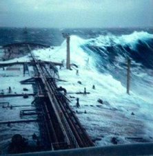
My good freind at Freaque Waves has a MUST READ article for all mariners. His "A list of freaque wave encounters." is just frightening...
Peril in the age of internet
Two years ago, shortly after I started this blog, I posted an item entitled "A list of freaque wave encounters." That list was later published in the journal Geofizika (Vol. 24 No. 1, 2007) as a professional paper.
In the blog list I included the case of the tanker World Glory which "encountered an abnormally large wave 105 km east of Durban, South Africa, broken in half , and both halves sunk within 4 hours" along with the picture:
 which I referenced the site http://www.dynagen.co.za/eugene/freak.html. In the Geofizika publication I used the same URL but not the picture.
Recently Professors Kharif, Pelinovsky, and Slunyaev of Russia are preparing a book "Rogue Waves in the Ocean" to be published by Springer-Verlag Berlin-Heidelberg-New York and wish to include this picture in the book. Unfortunately the acknowledged source is no longer there.
This must be the peril of internet age. Pages on the internet can never be expected to be permanent. People changing jobs and company strorages are limited so internet pages are subject to things like now you see it and now you don't!
Now the proper source of this dramatic picture of tanker World Glory broken in half is in a limbo.
Anyone who owns the copyright, or knows who owns the copyright, of this picture would you please kindly let me know?
The picture is very valuable, dramatic, and historical. For now it may be simply designated as "copyright unknown." But whoever happens to be at the right place and at the right time to be able to capture that historical moment certainly deserves an appropriate recognition and acknowledgment.
Rescue crews issue summer safety alert
MARITIME emergency services issued a summer safety warning yesterday after seven people were rescued from the sea in a week.
Coastguard and RNLI lifeboat officials urged holidaymakers and locals to be constantly on the lookout for potential dangers – and not let a trip to the beach end in tragedy.
On Saturday, a 10-year-old girl was airlifted to hospital by an RAF search and rescue helicopter after she and two other people were helped to safety after being swept out to sea at Embleton Sands in Northumberland.
The previous evening, two children and their pet dog were plucked from rocks at Cresswell, near Druridge Bay, by the Newbiggin lifeboat crew after being cut off by the incoming tide while playing.
And the previous weekend, Newbiggin lifeboat was launched to rescue two youngsters who got trapped by the tide while playing on the village breakwater.
The three incidents have led maritime 999 services to re-emphasise the perils involved in not taking the right precautions when swimming in the sea or playing on the coastline on summer days. A Coastguard spokeswoman said: “It is lovely, hot and sunny at the moment but people must ensure they can get back to the shore safely when they go into the sea. Our advice is to check tide times, make sure someone is watching when you swim and can see you from the shore, don’t get out of your depth and just be generally aware of the hazards involved with the sea.”
Richard Martin, spokesman for Newbiggin’s RNLI lifeboat, said Friday evening’s incident could have ended in tragedy. He said: “The children had been playing on the rocks, with an adult nearby, but the rapidly flowing tide caught out all of them. It is important to appreciate that the tide flows into these areas very quickly and the outcome, but for the actions of the lifeboat crew, could have been much different.”
Saturday afternoon’s incident at Embleton Sands involved a party visiting the area from Sheffield. The coastguard was alerted at 1.40pm that three people were in the sea and were shouting, waving for help and showing signs of being in distress. A local coastguard team, the Craster inshore lifeboat and a Sea King helicopter from RAF Boulmer were sent to the scene, where the three people – two children and an adult – had made it back to the beach with help from a member of the public.
They were exhausted and needed to be assessed by the helicopter crew, who decided to fly the 10-year-old girl to Wansbeck General in Ashington because of her condition. She was checked at the hospital and later allowed home.
On Friday, the two children and their dog were playing on rocks at Cresswell Scarrs at 6pm when the speed of the incoming tide caught them unawares and cut off their escape route to the shore. Their mother called the coastguard for help and Newbiggin’s Atlantic 75 lifeboat crew carried the youngsters off the rocks and took them ashore.



![Validate my RSS feed [Valid RSS]](valid-rss.png)
No comments:
Post a Comment