skip to main | skip to sidebar

... In Search of Severe Weather

Friday, December 12, 2008

Aid agencies say overwhelmed by rising climate disasters

Aid agencies say overwhelmed by rising climate disasters

POZNAN, Poland, Dec 3 (AlertNet) -
The humanitarian community is overwhelmed by rising weather-related disasters and tens of billions of dollars are needed each year to reduce the risks from global warming, aid officials at U.N. climate change talks said on Wednesday.

The number of natural disasters had doubled in the past 20 years from around 200 to 400, Kasidis Rochanakorn, director of the U.N. Office for the Coordination of Humanitarian Affairs (OCHA) in Geneva, told journalists.

There were 200 floods in 2005 compared with 50 in 1985, and they were damaging larger areas, he said. "Floods, droughts, storms do not have to end in disaster, they don't have to kill, people don't have to die. They die because they are not prepared," he said. "The problem today is that capacity has been overwhelmed because of the frequency and intensity of natural disasters." He called on governments negotiating a successor pact to the Kyoto Protocol on global warming to provide more support for the humanitarian community to improve its ability to prepare and respond.

Maarten van Aalst of the Red Cross/Red Crescent Climate Centre said it was not clear what proportion of the increase in weather-related disasters was due to global warming, but "we do know that climate change is already playing a role". The U.N. climate change panel has predicted that rising global temperatures will bring more heatwaves, droughts, heavy rains and stronger storms.

Reid Basher, policy coordinator for the U.N. International Strategy for Disaster Reduction (ISDR), warned that harmful development practices - such as stripping forests, destroying wetlands and poor construction - are making disasters more likely just as the impact of climate change begins to bite. "We are making things worse for ourselves and really putting almost like a time bomb there, waiting for climate change to reveal the hazards and the risks that we have been developing over many years," he said.

Basher said a large proportion of the estimated $50 billion needed each year to cover the cost of adapting to climate change would be required to cut the risk of disasters. The humanitarian community knows how to help people prepare for increasing disasters - including giving them better climate information and strengthening early warning systems - but there is a lack of capacity to put this into practice on a large enough scale, he added. José Riera, policy adviser for the U.N. refugee agency, said aid agencies and governments should sit down and work out how to deal with the increasing number of people who will be forced to flee their homes by climate change. "Climate has always been one of the reasons forcing people to move ... but what we risk seeing in the coming months and years is climate suddenly becoming the main driver of population movements," he said. Riera said climate change could increase the number of displaced people by around 6 million per year.

Statistics from the refugee agency show that 67 million people were uprooted around the world at the end of 2007, 25 million of them because of natural disasters. The aid officials called on the international community not to treat climate change only as an environmental issue but to focus on the needs of vulnerable people. "They know that disasters are coming with more intensity, more severity, they want to be supported, and governments around the world ... have to consider seriously the humanitarian aspects, because in the final analysis people matter," said Bekele Geleta, secretary-general of the International Federation of Red Cross and Red Crescent Societies.

WEATHER NOTE

Mother nature on display

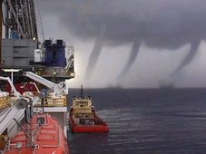
Dalyellup resident Jaco Bosman snapped this image of a water spout forming off the coast of Bunbury on Saturday afternoon.

A DALYELLUP resident in the right place at the right time witnessed a marvel of Mother Nature on the weekend – a waterspout off Bunbury’s coast.

Jaco Bosman was driving past Dalyellup Beach on Saturday evening when the meteorological phenomenon caught his eye.

Mr Bosman pulled over and watched the water spout for about a minute or two before it disappeared out of sight.

“I just caught the last of the show,” he said.

“It is the kind of thing you see on the Discovery Channel.

“I didn’t expect to see it happen in real life.”

A waterspout is an intense columnar vortex usually appearing as a funnel-shaped cloud that occurs over a body of water and is connected to a cumuliform cloud.

Waterspouts have long been recognised as serious marine hazards and history is filled with examples of ships being destroyed or damaged by them.

Meteorologist Joe Courtney said the waterspout formed due to unstable weather conditions on Saturday and rotating columns of air.

Lockheed wins $1.1 billion weather satellite contract

NEW YORK (MarketWatch) -- Lockheed Martin Corp. has scored a $1.1 billion U.S. contract to build the country's next-generation of weather satellites, beating out rivals Boeing Co. and Northrop Grumman Corp. in a three-way race.

In a news release late Tuesday, Bethesda, Md., Lockheed (LMT) said it would build two generation-R spacecraft for the Geostationary Operational Environmental Satellite system. The deal also provides for an option to build one additional craft.

The first satellite is scheduled for delivery in 2014 with the second satellite's delivery a year after that. Launch of the first satellite is planned for 2015.

(
NOC
)
had built the most recent generation in series.Shares of Lockheed were up a fraction at last check to $73.92. Shares of Boeing Boeing Co. (BABA) slipped 2% to $39.80 and Northrop fell 1.3% to $38.70, trending the wider market.

GOES satellites circle the Earth at 22,300 miles above the surface and scan for severe weather conditions such as tornadoes, flash floods, hail storms, and hurricanes. The first in the series was launched in 1994.

NASA and the National Oceanic and Atmospheric Administration said the new generation of GOES satellites will result in more timely and accurate weather forecasts, directly affecting public safety and ultimately, economic health and development.

The contract value includes options. Last year Lockheed sales were $41.9 billion.

MARITIME NOTE

IMO CHIEF'S “GROUNDS FOR CONCERN”

Thursday, 27 November 2008

OPENING IMO's Maritime Safety Committee meeting this week the body's secretary general Efthimios Mitropoulos has expressed concern at the number of seafarers killed at sea this year, mainly in domestic ferries and small vessel, and at the prospect of the economic crisis leading to dangerous practices.

He said that there are grounds for genuine concern over a number of issues, one of them being the overall safety record of certain sectors of the shipping industry. He continued: “While the recent delivery of many new ships built to the highest IMO standards has injected a welcome element of youth into the age profile of the world merchant fleet and, as a consequence, a higher degree of safety, we cannot ignore the fact that, since the beginning of the year, well over 1,600 seafarers are estimated to have lost their lives in accidents mainly involving ferries in domestic service and small cargo ships caught up in adverse weather conditions.”

Mr Mitropoulos said: “I find these figures both disturbing and unacceptable – a real setback at a time when so many efforts are being made to enhance safety at sea and so many endeavours are coming to fruition, including the International Safety Management Code, the first phase of which entered into force 10 years ago.”

“Also of concern,” he said, “is the current financial crisis, which analysts predict will continue for some time to come and which is already negatively impacting on economies worldwide, triggering fears of a global recession. A prolonged crisis of the sort we have been experiencing since the summer will leave no sector unscathed and, along with the world trade, it has already affected the shipping industry. The situation may be exacerbated by the release of new tonnage into the market place from the recent years’ unprecedented world order book, which, in spite of the anticipated withdrawal of further single-hull tankers in 2010, may lead to a substantive imbalance between supply and demand of shipping capacity worldwide forcing ships to lay up.”

He cautioned: “In this difficult time ahead, when it will be prudent to seek economies to face the storm, it would also be necessary to guard against measures that may have a negative impact on the safety of ships and shipping operations. While recommending that we should all exercise patience and perseverance in weathering the crisis, I would advise against adhering to savings and practices that might play a contributory part in any decline in the safety record of shipping and in the efforts of the maritime community to protect and preserve the marine environment.”

Antarctic cruise vessel refloated

CHILEAN NAVY PHOTOGRAPH

December 9, 2008

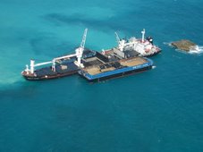
The Antarctic cruise vessel MV Ushuaia has been successfully refloated. The ship grounded December 4 at position 64¼35.5'S 062 ¼25'W, at the entrance of Wilhelmina Bay near Cape Anna in the NW Antarctic Peninsula. On board were 82 passengers and 42 crew.

Two diesel tanks were punctured and/or damaged (tank Nr.4 port side, and Nr.5 center), and spilled MGO.

The passengers, who may have gotten a little more adventure than they signed on for, were transferred to Chilean Naval Vessel Achiles next day using Zodiac landing craft from the MV Ushuaia and from another Anarctic tourist vessel, the MV Antarctic Dream, which had been standing by. The crew of the Ushuaia remained on board.

On the afternoon December 7, the crew of the MV Ushuaia and the crew of the Chilean Naval Tug Lautaro started to transfer 120 cu.m of diesel from MV Ushuaia to storage tanks on the Lautaro and 100 cu.m of fresh water was discharged into the sea. This was done to improve the buoyancy of the MV Ushuaia. Transferring fuel off the vessel also reduced the potential for additional spillage should anything go wrong with the refloating.

Efforts to refloat the vessel began at high tide (approximately 0400UTC/0100LT). The vessel was fully free at 0545UTC/0245LT. Escorted by Lautaro, MV Ushuaia began making way under its own steam towards Paradise Bay. No oil has been seen leaking from the vessel while underway; however, this could be due to wind and wave action causing any fuel leaked to be rapidly dispersed. To minimize any further oil spill, fuel from the damaged tanks is being transferred into tanks that are not compromised. Once the MV Ushuaia is in the relatively sheltered waters of Paradise Bay, a further inspection of the hull will take place.

You can read a blow by blow account of the incident from the International Association of Arctic Tour Operators HERE

You can get a somewhat different perspective on the incident from the Antarctic and Southern Ocean Coalition HERE.

The Ushuaiia is the former NOAA vessel Baldridge, which was retired from the agency in 1996 and which was originally delivered to NOAA as the Researcher from American Shipbuilding, Toledo, Ohio in 1978.


Messing About In Ships Podcast


12 more days to Christmas! Enjoy!

RS
Posted by Robin Storm - In Search of Severe Weather. at 00:02 No comments:
Labels: climate change, disaster response, maritime safety, severe weather, waterspouts

Thursday, December 11, 2008

Climate Clues In Southern Ocean: Ocean Currents Surprisingly Resistant To Intensifying Winds

Climate Clues In Southern Ocean: Ocean Currents Surprisingly Resistant To Intensifying Winds

ScienceDaily (Dec. 2, 2008) — The Antarctic Circumpolar Current is the current system with the largest volume transport in the world ocean. Between 40° and 60°S strong westerlies move about 140 million cubic meters of water per second around the Antarctic continent (this is about five times the transport of the Gulf Stream).

Vertical motions associated with this current have been responsible for transporting a substantial fraction of the anthropogenic carbon dioxide emissions from the atmosphere to the deep ocean, thereby effectively damping the rate of global warming.

Investigations in this key region of the world ocean have been hampered by a sparse database due to the logistical challenges for ship based expeditions in the high-latitude Southern Ocean.

“In our study we used data obtained by the international Argo Programme”, explains Prof. Claus Böning from the Leibniz Institute of Marine Sciences (IFM-GEOMAR) in Kiel, Germany. Argo is a system of currently 3000 autonomous free-floating robotic systems which are surveying the world ocean. Every 10 days these buoys measure temperature and salinity profiles over the upper 2000 meters. These measurements are transmitted to land stations via satellite. “For this study about 52,000 profiles of more than 600 Argo-drifters in the Southern Ocean were used and compared with historic ship measurements”, explains oceanographer Astrid Dispert from IFM-GEOMAR. For this analysis the extensive archives of the Australian marine research centre in Hobart, Tasmania were also used.

As expected, the observations in the subpolar ocean demonstrate an increase of water temperature and a decrease in salinity at the same time. Nevertheless, in contradiction to the simulations of various climate models the data show no significant changes in water transport. “Our results point to one important thing: Eddies which are currently not resolved in climate models might be the key process in controlling the transport of the ACC”, Prof. Böning explains. Hence, his conclusion is that investigations with high-resolution ocean models are required to test this hypothesis. “Of course, besides the simulations we also need further observations”, adds Prof. Martin Visbeck (IFM-GEOMAR). “Thanks to the international Argo observations programme we now have continuously access to data from a worldwide network of more than 3000 profiling-drifters. This is a quantum leap in the field of ocean observations, which, together with high resolution modelling gives us new insights about long-term changes in the ocean.“

Further investigations have to show whether the results are robust. If confirmed, this would in one way be good news: Until now the Southern Ocean is the biggest oceanic sink for anthropogenic carbon dioxide and therefore a crucial regulator for the atmospheric carbon dioxide concentration. Climate models predicted a severe reduction in the southern ocean carbon dioxide uptake due to wind-forced changes in the current fields. Now high-resolution models are needed to assess the role of the hitherto unresolved ocean eddies in the Southern Ocean’s response to the progressive changes in the atmospheric conditions.

WEATHER NOTE

Venice under water

Duckboards and elevated walkways were set up throughout Venice today and elderly residents were carried to dry ground, as the city faced its worst flooding for two decades.

Venice

A woman wakls on Piazza San Marco yesterday. Nearly all the streets of the city were underwater. Pic: AFP

As sirens blared throughout the city, the Mayor Massimo Cacciari asked prospective tourists to not to visit - and advised those already there not to move around unless it was "unavoidable" because of the "exceptional" situation. "Anyone thinking of coming to Venice should think again," he said.

As the sea surged into St Mark's Square, arguably Venice's most famous landmark, it became completely submerged under eighty centimetres of water. In total, more than 95% of the rest of central Venice was flooded and some pontoon bridges began floating away in the rising tide, leaving residents stranded in their homes.

Driven by strong winds and heavy rain, the water rose to 156cm above sea level - the highest "acqua alta" since 158cm in 1986. Sirens sounded as the Venice tide monitoring centre warned that the water could rise to over 160 centimetres for the first time in thirty years.

The worst floods took place in 1966 when the waters reached a record 194 centimetres above sea level, causing devastation to homes, shops and historic monuments and art works. Flooding of 100-130cm above sea level is common in the lagoon city in autumn and winter.

As today's floods intensified, workers set up duckboards and elevated walkways as the sirens sounded, and text messages with warnings and updates were sent to those who have registered with the flood warning centre on their mobile phones. Elderly residents were carried to dry ground, and homes and shops activated their ground floor pumps.

The plight of Venetians and visitors was compounded by a national transport strike which affected the Venice "vaporetto" or water bus service.

Giancarlo Galan, head of the Veneto region, said the transport workers had chosen a bad time to strike. "I'd like to give them a medal for their sense of responsibility," Mr Galan said sarcastically.

A floating flood barrier is under construction at three entrances from the Adriatic into the lagoon, but is not due to go into operation until 2012 at the earliest. The authorities are also considering a scheme to raise the city's buildings by up to a metre using piston-supported-poles.

The growing severity and frequency of floods is attributed to silt deposits raising the floor of the lagoon and a rise in sea levels caused by global warming.

However Mr Cacciari played down alarm, saying flooding was part of everyday life in Venice. "We get sea levels of 140m, 160m every few years," the Mayor said. Italian meteorologists said the entire country was being affected by bad weather, with driving rain, snow, hail and high winds causing flooding "from the Alps to Palermo".

Many roads in Piedmont, Liguria and Lombardy were closed, and Rome was hit by hail and rainstorms, with fallen trees blocking roads and cars submerged in flooded road tunnels.

Researchers Use Sun Cycle to Predict Rainfall Fluctuations


(PhysOrg.com) -- The sun’s magnetic field may have a significant impact on weather and climatic parameters in Australia and other countries in the northern and southern hemispheres.

ccording to a study in Geographical Research published by Wiley-Blackwell, the droughts in eastern Australia are related to the solar magnetic phases and not the greenhouse effect.

The study titled “Exploratory Analysis of Similarities in Solar Cycle Magnetic Phases with Southern Oscillation Index Fluctuation in Eastern Australia” uses data from 1876 to the present to examine the correlation between solar cycles and the extreme rainfall in Australia.

It finds that the Southern Oscillation Index (SOI) – the basic tool for forecasting variations in global and oceanic patterns – and rainfall fluctuations recorded over the last decade are similar to those in 1914 -1924.

Author Professor Robert G. V. Baker from the School of Environmental Studies, University of New England, Australia, says, “The interaction between the directionality in the Sun’s and Earth’s magnetic fields, the incidence of ultraviolet radiation over the tropical Pacific, and changes in sea surface temperatures with cloud cover, could contribute to an explanation of substantial changes in the SOI from solar cycle fluctuations. If solar cycles continue to show relational values to climate patterns, there is the potential for more accurate forecasting through to 2010 and possibly beyond.”

The SOI-solar association has been investigated recently due to increasing interest in the relationship between the sun’s cycles and the climate. The solar application offers the potential for the long-range prediction of SOI behavior and associated rainfall variations, since quasi-periodicity in solar activity results in an expected cycle of situations and phases that are not random events.

Professor Baker adds, “This discovery could substantially advance forecasting from months to decades. It should result in much better long-term management of agricultural production and water resources, in areas where rainfall is correlated to SOI and El Niño (ENSO) events.”

This paper is published in the December 2008 issue of Geographical Research Vol. 46 Issue 4. (Report)


MARITIME NOTE

Science Speaks: Rogue Waves are Real
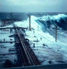
'Rogue wave approaching on ship Nathaniel B Palmer' .
Every year sound sailing boats, well equipped with safety gear, with experienced crew on board, go missing. Their loved ones are forever left wondering: Was it a whale? a floating container? a rogue wave?

In the past, some scientists wrote off 'rogue waves' as rare or even mythology.


Rogue waves on NOAA ship Discoverer in the Bering Sea - .. .
However, satellite data collected by the European Space Agency's (ESA) ERS satellites has confirmed what too many ship captains have come to know (and occasionally captured photographs). Ocean waves that rise as tall as ten-story apartment buildings are a leading cause of large ship sinkings.

The Norwegian Dawn, a 965-foot ocean liner , was sailing back to New York from the Bahamas on April 16 2005 when it was struck by a rogue 70-foot wave. The wave smashed windows and sent furniture flying, but the ship survived and the crew lived to record the wave's arrival.

A sailing boat faced with such a wave would have little chance of survival, and if it came at night, maybe not even the chance to hit the EPIRB.

A giant wave can form when strong winds beat against an opposing ocean current, when waves from different storms join forces, or when swells interact in strange ways with a particular seafloor.

Wave Height Predictions off the coast of Massachusetts - .. . Click Here to view large photo
Since 2005, Vijay Panchang at the A&M University at Galveston in Texas and his associates say they can accurately predict the daily height of waves anywhere off the coast of the United States for the next 48 hours across spaces as close as 500 yards apart.

A buoy off the coast of Alabama recently recorded an average wave height of 16 meters before the gauge broke, Panchang said. Since that figure is just an average of measurement of a sea-state, the biggest wave at that location was probably twice that size--32 meters, or about 100 feet.

'There were oil platforms destroyed,' said Panchang, who requires his wave mechanics students to read The Perfect Storm. 'The sheer magnitude of these things amazes me.'

Severe weather has sunk more than 200 supertankers and container ships more than 200 yards long in the past two decades, an ESA analysis found.

Counting waves from space:

The two ERS satellites equipped with radar carry out a global rogue wave census and arrive at the truth.

Without aerial, cloud-penetrating radar, scientists could only go on radar data on waves collected from oil platforms.

The radar instruments on the satellites detected the height of individual waves at the surface in 3-mile by 6-mile patches of the sea. Three weeks of data, including 30,000 of these patches or 'imagettes' of the sea with their wave height information were analyzed and searched for extreme waves at the German Aerospace Center.

A scientific team counted more than ten individual giant waves around the globe more than 75 feet high during the three-week period.

What can the cruising sailor do?
Rogue wave approaching in the Bay of Biscay Fall 1993 - NOAA - .. .
There are a few things that long range cruisers can do when setting off, apart from the obvious ones like never travelling close to a cyclone season, taking particular note of existing currents, and watching the weather like your life depends on it - because it does.

If there are different swells meeting, the other most obvious rule is to stay away from underwater mountains and ranges, where rogue waves are likely to develop if other conditions accumulate. There are many examples of underwater disturbances on the world's charts, eg. between Madeira and the Canary Islands, between Sydney and Lord Howe Island, and between Palmerston Atoll and Tonga.

Another underwater feature to be avoided is the underwater cliff, which often occurs close to coastlines. One of the most notorious of these is in the Bay of Biscay, where the depth changes from thousands of meters to a few hundred in a short distance.

To find examples of Vijay Panchang's wave predictions, which do not exist for all parts of the world, click here


RS
Posted by Robin Storm - In Search of Severe Weather. at 00:25 No comments:
Labels: coastal flooding, floods, large waves, oceanography, rogue waves, severe weather

Wednesday, December 10, 2008

Atmospheric alert system launched

Atmospheric alert system launched

A prototype atmospheric alert system for severe weather events for the Maltese Islands and the Central Mediterranean area has been set up by the Physical Oceanography Unit (PO-Unit) of the International Ocean Institute-Malta Operational Centre (IOI-MOC) at the University of Malta.

The system makes extensive use of satellite observations, the optimization of high resolution meteorological forecasting models, the combined use of wave models for forecasting hazardous sea conditions, and also the use of meteo-marine observations targeting to provide useful information in key areas to the end-users.

The web interface developed for the alerting system is mainly dedicated to furnish early warnings at sea and allows remote users to view predicted alerts of extreme weather and sea conditions within nine sub-areas within the Central Mediterranean

The service is part of a project called Weather Risk Reduction in the Central and Eastern Mediterranean (RISKMED) and is partly financed by the European Regional Development Fund (ERDF) through the Interreg III Community Initiative, which forms part of the Structural Funds Programme for Malta (2004-2006). The project is led by the Greek University of Ioannina, and brings together a consortium of eight partners from Greece, Cyprus, Italy and Malta with interests and expertise in the subject.

The work was coordinated by Dr Aldo Drago, Director of the research institute. Through a dedicated website, this system provides alerts to end users well in advance of any extreme weather event, giving responsible authorities the opportunity for timely response and mitigation.

WEATHER NOTE

Satellite Should Drastically Improve Forecasting


LITTLETON, Colo. (CBS4) ―
Imagine being able to know not just what the weather will do tomorrow but next week, and with a great degree of certainty. Engineers at Lockheed Martin say they are building a new satellite that will make that possible.

The company landed a $1 billion NASA contract to build a new version of a satellite called Geostationary Operational Environmental Satellite R-Series, known as GOES-R.

It is based on the same technology that generates satellite imagery used in forecasting by CBS4. The difference is pinpoint accuracy, and it could help save lives and crops.

Engineers at Lockheed Martin say the satellite will have the first lightning mapper -- an instrument that can help predict severe weather.

Warnings for tornados could come hours earlier and for hurricanes they could come days in advance. Meteorologists will be able to tell exactly where the severe weather will hit.

"So we'll be able to see when storm changing course and moving against the way we modeled - much more data six times quicker," Lockheed Martin project manager Amy Flanagan said.

Engineers will begin designing the satellite within the next few weeks. It is scheduled to launch in 2015, and will be used by the National Oceanic and Atmospheric Administration.

Lockheed Martin plans to hire more than 100 people in Denver in upcoming years to work on the project.

More Information From Lockheed Martin

The company released the following details about the project on Tuesday:

Lockheed Martin's GOES-R solution builds upon the renowned A2100 geosynchronous spacecraft bus and proven precision imaging capabilities from previous remote sensing programs. The A2100 satellite fleet currently consists of 36 satellites and has achieved an accumulated 200 years of successful in-orbit operations.

"Our team is ready to move forward to design and field this important national system," said Jim Crocker, vice president of Sensing and Exploration Systems at Lockheed Martin Space Systems Company. "We look forward to continuing our ongoing relationship with NOAA and NASA including two previously awarded GOES-R instruments - the Solar Ultra-Violet Imager and the Geostationary Lightning Mapper."

Lockheed Martin Space Systems Company has a long history of developing highly reliable civil and military weather and environmental satellite systems including Landsat, TIROS, Terra and DMSP.

The Lockheed Martin GOES-R program office will be located at its Space Systems Company facilities in Newtown, Pa.

While substantial engineering and production effort will be conducted in Newtown, the program will also leverage Space Systems Company capabilities across the country including Denver, Colo. and Sunnyvale, Calif.

Headquartered in Bethesda, Md., Lockheed Martin is a global security company that employs about 140,000 people worldwide and is principally engaged in the research, design, development, manufacture, integration and sustainment of advanced technology systems, products and services. The corporation reported 2007 sales of $41.9 billion.

MARITIME NOTE


Search and Rescue S-92(R) Helicopter Marks Anniversary of Introduction to U.K. SAR Market

STRATFORD, Conn., Dec 01, 2008 /PRNewswire-FirstCall via COMTEX/ --
In its first year of use by the United Kingdom Maritime and Coastguard Agency and under the operation of CHC Helicopter Corp., Sikorsky Aircraft's Search-and-Rescue (SAR)-configured S-92(R) helicopter logged 279 rescues and is operating at availability levels of more than 98 percent. Sikorsky is a subsidiary of United Technologies Corp.

United Technologies Corporation
(UTX:

CHC operates the SAR S-92 helicopters from two bases covering territory in the North Atlantic and the North Sea. In Stornoway, Western Isles, Scotland, the fleet has conducted 174 rescue missions, while missions flown out of Sumburgh, Shetland Isles, Scotland, have totaled 102 to date. Aircraft technical availability at Stornoway has been 98.35 percent; availability at Sumburgh, 100 percent, said Ian McLuskie, UK SAR Business Unit Leader, CHC Search and Rescue.

"The Maritime and Coastguard Agency has seen a 20 percent increase in rescue missions at its bases, which is attributed to the increase in speed and capability that the S-92 helicopter offers," said McLuskie. "The aircraft's fully coupled automatic flight control system has been invaluable, and the large cabin and tail ramp also have been of great benefit, particularly when airlifting rescue teams."

Sikorsky initially developed the S-92 helicopter for over-water search and rescue in demanding and challenging environments such as the North Sea and North Atlantic, where the MCA is in service.

"Sikorsky has a successful history of search and rescue. The CHC-operated MCA missions are adding to that legacy," said Marc Poland, Sikorsky Vice President, Commercial Programs. "The S-92 helicopter fleet today has logged more than 120,000 flight hours and in doing so, has shown itself to be a safe, extremely reliable and cost-efficient platform."

The SAR aircraft have conducted rescues from mountains, cliffs, and vessels, rescued divers in difficulty, and extracted complete crews from stricken vessels. One such incident in February this year led to the rescue of 14 fishermen from the vessel Spinningdale, which had run aground at St. Kilda. That rescue, conducted amid gusting 70-knot winds as the vessel sat stranded on rocky, cliff-facing terrain, brought the crew recognition for its bravery and professionalism as it was awarded the Great Scot of the Year Award.

The S-92 is the first helicopter in the world certified to the latest U.S. Federal Aviation Administration and European airworthiness safety standards. The S-92 features a Rotor Ice Protection System (RIPS), which allows the aircraft to operate in known icing conditions. RIPS has been certified by both North American and European aviation authorities and is available on S-92 military variants as well as commercial aircraft. EASA certification was issued in April for an IAFS equipped aircraft, which is currently in commercial operation.

Sikorsky Aircraft Corp., based in Stratford, Conn., USA, is a world leader in helicopter design, manufacture and service. The company's mission statement reflects its long commitment to safety and innovation: "We pioneer flight solutions that bring people home everywhere ... every time(TM)." United Technologies Corp., based in Hartford, Conn., USA, provides a broad range of high technology products and support services to the aerospace and building systems industries.

SOURCE Sikorsky Aircraft Corp.
 http://www.sikorsky.com


RS
Posted by Robin Storm - In Search of Severe Weather. at 00:09 No comments:
Labels: international weather, MCA, rescue at sea, satellites, search and rescue, severe weather, weather story

Tuesday, December 9, 2008

National Weather Service in Norman gauges readiness

National Weather Service in Norman gauges readiness

NORMAN — There were no black clouds rolling in from the southwest. No lightning strikes. No hail denting car hoods.

So why were all the emergency management vehicles in the parking lot of the National Weather Center on Tuesday?

Because more than 100 emergency managers, media, National Weather Service and other National Oceanic and Atmospheric Administration personnel are preparing for the days the clouds, the lightning, the hail and possibly much more bully their way into Oklahoma.

Tuesday marked the opening day of the National Weather Service’s three-day "Next Generation Warning Services Workshop.”

"The idea is to make our warning services for hazardous weather better,” said Kevin Scharfenberg, the weather service’s severe storm services coordinator.

Tom Merrill is the Emergency Manager for Cordell in Washita County. He said the weather service is receptive to making changes to fit the needs of the end-users — emergency management and the citizens they protect.

Merrill said in January the Weather Service starts going to communities to train storm spotters. In March, a severe weather workshop is held.

"That prepares everyone for the storm season,” he said. "Plus, it’s great to be sitting in Cordell talking on a ham radio during severe weather and know who you are talking to at the National Weather Service. You have a feel for what he’s wanting.”

He praised the OK

FIRST program through the Oklahoma Climatological Survey that prepares personnel for severe weather.

Lloyd Colston also is attending this week’s "Next Generation Warning Services Workshop.” Colston is the director of emergency management for the city of Altus in Jackson County.

"We live in an age when the sirens are not enough,” Colston said.

In the last two months, Colston has set up AltusEm.Blogspot.com and Twitter.com/AltusEm.

WEATHER NOTE

Rogue wave drowns 3 people

2 others survive Mugu Rock waters

By Cheri Carlson
Originally published 10:54 p.m., November 27, 2008
Updated 10:11 a.m., November 28, 2008

Three young Oxnard men died Thursday after being swept off a rocky ledge and into the ocean near Point Mugu.

Shortly before 2 p.m., a wave knocked five people into the water beneath Mugu Rock, according to witnesses. The two survivors, a 17-year-old and a 27-year-old, made it to the shore and started calling for help, said Ventura County Sheriff's Sgt. Steve Sagely.

Three others were later pulled out of the water. All three were pronounced dead at the scene, Sagely said. On Friday, the Ventura County Medical Examiner's Office identified two of the dead as brothers, Catalino Ramos Vasquez, 19, and Marcelo Ramos Vasquez, 17. The other victim was identified as Pedro Avila Ramos. His age was not immediately known.

A woman at the popular ocean lookout responded to the calls for help before rescue crews arrived, jumping into the water and pulling one of the three victims onto shore, according to witnesses.

Sagely identified her as 24-year-old Kathryn Barrona of Camarillo. He called her actions heroic. She could not be reached for comment.

The two other men were pulled from the water by emergency responders, including rescue swimmers and a helicopter crew, by 2:30 p.m.

The victims' names were not released, pending notification of family members. It was unclear if they all were related.

Ana Savedra of Canyon Country was reading in her car parked on the turnout at Mugu Rock and watched as the five headed down the rocky hill closer to the water.

"They seemed like they were having fun," she said. Later, however, Savedra saw people running around, calling for help. Rescue crews and a helicopter came quickly, she said.

Previous drownings have been reported in the same area, including a 16-year-old boy who was swept into the water while fishing off a cliff below Mugu Rock in January.

For the past two years, Savedra has been going to the same spot to relax.

"It's a beautiful place," she said, but she's never gone down the hill where the tide crashes up against the rocky shoreline. "It's very dangerous."

MARITIME NOTE

Russian Register of Shipping - Guarantee for quality and safety

Russian Maritime Register of Shipping (RS) has been awarded a golden medal ‘Guarantee for quality and safety’. RS has become a laureate of National Safety awards and has received a golden medal in the nomination “For the development of technical standards aimed at ensuring safety of offshore oil and gas facilities”. The National Safety awards were held during the “Russian Industrial Exhibition – 2008”. More than 300 Russian and foreign companies participated in the event.

As a participant RS has submitted its Rules for the Classification, Construction and Equipment of Mobile Offshore Drilling Units (MODU) and Fixed Offshore Platforms (FOP). The Rules are based on the scientific research carried out by the leading scientific organizations of Russia (in total over 40 research works).

The Rules are systematically being improved and in the 2008 the third edition was published. The new edition is based upon the IMO and IACS recommendations and the latest research results as regards the advanced study of the external loads on the FOP hull structure, incorporating the requirements to the TLP and Spar installations in the Rules, further improvement of the formal safety assessment of MODU and FOP, continuous monitoring of the FOP subject to the heavy ice loads.

RS allocates considerable resources to perform scientific research aimed at enhancing safety and environment protection standards.

The requirements of the RS rules aimed at minimising the mankind impact on the marine environment are based upon scientifically based risk assessment and risk management procedures.

Source: Russian Maritime Register of Shipping

Mich. law restricting ballast dumping is upheld


A federal appeals court has upheld a Michigan law designed to prevent oceangoing freight ships from bringing invasive species to the Great Lakes.

The 6th U.S. Circuit Court of Appeals on Friday rejected a challenge to the law filed by shipping organizations.

The 2005 law requires saltwater ships calling at Michigan ports to get a permit from the state Department of Environmental Quality.

The permit certifies that the ship will not discharge ballast water in port or has technology to kill any live organisms in the water before it's dumped.

More than 180 invasive species are in the Great Lakes. Many of them are believed to have arrived in ship ballast.


RS
Posted by Robin Storm - In Search of Severe Weather. at 00:36 No comments:
Labels: large waves, maritime safety, national weather service, noaa, rogue waves, severe weather

Monday, December 8, 2008

Computers Determine When To Stop Searches For Missing People At Sea

Computers Determine When To Stop Searches For Missing People At Sea

ScienceDaily (Nov. 27, 2008) — British researchers are developing a new computer model to predict how long someone will survive when lost at sea, which will in turn determine when a search and rescue operation may be stopped.

The Search and Rescue Survival Model is being developed by the University of Portsmouth’s Sports Science and Mathematics departments and the US Coast Guard.

It aims to support the US Coast Guard target of saving 93 per cent of victims annually - between 3000-6000 people - whose lives are in danger at sea.

“Using this new computer model will take pressure off humans making very emotional and sensitive decisions about when to end a search,” said Professor Mike Tipton, human and applied physiologist, from the University of Portsmouth.

“When the model predicts that a victim can no longer survive, the search and rescue team can stop or redeploy the search.

“It will ensure that Coast Guard personnel are not exposed to the high risks associated with search and rescue operations any longer than necessary and will also help to save time and resources,” he said.

The US Coast Guard currently uses a software system known as SAROPS (Search and Rescue Optimal Planning System) to calculate how far a person will have drifted and how large the search area should be.

Data such as wind speed, sea state and water temperature is entered into SAROPS along with information about the victim’s sex, height, weight and what they were wearing to determine exactly how the search should be conducted.

“Calculating survival time will add another layer to SAROPS; it will be able to predict not only where a search should be conducted but when it should be stopped,” said Professor Tipton.

Chris Turner, Ocean Engineer and Manager for the project for the US Coast Guard in Groton, Connecticut, sought the help of the university because of its international reputation for expertise in the area of survival in the sea.

“The University of Portsmouth has been able to tap into and analyze data held by the Institute of Naval Medicine and the Royal National Lifeboats Institution, both critical to the development of this survival model. To our knowledge no other similar repository of this information exists - even in the US.

“The development of this technology is very exciting. It will be trialled in American waters in late 2009 and once thoroughly tested, the aim is to roll it out to the whole of the US,” he said.

WEATHER NOTE

Weather disasters claimed 15,000 lives, report says

Stevie Emilia, The Jakarta Post, Poznan, Poland

More than 15,000 people across the world died last year from extreme weather, which also caused US$80 billion in damages, a report released Thursday at the ongoing UN climate change talks here revealed.

The Global Climate Risk Index 2009 by the environment and development group Germanwatch puts Bangladesh at the top of the list of countries most affected by weather-related disasters last year.

Bangladesh, which suffered heavily from cyclone Sidr that killed more than 4,000 people and caused $10 billion in damages, was followed by North Korea and Nicaragua.

Sven Harmeling, the group's senior advisor for climate and development, and author of the study, said many people had been severely affected by storms, floods and other weather extremes.

"People in less-developed countries have a far harder time coping with such events compared with their peers in industrialized countries," he said.

Hurricane Katrina caused $215 billion in damages when it devastated the U.S. Gulf Coast three years ago, making it the most expensive storm in history.

While no single weather disaster can be directly attributed to global warming, Harmeling warned the changing climate would most certainly lead to an increase in their frequency and intensity in many parts of the world.

The UN's Intergovernmental Panel on Climate Change earlier warned that climate change this year was likely to make extreme weather events more frequent and possibly more intense too.

Germanwatch, which first calculated the global climate risk in 2006, derived data for the present study from a database compiled by German insurance giant Munich Re.

The report analyzes how severely countries were affected in 2007 and in the past decade, or from 1998-2007, by weather-related events, including floods, heat waves and storms. It excluded droughts or sea-level rises -- long-term events that are harder to evaluate.

In the latest report, a total of 1,066 disasters were registered last year, causing 15,240 fatalities and economic losses of over $70.1 billion.

Indonesia came in at seventh place on the Down 10 list of countries with the highest death tolls, recording 470 deaths last year, and was ranked eight in the list of Down 10 countries with highest absolute losses, with a total of $3.09 billion.

"We're witnessing a strong increase in disasters, particularly the climate-related ones, in terms of the number of disasters, economic damage and people affected," said Maarten van Aalst, associated director of the Red Cross/Red Crescent Climate Center in The Hague.

"This is partly due to rising vulnerability, partly already reflecting global climate change, a trend which is bound to continue."

Apart from providing assistance when disaster strikes, van Aalst said the most effective response was disaster mitigation, stressing that "reducing the impact of the increasing hazards is crucial. Practical risk reduction options include better early warning, drought resistant crops or reforestation to prevent floods."

The report, which aims to give pointers about a country's vulnerability to climate change, proposes the inclusion of insurance instruments in the post-2012 regime.

In the Bali conference last December, the Bali Action Plan called for the "consideration of risk sharing and transfer mechanisms such as insurance" to deal with loss and damage in developing countries particularly vulnerable to climate change.

The ongoing Poznan conference serves as a bridge to the next conference, in Copenhagen, Denmark, to agree on a new deal to replace the climate treaty Kyoto Protocol, which expires in 2012.

"The Copenhagen treaty can introduce the necessary support mechanism with both prevention and insurance pillars," said Germanwatch executive director Christopher Bals.

"It is very positive that concrete proposals for risk management and insurance are today discussed in detail in Poznan."

Tornado confirmed in Palm Bay

BY KIMBERLY C. MOORE
FLORIDA TODAY

PALM BAY — National Weather Service meteorologists confirmed today that the windstorm that damaging more than a dozen homes in Palm Bay on Sunday was a tornado.

“It was kind of hopscotching,” National Weather Service meteorologist Scott Kelly said. “It did touch down, but it was very spotty. It was not a continuous track.”

Palm Bay residents spent Monday cleaning up their yards and dragging tree branches to the curb. Some homes had blue tarps on roofs. And contractors already were out, giving homeowners estimates to repair the damage.

Palm Bay officials did not yet have a dollar estimate of how much damage the tornado did.

No one was injured.

Keith Rittscher, 63, found the roof of his plastic shed near a neighbor’s home about 25 yards away from his Holiday Park house.

“That’s my roof,” he said, pointing to a tangled web of aluminum wedged into Australian pines behind his house.

Nearby, a collection of plastic pieces rested against his home’s back wall.

“This is my shed,” Rittscher said.

Rittscher estimated that damage to the home, which is uninsured for property damage, probably is about $20,000. He said he and his wife have enough to cover the cost.

“We’re OK,” he said.

The roof of one home on Emerson Drive at Consumer Street had several shingles ripped off.

Along Velvet and Ritter avenues on the east side of Interstate 95, residents picked up branches torn from trees and propped up trees knocked over by the powerful winds.

It was the same story east of Babcock Street, along Edith Street and Cambridge Avenue.

Kelly said Palm Bay got lucky. A stronger storm might have claimed lives.

“There could’ve been more chance for fatalities if trees had fallen on those homes,” he said.

In Holiday Park, a community of manufactured homes, Don Clark spent the morning with two contractors, getting bids for his roof.

A blue tarp now is tied in place to shield their home.

In the backyard, the doors of his shed remain, but the rest of the structured vanished in the whirlwind. In addition, the storm ripped off the slats of his hurricane shutters.

“They were all twisted up in knots,” he said.

But, he said, he is grateful.

“We’re doing good,” Clark said. “We’re just happy to be safe.”

MARITIME NOTE

Loading is first area to probe in ship sinking: experts

Updated Fri. Dec. 5 2008 1:50 PM ET

The Canadian Press

HALIFAX -- Experts say the loading of a cargo vessel that sank off Newfoundland, with the loss of four sailors, should be the first area investigators probe to unravel the mystery of its sudden capsizing.

The Cap Blanc stopped communicating with the coast guard at 8:30 p.m. local time on Monday as it crossed Placentia Bay.

Ten hours later, aircraft discovered a portion of the sinking hull of the vessel from the French islands of St-Pierre-Miquelon.

None of the four sailors on board was found, and the joint rescue co-ordination centre declared the active sea search over late Thursday.

In St-Pierre-Miquelon, the father-in-law of the captain says a full inquiry is needed into the sinking of the ship, which was carrying a load of road salt.

Eric Snow, who spent 30 years doing marine investigations for Canadian government agencies, says "the first thing you have to do" is go to the companies involved and ask how the vessel was loaded, and how the cargo was secured.

The lead investigator in the accident is a French transportation safety agency, which is being assisted by the Transportation Safety Board of Canada.

Floods knock out Port of Itajaí

The Brazilian port has been devastated by flash floods. Ironically, the controversial PortoNave container terminal, on the other side of the river, has been the least affected facility

Brazil’s President Luiz Inácio Lula da Silva has visited the flood stricken port of Itajaí to see for himself the damage caused by floods that have now taken the lives of 99 people in the state of Santa Catarina (and the numbers and extent of the damage are rising almost by the hour).

Reports suggest that 12 people have perished in the floods in the port city itself, and the raging torrent of the River Itajaí -Acu – flowing at more than 24 kmh when the average is normallya round 2 kmh – have destroyed much of the infrastructure of the country’s number two port for containers.

Lula has declared Itajaí and the state of Santa Catarina a disaster zone and met the president of Itajaí Port Authority (API) Arnaldo Schmitt to discuss rescue and various reconstruction plans, and how best to divert federal resources to the port.

Ports Minister Pedro Brito has sent a special task force of military and civilian engineers to Itaja to work out the best way to repair damages and get the port open as soon as possible. Latest news is that Lula has promised at least US$150M to reconstruct the port.

Two of the port’s three berths have been completely destroyed and the port is now shut to all commercial traffic. In the state of Santa Catarina some 76,000 people are homeless and 160,000 homes are still without power supplies, according to the state energy company Celesc.

API spokeswoman Patrícia Barcelos told WorldCargo News: “We had 90% of the city of Itajaí under 2m of water, it’s an absolute catastrophe. It has barely stopped raining for two months and we are supposed to be entering the summer period.

“The number one Berth has been washed away by the river, as has half of number three berth. We think number four berth is intact but cant get the divers down to inspect until the water flow reduces.”

The APM Terminals’ container terminal in Itajaí, Teconvi, has suffered very heavy damage with Pier One mostly disappearing into the river torrent. However, no personnel were hurt.

Teconvi’s commercial manager Patrício Júnior said: “The port of Itajaí will receive emergency funding for dredging and that will allow us to clear the river and hopefully start dredging berth zero. Dredging is of the utmost priority and works are expected to be finished only by mid December.” Berth zero is a new berth that had almost entered into service for Teconvi.

With many quay and paved back-up areas at the port seriously damaged, carriers such as Maersk Line, CMA CGM and Hamburg Süd are seeking alternative ports of call, including Santos, Rio Grande and Paranaguá. However, many of these “alternatives”are already seriously congested. The port of São Francisco do Sul – some 60 km away from Itajaí- has also been closed due to the weather but may open within the next few days, according to API officials.

Ironically, the controversial Portonave facility – just a short hop across the river from Itajaí in Navegantes – has escaped from the calamity relatively unscathed and could open for business within a week or two once the strong currents recede and a link road to the terminal is re-opened.

Henrik Simon, the director of reefer services for Hamburg Süd, ECSA trades, said: “The whole shipping community of Brazil is in a state of shock. Our 10 employees in Itajaí are safe but are homeless. I have never seen anything like this in 20 years of working in Brazil.

"With so much silting up, it will take at least three weeks to get dredging arranged. In the meantime we are diverting to Paranaguá.”

Bathometric tests carried out on 28th November show that the quantity of sand has reduced the depth of the channel from 10 metres down to just 7m.


RS
Posted by Robin Storm - In Search of Severe Weather. at 00:27 No comments:
Labels: coastal flooding, floods, maritime alert, preparedness, rescue at sea, severe weather, torando

Saturday, December 6, 2008

MARITIME ALERT - ACR GlobalFix iPRO EPIRB RECALL NOTICE

MARITIME ALERT NOTICE

ACR announces limited recall of GlobalFix iPRO EPIRB

ACR Electronics, Inc. is notifying dealers, distributors and customers that a small percentage of GlobalFix iPRO EPIRBs may not activate manually and is voluntarily issuing a limited recall notice.Through its ongoing quality assurance processes, ACR had discovered that some of the witness seal tabs used in the manual activation of the GlobalFix iPRO required the application of excessive force to put the switch into its correct position.

The water activation feature works separately and is not affected by the manual switch.

According to ACR, the manual switch assembly will require re-working on a very limited range of GlobalFix iPRO units shipped to market. No other ACR EPIRB units are affected.

This condition, according to ACR Electronics, could exist in a maximum of 400 units built within serial number range of 1,000 to 1,699.

The 400 units could be either the P/N #2846 Category I (automatic deploy) or P/N #2848 Category II (manual deploy) model. ( iPROs with serial numbers outside of this limited recall range are not affected by this notice).

The company has asked anyone owning a GlobalFix iPRO falling within the suspect serial number range contact ACR¹s Customer Service Department immediately.

--------

We cannot tell you how serious this recall notice is, nor how it effects the maritime community at large. But everyone with a ACR GlobalFix iPRO EPIRB immediately contact ACR. In the meantime we also recommend that all EPRIB owners make sure that their EPRIBs are properly registered and in working order.


RS
Posted by Robin Storm - In Search of Severe Weather. at 00:29 No comments:
Labels: Emergency Position Indicating Radio Beacon. EPIRB, GlobalFix iPRO EPIRB Recall, maritime alert

Friday, December 5, 2008

The Lightning Flash Before The Flood

The Lightning Flash Before The Flood

ScienceDaily (Nov. 24, 2008) — Flash floods are the most common natural disaster in the United States, and because of their unpredictability they’re the leading weather-related cause of death for Americans. They usually arrive with little or no warning, but a Tel Aviv University researcher is trying to predict where and when they will occur ― using lightning.

Prof. Colin Price, coordinator of the international “Flash Project” and head of the Geophysics and Planetary Physics Department at Tel Aviv University, is studying the link between lightning and subsequent flash floods. The three-year study includes scientists from five European countries, and its results are expected to be adopted by weather forecasting agencies around the world.

The goal is to develop an early warning system for people in the path of a flood. “Flash floods are different from normal floods, which are often the product of melting snow. Flash floods are short-lived and dump a lot of rain,” says Prof. Price, a climate change specialist. “Using the radiation emitted from lightning flashes, we’ve developed a system that can give adequate warning to the public ― and save lives.”

Eventually, the Flash system may be used to send messages to cell phones, RSS feeds, GPS units and other devices to warn people in the path of a flash flood and avert disaster.

“Nowcasting” for Flood Warnings

Unlike normal floods which arrive slowly and with more warning, flash floods are particularly dangerous because they happen so quickly, developing from thunderstorms that form in a matter of hours. By measuring the radiation emitted by lightning, researchers can pinpoint the most intense thunderstorms, and the resulting rainfall can be located and tracked.

This data has been used to predict both the path of a storm and where heavy rainfall will appear ― crucial predictions, since the impact of flash floods depends on ground topography, slope and vegetation cover. “Nowcasting,” which predicts what conditions will be in the next few hours, versus “forecasting” a day or two in advance of expected weather conditions, is critical.

Looking at real-time lightning data, Tel Aviv University researchers can see where storms will travel over a period of a few hours, and can warn people in the path of the flood of impending danger. Such a tool will become even more relevant as erratic weather patterns, predicted by climate-change scientists today, become a reality tomorrow.

A Flood of Warnings Delivered in a Flash

The research from the Flash program can be extrapolated for use anywhere in the world, including the flash flood-prone regions of the U.S. For example, the U.S. National Lightning Detection Network could easily apply the results of the Flash research.

“This is a tool for the future,” says Prof. Price. “And it will be even more exciting in the next decade, when we’ll have continuous real-time detection of lightning activity from satellites. That data will be used to predict floods anywhere.” The U.S. will also have geostationary satellites with lightning trackers that will take a picture every 15 minutes from 36,000 kilometers above the earth.

WEATHER NOTE

FEDERAL COMMUNICATIONS COMMISSION ANNOUNCES AGENDA FOR SUMMIT ON LESSONS LEARNED: HURRICANE SEASON 2008

Washington, D.C. –
The Federal Communications Commission’s Public Safety and Homeland Security Bureau (Bureau) today announced that it will host a Summit on Lessons Learned: Hurricane Season 2008 to be held on Thursday, December 11, 2008, 9:00 a.m. – 1:00 p.m. in the Commission Meeting Room (TW-C305).

The Summit will focus on communications and coordination between state, local and federal governments, healthcare and industry in preparation for and response to the 2008 storms. The panel discussions will also highlight ways that communications may be expanded and enhanced in preparing for future storms or other disasters (see detailed agenda below).

The Summit will be open to the public; admittance however will be limited to the seating available. Those individuals who are interested in attending the summit may pre-register on-line at: http://www.fcc.gov/pshs/summits. Those who pre-register will be asked to provide their name, title, organization affiliation, and contact information. Individuals may also contact Stephanie Caccomo at 202-418-1812 regarding pre-registration. The deadline for pre-registration is Friday, December 5, 2008. Audio/Video coverage of the meeting will be broadcast live with open captioning over the Internet from the FCC's web page at www.fcc.gov/realaudio. The FCC’s web cast is free to the public and does not require pre-registration.

Reasonable accommodations for persons with disabilities are available upon request. Please include a description of the accommodation you will need. Individuals making such requests must include their contact information should FCC staff need to contact them for more information. Requests should be made as early as possible. Please send an e-mail to fcc504@fcc.gov or call the Consumer & Governmental Affairs Bureau: 202-418-0530 (voice), 202-418-0432 (TTY).

For additional information about the meeting, please contact Susan McLean at (202) 418-7868 or by email: susan.mclean@fcc.gov .

For full (agenda)

Mechanical problems hamper mock disaster exercise
2008-11-21 18:21:00.000

Mississauga's Pearson International Airport was supposed to be the launch point from where emergency personnel and resources would be deployed to a mock ice storm disaster today.

That plan wouldn't fly, though. Literally.

Originally, a C-17 Globemaster was to arrive at Pearson 11 a.m. as part of Trillium Response – a multi-jurisdictional disaster response effort developed by the Emergency Management Ontario, the Office of the Fire Marshal and the Canadian Forces. The C-17 – the military's newest aircraft which can carry a payload of 160,000 lbs. – was to be employed to transport personnel and resources to a mock emergency in Thunder Bay.

Due to mechanical problems, however, the plane was grounded. Instead, a C-130 was flown in at 2 p.m.

The mission was a response to a desperate plea for help from the Iain Angus the acting mayor of Thunder Bay, who had contacted the Provincial Emergency Operational Centre at about 8 p.m. last night. She was asking for help after a grain elevator had collapsed because of heavy snow and ice. The collapse injured 30 people and trapped another 80.

Still, members of Trillium Response refused to see the malfunctioning aircraft as a setback. Instead, they told the press that patrt of reacting to a disaster is dealing with the unpredictable.
.
"The only thing predictable in an emergency is the unpredictable," said Rick Bartolucci, Ontario's minister of community safety and correctional services. "The team had to strategize and come up with another alternative because the reality is this exercise has to go on because we're responding to an emergency."

By 8:30 p.m., the Heavy Urban Search and Rescue team (HUSAR) had been deployed. The team consists of 70 people from Toronto fire and police servives medical staff and specialists in structural engineering, hazardous materials, heavy rigging, search and logistics.

They flew out of Pearson to the disaster scene, albeit delayed by three hours until the replacement ride arrived.

"We will, at the end of the day, have learned from this exercise so that in the event of a real emergency here in the province of Ontario we will be equipped with not only the human not only the physical resources that are necessary but also having had the experience of reacting to a very serious situation," said Bartolucci.

The Thunder Bay mock disaster was one of several taking place simultaneously in other areas across northwestern Ontario, including in Kenora and Dryden.

The entire operation involved over 40 government and non-government organizations including 11 ministries of Ontario, four federal government departments and nine First Nations communities.

"This is going to be the largest exercise, peace-time joint exercise that has taken place in the province of Ontario," said Brigadier General Gary Stafford.

MARITIME NOTE

Reports released in November analyze three deaths at sea in ‘06

November saw the release of two separate incident reports in response to loss of life at sea. Both incidents occurred in heavy weather conditions. The first was investigated by the Marine Accident Investigation Branch (MAIB), which investigates accidents involving UK ships and ships in UK territorial waters. The second was done by the Transportation Safety Board of Canada.

Both bodies investigate accidents to determine circumstances and causes with the mission of improving the safety of life at sea and to help avoid future accidents. Neither group is charged with assigning fault or determining civil or criminal liability.

In the first report, the training tall ship Picton Castle of Nova Scotia, Canada, lost a crew member while sailing in the North Atlantic Ocean.

"On the afternoon of 05 December 2006, the barque Picton Castle departed Lunenburg, Nova Scotia, bound for St. George’s, Grenada, in the eastern Caribbean Sea," a summary of the incident from the report states. "On board were 12 crew and 16 other persons who had signed on as trainees. On the evening of Dec. 8, shortly before 2235, while in heavy weather, a deckhand was swept overboard from the leeward side of the vessel. An air and sea search ensued, but it was unsuccessful."

The near 12,000-word report found seven "causes and contributing factors" and five "findings as to risk." These include that the safety of the vessel was adversely affected by the decision to sail, given the limited training of the crew in emergencies and the limited experience of the trainees. Issues regarding training, communications, fatigue, safety drills and record keeping were also addressed in the report as factors in the incident.

According to the ship’s Web site, Capt. Daniel Moreland accepts recommendations of the investigators and has responded to the report with an intense review and scrutiny of safety equipment and all practices and procedures aboard, including an in-depth independent Extraordinary Safety Audit and Transport Canada inspections.

For the full report see The Transportation Safety Board of Canada’s Web site, www.tsb.gc.ca.

In the other incident, in a 2006 incident that claimed the lives of two crew members, a MAIB report says the ship’s master with FR8 Ship Management PTE of Singapore, should have never left the harbor and should have delayed sailing.

"At about 1220 on 11 November 2006, while outbound from Scapa Flow and transiting the Pentland Firth, the 74,065 dwt Singaporean registered tanker, FR8 Venture, shipped two large waves over her bow," the report states. "This resulted in the death of two able seamen (ABs) and serious injuries to an ordinary seaman (OS), all of whom were working on the forward mooring deck. The waves also caused minor damage to the ship."

According to the UK Coast Guard, weather conditions were "horrendous" including strong winds, heavy seas and huge swells. Safety issues addressed by the report, say waves of the size that killed two men and injured a third should have been anticipated and the foredeck should have been secured.

It was recommended that the master should revise the securing schedule, depending on weather and if the vessel is arriving or leaving port to ensure crew are on deck, exposed to the elements, for the least amount of time. Also, the report stated it would be "prudent to concentrate the manpower in one locale rather than spreading them out and trying to secure all over as a concentrated effort will mean a quicker securing [sic]."

The company should have had effective safety measures in place with an effective plan of action. Named Navig8 Ship Management Pte, Ltd. since 2007, the shipping company has reviewed all recommendations and has now set policy for all its ships.

Also, the MCA issued a Safety Alert, which gives a brief outline of the accident and draws attention to the contents of Chapter 3 of the Admiralty Sailing Directions North Coast of Scotland Pilot that warns mariners of strong tides, with large waves that frequently occur in the area of Pentland Firth. In light of the actions taken as a result of this accident, the MAIB has issued no safety recommendations.

To see details of this report see MAIB’s Web site: www.maib.gov.uk.

On This Day, December 4 1872

Ghost Ship Mary Celeste Found Near Strait of Gibraltar

An engraving of the Mary Celeste as she was found.

An engraving of the Mary Celeste as she was found.

DECEMBER 4 1872, ATLANTIC OCEAN - The Mary Celeste was sighted by the Dei Gratia, commanded by Captain David Reed Morehouse, who knew Captain Benjamin Briggs, the commander of the Mary Celeste. According to the account given by the crew of the Dei Gratia, the ship was observed for two hours, under full sail and heading toward the Strait of Gibraltar. They concluded that she was drifting, though she was flying no distress signals.

On November 5, 1872, the Mary Celeste picked up a cargo of commercial alcohol shipped by Meissner Ackermann & Co. and set sail from Staten Island, New York to Genoa, Italy. In addition to the captain and a crew of seven, she carried two passengers, the captain’s wife, Sarah E. Briggs (maiden name Cobb), and their two-year-old daughter, Sophia Matilda, making 10 people in total.

Oliver Deveau, the chief mate of the Dei Gratia, led a party in a small boat to board the Mary Celeste. He found the ship in generally good condition, though he reported that “the whole ship was a thoroughly wet mess”. There was only one operational pump, with a lot of water between decks and three and a half feet of water in the hold. The forehatch and the lazarette were both open, the clock was not functioning and the compass was destroyed. The sextant and marine chronometer were missing, and the only lifeboat appeared to have been intentionally launched rather than torn away, suggesting the ship had been deliberately abandoned. Popular stories of untouched breakfasts with cups of tea on the cabin table, washing hung out to dry, a cat found asleep on top of the gallery locker and a bowl of a half-eaten apple pie are wholly without substance.

The cargo of 1,701 barrels of alcohol was intact, although when it was eventually unloaded in Genoa, nine barrels were found to be empty. A six-month supply of food and water was aboard. All of the ship’s papers, except the captain’s logbook, were missing. The last log entry was dated November 24 and placed her 100 miles west of the Portuguese islands of the Azores. The last entry on the ship’s slate showed her as having reached the island of Santa Maria in the Azores on November 25.

Crewmen from the Dei Gratia sailed the Mary Celeste to Gibraltar where, during a sitting of the Vice Admiralty Court hearing a claim against the owners of the ship for salvage, the judge praised them for their courage and skill. However, the Attorney General of Gibraltar, Frederick Solly Flood QC in his role as Queen’s Proctor to the court, turned the hearing from a straightforward salvage claim into a de facto trial of the men of the Dei Gratia, whom Flood suspected of foul play. In the end, the court did award prize money to the crew, but the sum was much less than it should have been, as “punishment” for suspected, but unproved, wrongdoing. Captain Morehouse was awarded one fifth of the ship and cargo.

None of the Mary Celeste’s crew or passengers were found, and it is unlikely that the events leading to their disappearance will ever be known with certainty.

Many theories have been proposed to explain the mystery.

The first theory proposed during the admiralty court proceedings, was that the Mary Celeste was the victim of an act of piracy and the crew was murdered.

The crew of the Dei Gratia was suspected as culprits, who murdered those on board and then fabricated the story of the ghost ship with the aim of securing the salvage rights.

Of the theories consistent with the account given by the crew of the Dei Gratia, the most plausible are based on the barrels of alcohol. Briggs had never hauled such a dangerous cargo before and did not trust it. Nine leaking barrels would have caused a buildup of vapor in the hold. Historian Conrad Byers believed that Captain Briggs ordered the hold to be opened, resulting in a violent rush of fumes and then steam. Believing the ship was about to explode, Briggs ordered everyone into the lifeboat, failing, in his haste, to properly secure it to the ship with a strong towline. The wind picked up and blew the ship away from them. The occupants of the lifeboat either drowned or drifted out to sea to die of hunger, thirst and exposure.

During the admiralty court proceeding, Solly Flood proposed that the crew, after consuming the alcohol from the kegs that were recovered empty, murdered the Briggs’ in a drunken mutiny. The mutinous crew are then presumed to escaped in the missing lifeboat. However, the captain was a believer in abstinence and unlikely to tolerate drinking on board, or a crew inclined to drink alcohol on board.

Another theory has suggested there was a mutiny among the crew who murdered a tyrannical Briggs and his family, then escaped in the lifeboat. However, Briggs had no history to suggest he was the type of captain to provoke his crew to mutiny. First Mate Albert Richardson and the rest of the crew also had excellent reputations.

An alternate scenario has the ship encountering a waterspout, a tornado-like storm with a funnel cloud that occurs at sea. In such a case, it is suggested, the water surrounding the ship may, in being sucked upwards, have given the impression that the Mary Celeste was sinking. It would explain why the Mary Celeste was soaking wet when discovered by the crew of the Dei Gratia, and a mass panic among the crew during such an occasion would probably explain the scratched railing and the broken compass, as well as the missing lifeboat. A further theory offered by Captain David Williams is that a seaquake erupted below the ship and jarred open nine barrels of alcohol (~450 gallons), which leaked into the bilge. The earthquake also dislodged the flue for the hot stove on deck and caused embers from the fire to drift into the rigging. Smelling the alcohol in full view of the burning embers caused the crew to panic and abandon the ship. The ship sailed on without the crew. The crew then decided to try to catch the ship and sail off after her in the small sailing dingy, but they never caught up with the Mary Celeste and died at sea.

Yet another theory claims that ergotamine from contaminated flour aboard the ship which could have led all its occupants to throw themselves overboard. However, the sailors from the Dei Gratia were not affected.


Messing About In Ships Podcast


19 days til Christmas! http://kdfblog.files.wordpress.com/2007/12/1christmas_tree.png
Have one really great weekend!


RS
Posted by Robin Storm - In Search of Severe Weather. at 00:29 No comments:
Labels: lightning, lightning safety, marine accidents, maritime safety, preparedness, severe weather
Newer Posts Older Posts Home
Subscribe to: Posts (Atom)

NEW - The Ship Watcher

watcher

EXPERIMENTAL - KLOT Snowfall Map

snowfall

WRN Ambassador

2009 National Severe Weather Workshop

Workshop
BunnyERabbit `
NOAA
Remote
NCDDC
NCDDC
National Weather Service
NWS Skywarn
VOS Reportst
GLERL
storm pulse

Dundee Tracking Station

Dundee
NODC
Geology Times `
NASCAS
Robin Storm
Big Med
Mesoanalysis
NIU Weather
National Lighting Safety
Hurricane Watch.Net
Stormtrax
Storm Report
Tropical Meteorology
Valparaiso University Storm Intercept Team
College of DuPage
Severe Studios

The Cargo Letter

Cargo Law

Maritime Transportation And Shipping Talk

shiptalk
COSPAS SARSAT
Messing About In Ships Podcast
Sea-Fever.Org
Nautical Anchor
Art Of Dredging
Life At Sea
VesselTrax
Mariitime Accident Casebook
MarEx
Marine Firefighting Institute
Embassy Suites Chicago

About Me

My photo
Robin Storm - In Search of Severe Weather.
My name is Jay Cafasso and I am a retired hazardous mateials specialist and corporate executive. I am also a NWS advanced storm spotter. Robin Storm seeks to educate the public regarding severe weather as well as scientifically intercept and observe severe storm. We chase safely to intercept and observe storms and report our observation to the local NWS/WFO so they can keep you better informed. Remember, safety first always!
View my complete profile

Site Purpose and Fair Use

The purpose of this site is to educate the public on the topics of 'severe weather" and its effects on the "maritime service". Articles are drawn from a variety of sources both government and private and re posted in partial or full text. Article credit is linked or posted.

The information contained on this site is for educational purposes only and is not intended for any particular person and or circumstance nor for profit.

The author of this site makes no express warranties or guarantees.

OSEI Pix Of The Day!

OSEI Pix Of The Day!

Photo of the Day

Photo of the Day
Landspout Lowell, Indiana

Indiana Dunes Nowcast

Indiana Dunes Nowcast

GL Vessel Passage

Vessel Locations

Seaway Vessel Passage

Seaway Vessel Locations

Worldwide Ship Locator

Worldwide Ship Locator

Latest Vessel Casualties

Latest Vessel Casualties

Marine Forecast

mforecast

Southeastern U.S. Marine Weather

Marine Portal

Worldwide Cloud Cover

cloud

OPC Atlantic Alalysis

OPC

OPC Atlantic Analysis

OPC Atlantic Analysis
Wind and Wave

OPC Pacific Analysis

OPCP

OPC Pacific Analysis

OPC Pacific Analysis
Wind and Wave

Offshore NHC Enhancement

Offshore NHC Enhancement

CONUS Lightning Strikes

Lightening Strikes

SPC Activity Chart

SPC Activity Chart

SPC Mesoanalysis Sectors

SPC Mesoanalysis Sectors

WX Warnings

Storm Track - Carib

Storm Track - Carib

Morphed Composite

Morphed Composite
Atlantic

Hurricane Tracking IR

Hurricane Tracking IR
Updates every 30 minutes

National Hurricane Center

National Hurricane Center

Western/South Pacific

Western/South Pacific

South Pacific

South Pacific

Illinois WX

Illinois WX
Base Reflectivity - NEXLAB

Latest Illinois Region

Latest Illinois Region
NEXLAB

Weather Story - LOT

Weather Story - LOT

South Central CONUS

South Central CONUS
NexLab

GOES - CONUS

GOES - CONUS

GOES IR CONUS

GOES IR CONUS

The "Cape Of Needles"

The "Cape Of Needles"
Just for Lighthouse

Middle East

Middle East

METEOSAT IR Africa

METEOSAT IR Africa
Updated Every 6 Hours

GOES (vis) Pacific

GOES (vis) Pacific

MTSAT - Japan

MTSAT - Japan

Keeping an eye on Wilkins Ice Shelf

Keeping an eye on Wilkins Ice Shelf

Buoy CHII2 Webcam

Buoy CHII2 Webcam
Three Miles Offshore

Chicago Water Tower

Chicago Water Tower

Chicago - Looking South

Chicago - Looking South

MIlwaukee, Wisconsin

MIlwaukee, Wisconsin

Toledo Light #2

Toledo Light #2

Dundee, Scottland

Dundee, Scottland
Satellite Receiving Station Webcam

Wellington, Harbor, NZ

Wellington, Harbor,  NZ
Harbor Cam

Port De Brest - France

Port De Brest - France
Harbor Cam

North Pole Webcam

North Pole Webcam
Updated every 14 days

ShipCam

ShipCam
Green Peace Esperanza

ShipCam

ShipCam
Caribbean Princess

ShipCam

ShipCam
P&O Arcadia

A Bad Sign or SLC?

A Bad Sign or SLC?

A Real Bad Sign!

A Real Bad Sign!

Surfs Up!

Surfs Up!

What Rock?

What Rock?

Oh My Aching Bow!

Oh My Aching Bow!

Hot Night In Bay City!

Hot Night In Bay City!

It Just Popped UP!

It Just Popped UP!

What A Sunset!

What A Sunset!

Blog Archive

  • ▼  2014 (18)
    • ▼  March (3)
      • ▼  Mar 22 (1)
        • Visit us at Twitter! @teamrobinstorm
      • ►  Mar 20 (1)
      • ►  Mar 01 (1)
    • ►  February (15)
      • ►  Feb 26 (1)
      • ►  Feb 14 (1)
      • ►  Feb 11 (1)
      • ►  Feb 10 (1)
      • ►  Feb 08 (1)
      • ►  Feb 07 (1)
      • ►  Feb 06 (2)
      • ►  Feb 05 (1)
      • ►  Feb 04 (2)
      • ►  Feb 03 (1)
      • ►  Feb 02 (1)
      • ►  Feb 01 (2)
  • ►  2009 (24)
    • ►  February (1)
      • ►  Feb 02 (1)
    • ►  January (23)
      • ►  Jan 30 (1)
      • ►  Jan 29 (1)
      • ►  Jan 28 (1)
      • ►  Jan 27 (1)
      • ►  Jan 26 (1)
      • ►  Jan 23 (1)
      • ►  Jan 22 (1)
      • ►  Jan 21 (1)
      • ►  Jan 20 (1)
      • ►  Jan 19 (1)
      • ►  Jan 17 (1)
      • ►  Jan 16 (2)
      • ►  Jan 15 (2)
      • ►  Jan 14 (1)
      • ►  Jan 13 (1)
      • ►  Jan 12 (1)
      • ►  Jan 09 (1)
      • ►  Jan 08 (1)
      • ►  Jan 07 (1)
      • ►  Jan 06 (1)
      • ►  Jan 05 (1)
  • ►  2008 (270)
    • ►  December (22)
      • ►  Dec 31 (1)
      • ►  Dec 30 (1)
      • ►  Dec 29 (1)
      • ►  Dec 24 (1)
      • ►  Dec 23 (1)
      • ►  Dec 22 (1)
      • ►  Dec 19 (1)
      • ►  Dec 18 (1)
      • ►  Dec 17 (1)
      • ►  Dec 16 (1)
      • ►  Dec 15 (1)
      • ►  Dec 12 (1)
      • ►  Dec 11 (1)
      • ►  Dec 10 (1)
      • ►  Dec 09 (1)
      • ►  Dec 08 (1)
      • ►  Dec 06 (1)
      • ►  Dec 05 (1)
      • ►  Dec 04 (1)
      • ►  Dec 03 (1)
      • ►  Dec 02 (1)
      • ►  Dec 01 (1)
    • ►  November (20)
      • ►  Nov 28 (1)
      • ►  Nov 27 (1)
      • ►  Nov 26 (1)
      • ►  Nov 25 (1)
      • ►  Nov 24 (1)
      • ►  Nov 21 (1)
      • ►  Nov 20 (1)
      • ►  Nov 19 (1)
      • ►  Nov 18 (1)
      • ►  Nov 17 (1)
      • ►  Nov 14 (1)
      • ►  Nov 13 (1)
      • ►  Nov 12 (1)
      • ►  Nov 11 (1)
      • ►  Nov 10 (1)
      • ►  Nov 07 (1)
      • ►  Nov 06 (1)
      • ►  Nov 05 (1)
      • ►  Nov 04 (1)
      • ►  Nov 03 (1)
    • ►  October (22)
      • ►  Oct 31 (1)
      • ►  Oct 30 (1)
      • ►  Oct 29 (1)
      • ►  Oct 28 (1)
      • ►  Oct 27 (1)
      • ►  Oct 24 (1)
      • ►  Oct 23 (1)
      • ►  Oct 22 (1)
      • ►  Oct 21 (1)
      • ►  Oct 20 (1)
      • ►  Oct 17 (1)
      • ►  Oct 16 (1)
      • ►  Oct 15 (1)
      • ►  Oct 13 (1)
      • ►  Oct 10 (1)
      • ►  Oct 09 (1)
      • ►  Oct 08 (1)
      • ►  Oct 07 (1)
      • ►  Oct 06 (1)
      • ►  Oct 03 (1)
      • ►  Oct 02 (1)
      • ►  Oct 01 (1)
    • ►  September (28)
      • ►  Sep 30 (1)
      • ►  Sep 29 (1)
      • ►  Sep 27 (1)
      • ►  Sep 26 (1)
      • ►  Sep 25 (1)
      • ►  Sep 24 (1)
      • ►  Sep 23 (1)
      • ►  Sep 22 (1)
      • ►  Sep 21 (1)
      • ►  Sep 20 (1)
      • ►  Sep 19 (1)
      • ►  Sep 18 (1)
      • ►  Sep 17 (1)
      • ►  Sep 16 (1)
      • ►  Sep 15 (1)
      • ►  Sep 13 (1)
      • ►  Sep 12 (1)
      • ►  Sep 11 (1)
      • ►  Sep 10 (1)
      • ►  Sep 09 (1)
      • ►  Sep 08 (2)
      • ►  Sep 06 (1)
      • ►  Sep 05 (1)
      • ►  Sep 04 (1)
      • ►  Sep 03 (1)
      • ►  Sep 02 (1)
      • ►  Sep 01 (1)
    • ►  August (23)
      • ►  Aug 29 (1)
      • ►  Aug 28 (1)
      • ►  Aug 27 (1)
      • ►  Aug 26 (1)
      • ►  Aug 25 (1)
      • ►  Aug 22 (1)
      • ►  Aug 21 (1)
      • ►  Aug 20 (1)
      • ►  Aug 19 (1)
      • ►  Aug 18 (1)
      • ►  Aug 15 (1)
      • ►  Aug 14 (1)
      • ►  Aug 13 (1)
      • ►  Aug 12 (1)
      • ►  Aug 11 (1)
      • ►  Aug 08 (1)
      • ►  Aug 07 (1)
      • ►  Aug 06 (1)
      • ►  Aug 05 (1)
      • ►  Aug 04 (1)
      • ►  Aug 03 (1)
      • ►  Aug 02 (1)
      • ►  Aug 01 (1)
    • ►  July (23)
      • ►  Jul 31 (1)
      • ►  Jul 30 (1)
      • ►  Jul 29 (1)
      • ►  Jul 28 (1)
      • ►  Jul 25 (1)
      • ►  Jul 24 (1)
      • ►  Jul 23 (1)
      • ►  Jul 22 (1)
      • ►  Jul 21 (1)
      • ►  Jul 18 (1)
      • ►  Jul 17 (1)
      • ►  Jul 16 (1)
      • ►  Jul 15 (1)
      • ►  Jul 14 (1)
      • ►  Jul 11 (1)
      • ►  Jul 10 (1)
      • ►  Jul 09 (1)
      • ►  Jul 08 (1)
      • ►  Jul 07 (1)
      • ►  Jul 04 (1)
      • ►  Jul 03 (1)
      • ►  Jul 02 (1)
      • ►  Jul 01 (1)
    • ►  June (21)
      • ►  Jun 30 (1)
      • ►  Jun 27 (1)
      • ►  Jun 26 (1)
      • ►  Jun 25 (1)
      • ►  Jun 24 (1)
      • ►  Jun 23 (1)
      • ►  Jun 20 (1)
      • ►  Jun 19 (1)
      • ►  Jun 18 (1)
      • ►  Jun 17 (1)
      • ►  Jun 16 (1)
      • ►  Jun 13 (1)
      • ►  Jun 12 (1)
      • ►  Jun 11 (1)
      • ►  Jun 10 (1)
      • ►  Jun 09 (1)
      • ►  Jun 06 (1)
      • ►  Jun 05 (1)
      • ►  Jun 04 (1)
      • ►  Jun 03 (1)
      • ►  Jun 02 (1)
    • ►  May (24)
      • ►  May 30 (1)
      • ►  May 29 (1)
      • ►  May 28 (1)
      • ►  May 27 (2)
      • ►  May 26 (1)
      • ►  May 23 (1)
      • ►  May 22 (1)
      • ►  May 21 (1)
      • ►  May 20 (1)
      • ►  May 19 (1)
      • ►  May 16 (1)
      • ►  May 15 (1)
      • ►  May 14 (1)
      • ►  May 13 (1)
      • ►  May 12 (1)
      • ►  May 09 (1)
      • ►  May 08 (1)
      • ►  May 07 (1)
      • ►  May 06 (1)
      • ►  May 05 (1)
      • ►  May 04 (1)
      • ►  May 02 (1)
      • ►  May 01 (1)
    • ►  April (22)
      • ►  Apr 30 (1)
      • ►  Apr 29 (1)
      • ►  Apr 28 (1)
      • ►  Apr 25 (1)
      • ►  Apr 24 (1)
      • ►  Apr 23 (1)
      • ►  Apr 22 (1)
      • ►  Apr 21 (1)
      • ►  Apr 18 (1)
      • ►  Apr 17 (1)
      • ►  Apr 16 (1)
      • ►  Apr 15 (1)
      • ►  Apr 14 (1)
      • ►  Apr 11 (1)
      • ►  Apr 10 (1)
      • ►  Apr 09 (1)
      • ►  Apr 08 (1)
      • ►  Apr 07 (1)
      • ►  Apr 04 (1)
      • ►  Apr 03 (1)
      • ►  Apr 02 (1)
      • ►  Apr 01 (1)
    • ►  March (22)
      • ►  Mar 31 (1)
      • ►  Mar 28 (1)
      • ►  Mar 27 (1)
      • ►  Mar 26 (1)
      • ►  Mar 25 (1)
      • ►  Mar 24 (1)
      • ►  Mar 21 (1)
      • ►  Mar 20 (1)
      • ►  Mar 19 (1)
      • ►  Mar 18 (1)
      • ►  Mar 17 (1)
      • ►  Mar 15 (1)
      • ►  Mar 14 (1)
      • ►  Mar 13 (1)
      • ►  Mar 12 (1)
      • ►  Mar 11 (1)
      • ►  Mar 10 (1)
      • ►  Mar 07 (1)
      • ►  Mar 06 (1)
      • ►  Mar 05 (1)
      • ►  Mar 04 (1)
      • ►  Mar 03 (1)
    • ►  February (21)
      • ►  Feb 29 (1)
      • ►  Feb 28 (1)
      • ►  Feb 27 (1)
      • ►  Feb 26 (1)
      • ►  Feb 25 (1)
      • ►  Feb 22 (1)
      • ►  Feb 21 (1)
      • ►  Feb 20 (1)
      • ►  Feb 19 (1)
      • ►  Feb 18 (1)
      • ►  Feb 15 (1)
      • ►  Feb 14 (1)
      • ►  Feb 13 (1)
      • ►  Feb 12 (1)
      • ►  Feb 08 (1)
      • ►  Feb 07 (1)
      • ►  Feb 06 (1)
      • ►  Feb 05 (1)
      • ►  Feb 04 (1)
      • ►  Feb 02 (1)
      • ►  Feb 01 (1)
    • ►  January (22)
      • ►  Jan 31 (1)
      • ►  Jan 30 (1)
      • ►  Jan 28 (1)
      • ►  Jan 25 (1)
      • ►  Jan 24 (1)
      • ►  Jan 23 (1)
      • ►  Jan 22 (1)
      • ►  Jan 18 (1)
      • ►  Jan 17 (1)
      • ►  Jan 16 (1)
      • ►  Jan 15 (1)
      • ►  Jan 14 (1)
      • ►  Jan 11 (1)
      • ►  Jan 10 (1)
      • ►  Jan 09 (1)
      • ►  Jan 08 (1)
      • ►  Jan 07 (1)
      • ►  Jan 05 (1)
      • ►  Jan 04 (1)
      • ►  Jan 03 (1)
      • ►  Jan 02 (1)
      • ►  Jan 01 (1)
  • ►  2007 (168)
    • ►  December (13)
      • ►  Dec 28 (1)
      • ►  Dec 27 (1)
      • ►  Dec 26 (1)
      • ►  Dec 24 (1)
      • ►  Dec 21 (1)
      • ►  Dec 18 (1)
      • ►  Dec 17 (1)
      • ►  Dec 16 (2)
      • ►  Dec 15 (2)
      • ►  Dec 04 (1)
      • ►  Dec 01 (1)
    • ►  November (20)
      • ►  Nov 29 (1)
      • ►  Nov 27 (1)
      • ►  Nov 26 (1)
      • ►  Nov 23 (1)
      • ►  Nov 21 (2)
      • ►  Nov 20 (1)
      • ►  Nov 19 (1)
      • ►  Nov 16 (1)
      • ►  Nov 15 (1)
      • ►  Nov 14 (1)
      • ►  Nov 13 (1)
      • ►  Nov 12 (1)
      • ►  Nov 09 (1)
      • ►  Nov 08 (1)
      • ►  Nov 07 (1)
      • ►  Nov 06 (1)
      • ►  Nov 05 (1)
      • ►  Nov 02 (1)
      • ►  Nov 01 (1)
    • ►  October (24)
      • ►  Oct 31 (1)
      • ►  Oct 30 (1)
      • ►  Oct 29 (1)
      • ►  Oct 26 (1)
      • ►  Oct 25 (1)
      • ►  Oct 24 (1)
      • ►  Oct 23 (1)
      • ►  Oct 22 (1)
      • ►  Oct 19 (1)
      • ►  Oct 18 (1)
      • ►  Oct 17 (2)
      • ►  Oct 16 (1)
      • ►  Oct 15 (1)
      • ►  Oct 12 (1)
      • ►  Oct 11 (1)
      • ►  Oct 10 (1)
      • ►  Oct 09 (1)
      • ►  Oct 08 (1)
      • ►  Oct 05 (1)
      • ►  Oct 03 (2)
      • ►  Oct 02 (1)
      • ►  Oct 01 (1)
    • ►  September (22)
      • ►  Sep 28 (1)
      • ►  Sep 27 (1)
      • ►  Sep 26 (1)
      • ►  Sep 25 (1)
      • ►  Sep 24 (1)
      • ►  Sep 21 (2)
      • ►  Sep 20 (1)
      • ►  Sep 18 (1)
      • ►  Sep 17 (1)
      • ►  Sep 14 (1)
      • ►  Sep 13 (1)
      • ►  Sep 12 (1)
      • ►  Sep 10 (1)
      • ►  Sep 07 (1)
      • ►  Sep 06 (1)
      • ►  Sep 04 (2)
      • ►  Sep 03 (2)
      • ►  Sep 02 (2)
    • ►  August (31)
      • ►  Aug 31 (1)
      • ►  Aug 30 (1)
      • ►  Aug 29 (1)
      • ►  Aug 28 (1)
      • ►  Aug 27 (1)
      • ►  Aug 25 (1)
      • ►  Aug 24 (2)
      • ►  Aug 23 (1)
      • ►  Aug 22 (1)
      • ►  Aug 21 (1)
      • ►  Aug 20 (1)
      • ►  Aug 19 (2)
      • ►  Aug 18 (1)
      • ►  Aug 17 (1)
      • ►  Aug 16 (2)
      • ►  Aug 15 (2)
      • ►  Aug 14 (1)
      • ►  Aug 13 (1)
      • ►  Aug 11 (1)
      • ►  Aug 10 (1)
      • ►  Aug 09 (1)
      • ►  Aug 08 (1)
      • ►  Aug 07 (1)
      • ►  Aug 06 (1)
      • ►  Aug 03 (1)
      • ►  Aug 02 (1)
      • ►  Aug 01 (1)
    • ►  July (23)
      • ►  Jul 30 (1)
      • ►  Jul 29 (1)
      • ►  Jul 27 (1)
      • ►  Jul 26 (1)
      • ►  Jul 25 (1)
      • ►  Jul 24 (1)
      • ►  Jul 23 (1)
      • ►  Jul 20 (1)
      • ►  Jul 19 (1)
      • ►  Jul 18 (1)
      • ►  Jul 17 (1)
      • ►  Jul 16 (1)
      • ►  Jul 13 (1)
      • ►  Jul 12 (2)
      • ►  Jul 11 (1)
      • ►  Jul 09 (2)
      • ►  Jul 06 (1)
      • ►  Jul 05 (1)
      • ►  Jul 04 (1)
      • ►  Jul 03 (1)
      • ►  Jul 02 (1)
    • ►  June (24)
      • ►  Jun 29 (1)
      • ►  Jun 28 (1)
      • ►  Jun 27 (1)
      • ►  Jun 26 (1)
      • ►  Jun 25 (1)
      • ►  Jun 22 (1)
      • ►  Jun 21 (1)
      • ►  Jun 20 (1)
      • ►  Jun 19 (1)
      • ►  Jun 18 (1)
      • ►  Jun 15 (1)
      • ►  Jun 14 (2)
      • ►  Jun 13 (1)
      • ►  Jun 11 (1)
      • ►  Jun 09 (1)
      • ►  Jun 08 (1)
      • ►  Jun 07 (3)
      • ►  Jun 05 (1)
      • ►  Jun 04 (2)
      • ►  Jun 01 (1)
    • ►  May (11)
      • ►  May 31 (1)
      • ►  May 30 (1)
      • ►  May 21 (1)
      • ►  May 17 (1)
      • ►  May 16 (1)
      • ►  May 15 (3)
      • ►  May 14 (1)
      • ►  May 12 (1)
      • ►  May 11 (1)

My Personal Favorites

  • Arms Control Wonk
  • Fred Fry International
  • gCaptain
  • Maritime Accident Casebook
  • No Quarter
  • Sic Semper Tyrannis

Marine Links & Blogs

  • Bitter End
  • Boat Watch
  • Cargolaw.com
  • Cruiser Log
  • Cruising Connections
  • Fred Fry International
  • gCaptain.com
  • IMO
  • John's Nautical Links List
  • John's Nautical Links List
  • Kiwi At Sea
  • Life Of A Sea Wife
  • Lloyd's List News
  • MarineBuzz.com
  • Maritime Accident Case Book
  • Maritime Links
  • Maritime Reporter
  • MaritimeTerrorism.com
  • ONI Threat To Shipping
  • Professional Mariner.Com
  • Sea Fever
  • Shipinfo Link
  • Steve's Maritime Page
  • The Monitor
  • The Pilot Boat
  • United States Coast Guard
  • Unofficial Coast Guard Blog
  • Unofficial Coast Guard Blog
  • USCG Marine Safety Office
  • VesselTrax
  • World Cargo News
  • Yankee Sailor

Weather Links

  • AMS Home Page
  • Austrailian Weather Service
  • Bostoncaptain.com
  • Buoy Weather
  • Canadian Severe Weather Center
  • Central Pacific Hurricane Center
  • Countryman & McDaniels
  • Cruiseing Connections
  • Cruiser Log
  • Deadlest Reports
  • Earthquake Watch
  • eSpotter
  • Fleet Weather
  • Freaque Waves
  • Fred Fry International
  • gCapatain
  • German - MET
  • Holland & Knight
  • Hurricane Hunters
  • Immersion Presents
  • Inistute for Exploration
  • Inmarsat
  • Int'l Assoc. Of Emergency Managers
  • Int'l Boat Watch Network
  • International Maritime Organization
  • International Meterological Org
  • J-Pass
  • Japan Weather service
  • Jenifer Clark's Gulfstream
  • Jenifer Clark's Gulfstream
  • Joint Typhoon Warning Center
  • Marine Forecasts
  • Marine Log Magazine
  • Marine Log Magzine
  • Marinewaether.com
  • Maritime News
  • MaritimeLinks
  • MET Office (London)
  • NASA -ESO
  • NASCS
  • National Data Buoy Center
  • National Environment Agency (Singapore)
  • National Hurricane Center
  • National Lightning Institute
  • National Weather Service
  • NCAR
  • NexLab
  • NOAA
  • NOAA - Internet Weather
  • NOAA Aviation Weather
  • NOAA Coastal Services Center
  • NOAA Satellite Service
  • NOAA/GSD National-Scale Satellite Image Loops
  • NOAA/GSD Satellite Images
  • Norway - MET
  • NSSL
  • NWS Ocean Prediction Center
  • Oklahoma Mesonet
  • ONI Threats to Shipping
  • OSEI
  • OSEI Event Imagery
  • Pacific Tsunami Warning Center
  • Sealaw.org
  • Ship Info Link
  • Sky Vector
  • SKYWARN
  • South African Weather Service
  • Space Weather. Com
  • Stan's Weather
  • Steve's Maritime Page
  • Storm Alert
  • Storm Event Database
  • Storm Satori Page
  • Storm Tracker (TRS)
  • The Jason Project
  • The Radar Maker
  • The Weather Channel
  • The Wetter Board
  • Torando History Project
  • Tornado Project
  • UK-MET
  • United States Coast Guard
  • USAF Weather
  • USCG Marine Safety Office
  • Volcano Data
  • Weather Display
  • Weather Matrix
  • WMO
  • WMO Severe Weather
  • WMO Severe Weather
  • World Cargo News

Weather Blogs

  • Allan Detrich
  • Atmospheric Wildlife
  • Beau's Weather Blog
  • Caribbean Hurricane Network
  • Carlson Chasers
  • CIMSS Satelitte Blog
  • Extreme Instability
  • George Kourounis
  • High Plains Drifter
  • Hurricane Track.com
  • IOWA Chaser
  • Jeff Gammons
  • John Farley
  • Matt Ziebell
  • Mesovortex
  • NW Wisconsin Weather
  • NYNJPA Weather
  • Roger Edwards
  • Scott McPartland
  • Sky Pix
  • Stan Olson
  • Stans Weather
  • Storm Chaser. Org
  • Storm Eyes
  • Storm Satori
  • Storm Track
  • Stormnut
  • Strom Satori
  • Super Cell Crazy
  • Tony Laubach
  • Twister Chasers
  • Walker's Travels
  • Weather Bug Backyard
  • Weather Matrix
  • Weather Vine
  • WeatherMatrixBlog
  • WGN Weather Blog

Maritime Lawyers

  • Countryman & McDainels
  • David Farrell - Sealaw.org
  • Holland And Knight
  • Law Boat
blog readability test

Movie Reviews

Powered by WebRing.
World Wide Weather Web ring.
home - forum - join previous - next - members
powered by RingsWorld.com

Subscribe via email

Enter your email address:

Delivered by FeedBurner

anchor US Inland Waterways Site Ring
Navigate on thru the ring!
This site owned by Robin Storm at Robin Storm.
PREV LIST RANDOM JOIN NEXT
Locations of visitors to this page
Subscribe in a reader

Bunny's Search Engine

Google
Custom Search

Google Rank

Google PageRank 
		Checker - Page Rank Calculator
[Valid RSS]