Showing posts with label Artic research. Show all posts

Thursday, October 16, 2008

Why Hurricane Ike's "Certain Death" Warning Failed

Why Hurricane Ike's "Certain Death" Warning Failed

As residents of Galveston, Texas, were allowed to return to the devastated island this week, experts puzzled over why tens of thousands of others had remained during Hurricane Ike—despite the National Weather Service's "certain death" warning.

Among the possible explanations: memories of a chaotic 2005 evacuation, an anti-government attitude, and a false sense of security fueled by TV news and the abundance of hurricane data on the Web.

(See full Hurricane Ike coverage: photos, stories, and videos.)

Avoiding Chaos

Gene Hafele, director of the Houston-Galveston National Weather Service office, said about 500,000 people in and around Galveston were in a mandatory evacuation zone, and only about 300,000 left.

Bill Read, director of the National Hurricane Center in Miami, estimated there were about 140,000 people in the smaller, "certain death" zone. About 70 percent of those residents evacuated. That left nearly 40,000 people to contend with the worst of the storm surge.

There is "no one answer" why so many Texas residents ignored the evacuation order, Read said.

Some probably refused to leave because they'd been caught in the chaotic evacuation for Hurricane Rita in 2005, he said.

During that event, roads out of Houston became gridlocked. Officials later estimated that about 90 people died during the 2005 evacuation because of heatstroke, dehydration, and other causes.

Read also said that some of those who refused to leave during Hurricane Ike stayed because they have an intense anti-government attitude. "They think, No one tells me what to do," Read said.

The National Weather Service's Hafele said officials decided to issue the "certain death" evacuation warning because the storm surge from Hurricane Ike would be unlike anything seen on the Texas coast since an unnamed hurricane in 1915.

"People who were living in the storm surge zone had never experienced a surge like this and had no way of knowing how severe this could be," Hafele said.

Hafele said he was puzzled by why some residents of Bolivar Peninsula—a low-lying, more rural community just north of Galveston—defied the evacuation order.

The peninsula took the worst of Ike's storm surge, and dozens of homes and other buildings there simply disappeared after the hurricane (photo: the peninsula before and after Hurricane Ike).

"The people who live on Bolivar understand their vulnerability," Hafele said. "Some have lived out there an unusually long time, and they've experienced a lot of storms. Why some of those people decided not to leave really is beyond me."

False Sense of Security

Jay Baker, a professor of geography at Florida State University in Gainesville, has studied how people respond to hurricane warnings.

The main reason people don't comply with evacuation orders is because they think they will be safe despite the warning to leave, Baker said.

"They think the storm will miss them, or they think they will be safe in their homes even if the storm does hit," Baker said.

There's also the fact that evacuating can be an expensive and very difficult task, and that can prompt people to decide not to leave, Baker said.

In addition, the National Hurricane Center's Read added, live news reports from the ground in Galveston may have given some viewers a false sense of security. "Viewers think, It's OK for the cameraman to stay there, why not me?"

Florida State's Baker said, "I'm not convinced that there's any kind of deep-seated psychological reason. People just make poor judgments. They don't know how bad it can get if they stay."

Billy Wagner is the chief emergency management specialist for Early Alert, a private hurricane warning and emergency management consulting service based in Tampa, Florida.

The availability of so much hurricane information on the Internet may be another reason why some people decide to ignore evacuation orders, Wagner said.

Amateur forecasters don't have the skill and training to evaluate hurricane data and make sound decisions about whether they should evacuate, he added.

The National Hurricane Center, on the other hand, has the "overall picture" of the approaching storm and also is communicating with local officials about whether to issue evacuation orders, he said.

"They need to listen to public officials," Wagner said. "I'm always concerned that too many people think they're tropical meteorologists now and are second-guessing what's taking place."

Read, the National Hurricane Center director, said forecasters will be taking a "cold, hard" look after the hurricane season at hurricane warnings and how people responded to them. The review could prompt changes in how the center issues warnings, he said.

Willie Drye is author of Storm of the Century: the Labor Day Hurricane of 1935, published by National Geographic Books.

HURRICANE BASICS


WEATHER NOTE

Arctic Sea Ice Hits Second-lowest Recorded Extent, Likely Lowest Volume

ScienceDaily (Oct. 3, 2008) — Arctic sea ice extent during the 2008 melt season dropped to the second-lowest level since satellite measurements began in 1979, reaching the lowest point in its annual cycle of melt and growth on Sept. 14, according to researchers at the University of Colorado at Boulder's National Snow and Ice Data Center.

Preliminary data also indicate 2008 may represent the lowest volume of Arctic sea ice on record, according to the researchers. The declining Arctic sea ice is due to rising concentrations of greenhouse gases that have elevated temperatures across the Arctic and strong natural variability in Arctic sea ice, according to scientists.

Average sea ice extent during September, a benchmark measurement in the scientific study of Arctic sea ice, was 1.8 million square miles. The record monthly low, set in 2007, was 1.65 million square miles. The third lowest monthly low was 2.15 square miles in 2005, according researchers at the center.

The 2008 low strongly reinforces the 30-year downward trend in Arctic sea ice extent, said CU-Boulder Research Professor Mark Serreze, an NSIDC senior scientist. The 2008 September low was 34 percent below the long-term average from 1979 to 2000 and only 9 percent greater than the 2007 record. Because the 2008 low was so far below the September average, the negative trend in the September extent has been pulled downward, from a minus 10.7 percent per decade to a minus 11.7 percent per decade, he said.

"When you look at the sharp decline we have seen over the past 30 years, a recovery from lowest to second lowest is no recovery at all," Serreze said. "Both within and beyond the Arctic, the implications of the decline are enormous."

Conditions in the spring, at the end of the growth season, played an important role in the outcome of this year's melt, the researchers said. In March 2008, thin first-year ice covered a record high 73 percent of the Arctic basin. While it may appear to be a recovery of the sea ice, the large extent masked an important aspect of sea ice health since thin ice is more prone to melting during the summer. The widespread thin ice in spring 2008 set the stage for extensive ice loss during the melt season, according to the NSIDC researchers.

Through the 2008 melt season, a race developed between the melting of thin ice and gradually waning sunlight, said CU-Boulder Research Associate Walt Meier, a research scientist at NSIDC. Summer ice losses allowed significant solar energy to enter the ocean and heat up the water, melting even more ice from the bottom and sides. Warm oceans store heat longer than the atmosphere does, contributing to melt long after the sunlight has begun to wane, Meier said. In August 2008, the Arctic Ocean lost more ice than any previous August on record.

"Warm ocean waters helped contribute to ice losses this year, pushing the already thin ice pack over the edge," said Meier. "In fact, preliminary data indicate that 2008 probably represents the lowest volume of Arctic sea ice on record, partly because less multiyear ice is surviving now and the remaining ice is so thin."

In 2008, summer conditions worked together to save some first-year ice from melting and to "cushion" the thin ice pack from the effects of sunlight and warm ocean waters, preventing the "perfect storm" for ice loss seen in 2007, according to the researchers. Temperatures in 2008 were cooler than in 2007, although still warmer than average.

Cloudier skies also protected the ice from some melt, and wind patterns spread the ice pack out, leading to higher extent numbers, according to CU-Boulder Research Associate Julienne Stroeve, an NSIDC research scientist. The end result was the natural variability of short-term weather patterns provided enough of a "brake" to prevent a new record-low ice extent from occurring, she said.

"I find it incredible that we came so close to beating the 2007 record, without the especially warm and clear conditions we saw last summer," said Stroeve. "I hate to think what 2008 might have looked like if the weather patterns had set up in a more extreme way."

The melt season of 2008 reinforces the decline of Arctic sea ice documented over the past 30 years, said CU-Boulder Senior Research Associate Ted Scambos, NSIDC lead scientist. "The trend of decline in the Arctic continues, despite this year's slightly greater extent of sea ice," said Scambos. "The Arctic is more vulnerable than ever."


MARITIME NOTE

Maritime Casualties and Homeland Security


Shortly after 1:30 A.M. of July 23, 2008, two vessels were transiting the Mississippi River. The Motor Tanker TINTOMARA, a 600-foot tanker was heading down river on a transit that seemed perfect for the early morning sail. The sky was clear with a three-quarter moon, 82 degrees with a light wind and ten-mile visibility. Lighting from the New Orleans Riverfront and two separate spans of the Crescent City Connection Bridges lit the waterway. The transit should have been enjoyable; the type of sail that sailors reminisce about years later.

Yet, another vessel, the MEL OLIVER, a Towboat pushing a loaded barge with over 400,000 gallons of No. 6 oil was heading upriver in the path of the tanker. The bridge crew on the TINTOMARA called out a warning via the radio to the smaller vessel. The MEL OLIVER seemed to ignore the call and continued into a deadly path. The U.S. Coast Guard Vessel Traffic Service (VTS) tasked as the traffic controller of the busy waterway also called out to the Towboat, “Mel Oliver, Come in, cap! You’re crossing the bottom of a ship coming at you!” The towboat once again ignored the call and took aim at the larger ship.

The TINTOMARA had few options given the location of this unfortunate meeting on the water. Given the strong current at that location and two bridges ahead, there were two choices: run the vessel aground to avoid the towboat and bridges, or stay on track and wish for the best. The vessel characteristics of the TINTOMARA show the ship operates on a single shaft and propeller. If the Pilot of the larger ship opted to slow down, they would lose bare steerageway, the needed force against the rudder to allow controllability. Putting the engines into reverse with a single screw ship risked loss of control, a grounding or an allision with one of the two bridge spans ahead. The Master continued ahead. Moments later, the TINTOMARA called the Coast Guard VTS, “This ain’t good, man! … We just took his tow. The barge is right in front of us and we’re running it over!”


The tanker hit the loaded barge and literally cut it in half. As the oil was quickly spread by the rapid current, the two oily hulks of steel rested near the first span of bridges. The investigation shows the TINTOMARA was in good mechanical and electrical condition. There were no competency issues with the crew. In the case of the MEL OLIVER, the Pilot of the towboat was unlicensed.

Another maritime tragedy occurred 15-years earlier when the pilot of the towboat MAUVILLA hit a rail bridge separating the tracks near Mobile, Alabama. Shortly after the strike, the Amtrak “Sunset Limited” plunged into water below killing 47 people. The towboat pilot was unfamiliar with the waterway and became disoriented in the fog. Rather than turn right, he went left. The bridge was seen on the radar; unfortunately, the pilot was untrained and couldn’t discern the radar image on the scope. The loss of life and the economic cost of diverting rail systems, response and recovery cost the U.S. economy millions. It took eight years for the enactment of regulation requiring training and record keeping for towboat pilots.

The MEL OLIVER case shows that there are existing holes in the regulations; in fact, sometimes they are ignored. As it turns out, the same company that operated the MEL OLIVER, DRD Towing had another incident just ten days earlier when the pilot of the RUBY E was also unqualified. In that case, the towboat sunk, again requiring response and a diversion of U.S. Coast Guard assets. Now is the time to amend the existing regulations requiring towboats to “check-in” with the Coast Guard prior to sailing. The Coast Guard operates the Maritime Information for Safety and Law Enforcement (MISLE) database. This information resource provides a detailed listing of mariners and their qualification status. Prior to moving barges with potentially hazardous cargoes on navigable waterways, operators should be held responsible to prove they have a qualified crew.

Hundreds of barges move along our waterways and nearby populated areas each day. As I describe in my book, “Terrorism and the Maritime Transportation System” many times these large vessels carry dangerous caustic chemicals that could kill thousands. The same chemical mixture that killed in 20,000 people in Bhopal, India is moved along our waterways. It’s best to have qualified crews capable of safely handling these vessels.

Whenever there is a significant marine casualty, vital assets normally available to respond to a serious homeland security situation or terror attack are diverted leaving gaps in our national security. According to the Coast Guard, in the case of the MEL OLIVER, there were over 2,000 personnel involved in the operation including the USCG Gulf Strike Team from Mobile, Alabama; USCG District Eight Response Teams; the Coast Guard Cutter Razorbill; multiple 41-foot patrol boats; regular HH-65 helicopter flights; Unified Command Personnel and State and Local response units.

The incident closed 97-miles of the Mississippi River to maritime shipping for six days. When I asked the Coast Guard for an estimated cost to our national economy, I was told the New Orleans Port Authority assessed a national cost of $275 million per day. Over the six-day period, the cost to maritime commerce and response totaled over $1.6 billion; all because one person opted to ignore maritime safety regulations. Let’s put this amount into perspective. Comparing against the 2008 Department of Homeland Security budget, the cost of this one maritime casualty exceeds the following budgets:

  • All US Customs and Border Protection Air and Marine Interdiction operations ($528M).
  • The entire U.S. Coast Guard Marine Safety program ($728M), and
  • The entire Federal Law Enforcement Training Center ($274M - effectively trained 60,458 law enforcement agents in 2007)

Our nation cannot afford to relinquish vital resources to protect our national security. Rather than pursue earmarks to support local economies, our elected leaders should come together in a bi-partisan effort and amend 46 Code of Federal Regulations, parts 10 and 12 requiring that mariners acting in Bridge crew positions of commercial vessels check in with Coast Guard or appropriate local port authorities prior to sailing. Will this prevent maritime accidents from happening? No, but it will severely hamper the attempts by unqualified mariners to operate vessels. When local budgets are not lost and resources expended unnecessarily, they are available for homeland security issues.

In the case of the MEL OLIVER, the entire incident was (literally) on the radar of the USCG VTS. While the Coast Guard attempted to intervene and avert a casualty, the towboat pilot ignored the call. Coast Guard and marine patrols cannot be everywhere at every time. Looking back at this case, what if a terrorist group knowing quick intervention is unlikely attempted to duplicate this incident? If the target was a vital bridge or the intent to shut down a navigable waterway, it impacts maritime commerce and our national homeland security posture. Look at the cost. As we’ve seen in recent days, people are nervous about the economy. If a terror incident can shake the economic front, it would also shake the confidence of citizens.

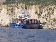
Smoldering containers removed from APL Peru

SEATTLE - Four containers that were putting off alarmingly high heat since Sunday were removed from the APL Peru Saturday.

Members of the Seattle Fire Department cut holes into the containers and sprayed water inside in order to extinguish the smoldering contents of what is believed to be clothing, shoes, and appliances. No other source of heat or smoke has been detected aboard the vessel and the remaining containers will be offloaded according to schedule.

The cause of the fire is under investigation.


RS

Wednesday, October 1, 2008

1938: The 'wind that shook the world' kills 700 here

1938: The 'wind that shook the world' kills 700 here

70 years ago: The 1938 surprise hurricane
.

New England's worst and America's 5th worst

By Walter Brooks

On this day 70 years ago, I was looking out the front window of my parent's home on Route 6 in Woodbury, Conn., as one by one the eight giant elm trees in front of our yard were blown over like twigs by the worst hurricane New England ever experienced. nd my home was 22 miles from the nearest salt water in Long Island Sound.

New England has had 24 hurricanes and 14 tropical storms since 1900, but this one was the worst.

Except for a junior forecaster in the U.S. Weather Bureau who predicted the storm but was overruled by the chief forecaster, the Weather Bureau experts and the general public never saw it coming.

Later that day, the greatest weather disaster ever to hit Long Island and New England struck in the form of a category 3 hurricane. Long Island, New York and New England were changed forever by the "Long Island Express."

Case studies have shown that the next time a storm like the Long Island Express roars through, it might be the greatest disaster in U.S. history.

Nobody saw it coming, and Hitler blew it off the front page


Cape Cod almost "got it" in the 1938 Hurricane
The hurricane of 1938 has been called, "the wind that shook the world". In 1938 the U.S. Weather Bureau wasn't what it is today . Meteorologists depended on the merchant ships and aircraft to forecast the weather. At 2:15 on Wednesday, September 21 1938 a Long Island fisherman saw what he thought was a huge fog bank, then, he realized it wasn't fog. It was a churning wall of water 50 feet high bearing down on the New England coast and thirteen million unsuspecting people, with 200 miles per hour winds. The eye of the hurricane came at 60 mph, the velocity of a tornado. It hit the Connecticut shore a little after 3p.m. and flooded downtown Providence and New Bedford.

Future Oracle reporter on the job
Barns sixty miles inland were white with salt spray the next morning. 700 died and 100,000 were homeless in an era when the population was a quarter of what it is today. Communications and roads to Cape Cod were cut off, but an enterprising young Orleans native and reporter, Mary Smith, at the Providence Journal contacted the French Cable Co. in Brest, France to find out what the conditions were in her hometown. A few years later she and her husband Ed started The Oracle newspaper.

The great New England hurricane of 1938 struck at high tide, which coincided with the highest astronomical tide of the year, pushing a storm surge of 12 to 15 feet across the south coast and up the many bays and inlets including Narragansett and Buzzards Bays. Winds of over 120 mph blew across the coastal regions. The Blue Hill observatory, in Milton MA, recorded a sustained 5-minute wind of 121 mph and a peak gust to 186 mph.

Parts of interior Connecticut and Massachusetts not only bore the brunt of high winds, but also experienced severe river flooding as rain from the hurricane combined with heavy rains earlier that week to produce rainfall totals of up to 17 inches. This resulted in some of the worst river flooding ever experienced in parts of Connecticut and Massachusetts.

This powerful storm caused 564 deaths and over 1,700 injuries. Nearly 9,000 homes and businesses were destroyed with over 15,000 damaged. The boating community was equally devastated with 2,600 boats destroyed and 3,300 damaged.


WHOI as the wave hit Cape Cod, and houses floated through the Cape Cod Canal.

Those who survived the hurricane have extraordinary stories to tell. Everett S. Allen titles one such book of vignettes "A Wind To Shake The World, The Story of the 1938 Hurricane".

The author, a Vineyarder who began his first newspaper job as waterfront reporter at the New Bedford Standard-Times on the day the hurricane hit, captures the essence of shock and despair and at times, humor and irony in the many stories from the three New England states that suffered this freak of nature. The book is available at your public library or be sure to check the Internet used-book sites for this gem of a book. In the preface he writes:

"For two years, I have forced myself -- and countless others -- to see again the sick color of sky and sea on that day, to hear the scream of the wind, which was everywhere.

"To confront anew the shocking, instant obliteration of what had always been assumed permanent and mile upon mile of man's work reduced to rubble.

"And I have forced myself and others to see man himself, face down and weaving like weed in the roiling shallows or open-mouthed and still, half-buried in the damp sand. I have made people weep by asking them to remember what for many of them remains their most terrible day."

"The Long Island Express" kills 700

September 10th, 1938 is the first day the weather disturbance was tracked as a tropical storm. The winds began to intensify to hurricane level on September 15th and within four more days, grew to a category 5 - the highest and most intense and deadly level.

One wonders if we should be thankful that on the day of landfall the storm was at category 4, and as it hit land was reducing to category 3? The death of this storm occurred on the 22nd of September after leaving in its wake close to 700 deaths from the tri-state area and beyond.

Diana Rosenberg, a well-known astrologer from New York, said that her family summer home on Long Island was destroyed and some of their documents were blown hundreds of miles north to the state of New Hampshire.

Then Germany invaded Czechoslovakia

Please note that many of our worst storms have companion events in the day-to-day world. On Sept. 21, 1938, Adolph Hitler gained his first foothold in the Sudentenland.

In addition to the extreme loss of life, the abundant stately elm trees and white church spires, the pillars of many New England communities fell and while the steeples could be replaced, the trees never returned to their original splendor.

A disease - the Dutch Elm disease - killed off the remaining elms.

The 1938 hurricane is the most intense tropical cyclone to strike the United States Atlantic coastline north of North Carolina. Along the Atlantic coast of the United States (north of Florida) - only Hurricanes Hugo (1989) and Hazel (1954) - were more intense at landfall. Every record for wind speed, tidal surge, and barometric pressure in New York, Connecticut, and Rhode Island - can be traced to this single event.

Overall, a six-state area experienced economic difficulties for many years due to the record flooding and many mill towns in New England were inundated.

When the "big one" hit Cape Cod

Paul Gately in the Bourne Courier did a bang-up report on the storm this week:

chester_park-9-22-38_242
A sailboat was tossed to the shoreline north of Chester Park in the hurricane of '38. Bourne Historical Commission.

The catastrophic Hurricane of 1938 hit Bourne on the afternoon of Sept. 21, killing seven townspeople. Selectmen in their report said the storm “tore through an unprepared community; the angry sea irritated by ceaseless winds, arose like one huge wave and approached helpless nearby villages.”

Buzzards Bay shopkeepers were forced to evacuate their businesses due to rising water, and townspeople boarded themselves up in their homes... Bourne Courier.

WEATHER NOTE

Life and death after Ike


The mixed political response to Hurricane Ike has reinforced the idea that Texans can't rely on the government for help


As with every storm, Hurricane Ike will be either a boom or bust for politicians. Some will reaffirm the trust that voters placed in them. Others will embarrass their constituents on a national stage. Some politicians shine in the spotlight. Others just crash and burn. Bill White, the mayor Houston, Texas, and Ed Emmit, a Harris County judge, have shone, going so far as to camp out and become dispatchers when relief supplies bottlenecked, leaving people waiting in line for hours for ice that was sitting in a parking lot at a sports arena.

To their south however, Lyda Ann Thomas, the mayor of Galveston, appears to be going through an emotional meltdown. On Tuesday, Thomas announced that Galveston residents would be allowed back on Galveston Island briefly. Predictably to everyone but Thomas and her city manager, thousands rushed back to the island, clogging the major highway with a 10-mile long traffic jam and burning already scarce gasoline. Thomas quickly reversed her decision, leaving thousands of her constituents parked on the highway waiting to enter, justifiably irate.

The next day she was reduced to tears during a meeting of the remnants of the Galveston city council when a council member accused Thomas of showing favouritism by allowing a selected few to return to the island and providing essential services such as tetanus shots to city employees while denying them to residents that remained on the island.

There are some things that have changed about hurricanes in recent years. Hurricane Katrina hangs over the head of every coastal area politician. Nobody wants to be the next Ray Nagin (the mayor of New Orleans), Kathleen Blanco (the former governor of Louisiana) or George Bush. Even Bush doesn't want to be Bush. He took to the airwaves last Saturday morning to send a message that he was aware that a hurricane had struck the fourth largest city in the country.

For his efforts, the Federal Emergency Management Agency (Fema) remains the whipping boy for everything that goes wrong in the aftermath of the storm. "Blame Fema" is the new post-hurricane mantra. I didn't even know Fema existed as a child. Prior to Katrina, most Americans likely didn't know what Fema did, and apparently some local officials still don't know.

Despite news reports to the contrary, most Texans aren't relying on Fema. They are relying instead on what we have always relied on in hurricane country: the FFEMA, the Family and Friends Emergency Management Agency.

Our family disaster response swung into action when I got the call from my mother at 7:00am a week ago. Jefferson County officials had ordered a mandatory evacuation of my hometown in southeast Texas. My parents and extended family hadn't bothered to unpack from their evacuation for Hurricane Gustav a little over a week earlier. My mother wanted to head west toward me, but ended up heading north.

After that initial call, as is typical, the cell phone circuits were jammed and calls could not go through. Text messages became the only reliable means of communication. My parents didn't know how to text message, however. My sister on the east coast sent me a text the following morning that, after travelling overnight, my parents and assorted extended relatives had finally reached Arlington, Texas, where they were near family.

My two sisters who live in Houston messaged that they had decided to ride the storm out. My sister in the suburbs north of Houston lost an oak tree, but they survived Ike with no major structural damage. After a day and a half without electricity however, the novelty of playing board games in the dark got old, and they messaged that they were coming to stay with me in Austin.

Like my family, most people aren't waiting around for the federal or state government. They are clearing their streets, creating their own rudimentary power grids by draping extension cords across streets and driveways to share electricity with neighbours. Family members in unaffected areas are driving into town with coolers full of ices and five-gallon gasoline canisters strapped to roofs of cars and SUVs. It was a bit disconcerting driving on I-35 watching an SUV with six full five-gallon gas canisters strapped on top. Is that safe?

People are doing what they have always done after major storms, they are adapting to the situation. Which is why I taught my 60-something-year-old mother how to text message on Sunday when I drove to check on them at their hotel in north Texas. Cell phone companies can provide GPS, internet service and picture mail, but they haven't quite figured out how to cope with all of the families and friends who clamour for contact with each other in times of disaster.

Mama figured it out in about three minutes. In her exuberance in sending and receiving messages I had to caution her that text messaging is not part of her cellular plan. Her newly discovered modern day Morse code was probably costing her $0.15 a message. She didn't appear to care. Contact with the outside world was more than worth it.

MARITIME NOTE

The New Maritime Arctic

A lecture given by
Dr Lawson Brigham

At the Institute of Marine Engineering Science & Technology (IMarEST)

8 September 2008

The Arctic Ocean is about five times the size of the Mediterranean. It has a large continental shelf, possibly the largest in the world, yet is approximately 2 miles deep at the North Pole.

Google Image Result for http___www.pelagic.co.uk_maps_arcticdests.jpg.jpg16 September 2007 marked the minimum extent of polar ice in recorded history. The North West Passage was open for 16 days in 2007. The North East Passage (also known the Northern Sea Route (‘NSR’)) was open but even then needed strengthened, ice-capable ships to navigate the ice that remained.

The last fifty years have seen a steady decrease of ice in all seasons both in extent and also in the thickness. The average depth of the pack ice from the Barents Sea to the Baring Sea is approximately 1.8 metres to 2 metres in mid-winter.

Paradoxically, there is actually more ice this year than there was in 2007 although Dr Brigham was at pains to stress that the overall trend is for less ice, both in extent and in thickness.

He also said that, for reasons that are not yet readily explained, the age of the ice is changing too. The older ice, which has had most of the salt leached out of it and is much harder to break up by ships, is disappearing and being replaced by much younger ice. This leads to an increase in the ability of ships to use the circumpolar waters.

Uses of the Arctic Region

Dr Brigham then went through the five main uses of the Arctic as follows:

Hard minerals

Zinc and coal in Alaska - The largest zinc mine in the world is in Alaska and in the ice-free periods of the year some of the largest ships in the world dock there to load zinc. In eastern Canada, in Baffin Bay, one of the largest warehouses in the world holds iron ore deposits from the very large fields in the hinterland. Again, when the ice clears, some of the largest ships in the world sail there in order to load the iron ore and there is a regular trade route between Eastern Canada and the North West region of Russia (Murmansk and Norilsk).

Nickel and Copper in North West Russia - The largest nickel mine in the world is just near Norilsk.

Marine Tourism

There is an increasing amount of tourist activity in the polar regions. There have been 77 trips by ice-breaking ships to the North Pole itself although tickets are steep at somewhere in the region of US$30,000-$40,000 for each passenger (although there seems to be no shortage of applicants).

There is a certain amount of activity in the North West Passage, too, but this is of the lighter impact variety, mainly eco-tourism.

The more worrying type of activity is the non-ice capable ships that are now beginning to cruise in Greenland waters, these being mainly vessels that can and do normally potter around the Mediterranean and the Caribbean and are simply not capable of withstanding the heavy weather and extreme conditions that can prevail in Arctic waters even in summer.

Fisheries

Especially in the Barents Sea and the Baring Sea – as stocks get over-fished in the other main fisheries of the world there are increasing signs that the large fleets are moving ever northwards.

Oil and gas

This is the big driver, especially in the Chukchi Sea and the Beaufort Sea, and there has also been a massive increase in developments in North West Russia. Dr Brigham said that the relationship between Russia and Norway over the area disputed between those two countries is going to be critical in the coming decades.

Offshore exploration by scientists

Again, although this is relatively minor compared to the oil and gas expansion, there has been a significant increase in the amount of work carried out by scientists in the Polar Region and this is only likely to expand.

Arctic activity

A major problem for the region is that most of those interested in the Arctic are non-Arctic nations.

Although some countries appear not to know how many ships they have in the Arctic at any one time, the general consensus is there are probably about 5,000 ships active in the area each year.

To get some idea of the increase in activity by non-Arctic entities, consider that in 2005 there were 53 cruises in Greenland waters, in 2006 150 and in 2007 there are estimated to be over 200. Almost all of these come from non-Arctic countries and many fly under flags of convenience.

Most traffic in the Russian area is confined to the North West of the country, between and around Norilsk, Dudinka and Murmansk. It is odd but probably not that surprising to note that traffic on the North Sea route (NSR) is down from three hundred and thirty-one thousand trips in 1984 (when Soviet power was at its height) to around about fifty-four thousand now.

In terms of trade consider that from Hamburg to Yokohama can be done in one of the following ways:

  • Northern Sea Route — 7,000 miles
  • Suez — 11,000 miles
  • Panama — 12,500 miles
  • Cape of Good Hope — 14,500 miles

The potential for significant cost and time benefits in opening up the NSR is plain. However, the corollary of that is that vessels would be much more expensive, being ice-strengthened and their speed would be generally lower than coventional ships on conventional routes as they have to go more slowly through pack icE.

Risk scenarios

Dr Brigham said that the Arctic Marine Shipping Assessment (AMSA) of which he is one of the Chairs, had engaged in some scenario planning and had come up with the following not entirely unlikely events that might happen:

  1. a collision between a tanker and a trawler in the Norway/Russia disputed region;
  2. a fire on an oil rig in the Canada/US region;
  3. a barge laden with explosives running aground near an indigenous settlement in the Canadian North;
  4. a giant ore carrier sinking at the North Pole, flying under a flag of convenience and uninsured; and
  5. a large cruise ship grounding off Greenland carrying 2,000 passengers and 900 crew.

reuters-pics-of-yr-07-mv-explorer.jpg (JPEG Image, 414x310 pixels).jpgThis last one Dr Brigham said he thought particularly realistic and worrying, and he referred to the sinking of the Antarctic cruise ship Explorer on 23 November 2007. That incident had involved no loss of life but it should be remembered that that was a smaller and more weatherly vessel than many of the ships cruising in Greenland waters, that the weather was unusually good at the time of the incident and that they had had great good luck in that a Danish vessel happened to have been nearby.

Nordnorge_with_penguins_-_reduced_for_web.jpg (JPEG Image, 336x337 pixels).jpgHe said that the probable scenario with the passengers on such a vessel was that there would be sufficient life boats to get them off but that the 900 or so crew would be left to their fate aboard life rafts of which there might not even be enough. In those waters even without submersion hypothermia begins to set in after about six to eight hours even in high Summer and so one could be looking at potentially a very large casualty rate.

He also pointed to the fact that in these waters, which are well off the normal beaten track for these sorts of cruise ships, there is no infrastructure, no support, no nearby hospitals, no easily available search and rescue facilities, the nearest salvage being five to six days away. All you needed was to have a fire, such as could break out anywhere on a cruise ship, involving say twenty to fifty people being badly burned and you might find that they would all die and more that the ship might be left stranded there subject to even worse events.

Drivers of activity

Commodities and their prices will drive the future of the Arctic at least in the short term. A USGS survey report was published in July 2008 which gives figures about the amount of oil, natural gas and minerals that are expected to be found in the Arctic as percentages of the world’s known deposits. Some of these really are rather speculative (how can one have a “100% probability” of oil being discovered in a certain place?).

There are also ecological issues and recently the power of ethnic groups and ecologically interested parties to stop and slow down the exploration/exploitation of the Arctic has been seen in Alaska where exploration has been brought to a halt by a series of law suits. A choke-point in the Baring Straits in particular could be susceptible to direct action in certain circumstances.

Another issue is that of pollution and emissions. There is some evidence, apparently, that normal emissions by ships have a much more deleterious effect in the Arctic, i.e. the very fact of operating in that particular climate makes the effect of the pollution much worse than it would do at, say, the Equator.

There are also legal wrangles over the rival claims to Exclusive Economic Zones. UNCLOS Article 76 provides that 200 miles from each country into the sea is effectively a private zone for that country. However, the US did not sign UNCLOS and the later Ilulissat Declaration – which was agreed by Canada, Denmark/Greenland, Norway, Russia and the USA – held that there was “no need for any further specific Arctic Treaty”. This, said Dr Brigham, struck him as odd and not altogether desirable.

High Technology Finland | New Materials & Processes.jpgAnother factor is the new ship technology and in particular a new breed of Finnish built ships which operate without rudders but with propulsion systems at each end, the idea being that they proceed ahead in open water but stern ahead in ice. One such vessel is already being run by the Russians in their Arctic waters and is both very fast and very efficient.


RS

Wednesday, August 13, 2008

High Arctic surveillance study hampered by strong winds

High Arctic surveillance study hampered by strong winds

Inclement weather is creating delays for Canadian defence scientists trying to test surveillance devices in the High Arctic this week.

A 10-person team with National Defence is on Devon Island, trying to install land-based sensors there and underwater listening devices stretching out into Barrow Strait, as part of its four-year Northern Watch pilot research project.

But winds gusting up to 90 km/h in the area are hampering the research team's efforts to install the devices, which requires use of a helicopter, Twin Otter airplanes and all-terrain vehicles.

"We've been successful at setting up the basic camp, but now we're on standby and waiting for better weather conditions," Roger Dao, the Northern Watch project manager with Defence Research and Development Canada, told CBC News on Thursday.

"It's been a challenge. People need to bend over because the winds are really moving, pushing them around," he added with a laugh.

The Northern Watch project is aimed at boosting Canada's ability to keep an eye on ships and submarines passing through the eastern entrance to the Northwest Passage.

Dao said his team has installed the satellite link, so they have communications from the base.

The coast guard ship Terry Fox is waiting for the weather to clear so it can help the researchers install an underwater cable out into Barrow Strait.

The team is supposed to be in the High Arctic for two weeks, but Dao said they may extend their stay and try to get more work done.

Keeping an eye for 'rogue' vessels

Grise Fiord resident and Arctic sovereignty watcher Larry Audlaluk said he's glad Canada is moving ahead with the Northern Watch project, especially given all the cruise ships and other vessels coming into the North.

"I think it's a very good idea, keeping an eye on who's coming, what foreigners are coming, and to keep an eye on any rogue ships or submarines that are not friendly, as they say, in military terms," Audlaluk said.

Still, Audlaluk added that the federal government should give northerners more information about their efforts, so residents know what's going on.

National Defence says it plans to get the Canadian Rangers involved with the project, as well as hire locals for jobs at the base camp.

Dao said the lessons they learn this summer will be useful for the next three years of the Northern Watch project.

WEATHER NOTE

Regional Hurricane Shelter Step Closer

Published: June 24, 2008

NEW PORT RICHEY - NEW PORT RICHEY - Plans are moving forward for a regional hurricane shelter and health care clinic in Hudson.

The county commission at a meeting today in New Port Richey awarded a $7.5 million contract to Spring Engineering and Bandes Construction to design and build the facility off Denton Avenue. The project is being funded with state and federal grants.

According to the terms of the agreement, the shelter must comply with the latest federal standards, to withstand winds up to 200 miles per hour and the pressures of an F5 tornado.
The Federal Emergency Management Agency has, however, exempted the facility from the more stringent rules, Assistant County Attorney Jane Fagan said, and the cost of construction may decrease in light of the exemption.

The shelter still must withstand 190 mph winds, but the exemption will allow for significant savings, county officials have said.

An additional $750,000 has been allocated to convert the shelter into a clinic for uninsured and underinsured residents.

Also Tuesday, the West Pasco Chamber of Commerce asked the board to renew its sponsorship of Business Development Week in January.

In the past, the county has been a major sponsor, contributing $15,000 to the weeklong event.
Commissioners delayed consideration of the item until next month, when they begin the arduous process of cutting some $22 million from the $1.2 billion county budget. The cuts are needed to compensate for a constitutional amendment allowing bigger property tax breaks for homeowners and to make up for reductions in state funding.

Chamber President Joe Alpine said his organization understands the county's financial constraints and hopes for some kind of contribution. This past January, more than 1,000 people participated in Business Development Week.

"We do know it's hard economic times right now," Alpine said. "No matter what the decision is, we intend to move forward with our workshops. It's very important for businesses to get good skills and experience they need to operate efficiently. Much hinges on the success of businesses."
Commissioner Jack Mariano suggested the chamber look to outside funding sources in case the county commission can't contribute.

Commission Chairman Ted Schrader asked if there were other levels of sponsorship.
Alpine said the county could contribute $7,500 and still be a leading sponsor.

Maritime Note

My good friend at Freague Waves has a excellent article on the KAZ II

Sunday, August 10, 2008
The case of Yacht Kaz II

I blogged about the case of yacht Kaz II as part of a post entitled "Peril of yachting in the South Ocean" last year. Kaz II has been branded as a ghost ship ever since she was found on April 18, 2007 while drifting with engine running but no crew on board. TimesOnline reported a week later that pthe three men crew "were most like washed overboard in a violent squall or freak wave according to police" among other possible explanations.

Well, there was a "coronial' inquiry being conducted last week and this morning the Guardian reported the coroner's ruling. First a recap of the case:

The trio, described as "typical Aussie blokes", vanished after setting sail on April 15 last year on a planned two-month trip, bound for Western Australia where they all lived. Three days later, the white-painted vessel which Mr Batten had only recently bought for £60,000 was found adrift and with a ripped sail about 100 miles north-east of Townsville, near the Whitsunday islands.

The engine was idling, a half-empty cup of coffee and a laptop computer were sitting on a table, a newspaper was lying open with some pages strewn on the floor and clothing had been piled on a bench.

The men went to sea with a large supply of food, three cases of beer, a .44 calibre rifle and 100 rounds of ammunition, the inquest was told.

Now the finding:

Coroner Michael Barnes said evidence put before him during a four day inquest led him to conclude that "an unfortunate series of events," befell the trio, who were all relatively inexperienced sailors, only a few hours after they set sail.

In the scenario he laid out, the coroner said one of the brothers attempted to free a fishing line that had become wrapped around the yacht's propeller when he fell overboard. The other brother fell in while trying to rescue him.

Mr Batten tried to drop the sails so he could turn around and go back for his two friends but a change in the wind's direction caused the yacht's boom to swing and knock him overboard.

"Once the three men were in the water there was very little chance they could get back on the boat," he said. "It would be beyond their reach in seconds. From that point, the end would have been swift.

"None of them was a good swimmer, the seas were choppy, they would have quickly become exhausted and sunk beneath the waves. Although I can't exclude the possibility of a shark attacking them, drowning is a far more likely cause of death."

which is a very plausible scenario. I am impressed. I guess an important piece of evidence which might not have made public before was shown to the court, in which the skipper, Des Batten, was holding the camera and

Jim Tunstead can be seen fishing while he and Mr Batten are heard mocking Peter Tunstead, a non-swimmer, who was sitting fishing at the back with the safety rail down. He was not wearing a lifejacket. In the film, the men talk about "threatening skies" ahead.

That seems to be a logical scene that led to the scenario the coroner concluded. They were not good swimmers and they did not bother to wear their lifejacket should also be an important lesson for everyone to learn here.
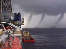
The seas were choppy, we can not preclude the possible occurrence of a freaque wave. But whether or not a freaque wave occurred, it will not alter in any way the scenario the coroner so brilliantly laid out.

They still have not been able to find their bodies. But at least their yacht, the Kaz II, is no longer a ghost boat.

RS