Wednesday, September 26, 2007

New technology helps Coast Guard pin point emergency signals


Office of Public Affairs
U.S. Coast Guard First District

BOSTON - Recent radio upgrades on a falcon jet at Air Station Cape Cod Mass., enable crews to rapidly locate the exact source of emergency signals, as seen during a recent search.

(Coast Guard Petty Officer 1st Class Michael O'Neal inspects the new 430 Direction Finding system aboard a Falcon jet at Air Station Cape Cod here Friday, Sept. 21, 2007. The new technology enables crews to rapidly locate the exact sources of emergency signals. U.S. Coast Guard photo.)

The HU-25 falcon jet equipped with the new gear launched Sept. 7 after the air station was notified of an Emergency Position Indicating Radio Beacon (EPIRB) emitting a distress signal from a boat near Jonesport, Maine. Coast Guard aircraft respond to EPIRB distress signals by following instrument guidance towards the radio beacon provided by direction finding equipment.

During the air station's first operational test of the new 430 Direction Finding (DF) system, the aircraft locked onto the EPIRB's signal from 72 miles away and obtained its location.

A 25-foot response boat from Station Jonesport determined that the boat was safely moored and the EPIRB was sending a false alarm.

"This new system saves us valuable response time, allowing us to receive more accurate guidance and acquire weaker signals," said Lt. j.g. Adam Young, a pilot at Air Station Cape Cod.

The HU-25 Falcon jet is one of only three aircraft in the Coast Guard with the new 430 DF system.

There are two types of EPIRB's, the original model that supplies only azimuth guidance and a newer device, a 406 EPIRB, that is registered to a specific user and can provide coordinates for the activated device's position.

When a boater's 406 EPIRB emits a distress signal, the beacon's position is transmitted via satellite to the U.S. Mission Control Center in Maryland where it is then passed to the appropriate rescue coordination center. The rescue coordination center in turn passes the position to the aircraft.

"The notification process usually only takes a few minutes, but those few minutes can be vital when factors such as cold water or injuries come into play," said Lt. Michael Nalli, a search and rescue coordinator at the First Coast Guard District.

With the new system, the Falcon not only obtains real-time data for a quicker response, it also obtains a more exact location.

The position the EPIRB passes to the satellite may be off by as much as three miles. But when the Falcon picks up the EPIRB's signal, it can usually pin-point the location.

"Mariners' widespread use of the 406 EPIRB has significantly reduced search time and unnecessary asset use," said Young. "Now if all mariners use a 406 EPIRB with the capabilities of the 430 DF system, we have the potential to take the search out of search and rescue."

Weather Story

Tropical Storm Karen and Jerry

MIAMI (AP) — Tropical Storm Karen strengthened from the twelfth tropical depression of the season early Tuesday in the open Atlantic Ocean but posed no immediate threat to land.

[full basin map of tropical cyclone activity] Tropical Storm Karen is about 1,355 miles east of the Windward Islands, and the 13th tropical depression of the hurricane season is about 165 miles east of Tampico, Mexico, the National Hurricane Center reported late Tuesday.

An area of cloudiness and a few thunderstorms is associated with a broad area of low pressure near the Virgin Islands in the Lesser Antilles, but the system is poorly organized and unlikely to develop, the NHC reported.

Another area of disturbed weather over South Florida, western Cuba and the western Bahamas is associated with a mid- to upper-level trough that could bring heavy rains to South Florida and the Florida Keys in the next several days, the NHC reported.

Additional information to expand on the West African flooding. . .

"Following torrential rains recorded in West Africa, floods have affected over 500,000 people in 12 countries: in Ghana (+270,000), Nigeria (50,000), Burkina Faso (+40,600), Togo (+100,000), Mali (25145), The Gambia (298), Niger (16,700), Senegal (3100), Côte d’Ivoire (2000), Liberia (17,000), Mauritania (30,000) and Sierra Leone (4500). Floods have caused the destruction of houses, food stocks, goods, farms and polluted most of the water sources (wells and canals). This has resulted in the displacement of thousands of people."

Maritime Notes

Long Beach – counter-terrorism exercise

The US Coast Guard issued a press release stating that members of the Los Angeles-Long Beach Area Maritime Security Committee will conduct a command post counter-terrorism exercise in Long Beach on September 27. (9/24/07).


RS


Tuesday, September 25, 2007

SURVIVAL AND TRAGEDY - ‘Fatal Forecast’

SURVIVAL AND TRAGEDY - ‘Fatal Forecast’ retells Georges Bank storm of 1980

By JODY FEINBERG
The Patriot Ledger

Twenty-seven years have passed since Plymouth lobsterman Gary Brown and three others died in a hurricane-force storm on the fishing grounds of Georges Bank. A fifth fisherman miraculously survived by hanging on to an inflatable raft for more than 50 hours.

The disaster and good fortune from that unforeseen November storm are dramatically told for the first time in the book ‘‘Fatal Forecast,’’ by Michael Tougias of Norfolk. Decades later, it’s both a riveting survival story and a cautionary tale.

‘‘I think it will go down as one of the top survival accomplishments ever recorded,’’ said Tougias, who was researching Coast Guard casualty reports for an earlier nautical thriller when he became fascinated with the survival of lobster man Ernie Hazzard of the Fair Wind.

A genuine page turner, ‘‘Fatal Forecast’’ vividly recreates the storm, the struggle and the survival. To convey what crew members and rescuers saw, thought and felt, Tougias extensively interviewed them. The book’s 14 photographs also bring alive the reality. One of the most incredible shows a small launch craft from a Coast Guard cutter heading toward Hazzard’s tiny life boat. Another shows the Coast Guard crew moving a blanket-covered Hazzard onto the boat.

‘‘It is both a miracle and a tribute to Ernie’s fortitude and decision making,’’ said Tougias, who has written 17 books and gives motivational presentations, including one inspired by Hazzard, titled ‘‘Survival Lessons.’’

‘‘I think his mind set and the techniques he used can help any of us who face difficult odds,’’ Tougias said.

As a former Marine, long-distance cyclist and mechanic, Hazzard drew upon all that he had learned from these experiences: Focus on the present, make the most of available resources, endure pain and discomfort, and accept loneliness.

When a monster 100-foot wave capsized the 50-foot Fair Wind and trapped the four-man crew inside, Hazzard, 33, survived by a mixture of luck and canniness. Seeing an exit, he dove underwater and through an opening into the sea, a risky move that would have been impossible if he’d been wearing a survival suit. His second bit of luck was finding a plastic bucket to cling to and then reaching an inflatable raft attached to the overturned boat. In the next two days as waves battered and toppled the raft, he survived by sheer mental determination, strength and practical know-how.

Like Hazzard, 30-year-old lobster man Gary Brown of Plymouth ended up in the ocean, when a giant wave blew out a side of the pilot house of the vessel, Sea Star. But Brown had no lifeboat to cling to and slipped away as his fellow crew threw him lifelines.

A memorial stone to Brown overlooks the ocean in front of the Lobster Pound on Manomet Point Road in Plymouth. Erected by his widow Honour Brown (who chose not to be interviewed for the book, but still lives in Plymouth with her second husband and children), the monument has a plaque inscribed with lines from the poem ‘‘Sea Fever’’ by John Masefield.

In the epilogue, Gary Brown is remembered by his captain Peter Brown (no relation). Brown also is the son of Bob Brown, owner of the Andrea Gail, whose tragic fate was the subject of ‘‘The Perfect Storm’’ by Sebastian Junger.

‘‘I never want to see a friend or crew member on my boat lost because of a bad forecast,’’ Brown reflected. ‘‘Gary Brown was a good man.’’

To Tougias, Hazzard also spoke about the long-term effects of the trauma on his life.

‘‘I don’t let little stuff get to me. And when bigger problems come along, I figure I’ll solve them somehow,’’ Hazzard said. ‘‘Although I don’t always make the best of these extra years, I am surely thankful for each and every day.’’

The cautionary story stems from the fact that the outcome might have been different if the fisherman had known about a broken wind sensor on the sole weather buoy on Georges Bank. Unaware of rising winds, they were surprised by hurricane speeds that brewed 60 foot waves, which grew to 90 to 100 feet.

A meteorologist in the Boston office of The National Weather Service had warned the National Oceanic and Atmospheric Administration (NOAA) of the danger of the broken sensor. Facing budget constraints, NOAA decided to put off repairs since a more sophisticated wind sensor was expected to be installed in January, Tougias wrote.

Whether the outcome would have been different even if the wind sensor had been working is something meteorologists debate, since the storm blew in so fast they called it ‘‘a bomb,’’ Tougias said.

‘‘I believe they were wrong not to alert listeners that their forecast did not have the benefit of the usual data from the weather buoy,’’ Tougias said. ‘‘But even if the wind sensor was working, it may have only reported what was actually happening at Georges Bank when the storm hit, and that would have been too late for the boats to turn back.’’

After the families learned about the buoy, Gary Brown’s wife, who was pregnant at the time of his death, and several other families sued and won $1.2 million in damages, the first time the National Weather Service was held responsible for an inaccurate forecast. However, the U.S. First Circuit Court of Appeals reversed the judgment in 1986, asserting that the government was protected from liability because weather forecasting is a ‘‘discretionary function.’’

‘‘I thought the judgment for the plaintiffs was the correct decision, and I did not agree with the appeals court over-turning it,’’ Tougias said. ‘‘However, the National Weather Service did make one important change as a result of the case, and that was in the future it would tell mariners when a weather buoy was not working.’’

Tougias will give a slide presentation on ‘‘Fatal Forecast’’ at 7:30 p.m. Nov. 12 at the Mansfield Historical Society, at 7 p.m. Nov. 15 at the Norwood Public Library and at 7 p.m. Dec. 6 at the Hull Lifesaving Museum. Admission is free. For more information, go to michaeltougias.com.

Copyright 2007 The Patriot Ledger
Transmitted Monday, September 24, 2007

Maritime Notes:

2008 Ocean Sciences Meeting

From the Watershed to the Global Ocean

2008 Ocean Sciences Meeting · 2-7 March 2-7 2008 · Orlando, Florida, USA

Co-sponsored by the American Society of Limnology and Oceanography, the American Geophysical Union, The Oceanography Society and the Estuarine Research Federation.

Key Dates

Submittal Deadline
2 October 2007

Author Notification
December 2007

Schedule Posted
January 2008

Registration Fees
Early: 1 February 2008
Regular: 1 March 2008
On-site: after 1 March 2008

Abstract Submittal Now Open

The abstract submission deadline is midnight (23:59 US, CDT) on Tuesday, 2 October 2007. In order for scheduling to be completed in a timely manner, all Internet and mailed submissions must be received by this date. An abstract submission fee of $50.00 USD is required for each submission, along with a full paid registration. This fee is non-refundable should it later be determined you are not able to attend and make your presentation. However, registration fees are refundable under the registration guidelines. Only one paper per first author will be accepted. Poster presentations are strongly encouraged and will play an important role in this meeting.

Be sure to read the abstract guidelines and registration policies before submitting.

Please click here to proceed to registration and abstract submittal.

Weather Disaster Reports - Africa

Floods in West Africa Minimize

Floods affect more than 500,000 people in West Africa

Following torrential rains recorded in West Africa, floods have affected over 500,000 people in 12 countries: in Ghana (+270,000), Nigeria (50,000), Burkina Faso (+40,600), Togo (+100,000), Mali (25145), The Gambia (298), Niger (16,700), Senegal (3100), Côte d’Ivoire (2000), Liberia (17,000), Mauritania (30,000) and Sierra Leone (4500). Floods have caused the destruction of houses, food stocks, goods, farms and polluted most of the water sources (wells and canals). This has resulted in the displacement of thousands of people.

Displaced populations are living either with host families or in public infrastructures such as schools and in IDPs camps . The school year scheduled to being in September in some of these countries may be delayed due to the occupation of schools by the displaced. In this lean season period, households already face problems to feed their own members and having to host victims of the floods may aggravate further their already precarious food security situation.

Access to affected population remains constrained by the poor condition of some roads (in Mauritania, Burkina Faso, Niger) and insecurity notably in Iferouane, northern Niger. The situation in Iferouane is of particular concern as humanitarian organisations continue to struggle to respond to the needs of some 500 persons affected by floods and food insecurity. In addition, reports of new landmines being laid around the city are also hindering humanitarian interventions. On 20 August landmines caused the death of four gendarmes in the region. In this regard there is an urgent need for relevant safety measures to be ensured by state and non-state actors to enable the safe provision of humanitarian assistance.

Health authorities and humanitarian actors remain concerned about the possible outbreak of waterborne diseases like cholera and the recrudescence of malaria cases.

These floods coincide with the most critical time of the year, the lean season when West African families mostly in the Sahel region face food insecurity. The destruction of crop and food stocks has aggravated the vulnerability of poor families and needs to be addressed promptly through emergency and recovery interventions.

Potable water is of concern because of the pollution of water sources and the existence of destroyed latrines that are considered to be the vector of possible epidemics.

20061054w.jpg


Floods in Ghana Minimize

Flooding in the Upper East Region, Upper West Region and Northern Region of Ghana has killed at least six people and affected over 276,000, according to the Government. They destroyed thousands of homes after torrential rains from 24 to 29 August. The flooding has also caused major bridges to collapse, and destroyed crops. Response-Government officials have visited the region to assess the damage and announced they would deliver initial relief supplies to affected populations. Regional authorities had appealed to the government, charitable organizations, religious bodies and NGOs for assistance. The United Nations are considering the deployment of an UNDAC team to Ghana.

Please find below some resources relative to the situation:

Ghana floods - Situation report n°2 - As of 17 September 07

Map of flood in Ghana - As of 18 September 07

Ghana - Humanitarian Contact list

Latest sitrep (12 September 07) in floods West Africa

Reference map of Ghana (UNCS)

Latest Map on floods in West Africa - As of 18 Sept. 07


Situation reports Minimize


Resource mobilisation Minimize


Maps Minimize

In this section you will find a range of maps that present information related to flood in West Africa.

Burkina Faso - Map of floods - As of 21 Sept. 07
Source : IRIN, Red Cross, IFRC
Date : 09 August 2007
Map made by: OCHA Dakar

West Africa- Map of floods in West Africa - As of 18 Sept. 07
Source : IRIN, Red Cross, IFRC
Date : 09 August 2007
Map made by: OCHA Dakar

West Africa- Map of floods in West Africa - As of 11 Sept. 07
Source : IRIN, Red Cross, IFRC
Date : 09 August 2007
Map made by: OCHA Dakar

West Africa- Map of floods in West Africa - As of 30 Aug. 07
Source : IRIN, Red Cross, IFRC
Date : 09 August 2007
Map made by: OCHA Dakar

West Africa- Map of floods in West Africa - As of 23 Aug. 07
Source : IRIN, Red Cross, IFRC
Date : 09 August 2007
Map made by: OCHA Dakar


WA_floods_23Aug_07.jpg


West Africa- Map of floods in West Africa - As of 22 Aug. 07
Source : IRIN, Red Cross, IFRC
Date : 09 August 2007
Map made by: OCHA Dakar


WA_floods_22Aug_07_thmb.jpg


Niger - Map of floods Niger - As of 22 Aug. 07
Source : OCHA Niger
Date : 09 August 2007
Map made by: OCHA Dakar


NER_floods_22Aug_07_thmb.jpg


West Africa- Map of floods in West Africa - As of 16 Aug. 07
Source : IRIN, Red Cross, IFRC
Date : 09 August 2007
Map made by: OCHA Dakar


WA_floods_17Aug_07_thmb.jpg

West Africa- Map of floods in West Africa - As of 8 Aug. 07
Source : IRIN, Red Cross, IFRC
Date : 09 August 2007
Map made by: OCHA Dakar

WA_floods_Aug_07.jpg
Mali - Carte de situation des inondations - A la date du 31 juillet 2007
Source : OCHA, MSF, Government
Date : April 2007
Map made by: OCHA Dakar

MALI_FloodsMap_August07.jpg
Map - Floods in Nigeria - As of 08 August 07
Source : IRIN, Red Cross
Date : April 2007
Map made by: OCHA Dakar

MAP_NGR_floods_Aug_07.jpg


Resources & Links Minimize


This website was developed with the assistance of Thematic Funding from the Humanitarian Aid Department of the European Commission in 2004 and 2005


RS

Monday, September 24, 2007

Ballard Live!

We talked about the Jason Project and what it offers school systems. Now here is an example from a school in Smithfield Rhode Island.

From the Providence Journal:

(Pix Left - Dr. Robert Ballard, live on the screen from the Mystic Aquarium, at upper right, speaks to teachers from around the state during a conference yesterday at Smithfield High School. Technical coordinator Michael Deslauriers is in the foreground.)

A group of science teachers and administrators from 10 public school districts in northern Rhode Island received a glimpse into the future of science education in Rhode Island and, perhaps, the nation yesterday.

Robert Ballard, discoverer of the Titanic and Bismarck wrecks, teleconferenced with the group, seated in the Smithfield High School library, from his office at the Institute for Marine Exploration at Mystic Aquarium, in Connecticut.

University of Rhode Island scientists under his supervision are excavating a sunken ship from the Byzantine era (about 1,500 years old) at the bottom of the Black Sea, near the Turkish shoreline, he explained.

Another television screen showed a live action feed from the Alliance, a NATO research vessel where the team is based.

“We’ll be getting into the stern of the ship in a day or so, where we hope we’ll see a greater diversity of artifacts, possibly even bodies,” Ballard told the rapt audience. Any human remains found in the oxygen-less waters at the bottom of the Black Sea are “likely to be perfectly preserved,” he said.

Smithfield High is the first high school in the world to be connected to the Inner Space Center at the University of Rhode Island, a place where university researchers monitor, track and share information about oceanography and archaeology in real time.

Half a year ago, Ballard, who created Inner Space, partnered with the Smithfield School Department to develop a control center that would enable students to interact directly with scientists engaged in ocean exploration anywhere on the planet, much as university-level researchers do.

The goal is to bring the technology into every science classroom in every school in the state.

“As the Ocean State, we have the opportunity to develop a unique curriculum, where we teach what we normally teach, and put an ocean take on it,” said Ballard. “This is an opportunity to be the tip of the spear.”

Considering yesterday’s setting was a public high school library, and not, say, a command center for NASA, the setup was impressive.

Three black, plasma televisions arrayed on a wall. Two high resolution computer monitors cycling a series of graphs, charts, and tables on a table below them. Behind hummed a massive black crate concealing a handful of networked computers, the brains of the operation.

Bridget Buxton, the project archeologist and an assistant professor at URI, explained from the Alliance live feed that the ship had been damaged in rough seas recently, and so a submersible could not be sent underwater to give the audience a glimpse of the wreckage.

Ballard, seated before a console identical to the one in the library, took questions from teachers, much as Smithfield students did in March, when his team was studying the Flower Garden Banks National Marine Sanctuary in the Gulf of Mexico.

This coming school year, Smithfield students will talk with Ballard’s team as they monitor changes in wildlife in Monterey Bay, Calif., another nationally designated underwater sanctuary.

Lauren Woods, an oceanography teacher at Woonsocket High School, liked that the program would allow students to interact regularly with scientists over the course of a year. She said her district has been incorporating video conferences in their curriculum for many years, but those opportunities are too few.

“It’s hard for kids to come up with questions on demand. This way, they can develop a relationship with the scientists so that there wouldn’t be any barrier to asking questions,” she said.

But the hardware that makes the innovative program work isn’t cheap.

Smithfield Supt. Robert O’Brien said the department would not have been able to afford the equipment, which included access to Internet2, the high speed network used by universities, had it not been on loan from URI.

“Cost is going to be the biggest hurdle,” observed Edward Saravo, a biology teacher at Johnston High School.

O’Brien said a more efficient system is in the works that will make the system more lightweight and portable. The school is also testing a larger version of the system in its 840-seat auditorium, where the entire high school can gather, if and when Ballard’s team makes a major discovery.

“It will become very affordable as the technology develops,” O’Brien said. “We’re at the very beginning of the future.”

Weather Story

Substropical Storm Jerry


http://www.ssd.noaa.gov/goes/flt/t1/avn.jpg

Subtropical storm Jerry, located far away from Florida in the north central Atlanta, is the 10th named storm of the 2007 hurricane season.

The National Hurricane Center announced Sunday morning that subtropical depression 11 had formed in the north central Atlantic. Before noon, the system had strengthened into a named storm. The NHC said the storm could acquire tropical characteristics later on Sunday.

Jerry poses no threat to the US mainland.

Maritime Notes

We talk about how severe weather like TS Jerry generates waves that effect ships at sea. Below is a video of ships listing and or taking large waves.


RS

Friday, September 21, 2007

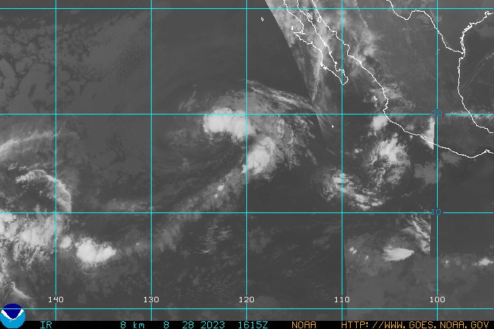
Update On Hurricane IVO and TD #10

Hurricane Ivo Continues Its Northward Trek

Hurricane Ivo, which at 11 a.m. EDT on Friday, Sept. 21 was a Category One storm with maximum sustained winds of 65 knots (75 miles per hour), continues to move north toward Baja, Calif., in this infrared image from the Atmospheric Infrared Sounder instrument on NASA's Aqua satellite. Ivo is expected to weaken to a tropical storm later today and make landfall in Baja, Calif., as a tropical storm some time on Monday, Sept. 24. The image, acquired at 5 a.m. EDT Sept. 21, shows large areas of strong convection surrounding the core of the storm (in purple).

Image credit: NASA/JPL

+ Larger view


Tropical Depression Ten Forms in the Gulf of Mexico

Tropical Depression Ten


Tropical Depression Ten, expected to become Tropical Storm Jerry later today, formed in the northeastern Gulf of Mexico south of the Florida Panhandle on Friday, Sept. 21, and is expected to make landfall somewhere in the U.S. Gulf Coast on Sept. 22. This infrared image from the Atmospheric Infrared Sounder instrument on NASA's Aqua satellite was acquired at 3:17 a.m. EDT Sept. 21, while the system was still subtropical. At 2 p.m. EDT Sept. 21, Tropical Depression Ten had maximum sustained winds near 30 knots (35 miles per hour), and was moving toward the northwest near 18 kilometers per hour (11 miles per hour). The AIRS image shows the temperature of the cloud tops or the surface of the Earth in cloud-free regions. The lowest temperatures (in purple) are associated with high, cold cloud tops that make up the top of the storm. The infrared signal does not penetrate through clouds. Where there are no clouds the AIRS instrument reads the infrared signal from the surface of the Earth, revealing warmer temperatures (red).

Image credit: NASA/JPL

+ Larger view (575Kb)

Keep Posted...

RS

The Jason Project - Operation Monster Storms! + Hurricane IVO!

The Jason Project was founded by famed Oceanographer Dr. Robert Ballard. This organization is one of two that Ballard founded. The other is Immersion Presents. I cannot say enough about either of these programs. Both are interactive programs that beam ocean and underwater explorations directly to the classroom. Both are just amazing! Ballard also founded the Institute for Exploration, which specializes in deep-sea archaeology and deep-sea geology. It joined forces in 1999 with the Mystic Aquarium located in Mystic, Connecticut. They are a part of the non-profit Sea Research Foundation, Inc. The JASON Project, named for the mythological Greek explorer has connected more than 10 million students and teachers with real scientific exploration and discovery.

Today I am going to focus on a new Jason Project. There is some very exciting weather related news from Jason. The organization has released Monster Storms.
From the webiste: "Operation: Monster Storms transports classrooms to the center of Earth’s most extreme weather events. Fly into the eye of a hurricane or chase tornadoes through Tornado Alley. Learn how powerful storms form and how cutting-edge technology is used to better understand and forecast weather. Developed in partnership with NOAA, NASA, and the National Geographic Society, Operation: Monster Storms examines current research to improve forecasting, allowing communities to better prepare for storms and avoid their destructive potential. From collecting data on the ground to using instruments in the sky and analyzing satellite images from space, students join leading weather scientists as they explore wild weather while learning key National Science Education Standards (NSES)."

Operation: Monster Storms transports classrooms to the center of Earth’s most extreme weather events. Fly into the eye of a hurricane or chase tornados through Tornado Alley. Learn how powerful storms form and how cutting-edge technology is used to better understand and forecast weather. Developed in partnership with NOAA, NASA, and the National Geographic Society, Operation: Monster Storms examines current research to improve forecasting, allowing communities to better prepare for storms and avoid their destructive potential.

From collecting data on the ground to using instruments in the sky and analyzing satellite images from space, students join leading weather scientists as they explore wild weather while learning key National Science Education Standards (NSES).

Please visit the Jason Project Website for further details. I highly recommend this program to all school systems.

Weather Story
From
FEMA

Eastern Pacific:
Hurricane IVO

Hurricane Ivo is located about 470 miles south-southwest of Cabo San Lucas, Mexico Ivo is moving toward the north-northwest at 6 mph with an estimated minimum central pressure 987 MB (29.15 inches). Maximum sustained winds are 75 mph with gusts to 92 mph. The forward motion has slowed as Ivo makes its way around the western periphery of the subtropical ridge. A slow northward motion is anticipated for the next 36 hours or so. The hurricane is currently in a favorable environment for additional strengthening with warm waters and relatively weak shear.

latest goes west infra red hurricane image


RS


Thursday, September 20, 2007

How is Local Search Like Storm Tracking?

News from the National Weather Service that is sure to get (geo)data-wonks excited…

From the National Oceanographic & Atmospheric Adminstration (parent agency of NWS), the current means of tracking severe weather events is done in the following manner:

…The NWS currently issues and disseminates warnings for tornado, severe thunderstorm, flood and marine hazards using geopolitical boundaries.

As of 1 October 2007, this system will change to something new:

Storm-Based Warnings (threat-based polygon warnings), are essential to effectively warn for severe weather. Storm-Based Warnings show the specific meteorological or hydrological threat area and are not restricted to geopolitical boundaries. By focusing on the true threat area, warning polygons will improve NWS warning accuracy and quality…

You may want to ask Umibot “what’s the big deal?” Some graphics from the Storm-Based Warnings (NB: press release to follow on 10/01/07) illustrate this:

as-is to-be

On the left, the county is used as the unit of measure–this means if a predicted storm path touches a county boundary, the entire county will receive an alert. This is especially cumbersome in some Western states, where counties can be extremely large. Deploying emergency resources (first responders, food, supplies, etc…) and alarming the public when not necessary could prove and expensive proposition.

The image on the right highlights the new approach: “threat-based polygons” might sound menacing, they are no different from what the NWS currently uses with a key exception: the granularity has changed such that the unit of measure is now the municipal boundary.

From UMI’s perspective, what is interesting to note is that NOAA prediction accuracy did not drive the Storm-Based Warnings program–there are meteorological (and related) advances that help officials understand patterns of severe weather, and that is independent from presenting those data. Because prediction science has become more accurate, a smaller unit of measure (ie, municpal area) can be used. From this perspective one could say predictions were ‘hiding’ behind the larger unit of measure (ie, county).

Umibot likes these kinds of stories because they play directly into his (or her?) sweet spot–the design of data. And this was the focus of a talk Ian gave last year on the very subject.

The analogy for local search is clear–data should drive the use case of an application. If one is going to offer an application that allows for (say) mobile search, will a user have the granularity that is needed to have a meaningful experience? An example here is “restaurants in San Francisco”–mobile means you are, well, mobile, on the go, and a city is (probably) not a meaningful geo-constraint. Something more granular, like a 2 mile radius (if the device is location-aware), cross street, or neighborhood will likely be more satisfying.

Maritime Notes:

DHS OIG – targeting oceangoing cargo containers

The Department of Homeland Security (DHS) Office of the Inspector General (OIG) issued an unclassified summary of its investigation into targeting of oceangoing cargo containers by the US Customs and Border Protection (CBP). Although it identified improvements since its earlier investigation, the OIG found that CBP is not consistently monitoring entry data for all shipments, resulting in some high-risk containers being allowed to leave ports without mandatory examinations. Furthermore, flaws in the Cargo Enforcement Reporting and Tracking System may result in improper container releases and CBP still has not automated its integration of examination findings into ATS. Finally, some ports need to improve their controls over high-security bolt seals. OIG-07-72 (9/18/07).

Hearing re new radiation detection monitors

The Subcommittee on Oversight and Investigations of the House Committee on Energy & Commerce conducted a hearing on the Status of the Federal Government’s Assessment of New Radiation Detection Monitors. These devices, known as advanced spectroscopic portal (ASP) monitors, are intended to reduce the frequency of false positive reports by differentiating between harmless and harmful radiation sources and to make it more difficult for terrorists to mask radiation signatures. The Government Accountability Office (GAO) submitted testimony showing that the agency used biased test methods, allowing ASP contractors to conduct preliminary runs so that the monitors could be adjusted for specific test material. The GAO also submitted a Timeline of the ASP program and a Briefing regarding its concerns about going forward with this procurement. Mr. Paul A. Schneider, DHS Undersecretary for Management, testified that additional independent tests of the ASP monitors have been ordered. Mr. Vayl S. Oxford, Director, Domestic Nuclear Detection Office (DNDO), stated that his agency is committed to rigorously testing and evaluating emerging technologies. Mr. David Huizenga, Department of Energy, stated that additional analysis and field testing will be conducted before large-scale acquisition of ASP monitors begins. Why does one get the impression that DNDO got caught with its hand in the cookie jar? (9/18/07).

From Cargolaw

Jack-up rig barge Lisa A, being used to work on a wind farm development between Scotland and England, was evacuated amidst fears it would overturn in gale force winds on the night of 16 Sept. During the operation, two of the vessel's legs bent, causing it to list over 30 degrees. Coast Guard teams and helicopters from both sides of the Solway Firth took part in the rescue. From our Correspondent A. L. Griffiths (Tues. Sept. 18 2007)

RS


Posted in ,

Tuesday, September 18, 2007

NATO assets used in survey of sunken Russian submarine

ROVs are not just used in commercial applications. As we will learn in the article below they are used in military applications.

NATO
assets used in survey of sunken Russian submarine

20 July 2007 – NATO Research Vessel ALLIANCE was recently engaged in a task to survey the wreck of a sunken nuclear submarine, 21 June to 7 July. This was part of an international effort led by the UK Ministry of Defence’s (MOD) Defence Equipment and Support Salvage and Marine Operations Team (SALMO) at the specific request of the Russian Federation (RF). The UK MOD requested the use of NRV ALLIANCE, managed by NURC, a NATO research centre in Italy, due to the unique capabilities of the ship to perform oceanographic research and surveying. NRV ALLIANCE was used, in this operation, as the host ship for the NATO Submarine Rescue System (NSRS) Intervention Remotely Operated Vehicle (IROV), owned jointly by the UK, France and Norway.

The decommissioned Russian submarine, B-159, was being towed to a breakers yard in 2003 when it broke loose and sank in rough weather in the Barents Sea at the entrance of the Murmansk River, resulting in the loss of nine Russian sailors. Two nuclear reactors were onboard the submarine when it sank, although the reactors were shut down and in a safe state. This survey was the first stage of a recovery effort and was carried out through the Arctic Military Environment Co-operation (AMEC), with the UK and Russia as active members and Norway and the US as observing members.

Upon arrival at the wreck site under the escort of a RF naval vessel, the survey team was officially welcomed by Vice Admiral Maksimov, Deputy Commander in Chief of the Northern Fleet. The location and position of the submarine was quickly found using sensors on NRV ALLIANCE. Environmental sampling was conducted by sonar surveyors from St. Andrews University, while the IROV removed debris from the vicinity of the wreck. This was the IROV’s first operational deployment, and the vehicle stood up to the challenge. With the IROV pilots working 24/7 over the wreck site, a considerable amount of seabed work was completed. Radiation monitoring indicated no radiation hazard from the submarine.

A highlight of the operation was the recovery of a small Russian ROV that had become entangled in the wreck a few years ago, as well as the RF naval flag that had been flying on the B159 when she sank. The ROV was returned to the surface and presented back to Admiral Maksimov, along with the flag.

The operation was a great success, meeting all its objectives: SALMO was particularly pleased with the performance and capability of NRV ALLIANCE. In addition, it was noteworthy to see the NATO flag flying alongside that of the Russian Federation, with international teams working collaboratively on such a worthwhile project. Prior to its departure from the area of operations, NRV ALLIANCE participated in a wreath laying ceremony with the RF Navy Destroyer ADMIRAL LEVCHENKO.

Credits: Photos courtesy of the UK MOD

Weather Story

tornado.jpg

Saturday (September 15, 2007) evening at approximately 7:00 p.m. a weather cell confirmed to be a tornado ripped through the Palo Verde, California region and heavy damage occurred. It is anticipated that the total damage will exceed $10,000,000.00. Palo Verde, California is located at the northeast corner of Imperial County, just within the county limit that is shared with Riverside County.

The initial site survey reports conducted by the Imperial County Planning Department estimated that 80% of the community’s structures incurred major damage. 13 Condemnation notices have already been posted and it is estimated that 30% of the structures will be condemned once the damage assessment surveys are completed. The water has been deemed safe to drink, and shelters have been established at the Colorado Fairgrounds in Palo Verde. It is estimated that power will not be fully restored for a few days. Responders to the scene included but were not limited to; Imperial County Sheriff Ray Lorea, Imperial County Supervisor Wally Leimgruber, ICFD Battalion Chief Tony Rohoutas, Fire Chief Bill Zimmerman, Imperial Valley Red Cross Volunteers Ramon Barron & Roland Pritchard.

Imperial County CEO Roberta Burns has been working with the Governors Office to have this emergency classified a State Disaster. Imperial County Supervisor Joe Maruca signed the Imperial County Disaster Proclamation at 3:45pm today. This weather cell also downed eight Power Lines in the City of Calexico and two in Holtville, power was restored this afternoon to all of Calexico and Holtville. Note: Palo Verde has a population of 279 people with 225 Residential structures mostly mobile homes.

Damage level: Heavy

Update Typhoon NARI

SOUTH KOREA: Typhoon kills at least one, strands 15,000 in South Korea

A powerful typhoon killed at least one person in South Korea on Sunday, grounded 280 flights and stranded 15,000 passengers on its southern resort island of Jeju, officials said. The anti-disaster agency reported one dead and two missing on Jeju. South Korea's Yonhap news agency put the total typhoon death toll at six -- on Jeju and elsewhere.The agency said Typhoon Nari, expected to hit the mainland late Sunday, moved faster than the country's weather office had expected, flooding scores of houses and leaving more than 100 people homeless. The powerful storm also cut power to some 150,000 homes on Jeju and parts of southwestern South Jolla province for hours.

RS