Monday, September 1, 2008

Gustav whipped up by deep waters of the Loop - and more hurricanes on the way

Gustav whipped up by deep waters of the Loop - and more hurricanes on the way

Hurricane Gustav is a monster that seemed to explode into life from a tropical storm on Friday afternoon to a Category 3 hurricane with winds of 230km/h (125 mph) on Saturday morning. Everything has been perfect for its growth, especially the sea temperature.

The Gulf of Mexico is a notorious breeding ground for tropical storms that feed on a dangerous current of deep, warm water called the Loop.

This sweeps up between the Yucatan Peninsula and Cuba, before looping past the tip of Florida, spinning off eddies of warm water. In 2005, Hurricanes Katrina and Rita became mega-storms as they rode over the Loop, and these waters have been responsible for almost all the worst hurricanes in recent years.

The warm water is like rocket fuel for a hurricane, injecting huge amounts of energy that drive the storm into a fury. As the warm, wet air is sucked into the storm it cools and condenses into huge thunderclouds, unleashing a phenomenal amount of energy that powers the hurricane — an average-sized hurricane has the energy of some 10,000 nuclear warheads.

To make this bomb go off, the hurricane needs waters of at least 26C (79F) — and at the moment the waters of the Loop are around 29C (85F). Because the warm waters in the Loop run far deeper than most tropical seas, this gives hurricane a deep reservoir of warm water to feed off even as it churns up the sea with its winds.

Gustav has had a lucky ride in other respects. There is little dry air around to choke it off, and high-level winds, which might otherwise decapitate the storm, have been very calm. High pressure in the upper levels of the atmosphere is also acting like a car exhaust, venting waste air from the top of the storm.

High pressure is also helping steer the storm towards Louisiana, and as Gustav charges across the sea its ferocious winds and low pressure are heaping up a vast bulge of water that will smash into the coastline as a storm surge — the phenomenon that led to the catastrophic floods of Katrina.

In so many ways, this is the perfect recipe for disaster. But forecasters had warned that this was going to be a bad hurricane season, with up to ten hurricanes expected. So far we have had only two, although this was an unusually active start to the season, and in August, Tropical Storm Kay set a new record by making four separate landfalls in Florida, each time blowing out to sea where it recharged before battering the coast again and causing disastrous floods.

Apart from Gustav, there are more problems on the way. Out in the Atlantic, Hanna is about to hit the Bahamas and then may push off to the north and strike eastern parts of the US. More storms are queuing up in the Atlantic’s “Hurricane Alley”, with two areas of concern that could turn into full-blown tropical storms later this week. With another three months of the official hurricane season left to run, this could be a very stormy period.

Whether global warming can be blamed for the surge in hurricanes in recent years is hotly debated. There is a natural cycle in hurricane activity in the Atlantic and Caribbean that goes round every 20 to 50 years, and we are in a very active phase of that cycle. But on top of that natural variability some scientists believe that warmer seas are fuelling more, or more powerful, hurricanes.

USA. Great Lakes Coast Guard units prepare to support Gulf Coast

Sunday, 31 August 2008

Ninth Coast Guard District resources are mobilizing and preparing, Sunday, for deployments to the Gulf Coast as Hurricane Gustav gains strength.

Great Lakes-based Coast Guard units, including some that participated in Hurricane Katrina response operations, are ready to deploy to the region as Gustav's path and strength are monitored.

U.S. Coast Guard Air Station Traverse City, Mich., will deploy an HH-65C Dolphin helicopter to Jacksonville, Fla., and Ninth District support staff members are scheduled to deploy to Mobile, Ala.

An additional Dolphin from Air Station Detroit and members of the Ninth District Incident Management Team stand-by and are ready to respond. The IMT is a group of Coast Guard members who specialize in the management of disaster assistance and emergency response.

The deploying units are prepared to work with Coast Guard units from around the nation, in addition to the numerous Federal, state, local and volunteer responders.

"Similar to Katrina, we are preparing for the worst," said Lt. David French, Ninth Coast Guard District External Affairs Officer. "Our Coast Guard responders remain 'Always Ready' to assist the American public.

"Our hearts and prayers are with the residents of the Gulf Coast and the multi-agency responders who are preparing to assist the region," French added.

HURRICANE TRACKING

STORM2008

Photo gallery


 Gustav Storm Path


http://www.aoml.noaa.gov/phod/dataphod1/work/HHP/NEW/2008243go.jpg

NATIONAL HURRICANE CENTER

tab Eastern Pacific tab tab Atlantic tab
tab
Click for Eastern Pacific
TC Activity

TROPICAL STORM HANNAH

Coastal Watches/Warnings and 3-Day Track Forecast Cone

Click image to zoom out – Turn track offDownload GIS data [Image of 3-day forecast of predicted track, and coastal areas under a warning or a watch]


TRACKMAP HANNAH

HURRICANEVILLE


We Are Broadcasting Live Or New Updates
Live Storm Coverage
Live Broadcast


HERE ARE SOME LIVE WEBCAM SITES

GULF SHORES


LAKE CHARLES


Small | Animate | Weather

Home || Forecast || Radar/Satellite || Live Java || Cam List || Live Java Map

STAY SAFE!
RS

Friday, August 29, 2008

NASA Mission To Be Crystal Ball Into Oceans' Future, Mirror To The Past

NASA Mission To Be Crystal Ball Into Oceans' Future, Mirror To The Past

ScienceDaily (July 21, 2008)
Imagine the lives that could be saved from flash floods and drought, the millions of dollars in fuel costs that could be avoided for fishing vessels, and the homes that could be spared from the effects of coastline erosion if only scientists could more accurately predict the dynamics of Earth's often unpredictable oceans. Armed with increasingly more accurate forecasts, weather services in countries across the globe are improving time-sensitive warnings of cyclones, flooding and high sea winds, as well as information about when it's safe to scuba dive, sail, or fish 48 kilometers (30 miles) or more beyond coastlines.

NASA and several other international organizations have joined forces to launch into space a "crystal ball" to give scientists an extended satellite data record. The data can be used to improve ocean forecasting and to test the accuracy of climate and weather models using knowledge of past ocean conditions.

The newly-launched Ocean Surface Topography Mission/Jason 2 is made up of next-generation, state-of-the-art, satellite-based instruments that will provide a global view of Earth's sea surface height every 10 days. Scientists will use these data to create complex simulations of how ocean currents, tides and eddies might behave. Similarly, the data will also allow scientists to "hindcast"--that is, to test how accurate the simulations of past ocean forecasts were.

"To borrow from an old saying, 'it's the motion of the ocean' that is of most interest to us as scientists, and our ability to forecast it and learn lessons from it," said one of the mission's science team members, Robert Leben, an associate research professor at the University of Colorado in Boulder. "The further we can look into the past with the record of ocean measurements, the better we can predict future events. That is to say, if one day we can look back at a 20- or 30-year data record, we can more accurately say what will happen in the next 10 or 15 years because we will have a data record that indicates trends or correlations that lead to specific or expected outcomes. OSTM/Jason 2 is going to add to knowledge we've gained from the Topex/Poseidon and Jason 1 missions and put us closer to this goal."

To create the simulations, also called models, that predict ocean behavior, scientists combine information about factors such as wind speed, wave height, sea level pressure, temperature and air pressure with data gathered by satellite altimeters that measure the height of the oceans' surface (more commonly known as sea level). Radar altimeters, like those on OSTM/Jason 2, measure sea level by sending a radar pulse to the sea surface and clocking the time it takes for the signal to reflect back. All these data are fed into a computer program, allowing scientists to see into the future or to gain further insight from simulations of the past when hindcasting.

OSTM/Jason 2 is slated to orbit Earth and collect this important data set for at least three to five years. It will provide scientists with significantly more data to test their models, and extend the record of information available about ocean circulation and how the ocean affects global climate. During the mission's lifetime, scientists hope to add to what they currently understand about weather phenomena like El Niño and La Niña. During an El Niño, the eastern Pacific Ocean temperatures near the equator are warmer than normal, while during La Niña the same waters are colder than normal. These fluctuations in the Pacific Ocean temperatures can wreak havoc on climate conditions around the Pacific and beyond, leading to increased rainfall or drought.

"A longer period of data from the OSTM/Jason 2 mission can tell scientists more about how El Niño and La Niña are coupled not only to seasonal or yearly changes but to decade-to-decade oscillations of the Pacific Ocean," said Leben. "Owing to data from the mission's forerunner Topex/Poseidon and Jason 1 missions, scientists have already determined that decadal fluctuations in the Pacific enhance the frequency and intensity of shorter-term ocean events such as El Niño and La Niña. Just think of what more we'll learn as we collect future data from OSTM/Jason 2."

Knowing more about the oceans' behavior, including what El Niño and La Niña climate conditions may bring, will improve our quality of life and benefit industry. "For example, forecasts of ocean currents can predict the oceans' salt balance, which can be used to study the global water cycle," said science team member Yi Chao, a satellite oceanographer at NASA's Jet Propulsion Laboratory in Pasadena, Calif. Water evaporates from the ocean surface, and water from rivers and land-runoff cycle back into the ocean, so more precise forecasts of these movements will boost our knowledge of and ability to manage our most precious natural resource. This mission can help us determine the role of ocean circulation in completing the global water cycle."

"On the commercial front, offshore industries such as oil and gas exploration and production require accurate information about ocean circulation to minimize the impacts from strong currents and eddies," said Leben. "Search and rescue officials, marine operators, recreational boaters, and marine animal researchers all benefit from increasingly more accessible near real-time data."

"The Topex/Poseidon and Jason 1 missions got us off to a great start," said Chao. "When the two missions operated together in tandem, they doubled the coverage area and sharpness of the resolution of the sea level data so that we could 'see' more detail. This higher resolution is critical for extending the global sea level data into coastal zones, which of course are regions of great societal importance. OSTM/Jason 2 will provide another opportunity for a tandem mission with Jason-1."

Leben pointed out that with this new mission, the focus moves from research objectives to practical ways to apply the data that benefit society in tangible and essential ways.

For more information on OSTM/Jason 2, visit: http://www.nasa.gov/ostm .


WEATHER NOTE

http://www.weather.gov/nwr/images/NOAA_All_Hazards_Color.jpg
‘America Is Safer When Our Schools Are Safer’:
U.S. Schools Receive Life-Saving NOAA Public Alert Radio


Federal agencies have begun distributing more than 182,000 Public Alert Radios to preschools, Head Start programs, K-12 nonpublic schools and nonpublic school central offices, K-12 school district offices and post-secondary schools. In two earlier phases, the federal government distributed radios to all 97,000 K-12 public schools across the country, bringing the program to a close this September with life-saving radios in every school in the nation.

The radios sound an alarm to alert school personnel about hazardous weather and other emergencies, even when other means of communication are disabled.

The radios are distributed by the Department of Commerce’s National Oceanic and Atmospheric Administration with funding from the U.S. Department of Homeland Security and assistance from the departments of Education and Health and Human Services.

Commonly known as NOAA Weather Radio All Hazards, these Public Alert Radios provide alerts and safety steps on a wide range of emergencies—from an approaching tornado, a telephone outage disrupting 911 emergency services, local roads overrun by flash floods, a derailed train posing a hazardous material threat, or the urgent need to be on the lookout for an abducted child.

The program also encourages school officials, emergency managers, human service providers, and Citizen Corps Councils across the country to partner and align their efforts with local emergency plans to build overall community preparedness. By coordinating with their local emergency managers and Citizen Corps Council, schools also can obtain technical and other assistance to improve their school safety plans and other emergency preparedness efforts.

For additional information on the Public Alert Radios for Schools program, see the Web site at http://public-alert-radio.nws.noaa.gov. The general public can learn about these radios at http://www.weather.gov/nwr.<READ MORE>

MARITIME NOTE

OSHA Updates Safety Equipment Regulations
August 22nd, 2008 Posted by Amelia

On August 19, the U.S. Department of Labor Occupational Safety and Health Administration (OSHA) published a proposed final rule to clarify the requirement for personal protective equipment and training for workers. The item was published in the Federal Register.

The new OSHA regulation affects personal protective equipment or PPE in general industry, maritime and construction trades.


Employers are invited to comment on the proposed regulation for 30 days. OSHA regulations have long required employers to furnish PPE to workers at no charge. Such protective gear may include work gloves, safety glasses or goggles, safety masks and other protective equipment. Even though the equipment is not shared among employees, the employer must bear the expense of providing it.


Since 1990, OSHA regulations have permitted inspectors to issue separate fines for each instance where an employee was not using a required PPE. In a factory, if 10 employees were not using safety glasses, OSHA could issue 10 fines to the employer. OSHA claims that it only did so in cases where the employer flagrantly disregarded its legal responsibilities for the safety and health of workers.


The most recent regulation addresses several court decisions that the language of the ordinance may not permit OSHA to issue multiple violations. Employers are still responsible for issuing personal protective equipment to all workers, and ensuring that it is used. However, in some cases, under the previous regulations, if 10 workers in a single location are found not to be using protective eyewear, the courts threw out 9 of the 10 OSHA citations and penalties, and only permitted one.


The new regulations would close that loophole, requiring employers to pay all 10 fines. The proposed revisions are primarily concerned with PPE and training related to known health hazards, such as asbestos and lead. The proposed changes will make no difference to employers’ legal obligations; however, they will ensure that OSHA has the necessary tools to assess higher penalties when safety inspectors deem it necessary.


Messing About In Ships Podcast


Golden Shellback Logo


Have a great weekend! RS

Thursday, August 28, 2008

Harnessing the Tides

Harnessing the Tides

EASTPORT — You don’t need a graduate degree in fluid dynamics or hydrokinetics to appreciate the energy inherent in the sea.

Between waves, currents and tides, the ocean is a powerhouse, an enduring, global source of virtually boundless natural energy.

Researchers and entrepreneurs in Maine and elsewhere are finding that tapping that energy and converting it into electricity is more than a bit of a challenge.

Ongoing research in laboratories at the University of Maine and at field testing facilities in Eastport and at the Maine Maritime Academy in Castine is beginning to yield insights into how best to harness the energy of not only dramatic ocean tides but the water that flows through rivers and creeks.

Since 2004, Ocean Renewable Power Co. (ORPC) has been building and testing prototypes of underwater generators engineered to convert into usable electricity the energy that drives the 18-foot tides of Passamaquody Bay.

The firm’s floating laboratory moored in Cobscook Bay and another tidal energy testing site in the nearby Western Passage of Passamaquody Bay have not only proven the concept but have generated new insights into how best to design blades that drive the underwater turbine that began generating kilowatts in April.

“We’re the people who are actually doing tidal energy in Maine,” Chris Sauer says of the company he founded. “We have generated electricity.

“We were initially focused on the current within the Gulf Stream in Florida, but realized quickly there was a better opportunity with tidal currents in Maine.”

The company set up shop in Eastport within a Main Street building that once housed a grocery store. In designing and building its floating laboratory and the electrical and data collection systems it includes, ORPC made use of as many local carpenters, electricians and other skilled workers as it could recruit. The fourth generation of turbine blades were fabricated at the Husson College Boat School located within a mile of the test site in Cobscook Bay.

As ORPC moves from prototypes to full-scale production, Sauer envisions the firm as a source of long-term and high-paying jobs for rural Washington County.

“We’ve been blown away by the capabilities of the people in the state of Maine who have helped us with our project,” Sauer said. “Eastport has a long history of shipbuilding, fishing and work related to the maritime industry, which is an absolute requirement for us to grow.”

Sauer said the company’s proprietary, no-emission generating technology appeals to Maine’s values.

“People care about the environment in Maine, and, in rural Maine, they care a lot more about jobs,” he said. “We’re bringing futures to the people of rural Washington County and a chance for families to stay together.”

Bob Lewis, the site manager for the Eastport research stations, said ORPC continues to work collaboratively with faculty and students at both UM-Orono and the Maine Maritime Academy, which is undertaking its own tidal energy research.

“Orono has been helping us with access to their tow tank and with modeling and computer analysis of the performance of various prototypes,” Lewis said. “The field testing allows us to determine how tow tank modeling coincides with the results we see when we’re operating in the bay, 30 feet underwater.”

While the project’s current focus is tidal energy, Lewis sees applications for rivers, streams and even creeks as an energy source at locations far from the electrical grid.

Lewis and Sauer understand that the 2 billion people worldwide who are now without access to electricity represent a significant customer base.

WEATHER NOTE

DEVASTATING HURRICANES: EXPERTS SAY THE JERSEY SHORE ISN'T IMMUNE


Anyone who says it can't happen here, should think twice. So say meteorologists who think the Northeast is due for a direct hurricane strike. That's because it has happened before, not far from the coastline.

The storm that split Long Island on September 21, 1938 packed winds of 115-120 miles per hour, according the weather service, when it hit the southern side of the island. Even more frightening was its 50 miles per hour forward speed, meaning everything in its path was shaken to its core.

The storm surge was estimated between 12 and 16 feet above mean tide, producing a tidal wave that was recorded on seismographs 3,000 miles away. The lower end of Manhattan was under 10 feet of water. The storm devastated Rhode Island and Connecticut, then tore through New England before it ebbed in eastern Canada.

The worst part of all was the lack of warning, leaving post-Labor Day vacationers especially vulnerable along the seacoast.

The U.S. Weather Service mistakenly believing the storm had curved easterly away from shore - there were only sporadic reports from ships in the area to aid their predictions at the time - had predicted a slight chance of rain locally that day.

When the skies cleared on the morning after the storm, 688 people were dead, 4,500 injured and 75,000 buildings in four states were damaged or destroyed.

It was the worst disaster in the history of New York State until September 11, 2001.

New Jersey State Police Sgt. Robert Aponte, a Toms River resident, recently outlined preparations for such an emergency at a forum on the subject in Berkeley Town Hall. The OEM specialist also distributed material showing how to collect the necessities of self-sustainability for three days after a catastrophic event and how to get ready for evacuation.

Aponte told the 70 or so people on hand - only five showed up at a similar meeting in Toms River recently, he said - that watches and warnings would be relayed from the National Weather Service to a manned command center at state police headquarters in West Trenton. The state police would then communicate with county emergency management specialists to prepare for the threat.

Many in the crowd were startled to learn that any property east of Route 9 falls within the SLOSH (Sealand and Overland Surges from Hurricanes) coastal tidal flood zone.

That means any extraordinary event like a powerful northeastern storm or hurricane likely would cause severe flooding in those areas.

Other tidbits gleaned include the fact that two hurricanes - in 1821 and 1944 - were category 4 storms and passed right over New Jersey. Many in the crowd nodded as Aponte showed slides of the 1962 Nor'easter that split Long Beach Island into five sections at the north end in Harvey Cedars. A dozen people died in that storm.

Another one with local impact was the 1992 Nor'easter that joined salt water with fresh water Monmouth Beach, Monmouth County.

A representative of the Ocean County Office of Emergency Management told the crowd that sudden perils like the tornado that destroyed three homes in Holiday City a decade ago can cause havoc in the community.

You should have a plan, where you can go to get out of harm's way, and take care of the elderly or infirmed to make sure they're not left behind in an evacuation. You should work out a mutual aid pact with a friend or relative within an easy drive to help in an emergency. Many refuse to leave their homes to stay with their pets.

Ocean County public shelters now accept pets, even iguanas, but will turn away anyone bringing drugs, alcohol or guns to the shelter. Extra food is also frowned upon.

It is important that medicines or prescription drugs be brought along with special dietary food, a change of clothing, blanket, sleeping bag and pillow for each in the family.

Also, important documents including insurance, stocks, birth certificates and jewelry along with cash, credit cards and checkbook should be brought along.

Scientists: U.S. not prepared for severe weather, climate change

Heavyweights in the meticulous community are not waiting until the November appointment.

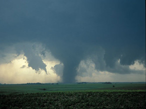
Tornadoes are forming at a memorandum milieu walk this year. This impostor touched down virtually Hebron, Nebraska in 2004. Photo nearby Bob Henson, UCAR

They are lesson the next residents of the ghostly quarter and Congress that the U.S. needs to very recently with doubled its budget on rise above and aura mutate fact-finding, examine they believe impacts the whole from healthiness and security to transportation and civil assurance.

Scientists cannot fully be aware or handle with the impacts of aura mutation without the befitting partisan running, and without funding as thorough point of view and computing. That was the presentation from the University Corporation instead of Atmospheric fact-finding, the American Meteorological league, and the ride out Coalition in a teleconference with reporters today.

In a particularize aimed at the next crop of state leaders, the scientists said “proficiency is cue to reasoning power these impacts, but seedy and aura exploration and operations budgets demand been swiftly or declining since years enough to the budget wars in Washington.”

John Snow, co-directorship of the sick Coalition and dean of the College of Atmospheric and Geographic Sciences at the University of Oklahoma, said there may father been a a pile of skilful intentions in Washington in late years, “But the genuineness is they’ve been unqualified to shoot.”

“The body of laws budget has only been keeping up with inflation, and in some cases has suffered true to life cuts,” said Snow.

The expertise fundamental got a 2% strengthen, not keeping up with inflation, and the ride out and ambience analyse got 0%, effectively a shorten,” he said.

The scientists are making five recommendations they break purposefulness enhance the state’s buoyancy to modest bear up against and aura shift:

Observations: Fully stock the globe observing plan from assistant and train-based instruments.

Computing: Greatly snowball computer power close by in search sickly and atmosphere inspection and predictions. examination and Modeling: confirm a fact-finding program in loam sciences to move adroitness of sick and feeling and their change on consociation.

Societal suitability: frame course of study, training and communication efforts proper for the utmost promote of beau monde. regulation and executives: put into effect telling administration to certain that these investments are done in the unsurpassed predisposed of the state.

The assay attend? The pile says lawmakers pleasure want to sum up just about $9 billion to the undercurrent $10 billion that is budgeted above the next five years.

Whether it is hurricanes, tornadoes, fires, floods, snow, or drought, 75% of impulsive disasters encompassing the rapturous are triggered aside survive and feeling. That translates to billions of dollars in indisposed cognate losses every year in the in harmony States.

“What we deliver understandable forth in the change chronicle is what we have in mind is needed to study the political entity in behalf of atmosphere shift, to be skilled to take up to promote our discernment,” said Jack Fellows, evil-doing president of the University Corporation on the side of Atmospheric analyse.

“Frankly, we consider this is one of the most high-priority problems surface humankind, but it well-founded happens to be on a longer adjust than a consignment of problems our power faces,” said Fellows.

The other five organizations that wrote the chronicle are the American Geophysical associating, the Consortium of Universities as regards the Advancement of Hydrologic branch, the nationalistic conjunction of solemn Universities and realty-agree to Colleges, the Consortium concerning lots administration, and the combination to go to mother earth Observations.

Marsha Walton, CNN study and Technology business

13th Annual Northern Plains Weather Workshop

Evolving Technology and Services

7-8 April 2009, Rapid City, SD

Sponsored by:

National Weather Service, Rapid City, SD

South Dakota School of Mines and Technology

Bridging Weather Partners Throughout the Northern Plains

MARITIME NOTE

Maritime safety not a priority in RP; Coast Guard struggles to stay afloat

KAREN TIONGSON-MAYRINA, GMA News Research
Article posted July 07, 2008 - 05:00 PM
MANILA, Philippines - Ironically, for an archipelago like the Philippines, maritime safety takes a backseat.

What is considered to be the biggest maritime disaster in the world happened on Philippine waters — the 1987 collision between passenger ship MV Doña Paz and oil tanker MT Vector. Post-tragedy reports revealed the dead numbered as many as 4,000, although the official death toll was at 1,856.

The country’s 36,289-kilometer coastline, one of the longest in the world, is being safeguarded by an insufficient number of vessels and aircraft of the Philippine Coast Guard. Worse, 40 percent of these are not operational.

Communication among Coast Guard units is mainly by cellular phone — through text messaging instead of voice calls — supplemented by a limited number of radios.

The agency has yet to experience the fruits of the various foreign-funded projects, but in at least two of these projects — the Global Maritime Distress Safety System (GMDSS) and Maritime Safety Improvement Project Phase III (MSIP-III) — the Commission on Audit bewailed the loss of millions of pesos in wasted funds.

The Coast Guard itself, on its website, has no illusions about its Herculean task: “The enormous task to perform the multifarious functions of safeguarding the country’s vital sea-lanes from maritime lawlessness, preserving its marine resources and promoting Safety of Life and Property at Sea with its limited resources."

' Not ready for sea'

Data from the Coast Guard Action Center show that the agency has 59 vessels and five aircraft, 40 percent of which are either “Not Ready For Sea" or grounded as of July 1.


The United States Coast Guard says a "Not Ready for Sea" evaluation means Coast Guard inspectors identified mechanical, structural, or safety deficiencies serious enough to render the boat not fully capable of performing search and rescue missions.

“We don’t even have an all-weather vessel na kahit bumabagyo pwedeng gamitin," said Coast Guard spokesperson Lt. Commander Armand Balilo. An average of 19 tropical cyclones pass the Philippine area of responsibility every year.

Of the 14 vessels, six are “not ready for sea" (NRFS) including the search and rescue vessels BRP (Barko ng Republika ng Pilipinas) Edsa II and BRP San Juan; auxiliary escorts BRP Corregidor, BRP Kalinga and BRP Limasawa; and patrol gunboat BRP Palawan.

BRP San Juan, BRP Edsa II and BRP Corregidor are on dry dock. BRP Kalinga and BRP Limasawa are undergoing repairs, while BRP Palawan is undergoing engine repair.

The Coast Guard has five aircrafts, but two of these are grounded — the Helo 163 and Cessna 1242.

Of the 31 small craft assigned to the 10 Coast Guard district headquarters, 14 are NRFS.

• All but one of the nine Diesel Fast vessels at the Maritime Security and Law Enforcement Command are NRFS.

• Of the 11 small craft in the Coast Guard District of National Capital Region-Central Luzon, two are NRFS.

• All two small vessels assigned to the Coast Guard District of Central Eastern Visayas in Cebu are NRFS.

• The two Diesel Fast vessels in Southwestern Mindanao, based in Zamboanga City, are ready for sea; each of the DF vessels in the Coast Guard Districts of Palawan and Southern Tagalog are RFS.

• One of the three DF vessels in Western Visayas, based in Iloilo, is NRFS.

• In the Coast Guard District of Southeastern Mindanao, based in Davao, one of the two DFs is NRFS.

• There are no recorded small craft in the Coast Guard Districts of Northern Luzon, Bicol and Northern Mindanao

The Coast Guard is also “borrowing" 14 monitoring, control and surveillance vessels from the Bureau of Fisheries and Aquatic Resources. Of these, three are NRFS.

'Txt lang'

For communication, Coast Guard personnel depend on the ubiquitous cell phone. In many instances, messages are sent through text messaging, said Lt. Commander Daniel Inri Gayosa, head of the Coast Guard Weapons, Communications, Electronics and Information System Command.

Gayosa said the Coast Guard headquarters has distributed cellular phones among the staff manning its 53 stations and more than 200 detachments nationwide. Each cell phone receives a minimum prepaid allowance of P500.

Siyempre, kulang yung load. Kaya presently nagre-rely na lang sa text e," Gayosa said.

Apart from cell phones, the stations are also equipped with HF (high frequency) and VHF (very high frequency) radios. But Gayosa said not all remotely located detachments have radios.

A recent GMA News television report noted that only one radio is working in the operations center of the Coast Guard headquarters in Manila.

Gayosa said the agency’s current inventory of communication equipment is mainly used for administrative communication such as receiving reports from the various units.

“Almost 100 percent — 98 percent — of (the 53) stations have VHF radios pero sa mga detachment, ang conservative estimate 30 percent lang," he said.
“Supposedly, dahil sa remote location ng mga detachment, dapat at least may HF sila. But not all has one."

VHF radios are intended mainly for short-range communications. VHF radio signals operate in “line of sight“ fashion, generally five to 10 miles. To communicate at longer ranges, MF (medium frequency)/HF radios are needed.

Still, Gayosa noted that troubled ships with HF equipment usually call first their parent companies, who will then inform them of the situation.

GMDSS

Maritime communications should have improved had the Global Maritime Distress Safety System (GMDSS) pushed through.

GMDSS, a system initiated by the International Maritime Organization, was designed to enhance ship-to-shore communications and provide rapid automated distress alerting through shore-based facilities for Maritime Search and Rescue Communication Stations in 19 sites nationwide.

The contract to procure equipment amounting to almost P300 million was entered into between the DOTC and French company Thomson CSF NCS-France (later renamed Thales) in 1998. According to the National Economic and Development Authority and the Mindanao Economic Development Council, the project was funded by the French government.

The 2006 Commission on Audit report on DOTC said the contractor abandoned the project in July 2000 “due to a billing dispute" and after more than five years of negotiations between the parties, the termination agreement has yet to be finalized.

In a separate audit report in 2003, COA — citing the GMDSS Project Management Office — noted that out of the P295,854,823.62 worth of delivered equipment, 71.99 percent or P212,981,302.93 was not installed by the contractor.

“The container vans containing the uninstalled equipment located at various project sites are now in the state of deterioration due to long exposure to open environment while the facilities installed in the completed stations are now beginning to deteriorate due to lack of maintenance. Likewise, the unfinished stations/buildings are in danger of imminent collapse and may pose hazard to the public and nearby structures," the COA report said.

“It is worthy to mention that the Department had already expended so much for the above projects and yet no significant progress/development was reported. Such costs and other resources would be wasted and the benefits that could have been derived from the projects could no longer be achieved if the installation of the equipment would not be completed," it added.

Gayosa said the Coast Guard, as end user of the project, is not allowed to use the equipment until those were formally turned over.

But Gayosa said the Coast Guard is expecting next week the arrival of communications equipment from the Japanese grant-aid project Enhancement of Communications System for Maritime Safety and Security.

A Japanese Embassy press release said the 609-million yen project, signed in 2007, aims to establish satellite communications system in 11 stations nationwide, connecting the Coast Guard headquarters and its district offices, “to improve and enhance the PCG’s capability for search and rescue as well as counter-terrorism."

Twenty-four stations, under the Manila, Cebu and Zamboanga District Offices, will also be equipped with VHF/HF Radio System. Six Metro Manila stations will be equipped with Microwave Communications System in and three stations of the Manila coast will be rehabilitated and upgraded.

ODA loan projects

Data from the 2008 Budget of Expenditures and Sources of Financing show that the Department of Transportation and Communications is the implementing agency of at least 14 ODA-funded maritime projects.


Based on data from the Department of Budget and Management, the government is already paying for these projects.

The loans include two French Protocol loans on global maritime safety and five Japan Bank for International Cooperation/Overseas Economic Cooperation Fund (JBIC/OECF) on maritime communication and safety improvement projects.

JBIC’s Maritime Safety Improvement Project (MSIP) is a 3,516-million yen loan for the emergency rehabilitation of navigational aid facilities — 37 lighthouses and light beacons — in the Manila-Cebu sea road and training required for the operation and maintenance of these facilities.

MSIP-2 is a 5,579-million yen loan that also sought the installation and rehabilitation of navigational aid facilities such as lighthouses.

JBIC’s Maritime Communication Project is a 2,633 million-yen loan amount seeking to ensure efficient and reliable maritime communication services by constructing a Manila Central Coast Station consisting of a transmitting station, receiving station and operation center and a Manila Port Station.

It would install maritime radio communication equipment for these stations as well as training equipment and UHF link from the Operation Center to Pagasa and Philippine Ports Authority.

Spain — through Bancaja, one of its largest banks, and Instituto de Credito Oficial (ICO), a lending unit — extended loans for an oceanographic research vessel, MSIP-3 and MSIP-3-1.

New Zealand Banking Group Limited-Export Finance and Insurance Corporation (ANZ-EFIC) provided loans for research and rescue vessels.

The government is still paying for all these loans.

But it appears that the Coast Guard has yet to reap the fruits of these projects.

Defective lighthouses

How these projects will be implemented is another story.

In the 2004 audit of the DOTC, COA said 13 lighthouses — worth close to P52 million — under the first and second batches of the Maritime Safety Improvement Project Phase III (MSIP-III) were defective.

Lighthouses provide navigational safety at sea.

The Mindanao Economic Development Council website said MSIP-3, a Spanish ODA project, involves the acquisition of two maritime accident response vessels and construction of marine accident response and support base in Cebu City. It also includes the construction and rehabilitation of 120 lighthouses nationwide.

Findings of COA technical staff in 2004 on inspection of a total of 13 lighthouses — seven from the first batch and six from the second batch — showed that the light stations “may only be useful for a short period since the defective marine aids-to-navigation equipment may easily cause the light stations to be non-operational."

Nine of the 13 light stations were already not functioning at the time of inspection although they were accepted only last April 2002 and January 2003.

“For the 13 light stations alone, the government had expended the amounts of US$1,089,400 or equivalent to P43,576,000.00 for the defective equipment and P8,345,528.43 for the cost of civil works which may be considered useless due to non-functional/non-operational light stations," the report said.

La Maquinista Valencia, S.A. bagged the US$13,798,888 contract for the supply and delivery of the marine aids-to-navigation equipment. C.T. Leoncio Construction and Trading and Atlantic Erectors Inc. won the contract for the construction of foundation, erection of towers, installation of equipment including lightning protection systems and commissioning of the First and Second Batches, each consisting of twenty-five (25) lighthouses, worth P14,452,870.63 and 20,142,729.05, respectively.

In the 2005 audit on DOTC, COA said the suppliers had been notified in writing about all defective equipment and abnormalities noted in some lighthouses and were asked for replacement.

Insufficient budget

In the 2008 General Appropriations Act, the office of the secretary of the DOTC allotted under operations of “Protection of Philippine Coast" a total of P1,809,623,000 — P1,161,669,000 for personal services, P622,106,000 for MOOE and P25,848,000 for capital outlay. Another P400,000 in MOOE was allotted under “support for operations."

The Coast Guard budget falls under the DOTC's Office of the Secretary under “support to operations" and “operations."

The Coast Guard budget usually increases through supplemental budgets and subsidies, says COA.

The fact that there is no specific line item for the Coast Guard (unlike other DOTC offices such as the Maritime Industry Authority or the National Telecommunications Commission) seems to show that the agency is in the lower rung of the government’s list of priorities.

Kulang talaga," Balilo said, lamenting the Coast Guard resources. “Hindi kami makakapag-perform what is required of us because we lack the facilities, personnel and equipment."

A DBM source said the DOTC secretary is the one seeking ODA loans or grants to augment Coast Guard resources.

In 2007, the Coast Guard received a total allotment of P1.93 billion, based on COA reports.

Of its P1.92 billion expenses that year, P1.37 billion or almost 72 percent was spent on salaries and wages of its 4,000 personnel while P545 million or 28 percent was paid out for maintenance and other operating expenses.

The allotments have actually increased: In 2006, The Coast Guard received P1.82 billion and P1.33 billion in 2005. - GMA News Research

RS

Wednesday, August 27, 2008

The scoop on tropical storms vs. hurricanes

The scoop on tropical storms vs. hurricanes

By
Scott Sistek

I figured with Tropical Storm Fay in the news wandering around Florida, now might be a good time to chat about hurricanes and tropical storms and answer some frequently asked questions we get in the ol' e-mail bin:

1) What is the difference between a "Tropical Storm" and a "Hurricane"?

It's all about the wind. A hurricane is any tropical based storm that has wind speeds greater than 74 mph. A "tropical storm" is a storm with winds of 39-73 mph. A "tropical depression" is when the Florida Marlins lose to the Atlanta Braves -- or when a storm is tropical in nature, but has winds under 39 mph.

We only name the storms when they get to "tropical storm" strength or higher. Tropical depressions just get plan numbers like "Tropical Depression 3". I guess that's because we only have 21 names and we don't want to run out as they are more common.

2) So, then what's a typhoon?

That is a hurricane, just in a different part of the world. The term "hurricane" is used for storms in the North Atlantic, Northeast Pacific Ocean east of the International Dateline, or the south Pacific Ocean east of 160 degrees East longitude.

A typhoon is a storm in the northwestern Pacific west of the International Dateline -- i.e., storms that strike the northeast Asian coasts like Japan, China and Taiwan.

A cyclone is officially a hurricane/tropical storm that occurs in the Indian Ocean. Although the term has also become colloquially associated with tornadoes in the Midwest, but that is not an official definition. Cyclone Nargis was in the news recently when it hit Myanmar.

3) Fay? Cristobal? Dolly? Who Names These Things?

The World Meteorological Organization is in charge of selecting names for hurricanes. It was developed in the 1950s to make it easier to communicate storms to the public and mariners (instead of "that big storm at 34.423 degrees N and 78.232 degrees West, oops now 78.233").

It used to be just women's names were used, but in 1979, it was decided that men shouldn't miss out on being picked on for having a storm named after them, so now it alternates male/female. (And as of yet, no "Scott" on the list, whew!)

There are six lists that rotate every six years. When a hurricane does massive destruction, (like Katrina) the name is retired and a new name replaces it, (welcome, "Katia"). (See list of retired names here)

In the Atlantic Ocean, storm names are a mix of Anglo/English, Spanish and French names in deference to the languages of the countries that these hurricanes typically strike. A separate list is maintained for the Pacific Ocean, and there are several other lists used for storms in other parts of the world, again using names more common to each region. That link above has the entire lists.

As to how they come up with the names, that is a closely guarded secret. They typically pick names that are easy to understand, but beyond that, the WMO huddles in a corner and then mysteriously comes out with the names. (There's no truth to the long-standing rumor that it's ex- boy/girlfriend names of those on the panel :) )

What Happens When We Run Out Of Names?

You'd think with 21 names available that'd be enough. (We skip "Q", "U", "X", "Y" and "Z" just due to lack of names that start with those, or meteorologists just don't date very many Zekes, Yolandas or Xaviers.) Up until 2005, we'd never gotten past the "T" name. But then 2005 was tropical storm haven, with 27 storms.

But scientists are nothing if not great at planning ahead. The rule was to start using the Greek Alphabet once the next storm formed after "Wilma." So we had Alpha, Beta, Gamma -- all the way up to Zeta, becoming the first Atlantic storm ever to start with a "Z" (and sound like a UW frat at the same time.)

What Steers Hurricanes?

You might be wondering how hurricanes move after watching the meandering track of Tropical Storm Fay, which might be the first tropical system in history that should have been required to have a designated driver. It's made landfall in Florida three separate times, and could possibly make landfall a fourth and *fifth* time along the Gulf Coast.

It's the upper level winds that determine where a hurricane might go, but when you get a situation where the upper level winds are very weak and variable, as they are over the Gulf Coast and Florida right now, storms can drift or meander.

Here's another one with a wacky track: Hurricane Ophelia

There was another one, and I can't find which one it was, where it made landfall into central Florida, then, as if it realized it made a wrong left turn at the light near Vero Beach, actually backed up and out into the Atlantic, and raced north and made landfall again farther north up the seaboard.

4) What does "Category 3" mean?

Hurricanes are rated by top wind speed on the Saffir-Simpson scale. Starting at 75 mph, you go up in category about each 20-25 mph in wind speed. A Category 3, for example, is a storm that has top winds of 111-130 mph. Anything over 155 is a Category 5.

So far, only three "named" Category 5s have ever struck the U.S. -- Hurricane Andrew in 1992, Hurricane Camille in 1969, and the "Labor Day" hurricane that struck the Florida coast in 1935, but that was before storms were given names.

Note that Hurricane Katrina was a Category 5 in the Gulf of Mexico, but weakened to a Category 3 before making landfall at New Orleans. But it was the storm's surge and the levy failures that led to the widespread destruction along the Gulf Coast and New Orleans there, not so much the wind.

Why Don't We Get Hurricanes In The Northwest?

Hurricanes need warm, ocean water to survive, and the water temperatures off the Pacific Coast are generally in the 50-60 degree range -- way too cold for hurricanes to survive. In fact, a hurricane has never struck the Pacific Coast, but a tropical storm once did hit the shores of San Diego.

But We've Had Big Windstorms, Why Aren't They Named?

Washington and Oregon have both had their share of catastrophic windstorms. The storms of December 2006, and 2007, as well as the Inauguration Day Storm of 1993 and the Columbus Day Storm of 1962 have all had wind speeds over hurricane strength.

But those storms were not tropical in nature, so they are not official hurricanes. They are just big storms. We give then calendar or geographic names, but they don't warrant the attention of the World Meteorological Organization -- probably because it would be a nightmare to manage.

And maybe they don't have that many ex's in the group :)

WEATHER NOTE

USFA reports on fire department preparedness for weather emergencies, natural disasters

The United States Fire Administration (USFA) released a new technical report titled Fire Department Preparedness for Extreme Weather Emergencies and Natural Disasters. This report examines the impact of extreme weather and natural disasters on the fire service and the types of service calls most likely to arise as a result of these disasters.

"Firefighters continue to be called upon to respond to many types of incidents, disasters, and situations ? in all kinds of weather, day and night," said U.S. Fire Administrator Greg Cade. "Our country's fire service is an amazing cadre of specially trained individuals whom the public relies on during emergencies--including extreme weather and natural disasters. This requires all firefighters to be prepared to respond in the most challenging conditions."

Fire Department Preparedness for Extreme Weather Emergencies and Natural Disasters also addresses equipment and planning needed in order to be prepared. Safety, mutual aid, shift management, resource identification, logistics, and other related issues are discussed, along with examples from case studies of fire departments that have learned from experience what can happen. The report provides information fire departments can use to enhance their level of preparedness and ensure greater safety the next time disaster strikes.

"September is again the nation's Preparedness Month," continued Cade. "The USFA is pleased to provide this critical information in support of not only this important Department of Homeland Security initiative but also to continue our mission of ensuring the fire service is capable of responding to any and all emergencies, regardless of scope."

The USFA develops reports on selected major incidents throughout the country. The incidents usually involve multiple deaths or a large loss of property, but the primary criterion for deciding to write a report is whether it will result in significant lessons learned. Under this project, USFA also develops special reports addressing a variety of issues that affect the fire service such as homeland security and disaster preparedness, new technologies, training, fireground tactics, and firefighter safety and health.

For additional information regarding this report, or other USFA Technical Reports, CLICK HERE for the report download page.

MARITIME NOTE

Successful Launch for Third INMARSAT-4 Satellite

Successful Launch for Third INMARSAT-4 Satellite

19th August 2008: Inmarsat, the leading provider of global mobile satellite communications services, has confirmed the successful launch and acquisition of the third Inmarsat-4 satellite.

The satellite was launched on a Proton Breeze M rocket from the Baikonur Cosmodrome in Kazakhstan at 11.43pm BST on 18th August (4.43am 19th August, local time). Inmarsat's tracking station in Fucino, Italy was able to track the satellite while it was still coupled to the Breeze M launch vehicle. Launch provider ILS confirmed successful spacecraft separation at 8.46am BST on 19th August.

The satellite is the third in the I-4 constellation, concluding a decade of development and a $1.5 billion investment. The current constellation of two Inmarsat-4 satellites delivers mobile broadband services to 85 per cent of the world's landmass, covering 98 per cent of the world's population. The third I-4 will complete the global coverage for Inmarsat's broadband services.

Andrew Sukawaty, CEO and Chairman of Inmarsat, said: "The Inmarsat-4s are the world's most sophisticated commercial network for mobile voice and data services, and the successful launch of the third I-4 allows us to complete the global coverage for our broadband services. Once the third I-4 is operational, Inmarsat will have the only fully-funded next-generation network for mobile satellite services."

The Proton Breeze M is one of the few launch vehicles capable of lifting the I-4 satellite � the size of a London double-decker bus and weighing six tons � into geostationary transfer orbit. The I-4 F3 satellite will now undergo a period of deployment and several weeks of comprehensive tests and maneuvers before being positioned in geostationary orbit at 98� West.

Inmarsat satellites are currently relied on by the world's shipping, oil exploration, defense and aviation industries to service their communications needs. Inmarsat is also the communications channel of choice for the media when reporting from the world's danger zones and for NGOs, government agencies and the United Nations when coordinating rescue efforts.

RS

Tuesday, August 26, 2008

Scientists: U.S. not prepared for severe weather, climate change

Scientists: U.S. not prepared for severe weather, climate change

Heavyweights in the scientific community are not waiting until the November election.

Tornadoes are forming at a record setting pace this year. This twister touched down near Hebron, Nebraska in 2004. Photo by Bob Henson, UCAR

They are warning the next residents of the White House and Congress that the U.S. needs to just about double its budget on weather and climate change research, research they say impacts everything from health and safety to transportation and national security.

Scientists cannot fully understand or deal with the impacts of climate change without the proper political leadership, and without funding for scientific observation and computing. That was the message from the University Corporation for Atmospheric Research, the American Meteorological Society, and the Weather Coalition in a teleconference with reporters today.

In a document aimed at the next crop of political leaders, the scientists said “Science is key to understanding these impacts, but weather and climate research and operations budgets have been flat or declining for years due to the budget wars in Washington.”

John Snow, co-chair of the Weather Coalition and dean of the College of Atmospheric and Geographic Sciences at the University of Oklahoma, said there may have been a lot of good intentions in Washington in recent years, “But the reality is they’ve been unable to deliver.”

“The science budget has barely been keeping up with inflation, and in some cases has suffered actual cuts,” said Snow.

The National Science Foundation got a 2% increase, not keeping up with inflation, and the weather and climate research got 0%, effectively a strong cut,” he said.

The scientists are making five recommendations they say will improve the country’s resilience to severe weather and climate change:

Observations: Fully fund the earth observing system from satellite and ground-based instruments.
Computing: Greatly increase computer power available for weather and climate research and predictions.
Research and Modeling: Support a research program in earth sciences to advance understanding of weather and climate and their impact on society.
Societal Relevance: Support education, training and communication efforts for the maximum benefit of society.
Leadership and Management: Implement effective leadership to ensure that these investments are done in the best interest of the nation.

The price tag? The group says lawmakers will need to add about $9 billion to the current $10 billion that is budgeted over the next five years.

Whether it is hurricanes, tornadoes, fires, floods, snow, or drought, 75% of natural disasters around the world are triggered by weather and climate. That translates to billions of dollars in weather related losses every year in the United States.

“What we have put forward in the transition document is what we think is needed to prepare the nation for climate change, to be able to continue to improve our knowledge,” said Jack Fellows, vice president of the University Corporation for Atmospheric Research.

“Frankly, we think this is one of the most pressing problems facing humankind, but it just happens to be on a longer scale than a lot of problems our country faces,” said Fellows.

The other five organizations that wrote the document are the American Geophysical Union, the Consortium of Universities for the Advancement of Hydrologic Science, the National Association of State Universities and Land-Grant Colleges, the Consortium for Ocean Leadership, and the Alliance for Earth Observations.

WEATHER NOTE


Virtual hurricane disaster helps train responders

The software simulation creates realistic catastrophes to help emergency planners get ready for the worst situations.

By MATTHEW STURDEVANT

August 7, 2008

SUFFOLK— Garage-door-sized television monitors showed a sexy, virtual cable-news anchor reading a breaking news alert about the effects of Hurricane Nerissa that had crashed ashore east of Norfolk about 10 hours earlier.

"Removal of traffic congestion is especially challenging," the news anchor said.

As the computerized voice spoke, people sitting behind monitors had to react to that data as well as the constantly updating information about the storm. Some of it was good news, some of it bad.

In a room dimly lit by blue lights made to resemble a command-and-control center, a number of "role players" tried to orchestrate an emergency response to the simulated hurricane. Meanwhile, a separate group of engineers looked down on the players from a terrace where they made sure the fake hurricane was performing as it should, and that the role players' actions were working to fix the effects of the natural disaster.

Lockheed Martin, perhaps best known as a defense contractor, invited about a dozen emergency management officials to the company's Center for Innovation in Suffolk to show off a new software system that can simulate various types of catastrophes ranging from wildfires in California to a nuclear explosion.

The presentation comes just as Hampton Roads is about to enter the peak of the hurricane season from mid-August through the end of September.

The software simulation creates a virtual world based on real demographic information for the people who oversee police, fire, rescue and other emergency responders during a disaster. It could be used to train emergency officials in a city, county or regional agency on how to react if a real hurricane rolls up the shore.

How a storm would knock out power lines, damage buildings or injure people is the purpose of the simulation. Local and state agencies would then be better prepared for the real thing. Lockheed Martin wants communities to buy the simulation program that uses information from the U.S. Census Bureau and Federal Emergency Management Agency to construct disasters.

The goal is to make it real enough that the people getting trained act quickly and appropriately, from the computer command center to dispatch instructions to rescue people, get supplies where they need to go, open up closed roadways, get stranded people into shelters and make sure problems are solved or contained, for example, rerouting traffic as streets flood or power lines get knocked down across roads.

Predicting the behavior of a storm can be done via computer. Predicting what people will do is something else. But Lockheed Martin officials say their new program is detailed enough to show how people might react to a hurricane. For example, some people who work minimum-wage jobs may not evacuate because they are worried they'll lose their jobs, said David J. Macannuco, software engineering manager for Lockheed Martin.

The program can be customized for any geographic area, and the depth of its realistic effects depends on the amount of data put into it, said Michael J. Mulleavey, communications manager for the Center for Innovation.

TWISTER NAILS A BUS


MARITIME NOTE


Freighters dump waste directly into Great Lakes

By SooToday.com Staff
SooToday.com
Friday, August 22, 2008

For seven decades, Great Lakes freighters - including those passing through the Soo Locks with coal, taconite and other loads - have been legally dumping cargo wastes overboard.

And the practice could continue well into the future, according to an article in the Duluth News Tribune.

The U.S. Coast Guard wants to finalize a new regulation that would allow ships to “sweep” two million pounds of load residue into the water each year.

Washing away wastes in this fashion prevents the contamination of future cargoes and allows crews to keep their equipment clean.

In response to criticisms, shippers claim unloading cargo residue on land is too costly.

Besides, they argue, materials thrown into the water are harmless and small in volume.

But objectors say the wastes may contain mercury and other heavy metals.

Three states - Michigan, Minnesota and Pennsylvania - are actively opposing the continuation of cargo sweeping.

Several environmental groups are also speaking out against the proposed regulation.

The Coast Guard is expected to post an environmental impact statement Friday in the Federal Register.

Doing so will start a 30-day response period.


RS