Wednesday, October 17, 2007

EC unveils new EU maritime policy

EC unveils new EU maritime policy
12 October 2007

The European Commission has adopted an Integrated Maritime Policy for the European Union, which has the world’s largest maritime territory, marking the first time in its 50 years that it will have a strategic approach to decision-making in Maritime Affairs. The policy was unveiled at a press conference on 10 October in Brussels, Belgium.

European Commissioner in charge of Fisheries and Maritime Affairs Joe Borg said: "This is a crucial first step for Europe's oceans and sea – unlocking the potential and facing the challenges of a Maritime Europe will be our common goal. It will allow us to make the most of the geopolitical realities of our continent and will help Europe face some of the major challenges before it.

"At the European level, it is clear the transnational character of maritime affairs demands a European approach: shipping and traffic corridors cross the waters of our Member States, oil spills and pollution know no borders in Europe's waters and illegal activities … are transnational by nature, affecting all of Europe."

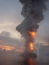
oil spill

Prestige oil spill
The European Commission (EC) said the new policy will build on Europe's strengths in marine research, technology and innovation and will be anchored in the European Union's (EU) overarching commitment to ensuring that economic development does not come at the price of environmental sustainability.

Under the European Space Policy, ESA is responsible for implementing space capabilities that respond to EU policy needs. The Integrated Maritime Policy will facilitate efficient exploitation of space systems in the maritime sector, which ESA has been actively involved in over the last 25 years.


ESA’s ERS satellites have been the main vehicles for testing and demonstrating the feasibility of using satellite Earth Observation (EO) data in different maritime policy areas. The ERS missions supported developments in oil slick detection, sea ice monitoring, wind and wave forecasting, regional ocean current forecasting, coastal bathymetry mapping and vessel detection.

Because both ERS-1 and ERS-2 significantly exceeded their original design lifetime of three years, it was possible to build an extended, continuous and homogeneous time series of oceanographic measurements, which were not previously possible.


SST map
Sea surface temperature map

In particular, accurate measurements of sea surface height variation by the radar altimeter instrument provided a unique capability to monitor variations in currents at the regional level while the Along Track Scanning Radiometer (AATSR) series of instruments have delivered a highly accurate time series of sea surface temperature variations over a 16-year period.

In addition, satellite data from the radar altimeters onboard ESA’s ERS-1, ERS-2 and Envisat and NASA/CNES’ Topex-Poseidon detected a trend in sea level rise between 2.64 and 3.29 mm/year over the last 15 years.

In 2002, the newly launched Envisat acquired images of the Prestige oil spill in Spain with its Advanced Synthetic Aperture Radar (ASAR) instrument. Since this time, ESA has been working within the Global Monitoring for Environment and Security (GMES) Services Element to demonstrate and qualify the capacity for pan-European oil spill surveillance. Last year, an operational satellite-based oil slick detection service based on SAR data from Envisat and the Canadian Radarsat satellite was set up for all European waters under the European Maritime Safety Agency (EMSA). The service, named CleanSeaNet, is the first operational pan-European satellite based surveillance service for European waters.


CleanSeaNet service

CleanSeaNet service
Under this service, a notification of a pollution event can be provided within 20 to 30 minutes of the satellite overpass. By integrating the SAR oil slick information with vessel information, it becomes possible to identify potentially responsible vessels.

"This is a first, and significant, step in the process whereby EMSA assists Member States and the Commission in detecting illegal and accidental discharges at sea," Willem de Ruiter, Executive Director of EMSA said.

Intentional and accidental discharges threaten fragile coastal ecosystems, impact on tourism and generate significant clean-up costs. The European policy goal, as stated in the Marine Thematic Strategy of the 6th Environment Action Plan is a complete elimination of discharges into the marine environment by 2020. Effective surveillance such as CleanSeaNet is essential if this objective is to be met. However, oil spill detection is not the only area where satellite based SAR surveillance is being applied.

There is growing interest in the use of satellite SAR for fisheries and for maritime border control. In particular, the Integrated Surveillance System for Europe’s southern maritime borders as requested by the European Council is intending to integrate satellite based surveillance with conventional vessel tracking systems.


Chlorophyll-a concentrations
Chlorophyll-a concentrations in the Dutch coast

Routine monitoring of water quality in European coastal areas is important to effectively protect fragile coastal ecosystems. Within the MARCOAST Consortium under the GMES Services Element, most European coastal states are provided with key parameters, including chlorophyll-a concentration, transparency and suspended sediment load, for their region of interest several times per week.

Due to the extensive winter transport levels in the Baltic Sea, Europe hosts the largest volume of commercial shipping activity in ice-infested areas. The timely delivery of accurate, up-to-date sea ice information by national ice services is critical in maintaining the security and efficiency of this transportation. Many national ice services have routinely integrated Envisat and Radarsat SAR imagery into their operational sea ice charts for several years.

These capabilities are based on EO satellites that have already been operating for some time. ESA is working to ensure continuity of the key data streams underpinning these services within the framework of GMES. The Sentinel missions will ensure that SAR, ocean colour, radar altimeter and sea surface temperature observations will be continued beyond the lifetime of the current missions. In addition, ESA is working with the European scientific community to bring new observation techniques, the so called Earth Explorers, to support research in critical Earth science issues such as global change and biodiversity.

ESA welcomes the Integrated Maritime Policy and intends to work with the different actors involved in areas where it sees current or potential future demand for space-based capabilities in the maritime sector.

Tsunami Early Warning Centre inaugurated

Hindu Times Special Correspondent
It will take 30 minutes to analyse the seismic data following an earthquake of more than magnitude 6
— PHOTO: K. RAMESH BABU

MEETING A CHALLENGE: Union Minister for Science and Technology Kapil Sibal at the inauguration of the Tsunami Early Warning System centre in Hyderabad on Monday.

HYDERABAD: A state-of-the-art National Tsunami Early Warning Centre, which has the capability to detect earthquakes of more than 6 magnitude in the Indian Ocean was inaugurated here on Monday by Union Minister for Science & Technology Kapil Sibal. He asked experts to improve the system and further reduce the time for disseminating information to the targeted people.

Lauding various agencies involved in establishing the Rs. 125-crore tsunami warning system without time and cost overruns, he said it was the most modern one in the world. It would now take 30 minutes to analyse the seismic data following an earthquake. The next task was to reduce the time to six to seven minutes, he said. The Centre was set up by the Ministry of Earth Sciences in the Indian National Centre for Ocean Information Services (INCOIS) here.

Mr. Sibal later announced that two more centres of excellence — Joint Marine Meteorological Organisation and Operational Oceanography — would be set up on the INCOIS campus after Chief Minister Y.S. Rajasekhara Reddy instantly agreed to allot 10 acres to the institution.

He said a system was being put in place for collaborating with all neighbouring countries for sharing data. He said four Bottom Pressure Recorders (BPRs) were now deployed in the Bay of Bengal, two in the Arabian Sea and another six would be installed in five to six months. He stressed that technology must be used to provide information to the people through SMS in the local languages.

Real-time network

According to an INCOIS release, the warning system comprises a real-time network of seismic stations, BPRs and 30 tide gauges to detect tsunamigenic earthquakes and monitor tsunamis. The tsumanigenic zones that threaten the Indian Ocean were identified by considering past tsunamis, earthquakes, their magnitudes, and the location of the area relative to a fault and also by tsunami modelling.

The east and west coasts of India and the island regions are likely to be affected by tsunamis generated by earthquakes from two potential sources — the Andaman-Nicobar Sumatra island arc and the Makran subduction zone, north of the Arabian Sea.

Integrated Coastal and Marine Area Management (ICMAM) customised and ran the tsunami model for five ‘historical earthquakes’ and predicted inundation areas. The inundated areas are being overlaid on cadastral level maps of 1:5,000 scale. These community-level inundation maps are extremely useful for assessing the population and infrastructure at risk, the release added. Apart from Dr. Reddy, P.S. Goel, Secretary, Ministry of Earth Sciences, Peter Koltermann, Head, Tsunami Unit, Inter-governmental Oceanographic Commission, and Shailesh Nayak director, INCOIS, spoke.

From the Legal Beagles

Senate hearing on implementing the SAFE Ports Act

The Senate Committee on Homeland Security and Government Affairs conducted an oversight hearing on Implementation of the SAFE Ports Act. The Act assigned approximately 100 maritime security tasks. Mr. Stewart Baker, Department of Homeland Security (DHS), testified that the Department has completed half of the assigned tasks and is on track to complete most of the remainder within the statutory timeframe. He specifically cited the Secure Freight Initiative (SFI), Long-Range Tracking and Identification (LRIT), and Transportation Worker Identification Credential (TWIC) programs as high priority. He also discussed the gap between the pace of technology and the legislative mandates. Mr. Reginald Lloyd, Department of Justice, testified that Project Seahawk in the Port of Charleston has successfully integrated work of the various federal, state, and local agencies. Mr. Stephen Caldwell, Government Accountability Office (GAO), testified that the Department has made significant progress in enhancing maritime security, but that challenges remain, particularly with regard to meeting statutory deadlines. Captain Jeffrey Monroe, City of Portland, Maine, testified that increased emphasis is needed with regard to cargo security. (10/16/07).

Senate hearing on implementing 9/11 Commission recommendations

The Senate Committee on Commerce, Science, and Transportation conducted an oversight hearing on Implementation of the 9/11 Commission Recommendations Act. The focus of this hearing was security in the aviation and surface transportation sectors. Mr. Edmund "Kip" Hawley, Transportation Security Administration (TSA), testified that drafting and implementing regulations is time-consuming. The Department utilizes risk management principles in its security programs, focusing on high-threat, high-consequence events. He mentioned that the TWIC rollout has commenced. Ms. Cathleen Berrick, Government Accountability Office (GAO), testified that the Department has made significant progress in its transportation security efforts, but that many challenges remain. The GAO strongly endorses use of risk management principles with regard to transportation security. (10/16/07).

Weather Note

IAEM Discussion Group:
From the International Data Links Symposium in Washington DC.

TUNISIA: Tunisia: Head of State Gives Instructions to Dispatch Emergency Relief to People in Stricken Areas

Following the exceptional torrential rains that have fallen over the country on Saturday evening and that have affected some of the capital's suburban areas, causing a number of casualties and material damages, President Ben Ali has given instructions to the competent services to closely monitor the situation, while providing emergency relief to the areas concerned. The spokesman for the Presidency of the Republic also announced the cancellation of the ceremony the Head of State was to chair on Monday October 15, on the occasion of the commemoration in Bizerta of Evacuation Day. Search and rescue operations for missing persons, are mostly focusing over the Cebalat Ammar area, north - west of the capital. So far 3 bodies have been found bringing the death toll to 11 people. Civil protection and national guard units are still searching the area, taking advantage of the sunny spell that is affecting the capital this Monday morning.

Bangladesh/India (16 Oct 2007) Monsoon flooding mainly in Bangladesh and parts of India- Reports indicate that 1071 person(s) have been killed and 5000000 have been displaced since late July. Source: http://www.gdacs.org/reports.asp?eventType=FL&ID=129&country=Bangladesh%20India&location=&system=asgard&alertlevel=Red&glide_no=

THAILAND: Northern Thailand is also affected by flooding caused by heavy monsoon rain. Reports indicate that 10 person(s) have been killed and 17000 have been displaced.

KENYA & UGANDA: Ongoing floods because of heavy rains in Kenya and Uganda during the last 61 days have caused a red flood alert. Reports indicate that 52 person(s) have been killed and 340000 have been displaced. It is the heaviest flood in eastern Uganda floods in 35 years which affected 22 districts.

GULF OF MEXICO: Low-pressure system emerged from the Yucatan Peninsula in Mexico into the southwestern Gulf of Mexico and could develop into a tropical cyclone over the next day or two, the U.S. National Hurricane Center said Monday.

Arthur Rabjohn
Visit http://www.iaem.com/regions/iaemeuropa/ and see what we are up to......

RS


Tuesday, October 16, 2007

Time-frequency Study of Nearshore Wind and Wave Processes

Thought I post a wonderful study by my good friend and naval peer, Paul C. Liu..

Paul Liu

Surface wind- gravity waves represent a primary driving force for dynamic processes in the oceans and lakes. As long as wind waves are ubiquitous features on the surfaces of the oceans and lakes, so too are the breaking waves appearing in the form of whitecaps woven in the midst of the wind waves. These waves induce intermittent temporally and spatially energetic mixing events at the sediment-water boundary which affect the redistribution of sediment, heat, and biogeochemical substances (such as nutrients and pollutants). While the importance of surface waves is well recognized, the study of the processes of the surface wind-generated gravity waves appears to have stagnated. At present there seems to be uncertainty as to how to proceed.

We think the there is a need to rethink the basic research approach to wind wave studies. Conventional wind waves studies such as the stationary Gaussian random process, the frequency energy spectrum, and the significant wave height are all based on conceptual frameworks devised over 4 decades ago. These approaches worked quite well for many years in practical applications but they may now be on the verge of obsolescence. Any casual observer looking at the ocean or at lake surfaces cannot possibly conclude that the processes they are seeing are "stationary" by any stretch of imagination. We see it as our challenge to address the non-stationary aspect of the ocean and lake surfaces, and to re-think the earlier approach of relying on frequency spectrum. We seek a fresh and novel new approach and ideas for surface wind wave studies.

Collaborators
Alexander V. Babanin, Swinburne University of Technology,
Australia (Swineburne University web site)
Chen H. Tsai, National Taiwan Ocean University, Keelung, Taiwan (National Taiwan Ocean University web site)

2006 Plans

In spite of the fact that breaking waves are integral components of the wind wave system, they have been largely ignored in wave modeling development and general studies. Most of the vast amounts of the available time series data of wind waves undoubtedly contain breaking waves, nevertheless most of the conventional study of wave modeling and wave data analysis based on theses time series recordings were performed as if the breaking waves were entirely absent. An early attempt (Liu in Annales Geophysicae, 1993) used continuous wavelet transform and the complex valued Morlet wavelet to estimate local surface acceleration and thereby detect wave breaking events through a given limiting fraction of gravitational acceleration. The approach remained idle until we meet Alex Babanin who has just the kind of breaking wave field measurements that can be used to test and substantiate our 1993 proposition. This collaborative work has been making encouraging progress. Additionally, we recently were able to acquire 5 GB of continuously recorded high quality time series wave data from western Pacific Ocean northeast of Taiwan from Prof. C. H. Tsai of National Taiwan Ocean University. We wish to continue these collaborations on breaking wave field measurements.

Program Accomplishments

We have been involved in wind wave studies since 1998. We have experimented with a number of different research approaches and worked with data from a variety of instrumentation deployed in Lake Michigan over this timeframe including Acoustic Doppler Current ProfilersADCP's), waveriders, tripods equipped with: pressure sensor, current meter, thermistor, and a transmissometercurrent meters. Beginning in summer of 2003 we shifted our research effort externally available wave data. We are now studying the detection of breaking waves in the time series using Wavelet Transform in collaboration with Alex Babanin. Additionally, are collaborating with C. H. Tsai studying continuously recorded high quality time series wave data from western Pacific Ocean northeast of Taiwan. (

In 2003 started by analyzing the new wave data recorded by the two bottomed-mounted, upward-looking Acoustic Doppler Current Profiler (ADCP) deployed in eastern Lake Michigan in the late autumn of 2002. The two gages were deployed at depths of 20 m and 12 m. From the middle of October to the beginning of December, over 40 days of continuous, non-intermittent wave measurements were collected. As ADCP's are well known for current measurements, wave measurement is their developed function. While the wave measurements have been quite successful, we found, at some unknown and difficult to trace frequencies the surface recording tends to become noisy. So while it provides reasonable general wave conditions we are not yet able to work with its time series data. In the later part of the year we shifted our effort to study the detection of breaking waves in the time series using Wavelet Transform in collaboration with Alex Babanin of the University of Adelaide of Australia who has breaking wave measurements from Lake George and Black Sea.

Prior to 2003 we focused on an analysis of the data collected from this instrumentation during the field seasons of 1998-2000. The effort concentrated on determining the differences between the wave parameters derived from the observations and those calculated by the GLERL-Donelan wave model. The wave model tends to under estimate the wave periods, so the bottom stresses calculated from the model results are usually less than those derived from the observations. This may be important when analyzing the results at a specific site, but for lake-wide models other sources of error are probably more important. The present sediment resuspension model is being modified to calculate the shear stress in order to model the measured results from the 18 deployments in Lake Michigan conducted over the last few years. No more sediment resuspension study will be done in this program.

deployment of   wave rider buoy

Deployment of Waverider buoy

The Waverider and two other moorings were deployed near Muskegon in the spring of 2000 to collect simultaneous surface measurements and water pressure measurements of wave heights. Analysis of the 1998-1999 data has proceeded continuously. The data show that the occurrence of waves with periods greater than 8 seconds is more frequent than previously thought, and that the present wave model does not accurately calculate the wave periods. Further analysis on applying the time-frequency wavelet spectrum analysis leads to new approach of identifying wave groups in each of the measured time series and defining relevant empirical wave group dimensional parameters. The results led to two normalized non-dimensional wave group parameters through classic dimensional analysis that provided new perspectives on wave grouping characteristics.

In 1998-99 an essentially complete time series records of wave parameters were obtained from the moorings at Michigan City, Benton Harbor, and Milwaukee. A complete time series record of water transparency was collected at the Milwaukee mooring and a partial one from Michigan City. In addition, measurements of water transparency and water temperature were obtained from 8 water intake plants. .

In 1998, an instrumented NDBC buoy 45011 was deployed in 1997 in the eastern Lake Michigan nearshore area near Grand Haven, Michigan at 43.02N and 86.27W. A number of interesting wave growth episodes were recorded. Besides research use of the measured data, the availability of lake meteorological information in the nearshore area has also received appreciative and favorable comments from nearshore lake users. In 1998, however, because of funding shortage the NDBC buoy measurement had been discontinued. Instead we chose to explore making underwater pressure sensor measurements of surface waves during the winter season.

In preparation of the instrument deployment, one tripod was modified to collect time series wave data and deployed in June and July of 1998. The test development was successful and three other tripods were modified prior to deployment in October.

Five moorings were deployed in October and November of 1998. Four of these (located near Milwaukee, Muskegon, Benton Harbor, and Michigan City) are tripods equipped with a pressure sensor, a current meter, a thermistor, and a transmissometer. The 5th mooring is an acoustic current meter, located near Muskegon to provide observations of the near bottom wave orbital velocities.

Milestone Reports

FY 2001 Q3 Milestone Report Complete the preliminary assessment of the wave grouping effects in nearshore Lake Michigan.

FY 1997 Q4 Milestone Report Completion of the Lake Michigan near shore hydrodynamic study of the Milwaukee area and reporting on wind and wave time series data analysis.

Products

Liu, P.C., D.J. Schwab, and J.R. Bennett. 2005. Some perspectives of the GLERL/DonelanDonelan Wave Symposium, University of Miami monograph. (In press) wave model, in

Lin, A. B. and P. C. Liu, 2004. Wavelet based comparison of infrared and water vapor images. Far East Journal of Applied Mathematics. 17(3), 309-326.

Liu, P. C., and B. V. Babanin. Using wavelet spectrum analysis to resolve breaking events in the wind wave time series. Annales Geophysicae 22:3335-3345 (2004). http://www.glerl.noaa.gov/pubs/fulltext/2004/20040024.pdf

Liu, P.C. and N. Hawley. 2002. Wave grouping characteristics in nearshore Great Lakes, Part II, Ocean Engineering, 29, 1415-1425.

Liu, P.C., editor, 1997. Nearshore Hydrodynamics Studies in Western Lake Michigan. NOAAGLERL-103, Great Lakes Environmental Research Laboratory, (NTIS# PB97-211031INZ) 40 pp. Technical Memorandum ERL

Maritime Notes

From Cargolaw

On June 22 2007 the 24 crew of M/V Denden began a 20 hour ordeal off the Thannirbhavi coast, about 13 km from Managalore, India. The vessel had departed New Mangalore Port, making for Dubai with a cargo of furnace oil slag when her engines failed off Panambur Beach. High velocity winds from Cyclone Gonu pushed M/V Denden towards the land.

Cyclone Gonu was the strongest tropical cyclone on record in the Arabian Sea, and tied for the strongest tropical cyclone on record in the northern Indian Ocean.

This would be the first casualty experience during the distinguished 40-years career at sea for Capt. Abraham Kwaw.

The entire crew would be tested. All would be heroes. Some would be lost in the wake of Cyclone Gonu. Cyclone Gonu.

Michael S. McDaniel - Your Editor

Flag from the Bridge

This dramatic photo of the M/V Denden is just incredible from a seaman's point of view. The vessel itself was a total loss due to the Cyclone. Mother nature can be a witch when she wants to. 2 died 14 rescued.

RS


Monday, October 15, 2007

Underwater Weather Watchers

One of my favorite subjects! Underwater Weather! This is a 2005 article from the American Institute of Physics and DBIS.

We have spoken about how we humans view things on a one-plane thought process, notably what we see. While much of what effects our planet and our weather are conditions, atmospheres and environments we either do not see or in some cases cannot see, yet.

The fact is that weather is a complex science with many variables. Science is on the path to try and understand these unseen but critical factors. RS

Underwater Weather Watchers


Oceanographers, Physicists Design Submersible Floats For Eyeing Ocean Weather
January 1, 2005

Researchers are now collecting valuable information about ocean weather from a fleet of cost-effective instruments called Argo floats. Using hydraulic fluid in internal and external sacs, each float sinks about a mile and a half underwater.

Every ten days, the float rises to the surface and transmits information on the ocean temperature and salt content. Researchers hope Argo will improve the ability to forecast the paths of hurricanes and where they will make their landfall.

Why do some objects float and others sink?

Legend has it that around 200 B.C., the Greek philosopher Archimedes took the first step to determine why objects float. Archimedes noticed as he was getting into his bath that when he sat down, water flowed over the sides of the tub. His weight had moved, or "displaced," it. He concluded that water pushes upward with a force equal to the object's weight.

When an object is floating, part of it is under the water; how much of it is underwater depends its weight. For instance, if a boat weighs 1,000 pounds, it will sink into the water until it has displaced 1,000 pounds of water. The object will float unless it is too heavy to push away enough water equal to its own weight and still have part of itself above the water.

But weight is not the primary factor in determining whether something will float. After all, big ships are very heavy, yet they stay afloat. It all comes down to an object's density: Objects with lower density will float more easily than objects of higher density. The density of the liquid is also a factor.

A boat may weigh 1,000 pounds, but it is not solid steel throughout: Much of its interior is air. So the average density of a boat is very light compared to the average density of water. Filling the boat with heavy rocks will increase its density, and eventually the boat will sink when its density becomes greater than that of the water.

The American Geophysical Union contributed to the TV portion of this report.

Additional information on Argo: Underwater Weather.

Maritime Note


Another amazing USCG Rescue was brought to my attention. This also includes another reported EPIRB malfunction as both gCaptain and myself have been reporting on with regards to the s/v Sean Seamour II. I am taking a look into the
fishing vessel Illusion's report to see if there was any USCG findings..

Aleutian rescue a close call for Coast Guardsmen AWARD: Helicopter crew saved fishermen in February sinking.

The Associated Press

(Published: October 14, 2007)

KODIAK -- When rescue swimmer Wil Milam pulled into Dutch Harbor aboard the cutter Mellon on a stormy February morning for a patrol break, his task was to brief some third-graders about his life in the U.S. Coast Guard.

It was 7:30 a.m. Feb. 19 when he gathered with the kids and told them he never had used the strobe light attached to his shoulder.

He would have to eat his words later that night when he saved the lives of four fishermen at sea.

The fishing vessel Illusion and its crew of four, longlining for cod, sank by the time the rescue helicopter arrived. Milam ended up in the hospital attached to an IV, wrapped like a cocoon in blankets beneath heat lamps until he was able to recover hours later.

Milam recently returned from Washington, D.C., where on Sept. 29 he received the Capt. Frank Erickson Rotary Wing Rescue of the Year award.

The award recognized the entire crew: Milam, pilot Lt. Devin Townsend, co-pilot Lt. Cmdr. Joe Carroll and flight mechanic John Maghupoy.

POWER OUTAGE

Dressed in a Coast Guard jumpsuit, Milam told his story last week to the Kodiak Rotary.

It was about 11:30 p.m. when he and his crew finished dinner. Milam was headed back to the Mellon when he was told the HH-65 Dolphin helicopter might have to launch.

The Mellon is a cutter fitted with a helicopter pad.

He arrived at the Mellon only to find there were no lights on board the ship because there was no power. He drove to the hangar, where there also was no power, meaning the doors could not be opened. The helicopter was parked behind other aircraft. He seemed stuck.

Milam said the flight mechanic luckily was able to get the hangar doors open. The helicopter was rolled out.

Winds were blowing from 40 mph to 55 mph and the visibility ceiling was only 150 feet. Finally off the ground, the chopper had to fly low and headed west about 50 miles to the location of a signaling emergency beacon near Makushin Bay.

The seas were swelling with 15-foot waves.

Milam had done rescues before. He didn't see why this one would be different, but like the other small obstacles that day, there would be more and more that would seem to pile higher and higher.

RACE AGAINST TIME

Milam that night was the only swimmer onboard the helicopter, a standard procedure on a mission.

As the chopper hovered above the sea, Milam spotted four people in a raft. None had survival suits on; they were all in street clothes.

He was lowering four survival suits to the stranded fishermen when two of the suits were lost in the rough water.

"I had to go back in the water after the suits. Then my own suit started filling with water because the T-handle had accidentally opened," Milam said. "I was trying to get into the raft, but I could not get my lower body in. My suit was full of water. It was very cold."

Milam then tried to get hold of the basket. One hand was holding the basket; the other was stretched to the raft. The raft got away.

"It was then I pulled out my strobe light. I was thinking what I had told the students -- that I had never, ever used my strobe light before," he said.

There were five in the raft, including Milam. The survivors did not speak English; two were Hispanic and two were Russian.

There was only 15 minutes of fuel left in the chopper. Milam got back to the chopper and climbed up and down repeatedly to pluck victims out of the basket to get them aboard.

"Now nauseous, I vomited. I went down again, this time in the basket instead of the hoist," Milam said.

But the ordeal wasn't over. One of the survivors jumped to the basket, but the basket flipped over, upside down.

As if that weren't enough, the cable tangled.

"One of the guys was swimming on his stomach. Another wave broke. He gets away and the cable is looped around his neck.

"Finally, I got him into the basket. I was ready to go. Everyone was safe. But I was shivering violently when the helo scooped me into the basket.

"In the end, our crew had saved the lives of four people," Milam said.

One of the victims was suffering from hypothermia.

"Then there was me," Milm said. "The two pilots and flight mechanic saved me. Had the crew not been able to scoop me out of the water, I might not have been able to make it back. The fuel was short and I am not sure I could have survived if I would have been left on my own."

"I don't remember the flight back. Coming into Dutch, the chopper had difficulty finding the airport lights. The pilot and a paramedic walked me to the ambulance. Except for the hospital, it was over."

ALL IN A DAY'S WORK

Milam, 41, a demure man, has lived in Kodiak since 1997. He told the rescue story without fanfare, as if it was just one of those things he does in the course of his Coast Guard duties as a petty officer first class.

Milam has been on numerous rescues. He was plucking people and dogs out of the water in the aftermath of Hurricane Katrina in New Orleans. Shortly after the hurricane, Milam was on the cover of Time magazine with a dog he had rescued.

Milam is quick to point out that it takes the entire crew to save lives, not just a rescue swimmer, as portrayed in the recent movie "The Guardian." He said the movie did not focus enough on the team and the support it takes in efforts to save lives.

Milam's next stop is New York City, where Thursday he will receive the U.S. Coast Guard Foundation Award for Heroism.

ASA elects new leaders

John A. Witte, Jr., Executive Vice President of Donjon Marine Co., Inc, Hillside, N.J. has been elected President of the American Salvage Association (ASA). Mauricio Garrido, Managing Director of Salvage for the Americas for Titan, a Crowley Company, Fort Lauderdale, Fla,. has been elected ASA's Vice President, and Tim Beaver, President of Global Diving & Salvage, Inc. ,Seattle, has been elected Secretary/Treasurer.

Flag From the Bridge

Since the printing of my OPED I have received a ton of email. Some supportive, some not and some just plainly hostile. I also have received some very hostile emails because of my posting of the Ethan Allan incident. I posted that article in full because it was a very important topic to the maritime community at large, or so I thought. Since then the only thing I have not been accused of is heresy and I am sure that is coming.

This blog is a hobby to highlight storms, storms at sea and maritime incidents caused by extreme conditions, rather than just on-shore storm and damage reports. I purposely avoid politics when blogging here and even my OPED is not posted on this site. While I get nothing in return for blogging...

I am not a reporter or journalist in the professional sense and really a novice at blogging. Nor do I believe that all blogger's are reporters or journalist just because they blog. I understand copyright issues. Though many times I do try to seek permission or at least notify that i am linking pr posting a story. I do at least link to the story or note the source, if it is not mine, or make sure my readers understand that the story is sourced out. Moreover, it does not take a rocket scientist to read my blog to understand this. While some of the comments I have received lately and anonymously are plainly stupid and down right insulting.

Other than that, its simple with me if you don't like my blog don't read it. But we all have the Constitutional right to free speech with out being intimidated. If you want to leave a comment that's fine but personal attacks are what we call "Bravo Sierra" and uncalled for, besides they just get deleted and I will not reply...

RS


Friday, October 12, 2007

Underwater Wi-Fi is here

Underwater Wi-Fi is here

Will help predict weather conditions, earthquakes

Anna Lagerkvist
11 Oct 2007 14:50 GMT

The Swedish Defence Research Agency (FOI) has developed an underwater wireless technology that will help to accurately predict weather conditions, sea pollution and earthquakes.

The new wireless technology is said to be a vast improvement over traditional echo sound technology, which can only transmit data at a limited rate underwater. Originally developed for military purposes, the underwater wireless technology has been tested by the European Union to detect environmental changes in the sea.

Cheaper than echo sound

It could be particularly useful to accurately predict earthquakes, follow underwater weather patterns, and monitor sea pollution and climate changes. Using sensors at the sea bed, the wireless technology could also be utilised in oil and gas industry exploration, Tommy Öberg, director of research at FOI, told Tech.co.uk.

The new underwater wireless technology is also cheaper than echo sound, Öberg said. The new technology is capable of transmitting images, movies and sound.
tech.co.uk
Maritime Notes

Attached is the latest Notice to Mariners Published by the National Geospatial-Intelligence Agency.

Below is the link to the Notice to Mariners Web Page:

http://www.nga.mil/maritime/


USCG Airboat on Lake St. Clair Ice


RS

Thursday, October 11, 2007

Satellite Data Used To Warn Oil Industry Of Potentially Dangerous Eddy

Satellite Data Used To Warn Oil Industry Of Potentially Dangerous Eddy

Science Daily — Ocean FOCUS began issuing forecasts on 16 February 2006 – just in time to warn oil production operators of a new warm eddy that has formed in the oil and gas-producing region of the Gulf of Mexico.


The model forecast shows the jet along the western edge of the Loop Current weakening, and an intense jet forming along the north eastern Loop front. (Credit: Ocean Numerics 2006)

These eddies, similar to underwater hurricanes, spin off the Loop Current – an intrusion of warm surface water that flows northward from the Caribbean Sea through the Yucatan Strait – from the Gulf Stream and can cause extensive and costly damage to underwater equipment due to the extensive deep water oil production activities in the region.

The Ocean FOCUS service is a unique service that provides ocean current forecasts to the offshore oil production industry to give prior warning of the arrival of eddies. The service is based on a combination of state-of-the-art ocean models and satellite measurements.

Oil companies require early warning of these eddies in order to minimise loss of production, optimise deep water drilling activities and prevent damage to critical equipment.

The Loop Current and eddies shedding from it pose two types of problems for underwater production systems: direct force and induced vibrations, which create more stress than direct force and results in higher levels of fatigue and structural failure.

The impact of these eddies can be very costly in terms of downtime in production and exploration and damage to sub sea components.

Information provided by Ocean FOCUS gives industrial operators an accurate and up-to-date analysis of the present situation to support production management decisions.

In addition, Ocean FOCUS forecasts will be used by oil and gas companies planning major operations such as installing new equipment – which are very sensitive to local conditions and may require prolonged ‘windows’ of low current speed to achieve successful completion.

The Loop Current is presently to the north of its average position, sparking concerns that more eddies could be generated over the next few weeks. The current eddy, dubbed ‘Walker’, was detected breaking away from the Loop Current in mid February.

Ocean FOCUS was developed by Ocean Numerics and is partially supported by the ESA’s Earth Observation Market Development (EOMD) programme. Ocean Numerics and the Ocean FOCUS operators will continue their monitoring to ensure early and reliable detection of further eddies.

Ocean Numerics is a joint venture between France’s Collecte Localisation Satellites (CLS), the UK’s Fugro GEOS and Norway’s Nansen Environmental and Remote Sensing Centre (NERSC).

Maritime Notes:
Up coming conferences...

08-Oct-07 Maritime Reconnaissance & Surveillance 2007
09-Oct-07 Safer Seas 2007
09-Oct-07 National Maritime Salvage Conference and Expo
10-Oct-07 19th annual Deep Offshore Technology International Conference & Exhibition (DOT)
10-Oct-07 ShipRepair & Conversion 2007
17-Oct-07 Baltic RO-RO & Ferry Conference 2007
18-Oct-07 5th Charting the Course in Welding: US Shipyards
18-Oct-07 2nd Southern Asia Ports, Logistics and Shipping 2007
21-Oct-07 Ocean Innovation 2007: Rise of Maritime Simulation
21-Oct-07 CSCMP's 2007 Annual Conference
22-Oct-07 Networked Public Safety
25-Oct-07 Turkish Shipping Summit 2007
26-Oct-07 CONECT Northeast Cargo Symposium 2007
30-Oct-07 India Shipping Summit 2007

Around the World Today

IAEM Discussion Group:
UN Day of Disaster Reduction
IAEM President addresses IDER Conference and opens 1st IAEM Europa AGM.


USA: SAN DIEGO – Gov. Arnold Schwarzenegger declared a state of emergency in San Diego Monday in the wake of a landslide on La Jolla's Mount Soledad that caused $48 million in damage.

The proclamation allows the state Office of Emergency Services to deploy personnel and equipment and to provide other assistance, according to the governor's office. It also clears the way for Caltrans to request an emergency declaration from the federal Highway Administration. Last Wednesday's landslide, which occurred in the 5700 block of Soledad Mountain Road, caused $26 million in public works damages and $22 million in property damage, city officials said over the weekend. Seven homes remain “red-tagged,” which means they have been declared uninhabitable by the city.

AUSTRALIA: Hail storms stretch emergency crews to limit
Hail storms have left a trail of destruction through parts of northern New South Wales today and emergency service workers are struggling to keep up with the damage. The Bureau of Meteorology says hail stones the size of tennis balls have smashed homes and cars during two storms which have since moved off shore but are forecast to return. The city of Lismore, home to about 45,000 people and close to the NSW/Queensland border has been hardest hit. SES spokesman Phil Campbell says they've had some 300 calls for assistance and they're still coming in. A school at Lismore has asked for SES assistance after the storms smashed more than 100 windows at the facility. Churches, police stations and hospitals have also been damaged by the storms. The first and most severe storm hit Lismore about two o'clock (AEST) this afternoon and was followed about an hour later by another wave of large hail stones. Volunteers are expected to work through until about 11 o'clock tonight securing property and will start back at sunrise tomorrow weather permitting.

SUMATRA ISLAND: An earthquake with a magnitude of 6.0 hit off west coast of Indonesia's Sumatra Island. There were no immediate reports of deaths, injuries or damage. The epicenter of the quake was located about 129 kilometers southwest of the city of Padang, at a depth of 20 kilometers. So far no tsunami warning has been issued.

VIETNAM: The Vietnamese villages are under muddy water that reeks with the stench of dead animals. The worst floods in decades that followed last week's typhoon have left hundreds of homes submerged and rice fields under water. Food shortages and water-borne diseases were major concerns. Families are forced to cower on higher floors and rooftops, surviving on the little water and food they have. 34,000 soldiers have been deployed in order to distribute instant noodles, drinking water, medicines and other emergency supplies by helicopter and boat. Authorities and relief agencies struggle to deliver aid.

UGANDA: Flooding in Uganda, a country that has been worst hit by torrential rains and flash floods, makes the thousands of its inhabitants face severe food shortages and malnutrition. The risk of a cholera epidemic is also very serious because of reduced access to clean water. Rescue agencies say 1 million people are affected, and 20 people have died but with more rain expected the toll might climb.

USA: Cleveland, Ohio, student goes on gun rampage
A 14-year-old student has shot himself dead after going on a shooting spree at his school in the US city of Cleveland, Ohio, the city's mayor has said. Mayor Frank Jackson said five people were wounded when the teenager entered the SuccessTech Academy and walked down a corridor on the fourth floor firing. Two teenage boys and two adults were shot while a teenage girl injured her knee while fleeing, Mr Jackson said.

NIGERIA: Vaccine-linked polio hits Nigeria
Nigeria is fighting a rare outbreak of a vaccine-derived form of polio, says the UN's World Health Organization. It says 69 children in the north have caught the paralysing disease from others who had already been immunised. The WHO says such rare outbreaks have occurred where immunisation campaigns did not reach enough of the population.

RS

Wednesday, October 10, 2007

UPDATED! NTSB Investigator Takes Issue With RPI Ethan Allen Report

UPDATED

I am just continually amazed. I have had a banter of emails from Ms. June Maxam the publisher of the North County Gazette
. Even insulting ones about my simple little blog. As Ms Maxam writes, "Considering your Blog has generated less than 250 views since its inception, obviously no one pays much attention to you" Kicks!

I guess my "no attenton blog" got hers! Ms. Maxam I follow the fair use clause in all my postings and have bowed to your requests though I should not have. So here is what I am going to do. I am going to take a very hard professional look into your report and publish my findings in both a major maritime journal and major local newspaper in your area. I am sure I will be able to get a little OPED space.

I am one who is very much concerned about maritime safety and I believe that this might be a very good case to take a look at and see what the actual facts are and how they have been reported. Moreover, the last communications with Ms. Maxam a so-called professional journalist was that she has blocked any further emails from me.

Just amazing.... I will keep you posted!

NTSB Investigator Takes Issue With RPI Ethan Allen Report

EXCLUSIVE

By June Maxam

Using data provided and generated by the National Transportation Safety Board, a professor and his students at Rensselaer Polytechnic Institute have predictably endorsed the findings of the NTSB that instability, overloading and that alleged “rogue” wave caused the Ethan Allen to capsize on Lake George two years ago this month.

Read the rest of the report here without due threat of a law suit, NTSB Investigator Takes Issue With RPI Ethan Allen Report

NOTE:

I originally posted the entire article and linked to the writers site, thinking that my readers would be interested in this report. Let me be very clear here. This website is actually a hobby and I make no money on it what so ever. Its for educational purposes only. Its because of my love for the subject matter and nothing more than that. If I wanted to I could very well make this site a professional site. Not my style nor my wants. Nor do I really have the time.

Today I got a email from the author who seems to think she is some top flight investigative reporter and has a real attitude problem. It reads;

Mr. Storm:

Obviously you either failed to read the copyright notice on the bottom of my exclusive article which you lifted or else intentionally ignored it. You have engaged in copyright infringement and theft of my intellectual property, an exclusive no less, which is absolutely unacceptable and unlawful. My work is not yours for the taking. Please remove my work from your blog immediately or I will submit this to my attorney. The article was clearly marked copyright protected and exclusive. You did not ask for permission to reprint and it certainly was not granted nor did you compensate me for stealing my work and using it for your own purposes. You DO NOT have permission to use ANY of my work for your own purposes. Please advise when my work has been removed from your blog or you'll have a storm that you didn't forecast.

June Maxam
Publisher
North Country Gazette

Well now first of all the copyright to this article is not even part of the article and yes I did miss it. But saying that, I am not a competitor and again all of the articles I post are for educational purposed only. I posted without comment since I wanted to leave it to my readers to come to their own conclusions. But since Ms. Maxam insists, so be it and of course I have a reaction.

Since I am a Master Salvor ( look it up Ms. Maxam) and Marine Engineer I have decided to take a serious look at Ms. Maxam's report. For accuracies sake.
If I do an investigative piece as I did with the s.v Sean Seamour II, of course I would be in direct contact with the people involved. Now I am getting involved in this report and will be checking with all parties.

I do not know what I will find and if I find in support of her report I will post such. I already have some concerns with her report and I will be checking with NTSB and the USCG for their side of the story.

Moreover if i find different, the Storm that Ms. Maxam will feel, will make a Typhoon look like a gentle sailing breeze.

I just dislike people with attitudes... Simply put Ms. Maxam, you get more with honey than threats...

Stay Tuned!

Maritime Note

Hijacking of the cruise ship ACHILLE LAURO On October 7, 1985, four terrorists associated with the Palestine Liberation Front took control of the Italian cruise ship ACHILLE LAURO in the Mediterranean Sea off the coast of Egypt. The terrorists, headed by Abu Abbas, demanded that Israel release 50 detained Palestinians. After the Israelis refused, the terrorists shot American passenger Leon Klinghoffer, who was disabled and wheelchair-bound, and then threw him and his wheelchair into the water. Egypt eventually agreed to give the terrorists safe conduct to Tunisia. US Navy fighter jets intercepted the flight and forced it to land in Italy. Nine years later (November 30, 1994) the ship was destroyed and then sank following a fire off the coast of Somalia.


RS

Tuesday, October 9, 2007

Freak Waves and Rogues

Freak Waves and Rogues
Jerry Dennis & Glenn Wolff

Waves generate much sound and fury, impressing us greatly, so we can probably be forgiven for exaggerating their size. I once spent a miserable day tossed around in a small cod boat off the southern coast of Iceland by waves I was certain were at least twelve feet high. They came at us like they were attacking, rising out of the choppy chaos of smaller waves until they crested above the height of the cabin roof and seemed about to come down like giant fists. It was humbling and a little disappointing to learn later from the weather service that the waves had been mere six-footers. I've taken some comfort since watching anglers on Lake Michigan motor into harbors for protection from waves measuring barely three feet from trough to crest.

Even in the open ocean the immense waves of popular imagination are rarely encountered. At least three-quarters of all sea waves have a height less than 12 feet, and only very powerful storms produce mountainous seas of more than 30 feet. Nonetheless, some parts of the oceans have earned notoriety from producing larger-than- average waves, some of them very large indeed. Many of the biggest waves that reach the shores of Europe and eastern North America originate in the middle of the North Atlantic, especially in the stormy regions south of Iceland and Greenland. The long rollers that frequently strike the southwest corner of England can begin as far south as the Cape of Good Hope, South Africa -- some 6,000 miles away. In the Pacific, swells washing on the shores of California and even Alaska have been traced to the Antarctic Ocean. The winds south of Cape Horn, at the southern tip of South America, follow the "Screaming Sixties" all the way around the world without interruption by continents. This endless fetch produces long, powerful waves known as "graybeards" or "Cape Horn Rollers" by mariners who claim they have seen them measure a mile from crest to crest and reach heights of 200 feet.

Such figures were once discounted as the result of fancy and fear by oceanographers convinced that no wave could surpass 60 feet in height without collapsing. But this "60-foot rule" has been challenged recently by computer models that seem to prove that powerful storms are capable of creating waves as high as 219 feet.

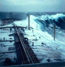
The big waves of computer models, of course, are an exercise in theory divorced from practice. In nature, waves are not nearly as predictable and orderly as they are in laboratories, computers, and mathematical equations. While features such as velocity, period, and length are easy to measure in controlled circumstances, in the open ocean they can be hopelessly confused. Swells the size of small hills come at you from several directions at once, each rising and descending unpredictably, the slopes hacked by wind waves and covered with a perplexity of tiny capillary waves. One moment a breaking curler rushes down the slope of a large swell, then a trough fills with the crest of a wave coming from the side or falls away into yet a deeper trough. The random and disorderly nature of waves in the oceans almost guarantees that they will occasionally produce waves of a higher order. Such "rogue," "freak," or "episodic" waves are known as Extreme Storm Waves (or ESW) when they develop within a storm, and often rise in groups of three that have earned the quasi-mythical designation "Three Sisters Waves." Most reports of ESWs note that they look like "walls of water," that they're accompanied by steep-sided and unusually deep troughs (deep enough to occasionally swallow a ship), and that they spill forward and break simultaneously and with equal energy the entire lengths of their crests. An enormous freak wave with those characteristics struck the Queen Mary amidships south of Newfoundland while ferrying U.S. soldiers home at the end of World War II, rolling her to within a degree or two of capsizing.

Rogue waves can occur on relatively calm seas with no storms for hundreds of miles. Trains of swells traveling in the same direction but at different speeds will pass through one another; when their crests, troughs, and lengths happen to coincide they reinforce each other, combining their energies to form unusually large waves that tower mountainously for a few minutes then subside. Such giants can suddenly reach several times the height of most of the waves around them, forming mid-ocean breakers that are probably responsible for at least some mysterious disappearances of ships. When such anomalous waves occur near shore, roaring down without warning on piers and rocky ledges, they sometimes sweep people to their deaths.

When waves meet opposition in an oncoming current the wavelength is shortened and the wave is forced to become steeper and as much as two to four times higher. Examples can be seen on a relatively small scale at the mouths of rivers or estuaries, where the outflowing current creates high choppy waves that can be dangerous for small craft. When a current exceeding about four miles per hour is spread over a large area and involves massive amounts of water the danger is magnified. Regions notorious for such hazardous juxtaposition of waves and current include the Agulhas Current off the east coast of South Africa, the Kuroshio Current southeast of Japan, and the Straits of Florida and elsewhere along the Gulf Stream, where 30-foot waves blown up by nor'easters sometimes reach 40 to 60 feet in height.

Reports of rogue waves a hundred or more feet in height are no doubt often exaggerated, but careful measurements by coolheaded observers have left little doubt that waves of that size sometimes occur. One fairly reliable way sailors have measured such waves is to climb the rigging until they reach the point, while the ship is in the bottom of a trough, at which the crest of the wave lines up with the horizon. The height climbed then equals the height of the wave. This technique, or variations on it, have been used to measure some waves of terrifying dimensions.

One of the largest waves ever measured was reported by Navy Lieutenant Commander R. P. Whitemarsh in a famous paper titled "Great Sea Waves," published in the U.S. Naval Institute Proceedings in August 1934. Whitemarsh encountered a storm on February 7, 1933, while crossing the Pacific in the navy tanker the U.S.S. Ramapo. During this storm, west winds had a fetch across thousands of miles of unobstructed ocean and had already blown at gale force for days. With the wind at 60 to 66 knots (69 to 76 miles per hour) directly from the stern and the waves consistent, without cross seas, Whitemarsh and his crew were able to estimate (based on the 478-foot length of the ship) that the length of the waves was 1,000 to 1,500 feet. Using a stopwatch they timed wave periods up to 14.8 seconds. Crew members standing on the ship's bridge could measure the height of a wave by lining up its crest with the horizon and a point on the ship's mast (making the line of sight approximately horizontal) while the stern of the ship was at the bottom of a trough. By triangulating from the line of sight to the bottom of the ship's stern (or the trough of the wave) they were able to determine the height of each wave. The largest they measured was 112 feet.

Other notable waves have been measured against stationary objects, especially lighthouses. In the winter of 1861, for example, the Bishop Lighthouse in the Isles of Scilly was struck by a wave high enough to smash a fog bell hanging 100 feet above the ground (eyewitnesses insisted the crest of the wave came down on the bell), breaking a metal support bracket four inches thick and tossing the bell to the rocks below where it smashed to pieces. Waves have occasionally passed over the top of the 75-foot-high lighthouse on Minots Ledge, Massachusetts, and have flung rocks through the glass of Oregon's Tillamook Rock Lighthouse, 133 feet above the water.

Weather Story

From IAEM supported IDER Conference in London, England.

VIETNAM: Homes of hundreds of thousands of Vietnamese villagers are still under water after days of some of the worst flooding in decades, caused by the typhoon Lekima. Up to 67 people were killed and 14 were missing. The provinces Thanh Hoa and Nghe An were worst hit by floods and landslides and its two million inhabitants are affected. Maintaining sanitary conditions and the threat of water-borne diseases is becoming real. The disasters damaged over 100,000 houses, closed roads, submerged hundreds of thousands of hectares of subsidiary crops, and disrupted electricity and telecommunications system, isolating villages in several mountainous areas. Preliminary reports said nearly 58,000 houses were damaged or destroyed.

CHINA: Typhoon Krosa caused landfall in the southern China, lashing with heavy rain and high winds up to 126 km/h. It has been downgraded to tropical storm today. No casualties were reported although over 5 million people in east China's Zhejiang Province were affected. The storm prompted evacuation of more than 1.41 million people. Transportation services were paralyzed, power supplies cut off, schooling and tourist businesses suspended, and ship services halted on Saturday.

Chicago - On Sunday October 6, 2007, we broke the record of 86 set in 1947 by one degree - 88. Unfortunately we also broke the Chicago Marathon. One died and some 300 needed medical attention. The race was called half way through... However fall has arrived so we will be moving from Construction Season to Winter.... Good Morning Chicago!

That time of year again! Water Buoys to be removed in 10 days (Oct 5, 2007)

Funny side story here as told to me by a port captain for a major tug and barge company here in Chicago a while back ago.

Every winter as the lakes freeze over the USCG has to remove buoys and get the ole icebreaker ready. Though one of the local maritime companies has a tug that is ice capable. Seems that the local Indians who snow mobile over the lakes between Michigan and Wisconsin will mark the trail with small trees so that they can follow the path back home. One Captain of the ice-tug seemed to love to target and "break ice" directly in between the path of the trees so that the trail ..eh...ends... abruptly.

Water Buoys to be removed in 10 days (Oct 5, 2007)

Warning buoys upstream of seven Grand River Conservation Area dams along the Grand River will be removed the week of Oct. 15 to prepare for winter.

The buoys will be put back in place in May 2008 after the spring runoff.

Boaters using the river after the buoys are removed should exercise extra caution around the dams.

Buoy removal schedule:

*Oct. 15 - Dunnville Dam;

*Oct. 16 - Caledonia Dam, Wilkes Dam (Brantford);

*Oct. 17 - Parkhill Dam (Cambridge), New Hamburg Dam, Drimmie Dam (Elora), Bissell Dam (Elora).

The schedule is subject to change depending on weather conditions.

The buoys are installed each May to warn canoeists and kayakers about the danger of approaching these dams, which are all known as "run of the river" or "low head" dams.

The water upstream of the dams can be still and placid, but the area downstream can be dangerous.

Strong currents at the base of the dam can capsize a canoe or kayak and trap the occupant underwater.

Just a note from me

Recently I wrote a OPED which appeared in the Forth Worth Star Telegram on the mis-placement of six nuclear ACM 129 Cruise Missiles. I really shy away from politics but this incident is a very grave and serious matter not just to me but many of my peers. I sincerely hope that the USAF completes its investigation and the truth comes out. I wish to thank Paul Harral, Editor of the Editorial Page of the Forth Worth Star Telegram for taking the subject matter seriously and giving me the opportunity to go to print. His editorial skills and patience with me was just outstanding.

I cannot take full credit for the entire article, many of my peers and maritime friends coached and helped with support and questions. It was a team effort and I wish to thank them as well. I also wish to thank Susan H and Larry Johnson of No Quarter for re-printing the article. Their blog is one all must keep in their bookmarks. I also wish to thank Fred Fry of Fred Fry International and my shipmate Captain John Konrad at gCaptain for re-posting the article. Both blog's are also truly amazing like the men who write them.

RS


Monday, October 8, 2007

Busy Pacific Storms

While its been extremely quiet in the Atlantic the Pacific is entirely another story.

To date there have been some 15 named storms and another three weather systems of interest harrassing the area. Unlike the Atlantic Hurricane season typhoons can run year round in the Pacific.


Tropical Cyclone Krosa now a tropical storm is now tracking toward China. At the last observation, on 2007/10/07 6:00 UTC, tropical cyclone KROSA is a Tropical Storm with maximum sustained wind speeds of 25 m/s (92 km/h, 50 knots) according to the Joint Typhoon Warning Center.
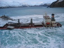
Meanwhile, another system Typhoon Lekima, triggered floods and landslides which battered Vietnam's central coast earlier this week and killed up to 34 people and left 19 others missing. Thousands of homes were destroyed in two central provinces of Ha Tinh and Quang Binh, Vietnamees officials reported on Sunday. Lekima was the fifth typhoon to hit Vietnam this season. Tug boats were stabilizing the M/V Aladdin Dream which ran aground during the storm.

Freak Waves?

Here is a interesting story from New Zealand on a reported "freak wave" in one of New Zealand's worse maritime accidents.

Sinking just a 'freak accident'
5:00AM Sunday October 07, 2007
By Michelle Coursey
An official report into one of New Zealand's worst maritime tragedies, the sinking of the Kotuku fishing boat in Foveaux Strait last year, attempts to lay blame where it shouldn't, say family members of the victims.

The 17-metre trawler capsized on May 13 last year, reportedly after being hit by two large waves, on its way back to Bluff from the Titi Islands, near Stewart Island.

Six people died in the incident - including members of three generations of one family - while three others narrowly escaped with their lives by swimming to a nearby island.

On board were members of the Topi family, a well-known clan in Bluff - Leslie Topi (known as Peter), 78, his daughter Tania Topi, 41, and his two grandsons Shain Topi-Tairi and Sailor Trow-Topi, both aged nine, all died; while Paul Topi and Dylan Topi both survived the accident.

Skipper John Edminstin also survived, but his friend Ian "Shorty" Hayward, 52, and crew member Clinton Woods, 34, perished.

Last week, the first preliminary report was released on the tragedy by the Transport Accident Investigation Commission, but those close to the victims are unhappy about its contents, and plan to tell the TAIC what they have got wrong.

Those who have seen it have had it "drummed" into them that they are not allowed to discuss its findings until after a meeting to be held this Thursday. The closed hearing will be held in Invercargill, where the three-member Commission will hear submissions from those affected.

All of those who spoke to the Herald on Sunday yesterday intended to be at the hearing, or make submissions via email on the content of the report.

But at least one family member, who did not wish to be named, said the conclusion of the findings was the part they found most objectionable, as it tried to "find something wrong" with various factors, including people's actions and the boat, to explain the incident.

"They've tried to find something to blame but it was a freak accident. They can't seem to accept there were two waves, and that's what did it."

While previous reports have speculated the boat may have been overloaded - it was carrying around 60 buckets of muttonbird on deck when it left the Titi Islands - the TAIC findings apparently do not say that was the cause.

Neither do they apportion blame to alcohol being consumed; however, they do make suggestions as to what might have been done by those onboard to survive.

"That just seems pointless. I guess they have to do it, because they said this report is meant to tell other people what not to do, but it's a bit late now."

The report includes much technical detail, including stability testing on the boat, and a close analysis of its seaworthiness. Some of the information in it has come as a surprise to family members, but then "we weren't on the boat" they say. And neither were the writers of this report, they add.

Edminstin did not wish to speak at length to the Herald on Sunday yesterday, preferring to save his comments on the tragedy for after the government reports were finalised.

TAIC hopes to release its final findings by the end of the year, but that will "depend on the extent of further work required following next week's hearing", chief commissioner Bill Jeffries said in a press release.

However, after that, another report will be put together by Maritime New Zealand, and Southland coroner Trevor Savage is waiting for both before deciding if an inquest into the deaths would be held.

Judy Hayward, who lost her husband Ian in the sinking, and who has since relocated to Melbourne, said every time someone mentioned the name of the boat to her "it brings it all up again", and she was looking forward to when "all of it has finished".

After reading the report, she would make her submission to the commission via email, but agreed that it was simply an accident.

"At the end of the day you can't change the sea. No amount of preparation can change the strength of the sea and no amount of reporting will make it [the accident] go away."

Another widow, Joyce Topi, who lost husband Peter, said she had not read the report because she didn't believe it needed to be written in the first place. "It's nobody's fault, it was an accident."

The Kotuku itself continues to sit rusting in the backyard of an old timber mill outside of Invercargill.

Edminstin still plans to burn the boat when it is returned to him - he has no use for it now.

"It should never have been lifted up," said Judy Hayward. "It was already a graveyard."


My favorite subject, USCG Rescue Teams.
2006 AIRSTA SAV rescue clips to music.


Weather Note

Chicago Weather for October? 88 degrees? Unheard of ! And what did the heat do the Chicago Marathon?

One dead, 250 hospitalized after heat-shortened Chicago Marathon Associated Press - October 7, 2007 5:43 PM ET

CHICAGO (AP) - A Michigan man died while running the Chicago Marathon as stifling heat and humidity forced race organizers to shut down the course midway through the race. Authorities say the 35-year-old man collapsed while running on the city's South Side and was pronounced dead at a Veteran's Affairs hospital.Some 250 people were taken to hospitals because of heat-related ailments.

The decision to turn runners around effectively ended the race for many thousands midway through the course. Organizers closed the second half of the course just before noon, four hours after the annual race started with temperatures already touching 73 degrees with 86% humidity. By 10 a.m., temperatures had already reached a race-record of 88 degrees.

The men's race was won by Kenya's Patrick Ivuti (eh-VOO'-tee). Ethiopia's Berhane Adere (buhr-HAYN' ah-DAHR') rallied to successfully defend her women's title.

Copyright 2007 The Associated Press. All rights reserved. This material may not be published, broadcast, rewritten or redistributed

RS