Showing posts with label skywarn. Show all posts

Thursday, May 22, 2008

Weather spotters critical element of severe weather warnings

Weather spotters critical element of severe weather warnings

Sunday, May 18, 2008 6:11 PM CDT

BLOOMINGTON -- Curtis Hawk has 2,400 eyes and ears when it comes to severe weather, and he needs them all.

He has 1,200 weather spotters scattered throughout McLean County, who are especially important during peak tornado season of March, April and May.

“Radar picks up a lot, but the man on the ground is very important,” said Hawk, McLean County Emergency Management Agency (EMA) director.

His agency handles other emergencies as well, such as hazardous material spills, but weather is the most common emergency, Hawk said.

A severe weather watch means the conditions are favorable for bad weather. A warning means severe weather has been spotted.

Ideally, there’s a watch before a warning. “It’s tough if it goes right into a warning,” Hawk said.

Many of the McLean County weather spotters have all-hazard alert radios that alert them to bad weather, Hawk said.

The spotters, he said, volunteer for the same reason as do volunteer firefighters — to protect their community. Spotters come from all walks of life and include everyone from firefighters to State Farm office workers, he said.

Severe weather occupies much of the time of the Emergency Management Agency in Woodford County, where Director Bob Hix said there are between 150 and 200 weather spotters.

His agency relies on the National Weather Service in Lincoln, emergency agencies in other counties and weather spotters. Warning sirens also help: Hix said Roanoke got three new sirens over the past five years and Eureka will get a new one this summer.

The new sirens cost up to $30,000, are louder than the old ones and can be used as a public address system. But Hix said they are no substitute for a weather alert radio because they can’t be heard by everyone inside a well-insulated house with the television on.

“A weather radio is still the answer for most people,” he said. The radios can be purchased for between $50 and $70.

Hix, who runs a one-man office, tries to stay available in case he’s needed. “I don’t make too many trips during the tornado season,” he said.

WEATHER NOTE

Florida Hurricane Conference Presents Message of Preparedness

Preparing for hurricanes, despite two slow previous storm seasons, is key to the survival of Floridians and recovery efforts, officials said.

About 2,800 people attended the 22nd Annual Governor's Hurricane Conference on May 14, where the main message was preparedness over complacency.

"Each and every individual citizen has a responsibility,'' Gov. Charlie Crist told a crowd of emergency responders.

Craig Fugate, the state's emergency management chief, said too often we refer to victims after hurricanes when instead we should focus on survivors.

The mentality in the past has always been, "something went wrong, blame somebody else,'' Fugate said.

"It's about being survivors, that's my message,'' Fugate said. "We can accomplish a lot if we include our neighbors, the people down the street. Write them out of your plan, and we're going to fail. It's just that simple.''

Fugate repeated a familiar message: it's not a question of if another hurricane will hit, but when, and the need to be prepared to survive alone for a few days after the storm is more important than ever.

"If we can't do that, everything else we do will fall flat on its face,'' he said.

"If the great Miami hurricane hits today, it will dwarf the cost of Katrina,'' Fugate added, noting estimates put such a disaster cost at more than $160 billion in losses. "The message is simple. We've got to be survivors.''

Earlier in the day, Crist also emphasized the need for citizens to be prepared to help themselves.

"Without our citizens, there's just no way we can help everybody,'' the governor said. "We were very fortunate last year ... but we can't count on that.''

Hurricane season begins June 1 and runs through November.

Later in the day, talk turned briefly to global warming and its potential effect on hurricanes, a debate that has been raging within the scientific community for several years.

Stanley Goldenberg, a meteorologist with the National Oceanic and Atmospheric Administration's Hurricane Research Division, warned that "just because it's published doesn't make it true.''

"This is a hot debate,'' Goldenberg said. "I have never seen anything like it in my career.''

He said "very prominent scientists with tremendous reputations'' have conflicting opinions about whether man-made global warming will have any effect on hurricane strength and frequency.

"The weather is always changing,'' he said, regardless of man's actions, and certainty about man-made climate change and its affect on hurricanes is far from, well, certain.

MARITIME NOTE

Bad weather for marine insurance
05/19/2008 08:13 PM |
By Frank Kennedy, Special to Gulf News


At the beginning of this year there was a mood of short-term optimism in the marine insurance sector that was summarised by Aon's Annual Marine Insurance Market Review that predicted the industry would experience a continuing run of favourable insurance premiums in 2008, despite facing higher risks.

Moreover, Aon said that the cargo and liability markets would offer a 'win-win' scenario to ship and cargo owners who were paying less and to underwriters who remained in profit due to fewer claims - for the time being, at least.

The expectation was that rates for well-managed risks would continue falling throughout 2008 by up to 10 per cent, due to a plentiful supply of capacity combined with a low claim level creating fierce competition between underwriters.

Furthermore, the relatively benign claims environment was a reflection on major advances in recent years in ship design, cargo handling and general maritime safety.

However, Aon was certainly not as optimistic for both the Protection and Indemnity (P&I) and the Hull and Machinery markets saying the tide was turning for P&I, the clubs having announced big rate increases for 2008 in response to a surge in the size of large claims.

Furthermore in Hull and Machinery, losses were beginning to impact the accounts of many insurers, although not as severely as in P&I. Affirmation of this mixed picture came last week from the UK P&I Club that said the high level of large claims seen in 2006 continued into 2007 except for those related to oil pollution that had been at their lowest for five years.

The Nordic marine insurance association CEFOR is also pessimistic about the overall future of all types of marine insurance following 2007 figures that demonstrated an alarming trend with the average hull claim cost rising 86 per cent over the last five years.

With claims costs likely to continue growing in the future, the association has expressed concern that the industry must take further steps to manage costs without risking safety.

Within different segments of marine insurance, the picture remains distressingly consistent and the members of the International Group of P&I Clubs are currently faced with a considerable increase in costs of their pooling arrangement, covering claims in excess of USD seven million. Indeed, the severities of large claims is showing record highs.

The present situation has been precipitated by several contributory factors, both internal and external to the maritime industry - and on the internal front the issue of manning is very relevant.

For some time now the International Maritime Organisation (IMO) has expressed concern regarding the growing shortage of skilled and experienced seafarers to man a growing and increasingly technological fleet.

Such is the price for a current shipping boom with resources being stretched by demand but this shortcoming is now impacting directly on insurance claims with an alarming indication of increasing human error statistics as significant contributory causes of marine accidents!

Cost increases

Externally, the current rises in costs of raw materials and services have also been a direct cause of price increases for all claims cost factors and the entire scenario has been adversely affected by the weak US dollar, add to this the increasing complexity of environmentally-aware processes of salvage and wreck removal, then cost increases are being further exacerbated.

Such are the forces that will undoubtedly determine the rises in premium prices that are now set to befall the ship operator and with little change expected in the external factors at play it will be incumbent on the industry as a whole to contain the situation as far as it can.

This must be by internal improvement to reduce the number of insurance claims; otherwise the costs may become exponential.

Such a solution is, of course, easier said than done but is symptomatic of the many fundamental flaws that are present within the global industry where the 'good-guys are carrying the bad guys' - this goes for operators, Flag Administrations and classification societies alike. Until management of risk is properly contained across the entire operational spectrum, the costs will be payable in lieu!

Medevac South of Freeport, Texas

HOUSTON - the Coast Guard medevaced a 42-year-old man from an oil tanker approximately 30 miles south of Freeport, Texas, May 8, 2008. Coast Guard Sector Houston-Galveston received a call at 5 a.m. ...


Happy National Maritime Day!

RS

Wednesday, February 27, 2008

First Spring Flood Outlook Released

First Spring Flood Outlook Released

The first 2008 Spring Flood Outlook was released February 22, 2008 and indicates the potential for minor to moderate flooding on streams within northern Illinois and northwest Indiana. The complete report can be viewed here.

We also urge those with river interests to view our Advanced Hydrologic Prediction Service (AHPS) web pages, for probabilistic flood outlook information through the spring, or anytime heavy rain occurs or flooding is possible.

The amount or severity of spring flooding depends on the following factors:

  • Current snow depth
  • Liquid equivalent of the snow
  • Current river levels and streamflow
  • Melting rate (how fast the snow melts)
  • Future precipitation
  • Soil moisture and frost depth
  • Ice jams (can lead to flash flooding)

Additional Spring Flood Outlook information is available from the North Central River Forecast Center.

The next scheduled spring flood outlook with be issued on Friday, March 7th.

Fermilab Severe Storm Seminar Info - A Sure Sign of Spring!

The annual Fermilab Tornado and Severe Storm Seminar will be Saturday April 5 at 1200 Noon and again at 600 PM. The program will be held at the Ramsey Auditorium at the Fermi National Accelerator Laboratory in Batavia, Illinois. The program lasts about 4 hours, its free and open to anyone. Seating is first come, first served. The program is hosted by WGN TV’s Chief Meteorologist, Tom Skilling and is put on by the Fermilab Visual Media Services Department.

This year’s speakers include;

Tom Skilling - Chief Meteorologist WGN TV

Dr. Joseph Schaefer - Director of the NWS Storm Prediction Center

Dr. Mary Ann Cooper - University of Illinois, Chicago

Brian Smith - Warning Coordination Meteorologist, Omaha, NE

Ed Fenelon - Meteorologist in Charge, NWS Chicago

Gino Izzi - Lead Forecaster, NWS Chicago

Jim Allsopp - Warning Coordination Meteorologist, NWS Chicago

More information to come!


SKYWARN TRAINING

NWS Chicago (KLOT) Severe Weather Spotter Talk Schedule


NSSL PODCASTS - Flash Floods

Estimating Precipitation and Improving Flash Flood Forecasting with Radar Kevin Kelleher, Deputy Director of the NOAA National Severe Storms Laboratory and Dr. Suzanne Van Cooten, NSSL Research Hydrometeorologist, discuss using radar to estimate precipitation and improve flash flood forecasting. Recorded 8 November 2007

  • Section 1 - Research in using radar to estimate precipitaton (2:44)
  • Section 2 - Research on flash flood forecasting and a demonstration project in the southeast United States (6:14)
  • Section 3 - Research on debris flow and mudslides (1:51)
  • Section 4 - How NSSL’s research benefits forecasters (2:08)
  • Section 5 - Kevin discusses his career path (4:08)
  • Section 6 - Suzanne discusses her career path (5:32)

headphonesLISTEN TO THE COMPLETE PODCAST RUNTIME 23.01 TEXT TRANSCRIP

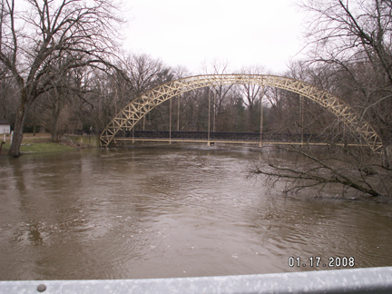
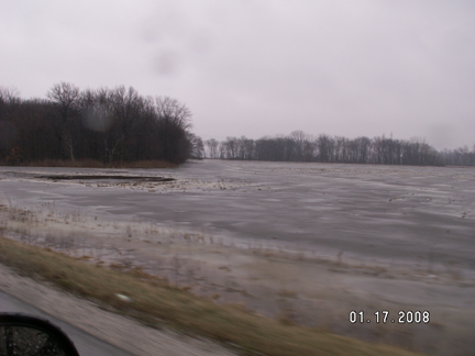
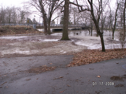
FLOOD PIX'S FROM DUNNS BRIDGE -PORTER/JASPER COUNTIES INDIANA


MARITIME NOTES:

Dar’s Maritime Institute to offer new courses for seamen

By MOHAMED ISSA MOHAMED
Special Correspondent

The Dar es Salaam Maritime Training Institute has introduced new training programmes to allow workers to keep abreast with international trends.

Two new courses were launched ordinary seafarers, officers at ports and onboard ships, cargo clearing and forwarding agents and ship fleet-freight operators.

Until recently, workers at sea and lake transport regimes in the country were employed without necessarily having qualifications.

But the country’s increased trade with advanced shipping nations like China, Netherlands, the United Kingdom, Japan, and the United States has put it under pressure to adopt international acceptable employment guidelines or risk its seamen and port being blacklisted.

According to Dar es Salaam Maritime Institute principal Thomas Mayagilo, the two new courses will add life to the industry.

The logistics and transport international diploma will provide a seamless transport convenience whose holder will professionally be able to arrange for a cargo from a port of loading abroad destined to inland Tanzania,” he said.

He added that the system would help the delivery of cargo without delay and the importer will not be obliged to travel all the way to Dar es Salaam to chase his merchandise.

Seafarers will train on fire fighting techniques, response during life-threatening instances at sea or inland waters, safe cargo deployment on decks or hatches among other skill-instigated job requirements.

Many seafarers get injured or are the cause of fatal ship accidents due to lack of proper training before they are signed in to man the vessels.

Tanzania liberalised the water transport sub sector in 1990s. The country has in its jurisdiction an 800-km shore strip facing the Indian Ocean and several inland water bodies.

The institute is among a few such institutes in sub-Saharan Africa mandated by the International Maritime Organisation to offer marine engineering courses and certificates of competency.

Tanzania had until recently 320 marine engineers, most of them graduates of the institute. About 62 per cent of them work aboard locally registered ships; seven per cent on shore while four per cent on board foreign ships.

Tanzanians risked a forfeiture of 420 international jobs after those who worked with international shipping lines were found to have not undergone courses that conform to the standards of training, certification and watch keeping (STCW).

Tanzania later adopted the STCW signed the International Ship and Port Security (ISPS) Code.

Established in 1991, DMI took over the responsibility of designing the STCW and ISPC oriented training programmes. It trains company security officers, ship security officers and port security officers as a result.

Besides offering advanced diploma courses in marine transportation and engineering, the institute trains deck officers and marine engineers at the operational level and other shipboard personnel at the supporting level.

The basic operational objectives of DMI being however to train seafarers to the requirements of the 1978 international convention on “Standards of Training Certification and Watch keeping for Seafarers as amended in 1995, it trains students up to level of class 3 Certificate of Competency for both engineers and deck officers.

In 1996, the now East African Community designated the Dar es Salaam Maritime Institute as the regional maritime training centre.

The institute, funded by the Tanzanian government, and the Norwegian International Development Agency, admits students from all over including Uganda, Zimbabwe, Zambia, Malawi and Namibia among others.

NATIONAL MARITIME FESTIVAL 2008

Jeanne Walls, 22 Feb. 2008

The annual National Maritime Festival will be held this year at the Newcastle foreshore on SUNDAY 12 OCTOBER 2008. Erica Townsend has been appointed as the new Event Manager. Erica has commenced planning for the Festival and the Grand opening of the Maritime Centre.

The National Maritime Festival celebrates Newcastle’s rich maritime history and is not only the longest running event but one of Australia’s largest maritime festivals.

This year promises to be the best Maritime Festival “Spectacular” to date and will herald The Grand Opening Exhibition of The Maritime Museum at Lee Wharf, Honeysuckle - this $800,000 exhibition is currently in progress with Convergence Design Consultants/Melbourne .

Newly appointed Event Manager for 2008 is Erica Townsend who coincidentally is the daughter of the late Captain Kenneth Hopper OAM. Captain Hopper was Newcastle Harbour Master from 1966 till retirement in 1980. In 1973 Captain Hopper was the founder and first President the Regional Maritime Museum and was responsible for resurrecting The Newcastle Harbour Regatta (now Festival). The ‘Regatta’ was first held in 1984 and was disbanded during World War II.

Erica comes with a heartfelt passion for the Maritime Festival as well as 25 years in Hospitality, Event Management and Tourism. Erica returned to the Hunter in 2000 to open and manage Len Evan’s iconic hotel in the vineyards, The Tower Lodge.

Erica says “this years Festival will be especially significant with the Grand Opening of the Maritime Museum Exhibition which will proclaim the opening of the National Maritime Festival weekend . The fun-for-all harbour celebration will include many of the favorite on-shore and on-water events and activities of past years as well as a few ‘spectacular’ surprises.”

A FREE shuttle service will be running on the day to transfer visitors and spectators from Various points along the foreshore in a continuous loop from 10am till 5pm.

It is expected that this unique and growing event will attract visitors from around the State including the Upper and Lower Hunter, Central Coast, Mid North Coast and Sydney Regions.

For more information and PHOTO opportunities please contact: Event Manager ERICA TOWNSEND 0411 461 075 Event Director JEANNE WALLS 0412275 707


Life and Death on the Bering Sea Deadliest Catch Alaskan Storm for Xbox 360 and PC

SEATTLE (February 26, 2008) - Battle 40-foot waves, storms, ice and a nearly 100-percent crewmember injury rate in the dangerous hunt for undersea riches on the Bering Sea with the new video game Deadliest Catch Alaskan Storm, to be launched on the Xbox 360®video game and entertainment system from Microsoft and PC in April 2008.

The game was inspired by Sig, Edgar and Norman Hansen - three brothers who have made their living crab fishing on the Bering Sea aboard their family's fishing vessel, the Northwestern. The Hansen brothers started game development with Liquid Dragon Studios in October 2005.


Shipping firms neglecting safety as top priority: NMSA


By MADELEINE AREK

SHIPPING companies have in the past, had a tendency of turning a blind eye to the safety of their vessels, putting the lives of the travelling public at risk.

The laxity of PNG’s shipping laws and of enforcing agencies in policing these laws, had allowed companies to operate unseaworthy vessels as well as bringing in very old ships and “treating us as a dumping ground for old vessels” National Maritime Safety Authority general manager Chris Rupen, said yesterday.

According to Mr Rupen, because monitoring agencies were ill-equipped to effectively carry out regular safety inspections, these companies got away with using vessels that were not seaworthy, often putting the lives of the travelling public and of thousands of kina worth of cargo at risk.

While it was not the intention of NMSA to delay the shipping operations of companies, it was important that regular safety checks were done so that the safety of the travelling public was not compromised, Mr Rupen said.

He said his office had the responsibility of policing shipping rules and regulations and that was what they have been doing over the three years since their establishment in 2006.

“Our officers carry out routine checks on all shipping vessels. Sometimes the deficiencies are minor and take a few minutes to rectify. At other times, they take a few hours and we tell the master to rectify the situation. If the deficiency is major, we ground the vessel,” he said.

“We work with these companies and not against them. We do what we do to make them more responsible and often, they are happy with what our officers do and comply.”

He said it was their duty to make sure shipping companies took responsibility of the safety of their ships; that they did not let defects go by.

“We do random inspections on all shipping vessels, foreign and local. On foreign vessels, we carry out port state control inspections while on domestic vessels, our officers’ carry out flag state control inspections. These checks are done to make shipping companies responsible,” he said


RS

Wednesday, September 12, 2007

Annual Call for SKYWARN Footage


This was a decent severe weather year for most of us --with possibly more nasty weather yet to come. Many of you are now working on/thinking about your highlight reels. I figured now would be a good time to announce my annual "call for SKYWARN video" a little early while you are spending time with the *raw* footage. My free classes would not be possible without the generous contributions of footage from storm chasers, spotters, EM, ham radio, and the media. Each year I search for fresh footage of weather-related phenomena to help get people more excited about attending the training / re-training.

Further, I'm on the look out for never-been-seen footage of unique events such as lightning strikes, accidents, flood rescues (there have been a lot of these lately), tornadoes causing damage, and giant hail. I'm talking about eye-opening video which helps drive the safety points home and maintain interest in a dark crowded room.
Most chaser highlight videos contain a lot of tornado footage. That's good for entertainment and research but not necessarily the best material for spotter training since the majority of what spotters really see (and get confused about) is non-tornadic. Therefore the footage you may be thinking of discarding from your highlight reel often turns out to be the best material for training. So what am I looking for? Well put yourself in the position of a new spotter.

This might be a 14 year old girl or a 50 year man old who's suddenly become interested in severe
weather after a recent close call with a tornado. These are folks who likely have little or no exposure to severe weather training outside of what they've seen on TWC/TLC/NGC. What kinds of things do you think these folks might need to know to operate safely around storms and make meaningful and accurate reports? Now consider the people who have attended several (perhaps dozens) of SKYWARN classes. You know, the folks snoring in the back of the room! What kind of material do you have which might help teach these "old dogs" some new tricks? Ask yourself this. Have you seen spotters make the same bad calls or dumb mistakes over and over and you've said to yourself "what's the matter with these morons?" Most people aren't morons they've just haven't received adequate training and reinforcement. It's the "old dogs", whom many new spotters look up to for training and reassurance, that pass on valuable experience as well as misinformation.

Therefore these folks need to be reached too.
When I look for footage I prefer DVD or mini-dv tapes but being that I work in broadcast TV I have access to all formats of players. I prefer raw, unedited, footage. That means you don't need to clean up the jump cuts, remove swear words, or add cheesy music Please no cheesy music).

It's helpful your footage includes the date, approximate time, location, and (if you can remember) the direction you were looking. I use this information to match up with archival satellite, radar, and surface data to give a more full picture. I am especially interested in events where multiple chasers got footage of the same event from different angles.
For example, I shot some nice footage of tornadoes in Protection, KS this year. Later at Rocky's chaser party I saw some great close-up footage of the same tornado. As I chaser I'd say the close-up footage was the best but as a spotter trainer I'd say both scenes were equally important since not every spotter will be 1/4 mile away or be looking at a back-lit tornado free from obstructions, and facing west. It's the not so obvious stuff like a developing tornado with no condensation funnel that spotters need to know about.

It's the stuff that looks like a tornado but is not that spotters need to know. It's the situations which appear safe but are in fact are very dangerous (like Greensburg at night) that spotters need to know how to deal with.
So if you have any footage of weather phenomena, safety-related issues (good and bad), reporting techniques (good and bad), measurement techniques, and spotter gadgets I sure could use it. As always I provide on-screen credit for people who provide footage. I once included people's names on every shot but this was a real hassle in editing and also proved really distracting to the viewers. When people ask specific questions about whose footage they just saw I provide them with the name of the contributor. It should be noted that I do these classes as Chris Novy, amateur radio operator/EM trainer. My classes are not affiliated with my TV station employer so I encourage you media folks on WX-CHASE to consider contributing station-obtained footage.

News crews often get the best footage of really dangerous people tricks. You have my guarantee that your footage will not appear on my TV station or be part of any weather-related productions outside the immediate scope of my live classroom talks. I've been doing this a long time and have a reputation with the chasing community to keep.
Last year I started sharing (with permission of the contributors) footage with NWS OUN.

I would like to offer this service again--either by 1) offering to make an exact copy of any footage you send me, 2) having interested NWS offices who have seen the footage you provided me with contact you directly for a copy, or 3) by compiling an edited down "SKYWARN essentials" DVD which contains scenes and supporting raw data to be used in NWS SKYWARN training. Such a DVD would contain no narration and no music.

I would probably burn the name
of each contributor on the video since I would not longer be in direct control of the video once it's left my hands and I want your assets to be protected. Here, NWS offices could digitize specific scenes of rain, hail, tornadoes, etc. as *they* require for their own unique training needs. I'm really interested in comments about the DVD idea and whether its release should be only to NWS offices or should also include organized EM and ham radio groups which do their own training. I've been asked about producing a complete training DVD but honestly I feel it's better for people to attend a SKYWARN class, mine or NWS, where they can interact with the instructer and learn from others at the presentation.

It's like saying "here's a book about how to do CPR" instead of encouraging someone to take an actual class.
Thanks again for your support. Please contact me off-list (chris@siu.edu) if you have footage you are willing to donate and also let me know if and how it can be shared with NWS.

If you think I (or someone else in the group) should put together a "SKYWARN Essentials" raw footage DVD for NWS purposes let's discuss this openly on WX-CHASE. I am willing to reimburse people, if needed, for postage but since I'm not operating under a grant and I don't play the lottery I have no funds for purchasing video.


Again thanks.
..
Chris Novy.. WA9V Yukon, OK

Maritime Notes:

Here is one for kicks! "
Bad weather conditions are being blamed both for the grounding and delays in getting her refloated" Yeah I would consider a Cat 5 Hurricane bad weather...


Maersk container ship runs aground
Mexican press report grounding of MAERSK DIADEMA

A MAERSK operated container-ship grounded outside the Lazaro Cardenas container terminal in Mexico, reports local press.

The incident happened on Saturday, according to Maersk and press reports. Bad weather conditions are being blamed both for the grounding and delays in getting her refloated.

A customer advisory on the incident, apparently published yesterday, by Maersk appeared to indicate that attempts would be made to refloat her, and it would appear these have so far been unsuccessful

The vessel does not seem to be damaged and power to her refeers is still maintained, according to Maersk

The local press claim that the vessel's grounding was suppressed by port officials initially and that a 'lesser employee' confirmed the story later.


The MAERSK DIADEMA is on charter to Maersk (initially chartered to P&O Nedlloyd before the merger with Maersk) and is actually the CHARLOTTE WULFF built for the German firm of Reederei Hermann Wulff at the Stocznia Gdynia S.A shipyard in 2005.

She was delivered with her Maersk name after being secured to an eight year charter with P&O Nedlloyd.

RS


Thursday, August 30, 2007

NOAA/NWS SEVERE WEATHER WARNINGS TO PROVIDE MORE PRECISE LOCATION THIS FALL, COMING OCTOBER 2007

NOAA NATIONAL WEATHER SERVICE SEVERE WEATHER WARNINGS TO PROVIDE MORE PRECISE LOCATION THIS FALL

NOAA image of NOAA Storm-based Warnings by county versus the more geographically specific locations due to take effect in October 2007.Jan. 16, 2007 — The NOAA National Weather Service will introduce this fall storm-based warnings for tornadoes, severe thunderstorms, flash floods and marine hazards that are more geographically specific for these short-duration weather events. Currently, such warnings are issued county wide. (Click NOAA image for larger view of NOAA Storm-based Warnings by county versus the more geographically specific locations due to take effect in October 2007. Please credit “NOAA.”)

"Weather doesn't follow geopolitical boundaries," said retired Air Force Brig. Gen. David L. Johnson, director of the NOAA National Weather Service. "Storm-based warnings provide the public with more specific information about the location of severe weather and the direction it is expected to move. Seconds count during tornadoes and flash floods. We want to provide the public with the most accurate description of what's happening in their neighborhood. We also want to avoid warning non-threatened portions of the county."

When issuing a warning, the NOAA National Weather Service will specify areas within a county and refer to commonly known landmarks such as highways or rivers.

NOAA image of the improved NOAA Storm-based Warnings due to take effect in October 2007."This is a fundamental change in our warning procedures and a major enhancement in our service capability," said Johnson. "Storm-based warnings will drastically improve graphical displays and empower the private sector to easily distribute the information through Web-enabled PDAs, cell phone alerts, pagers and other technologies. Communicating severe weather threats in this way is imperative in today's digital world." (Click NOAA image for larger view of the improved NOAA Storm-based Warnings due to take effect in October 2007. Please credit “NOAA.”)

The new warnings will take effect October 1, 2007.

NOAA, an agency of the U.S. Commerce Department, is celebrating 200 years of science and service to the nation. From the establishment of the Survey of the Coast in 1807 by Thomas Jefferson to the formation of the Weather Bureau and the Bureau of Commercial Fisheries in the 1870s, much of America's scientific heritage is rooted in NOAA. NOAA is dedicated to enhancing economic security and national safety through the prediction and research of weather and climate-related events and information service delivery for transportation, and by providing environmental stewardship of the nation's coastal and marine resources. Through the emerging Global Earth Observation System of Systems (GEOSS), NOAA is working with its federal partners, more than 60 countries and the European Commission to develop a global monitoring network that is as integrated as the planet it observes, predicts and protects.

Relevant Web Sites
NOAA National Weather Service

NOAA Weather Portal

Media Contact:
Theresa Eisenman, NOAA National Weather Service, (301) 580-5797


Maritime Notes:


Think intercepting this ship was any fun?


Our good freind Dr. Paul C. Liu of Freague Waves is reporting on two exciting new books. "It is a real life story, not a fiction, but it happened in November 22, 1980 over a decade before Sebastian Junger's Perfect storm." Take a look!


RS

Tuesday, July 3, 2007

Blind Man Leads SKYWARN


06/13/2007
Blind man leads Skywarn
By: Ed Kacik , Herald staff

NEWINGTON - Although Roger Jeanfaivre has always had trouble seeing, he remembers being fascinated with lightning and weather when he was growing up. His interest in weather continued even after he lost sight completely at the age of 24. While attending Oak Hill School for the Blind in Hartford, Jeanfaivre became interested in ham radio. After getting his license to operate one, Jeanfaivre would broadcast forecasts he made up."People used to think that I worked for the [National Weather Service]," Jeanfaivre said. Now he does.

People turn to the weather service for information when severe weather strikes. To make sure its information is right, the National Weather Service turns to an organization of amateurs called Skywarn.

"Skywarn provides a very valuable service to the NWS," said Betsey Doane, state section manager for the American Radio Relay League. "We can communicate quickly and directly and provide rapid response to information throughout the state."

Skywarn is made up of independent ham radio operators who are also trained weather spotters. They report wind gusts, hail size, rainfall and cloud formations that signal severe weather.

"Spotters are the people outside during the day. Their weather tools are their ears and their eyes," Jeanfaivre said. "The NWS radar is a few thousand feet up, so they can't see what is happening on the ground."

In 1994, Jeanfaivre became the state Skywarn coordinator and kept responsibility for Hartford and Tolland counties in a 2002 reorganization. He enjoys Skywarn because it allows him to blend two of his favorite hobbies, weather and ham radio, devices that work even when other forms of communication - computers and telephones or cell phones - do not.

Skywarn gathers firsthand reports of severe weather events and feeds them into local forecasts as quickly as it can. Anytime NWS issues a severe weather warning, Skywarn goes to work setting up nets.

"Nets are a gathering of radio amateurs," Jeanfaivre said. "We gather and activate the net and use repeaters ... a setup that takes a little signal and broadcasts it over a wider area which NWS can pick up. Because of the information that we're giving them, NWS can issue a watch or a warning. That's what the public sees on TV or hears over the radio."

During recent thunderstorms, such as one that produced a funnel cloud in Southington and a tornado warning in New Haven County, Jeanfaivre and his team of spotters were at work, verifying the NWS radar images.

Thanks to the evolution of the Internet, NWS can get Skywarn reports in under a minute."In 1994 we weren't tied into the Internet," Jeanfaivre remembered. "With the betterment of the new technology, they can get our reports and it supplements what they see. NWS can link into our system and get the reports as they come in. It's instantaneous." The work is "a joy" for Jeanfaivre.

"It's combining my weather interests with my skills as a communicator," Jeanfaivre said. "It's enjoyable ... We're really not weather forecasters, we're communicators, and it's my job to get the information provided by the spotters to the NWS."

RS