Wednesday, January 9, 2008

Black Sea Storms

Back on Tuesday, November 13, 2007 we reported on a severe storm that sunk several Russian ships on the Black Sea ( See Mother and Her Fury!). We recently reported on severe weather grounding the vessel Vanessa, (See Dar be Storms Ablow'in! ) and severe weather effecting Bulgaria and Romania. These at-sea storms have a deadly impact on ships and their crews while most of the incidents go unreported by electronic media outlets both in the United States and worldwide. For example, Cargolaw reported on the Vanessa,

"Bulgarian cargo M/V Vanessa, with 10 crew and a pilot aboard and cargo of scrap metal, sank in the Kertch Strait in severe seas on Jan 3 at 0600LT. There were 11 people on board the ship -- 10 Bulgarian crewmen and a Ukrainian pilot. Two ships proceeded to M/V Vanessa after its SOS-call but were unable to help due to the storm. Rescuers found only one survivor and the bodies of three crew. The bodies were taken aboard a rescue speedboat. Before the sinking the bulwark was torn from the ship. From our Sr. Correspondent Tim Schwabedissen and our Moscow Correspondent Mike Voitenko (Thurs. Jan 3 2008)."

Anyone remember seeing this report on any of the US major news outs? At-Sea Storm reports are just as critical if not even more critical than shore-side reports, since severe weather happens at sea more often than on shore. I include subsea storms or weather pattens exclusive to the oceans. Of course chasing these weather systems is not that easy either.

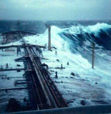
Chasing maritime weather systems is very different from chasing shore-side storms. Normally a seaman is not chasing, he is normally being chased or caught in the storm with limited escape possibilities. Meaning he is forced to ride out the storm. I can assure you that riding out one of these storms is not pleasant and scary. Like the old saying, "there is no atheists in a fox hole", well there are no atheists at sea either... As its been said, "Ship Happens!"

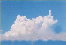
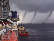
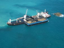
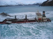
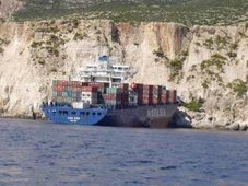
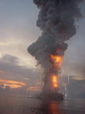
Thanks to my good friend and shipmate Captain John Konrad of gCaptain.com, These dramatic pictures are from Novembers storm.

storm in Ukraine 2


storm in Ukraine 2


storm in Ukraine 4

storm in Ukraine 5

storm in Ukraine 6

storm in Ukraine 7

storm in Ukraine 8


storm in Ukraine 6

storm in Ukraine 7


MARITIME NOTES

Cargolaw has a posting asking for assistance in solving this mystery. Dr. Beach Asks: What Vessel Lost This?

This little note from our British friends...

Gale-force winds of more than 75mph buffeted parts of Scotland and Northern Ireland today, causing flooding and danger on the roads. Ferry services between Northern Ireland and Scotland were suspended last night because of the weather conditions, which reached 78mph in the Isle of Islay off the west coast of Scotland. The Forth Road Bridge remained closed to all vehicles except cars, and Fife Constabulary said roads in the area suffered from minor flooding. The high winds would continue today, shifting further north as the day continues, leading to a bright day with blustery showers, forecaster said. The Met Office issued a severe weather warning of winds up to 80mph with the the prospect of structural damage. Tony Conlan, a forecaster with MeteoGroup, the Press Association's weather division, said the highest gust measured 78mph in the Isle of Islay. He said even stronger gusts were expected today across Northern Ireland and central Scotland. He said that by the evening most places will have seen the last of the bad weather, for now. Stena Line cancelled both fast ferry and conventional ferry services between Belfast and Stranraer because of the severe weather.

The firm warned of further possible disruptions today. Police warned of a road closure in Lisburn, County Antrim, Northern Ireland after power cables were brought down. The Foyle Bridge in Londonderry, Northern Ireland was closed to all traffic. A spokeswoman for Fife Police said: "Numerous trees have been blown down blocking the roads and we have had some minor flooding across the region. "But it has not been a disaster, it has just been a bad winter night due to high winds and sweeping rain." Rough sea conditions in the English Channel were causing delays this morning to some ferry services, the Port of Dover said. All sailings from the Eastern Docks with P&O Ferries were running about 90 minutes late. Norfolkline services to Dunkerque were also experiencing some disruption to their timetables, a port spokeswoman said.


RS

Tuesday, January 8, 2008

CRAZY WEATHER!

Tornadoes in January? You ain't just Whistling Dixie!

WBBM Chicago reported up to ten (10) possible tornadoes touched down between Northern Illinois and Southern Wisconsin!

The last time the area experienced tornadoes in January dates back to 1950. It certainly has been a day from records. Temp high 68 degrees!

Currently we have a flood watch until this afternoon.

(Photos taken by Valpo University student Aron Brackett)

chicagotribune.com

Rare tornadoes rake the area

Kenosha area gets worst of twisters

By Tara Malone, Andrew L. Wang and Jeff Long

Tribune staff reporters

11:31 PM CST, January 7, 2008


Monday in northern Illinois and southern Wisconsin, as tornadoes and high winds destroyed buildings, left scores of families homeless and derailed freight cars.

Funnel clouds—as rare of a January occurrence as people jogging along Lake Michigan in short sleeves—came as the downside of record-breaking warm weather across the area. With the date's previous high of 59 degrees shattered by 9:56 a.m. at O'Hare International Airport, winter-weary Chicagoans shed their heavy coats and ventured outside, when temperatures hit a high of 65.

A tornado watch went into effect at 2:35 p.m. and winds reached dangerous speeds. Lightning ended bike rides and playground visits in the city and suburbs, while darkening skies in parts of northern Illinois and southern Wisconsin introduced a storm so severe it derailed a freight train, forced an elementary school's lockdown and sent people fleeing for cover.

There were no reported fatalities or serious injuries.

In Kenosha County, authorities said about 100 people had been forced out of their homes, and a twister damaged at least 26 houses, including at least a half-dozen that were severely damaged or destroyed.

"So far I think it's rather miraculous" that injuries weren't worse, said Sgt. Gil Benn of the Kenosha County Sheriff's Department. "I can only venture a guess, but a forewarning from the sirens must have played a role in getting people into basements. That may have been a significant factor in saving lives."

The funnel clouds marked the Chicago area's first January tornado since the National Oceanic and Atmospheric Administration began tracking in 1950.

Wisconsin had not experienced a January tornado since Jan. 24, 1967, when funnels touched down in Rock and Green Counties, as part of an eight-funnel-cloud storm system in Wisconsin and Illinois that killed one person and injured 21 others.

"It's unusual, but it does happen," said Greg Carbin, NOAA's warning coordination meteorologist.

Monday's storm tore through the southwest part of Kenosha County around 4 p.m., then headed northeast, causing damage in a swath about a quarter- to a half-mile wide. Trees were uprooted. Homes were destroyed or left without power. A Wheatland, Wis., elementary school was locked down when the sirens sounded during an after-school basketball game.

Many homes remained out of reach for emergency crews late Monday because of debris and downed power lines, Kenosha County Sheriff David Beth said.

"I have never, ever seen damage like this," he said. "We have homes in Kenosha County that have just been flattened. . . . To have this happen in January is just mind-boggling."

The American Red Cross and Salvation Army were on the scene to help those whose homes were destroyed.

Jason and Jodie Hammock were at a family funeral in nearby Paris, Wis., when their 11-year-old daughter, who was at their Wheatland house alone, called to say she heard a tornado warning. The couple sped home and pulled into their driveway when they saw the funnel cloud bearing down.

"It was just a huge white thing. And you can't even describe the sound," Jason Hammock said.

He rushed his wife and daughter into a basement crawl space. Jodie Hammock attempted to console the weeping girl as he stayed outside.

In the crawl space, the mother and daughter heard an enormous roar, followed by what sounded like a pop.

Then silence.

"I thought everything was fine," Jodie Hammock recalled. "Then Jason opened up the garage door and he was like, 'Oh, my God.' It was just like the movies. It was scary."

Much of the family's home was undamaged. But the roof of the garage collapsed on their vehicles and a patch of roof over the kitchen was gone. A 50-foot-tall oak tree was felled in their back yard.

Across the border near Poplar Grove in Boone County, Ill., apple orchard owners Barb and Ken Hall headed toward the basement after an employee called from the road to report he had just seen a twister barreling their way. The couple reached the cellar just as the funnel cloud roared across their property, heavily damaging their two-story home and destroying a neighbor's house across the road.

The tornado knocked down buildings at the orchard as well as their store, Barb Hall said. It also uprooted several stands of tall pine and oak trees on their property but spared most of the apple trees.

"Things were flying all over," she said. "If you go into the house, it looks like a bomb went off in there."

The strong winds also caused a potentially hazardous freight train derailment in McHenry County, leading police to evacuate a small town.

Authorities asked 500 Lawrence residents to vacate their homes as a precaution after several cars—including one tank containing flammable material—derailed.

The derailment, which occurred at about 4 p.m. in nearby Harvard, involved a Union Pacific locomotive and 12 cars.

A tank car containing ethylene oxide, a flammable liquid, had rolled onto its side but did not appear to have sprung any leaks, Davis said. Another tank car was carrying shock fluid.

The storms knocked out power across the area and, as of 7 p.m., about 11,000 Commonwealth Edison customers were without power across Illinois, with nearly 9,200 customers in the south suburbs, spokesman Luis Diaz-Perez said.

"The hardest hit areas appear to be Richton Park, Monee and Oak Forest," Diaz-Perez said.


(Photo's by Aron Brackett)


FROM THE CHICAGO SUN TIMES

BY NORMAN PARISH Staff Reporter/nparish@suntimes.com

Tornadoes severely damaged dozens of homes, a semi-truck and an electrical transformer in northern Illinois and southern Wisconsin this afternoon, officials said.

Illinois State Police said they believe storms triggered a train derailment in McHenry County, causing nearly 200 people to be evacuated from 70 to 80 homes, said Sgt. Chris Melvin, of the state police.

In Kenosha County, tornadoes severely damaged nearly 50 houses, as well as an apartment complex, Kenosha County sheriff' officials said.

As of 8:30 p.m, there were no fatalities there but possibly some injuries after tornadoes struck the area just after 4 p.m., officials said. Dozens of families were displaced following the storms, officials added.

Near Poplar Grove in Boone County, three people suffered minor injuries when six or seven houses were severely damaged by tornadoes before 4 p.m., officials said. Some of the houses were "totally leveled," said Lt. Perry Gay of the Boone County sheriff's department.

A locomotive and seven train cars also derailed, Union Pacific officials said. It is unclear whether the derailment at about 4 p.m. just north of Harvard in McHenry County was because of storms, said Mark Davis, a spokesman for the railroad.

One car was carrying ethylene oxide - a flammable substance that is used to sterilize medical supplies. Officials don't believe there were any leaks in that car. But state police said the area was evacuated because they feared that when the car is removed, a leak could occur. Many residents were staying at Harvard High School.

One car carrying hydraulic fluid was leaking, Davis acknowledged.

The train was heading from North Lake to Janesville, Wis. No one was hurt during the incident, he said.

Also north of Harvard, tornadoes flipped over a semi-truck and damaged an electrical transformer. Officials said they didn't know of any injuries.

Fire departments from across Lake County (Ill.) responded to a "disaster box" call to assist in rescue efforts following the tornadoes that swept southeast Wisconsin.

Fire Marshal Steve Lenzi of the Waukegan Fire Department said crews from as far south as Lincolnshire responded to the call that was sent out at about 5:15 p.m. by the Kenosha Fire Department.

"This is the first one I can recall since the flood down in Chicago back in 1992," Lenzi said. " ... As I understand it, a lot of Kenosha's resources were sent out to Wheatland, so they needed assistance to cover Kenosha."

At Kenosha's request, Waukegan sent its heavy rescue squad, which Lenzi described as "a huge toolbox" for responding to structural collapses, trench cave-ins and hazardous material spills. A field command center was set up near Interstate 94 and Route 50.

Waukegan also sent a haz-mat technician to assist in Harvard, site of the McHenry County train derailment.

Contributing: Dan Moran, News Sun

FROM NWS CHICAGO

Rare January Tornadoes Produce Heavy Damage in Northern Illinois Monday Afternoon

January 7, 2008

A weather pattern more typical of early May than early January across northern Illinois brought severe weather to the area Monday afternoon. Two tornadoes were reported with these storms in counties along the Wisconsin border. The tornadoes were north of Poplar Grove in Boone County and north of Harvard in McHenry County.

The National Weather Service has tornado records dating back to 1950. In this 58 year period of record, only one other tornado has ever been documented anywhere in north central or northeast Illinois in the month of January. That tornado occurred on January 25, 1950 at Momence in Kankakee County. It was rated F2 on the Fujita scale. It was a day similar to Monday with temperatures in the middle 60s. In fact, Chicago set the all time record high for the month of January, with a temperature of 67 degrees, on that date.


National Weather Service survey crews will be mapping the damage paths during the day on Tuesday and determining more information about these tornadoes, including path length, path width, and severity on the Enhanced-Fujita (EF) Scale.

Preliminary Local Storm Reports

 0335 PM     TORNADO          POPLAR GROVE            42.37N 88.82W
01/07/2008 BOONE IL EMERGENCY MNGR

TWO HOUSES WITH MAJOR DAMAGE.

0335 PM TORNADO POPLAR GROVE 42.37N 88.82W
01/07/2008 BOONE IL TRAINED SPOTTER

WIND DAMAGE REPORTED NEAR 7061 CENTERVILLE RD. NORTH OF
POPLAR GROVE.

0335 PM TORNADO POPLAR GROVE 42.37N 88.82W
01/07/2008 BOONE IL TRAINED SPOTTER

TREES AND POWER LINES DOWN. A BARN AND APPLE ORCHARD
DAMAGED.

0335 PM TORNADO POPLAR GROVE 42.37N 88.82W
01/07/2008 BOONE IL TRAINED SPOTTER

TORNADO REPORTED ON THE GROUND.

0340 PM TORNADO POPLAR GROVE 42.37N 88.82W
01/07/2008 BOONE IL LAW ENFORCEMENT

PRELIMINARY PATH LENGTH OF 3 MILES.

0353 PM TORNADO N HARVARD 42.42N 88.62W
01/07/2008 MCHENRY IL BROADCAST MEDIA

HOUSE DAMAGED AND TRAIN TURNED OVER.

0353 PM TORNADO N HARVARD 42.42N 88.62W
01/07/2008 MCHENRY IL TRAINED SPOTTER

TORNADO REPORTED NORTH OF HARVARD CROSSING ROUTE 14. SEMI
TURNED OVER AND TRANSFORMER DOWN.


Evolution of Storm on NWS Doppler Radar

325 PM Z at 325 PM CST.
330 PM Z at 330 PM CST.
335 PM Z at 335 PM CST.
339 PM Z at 339 PM CST.
345 PM Z at 345 PM CST.


RS

Monday, January 7, 2008

Three crew airlifted to hospital as freak wave hits vessel

My good friend Freague Waves has a very interesting story and commentary posted about a reported large wave striking a ship.

By CHARLOTTE THOMSON

THREE offshore workers were airlifted to hospital yesterday after a freak wave hit their ship in a storm.
They were securing cargo on the storage offloading vessel Bleo Holm when the incident occurred, 50 miles north-east of Aberdeen.

The three were taken to Aberdeen Royal Infirmary by air ambulance but the extent of their injuries was not clear last night.

The vessel, owned by Talisman Energy (UK), had a crew of 70 on board.

A spokeswoman for the firm said: "We can confirm that four personnel have sustained injuries following an incident on board the Bleo Holm.

"All 70 people on board have been accounted for.

"The injuries were sustained after items broke free on the deck of the vessel during bad weather, with wind speeds in excess of 40 knots and a swell of nine metres.

"One person sustained minor injuries and has remained on board. Three personnel were airlifted onshore by helicopter for medical treatment."

Last year the firm admitted its safety procedures needed to be improved following the death of an employee on the same vessel on 6 January.

Matthew Grey, 59, of Darlington, suffered fatal injuries while fitting pipes in one of the cargo tanks.

Nick Walker, Talisman UK's vice-president, later admitted that some of its safety systems were not sufficiently robust.

The full article contains 228 words and appears in The Scotsman newspaper.
Last Updated: 04 January 2008 9:38 PM

MARITIME NOTES

More on the Vanessa incident.

Relatives of Bulgarian sailors want to know more about safety of life rafts 6 January 2008 | 11:59 | FOCUS News Agency

Burgas. In the seaside city of Burgas the relatives of the Bulgarian sailors from the Vanessa ship have met with officials with the Executive Agency “Maritime Administration”, Focus News Agency’s correspondent reported.

Besides relatives, other seamen from Board Marine Burgas Company, which operated the ship, attended the meeting. One of them is Nikolay Stoyanov. He told journalists that the questions the relatives asked during the meeting were the same that we all had recently asked. It’s very important for the relatives to hear the answers from the administration officials. Most of the questions were about the life rafts and their safety.

“The life rafts are safe. Once they are in the water they cannot be overturned,” said seaman Ivan Hristov, brother of Adrian Hristov, one of the missing crewmembers.
Katya NIKOLOVA


RS

Saturday, January 5, 2008

Dar be Storms Ablow'in!

Monster storm sweeps through California

Updated Sat. Jan. 5 2008 7:52 AM ET

The Associated Press

"We don't take these evacuation orders lightly. We do everything we can to make sure they're necessary," Blawn said. "The thing with debris flows, mudslides and flash floods is that you can't see them coming."

A voluntary evacuation was in effect at an apartment complex northwest of downtown Los Angeles because of flooding and a small mudslide.

Flash flood warnings were issued late Friday for most of Los Angeles County and all of southeastern Santa Barbara and Ventura counties. Riverside and San Bernardino counties deployed swift-water rescue teams in case torrential rains brought flash floods and mudslides.

Homeowners in Southern California stacked sandbags and hay bales around their homes while residents in the low-lying areas of the Central Valley piled sandbags to barricade their homes from streams and creeks that forecasters warned might swell.

The state opened its emergency operations center Friday morning to coordinate storm response, and Gov. Arnold Schwarzenegger said he had spoken with Homeland Security Secretary Michael Chertoff by phone.

The National Guard said it had personnel on standby, and the California Department of Forestry and Fire Protection dispatched inmate crews in Northern California's Butte, Glenn and Placer counties to clear debris from roadways, spokesman Daniel Berlant said.

The agency also deployed swift-water rescue teams in Butte, Placer and Riverside counties to handle torrential rains that might bring flash floods and mudslides.

In the Sierra National Forest, a frantic daylong search for three missing members of a Clovis family ended just after nightfall when rescuers found them in good condition with three other hikers who had apparently gotten trapped in the woods after the storm hit.

Forecasters expected the storm to dump as much as 10 feet of snow in the Sierra Nevada, where a blizzard warning was downgraded Friday evening to a winter storm warning.

Lake Tahoe was forecast to get between 1 to 2 feet of snow, and the Sierra foothills could get some light accumulation when a third, colder storm moves into the region Saturday.

"It's going to be a mess for travelers," said Chris Smallcomb, a weather service meteorologist. "We expect the road conditions will be hazardous if not impossible."

Friday evening, the California Department of Transportation closed Interstate 80 across the Sierra, the main east-west link between Northern California and Nevada.

The Red Cross set up a 200-bed shelter in Truckee for stranded motorists, as well as a shelter in Butte County.

Air travelers saw their flight plans put on hold when airlines delayed or canceled flights in Sacramento and the San Francisco Bay Area.

About 600,000 people from the Bay Area to the Central Valley were in the dark early Saturday, down from about 1.5 million the day before. Crews worked to restore power, but it could be days before all the lights are on, Pacific Gas & Electric officials said.

Howling winds, pelting rain and heavy snow took its heaviest toll Friday on Northern California, where trucks flipped on interstates.

The huge storm also toppled trees and cut power to thousands of residents in Washington and Oregon.

"A huge tree, over 100 years old, just fell across the house. It just wrecked the whole thing," said Faye Reed, whose daughter Teenia owns the damaged home north of Sacramento. "They won't be able to live in it. The whole ceiling fell in, and now it's raining inside."

INTERNATIONALLY - IAEM EUROPE REPORTS

MEXICO: Authorities in Tijuana are preparing for the heavy rains. Emergency officials are working to spread word about the storm to people in Tijuana's far flung neighborhoods. KPBS Reporter Amy Isackson has the story. Tijuana's director of Civil Protection, Alberto Escobedo, says weather officials predict the same amount of rain as 1993 when storms killed 28 people in Tijuana and left about 5,000 homeless. He says then the city's lack of infrastructure combined with four inches of rain in just six hours spelled disaster. Escobedo says a similar prediction for heavy rain this weekend has them preparing for the worst. Escobedo says shelters in Tijuana and Rosarito are ready to take in 2000 people and more shelters are open in neighborhoods throughout the region. Tijuana still suffers from overcrowded neighborhoods and drainage problems that contributed to massive flooding in 1993. Many newcomers live in makeshift homes on hillsides. Escobedo says that makes them vulnerable and many don't realize what heavy rain can do.

AUSTRALIA: New South Wales - Parts of the NSW North Coast have been declared natural disaster areas after heavy rain and severe flooding. NSW Emergency Services Minister Nathan Rees has officially declared the Tweed and Kyogle areas natural disaster zones after visiting the region today. A spokesman for the minister says they're still considering natural disaster declarations for the Richmond valley and Lismore depending on whether more rain falls tonight. Overnight some 500 people were evacuated from areas around Kyogle and South Murwillumbah where more than 300mm of rain fell in just three hours.

AUSTRALIA: Queensland - The Queensland State Emergency Service says flash floods in the Gold Coast Hinterland have caught many people by surprise. More than 350 millimetres of rain fell in some areas overnight, causing flash flooding and raising floodwaters in the Logan and Albert Rivers. The Logan River is expected to flood later today. SES spokesman Andy Christie says volunteers have been involved in 20 rescues overnight.

AFRICA: Deadly floods hit southern Africa
Heavy rain is expected to continue until February. Severe flooding in Zimbabwe and Zambia has killed at least 21 people and left thousands homeless in the past month, and threatens to affect farming. In Mozambique, the authorities have declared a red alert, with rivers rising above "critical" levels. The rains, which began in early December, have washed away homes and livestock throughout the area.

FROM PUERTO RICO

Coast Guard rescues passengers of Puerto Rican ship

Coast Guard rescues passengers of <span class=Puerto Rican ship" border="0" height="205" width="389">

KEY WEST, Fla. (WSVN) -- The Coast Guard rescued six people from a foreign boat stranded at sea.

Authorities said crews navigated through rough waves and strong winds before reaching the 127-foot Puerto Rican-based passenger ship, which experienced engine failure 33 miles south of Big Pine Key.

Officials transferred the passengers to a Coast Guard cutter before towing their ship to Key West.

MARITIME NOTE

Bulgarian cargo ship sinks in Azov Sea

Vanessa-C


SOFIA, Bulgaria, Jan. 4 At least seven sailors died when a Bulgarian cargo ship sank in a wind storm in the Azov Sea adjoining the Black Sea, Russian authorities said.

Russian and Bulgarian rescuers in ships and helicopters searched the area Friday for the three sailors who were still unaccounted for, the Bulgarian Sofia News Agency reported. One sailor was rescued.

The Bulgarian Vanessa ship, with a crew of 11 -- 10 Bulgarians and one Ukrainian -- sank Thursday morning at the Russian-Ukrainian maritime border in the Kerch Strait, Serbia's radio-television RTS reported quoting Russian officials.

The Vanessa was carrying Russian iron to the Bulgarian Black Sea port of Burgas.

The storm that sank the Vanessa affected land travel, too. Highways leading from central Bulgaria to the Black Sea coast were blocked by snowdrifts, leaving hundreds of vehicles stranded. The two major Black Sea ports, Varna and Burgas, were closed to sea traffic.

More than 300 villages and towns across Bulgaria were left without electricity and more than 30 villages had no tap water.


OTHER MARITIME STORM RELATED CASUALTIES
FROM CARGOLAW

42-ft sailboat Red Cloud, with two men, a woman and a dog, was overwhelmed by high winds and 20-ft seas nearly 200 miles offshore Galveston, Texas on Jan. 1. The vessel reported it was taking on water and that its cabin roof was being ripped apart. A rescue helicopter made it to to the vessel for rescue in about 50 minutes. From our Sr. Correspondent Tim Schwabedissen (Thurs. Jan 3 2008).

554-ft Thai-flagged freighter M/V Mathawee Naree (ex Ocean Camellia, Joy Victory), Vancouver to Japan with 28,000 tons copper concentrate and 24 aboard, lost power and became disabled 180 nautical miles northwest of Attu on Dec. 31 The vessel is adrift in heavy seas the Bering Sea. USCG Jarvis dispatched to the scene and a USCG C-130 was conducting aerial surveillance. From our Sr. Correspondent Tim Schwabedissen (Thurs. Jan 3 2008).

Unidentified North Korean fishing vessel, with 3 crew, disabled and required urgent assistance in the Japan Sea on Jan. 2. Russian-flagged M/V Kapitan Kiriy (IMO 7384261) assisted the vessel and took the crew aboard, though two crew had died of hypothermia. From our Moscow Correspondent Mike Voitenko (Thurs. Jan 3 2008)


RS

Friday, January 4, 2008

Winter in Romania!

Heavy snow blankets Romania and Bulgaria


SOFIA, Bulgaria -- A bitterly cold winter storm gripped parts of Europe on Thursday, leaving at least three sailors dead in the sinking of a ship and thousands stranded at airports, on snowy mountain roads and in remote villages.

In northeastern Bulgaria, authorities declared a state of emergency, with the army called in to help civil defense authorities clear roads and reach stranded motorists.

A cold spell also caused problems in neighboring Romania, where Bucharest's two main airports were closed. Parts of Turkey and Greece, as well as Western Europe, were also affected. Some 311 Bulgarian villages were left without electricity and dozens were cut off without food supplies or fresh water, authorities said. The northern Danube municipality of Ruse declared a state of emergency after snow blocked many roads, said Andrei Ivanov, chief of the Balkan country's civil defense service.

Temperatures fell to minus 15 degrees Celsius (5 Fahrenheit), while snow drifts reached two meters (more than six feet) in parts of the country. Hundreds of motorists were trapped on mountain roads.

At least three crewmen were killed when a Bulgarian ship carrying scrap metal sank early Thursday during a storm on the Azov Sea between Ukraine and Russia, officials said.

The Vanessa was carrying a crew of 10 and a Ukrainian pilot who was guiding the ship as it approached the Kerch Strait, which connects the Azov Sea to the Black Sea, said Sergei Petrov, a spokesman for the Emergency Situations Ministry for southern Russia.

Petrov said rescuers pulled one survivor and three bodies from the sea, where waves were as high as 10 feet. In Romania, thousands of passengers were stranded Thursday after Bucharest's two main airports were closed due to heavy snowfall. The snow also blocked many roads in the south of the country, forcing the closure of at least one border crossing with Bulgaria and prompting train delays.

In Turkey's capital, Ankara, snowfall caused traffic jams and accidents, but no injuries were reported. Temperatures in Greece fell to a low of minus 18 degrees Celsius (minus 1 Fahrenheit) in the north of the country, where snow blanketed roads.

In Western Europe, ice and snow disrupted traffic. The Mont-Blanc tunnel linking France and Italy was closed to trucks until Friday because sharp temperature differences between the two sides threatened to disrupt the tunnel's ventilation, traffic authorities announced.

A Boeing 737 from Marrakech, Morocco, flown by the Atlas Blue airline, slid off an icy runway while landing Thursday morning, said authorities at the airport in Deauville, northern France. The plane came to a halt in grass. The 169 passengers were evacuated unharmed.

Cold weather and heavy snow disrupted traffic in Sweden and caused half a dozen road accidents Thursday.

Fourteen people received minor injuries and one was wounded seriously after two buses collided in icy conditions in central Sweden.

In southern Sweden, two passenger ferries traveling from Rostock in Germany to Trelleborg were kept waiting at sea for several hours Thursday morning, as the bad weather made it impossible to dock. The situation was resolved in the early afternoon.


MARITIME NOTES

From Holland & Knight


USCG – Rescue 21 update

The US Coast Guard issued a press release stating that, on January 9, it will formally accept the new Rescue 21 facility at Sector New York on Staten Island. Rescue 21 is an advanced radiocommunications system that offers direction-finding capability, reduction in coverage gaps, enhanced playback capability, digital archiving of calls, and increased channel monitoring capability. (1/3/08).

NOAA – ensuring accuracy of Global Navigation Satellite System

The National Oceanic and Atmospheric Administration (NOAA) issued a news release stating that it will lead an international effort to ensure the accuracy of the Global Navigation Satellite System by pinpointing the locations of more than 40 global positioning satellites in Earth orbit. (1/3/08).

UK – container ship refloated

The UK Maritime and Coastguard Agency (MCA) issued a press notice stating that the container ship that grounded on Varne Bank in Dover Strait has, with the aid of three tugs, been refloated. The ship is undergoing inspection in a safe anchorage. (1/2/08).


RS

Thursday, January 3, 2008

It ain't just snow!


Here are the totals for the New Years Eve/Day Snow Storm across the area from the NWS Chicago Office.

New Years Eve/Day Snowfall

Storm total snowfall from December 31st through January 1st…


Location

Total


St. Charles (7NW)
7.9"


Barrington

7.1"


St. Charles

7.0"


St. Anne

6.8"


Herscher

6.7"


Wauconda

6.5"


Elgin


6.4"


Batavia


6.3"


Dekalb


6.2"


Bourbonnais

6.2"


Chatsworth

6.0"


Elgin


5.7"


Streamwood

5.7"


Oak Brook

5.4"


Paw Paw

5.3"


Harvard


5.0"


Watseka

5.0"


LaGrange

4.8"


Beecher

4.8"


Chicago Botanic Gardens
4.7"


Northbrook

4.6"


Rockford (offical)

4.5"


Steward

4.5"


Chicago OHare (official)
4.4"


Mundelein

4.4"


Lisle


4.0"


Midway (3SW)

4.0"


Ottawa (3SW)

4.0"


Joliet East

3.9"


Yorkville


3.8"


Milford


3.8"


Woodstock (5NW)
3.7"


LaGrange

3.6"


Downers Grove

3.6"


Roscoe


3.5"


Joliet (2N)

3.3"


NWS Romeoville

3.0"


Dwight


3.0"


Coal City

3.0"


Beach Park

2.9"


Peru


2.6"


Rochelle

2.5"


Schaumburg

2.5"


Channahon

2.5"


Mendota

2.4"


Gibson City

2.3"


Joliet Lock and Dam
2.0"


Paxton


2.0"


South Beloit

1.7"


Dixon (East-Side)
1.3"


Willowbrook

1.3"


Indiana


Chesterton

11.3"


Valparaiso (5NNE)
10.2"


Lake Village

9.8"


Demotte

8.1"


Morroco

8.0"


Lowell


6.8"


Valparaiso (3SE)

5.6"


Schererville

5.1"


Wanatah

5.0"


So you think its just snow and flurries in Florida! Try the rest of the world!

CURRENT ACTIVE STORMS IN THE WORLD


South Indian Ocean
-----------------------

Area of Responsibility
=================================
BOM - Perth (90E-130E, South of 10S)
BOM - Northern Territory (130E-140E, South of 10S)
TCWC Jakarta, Indonesia (90E-130E, North of 10S)


Bureau of Meteorology - Perth

(1) Central South Indian Ocean

Tropical Cyclone Outlook (03Jan)
==================================
Ex-Tropical Cyclone Melanie was located near 22.8S 106.4E as of 10 am WDT. The low is not expected to redevelop into a tropical cyclone.

There are no other significant lows evident in the central southeastern Indian Ocean at this time.

(2) Southeast Indian Ocean

Tropical Cyclone Outlook (03Jan)
=================================
Tropical Cyclone Warning Center Darwin is currently issuing advices for a developing tropical low near 14S 128E. Although the low is expected to develop further it is not expected to move into the western australia region.

Another tropical low (weak) is currently near 17S 116E and is moving northeast. The low is expected to weaken further and not develop into a tropical cyclone.

Joint Typhoon Warning Center

Tropical Disturbance Summary (1800z 02Jan)
============================================
The area of convection (92S) near 16.4S 114.2E or 350 NM north of Learmouth, Australia. Recent microwave and enhanced infrared imagery indicates a loosely organized low level circulation center with the main burst of convection to the west of the low level circulation center. Upper level support is limited due to moderate shear values and interaction of the remnant of Melanie.

Maximum sustained winds near the center is 15-20 knots with a minimum sea level pressure of 998 mb. Due to high vertical wind shear values, the potential of this disturbance to form into a significate tropical cyclone within the next 24 hours is POOR.

Bureau of Meteorology - Northern Territory

TROPICAL LOW
14.3S 127.9E - 30 knots 990 hPa

Tropical Cyclone Advice/Warning #2
=================================

At 6:00 AM UTC, Tropical Low [993 hPa] located near 14.1S 128.0E or 155 kms north of Wyndham and 365 west-southwest of Darwin had 10 minute sustained winds of 30 knots with gusts up to 45 knots. The low is reported moving west at 6 knots.

The low is expected to become slow moving, and possibly develop into a TROPICAL CYCLONE tonight or tomorrow morning, before moving eastward toward the Top End of the Northern Territory.

GALES could affect coastal and island communities between Mitchell Plateau in Western Australia and Daly River Mouth in the Northern Territory overnight or early tomorrow morning.

If the system were to take a more northeast track, there is the possibility that GALES could affect coastal and island communities between Daly River Mouth and Goulburn Island, including Darwin and the Tiwi Islands late on Friday or on
Saturday.

Heavy rain is expected to cause flooding in the north Kimberley region from tomorrow.

Heavy rain is expected to cause flooding in the north Kimberley region from tomorrow.

Tropical Cyclone Watches/Warning
===============================

A Cyclone WARNING is current for coastal and island communities from Mitchell Plateau in Western Australia to Daly River Mouth in the Northern Territory.

A Cyclone WATCH is current for coastal and island communities from Daly River Mouth to Goulburn Island, including Darwin and the Tiwi Islands


Storm archives (Active Storms in Bold)

December/January
04U.Melanie - 966 hPa
05U.NONAME - 994 hPa

06U.NONAME - 990 hPa
-----------------------
South Pacific Ocean
------------------------

Area of Responsibility
=============================
RSMC Nadi - Fiji Meteorological Services (E of 160E)
Bureau of Meteorology - Brisbane (W of 160E/S of 10S)
TCWC - Port Moresby (W of 160/N of 10S)
TCWC Wellington - New Zealand (E of 160E/S of 25S)

RSMC Nadi

No Current Tropical Bulletins/Advisories

Brisbane Bureau of Meteorology - Queensland

Tropical Cyclone Outlook (02January)
===============================
The low pressure system located over the central Coral Sea is not expected to develop into a tropical cyclone. It is still producing strong to gale force winds over a broad area east of southern Queensland and over coastal waters south of about St. Lawrence.

----------------------
Southwestern Indian Ocean
-----------------------

Area of Responsibility
=================================
RSMC Metro France - La Reunion

DEPRESSION TROPICALE, EX-ELNUS
22.5ºS 40.8ºE - 30 knots 998 hPa

Tropical Cyclone Warning #15
=============================================
At 6:00 AM UTC, Tropical Depression, Ex-Elnus [998 hPa] located near 22.5S 40.8E or 1495 kms west of the coast of Reunion had 10 minute sustained winds of 30 knots with gusts up to 45 knots. The storm is reported moving south-southeast at 7 knots.

Dvorak Intensity: T2.0/2.5

Near Gale-Force Winds within 30 NM from the center extending up to 90 NM in the southwestern quadrant and up to 140 NM in the southeastern quadrant, and locally reaching 35kts in the southeastern semi-circle up to 30 nm from the center.

Strong gusts under squalls.

Forecast and Intensity
======================
24 HRS: 24.0S 41.0E 35 knots (Tempête Tropicale Moderée)
48 HRS: 24.9S 41.4E 30 knots (Depression Tropicale)

Additional Information
========================
The low level circulation center is partially exposed northwest of the deep convection due to a rather strong northwestly vertical wind shear. Elnus should track southward for the next 36 hours and take advantage of a decreasing wind shear to slightly re-intensify to moderate tropical storm stage. Beyond located between two upper level ridges, the first shifting eastward and the other rebuilding in the west, the system should track southeastwards.

Joint Typhoon Warning Center

Tropical Cyclone Warning #6
============================
At 0:00 AM UTC, Tropical Cyclone Nine (Elnus) had 1 minute sustained winds of 30 knots with gusts of 40 knots. The cyclone was located 390 NM west-southwest of Antananarivo, Madagascar moving south-southeast at 4 knots.

Significant wave height associated with 09S Elnus is 17 feet.

Storm archives (Active Storms in Bold)

December/January

06R.ELNUS - 994 hpa

MARTIME NOTES

The Internatio
nal Maritime Human Element Bulletin, Issue 1

The PDF version of issue 16 of the Alert! Bulletin is now available for download from: http://www.he-alert.org/documents/bulletin/Alert!_16.pdf

You can also view a Flash version at: http://publishing.yudu.com/A5lhu/AlertIssue16

Issue 16 of Alert! focuses on complacency and routinisation. It introduces the term Rogue Behaviour to describe some of the character traits that can bring about a culture of non-compliance, lapses of judgment and unprofessional behaviour.

Included are articles from accident investigators, academics and a ship master offering some thoughts on how to overcome some of these traits.

Some rogue behaviour inducing conditions are readily recognisable: boredom, complacency, drudgery, familiarity, ignorance, impulsiveness, risk taking and routinisation. Others may not be so easy to recognise: apathy, assumptions, compliance, contentment, contempt, dumbing-down, invulnerability, perceptions, predictability and seclusion – all of these are explored further in the centrespread feature of this bulletin.

Through the Alert! Project, we seek to represent the views of all sectors of the maritime industry – contributions for the Bulletin, letters to the editor and articles and papers for the website database are always welcome.


And we welcome your comments on this report!

RS