Wednesday, March 26, 2008

Hurricanes - The World's Most Destructive Weather

Hurricanes - The World's Most Destructive Weather

Observing hurricanes is not just a dry academic exercise - what do you do if they head your way?


There is no doubt that hurricanes are right at the top of anyone's severe and extreme weather list.


With winds in excess of 175mph (280kph) and storm surges over 20ft (6m), damage can be complete and widespread.


Without adequate warning, loss of life can also be high, due to both drowning and injury.


Occurrence and Formation

Hurricanes are examples of cyclones - a term for any zone of low pressure enclosed within an area of higher pressure, in which the system rotates anticlockwise in the northern hemisphere, and clockwise in the south. Once the sustained wind speed exceeds 74mph (120kph) the system is defined as a hurricane in the Atlantic and eastern Pacific Oceans, a typhoon in the northwestern Pacific, and a tropical cyclone, severe tropical cyclone, or severe cyclonic storm in the southwestern Pacific or Indian Ocean.

An excellent source of information on hurricanes can be found at the National Hurricane Center website. In particular, check out the FAQ section.

Hurricanes occur in most parts of the tropics wherever the ocean waters can heat up to 80°F or 26.5°C but not within about 300 miles (500km) of the equator. They regularly occur in seven areas.

  1. Atlantic Basin - North Atlantic Ocean, Caribbean Sea, Gulf of Mexico

  2. Northeast Pacific Ocean - west of Mexico

  3. Northwest Pacific Ocean - from about the dateline to Asia, including the South China Sea

  4. North Indian Ocean - Bay of Bengal and Arabian Sea

  5. Southwest Indian Ocean - east of Africa

  6. Southeast Indian Ocean - west of Australia

  7. Southwest Pacific Ocean - east of Australia

Apart from warm oceans, other requirements for their formation include

  • Moist air extending well into the troposphere
  • Instability in the atmosphere, allowing thunderstorms to form
  • A pre-existing near surface disturbance with some rotational component
  • and not too much wind shear, or variation in wind speed and direction with height.

Hurricanes usually start as a tropical depression and intensify to become a tropical storm. With further growth, they evolve into a well organised, rotating system with strong sustained winds and heavy rain.

Once wind speed has reached 74mph (120kph), they've earnt the name hurricane.

Hurricane Categories

Because hurricanes vary so much in size and intensity, it has become necessary to categorize them to give some indication of the danger they pose to communities in their path. So while size, internal pressure, and wind speed are all important, other factors such as storm surge are very relevant.

The Saffir-Simpson Hurricane Scale, used in the USA and adjacent areas, is a 1-5 rating based on the hurricane's present intensity. This is used to give an estimate of the potential property damage and flooding expected along the coast from a hurricane landfall. While the hurricane is in open waters, wind speed is the most important factor.

Wind speed is a major contributor towards damage, and also controls the other major cause of destruction, storm surge. However storm surge varies a lot depending on the depth of the sea, the shape of the coast, and the position of the center of the hurricane. As a general rule, storm surge will be greatest to the left of the eye as it nears and crosses the coast, viewing the hurricane from the shoreline. Local disaster coordinators will be able to assess the type of damage likely in their areas.

It is important to keep in mind that hurricane intensities can change quickly. It is always better to be on the safe side, particularly if evacuation is necessary. On the other hand, things may not turn out as bad as they seemed. Both Hurricanes Katrina and Rita from late 2005, devastating as they were, decayed from Category 5 storms to Category 3 by the time they crossed the coast. But while wind speeds were not as severe as they might have been, storm surges generated during their most severe stages remained very high.

Much of the section on the Saffir-Simpson scale has been taken with little alteration from the NOAA page covering classification. I don't like ripping off other sources, but in this case it sppears best to include the full text here.

Category One Hurricane: Winds 74-95 mph (119-153 km/hr). Storm surge generally 4-5 ft (1.2-1.5m above normal. No real damage to building structures. Damage primarily to unanchored mobile homes, shrubbery, and trees. Some damage to poorly constructed signs. Also, some coastal road flooding and minor pier damage. Hurricane Lili of 2002 made landfall on the Louisiana coast as a Category One hurricane. Hurricane Gaston of 2004 was a Category One hurricane that made landfall along the central South Carolina coast.

Category Two Hurricane: Winds 96-110 mph (154-177 km/hr). Storm surge generally 6-8 feet (1.8-2.4m) above normal. Some roofing material, door, and window damage to buildings. Considerable damage to shrubbery and trees with some trees blown down. Considerable damage to mobile homes, poorly constructed signs, and piers. Coastal and low-lying escape routes flood 2-4 hours before arrival of the hurricane center. Small craft in unprotected anchorages break moorings. Hurricane Frances of 2004 made landfall over the southern end of Hutchinson Island, Florida as a Category Two hurricane. Hurricane Isabel of 2003 made landfall near Drum Inlet on the Outer Banks of North Carolina as a Category 2 hurricane.

Category Three Hurricane: Winds 111-130 mph (178-209 km/hr). Storm surge generally 9-12 ft (2.7-3.7m) above normal. Some structural damage to small residences and utility buildings with a minor amount of curtainwall failures. Damage to shrubbery and trees with foliage blown off trees and large trees blown down. Mobile homes and poorly constructed signs are destroyed. Low-lying escape routes are cut by rising water 3-5 hours before arrival of the center of the hurricane. Flooding near the coast destroys smaller structures with larger structures damaged by battering from floating debris. Terrain continuously lower than 5 ft above mean sea level may be flooded inland 8 miles (13 km) or more. Evacuation of low-lying residences with several blocks of the shoreline may be required. Hurricanes Jeanne and Ivan of 2004 were Category Three hurricanes when they made landfall in Florida and in Alabama, respectively.

Category Four Hurricane: Winds 131-155 mph (210-249 km/hr). Storm surge generally 13-18 ft (4-5.5m) above normal. More extensive curtainwall failures with some complete roof structure failures on small residences. Shrubs, trees, and all signs are blown down. Complete destruction of mobile homes. Extensive damage to doors and windows. Low-lying escape routes may be cut by rising water 3-5 hours before arrival of the center of the hurricane. Major damage to lower floors of structures near the shore. Terrain lower than 10 ft above sea level may be flooded requiring massive evacuation of residential areas as far inland as 6 miles (10 km). Hurricane Charley of 2004, a Category Four hurricane, made landfall in Charlotte County, Florida with winds of 150 mph. Hurricane Dennis of 2005 struck the island of Cuba as a Category Four hurricane.

Category Five Hurricane: Winds greater than 155 mph (249 km/hr). Storm surge generally greater than 18 ft (5.5m) above normal. Complete roof failure on many residences and industrial buildings. Some complete building failures with small utility buildings blown over or away. All shrubs, trees, and signs blown down. Complete destruction of mobile homes. Severe and extensive window and door damage. Low-lying escape routes are cut by rising water 3-5 hours before arrival of the center of the hurricane. Major damage to lower floors of all structures located less than 15 ft above sea level and within 500 yards of the shoreline. Massive evacuation of residential areas on low ground within 5-10 miles (8-16 km) of the shoreline may be required. Only 3 Category Five Hurricanes have made landfall in the United States since records began: The Labor Day Hurricane of 1935, Hurricane Camille (1969), and Hurricane Andrew in August, 1992. The 1935 Labor Day Hurricane struck the Florida Keys. Hurricane Camille struck the Mississippi Gulf Coast causing a 25-foot (7.6m) storm surge, which inundated Pass Christian. Hurricane Andrew of 1992 made landfall over southern Miami-Dade County, Florida causing 26.5 billion dollars in losses--the costliest hurricane on record. In addition, Hurricane Gilbert of 1988, plus Hurricanes Katrina, Rita and Wilma were all Category Five hurricanes at peak intensity.

Evacuation of residential areas near the shore is likely with Category 3 Hurricanes, and mandatory for Category 4 and 5. But if you are worried, don't wait for the official word.

Other areas affected by hurricanes, typhoons or cyclones use similar intensity scales.

Naming Hurricanes

Hurricanes and their equivalents in other parts of the world are given names for several reasons. Firstly, a simple naming system makes the warning process much more effective. Secondly there may be more than one active hurricane in an area, and individual names allows better reporting of their positions and threats.

Hurricanes Emmy and Frances
Hurricanes Emmy and Frances interacting in 1976 Source; NOAA Archives

Names are also given to tropical storms in the North American region, although not elsewhere in the world. This is sensible, as tropical storms can evolve into hurricanes, degenerate back to storms, and even reform to hurricane grade. Regardless of their classification they are a single weather event, and need to be watched until their final decay.

New names are assigned at the beginning of each hurricane season and dealt out in alphabetical order as each storm or hurricane appears. Names may be reused, but names of notable destructive hurricanes (Andrew, Camille, Gilbert, for example) are withdrawn.

The letters Q, U, X, Y, and Z are not used (not very many names start with these letters, giving an annual reserve of 21 names. In most years, thankfully, this is more than enough, but in the record year 2005 it wasn't. Plan B was to use the Greek alphabet, so Alpha, Beta, Gamma, Delta and Epsilon were used late in the season. Even Zeta got the nod for a late storm right at the end of 2005, well after the official end of the hurricane season.

OK, take a break before going on to Part 2 - Hurricane Tracking & Recording . Or, for something a bit lighter, try Part 3 - Tracking Hurricane Rita . Nothing too heavy there - just a few notes on what I was able to see using available resources (links are included on the page) as Rita exploded from Category 1 to Category 5 before calming to Category 3 before crossing the Gulf Coast on the Texas - Louisiana border.

More information on Hurricanes can be found among the Severe Weather articles, while you'll find heaps of other great resources -DVDs, videos, books, posters etc - at More Hurricane Resources

Ever wondered what it's like to stay on as a hurricane passes overhead? Check out Hurricane Safety for an account of sitting through Hurricane Wilma as it struck Southern Florida in October 2005.

MARITIME NOTES

Survival gear may have saved fishermen

The pilot involved in a dramatic sea rescue off Moreton Island says safety features on the boat of the stranded fishermen may have made the difference between life and death.

The four Brisbane men were spearfishing about five nautical miles off Cape Moreton on Monday afternoon when what they described as a freak wave swamped their boat, causing it to overturn and leaving the men stranded in turbulent water.

The men had no time to send out a distress signal and could only cling to the side of the vessel and hope help came.

It did – in the form of the Energex community rescue helicopter, which was activated by Australian Search and Rescue in Canberra about 2.30pm.

The AUSSAR satellite and aircraft flying overhead had picked up the distress signal from the vessel’s Emergency Position Indicating Radio Beacon.

Energex pilot Wayne Thompson said the vessel’s EPIRB and the other safety features the men had equipped it with may have made the difference between life and death.

“They had all the survival equipment, they had the EPIRB which is an absolute must, they had flares which they used to help guide us to them. They were quite well prepared,” he said.

“It could have been the difference between life and death for sure. They were blips in the ocean. It could have been a whole different outcome for them.”

With his crew helping Mr Thompson to position the aircraft, Dan King was winched down to the men where he helped them into the rescue strop.

The men were taken one by one to a nearby exposed reef and once all four were out of the water, they were airlifted two at a time to the Cape Moreton helipad.

One man was taken to Princess Alexandria hospital with a back injury.

“They said it was a huge sense of relief when they realised the helicopter was there for them,” Mr Thompson said.

“It was one of the more difficult rescues we have done, but it was a great result.”

Riverdance ferry will be scrapped

The owners of the Riverdance ferry have admitted the vessel will be scrapped after it is eventually removed from the Fylde coast.

Efforts are still ongoing to refloat the ferry, but Seatruck Ferries Ltd, have declared that the Riverdance will never sail again A spokesman for Seatruck said: "She has been declared a constructive loss and will not return to service.

"She suffered very significant damage during the last bout of bad weather.

"The plan is still to remove her in one piece, but she will be scrapped after that."

A meeting between the salvage team, the boat's owners and their insurance company was scheduled for last week, but that was postponed, and an announcement on the vessel's future remains more than a week away.

A spokesman for the Maritime and Coastguard Agency (MCGA) said: "Hugh Shaw, the Secretary of State's Representative for Maritime Salvage and Intervention, is currently looking at all options available, and is talking them through with the salvors and insurance company.

"We are still hopeful that the boat will be refloated in some form."

The ferry ran aground south of Cleveleys on January 31 after being hit by a freak wave during a storm.

Thousands of people have visited the area to see the stricken ferry, including over the Easter holiday.

18 FEARED DEAD IN SUNKEN TUG

Tuesday, 25 March 2008

Eighteen Ukrainian sailors are feared dead after a tug capsized and sank in Hong Kong after a collision with a cargo vessel. Salvors are working to attempt entry into the sunken ship, from which there have been no sounds or other indications of survivors amongst the crew trapped in the hull.

The Neftegaz 67 sank in 35 metres of water off Lantau Island on Saturday. Its hatches and deck are reportedly embedded in the sea floor, making rescue efforts difficult. The captain, who was among the seven crew rescued after the collision, has blamed the cargo vessel, the Yao Hai, for the incident, claiming it had not given his ship right of way.

The tug had been detained in Hong Kong in 2003 after port state control found its escape equipment and exits were deficient and that ship personnel did not know safety drills. It had not been detained since, however.

If the missing crew are confirmed dead, it would be Hong Kong’s worst maritime accident in decades.


RS

Tuesday, March 25, 2008

Puzzling 'Eye Of A Hurricane' On Venus

Thought this might be of interest. Ever wonder what weather is like on another planet?

Puzzling 'Eye Of A Hurricane' On Venus

ScienceDaily (Mar. 17, 2008) — Venus Express has constantly been observing the south pole of Venus and has found it to be surprisingly fickle. An enormous structure with a central part that looks like the eye of a hurricane, morphs and changes shape within a matter of days, leaving scientists puzzled.

The eye of the hurricane is at the centre of a 2000 km-wide vortex. It was discovered in 1974 by the Mariner 10 spacecraft. There is a similar structure on the planet’s north pole, which was observed by the Pioneer Venus mission in 1979.

Venus Express scientists have been studying the structure in the thermal infrared, the wavelength range which reveals the temperature at the cloud-tops. Seen in this wavelength, the core of the vortex appears very bright, probably indicating that a lot of atmospheric gases are moving downward in the region, which creates a depression at the cloud-tops, making the region hotter.

“Simply put, the enormous vortex is similar to what you might see in your bathtub once you have pulled out the plug” says Giuseppe Piccioni, co-Principal Investigator for the Visible and Infrared Thermal Imaging Spectrometer (VIRTIS) on Venus Express, at IASF-INAF, Rome, Italy.

In June 2006, the vortex appeared hourglass-shaped, closely matching observations in the north polar region by Pioneer Venus. Now we know that it changes its shape within a matter of days, from orbit to orbit. The image taken on 26 February 2007 shows the 'classic' dipole shape at the centre of the vortex, similar to that which has been observed previously. But an image taken a mere 24 hours earlier shows the centre of the vortex to be almost circular, indicating that the shape of this feature can change very fast. At other times, it is typically oval.

The vortex is very complex, with atmospheric gases flowing in different directions at different altitudes.

Scientists are not sure what actually creates the vortex. Colin Wilson, at the University of Oxford, says, “One explanation is that atmospheric gases heated by the Sun at the equator, rise and then move poleward. In the polar regions, they converge and sinks again. As the gases moves towards the poles, they are deflected sideways because of the planet’s rotation.”

The dynamic nature of this vortex is similar to behaviour observed in other vortices on Earth, including those observed at the centre of hurricanes.

Investigators will keep a close watch on the polar region and its variability, in order to gain a better understanding of how it works.

Adapted from materials provided by European Space Agency.Weather notes

MARITIME NOTES

White House – conserving our oceans

The White House released a Council on Environmental Quality (CEQ) Fact Sheet on conserving our oceans through stewardship, volunteerism, and education. (3/24/08).

Bering Sea – four dead and one missing when fishing vessel sinks

The US Coast Guard issued a press release stating that it was responding to a Mayday issued by a 190-foot fishing vessel in distress in the Bering Sea. A second press release stated that four crewmembers were reported to have died and one crewmember was missing, but the other 42 crewmembers have been rescued through the combined efforts of the Coast Guard and a sister-ship of the one that sank. A third press release stated that the Coast Guard is continuing to search for the missing individual. A fourth press release states that the search for the missing crewmember has been suspended. (3/24/08).

Ship owners warned over non reporting of accidents

BUSINESS EDITOR

SHIP owners and harbour contractors have been warned by a maritime specialist that they face fines of up to R60000 or three years in jail if they do not stick to accident procedures covering employees injured on duty.

The alert has been issued by Tony Edwards, of Shepstone &0x0026; Wylie‘s International Transport, following the SA Maritime Safety Authority‘s (Samsa‘s) having circulated a special notice.

It was that ship owners, masters and shore contractors must report casualties, accidents and serious injuries to them in terms of Section 259 of the Merchant Shipping Act of 1951.

Edwards said that in terms of the Act a fine of up to R5000 or imprisonment not exceeding three months could be imposed for a failure to report an accident.

“Increased penalties apply to a failure to report loss of life or serious injury, in which case the punishment may be a fine of up to R 60000 or imprisonment not exceeding three years.”

The requirement to report accidents applies to both South African-flagged and foreign- flagged ships. “Where a South African-flagged ship is involved, the accident must be reported to Samsa irrespective of where it occurred.

“An event involving a foreign-flagged ship need only be reported to Samsa if it occurred during a voyage to a South African port or within its territorial waters, or within a local port.

An accident must be reported to Samsa within 24 hours of a ship‘s arrival in a South African port. If it occurred in a South African port, it must be reported before the ship sails.


RS

Monday, March 24, 2008

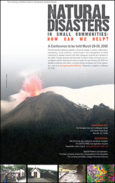
Helping small communities in a disaster

Helping small communities in a disaster

By ELLEN GOLDBAUM
Contributing editor

Whether it’s springtime flooding, an infectious disease outbreak or a volcanic eruption, small or rural communities affected by natural disasters often suffer additional hardship because of their size, say organizers of “Natural Disasters in Small Communities: How Can We Help?” a conference sponsored by the University at Buffalo on March 29 and 30

The conference, which will be held at the Ramada Hotel and Conference Center, 2401 North Forest Road, Getzville, is open to faculty, students, researchers and all stakeholders in the consequences of natural hazards. For more information, go to the Geohazards Web site.

“In the U.S. and around the world, smaller communities, clusters of less than 20,000-30,000 people, are generally less well-prepared to deal with extreme natural phenomena than are larger communities,” said Michael F. Sheridan, director of the UB Center for Geohazards Studies, which is organizing the conference. “They often are caught by surprise by an event that probably has been brewing for a long time.

“Small communities generally lack the more sophisticated communication networks, hospital facilities, crisis rescue squads, emergency housing and other resources that larger communities have,” he added. “They also are more remote, which means help takes longer to arrive.”

To address the disaster and emergency management issues specific to small communities, the multidisciplinary conference will feature presentations and case studies by researchers from across the U.S. and the globe focused on a broad range of hazards.

Among the disasters researchers will discuss are: volcanic activity in Chile and Argentina; a 2005 dengue fever outbreak on the border between Texas and Mexico and evacuation questions in communities near Ecuador’s Tungurahua volcano.

A cross-disciplinary group of geographers, geologists, computer scientists, engineers, mathematicians and social scientists will present data on planning, communication, modeling and assessment tools, such as remote sensing, satellites, geographic information systems and high-end computation.

Several presentations will focus on disaster communication and management issues in small communities and will address the role of relief agencies and how social networks can help a community recover.

A key focus of the conference will be on a community’s resilience in the aftermath of disaster, Sheridan said.

“Resilience is the capacity to recover after experiencing a large disaster,” Sheridan explained. “Small, precautionary measures, such as construction of a barrier to divert mudflows, a plan to move to higher ground or the use of gas generators for prolonged power outages, can make a great difference in survival rates and overall resilience,” he noted.

The conference is an outcome of UB's strategic strength in mitigation and response to extreme events. Research in this area has been identified in the UB 2020 strategic plan as one of eight areas of strategic strength that, along with a commitment to academic excellence, will be the foundation elevating UB to the ranks of the nation’s top public research universities.

In addition to Sheridan, UB faculty participating in the conference include Marcus Bursik, professor; Eliza Calder, assistant professor; Beata M. Csatho, assistant professor, all in the Department of Geology; Hugh S. Cole, professor of urban and regional planning; Bruce Pitman, associate dean for research, College of Arts and Sciences and professor of mathematics; Christian S. Renschler, associate professor of geography; and Natalie C. Simpson, associate professor of management science and systems in the School of Management.

Bruce McCombe, dean of the UB College of Arts and Sciences, will make welcoming remarks.

Conference sponsors include the UB Department of Geology, the College of Arts and Sciences and the State University of New York, Conversations in the Disciplines.

Established in 2007, the Center for Geohazards Studies seeks to reduce harmful societal effects of such natural phenomena as volcanic eruptions, landslides, mudflows, avalanches, climate change and groundwater contamination. The center’s team of scientists and engineers work together with social scientists, urban planners and public-health researchers to evaluate harmful effects of hazardous geological phenomena. The goal is to integrate analyses of the various impacts of geophysical mass flows from natural disasters on lifelines, structures and the environment in order to reduce property losses, bodily injury and mortality.

WEATHER NOTE

Agency funnels information to potential storm spotters

By Kathy Antoniotti/Beacon Journal online journalist

Spring is here -- at least according to the calendar.

And with spring severe weather in Northeast Ohio often arrives in the form of heavy thunderstorms and sometimes tornadoes.

Tornadoes are "one of our major concerns'' during severe weather, Lt. Jeff Nash of the Twinsburg Police Department said. He remembers the one that ripped through his town in 2001.

To prepare for the Mother Nature's onslaught, which usually occurs from April through September, the National Weather Service in Cleveland provided a tornado spotter training course to about 70 people at the Summit County Chapter of the American Red Cross in Akron Thursday night. The class was sponsored by the Summit County Emergency Management Agency.

Gary Garnet, meteorologist and warning coordinator for the weather service, taught the crowd, many of whom were amateur radio operators, how to effectively assist in warning Northeast Ohio residents about potentially damaging wind, hail and rain before a storm actually reaches them.

''Despite the advances in technology, it's still just that -- technology. You are our reality check,'' Garnet told the audience.

The weather service gathers information from technology and experience and uses the reports from the spotters as ''real-time verification,'' Garnet said.

The attendees were given the opportunity to register as official Skywarn Spotters and when they left they would know how to identify the speed of wind gusts by the amount of damage caused and all about the danger of urban flooding.

They were told how to use the Internet, amateur radios and telephones to relay weather information to the Weather Service in Cleveland and not to call 911.

Garnet told the potential spotters that if the weather service found their reports reliable, their location might be represented on the radar map as a star, which could be considered a mixed blessing.

''If you are (a star) and you get a call from us, you know something bad is going to happen,'' he said.

Mike Mullaly, a business consultant from Bath Township, said he intended to register as a storm spotter following the training. ''I've always enjoyed observing the weather and identifying storms," he said.

Akron geologist Vicki Deppisch, who works for the Ohio Environmental Agency, said the class was her third refresher course. She's been a trained weather spotter for six years because ''I personally feel we are going through a climate change,'' she said.

MARITIME NOTES

RIVERDANCE

RIVERDANCE

Incident Summary

The Ro-Ro Ferry RIVERDANCE grounded near Blackpool on 31 January. The ship is a 6,041 GT, 116m in length Ro-Ro ferry which was on route from Warren Point in Northern Ireland to Heysham, Lancashire. The ship is owned by Seatruck Ferries and registered in the Bahamas. The ship has 100 tonnes of light fuel oil on board.

At 1943 on 31 January Liverpool Coastguard received a MAYDAY transmission from the Ro-Ro Ferry RIVERDANCE advising that their cargo had shifted and the ship had developed a 40º list. The vessel had 23 people on board. The weather on scene was difficult with winds gusting to Force 10.

Liverpool Coastguard immediately requested the assistance of tugs, the RNLI Lifeboats from Lytham and Fleetwood and rescue helicopters, from Vallet, Prestwick and Dublin. With the situation deteriorating the ship’s Master requested that the 4 passengers be evacuated

The RAF Rescue Helicopter from Valley safely winched the 4 passengers from the ship at 2100. Two additional rescue helicopters from Prestwick and Dublin were also tasked to assist and with the ship’s increased list to 60º the decision was taken to evacuate 10 non-essential crew, who were airlifted to Liverpool Airport. The two rescue helicopters and RNLI Lifeboats stayed on scene whilst the nine remaining crew attempted to stabilise the situation.

Using the ship’s pumps, the list was reduced to 20º although the sea conditions remained difficult. At 2200 the Master asked for all the remaining crew to be airlifted from the ship due to the weather conditions and the worsening list which had increased to 35º. All remaining crew were safely winched from the vessel by RAF Rescue helicopter 177 from Prestwick. All passengers and crew were evacuated without injury.

The ship is currently hard aground at Blackpool North Beach – 200m off the promenade close to Norbrecht Castle Hotel.

We are not aware of any hazardous goods on board. There are no signs of any oil leaking.

The Secretary of State’s Representative for maritime salvage and intervention (SOSREP) has set up a Salvage Control Unit locally. A formal National Contingency Plan Environment Group has been set up under the chair of Natural England.

Latest Information 04/2/08

The vessel remains aground approximately 450 metres offshore however overnight the list increased to approximately 55 degrees.

Salvors successfully boarded the vessel yesterday to check its condition. The vessel is still intact and the engine room and cargo decks are free from flooding and the ramp is secure.

The vessel has 1,199 tonnes of freight on board, non of this is considered dangerous. The contents from some of these trailers have fallen overboard.

Frequently Asked Questions

Link to Images of the Riverdance

mcanet.mcga.gov.uk/press/Riverdance

Link to further information about the Secretary of States Representative for Salvage and Intervention (SOSREP)

www.mcga.gov.uk/c4mca/mcga-environmental/secretary_of_states_representative.htm

Link to further information about the Receiver of Wreck

www.mcga.gov.uk/c4mca/mcga-environmental/mcga-dops_row_receiver_of_wreck.htm


RS


Friday, March 21, 2008

Gravity Waves Make Tornados

see caption

+ Play Audio | + Download Audio |

March 19, 2008: Did you know that there's a new breakfast food that helps meteorologists predict severe storms? Down South they call it "GrITs."

GrITs stands for Gravity wave Interactions with Tornadoes. "It's a computer model I developed to study how atmospheric gravity waves interact with severe storms," says research meteorologist Tim Coleman of the National Space Science and Technology Center in Huntsville, Alabama.

According to Coleman, wave-storm interactions are very important. If a gravity wave hits a rotating thunderstorm, it can sometimes spin that storm up into a tornado.

Above: Click on the image to watch a gravity wave roll over Tama, Iowa, on May 7, 2006. Credit: Iowa Environmental Mesonet Webcam.

What is an atmospheric gravity wave? Coleman explains: "They are similar to waves on the surface of the ocean, but they roll through the air instead of the water. Gravity is what keeps them going. If you push water up and then it plops back down, it creates waves. It's the same with air."

Coleman left his job as a TV weather anchor in Birmingham to work on his Ph.D. in Atmospheric Science at the University of Alabama in Huntsville. "I'm having fun," he says, but his smile and enthusiasm already gave that away.

"You can see gravity waves everywhere," he continues. "When I drove in to work this morning, I saw some waves in the clouds. I even think about wave dynamics on the water when I go fishing now."

Gravity waves get started when an impulse disturbs the atmosphere. An impulse could be, for instance, a wind shear, a thunderstorm updraft, or a sudden change in the jet stream. Gravity waves go billowing out from these disturbances like ripples around a rock thrown in a pond.

When a gravity wave bears down on a rotating thunderstorm, it compresses the storm. This, in turn, causes the storm to spin faster. To understand why, Coleman describes an ice skater spinning with her arms held straight out. "Her spin increases when she pulls her arms inward." Ditto for spinning storms: When they are compressed by gravity waves, they spin faster to conserve angular momentum.

"There is also wind shear in a gravity wave, and the storm can take that wind shear and tilt it and make even more spin. All of these factors may increase storm rotation, making it more powerful and more likely to produce a tornado."

"We've also seen at least one case of a tornado already on the ground (in Birmingham, Alabama, on April 8, 1998) which may have become more intense as it interacted with a gravity wave."

see caption

Above: Click on the graphic to play an actual Doppler radar movie of a gravity wave interacting with a rotating thunderstorm and making it stronger in northwest Alabama on Jan. 22, 1999. Credit: NOAA.

Coleman also points out that gravity waves sometimes come in sets, and with each passing wave, sometimes the tornado or rotating storm will grow stronger.

Tim and his boss, Dr. Kevin Knupp, are beginning the process of training National Weather Service and TV meteorologists to look for gravity waves in real-time, and to use the theories behind the GrITs model to modify forecasts accordingly.

Who would have thought grits could predict bad weather? "Just us meteorologists in Alabama," laughs Coleman. Seriously, though, Gravity wave Interactions with Tornadoes could be the next big thing in severe storm forecasting.

Weather Notes

Spring Yields Tame To Tempest

The long awaited spring will arrive none too soon. With it comes more tolerable temperatures and those flower sprouting showers you hear songs about. But the core of this season’s rain activity isn’t portrayed as gentle showers as much as in pounding thunderstorms. The contrast in temperature between the receding grip of winter and summer’s northward advance will determine their intensity. Storms can vary from a distant annoyance to a raging overhead fury. Your best defense is to hope for the best while preparing for the worst. Your first line of defense when threatening weather approaches is not to panic. Cooler heads prevail. Should you hear sirens alerting you of impending danger, or you personally see damage occurring from advancing storms, seek shelter along the wall of your basement. If you have no basement, retreat to a central first floor room with no outside walls. This could be a bathroom or closet.

Let’s prepare even further ahead. While the weather is placid, make a plan now for where you will go when the worst occurs. Should your home become unlivable after an event, you will need a money resource and ID to hold out until your home is restored. To avoid these things being lost in the storm, prepare now what you will collect enroute to your shelter. Know where these items are at all times so you don’t spend precious time looking for them. Keep a bag or satchel at the ready to collect them on the run. Some of these items should include any cash, your checkbook, charge cards, driver’s license, and your car keys in case your vehicle survives. This is your survival kit, the seed to putting your life back together.

The National Weather Service classifies “severe” thunderstorms as producing ¾ inch diameter hail or greater, strong wind downbursts of 58 mph or more, or a storm producing a tornado. National outlooks for the probability of severe storms will be issued days ahead of time with suspected trouble areas covering whole regions of the country. Severe Thunderstorm and Tornado Watches are usually issued hours before storms appear or blossom into severe stage and may cover several states. If you are included in a Watch area, this is a good time to gather your valuables or take note of where they are. Watches are in effect for many hours and are not specific when or where any one location will experience severe thunderstorms.

Warnings are issued when a severe thunderstorm or tornado has been reported or determined by local radar to be imminent. A warning will be cause for local authorities to sound the sirens for your area. These are issued for a period of an hour or less, covering parts of an individual county. A Severe Thunderstorm Warning implies the large hail and/or high winds, as defined above, with the possibilities of tornadoes. A Tornado Warning implies specifically that a tornado has been spotted in or near your area.

While most receive their alerts via siren or the television crawl, the quickest reception will be through NOAA weather radio. Technology has come a long way since the old weather band radios. You can now purchase crystal controlled weather alert radios from a local electronics store. These modern day weather radios can be programmed to a local frequency to alert you of any warnings issued in or near your community. In non-threatening weather, you can use them to keep abreast of current weather conditions and forecasts, commercial-free. Warnings will interrupt the regular forecasts within seconds of their issuance from the National Weather Service. And the faster you are aware of the danger, the more time you have to take cover.

Keeping food safe during an emergency

March 20, 2008

The U.S. Department of Agriculture is providing recommendations to the regions affected by severe weather and flooding in the Central United States. USDA is hopeful that this information will help minimize the potential for foodborne illnesses due to food spoilage from power outages and other problems that are often associated with severe weather events.

“Power outages can occur at any time of the year and it often takes from a few hours to several days for electricity to be restored to residential areas,” said USDA Under Secretary for Food Safety Dr. Richard Raymond. “Without electricity or a cold source, foods stored in refrigerators and freezers can become unsafe. Bacteria in food grow rapidly at temperatures between 40 and 140 °F, and if these foods are consumed, people can become very sick.”

Steps to follow to prepare for a possible weather emergency:

  • Keep an appliance thermometer in the refrigerator and freezer. An appliance thermometer will indicate the temperature in the refrigerator and freezer in case of a power outage and help determine the safety of the food.
  • Make sure the freezer is at 0 °F or below and the refrigerator is at 40 °F or below.
  • Freeze containers of water for ice to help keep food cold in the freezer, refrigerator or coolers after the power is out.
  • Freeze refrigerated items such as leftovers, milk and fresh meat and poultry that you may not need immediately — this helps keep them at a safe temperature longer.
  • Plan ahead and know where dry ice and block ice can be purchased.
  • Store food on shelves that will be safely out of the way of contaminated water in case of flooding.
  • Have coolers on hand to keep refrigerator food cold if the power will be out for more than 4 hours. Purchase or make ice cubes and store in the freezer for use in the refrigerator or in a cooler. Freeze gel packs ahead of time for use in coolers.
  • Group food together in the freezer - this helps the food stay cold longer.

Steps to follow after the weather emergency:

  • Keep the refrigerator and freezer doors closed as much as possible to maintain the cold temperature.
  • The refrigerator will keep food safely cold for about 4 hours if it is unopened. A full freezer will hold the temperature for approximately 48 hours (24 hours if it is half full) and the door remains closed.
  • Discard refrigerated perishable food such as meat, poultry, fish, soft cheeses, milk, eggs, leftovers and deli items after 4 hours without power.
  • Food may be safely refrozen if it still contains ice crystals or is at 40 °F or below when checked with a food thermometer.
  • Never taste a food to determine its safety!
  • Obtain dry or block ice to keep your refrigerator and freezer as cold as possible if the power is going to be out for a prolonged period of time. Fifty pounds of dry ice should hold an 18-cubic-foot full freezer for 2 days.
  • If the power has been out for several days, check the temperature of the freezer with an appliance thermometer. If the appliance thermometer reads 40 °F or below, the food is safe to refreeze.
  • If a thermometer has not been kept in the freezer, check each package of food to determine its safety. If the food still contains ice crystals, the food is safe.
  • Drink only bottled water if flooding has occurred.
  • Discard any food that is not in a waterproof container if there is any chance that it has come into contact with flood water. Discard wooden cutting boards, plastic utensils, baby bottle nipples and pacifiers.
  • Undamaged, commercially prepared foods in all-metal cans and retort pouches (for example, flexible, shelf-stable juice or seafood pouches) can be saved. Follow the Steps to Salvage All-Metal Cans and Retort Pouches.
  • Thoroughly wash all metal pans, ceramic dishes and utensils that came in contact with flood water with hot soapy water and sanitize by boiling them in clean water or by immersing them for 15 minutes in a solution of 1 tablespoon of unscented, liquid chlorine bleach per gallon of drinking water.
  • When in Doubt, Throw it Out!

Asia: Satellites Help Manage Disasters

United Nations, Mar 20 (Prensa Latina) The UN Economic and Social Commission for Asia and the Pacific (ESCAP) calls to use satellites to predict and manage natural disasters in Asia.

Asia-Pacific have endured six of the worst natural disasters of the decades so the experts consider that an effective data collection from satellites may be effectively used for such end.

ESCAP said Disaster Management is the topic at a 72-hour seminar opened Wednesday in Bangkok, Thailand, with officials from 22 countries of Asia, host of 21,000 disaster victims in 2006, three fourth such events in the world.

Of the 53 member states of ESCAP, eight are among the 10 most affected by such natural calamities.

The specialists define as adequate disaster management an effective use of data supplied in time to assess risks, mitigate the impact, monitor the phenomena and issue early warning.

Shigeru Mochida, executive vice president of ESCAP, added that satellites may play a relevant role in rescue and assistance.

MARITIME NOTES

DNV “CASUALTIES TWICE AS LIKELY AS 5 YEARS AGO”

Thursday, 21 February 2008

NORWEGIAN classification society DNV says the chances of a ship being involved in a serious casualty have doubled in five years. DNV, which monitors the annual frequency of serious accidents, says that over the past five years, there has been an increasing incidence of serious navigational accidents in several shipping segments.

Speaking at DNV seminar in Singapore yesterday. Helge Kjeøy, regional manager DNV Maritime South East Asia said: “The main factors explaining the negative developments over the past few years are - that the undersupply of crew worldwide results in reduced experience and that the high commercial pressure results in a high workload. Adding new and more complex equipment does not only help the situation. Avoiding accidents under such situations requires a good safety culture, something which the maritime industry evidently needs to focus more on.”

Torkel Soma, Principal Safety Consultant in DNV Maritime, said: “DNV’s statistics shows that a ship is twice as likely to be involved in a serious grounding, collision or contact accident today compared to only five years ago. In addition, estimates show that also the costs of these accidents have doubled. Since this is the general trend for the international commercial fleet, the maritime industry needs to act on this immediately.”

The boom in the shipping market and increased deliveries of newbuildings has resulted in pressure on crews. The shortage of officers has resulted in lower retention and faster promotion. As a result, the general level of experience is decreasing on board. At the same time new technical solutions have been introduced which might have increased the complexity of operations.

Dr. Soma pinpoint: “Reliable technology and complying manuals are no assurance against making errors. Collisions, groundings and contact accidents do almost always involve human acts.”

Ferry Riverdance decision due next week
By Lisa Ettridge

The Riverdance

A DECISION on the future of stranded ferry Riverdance has been deferred again as coastguards say more information is needed.

It was hoped the fate of the stricken ship could be made at a meeting today but now discussions will not be taking place until next week. A spokesman for the Marine and Coastguard Agency said: "No decision about Riverdance is going to be made until next week at the earliest. "We had hoped the future of the vessel could be decided this week but we are still exploring our options at this stage. "We need to gather more information so we can make a properly informed choice and all parties concerned will meet probably in the middle of next week." Companies who lost property aboard the stranded ferry are cutting their losses one businessman said today. Steve Slater of SJ Slater Transport which is based in Cockerham, near Lancaster says he does not believe he will get his trailer back. He said: "I suppose what has happened to Riverdance is just one of those things, there is nothing that can be done about it."

Messing About In Ships Podcast Episode # 16

Messing About In Ships podcast episode #16 has launched.

(54 minutes)

Download MP3 file: Messing About In Ships 16

Subscribe Via iTunes HERE


Spring has sprung, the grass has riz, wonder where
all the flowers is?

HAPPY EASTER TO ALL!
Seafarers Prayers

Globe by Mimi


RS

Thursday, March 20, 2008

LEO-15 Undersea Node

LEO-15 Undersea Node

What is a Node?

Rutgers University has two unmanned undersea research nodes that are deployed 9 kilometers off the coast of Brigintinne, New Jersey. These two nodes are part of a research site called LEO-15.

They are linked to the Rutgers Marine Field Station in Tuckerton, NJ, with an electro-optic cable that contains optical fibers to transfer information and copper wires to transfer power. This link provides a real-time connection between the undersea world off the coast of New Jersey and the Internet, providing scientists, engineers, and educators with realtime access to the sea. It permits them to monitor experiments and to alter their direction from essentially any classroom, office building, or laboratory in the world. The cable also provides continuous and ample electrical power, a luxury denied to experimentalists using traditional methods to study the ocean.

The LEO-15 Concept

To most Americans, the coastal ocean is one of our nation's most important natural treasures. Issues associated with its management are the subject of constant debate by the public, the media, and politicians. A common feature of these debates is the need for better information about the ocean environment. Until now, we have depended upon ships, satellites, and a few buoys for information. A major limitation is our inability to make frequent observations of ocean processes from one place in the ocean over long periods of time. LEO-15 is designed to address that limitation; it is on line almost continuously, providing scientists and engineers realtime data.


NSSL PODCASTS - Severe Weather

Improving Forecasts of Severe Storms

National Severe Storms Laboratory Chief of Forecast Research and Development Dr. David Stensrud discusses severe weather modeling and improving forecasts of severe weather events. Recorded 8 November 2007


WEATHER NOTES

Enhanced River Flood Warning Service for the Iroquois River

On Tuesday, April 1 2008 at 8 am CDT, the National Weather Service (NWS) Chicago Forecast Office in Romeoville Illinois will begin providing river forecast and flood warning service for the Iroquois River at Rensselaer Indiana in Jasper county and the Iroquois River near Foresman Indiana in Newton county.

River flood products will be issued when these locations are at or forecast to rise to flood stage or above. The flood products will provide information such as the current and forecast river stages for these locations to provide early notification of potential flooding on the Iroquois river in Indiana. In addition, the current and forecast information for these locations will be available on the NOAA NWS Advanced Hydrologic Prediction Service (AHPS) web page at weather.gov/chicago.

If you have any questions or comments on this change...please Contact:

William Morris
Hydrologic Program Manager
National Weather Service Forecast Office
333 West University Drive
Romeoville, IL
Phone: 815-834-0600 x493
Email: william.morris@noaa.gov

What's New at the NDBC Web Site? 2008
  • March - DART buoy network expansion complete! NDBC deployed a new water level measuring buoy in the Pacific. This completes the planned expansion of the NOAA tsunami reporting network and brings the total number of DART stations to 39.

  • February - DART buoy network expanded. NDBC deployed four new DART buoys in the Pacific. This brings the total number of DART water level measuring stations in the NOAA tsunami reporting network to 38.

  • January - Waves/ocean buoy at Buzzards Bay! NDBC established WAMDAS buoy 44070 and added it to the Rhode Island map.


MARITIME NOTES

Salvage experts consider wrecking stricken ferry

The future of the stricken Riverdance ferry will be decided during crisis talks on Thursday.

Salvors, insurers and the boat's owners will meet to discuss what to do next, after the vessel was battered by further bad weather.

The ferry is now completely on its side and is sinking into the sand, and salvors have admitted that cutting the boat up on the sand is a possibilty, but still a last resort.

But it is starting to look like the most likely option, after attempts to salvage the boat over the last month have failed.

NOAA – CAMEO proposals

The National Oceanic and Atmospheric Administration (NOAA) issued a notice stating that it is soliciting proposals to strengthen the scientific basis for the Comparative Analysis of Marine Ecosystem Organization (CAMEO) program. The CAMEO program assists policy makers and resource managers to make ecosystem-science-based decisions that fulfill policy goals and management objectives of society. Proposals must be received no later than June 17. 73 Fed. Reg. 14774 (March 19, 2008).


RS

Wednesday, March 19, 2008

New weather project could help track tornadoes more closely

New weather project could help track tornadoes more closely

By Ellis Goodwin,
Daily Staff Writer

The 1996 movie "Twister" showed storm chasers travelling across Oklahoma and Kansas toting Dorothy, a mobile device that launches hundreds of flying sensors into a tornado.

In the film, Dorothy works by collecting data from the sensors, but in real life that would be nearly impossible, said Don Burgess, retired National Severe Storms Lab meteorologist.

Burgess said Dorothy is just a movie prop. It was based on a real piece of technology from the early '80s that did not fling hundreds of sensors into the air. Instead of Dorothy, it was called the Totable Tornado Observatory - TOTO for short.

TOTO weighs a few hundred pounds and holds basic atmospheric sensors that measure temperature, wind speed, pressure, dew point and other atmospheric characteristics, Burgess said. Burgess said the National Severe Storm Lab used TOTO for four or five years, but they did not have much success with it. It was big, bulky and difficult to put in the path of a tornado.

"There was just one TOTO; it was heavy and took a while to deploy," Burgess said. "We got close a number of times but had a problem getting a tornado to go right over it "

The technology in TOTO was high-tech for its time, but forecasters needed better technology to learn more about tornadoes, Burgess said.

In the mid '90s, a new design, VORTEX 1, incorporated new technologies developed after TOTO, NSSL Deputy Director Kevin Kelleher said.

Burgess said the VORTEX 1 machines that replaced TOTO are called Turtles. These devices are smaller and easier to deploy, and there are numerous units that can be placed in a grid.

Kelleher and Burgess described these devices as large, upside-down metal bowls that are loaded with atmospheric sensors. "You can set those out real quick so you don't have to worry as much about the safety factor," Burgess said.

Kelleher said forecasters learned a lot from VORTEX 1, but it there was still a lot to discover.

"VORTEX 1 was initially designed to find out what causes rotation," Kelleher said. "We wanted to forecast how [tornadoes] occur and how they dissipate, and what we learned is there is a lot we don't know."

New Technology

Large-scale tests like VORTEX 1 happen fairly rarely, NSSL Research Meteorologist Lou Wicker said. "VORTEX 1 made a significant difference," Wicker said. "But now we have a lot more technology to make real-time predictions, which can increase warning times."

The NSSL and National Oceanic and Atmospheric Administration are working with the National Science Foundation to develop VORTEX 2, Kelleher said.

VORTEX 2 is a bigger and better version of the original VORTEX project, he said. The NSSL will prepare this spring for the test, which will be conducted in the springs of 2009 and 2010, Kelleher said.

"It is basically VORTEX 1 on steroids," Wicker said.

VORTEX 2 was developed to give researchers a better understanding of tornadoes and increase the warning time for those in the path of tornadoes, Kelleher said. VORTEX 2 should help forecasters complete the picture of how and why tornadoes occur, he said.

"The goal is to use the best observations we have now and all of the information we gathered in VORTEX 1, and take that to make models," Kelleher said. "The end game is to help forecasters predict what is going on more accurately."

In VORTEX 2, the NSSL and partners will track the storm from all sides at three different levels and will use most of today's available forecasting technology.

Tracking a storm

The first level of observation includes Turtles, Stick-nets – another type of sensor – and Mobile Mesonets, vehicles with sensors attached to their roofs. This level of observation records basic atmospheric functions.

The second level of observation is conducted by trucks called Shared Mobile Atmospheric Research and Teaching Radars, known as SMART-Radars.

In 1997, OU, the NSSL and other partners developed these trucks, which are 34 feet long and have a 5 cm Doppler radar dish in the back, said Mike Biggerstaff, associate professor of meteorology and director of the SMART-Radar program. The 5 cm dish is less powerful than the larger stationary 10 cm Doppler radars, but its mobility allows it to move much closer to a storm and observe a clearer picture, he said.

The SMART-Radars are able to use radar signals to penetrate the storm, which bounce back and produce an image of what the storm looks like, Biggerstaff said.

"We can see the entire storm scale, the effect of the updrafts and the downdrafts on the development of circulation," he said.

On the third level of observation, behind the SMART-Radars, are the larger stationary 10 cm Doppler radar dishes. These radars provide a much farther-reaching radar sweep, Biggerstaff said. The more powerful beam provides a picture of the storm and areas surrounding it. Like the smaller radars, these take data and plug them into a computer algorithm, which creates a map of the storm, he said.

In VORTEX 2, the NSSL will also incorporate the new phased array radar, which was developed by the military. Phased array radar uses multiple beams and frequencies to reduce scanning time and can give forecasters minute by minute updates, Kelleher said.

Biggerstaff said there has never been a weather experiment as extensive as this one. And what makes VORTEX 2 so unique is the combination of all the technologies to create a data set that can be used to forecast future storms.

"I don't even think we have found all the ways that tornadoes form," Biggerstaff said. "We need to be able to observe all the scales of motion, and VORTEX 2 is designed to allow that to happen.”


WEATHER NOTES

The UK Chief Fire and Rescue Adviser’s review of the operational response by the Fire and Rescue Service to the widespread flooding in England during 2007 has been released. PDF at:

http://www.communities.gov.uk/documents/fire/pdf/725360


Tornadoes in 2008


Here’s a look at where tornadoes have occurred in 2008 so far. Tornado season starts in the deep south and migrates north and northwest. Note the few number of tornadoes in the Plains States.

We have had 69 tornado fatalities in the U.S. (and it’s still winter!), well ahead of average. A total of 465 tornadoes have been reported. Usually we go until late May to get that many tornadoes.There have been 19 “killer tornadoes” in 9 states. 37 of the 69 fatalities were people inside mobile homes (which, unfortunately, tend to become more mobile in a tornado). Note the isolated tornadoes in California and Oregon (small spinups). There are two advantages to cool weather in late March and April…less severe weather and the blossoms don’t come out too soon. We should stay a little cooler than average through the rest of March.

Fortified Homes Capture Growing Interest In Wake Of Disasters

The insurance industry takes special note of the changes in weather patterns that are doling out Dreamstime Image ID2377401 Tornado Damagespectacular new property losses. A spokesperson for the Institute for Business and Home Safety, (IBHS) a non-profit supported by the insurance industry, recently remarked:

"Ours is not to decide why it's happening, we just know disasters are more prevalent."

While "fortified" homes can refer to structures designed in the tradition of Joel Skousen as a buffer against uncertain times and to enhance survival in times of civil unrest, the term is now being used to describe structures that can resist, or survive, natural disasters.

Last week one such home was dedicated in Louisiana by Louisiana System Built Homes. IBHS sets out requirements for a home to be designated as "fortified," and the process includes inspections by those trained in inspecting for this purpose. It might surprise some to know that this home is largely built in a factory setting and transferred to the building site where it is assembled. This particular company uses SIPs as the building blocks.

IBHS certification promises to reduce insurance costs for the building owner. Requirements are related to where the structure is being built so they will vary from place to place but in Louisiana some of the requirements are:

  • Able to withstand wind speeds 20 mph higher than those established by the American Society of Civil Engineers;
  • Able to withstand high pressure at doors and windows;
  • Able to withstand water penetration, high winds and hail in the roof area.

In Seattle, where another of these homes was recently certified, requirements look like this:

  • Concrete construction must exceed seismic code standards by 20 percent;
  • Roof to wall to foundation connections have to be able to stand 130 mph winds;
  • Light metal roofs that resist shaking momentum but still also resist wind, hail and fire;
  • Two moisture barriers below the roof covering;
  • Windows and doors with a high degree of wind and water resistance.

By visiting this IBHS page you can view a number of videos with tips for fortifying buildings.

IBHS is also taking on the tough question that people always ask after a community sustains major losses from a natural disaster that was always expected to happen: "Why did they let them build there?"

You've all heard that one asked after yet another flood wipes out a portion of a community where the same thing happened in recent memory. As you might expect, answering the question requires getting into the nits and grits of some very formidable topics not the least of which have to do with property values and feelings related to "home." IBHS is advocating more comprehensive incorporation of natural hazards when communities consider land-use.

Images from the 03/15/08 tornadoes in Floyd and Polk County.


MARITIME NOTES


Independent Assessment by Coast Guard on Marine Safety program

In November 2007, VADM James C. Card, Ret. completed an independent assessment and analysis of the Coast Guard’s Marine Safety program. Below is taken from the introduction and gives a brief over view of the document:

Recently, Congress and the industry have criticized the Coast Guard because they believe Coast Guard Marine Safety performance and service have deteriorated. Many point to the Coast Guard’s increased role in Maritime Security and its move to the Department of Homeland Security as primary reasons for the deterioration. Coast Guard Marine Safety professionals also have concerns about the Coast Guard’s lack of focus on Marine Safety as an important mission.

The results gathered in this report show that concerns and suggestions fall into six major categories. Listed by priority they are: Strategy; Leadership; People; Policy; Customer Focus; and Organization.

Here is the link to the rest of the documen
t Coast Guard Marine Safety Analysis


RS


Tuesday, March 18, 2008

NOAA: Coolest Winter Since 2001 for U.S., Globe

NOAA: Coolest Winter Since 2001 for U.S., Globe

March 13, 2008

The average temperature across both the contiguous U.S. and the globe during climatological winter (December 2007-February 2008) was the coolest since 2001, according to scientists at NOAA’s National Climatic Data Center in Asheville, N.C. In terms of winter precipitation, Pacific storms, bringing heavy precipitation to large parts of the West, produced high snowpack that will provide welcome runoff this spring.

A complete analysis is available online.

U.S. Winter Temperature Highlights

  • In the contiguous United States, the average winter temperature was 33.2°F (0.6°C), which was 0.2°F (0.1°C) above the 20th century average – yet still ranks as the coolest since 2001. It was the 54th coolest winter since national records began in 1895.
  • Winter temperatures were warmer than average from Texas to the Southeast and along the Eastern Seaboard, while cooler-than-average temperatures stretched from much of the upper Midwest to the West Coast.
  • With higher-than-average temperatures in the Northeast and South, the contiguous U.S. winter temperature-related energy demand was approximately 1.7 percent lower than average, based on NOAA’s Residential Energy Demand Temperature Index.

U.S. Winter Precipitation Highlights

  • Winter precipitation was much above average from the Midwest to parts of the West, notably Kansas, Colorado and Utah. Although moderate-to-strong La Niña conditions were present in the equatorial Pacific the winter was unique for the above average rain and snowfall in the Southwest, where La Niña typically brings drier-than-average conditions.
  • During January alone, 170 inches of snow fell at the Alta ski area near Salt Lake City, Utah, more than twice the normal amount for the month, eclipsing the previous record of 168 inches that fell in 1967. At the end of February, seasonal precipitation for the 2008 Water Year, which began on October 1, 2007, was well above average over much of the West.
  • Mountain snowpack exceeded 150 percent of average in large parts of Colorado, New Mexico, Arizona, and Oregon at the end of February. Spring run-off from the above average snowpack in the West is expected to be beneficial in drought plagued areas.
  • Record February precipitation in the Northeast helped make the winter the fifth wettest on record for the region. New York had its wettest winter, while Pennsylvania, Connecticut, Vermont, and Colorado to the West, had their second wettest.
  • Snowfall was above normal in northern New England, where some locations posted all-time record winter snow totals. Concord, N.H., received 100.1 inches, which was 22.1 inches above the previous record set during the winter of 1886-87. Burlington, Vt., received 103.2 inches, which was 6.3 inches above the previous record set during the winter of 1970-71.
  • While some areas of the Southeast were wetter than average during the winter, overall precipitation for the region was near average. At the end of February, two-thirds of the Southeast remained in some stage of drought, with more than 25 percent in extreme-to- exceptional drought.
  • Drought conditions intensified in Texas with areas experiencing drought almost doubling from 25 percent at the end of January to 45 percent at the end of February.

Global Highlights

  • The combined global land and ocean surface temperature was the 16th warmest on record for the December 2007-February 2008 period (0.58°F/0.32°C above the 20th century mean of 53.8°F/12.1°C). The presence of a moderate-to-strong La Niña contributed to an average temperature that was the coolest since the La Niña episode of 2000-2001.
  • While analyses of the causes of the severe winter storms in southern China continues, NOAA Earth System Research Laboratory scientists are focusing on the presence of unusually strong, persistent high pressure over Eastern Europe, combined with low pressure over Southwest Asia. This pattern directed a series of storms across the region, while northerly low level flow introduced cold air from Mongolia. Unusually high water temperatures in the China Sea may have triggered available moisture that enhanced the severity of these storms.
  • Record Northern Hemisphere snow cover extent in January was followed by above average snow cover for the month of February. Unusually high temperatures across much of the mid- and high-latitude areas of the Northern Hemisphere in February began reducing the snow cover, and by the end of February, snow cover extent was below average in many parts of the hemisphere.
  • While there has been little trend in snow cover extent during the winter season since records began in the late 1960s, spring snow cover extent has been sharply lower in the past two decades as global temperatures have increased.

February Temperature Highlights

  • February was 61st warmest in the contiguous U.S. and 15th warmest globally on record. For the U.S., the temperature was near average, 0.2°F (0.1°C) above the 20th century average of 34.7°F (1.5°C), which was 2.0°F (1.1°C) warmer than February 2007.
  • Globally, the February average temperature was 0.68°F/0.38°C above the 20th century mean of 53.8°F/12.1°C.

WEATHER NOTES

Disasters cost taxpayers £77K

Emergency evacuations sparked by fire, flooded rivers and a burst water mains have cost Oxfordshire taxpayers more than £77,000 over the past year.

Oxfordshire County Council coordinated four emergency evacuations between January 2007 and January 2008.

Fifty people were evacuated from Normandy Crescent, in Cowley, after a water mains burst last January.

Residents were evacuated to the nearby council-owned Shotover Day Centre for one day at no cost to County Hall, but food and emergency supplies cost £380.

Some were later moved to the Premier Travel Inn, Cowley, where a few stayed for up to four months - but Thames Water picked up the bill.

Just six months later, in July, about 100 people were evacuated to the Kassam Stadium complex after floods struck the county.

The county council spent £27,550 on emergency accommodation for up to eight nights. It also spent £4,500 on transport, £1,202 on emergency supplies and £36,145 on food for evacuees and emergency workers.

In January 2008, the county council evacuated residents from Bablock Hythe, near Cumnor, due to floods but did not have to accommodate any of them because they all stayed with relatives.

The county council did spend £145 on food - transport costs are not yet known.

An explosion at a petrol station in Sutton Courtenay the same month saw 93 people evacuated to the Kassam Stadium with food and one night's accommodation costing £6,500 and emergency supplies costing £780.

The total cost to date of all four evacuations was £77,202 - but former evacuees said it was money well spent.

Yvonne Cocking, 78, was put up in a hotel at the Kassam Stadium after being evacuated from her house in Sutton Courtenay.

She said: "It sounds like a lot to an individual, but in terms of public money I suppose it is not too bad."

Normandy Crescent resident, Joseph Pearson, 77, said: "The council did all they could for us. I think it was worth every penny.

The county council's chief emergency planning officer, John Kelly, said spending the money was essential: "It is hard to see how people whose homes are plunged into the midst of an emergency can be left to fend for themselves."

6:00pm Saturday 15th March 2008

Flooding Possible Tonight into Tuesday Night

(click to enlarge)

Forecasted rainfall over the next three days from the Hydrometeorological Prediction Center

Periods of rain and isolated thunderstorms are expected over portions of northern Illinois and northwest Indiana this afternoon through Tuesday night. Total rainfall amounts through Tuesday night of 1 to 3 inches are expected. The soil moisture remains above normal in many areas from recent snowmelt. Many streams remain high from recent runoff including the Rock, Upper Des Plaines, and Kankakee Rivers. Heavy rainfall may result in renewed rises on these and other streams in the area with possible flooding. Residents in low lying flood prone areas should continue to closely monitor this developing weather situation.

For the latest outlook on the flooding potential, refer to the Flood Watch issued by the NWS Chicago.

River forecasts for locations in northern Illinois and northwest Indiana can be found by clicking on a river forecast point from the NWS Chicago Advanced Hydrologic Prediction Service page.

MARITIME NOTES

Riverdance ferry could be cut up

SALVAGE experts have admitted for the first time that the Riverdance may have to be cut up to get her off the beach.
The move would be a last resort once all options of refloating the stricken vessel had been exhausted.

But, after suffering "significant" damage in last week's storms and sinking further into the sand, the possibility of taking the ship apart is being discussed.

A meeting early this week will decide the next steps for the salvage team who have been working on righting the ferry for more than a month.

See more information on The Riverdance

View our Shipwreck online special

See The Riverdance webcam

See our Riverdance picture gallery

It is expected the destruction of the boat would come as a bitter blow to the salvors and the Riverdance fans who have come from far and wide to see her resting on the sands just south of Cleveleys.

It was hoped that flotation tanks welded to the upward side of the ferry and the pumping of water from the starboard to the port side would help right her.

The keel would then be slipped into a huge trench which has been dug along the side of the Riverdance.

But the team has been forced into a rethink after 78mph winds battered the ship last week.

The future of the vessel today seems uncertain with a range of options being considered including dragging her upright with a series of winches and taking her apart.

Donald McDonald, the coastguard's counter pollution and salvage officer, who is overseeing the operation, said: "The way that we were intending to right the vessel cannot be achieved so we are now looking at alternative methods.

"First of all we are looking at the possibility of righting her using mechanical winches then we will look at the damage she has sustained with a view to refloating her.

"If it looks like this will be impossiblethen we will have to consider cutting her up on the beach – but we are not at that stage yet. The salvage team met for discussion on Friday and will deliver their proposed plan of action in the middle of next week."

Owners Seatruck Ferrys Ltd are keen to see the ship saved. Spokesman Tony Reddings said there were a number of possibilities yet to be explored.

He said: "She suffered significant damage during the storm but we believe there are several options still open to us. The salvors might still be able to employ part of the original plan or they might have to look at using winches or even cutting her up. No decisions have so far been made, we will have a better picture after the meeting this week."

Riverdance got into trouble during high winds and story seas on January 31 while en route from Warrenpoint in Northern Ireland to Heysham, landing on the Fylde coast on February 1.

RS