Thursday, February 14, 2008

Improving ship safety and efficiency with proactive use of Voyage Data Recorders

Todd Ripley, Maritime Administration, Washington, DC

Thomas King, Litton Marine Systems Inc., Charlottesville, VA., Henry Chen, Ocean Systems, Inc., Oakland, CA

INTRODUCTION

The use of Shipborne Voyage Data Recorder (VDR) in the commercial maritime industry can raise both safety and operation efficiency levels. Although it is late coming compared with aviation industries, the International Maritime Organization (IMO) has recently passed the resolution A.861(20) Performance Standards for Shipborne Voyage Data Recorders. The International Electrotechnical Commission (IEC) is currently finalizing the technical specification of the VDR for type approval. Carriage requirements are now under discussion at IMO and will become a reality in the near future.

While mandatory carriage requirement is still years away, some progressive shipping companies have already started to install VDR as part of an advanced Integrated Bridge System (IBS). Actual field experience shows that cost-effective VDRs can be built and maintained to meet reasonable performance requirements with today's technology. Although the primary purpose of the VDR is for accident investigation after the fact, innovative uses of the VDR by the operators both in real-time and post voyage modes have demonstrated VDRs can improve safety as well as efficiency of operations. The concept is similar to the use of flight recorder to store engine data for maintenance in the aircraft industry. This paper describes several areas of proactive use of VDRs for central alarm management, performance efficiency monitoring, heavy weather damage avoidance and seamanship skill training.

SAFETY

The safe operation of commercial ships is most important to ship operators, regulators and the private sector. Just as in other industries, the prudent operator strives for a high degree of safety in its transportation operations. Operating safely and efficiently is a basic business requirement, which must be met just to stay in business. Today's legal liabilities make it non-profitable to operate unsafely, and can soon put sub-standard operators out of business. The risk of fighting law suits and paying judgements and fine for loss of life, injuries, damage to property, and damage to the environment make it impractical and foolish to operate un-safely.

Tools that encourage and ensure that shipping operations are conducted safely must be a priority. The VDR and its potential for improving marine transportation safety are far reaching. The extensive recording of ship navigation equipment, propulsion system and bridge command as well as alarm status provides a comprehensive analysis database. The data could be used to aid investigators in identifying causes of the accident. More important, it can also be used to study trends and precursor events, which lead to an incident, thereby assist in formulating proper procedures to avoid future similar scenarios. Incident data could be used as a training tool to make operators aware of potential hazards and assist in the avoidance of incidents. Data could also be used in the evaluation of certain critical equipment, to ensure proper maintenance and operation or to install added redundancy to further improve safety.

Furthermore, in the real-time mode and without affecting the recording function of the VDR, data can be made available for viewing by the operator to prevent accidents. The following are a few examples of the real-time use of VDR data:

    Heavy Weather Damage Avoidance

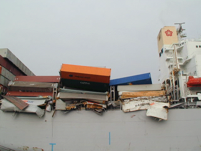
    Containers are lost and ships are damaged in severe sea states. Monitoring of vessel motion and hull stress can alert the operator when the safe operating threshold is about to be exceeded. The real-time display and analysis coupled with analytical prediction of motion and sea load with observed or forecast sea and swell condition can reduce the risk of heavy weather damage. Using these tools, the operator will be able to answer many "what if" questions on changing ship speed and heading to reduce motion and stress before it is carried out. The sensors will further confirm the operator's actions.

    Central Alarm Management

    With the proliferation of alarm signals on each piece of equipment and sensors on a modern ship, the sound and light signals quickly become confusing and unmanageable. The crew may take days to become familiar with the alarms and how to turn them off. Since the VDR is already monitoring all the major alarms, a Central Alarm Management System can automatically monitor, record and display ship's alarm at a central location so that the crew can easily identify the alarm and manage the condition in a timely manner. The entire system is designed to assist the mariner in overcoming the uncontrolled proliferation of alarms and warning sounds on modern ships by displaying the alarm status so that:

    · Alarms are easily distinguishable

    · Alerts or informs which important actions are to be taken

    · Non-important action can be postponed or transferred

    · Responsibilities, procedures, and routines are easily understood through the use of check lists and graphic display including video

    · Records are kept for later investigation and training

    Directional Stability

    A large vessel with blunt hull form can sometimes exhibit directional instability in slow forward speeds. When ship's turning is not responding to the rudder action, it can lead to collision in congested waters and grounding in narrow waterways. Real time display of turn rate, rudder angle and other factors influencing the ship's maneuver can alert the operator of potential dangers.

    Incident Investigation

    As in other transportation incident investigations, the marine incident requires accurate data records in order to gauge system and personnel performance as well as operating status prior to an incident. In maritime industry, most of these incidents are not fatal, the actions taken by the crew after the incident is also important. The VDR can record and save the data so that analysis can be made when the ship arrives next port. The determination of factors, which caused, or contributed, to an incident is most important in the prevention of similar future incidents.

    Perhaps the most notable are maritime investigation involve passenger vessels and the loss of human life. It is critical to determine which regulations, equipment, and operational procedures require modification to prevent these incidents. Also incidents which damage the environment have a "high profile" with a lot of public demand to find ways to prevent future incidents. For the operator, all ship incidents are important if lessons can be learned to avert damage in a potentially dangerous situation. The second by second replay of important ship data recorded by the VDR could be a critical tool for the marine accident investigator in the determination of specific precursor events, sources causing incidents, and subsequent actions taken to avert the incident.

    Bridge Team Training

    Shipping companies spend a great deal of effort in bridge team resource management training to ensure safe operation. Playback of VDR recording of actual operation data can provide realistic scenario to improve bridge team effectiveness and evaluate procedures for accident prevention. Corrective measures can then be reinforced via training.

EFFICIENCY

Operating efficiency is another important element in the competitive commercial shipping industry. In the long run, only the safe and efficient operator will survive in business. Efficiency can be improved only when the management can compare performance to an established base line standard. Ship operators currently rely on the crew to make observations of time, ship position, speed, engine output and other pertinent voyage data, then record them on a sheet of paper or input them into a computer data base. Uncertainties in weather conditions, effect of current, averaging process used to determine SHP, speed etc on once or twice a day basis degrade the overall data integrity. Since there is no way to check the validity of each input, the data is often of little use in performance monitoring except for record keeping purpose.

The continuous monitoring of navigation and engine data by the VDR creates an ideal database for performance evaluation in an automated fashion. Passage reports can be generated from past time history records on any selected data fields. Inferences can be made regarding the hull, engine, and propeller efficiencies as well as fuel consumption. The results can assist the management in making optimum dry-docking schedules, choosing fuel types, as well as validating claims of energy saving devices. In the real-time mode the VDR can supply critical engine data to alert operator of abnormal operating conditions before they result in engine damage. The following are a few examples of the use of VDR data in enhancing operation efficiencies:

    Engine overload

    Ships with low sea margin design of fixed pitch propeller and low speed diesel engine combination can often lead to engine overload when encountering head sea conditions. Monitoring of Shaft horsepower and RPM and displaying them on an engine overload diagram can alert the operator when approaching such conditions. The engineers can then take appropriate actions to minimize the engine wear when operating in restricted zones.

    Hull and propeller roughness monitoring

    An increase in Hull and propeller roughness can result in a large increase in fuel consumption over time. In the worst scenario, the added resistance will also cause frequent engine overload even in favorable weather conditions resulting in reduction of operating speed. The detailed recording of engine SHP, propeller RPM, and ship speed just after dry-docking can be used as a baseline for comparison with current conditions. Savings in fuel cost can be traded-off between early dry-docking, using long lasting anti-fouling paint and underwater propeller polishing.

    Performance evaluation

    Ship performance evaluation has been an elusive target due to lack of detailed navigation and engine data. Uncertainties on the effect of weather and ship's loading on fuel consumption plus changes in schedule requirement makes the performance evaluation difficult if not impossible.

    With the VDR recording actual ship position, speed, engine RPM, SHP and wind speed, it is possible to compare the performance to a known based line standard. Charter party speed claims can now be based on actual recorded ship speed and wind measurements. For owner operated ships, management can compare performance of sister ships running on the same trade route and identify deficient operating practice to improve efficiency. Historical data can also help the company naval architect in specifying proper sea margin when building new ships.

BEYOND VDR BASICS: ADDED ECONOMIC BENEFITS

Although the primary purpose of VDR is to record data for accident investigation, many real-time applications of the VDR can lead to improved safety by identifying and warning of impending danger or organize the alarms. VDR data could prove valuable for the training and education of mariners. Real life data of unfolding events could be used to simulate actual problematic situations and the decision of the student could safely be evaluated and guidance provided. Data could be used and reviewed by crews who operate in a problematic area to improve their decisions. VDR data can play a key roll in the education and training of our mariners to enhance the safety of operations.

Companies trying to become more efficient could also use VDR's information. Data collected and analysis performed by companies could be used to increase their competitive advantage. Historical vessel operating efficiency data could be collected and monitored to determine the need for vessel maintenance or modification to reduce operating cost. Performance evaluation could be carried out to identify operating deficiency. By using the VDR data, companies can improve their operating efficiencies. Safer and more efficient operations can be directly translated into cost-saving and increased profitability of those shipping companies utilizing the VDR technology.

CONCLUSION

Carriage requirements for commercial vessels will happen. It is not a question of if there will be a VDR requirement, just when. IMO has passed resolution on Performance Standards of VDR and encourages member states to vote for mandatory carriage of VDR. Discussions are focusing on passenger vessels, which have potentially the greatest impact on human life; followed by vessels which have the potential for environment impacts, such as tankers and chemical carriers, then cargo vessels. Progressive IMO implementation of carriage requirements is expected in the near future.

Currently the IEC is completing the final draft of the technical standard for the VDR. The specifications will have to be consensus standards developed collaboratively by all parties with an interest. They must allow for the cost-effective production VDRs, which can be used by the majority of the commercial shipping industry. In addition, innovative use of VDR data in both real-time and archived mode should be encouraged to bring about added benefits for the owner and operators.

In conclusion, VDRs can positively impact the commercial maritime industry. Safety will be increased just by the awareness of their existence. The utilization of VDR's in the commercial shipping industry will be a plus for the maritime industry. Just through the awareness of their existence, they will heighten operator's diligence in operating their vessels safely and efficiently. With the carriage requirements for the maritime industry coming out in the near term, the industry must be prepared for their implementation. As ships are required to carry such recording equipment, operators should take advantage of the VDR hardware and derive added benefits in enhanced safety as well as efficiency.

Acknowledgements

The research and development effort of VDR described in this paper is partially funded by an ARPA/Maritech project. Opinion expressed in this paper however, may not necessarily reflect that of Maritime Administration.

References

Chen, H. Cardone, V. and Lacey, P. "Use of Operation Support Information Technology to Increase Ship Safety and Efficiency", Society of Naval Architect and Marine Engineers, Annual Meeting 1998.

Biographies

Todd Ripley is a Naval Architect at the Maritime Administration under the U.S. Department of Transportation. He is the Maritime Administrations representative for technology development programs involving shipboard information systems and shipboard bridge systems. He is a member of ASTM and ISO and is engaged in shipbuilding and maritime standards development both at the national and international level.

Tom King is the Director of Marketing and System Sales for Litton Marine Systems. Litton Marine Systems, headed in Charlottesville, Virginia is a trade name of Litton Industries, representing the three legacy companies of Sperry Marine, Decca Marine and C. Plath.

Henry Chen is the President of Ocean Systems Inc. of Oakland, California. He has actively participated in the development of VDR hardware and software during the last 5 years. He is a member of the IEC committee formulating the draft technical requirement of VDR. His background is in naval architecture and marine systems engineering. He has a Ph.D. from MIT.

WEATHER NOTES:

The History Channel and Rogue Waves

"Join us for the amazing story of one of nature's most terrifying forces. With striking visuals from ships in storm-tossed seas, the special presents dramatic tales of rogue wave disasters throughout history, and explores the astonishing scientific discoveries surrounding this deadly phenomenon. Aided by mind-blowing CGI footage from the motion picture Poseidon by Wolfgang Petersen, director of The Perfect Storm, we reveal the awesome power of this ocean menace as it really is--a monster rising from the deep!"

STORM SPOTTER BEAU DODSON


February 12, 2008: MAJOR ICE STORM DAMAGE - WESTERN KENTUCKY

FROM THE TULLAHOMA NEWS

Sirens working, but take extra precautions against tornadoes


MARITIME NOTES


Smaller ferries in Admiralty Inlet would be dangerous


A former NOAA officer, otherwise anonymous, has filed an interesting report about weather conditions in Admiralty Inlet, where the Port Townsend-Whidbey Island ferry route runs (when it does). His verdict: the state's plans to replace the current ferry with a smaller boat would risk lives, due to the mighty winds and waves prevalent in the area.

The blogger describes, with detailed records, how the wind comes around the Olympics and creates intense pressure and high waves. That calls for boats that are "large, powerful, and sturdy," he writes. Here's his scary weather report:
By David Brewster, Ferries
Posted on February 13, 2008, Printed on February 13, 2008
http://www.crosscut.com/ferries/11537/

A former NOAA officer, otherwise anonymous, has filed an interesting report about weather conditions in Admiralty Inlet, where the Port Townsend-Whidbey Island ferry route runs (when it does). His verdict: the state's plans to replace the current ferry with a smaller boat would risk lives, due to the mighty winds and waves prevalent in the area.

The blogger describes, with detailed records, how the wind comes around the Olympics and creates intense pressure and high waves. That calls for boats that are "large, powerful, and sturdy," he writes. Here's his scary weather report:

When Southwest storm winds off the Pacific are forced to divide around the Olympic Mts., the eastern branch of these winds blows up Hood Canal. Because the mountains have forced the moving air aside, it is compressed, and by a well-known principle of fluid dynamics called the Bernoulli Principle, a flowing fluid (in this case air) that is compressed and subjected to higher pressure by dividing around an object speeds up in the immediate vicinity of the object. This is why Hood Canal experienced 100 mph winds in 1979, winds which broke apart and sank the original bridge. When this eastern branch of the “fluid” reaches the northern end of Hood Canal at the NE corner of the Olympic Peninsula and north end of the Kitsap Peninsula, it spews forth into Admiralty Inlet like water out of a fire hose and slams into the southwest side of Whidbey Island.

In calling for bigger boats to replace the scrapped small Port Townsend ferry, the writer also says there will need to be an expanded terminal at Port Townsend and a new terminal outside the tiny Keystone Harbor on Whidbey. He stresses that the Inlet is "a wild and dangerous place," as some recent episodes demonstrate:

The experience of the Keystone-Port Townsend passenger-only ferry the other day is a case in point, with the entire bow going under dark green water for what seemed like an eternity, flooding water into the passenger cabin and striking terror among the passengers. They literally thought they were about to die, screaming and helplessly running “up hill” toward the back of the boat. Another case in point is the recent event that damaged cars on a much larger San Juan Islands ferry.

The comments appear on a blog called Bitter End, run by a rescue tug captain, Richard J. Rodriguez. It's an interesting source of detailed information about our ferries, from the helm, as it were.

FINALLY

We have been blogging about the rescue of the s/v Sean Seamour II by the United States Coast Guard for some time now. The crew that rescued the sailors of this stricken sailboat were recently decorated for heroism. ( See Saved from the Angry Atlantic )

Well we are pleased to announce that USCG Rescue Swimmer Drew Dazzo is up for another award from the Naval Helicopter Association. Here is the announcement;

AST2 DREW DAZZO: 2007 NAVAL HELICOPTER ASSOCIATION RESCUE SWIMMER OF THE YEAR, REGION FOUR* - Recognized for saving 3 lives on 7 May 2007 180NM east of MCAS Cherry Point, NC.

AIRCREW OF 6003 (LCDR ADAM KERR, LT ANDY SCHANNO, AET1 THOMAS ROMERO, AST2 MIKE ACKERMANN): 2007 NAVAL HELICOPTER ASSOCIATION AIRCREW OF THE YEAR (NON-DEPLOYED), REGION FOUR* - Recognized for saving 2 lives on morning of
20 Feb 2007 200NM east of Bermuda.

Banquet to be held at 1100 on Friday, 21 March at the Vista Point All HandsClub in Norfolk. RSVP NLT 13 March. See below for details. Uniform foraward winners, military/civilian guests TBD.

*Region 4 is the Mid-Atlantic Region of the United States.


Way To GO.. Drew Dazzo!

RS

Wednesday, February 13, 2008

U.S. aims to give wake-up alerts on storms

By Jim Loney

MIAMI (Reuters) - In the not-too-distant future, the U.S. government would like to be able to wake up residents in the middle of the night when a hurricane or tornado threatens, perhaps by sounding the alarm on a cellphone.

The birth of a twister or the sudden, overnight intensification of a hurricane while people are sleeping, are the nightmare scenarios facing storm forecasters as they lay plans to strengthen America's natural disaster defenses.

"I'm worried about waking you up," Mary Glackin, a Bush administration official responsible for the day-to-day operations of the National Oceanic and Atmospheric Administration, said on Tuesday. "I call that completing the forecast."

The U.S. government is ready to spend more money on tracking satellites, sea buoys and research on hurricanes, Glackin said as she briefed south Florida officials on the administration's proposed fiscal year 2009 budget.

The disastrous 2004 and 2005 Atlantic hurricane seasons sent shock waves through global energy, insurance and commodities markets. Four powerful hurricanes struck Florida in 2004, causing a combined $35 billion in damage.

In 2005 a record-breaking 28 tropical cyclones formed, including some of the most intense hurricanes on record. Katrina killed 1,500 people and caused $80 billion in damage when it swamped the U.S. Gulf coast, bursting the levees protecting New Orleans and flooding the famous jazz city.

One of the biggest threats from hurricanes is the explosive intensification of a cyclone close to shore after residents have gone to bed, shortening the time available to safely evacuate millions of people from the crowded Atlantic and Gulf of Mexico coasts.

WAKE-UP CALL

Bill Read, the new director of the National Hurricane Center, said he would like to see a wake-up system, perhaps Internet-based and delivered by cellphone, within a decade.

"Look what can be delivered by cellphone now," Read said. "We ought to be there in 10 years."

In order to improve hurricane intensity forecasts, NOAA plans to deploy three new hurricane-monitoring buoys at sea this year, bringing to 15 the number in the Gulf of Mexico, Caribbean and Atlantic. They can measure wind speeds, wave heights, sea temperatures and other critical data.

Read said he hopes for a 3 percent yearly increase in the accuracy of intensity forecasts, the same as forecasters have been able to achieve in predicting hurricane tracks. The aim is to buy residents a little extra time to react to a storm.

"We're not going to solve the intensity problem if we don't do the research," he said.

The agency's budget for hurricane-hunter airplane flights into hurricanes is increasing, and it plans to equip a Gulfstream-IV jet with a new Doppler radar system, giving forecasters better data on a storm's wind field, Glackin said.

Researchers eventually hope to deploy unmanned aircraft like those used by the U.S. military in Iraq for hurricane research missions that are "dirty, dull or dangerous," she said. Such a drone was sent into Hurricane Noel last year.

The fiscal year 2009 budget, proposed by President George W. Bush and subject still to Congressional approval, would boost funding from $3 million to $6.3 million for the drones. Glackin said full deployment is "several years down the road."

The 2009 spending plan includes a huge $242 million increase for the GOES-R (Geostationary Operational Environmental Satellite) program, which is scheduled to put a new string of satellites into orbit starting in 2014.


Tuesday, February 12, 2008

TORNADO WARNINGS! WHAT'S IT GOING TO TAKE?

For quite a few years now weather forecasters, skywarn severe weather spotters, storm chasers and emergency management professionals have been pro-active in educating the public and school children to the risks of severe weather.

(Pix: New Disney attraction To Teach Storm Safety)

Initiatives such as recommending and even legislating ( in some States ) mandatory purchase and or installation of severe weather alert radios for some new modular homes and to the general public at large. Initiatives to build better storm shelters, and modular homes are also being discussed. Of course there are some communities and their leaders who think this is unreasonable or cost prohibitive.

However during the recent tornado outbreaks of January and February the loss of life has been extensive. To date the Storm Prediction Center (SPC) has preliminary numbers of reported twisters raging across the United States for the 5 February 2008 event at approximately 103, with associated deaths at approximately 66. This does not include some 250 wind reports and some 124 hail reports, for a total of 477 reports filed with the SPC just for that day.

Many of these death (14) were in mobile homes and with many people caught off guard or at the very last moment without knowledge of the watch or warning. However and not to down play the tragedy of the loss of human life and there is no intent on my part to do so. But all reported deaths so far, were either under a WS- Severe Thunderstorm Watch or a Tornado Watch or Warnings.
There has been much talk and debate on whether or not there was ample time for people to receive the watches and warnings and or whether or not there was even any warnings at all.

The morning of
Super Tuesday, 5 February 2008, NOAA's Storm Prediction Center had issued very early projections . These projections were delivered to all National Weather Services (NWS) Offices as well as all news media outlets and other federal, state and local agencies and organizations. Many weather related email listserves were jumping the morning of the 5th. News media meteorologists who forecast their own reports were well advised of the potential of these storms. Both NWS and the news outlets were very diligent in both forecasting and warnings with some outlets warning even in advance of the official warning being issued. Skywarn Storm Spotters and Chasers were ready and in many cases in position in advance of these storms.

Skywarn is a program the National Weather Service uses to improve severe storm warnings. Trained volunteers serve as storm spotters and chasers. These spotters pass on vital "ground truth" information to forecasters during severe weather events. They are the eyes and ears not only for forecasters, but for the community as a whole.


Take for example, Arkansas Storm Spotter George Hoelzeman who was already active and out attempting to position himself to spot and chasing the storm, which decided to dropped in on his 120ac property
doing significant damage to the woodlands on his property. The twisters track looks to have come approximately 1/5 to 1/4 mile or maybe slightly closer to his home, though he had two of the reported twister fatalities right in his own back yard.

They were his neighbors and one lived in a mobile home and had a son who lived next door in a brick home. Apparently the parents did not know the storm was approaching until their son who was either alerted to it or saw it coming over a hill and attempted to phone his parents to warn them, when the phone line went dead. That's when the son saw the mobile home go up. Both the mobile home and his brick home were destroyed.

The son, who suffered from several injuries including a piece of wood embedded into his thigh, was taken to the hospital by George. Amazingly enough the son walked almost a mile thru downed trees and power lines to the nearest paved highway where George was making his way back when he picked him up. George being a storm spotter, ham radio operator and weather geek is one of the reasons why his family was alerted and why they were safe.

Spotters and chasers like Geroge are hero's in my book... Most of George's neighbors rely on watching TV for their warnings or have relatives call them. In his area there are very few basements or storm shelters and apparently many people have been living under the misconception that tornadoes can't get them in hilly areas.

The 5 February 2008 storms were numerous rare fast movers are very hard to track and chase. But the National Weather Service and news meteorologists did a outstanding job of tracking and warning as the storms developed and took shape. There were hundreds of watches and warning issued as these storms traveled thru the United States. So many watches and warnings that keeping track of them all was difficult at times.


However there were also a number of news reports (such as, Twisters catch residents off-guard" stating that some people in the effected areas did not get warnings and that one local rural Emergency Management Agency (EMA) did not have sirens. While sirens are designed for out door warning and not reliable for in door and especially at night when people are asleep. What works for one community as far as sirens does not mean it works for all communities and people must just not learn how to protect themselves. But follow through with what they did learn (Residents must rely on themselves for tornado warnings) .

I am sure that there were some that got late warnings and some that were not tuned to the warnings. Moreover, the ones who got late warnings were either not tuned to the weather around them or alerted late by friends and relatives that day or were focused on the news of the day, the Super Tuesday Elections, or some other program or event. Or were part of what I call the "Ambient Clueless Factor". Like those who believe that tornadoes can't get them in hilly areas. While some were even brazen enough to go play in the approaching storms knowing that twisters were out there.....

Here are two examples of how people get themselves injured or killed in severe weather
(video provided by Storm Spotter Beau Dodson). Note the warning sirens in the background. (warning strong language).


And


Whats it going to take?

Like I said, The National Weather Service, many news outlets, storm spotters and chasers and local emergency management agencies spend a lot of time and money to educate folk preparing them for severe weather. Rural Emergency Management Agencies, many of which are staffed by volunteers, are being short changed by a federal funding system that favors large populations with a emphasis more on terrorism than natural disasters and cannot afford the staffs or equipment they need. But they get the blame anyway for not having the staffs or equipment they need so very badly. My questions here are, where are the local elected officials in these cases? Or are they part of the ambient clueless factor?

Yes there is no guarantee that anyone would survive a disaster or incident even with advanced warning. But if we take the percentage of survival from fire
because of early warning by a well maintained smoke detector and a evacuation plan (the risk of death by fire is reduced by 82 percent ). Then we can assume that the percentage of death from tornadoes from well maintained weather alert radios along with a plan of action, can do the same thing. While NOAA is continually expanding it's repeaters, especially in rural areas where reception is lacking.

So what's its going to take for people to start paying attention to the environment and their surroundings? What's it going to take for people who are willing to go out and buy smoke detectors to provide them with early warning of a fire in their homes, but not spend the money to buy a good NOAA Severe Weather Alert Radio? Especially these days? And what is it going to take for people to smarten up and not play with Mother Nature?


It appears death is not a deterrent to some, while the ambient clueless factor seems to play a leading role in many cases.

Take a moment to think about the loss of life and property damage that was caused by these storms. What's your plan to prepare your family for acts of Mother Nature like tornadoes and severe weather?


What's it going to take?

MARITIME NOTES:

M/F Riverdance WebCam

UK Vessel Incidents UK Vessel Incidents Three different vessels ran into trouble recently in the United Kingdom; the UK Marine Accident Investigation Branch also issued the report on its investigation of the Young Lady, which dragged its anchor and dislodged a natural gas pipeline in June of last year


RS

Friday, February 8, 2008

Twister Perliminary Report. The UND Adriyatik Fire. And The Mid-West Snow Storm!

Though this report is a preliminary report since it will take the Storm Prediction Center (SPC ) sometime to tally the official count.

This is still put together very well and one heck of a snap shot for February 2008.

It sure was a Super Tuesday! There were some 211 to 215 watches and warnings issued by my count.


The below posted report was compiled by KMTV Morning Meteorologist
C.T. Thongklin of Action 3 News, and First Warning Weather Blog in Omaha, Nebraska. As far any reports of twisters in Southern Illinois. As of this writing, NWS St. Louis documented wind damage in southern IL, but no tornado.... Yet! But
I am told that while some NWS offices are still surveying damage. So far there is not as many tornadoes or as widespread as the April 3, 1974 outbreak . Though probably the worst since the May 2003 outbreak.

Remember, take a moment of your day, to remember those lost and those displaced from these Super Tuesday's twisters, heavy seas, recent floods and snow storms, worldwide. It's been one hell of a start for 2008!

C.T. Thongklin's Analysis!

Torgraph

One thing concerns me from this chart is how far the 2008 curve (red line) is above 2005, 2006, 2007 and the 10-year average. From the quantity of tornadoes the U.S. has experienced this year, we can safely classify 2008 as an anomaly so far.

Also notice that we typically experience between 1,000 and 1,300 tornadoes per year in the entire U.S.

According to the National Climatic Data Center (NCDC), 83% of all tornadoes in the U.S. are F0 (40-72 mph) and 98% are below F3 (158-207 mph) intensity. That leaves about 2% as F3 or stronger! Keep in mind that the ratings I mentioned of F0 and F3 are part of the old Fujita scale of damage. The Enhanced Fujita Scale (EF Scale) became operational on 1 February 2007.

If you are curious, the following is the severe weather climatology of the Omaha/Valley National Weather Service Forecast Area. The following images represent the climatology within the WSR-88D radar range of 124 nautical miles from the radar site in Valley.

Total Severe Weather Reports during the period 1980-2006 (red = tornado, green = hail 3/4" or larger, blue = damaging wind or 50+ kts. wind)

Oax6

Significant Severe Weather Reports during the period 1980-2006 (red = F2 or stronger tornado, green = hail 2" or larger, blue = 65+ kts. wind)

Oax7

In terms of tornado frequency, the Omaha radar site ranks 3rd out of 141 other weather radar sites across the country! #1 is the Oklahoma City NWS radar site and #2 is the Goodland, KS, NWS radar site. In the Omaha radar site, 56 tornadoes is the average, using data from 1980-2006. Despite this high number, the Omaha radar site ranks #18 for F2 or stronger tornadoes out of the other 141 sites.

Using the same data, tornado frequency is highest between 3:00 pm CDT and 11:00 pm CDT in the Omaha radar area.

The last deadly tornado to occur in our area was the Hallam tornado (22 May 2004) that killed 1 person and injured 38 people.

Lets hope that our spring won't be too active! Now is the time to prepare for "tornado season" by crafting an evacuation plan at your home and practicing drills, along with keeping an emergency kit ready to go. One possible factor into the high number of deaths into Tuesday's outbreak was the time of day...mainly after midnight. Your television set or radio can't wake you up, but your best defense is a programmable or Specific Area Message Encoder (S.A.M.E.) NOAA Weather Radio. These radios are often between $29-$69 and can be programmed exclusively for your county and even for certain types of warnings, such as a tornado warning. When the alarm sounds, you can execute your emergency plan immediately, even though you may not be aware of what the weather is doing around you at 3 in the morning. You can purchase one of these radios at sporting goods stores, big box retailers and nationwide electronics retailers.

I'll write more on weather radios and severe weather preparation in future posts, but for now, please mark this date on your calendar...Saturday, 29 March 2008. It is the Central Plains Severe Weather Symposium on the UNL campus. It is a FREE public-oriented educational event discussing tornadoes, severe weather safety and you'll also have a chance to meet your favorite television weathercasters (besides me! ha ha). At this time, I plan on being there, but Dean and even Ryan my join me at this year's symposium.

The following websites were used extensively for stating factual information for this post:

National Climatic Data Center Tornado Climatology http://www.ncdc.noaa.gov/oa/climate/severeweather/tornadoes.html

SPC OAX Severe Weather Climatology http://www.spc.noaa.gov/climo/online/rda/OAX.html

More information on weather radios can be found at http://www.crh.noaa.gov/oax/?n=nwr_mainhttp://www.weather.gov/nwr/ or

Information about the 2008 Central Plains Severe Weather Symposium can be found at http://www.cpsws.unl.edu/

KENTUCKY TORNADO UPDATE

Seems as if Storm Chaser Dan Robinson of Storm Highway has caught the EF2 Twister that struck Crofton, Ky on camera..

MARITIME NOTES

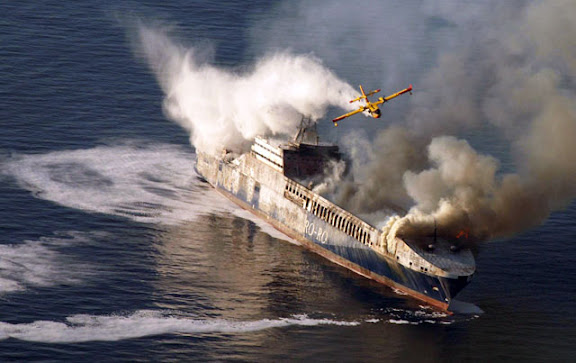
Firefight Explosion fears over Turkish ship

SPECIAL firefighting planes were dispatched off the Croatian coast after a fire broke out on a Turkish trading ship, writes Ed Holt.

The 193 m long Undadriyatik was transporting 200 trucks and 11 tonnes of oil to the Italian port of Trieste when the fire started yesterday morning as the ship was 16 nm off the western Croatian town of Rovinj.

The Greek vessel Ikarus Palace, which was nearby, answered a distress call and all 22 crew members on board and nine others on the vessel were rescued.

The upper deck of the ship had been completely burnt out by yesterday afternoon and authorities said there was a fear of an explosion if the flames reached the oil on board.

It was unclear if the fire had spread to other parts of the ship but rescue officials said they believe the ship is likely to sink.

THE M/F RIVERDANCE

Seatruck Ferries’ Riverdance, which remains aground off Blackpool, lost a further five trailers overboard on Tuesday night when the ship shifted at high water. From first light yesterday, teams worked to remove debris on the starboard side of the ferry to ensure a salvage team could access the ship by rigid inflatable. Pumps are being lifted onto the vessel as the salvors want to correct a 50° list before commencing operations to remove bunkers.

FROM HOLLAND AND KNIGHT

Casino boat blown about by Hurricane Katrina still not a vessel

In an unpublished decision, the US Court of Appeals for the Fifth Circuit ruled that a permanently-moored casino boat is not a vessel. In the instant case, the casino boat, floating in a marina in Biloxi, Mississippi, was moored to six steel dolphins using heavy “H” beams and received water and electricity from land-based sources. During Hurricane Katrina, the casino boat was ripped from its moorings, carried several thousand feet through flood waters and over a highway, and crashed into a hotel. The owner of the casino boat filed suit, seeking exoneration from or limitation of liability under the Shipowners’ Limitation of Liability Act. The hotel owner filed a counterclaim, seeking recovery of damages. The court held that a watercraft that has been permanently moored is not capable of being used in for maritime transport and, thus, is not a vessel for purposes of federal admiralty jurisdiction. Petitioner’s argument that the casino boat was “in navigation” when it struck the hotel was found to be unavailing. In the Matter of Silver Slipper Casino Venture LLC, No. 07-60330 (5th Cir., January 31, 2008).

UK – salvage begins for stranded ro-ro ferry

The UK Maritime and Coastguard Agency (MCA) issued a press notice stating that salvage has commenced on the ro-ro ferry that stranded near Blackpool. No pollution has been reported. A second press notice states that salvage gear is being placed on the ferry. (2/6/08).

USCG Marine Safety Program

Without fanfare, the US Coast Guard posted the insightful analysis of the agency’s Marine Safety Program undertaken by VADM James C. Card, USCG (ret). The major recommendations of this report are to increase the emphasis of the program within the Coast Guard, while improving interaction with the marine industry. The agency also released a one-page Marine Safety Overview, providing an indication of how it intends to achieve these goals. Related background material includes Admiral Thad Allen’s Address to the Washington, DC Propeller Club on September 19, 2007 and a Marine Safety Plan of September 25, 2007. The Coast Guard has now formally recognized that its recent relationship with the marine industry was in disrepair and can be expected to move forward with all deliberate speed to address the various issues. The agency is counting on the many segments of the marine industry to renew and enhance this long-standing and vital partnership. (2/8/08).

NOTES FROM THE BRIDGE

Maritime Affairs responds to captains' cry
Thursday February 07 2008

by Akedia Christopher

Director of Maritime Affairs McClean Hobson has thrown down a gauntlet to captains to introduce an alternative measure which they think would be more feasible to account for travelling passengers.

This came after captains expressed their disapproval in the new initiative in which passengers would be required to give their names when travelling on the ferries without having to produce photo identification.

He said if they have any information to help the process, they should contact the Maritime Department

FROM THE INTERNATIONAL DESK
by Arthur Rabjohn CEM

GLOBAL: Tipping Points Could Come This Century
The tipping points include the collapse of the Indian summer monsoon. A number of key components of the earth's climate system could pass their 'tipping point' this century, according to new research led by a scientist at the University of East Anglia. Published by the prestigious international journal Proceedings of the National Academy of Science (PNAS), the researchers have coined a new term, 'tipping elements', to describe those components of the climate system that are at risk of passing a tipping point. The term 'tipping point' is used to describe a critical threshold at which a small change in human activity can have large, long-term consequences for the Earth's climate system.

BOLIVIA; Severe flooding caused by weeks of heavy rain have left 48 people dead and some 40,000 families homeless. Two rivers in the Beni province have broken their banks. A state of emergency has been declared. Among the worst-hit areas are the eastern provinces of Beni and Santa Cruz as well as Cochabamba in central Bolivia. Several thousand people have been moved from areas at risk in Beni, where the River Mamore has broken its banks.

CHILE: Llaima volcano is erupting, prompting the evacuation of some tourists. Columns of ash and smoke rose from the crater up to 5,000m above the volcano that is located 700km south of the capital Santiago. If its activity increases, authorities will need to take evacuate the residents.

MOZAMBIQUE: Thousands of people have been evacuated from the Zambezi river valley, as Zambia would release water from the Kariba dam. The water is expected to flow down the Zambezi into areas of Mozambique already struggling to cope with high flood waters. In Mozambique there are already 100,000 evacuees and the reception centres are full to capacity. Another 40,000 will be evacuated. Mozambican authorities have managed well the crisis so far, but the pressure from the continuing rainfall is putting immense strain on the already overstretched resources.

LASTLY
From Gilbert Sebenste, Staff Meteorologist, Northern Illinois University


Illinois and Wisconsin Snow Totals

Stay dry and have a GREAT Weekend!

RS

Thursday, February 7, 2008

FLOODS, TWISTERS, SNOW AND THE RIVERDANCE

Wild weather returns

State hit again with storms, flooding
February 6, 2008

In January, people living along the Tippecanoe River were flooded out of their homes by a combination of snowmelt and heavy rain.

One month later, it's happening again, with more rain causing flooding in the area.The weather hasn't spared Central Indiana, either, as storms smacked the area with heavy rain and a possible tornado Tuesday night. Indiana's strangely volatile weather, which in the past month has seen swings from snow to thunderstorms, and tornadoes to snow and sleet, has moved back to an imitation of spring. A wave of thunderstorms crossed Central Indiana on Tuesday, causing damage in Putnam County about 9:30 p.m.

The Web site of the National Weather Service reported that U.S. 231 south of Greencastle was blocked by debris and that trailers, cars and trees were damaged at U.S. 231 and U.S. 36. There also was a report of a possible tornado west of Bainbridge.

Indiana State Police at the Putnamville post said buildings had been damaged in Bainbridge, including a fire station and a small restaurant. Continued Wild weather returns.

TORNADOES

AIR Worldwide Surveys Super Tuesday Tornadoes

More than two dozen tornadoes tore through the mid-South late last night, destroying homes, barns, and industrial buildings from Texas to Ohio. The severe thunderstorm outbreak, which included tornados, hail, heavy rain and lightning, killed nearly 50 people and injured 100 more.

"Tuesday's severe weather was caused by a strong, developing low pressure system that moved out of east Texas during the day," said Dr. Tim Doggett, senior research meteorologist at AIR Worldwide. "As the system moved into the Mississippi Valley, cold air from the plains was drawn southward. It clashed with the warm, humid air ahead of the system, triggering a cold front. The resulting cold front caused widespread thunderstorm formation in the middle of unstable air feeding in from the Gulf of Mexico. A dynamic jet stream located above the system provided the wind shear that fueled the numerous tornadoes."

The Storm Prediction Center has collected more than 70 reports of tornadoes, though the actual number of individual events is probably fewer. AIR meteorologists analyzed the SPC data and, based on time/space continuity of the reports, defined 25 individual tornados. In addition to the tornado reports, the SPC has recorded near 200 reports of straight-line winds and 112 reports of hail. There were several reports of hailstones the size of softballs (4.25").

In Tennessee, which suffered the worst damage, 15 students at Union University were trapped in their dormitories as shattered window and ceiling debris from a hard-hitting tornado prevented their escape. Approximately 40 percent of student housing buildings were destroyed, and classes at the university have been canceled for the next two weeks for cleanup. In Jackson, Tennessee, collapsed wreckage trapped fifty residents inside a retirement home. Last night's tornadoes also pulled a roof off a hangar at the international airport in Memphis. Forty miles outside Nashville, a tornado that struck a compressor station set off a natural gas fire that could be seen in the sky for miles around. The blaze was put out early Wednesday morning.

In Arkansas, a tornado that touched down overturned trucks on Interstate 40. Thirty homes were destroyed in Atkins, prompting the Red Cross to put up shelters. Officials in Gassville sealed off the entire town after concerns that storm-related gas leaks would result in an explosion. A damaged hospital in Mountain View was forced to close its emergency room.

In Muhlenberg County in western Kentucky, storms killed at least three people at a mobile home park. Meanwhile, a downpour that started in Evansville last night at 9 p.m. flooded major roads, causing street crews to barricade road access. Officials in surrounding counties reported heavy rains, downed trees and additional flooding. To the west, in Lafayette, Missouri, two industrial buildings, several homes and a church were destroyed by tornado winds, and in Ozark, there were reports of softball-sized hail. Heavy downpours prompted officials in Indiana to open the floodgates on Carroll County's Oakdale Dam, freeing excess water at a rate of 18,000 cubic feet per second. In Mississippi, the Emergency Management Agency estimated that 20 to 30 tornadoes pummeled the state in areas above the state capital of Jackson. A tornado damaged more than 30 homes at Fort Riley in Kansas.

AIR is dispatching a team to survey the worst damage and will provide updates as information becomes available.

FROM NWS Indianapolis

FROM NWS Louisville, Ky

SNOW! AND WE MEAN SNOW!

FROM NWS Milwaukee, Wi

Updated 545 pm CST: Rusty Kapela, WCM

TIME LAPSE VIDEO OF Milwaukee Storm

I also recieved this report from a Milwaukee Spotter earlier this evening (1830hrs).

"EOC is activating in Milwaukee County.

People are stuck on city busses, which are stuck in the snow, all over the city right now. Request came in to the American Red Cross to provide blankets to those on the busses. The Fire Chief from Mitchell International Airport called the Red Cross requesting 100 blankets for stranded travelers there. All flights are canceled. Ambulances are getting stuck around the city.
Snow plows are being pulled off the city streets in Green and Rock Counties."

This pix came in earlier today from Milwaukee Spotter Bob Wade


NWS Chicago Snow Reports

Storm Reports for February 5th and 6th Snow Storm


MARITIME NOTES - RIVERDANCE UPDATE

Salvagers work to move the Riverdance ferry


People who enter the exclusion zone around the stricken Riverdance ferry risk a fine or arrest, police said.

The ship, which is listing at about 50 degrees, has turned into a tourist attraction since running aground on Blackpool beach on Thursday.

HM Coastguard said onlookers straying too close during the salvage operation were putting themselves in danger.

Lancashire Police said they would step in to help the private security firm maintaining the 400m exclusion zone.

The Riverdance had been heading from Warrenpoint, County Down, to Heysham, Lancashire, last week when it was hit by a freak wave.

Twenty-three people were lifted to safety, including 19 crew and four passengers.


The area remains dangerous and unstable so people must remain cautious
Insp Tim Newton, Lancashire Police

A salvage team is still working to refloat the vessel, which is carrying almost 1,200 tonnes of freight in lorry trailers and containers.

Concerns have been raised after sightseers were seen posing for photographs next to the angled ferry.

"They're walking out along the sand at low water," a coastguard spokesman said.

A spokesman for Seatruck Ferries, which owns the ship, said the ship moved in high tide on Monday, causing about six containers to fall off.

Lancashire Police are providing assistance to the salvage operation and are warning the public to stay clear and use a section of the promenade set aside for people to watch from a safe distance.

Salvage continues

Insp Tim Newton, of Lancashire Constabulary, said: "We've had huge numbers of visitors over the last week to see the spectacle.

"We have been working closely with the Maritime and Coastguard Agency to facilitate the salvage operation and prevent people going onto the sand and out to the vessel.

"The area remains dangerous and unstable so people must remain cautious."

Anyone found in breach of the cordon will be asked to move on and if this request is refused, police say they could be issued with a fine.

If a person refuses to give details they will risk being arrested, the force said.

Salvage equipment is being lifted by crane on to the Riverdance in a bid to pump water into the empty ballast tanks to reduce the list.

The operation is likely to continue into Thursday when the prospects of refloating the vessel will be reviewed, said a spokesman for Seatruck Ferries.

Nautical Archaeology Workshop April 2008

The workshop teaches divers why underwater archaeology is important, how they can impact and protect Ohio's wrecks, techniques they will use during shipwreck surveys and much, much more.

For those in peril . . .
Remember the seafarers around the world


From
February 5, 2008

Sir, The recent bad weather affecting several ships off our coastline (report, Feb 4) has brought into sharp relief the extraordinary situations the seafarers who crew the merchant fleet face in order to keep us in the manner to which we have become accustomed.

The media have praised those involved in the dramatic rescue of the crew and passengers of the Horncliff (off the coast of Scilly) and the Riverdance (near Blackpool). However, no mention has been made of the crews that daily face heavy seas.

There are currently more than 1.2 million seafarers around the world manning the merchant fleet. The UK relies on shipping for more than 90 per cent of its daily needs. Seafarers bring us our food, our clothes, our petrol and our cars. We need them and they need us. Yet, because they are only in port for a few short hours, coupled with the long hours they work and the isolation they can feel while in a port miles from the nearest town, we push them to the backs of our minds.

As news breaks of possibly more foul weather to come, I urge all readers to remember the significant contribution seafarers make to the life of this country and to each and every one of us.

The Rev Canon Bill Christianson
Secretary General

The Mission to Seafarers


RS

Wednesday, February 6, 2008

Freak Waves, Twisters and a Spout!

The weather so far this year has been just extrodinary worldwide. And its only the start of February!

Seems we have another media report out of Port Townsend, Washington (article below) of a freak wave striking the M/V Snohomish a fast ferry last Friday, February 1, 2008 on the Port Townsend to Keystone route.

After checking with NWS Seattle, it seems they had a
Wind Advisory out for the sector.

The weather this time of year in the Port Townsend area is always rough and plays havoc on small ferries. Especially on the Port Townsend to Keystone run. While as reported if the
M/V Snohomish was struck by a wave cause by a passing container ship it is not a true freak wave and very possibility a navigation error by the ferry. But I don't think so....

Checking on the vessels particulars there is a ADA note that states:

"
The Snohomish is a high-speed passenger vessel that is equipped with accessible restrooms, adequate shelter, and wheelchair tie downs. There is no food service available on this vessel. At this time, access from street level to vessel passenger decks for passenger-only ferries may be difficult for some disabled customers. The slope of the ramps leading to the decks can be dramatically affected by tides and weather. Please ask for assistance or call ahead for tidal information."

The questions are, was the weather system or container ship powerful enough to create such a large wave? Or is the vessel's construction not
capable of taking on large waves?

11:32 AM PST on Tuesday, February 5, 2008


Passenger recall rogue wave during ferry route
By ELISA HAHN / KING 5 News

PORT TOWNSEND, Wash. - A big wave caused panic on board the ferry Snohomish last Friday after it pushed part of the boat underwater on the route between Port Townsend and Keystone.

The frightening incident was caught on video and passengers described what happened."This was nothing like we've ever experienced out there before," said Bob Rowth, ferry passengers. Video caught on a passenger's cell phone shows the lower cabin of the Snohomish in the aftermath.

The ceiling collapsed to the right and again to the left when a series of waves hit the bow of the boat and water came crashing into the cabin. "The water came through the front doors and the window, and then busted through the overhead, so the ceiling collapsed in on us," said Rowth.

The passenger ferry Snohomish was sailing from Port Townsend to Keystone ferry dock last Friday when passengers say a huge wave hit the front of the ship.

"All the windows in the front were covered with dark green water," said Janice Eklung, passenger. "And we were pitched going down and we stayed down."

"The jet in back was out of the water, so it was totally nose down," said Rowth "And from the side window all we could see was green water - no daylight."

Rowth was on board in the lower cabin with about 30 others. He said after the first wave hit, the boat's bow dipped about 20 degrees down underwater. Passengers started sliding forward to the front of the ship as water rushed inside.

"People were screaming, there was no direction from the crew about life vests or anything, so we all ran away from those windows because we thought they were going to break," said Janice Eklung, passenger.

Passengers say about six to eight inches of water flooded the lower cabin. A big wave caused panic on board the ferry Snohomish last Friday after it pushed part of the boat underwater on the route between Port Townsend and Keystone.

Some passengers called it a rogue wave while the others believe it was a wake from a passing container ship.

The ferry service was forced to cancel the next two runs on the Snohomish.

The state ferry service did not return calls by KING 5. On Friday, it released a simple statement that the run was cancelled due to weather.

Now many wonder whether the 54-car Steilacoom, which was in trial runs for the Keystone route Monday will be able to sustain a similar incident.

TORNADOS February 5, 2008


MEMPHIS, Tenn. (WHBQ FOX13 myfoxmemphis.com)

Deaths, Looting Blamed on Tornadoes in South
Last Edited: Tuesday, 05 Feb 2008,
11:43 PM EST Created: Tuesday, 05 Feb 2008, 10:43 PM EST

Tornadoes have been blamed for five deaths in Arkansas and for looting at a mall in Memphis, as parts of the South were hit by severe storms Tuesday.

About a half million dollars in merchandise has been stolen from Hickory Ridge Mall in Memphis that was hit by a possible tornado, according to a report by MyFOXMemphis.com.

Several people were trapped in the mall when the storm knocked part of the roof down, but no one was seriously injured, police said. Crews continued to battle poor light conditions in their rescue attempt as of 9 p.m. CT, MyFOXMemphis.com reports.

Meanwhile, police in Jackson, Tenn., about 75 miles of northeast of Memphis, say storms damaged Union University.

Arkansas Gov. Mike Beebe said five people were killed by tornadoes in Atkins, Clinton and Gassville.

In Atkins, storms hit about 20 homes and resulted in at least three deaths, according to the Pope County Sheriff's Department told KLRT-TV.

The tornado touched down near Highways 324 and 105, then stayed on the ground and passed into Conway County to the east, according to Renee Preslar, spokeswoman for the Arkansas Department of Emergency Management.

Authorities say a tornado touched down northeast of Memphis as part of a storm front that swept across west Tennessee as voters headed to the polls on Super Tuesday. No injuries were immediately reported.

Authorities confirmed a tornado touchdown near Arlington, about 25 miles northeast of downtown Memphis. The twister knocked out a radio tower for the Tennessee Highway Patrol.

Power outages, downed trees and other storm damage were reported across Shelby County.

And at least two tornadoes hit north Mississippi on Tuesday, tearing through buildings and ripping down power lines.

The Associated Press contributed to this report.

Officials: At least 2 tornadoes hit Mississippi

Associated Press Writer

-- Two tornadoes hit north Mississippi Tuesday and there were unconfirmed reports of a third twister as violent storms pushed across much of the South, authorities said.

There were no immediate reports of injuries or deaths.

"We did have a tornado touch down and several buildings have major damage," said Desoto County Sheriff's Department Cmdr. Steve Atkinson.

Officials were on the scene assessing the damage.

Latrice Maxie, a meteorologist with the National Weather Service in Jackson, said the tornado in Southaven was the same one that hit near Memphis, Tenn., just north of the state line Tuesday evening.

Authorities in Tennessee confirmed that a tornado touched down about 25 miles northeast of downtown Memphis, knocking down a radio tower for the Tennessee Highway Patrol.

Another tornado formed over Panola and Lafayette counties in Mississippi and hit near an industrial complex outside of the city of Oxford, officials said. Witnesses said at least one metal building was flattened and others were damaged.

A dispatcher with the Lafayette County Sheriff's Department said officials were "still trying to get to people" but there had been no reported injuries or deaths.

What officials called an unconfirmed tornado in Bolivar County ripped the roof off a mobile home and blew over a gas pump, Maxie said. There were also reports of hail and strong gusts in several north Mississippi counties.

Calls to the Mississippi Emergency Management Agency went unanswered Tuesday night.

Tornado watches were posted for much of Mississippi as warm temperatures and an approaching frontal system churned up powerful thunderstorms.

The thunderstorms moved into the state during the early afternoon after causing tornadoes and hail in Arkansas and Tennessee, officials said. The National Weather Service said the possibility of violent weather would continue well into the night in Mississippi, including the threat of damaging wind gusts and large hail.

The greatest threat appeared to be the Delta and northwestern counties but the watch area included counties down into the Jackson area.

A warning was issued for areas of Bolivar and Washington counties shortly after 4 p.m. when weather service meteorologists detected a possible tornado. The Bolivar County Sheriff's Department in Cleveland said there were no immediate reports of damage.


WAIT! HOW ABOUT A SPOUT IN THE UK?

‘Twister’ spins off the coast and more may be on the way
by Sally Williams, Western Mail

A SPECTACULAR “twister” was spotted off the west coast yesterday, prompting Welsh weather forecasters to warn of more on the way today.

The stunning weather phenomenon, a type of tornado known as a “waterspout” when it occurs over the sea, was seen heading towards Aberystwyth.

But the coastal town, with its population of about 20,000, suffered no damage as the twister fizzled out after just three minutes without hitting land.

Mike Wallwork, who works for the Wales Screen Commission in Aberystwyth, managed to capture the foreboding sight on camera as it cast a dark shadow over the Ceredigion coast at 10.55am.

He said, “I was on my tea break when I noticed what I thought was an odd-shaped cloud moving west to east.

“The cloud looked like it had spikes dropping down to the horizon and a funnel was sucking wind up into it at the same time.

“I wasn’t frightened because it was a long way off and I knew I wasn’t in danger, but I couldn’t believe my eyes.

“I had never seen anything like it before – apart from tornadoes on television.

“It seemed to be near the residential area of Penparcau and the Morfa Bychan caravan site but I couldn’t work out if it was on land or out at sea.

“It lasted around three minutes and when it lifted I could see the cloud sucking up quite quickly. It would have had a substantial windspeed.”

Derek Brockway, BBC Wales meteorologist, explained that some waterspouts can reach speeds of 64-80km/h.

“Waterspouts are funnel- shaped vortices of water associated with extremely low atmospheric pressure,” he said.

“They are very similar in appearance to tornadoes but are usually on a smaller scale.

“They can form anywhere where there are strong winds over the water, and usually occur during periods of instability.

“For instance, where cold front boundaries pass over the ocean, or over warm ocean currents, the instability and low pressure causes air and water to spiral rapidly inward and upward.

“This produces a spectacular funnel that extends from the ocean to the clouds.”

He warned that the air was likely to be unstable again today, adding, “So there could be more reports of waterspouts or tornadoes – the conditions are likely to be right again for them.”

He explained that because waterspouts form over the ocean, they do not pick up much debris.

But he added, “Although they are far less dangerous than the tornadoes, they can still cause considerable damage to yachts and small cruising craft.

“For instance in 1879, two or three waterspouts were reported to have caused the Tay Bridge rail disaster in Scotland. And they can sometimes suck up small animals from water below and later drop them when it can appear to be ‘raining frogs or fish’.”

A Met Office spokesman said there are an average of 33 reports of tornadoes in the UK each year but they are especially rare in built-up areas.

Just miles from the site of yesterday’s waterspout, more than 20 houses were damaged in 2006, with roofs and chimneys blown off, when a tornado hit the village of Bow Street, Ceredigion, on November 28, at 1.15am.

Residents at the time said houses shook before the storm hit, describing it as sounding “like a train crashing”.

Commercial and residential premises, vehicles and caravans were damaged by falling debris but no-one was injured.

The previous day, a tornado striking a Hampshire village threw two ponies into the air and left a trail of destruction.

In July 2005, 19 people were injured – three seriously – as a tornado ripped through the streets of Birmingham.

The sudden storm damaged buildings, uprooted trees and trapped people in their homes and the wind speed was estimated to have reached as high as 130mph

NWS CHICAGO (LOT)

Chicago’s Top Ten Snowstorms and 2007 to 2008 Snowstorms

Yeah Chicago is getting blasted by a winter storm again!

RS