Thursday, November 15, 2007

Sneaker Waves and Situation Updates!

Sneaker Waves Mar Oregon Coast Stormwatching Experience

By Tiffany Boothe, Seaside Aquarium

(Oregon Coast) - Now that the surf has picked up and winter storms loom on the horizon, it is time to remember beach safety. Many people flock to the coast to view these magnificent storms, but some are unaware of the danger.

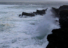
Sneaker waves are common and often catch people off guard while standing onshore. You can't see them and they are impossible to predict. These occur when smaller waves pile up on top each other to form one large wave – sometimes twice as large as the previous sets. Also, they can carry large pieces of debris with them such as logs, which present a whole set of other dangers.

Sneaker waves are a universal coastal phenomenon, although they are known to be more common in some areas than others. In the United States, northern California, Oregon and Washington are particularly affected. They can occur at anytime, even if it is calm and the surf is small.

There were a couple of incidences last winter where people were injured or swept out to sea by sneaker waves. That includes a pair of women at Gleneden Beach, near Lincoln City, whose bodies were never found after a walk on a stormy beach ended in tragedy.

Even cars were damaged in recent years. At the cove in Seaside, during large storms when the surf is huge, enormous sneaker waves have come up into the parking lot, abruptly and without notice, littering it with large cove rocks and debris which have dented cars in the past.

Safety during the most spectacular of storms is always a big concern, according to Newport beach expert Guy DiTorrice. He referenced various folks who had to be rescued on the beaches or in the water in the winter of 2005, including a pair of teens who disappeared from a central coast beach in the early part of this century. “Just remember: keep your butts well above the surf zone,” DiTorrice said. “Had at least one novice surfer discover how these waves can take a person offshore just as quickly as it moves one near shore.”

Dangerous conditions can be a bit hard to spot sometimes as well, calling for further vigilance.

“Exercise extreme caution on the beach between storms,” he added. “Skies might be cleared up and the tide table predicts low tide, but offshore conditions and ongoing nightly winds are building surf conditions that are limiting bar access on most rivers and not providing much room for safe beachcombing.”

Have your beach access available to you at all times. A big wave can come right up to a seawall, leaving you no path for safety, getting you cold, wet and possibly swimming when you don't want to do any of the three.

Stay on accessible high ground when storm-agitated surf is on the beach. Oregon State Parks maintains dozens of safe roadside parks and campground access points right along Highway 101 where you can get great photos of dramatic winter surf without endangering yourself.Tall cliffs or high vantage points may give you a seriously faulty, bad sense of security. As engaging as they are – and tempting because you’re away from the tidal madness - they pose even more danger in wet, stormy weather. Stay clear of coastal bluffs. They can collapse and cause injury.

If, for some reason, you’re on a beach during stormy weather, never turn your back to the ocean. You may be swept off coastal bluffs or tide pool areas and into the water by waves that can come without warning. This is also quite true of normal weather.

Do not climb up onto logs on the beach. While they look heavy and sturdy when climbing on them, the smallest wave will roll it over you or a child. Killer logs are real. It only takes an inch of water to move a log several hundred pounds.

Be aware of sneaker waves, even on the calmest days. Don't turn your back on the ocean and keep your eye on the surf. Avoid "Killer Surf."

Dress for the weather. Layer your clothes to provide you warmth and comfort. And carry along your rain gear to keep you dry when it does drizzle.

Some other friendly reminders:

- Learn to swim.
- Never swim alone.
- Supervise children closely.
- Don't rely on flotation devices, such as rafts.
- If caught in a rip current, swim sideways until free. Don't swim against the current's pull.
- Alcohol and swimming, surfing, windsurfing or boating don't mix.
- Protect your head, neck and spine. Don't dive into unfamiliar waters.
- If you are in trouble, call or wave for help.
- Follow posted regulations.
- Swim parallel to shore if you wish to swim long distances.
- Scuba dive only if trained and certified - and within the limits of your training.
- No glass containers at the beach - broken glass and bare feet don't mix.
- No beach fires except in designated areas.
. Report hazardous conditions.

Russian Oil Spill Update!

RUSSIA: Russia's Black Sea coast face an ecological catastrophe after a fierce storm broke up a tanker, disgorging several thousands of tonnes of oil on to the shore. 3 seamen are reported drowned, and about 20 missing. Spilt fuel oil killed 30,000 birds along the Russian coastline in the northern mouth of the Black Sea, near Russia's border with Ukraine. The loss of fish can hardly be evaluated. The collection of spilled oil is being conducted by about 100 workers at the coastal settlement of Ilyich, halfway between Kavkaz and Novorossiisk. The status of the ships in the area is being monitored. The sunk vessels are being inspected, and the search and rescue operation to find the missing crewmembers is under way.


Black Sea Oil Spill

PHOTOS: Black Sea's 'Environmental Disaster'

A vessel is seen after it ran aground near the settlement of Kabardinka, 19 miles southeast of Russia's Black Sea port of Novorossiisk Nov. 12, 2007. A severe storm broke a small Russian oil tanker in two off the Ukrainian port of Kerch on Sunday, spilling up to 2,000 tons of fuel oil in what a Russian official said was an "environmental disaster." The same storm in the Black Sea and Azov Sea also sank four freighters, three carrying sulphur and one with a cargo of scrap metal. The heavy seas also cracked the hull of another oil tanker, but the ship was afloat and not leaking. (Alexander Natruskin/Reuters)

The British Tidal Surge Update!

Written Ministerial Statement by Hilary Benn on the tidal surge, East Coast of England - 13 November 2007

The Secretary of State for Environment, Food and Rural Affairs (Hilary Benn)

Further to my report to the House last Thursday (8 Nov 2007 : Column 365) I would like to provide an update on the significant tidal surge which affected the coast of Eastern England last week.

On 5 November, the Met Office’s storm tide forecasting service alerted us to a possible tidal surge in the North Sea later on in the week. By Thursday, it had become clear that there was a significant risk of potentially serious flooding in coastal areas of Eastern England during the next 48 hours and the Environment Agency issued a number of severe flood warnings. Police Gold Commands were established in Norfolk, Suffolk and Essex to coordinate the emergency response to any flooding, including evacuation where necessary and in line with the standing emergency arrangements, the Government‘s COBR committee was convened to ensure that all preparations were in place. Continue reading

Update on the Cosco Busan

The term "In Hack" is going to have a new meaning!

The Cargo Letter for Nov. 11 2007 -- In Collision With Oakland Bay Bridge

"Human error factors" probably were involved in a ship crash and oil spill that killed nearly 400 birds in San Francisco Bay and prompted a federal criminal probe, the U.S. Coast Guard said Nov. 11. The U.S. attorney in San Francisco has opened a federal criminal investigation into the Nov. 7 crash of the
M/V Cosco Busan to determine whether the captain & crew violated federal maritime laws.

Although not officially detained, the captain and crew were barred from leaving the vessel, which is docked for repairs in Oakland, the Coast Guard said.


In command at the time -- harbor pilot
Captain John Cota said he could hardly feel anything on the ship -- suggesting that there wasn't much damage. The ship didn't roll. There wasn't a loud sound. Cota quickly radioed authorities over an open radio network to report the ship had "touched" the bridge, according to an official with knowledge of the investigation. "Traffic, we just touched the delta span" Capt. Cota is alleged to have said.

"You had a competently manned ship with a pilot, all the navigation and sensors," said
Admiral Thad Allen, Commandant, U.S. Coast Guard. There were "probably some human error factors, but we need to determine the facts, because there's no reason a ship like that should have collided with the bridge." M/V Cosco Busan was departing Port of Oakland for South Korea when it struck a tower supporting the western suspension span of the Bay Bridge, cutting a 212-foot, 12-foot wide gash in the ship's side.

About 58,000 gallons of heavy-duty bunker oil poured out of the vessel as it was moored near Treasure Island. The oil sickened birds and formed globules on more than 20 of the area's beaches. It oozed along the San Francisco city waterfront and out of the bay, beneath the
Golden Gate Bridge toward Marin County.

"Response was set into play within an hour of the event itself," Admiral Allen said Nov. 11. Regarding the initial low estimate of 140 gallons of lost oil, Allen said heavy fog and damage to the ship's tanks hindered initial aerial and on-ground evaluations of how much oil had leaked from the ship.


The
National Transportation Safety Board is investigating the accident, and was interviewing the pilot, the ship's crew, and other pilots who were on the water at the time of the crash on Nov. 7. The 26 crew had been on its inaugural voyage on the ship, which the current owner purchased last month. The NTSB also intends to review the ship's voyage data recorder, which should have recorded captain and crew conversations on the bridge and other information in the 12 hours leading up to the bridge collision, Hersman said.

As of Nov. 10, 23 beaches in the area remained closed.
Angel Island State Park, the Bay's largest island, reopened Nov. 11, the Coast Guard said. Gov. Arnold Schwarzenegger has declared a state of emergency, freeing money to clean up the spill. Seven miles of containment boom stretched across the bay has collected more than 12,271 gallons of oil so far, and another 4,000 gallons have evaporated, officials said.Nearly 400 dead birds have been recovered from the bay, while another 500 birds have been rescued alive but soaked in oil, according to Lisa Curtis, administrator of the Department of Fish and Games Office of Spill Prevention and Response.

In 1989, the oil
M/T Exxon Valdez ran aground & fouled Alaska's Prince William Sound with almost 11 million gallons of crude -- the nation's worst ever oil spill. Thousands of birds & animals died in the disaster, according to the National Oceanic and Atmospheric Administration. Often birds and animals are threatened when they come in contact with the oil and swallow it as they try to clean themselves, said the NOAA Web site. In addition to birds, oil spills can be very harmful to fish and shellfish, NOAA said.

Twenty wildlife teams were scheduled Nov. 11 to be the bay, working to find sick birds so they can be rehabilitated, Curtis said. On Nov. 10, the state's other U.S. senator and a leading Coast Guard official decried the accident.


Rear Adm. Craig E. Bone
, the U.S. Coast Guard's director of inspection and compliance said "This incident should have never ever occurred," he said. "There's systems, there's capabilities, there's licensed operators, there's a pilot on board the vessel, there's the capacity and the capability to safely navigate through this port and waterways every day." He added, "But we have to move beyond the incident and the fact that it occurred and move forward into the response." The California Dept. of Transportation said the collision did no structural damage to the bridge and there was no interruption of bridge traffic -- more than 250,000 vehicles daily.

Cosco Dusan Oil Spill Slideshow


Talk about Pirates? Yep those Oil Spill Response Organizations (OSRO's). Hopefully the Qualified Individual for the line is keeping them honest while cleaning up!

And lastly,
Super cyclonic storm Sidr!

Track and windspeed of Super cyclonic storm Sidr

Super Cyclonic Storm Sidr is forecast to strike India as a severe cyclonic storm at about 16:00 GMT on 15 November. Data supplied by the US Navy and Air Force Joint Typhoon Warning Center suggest that the point of landfall will be near 20.9 N, 89.2 E. Sidr is expected to bring 1-minute maximum sustained winds to the region of around 203 km/h (126 mph). Wind gusts in the area may be considerably higher.

According to the Saffir-Simpson damage scale the potential property damage and flooding from a storm of Sidr's strength (category 3) at landfall includes:

  • Storm surge generally 2.7-3.7 metres (9-12 feet) above normal.
  • Some structural damage to small residences and utility buildings with a minor amount of curtainwall failures.
  • Damage to shrubbery and trees with foliage blown off trees and large trees blown down.
  • Mobile homes and poorly constructed signs are destroyed.
  • Low-lying escape routes are cut by rising water 3-5 hours before arrival of the centre of the storm.
  • Flooding near the coast destroys smaller structures with larger structures damaged by battering from floating debris.
  • Terrain continuously lower than 1.5 metres (5 feet) above mean sea level may be flooded inland 13 km (8 miles) or more.
  • Evacuation of low-lying residences within several blocks of the shoreline may be required.
There is also the potential for flooding further inland due to heavy rain.

The information above is provided for guidance only and should not be used to make life or death decisions or decisions relating to property. Anyone in the region who is concerned for their personal safety or property should contact their official national weather agency or warning centre for advice.

This alert is provided by Tropical Storm Risk (TSR) which is sponsored by Benfield, Royal & SunAlliance, Crawford & Company and University College London (UCL). TSR acknowledges the support of the UK Met Office.


RS

Wednesday, November 14, 2007

November 11-17 is Winter Weather Preparedness Week for Illinois and Indiana

November 11-17 is Winter Weather Preparedness Week for Illinois and Indiana

To view Illinois Emergency Management Agency’s Winter Storm Preparedness Guidebook, click here.

To view the Indiana Winter Weather Preparedness Newsletter, click here.

National Weather Service, Chicago has a winter weather page with lots of information. Go to our web page, weather.gov/chciago, from the main menu on the left, under "Weather Safety", click on "Winter Weather". On our winter weather page you will find links to snowfall reports, snowfall records for Chicago and Rockford, historic snow storms, links to state road conditions, a wind chill chart and calculator, winter weather terminology and warning criteria, and more!

Winter Weather Safety Rules

Vehicle safety
  • Check the latest forecast with NOAA Weather Radio – All Hazards, or at weather.gov/chicago before traveling.
  • Let someone know your travel plans.
  • Clear snow and ice off all windows and lights.
  • Keep a winter weather disaster supply kit in your vehicle. It should contain an ice scraper, shovel, flashlight and extra batteries, blankets, a change of clothes, high energy, non-perishable snack foods, first aid kit, battery booster cables.
  • Check windshield washer fluid, wiper blades, tires and gas before traveling. Keep the gas tank at least half full.
  • If you become stranded on the road, stay with the vehicle. Do not attempt to walk out in the storm. Use a cell phone to call for help. Run the engine for short periods of time, about 10 minutes per hour, and open the window a crack for fresh air and to avoid carbon-monoxide poisoning. Make sure to keep the exhaust clear of snow. Tie a colored, preferably red, cloth to the antenna or door as a signal for help. Move arms and legs vigorously from time to time to keep warm.
  • Let snow plows do their jobs. Give them plenty of room. Do not pass a plow unless there is plenty of clearance and visibility is good.
Home safety
  • Keep a winter weather disaster supply kit at home in case you can’t get out and/or you lose power. It should contain bottled water, flashlight and extra batteries, portable radio or NOAA Weather Radio – All Hazards, first aid kit, high energy, non-perishable food.
  • Use extreme caution when using portable space heaters. Keep heaters at least 3 feet away from walls and furniture. Have a fire extinguisher and smoke alarms.
  • Use alternate heat sources such as a fireplace or wood burning stove.
Extreme cold
  • Dress in loose, lightweight, warm clothing in layers and cover all exposed skin. Trapped air insulates. Outer garments should be water repellent. Wear a hat. Mittens are warmer than gloves.
  • Avoid prolonged exposure to wind and cold. Stay dry.
  • Confusion, disorientation, and slurred speech are signs of hypothermia. Get indoors and seek medical attention. Warm the core of the body first.
Other tips
  • Make sure animals have food, water and shelter.
  • Avoid overexertion when shoveling snow, walking in deep snow, or pushing a car stuck in snow. The strain from the cold and hard labor could lead to heart attack. Sweating could lead to a chill and hypothermia.
  • Check with your airline before heading to the airport.

1 KM satellite image of snow swath from northeast OK/southeast KS, across MO, IL and southeast WI from December 2006.

Outlook for Winter 2007-2008
With La Nina conditions occurring across the Pacific, above normal temperatures and precipitation are forecast for northeast Illinois and northwest Indiana the winter months of December through February. For more information visit the Climate Prediction Center web site.


Continue reading story


Russian Oil Spill Update

Winds Halt Cleanup Of Russian Oil Spill Associated Press
Word Count: 562


PORT KAVKAZ, Russia --
Fierce winds Tuesday hampered crews struggling to clean up in the wake of a killer storm that sank at least 11 ships and split an oil tanker in two, spilling tons of petroleum in the waters near a southern Russia seaport. Officials called the breakup of the tanker an environmental disaster for the region and warned that the 560,000 gallons of spilled fuel oil, which has killed an estimated 30,000 birds, could cause long-lasting damage to marine life. Leading Russian environmentalists said the oil spill was triggered by years of official negligence that allowed oil transport ...


More Heavy Weather Damage


Cargolaw Report

Faroes ferry Norrona, with 284 passengers and 80 crew, suffered temporary power failure and total machine blackout in heavy weather between Norway and the Shetlands on Nov. 12. The stabilizers were damaged causing the vessel to roll in heavy seas, which resulted in damage to vehicles on board. Vessel was listing, but arrived to port with no serious injuries reported. From our Sr. Correspondent Tim Schwabedissen (Mon. Nov. 12 2007


Lastly a note from my buds at Sea-Fever.Org !

One of my high school shipmates recently gave my 4 year old son Luke and I a tour of the new NOAA fisheries ship Henry B. Bigelow. We took some pictures which are posted on the Sea-Fever blog with a cool video of the ship’s launch. http://sea-fever.org/2007/10/26/the-quietest-ship-in-the-world/ Thought your readers might be interested. Keep up the great work!


RS

Tuesday, November 13, 2007

Mother and Her Fury!

Been a bad few days in the Black Sea Region. Weather has been at an extreme.

My good friend PC Liu of Freaque Waves also has a commentary on the storms.

First, parts of England were almost washed away by 100 year
storm surges. Now as reported by CargoLaw, Five ships sunk in Kerch Straight storm - 23 people missing Russian tanker M/V Vologneft-139 tore apart and sank in heavy weather spilling 1,300 tonnes of fuel oil into the Black Sea on Nov. 11.

Four other cargo ships including three carrying sulphur also sank as winds of up to 108 kilometres (67 miles) an hour battered the Kerch Strait separating the Black Sea from the Sea of Azov. Forty vessels were evacuated from Kavkaz, a busy Russian commercial port some 1,200 kilometres (750 miles) south of Moscow, officials said.

(Photo above -
People look at a ships thrown on the rocks by fierce storm in the Kerch strait linking the Black and Azov seas in this image made from television broadcast Sunday, Nov. 11, 2007. Massive waves split a Russian oil tanker in two during a fierce storm, spilling at least 2,000 metric tons (560,000 gallons) of fuel into a strait leading to the Black Sea. The 8-meter-high (18-feet) waves also sank two Russian freighters nearby, in the Strait of Kerch, a narrow strait linking the Black Sea and the smaller Sea of Azov to the northeast. The two ships together carried about 6,500 metric tons (7,150 tons) of sulfur, said Russia's Emergency Situations Ministry. (AP Photo/Rossiya TV Channel)

A map locating the Kerch Strait -- between the Black Sea and the Sea of Azov


Ten others were forced to stay in the port because of the storm. Some 300 kilometres further west,
high winds sank another cargo ship with 17 sailors on board. Two were rescued and 15 crew reported missing. M/V Kovel, carrying sulphur, sank after hitting another Russian cargo ship, M/V Volnogorsk, which also sunk in the five-metre high waves and raging winds. From our Sr. Correspondent Tim Schwabedissen (Sun. Nov. 11 2007).

A vessel is seen after it ran aground near the settlement <span class=Kabardinka, 19 miles southeast of Russia's Black Sea port of Novorosiisk, in this television grab November 11, 2007. REUTERS/RVN Television" border="0">

A vessel is seen after it ran aground near the settlement Kabardinka, 19 miles southeast of Russia's Black Sea port of Novorosiisk, in this television grab November 11, 2007. REUTERS/RVN Television.

Ukrainian Ministry of Emergency, via Associated Press

A crew member from the stranded Russian cargo vessel Vera Voloshina is evacuated by line Sunday by the Ukrainian rescue service on the coast near Sudak, Ukraine.


Waves broke over the stranded Russian cargo vessel Vera Voloshina on the coast near Sudak, Ukraine. As Russian investigators continued to assess the disaster, they said they had determined so far that five or more cargo ships sank in the storm, and at least five others ran aground. Photo: Ukrainian Ministry of Emergency, via Bloomberg News


When it comes to environmental damage, the quantity of oil spilled can sometimes be less important than the location of the accident, and the one on Sunday was relatively close to the coastline. Photo: Pavel Shevtsov/Reuters


A fierce storm in the Black Sea sank at least five ships on Sunday, killing at least three sailors and causing a massive oil spill that could lead to severe environmental damage. At top, ships struggled in rough water on Sunday near the Black Sea port of Novorossiysk, Russia. Photo: Yuri Bereznyuk/European Pressphoto Agency

MOSCOW. Nov. 11 (Xinhua) -- A Russian oil tanker split in half in a fierce storm in the Kerch Strait leading to the Black Sea on Sunday, spilling at least 2,000 tons of fuel oil, Interfax reported.

"It is a large-scale environmental disaster which will take a long time to deal with. But in a year, and even in a more distant future the impact of the damage will be felt," Interfax quoted Vladimir Slivyak, head of the ECO-Zashchita, a public environmental protection watchdog, as saying.

The storm, with wind blowing at over 18 meters per second, has torn a barge, the Demetra, loaded with 3,000 tons of fuel oil, from its anchor and is carrying it away, Interfax reported on Sunday afternoon, citing an emergency headquarters spokesman from Port Kavkaz.

The storm has also sunk two Turkish freighters and another cargo ship which was carrying over 2,000 tons of sulfur, local emergency department sources said


Latest Situation Update:


Russia Krasnodarskiy Krayjkk Black Sea / Near Port Kavkaz


Situation

More than 30,000 birds have been killed by the thousands of tons of oil that leaked after a heavy storm broke a tanker apart near the Black Sea, the governor of the disaster-hit region said Monday, according to Russian news agencies. Countless other birds, weighed down by thick coatings of the fuel oil, hopped weakly along the shore or sat helplessly in the sand. Workers with pitchforks and shovels started the backbreaking labor of gathering up vast clumps of oil mixed with sand and seaweed. The spill from a tanker that split apart Sunday in the strait connecting the Black and Azov Seas is seen as potentially the worst environmental disaster in the region in recent years. It prompted criticism that many Russian tankers aren't seaworthy. "Some 30,000 birds have died and it's not possible to count how many fish. The damages are so great that it's hard to assess. It can be equated with an ecological catastrophe," said Alexander Tkachev, the governor of the Krasnodar region, according to the Interfax news agency. Another regional official, Sergei Zaitsev, was quoted as saying that much of the oil still on the water's surface could congeal in the wintry temperatures, forming globs that drop to the seabed.

Russian President Vladimir Putin ordered Prime Minister Viktor Zubkov to fly to the region to assess the disaster and clean-up efforts. As many as 10 ships sank or ran aground in the storm, including the freighter Nakhichevan, which broke up and spilled a load of sulfur, officials said. The bodies of three sailors from the Nakhichevan washed up on shore Monday and rescuers were looking for five missing crewmen, said Emergency Situations Ministry spokesman Sergei Kozhemyaka. Two other freighters carrying sulfur also sank. Russian environmental officials said the sulfur spilled from the freighters did not appear to pose any environmental danger. Jim Farr, a chemist with the U.S. National Oceanic and Atmospheric Administration, compared the spill to dumping a load of sand in the water and smothering a reef, or covering a patch of grass with a blanket. However, he said that it was difficult to know the long-term effects without better knowledge of the area's depth and currents.


The Volganeft-139 tanker was carrying about 4,800 metric tons (1.3 million gallons) of fuel oil when the storm sundered it. About half its load has leaked out already, officials estimated. The craft's 13 crew members were rescued. Alexei Knizhnikov, head of the World Wildlife Federation's Russian oil and gas program, said the Volganeft-139 was constructed for river use and was unfit to endure severe weather at sea. "In the Kerch Strait, river vessels and sea vessels change cargoes, as sea vessels cannot enter the Don and Volga rivers because of small water draft. But vessels constructed for rivers cannot stand strong sea storms," he said. Anatoly Yanhuck, a regional coast guard officer, said workers would begin pumping oil from the tanker once the weather improves, then tow the ship to port. Investigators would be looking at the actions of the ship's captain, but he said the weather appeared to have been worse than forecast.


Vesti 24 television on Sunday reported the sinking of a Russian freighter carrying metal near the port of Sevastopol on Ukraine's Crimean Peninsula. Two members of its 16-man crew drowned and one was missing, it said. Maxim Stepanenko, a regional prosecutor, told Vesti 24 that captains had been warned Saturday about the stormy conditions. He said the Volganeft-139 — designed during Soviet times to transport oil on rivers — was not built to withstand a fierce storm.

RS

Monday, November 12, 2007

Veterans Day!

IN FLANDERS FIELDS


In Flanders fields the poppies blow
Between the crosses, row on row, That mark our place; and in the sky The larks, still bravely singing, fly Scarce heard amid the guns below.


We are the Dead. Short days ago
We lived, felt dawn, saw sunset glow, Loved and were loved, and now we lie In Flanders fields.


Take up our quarrel with the foe:
To you from failing hands we throw The torch; be yours to hold it high. If ye break faith with us who die We shall not sleep, though poppies grow in Flanders fields.


- John McRae [May 3 1915]


2006 Veterans Day Poster


Thanks Hal for not forgetting!

RS

Friday, November 9, 2007

NOAA celebrates 200 years of science

Contributed by: NOAA News on 11/7/2007

(NOAA meteorologists Tom Schlatter and Nikki Prive test their skills on a mirror nephoscope, an antique instrument used to determine the direction and relative speed of cloud motion.

The instrument will be part of an old-time weather station recreated for a public celebration this Friday at NOAA's research center in Boulder. Provided by: NOAA)

NOAA's (National Oceanic and Atmospheric Administration) Boulder campus will celebrate and commemorate the agency's 200-year legacy in science with a dedication ceremony, public activities, and teacher training from 9:30 a.m. to 3:30 p.m., Friday, Nov. 9. All activities will take place at the agency's David Skaggs Research Center at 325 Broadway.

NOAA is hosting the public event as part of a year-long celebration to commemorate its 200 years of science, service and stewardship to the nation. Boulder mayor Mark Ruzzin and other local leaders will participate in the event.

"It all started in 1807 with President Thomas Jefferson'svision to support his fledgling nation's economy by ensuring safe maritime commerce. He accomplished this by creating the Survey of the Coast, the first federal science agency and the precursor to NOAA's navigation services," said Tim Keeney, NOAA deputy assistant secretary for oceans and atmosphere. "With his intense interest in weather and climate, Jefferson would certainly appreciate the world-class scientific community here in Boulder."

Keeney will present an award to U.S. Rep. David Skaggs, former congressman from the Boulder area, for his role in consolidating the agency's Colorado groups into the NOAA center in the late 1990s. Susan Graf, president and chief executive officer of the Boulder Chamber of Commerce, will accept an award for the Chamber's role in attracting the federal labs to Boulder in the early 1950s.

The day's events will begin at 9:30 a.m. with the dedication of a memorial marker placed by NOAA's National Geodetic Survey in the gardens just outside the main entrance on the west side of the building. At 10:30 a.m., visitors will be treated to a "Science Showcase" of new activities and demonstrations, many with a historical focus. Teachers are invited to visit the demos and participate in a special in-service training on Earth science.

Visitors will be able to follow a virtual underwater explorer through four of NOAA's marine sanctuaries, travel aboard a survey ship mapping the coastal ocean floor, mop up a disastrous oil spill, and experience the devastation algae can wreak during a red tide.

For real-world experience, share an expert's view of Boulder's fickle weather as a National Weather Service forecaster walks through a year of big storms. Get a preview of the upcoming weekend weather, spiced with fascinating insider trivia about Front Range climate. Then stop by an old-time weather station to check out a mirror nephoscope, a microbarograph, a Parisian thermograph, and other antique instruments with strange names that meteorologists used to track weather long before computers existed.

NOAA's Boulder lab is the best place in the world to see how scientists measure carbon dioxide levels around the globe, including Boulder County's carbon "footprint." Air-filled flasks arrive daily from remote corners of the planet to be analyzed in Boulder. The most powerful software to understand the world carbon cycle was launched right here last spring and produces colorful maps of atmospheric carbon levels daily.

On the space-weather front, guests will be able to look back through the ages to early evidence of sunspots and find out how they are related to spectacular auroras, or Northern Lights, which are sometimes visible here in Colorado.

Science on a Sphere will display brilliant global presentations of tsunamis, El Niño, a warming world, and what planet Earth looked like 600 million years ago.

Fresh baked goods will be on sale to benefit the Denver Botanic Gardens' certificate program in botanical art and illustration. Coffee will be provided at no charge by a local vendor.

Visitors must stop at the Visitor Center at the Rayleigh Avenue entrance before passing through the gate. Those 16 years old and over should bring a valid state or federal photo ID.

The National Oceanic and Atmospheric Administration, an agency of the U.S. Commerce Department, is celebrating 200 years of science and service to the nation. From the establishment of the Survey of the Coast in 1807 by Thomas Jefferson to the formation of the Weather Bureau and the Commission of Fish and Fisheries in the 1870s, much of America's scientific heritage is rooted in NOAA.

NOAA is dedicated to enhancing economic security and national safety through the prediction and research of weather and climate-related events and information service delivery for transportation, and by providing environmental stewardship of our nation's coastal and marine resources. Through the emerging Global Earth Observation System of Systems (GEOSS), NOAA is working with its federal partners, more than 60 countries and the European Commission to develop a global monitoring network that is as integrated as the planet it observes, predicts and protects.

NOAA: www.noaa.gov

NOAA Boulder 200th celebration: http://www.boulder.noaa.gov/events/noaa200

Weather Notes

"England: Storm surge flooding likely for eastern England"


[Nov 8 London]--Forecasters at the Met Office are providing the Environment Agency with the very latest weather information, ahead of a predicted storm surge down the North Sea.

A combination of north-westerly winds exceeding 50 m.p.h., low pressure and high tides could lead to severe flooding in the east of England. Areas at greatest risk are the Broads and the coast south of Great Yarmouth including Lowestoft and Felixstowe.

Sky News Video on British flood threat!


Update on Mexican floods!

By
Arthur Rabjohn MEXICO: Tens of thousands of Mexicans are threatened by ailments ranging from colds, respiratory illnesses and foot fungus. Authorities fear outbreaks of epidemics like cholera due to a lack of running water. Standing water attracts mosquitoes, carrying infectious diseases such as dengue. Government official said that fumigation of waterlogged areas would start in the next few days to reduce the risk of diseases.

Crocodiles and snakes taking to flooded streets are posing a new risk, as the reptiles have started swimming along flooded streets. The floods, caused by rivers overflowing after heavy rain, killed at least 3 people, damaging crops, homes, businesses and infrastructure. A further 4 people were killed, and 21 others were missing as a result of a huge mudslide.


Maritime Notes

Ouch! Here are some pix's from the USCG on the Cosco Busan collision with the Bay Bridge!


M/V Cosco Busan Allides With San Francisco Bay Bridge
SAN FRANCISCO (Nov. 7, 2007)- The motor vessel Cosco Busan, a 900-foot container carrier, allided with one of the towers of the San Francisco Bay Bridge Wednesday morning, prompting a response from the Coast Guard, CALTRANS, the city of San Francisco and several other state and local agencies. Coast Guard photo.


And finally and most exciting....

National Storm Chasers Convention 2008 - Denver, Colorado (Click on rwister for further details!)

The 2008 National Storm Chaser Convention will be held February, 16-18, 2008 in Denver!

Hello everyone!

Just a preliminary FYI for the upcoming 2008 National Storm Chaser's Convention. It will be held Feb 15-17 (President's Day weekend as usual) in Denver, CO at the Radisson Southeast (same hotel as last year). Check out www.chaserconvention.com in the coming weeks for updates and more details. Friday evening will be the traditional ice breaker where you can meet your favorite speakers. Saturday will be a day full of great speakers and Keynote Speakers at the evening banquet that you DO NOT WANT TO MISS!! Sunday will be a day of teachings on your favorite severe weather subjects, followed by a spotter training class conducted by the local NWS.

THIS IS THE 10TH ANNUAL CONVENTION AND IT WILL BE HUGE!!! EXPECT SOMETHING VERY SPECIAL TO HAPPEN!

Tune in by early December for the details.

Roger Hill and Tim Samaras

random7.<span class=


Be sure and register NOW and secure your seat at the largest gathering of storm chasers in the world!


RS

Thursday, November 8, 2007

Lessons Learned?

Seems like ConocoPhillips is not going to take the same chance that PEMEX took with the Usumacinta.

RigZone is reporting that ConocoPhillips is preparing to evacuate five installations located in its North Sea Ekofisk oil fields if weather conditions deteriorate.

Looks like there is a gale ready to blow.


Weather Forecast Forces North Sea Oil Worker Evacuation


Dow Jones News Wire
By Lananh Nguyen
Last Update: 5:33 AM ET Nov 7, 2007


Major oil companies operating in the Norwegian sector of the North Sea are bracing themselves for gale force weather in the coming days, with some preparing to evacuate staff.

BP PLC (BP.LN) confirmed it is evacuating 200 staff from the Valhall oil and gas field as a precautionary response to forecasts of severe weather. "We have started sending people to shore because severe weather is expected Friday morning. It is a precaution to demobilize people on Valhall field," Olav Fjellsa said. Production from 80,000 barrels of oil a day Valhall would be shut down until the severe weather has passed, Fjellsa added.

ConocoPhillips (COP) said it is also preparing to evacuate five installations located in its North Sea Ekofisk oil fields if weather conditions deteriorate. "We have not moved anyone yet, but are prepared to move personnel from five installations, if necessary," said the spokesman for ConocoNorge Stig Kvendseth. Kvendseth wouldn't comment on production from the fields but said that personnel would be moved from all five installations if the weather conditions worsened.

The Ekofisk area is made up of several smaller oil fields which taken together accounted for some 467,000 barrels a day of oil production in November traders said. Average daily oil production from the Norwegian Continental Shelf amounted to approximately 2.18 million barrels during September this year, preliminary statistics from the Norwegian Petroleum Directorate show. Meanwhile, Anglo Dutch oil major Royal Dutch Shell (RDSA) said it hasn't evacuated any workers from its North Sea oil fields and doesn't plan to ahead of forecasts for poor weather conditions in the coming days.

Spokesman Rainer Winzenreid said production from its North Sea oil fields is continuing as normal. A spokesman for StatoilHydro (STL.OS) also said it currently has no plans to remove personnel from its oil platforms in the North Sea but it's closely monitoring weather conditions.

"We actually don't have anyone loading at the moment but do have vessels scheduled for tomorrow morning," said Richard Hurding marine team leader at the port of Sullom Voe Northern crude oil loading terminal located in the U.K. Hurding added that if windspeeds rose above 35 knots then loadings wouldn't take place and ships would be kept out of port. "I think it obviously has bullish implications," said a trader of North Sea crude. "People are being tight-lipped about volumes to be shut, et cetera, but I wouldn't sell ahead of it." The U.K. Meteorological Office issued gale warnings on its Web site Tuesday covering the entire North Sea area.

It also predicted a period of very windy weather over northeastern parts of the U.K. Thursday and Friday.


The Ekofisk Song


Maritime Note


INTERTANKO sent out a press release today announcing that the Terminal Vetting Database will now be hosted on www.Q88.com. To view the press release, please click the link below.

INTERTANKO Press Release

The Terminal Vessel Database (TVD) allows you to lookup near real-time information about terminal and berth conditions at tanker ports around the world. Your vessels can also submit their own reports into the system. Currently, the TVD contains over 8,500 reports.

Terminal Vetting Database

Oh Yeah! Another Oops on the ole Radar! This time the 920-foot container ship Cosco Busan, kind of hit a bridge... not just a bridge, but the Bay Bridge!


RS

Wednesday, November 7, 2007

Tabasco is not hot !

It say's it all!


Wed, 7 Nov 2007 00:00 UTC
Source: Dartmouth Flood Observatory based on media analysis

Analysis:

A week of heavy rains from a cold front unrelated to Tropical Storm Noel. Water drained from 2 dams in Chiapas causes three Tabasco rivers to overflow. "This is one of the worst natural disasters in the history of the country" Tabasco - 1 dead. 30,000 in shelters. 300,000 stranded in flooding. 700,000 people's homes flooded. 80% of the state flooded. More than 850 towns under water. Worst flooding in 50 years. 100 percent of its crops lost. Floodwaters up to rooftops in Villahermosa city. Olmec carvings flooded at La Venta archeological site. Chiapas - 1 dead. 7,000 evacuated. 100,000 affected.


RS

Tuesday, November 6, 2007

Radar?

I just had a conversation about mis-reading radars and what happens?

It happens to the best of us. The weather was just fine on the 5th and the Light Tower was working just fine too...

OIL TANKER RAMS S.I. LIGHT TOWER

AP November 5, 2007 -- An oil tanker slammed into a light tower off Staten Island Saturday, hobbling a navigation aid that helps watch over the main shipping lanes to New York Harbor, the U.S. Coast Guard said.

The shipping lanes remained open, but the Coast Guard urged boaters to avoid the Ambrose Light until it could be fixed. A Coast Guard vessel was being sent to set up temporary navigation aids until permanent repairs could be made to the tower, about 12 miles southeast of Staten Island and four miles outside the shipping channel.

There are other navigation aids in the area, "but it's very important that all mariners know about this one so they don't come too close to it," Coast Guard Petty Officer 3rd Class Annie Berlin said.

The tanker Axel Spirit rammed into the 76-foot steel tower at around 2 a.m. Saturday, damaging its legs, the Coast Guard said. The tower's light - normally visible for about 18 miles - was still on, but no longer rotating and not reliable, Berlin said.

No injuries or leaks were reported. [END]

So the weather was clear, winds light, visability excellant and it still hit the light tower. As two of my maritime buds tell me

"
This happens about 2 times a year. In the 3 months I transited between Houston and NYC is happened twice!

And

"Darn it Rob, you're stealing my best after dinner joke !!! (ie the Irish Lighthouse keeper on the radio to a USN aircraft carrier, when the latter hadn't realised that the object in front of him on his radar was a lighthouse..... )."

Remember the Poll!


RS

Monday, November 5, 2007

To Mandate Weather Radio's or not?

There is a debate on going in my community about Indiana's decision to mandate weather radio's for new construction of mobile homes.

Now as of 30 October 2007 the US House passed a bill as well.


Tuesday, October 30, 2007

UPDATED: 4:46 PM
House passes emergency weather radio bill

WASHINGTON — New manufactured homes would have to be equipped with emergency weather radios to try to prevent tornado and flood deaths under a bill passed today by the House.

Rep. Brad Ellsworth, D-Ind., introduced the legislation at the behest of Kathryn Martin, whose 2-year-old son, C.J., was killed when a tornado ripped through the Indiana trailer park where the family lived in 2005.

People living in mobile homes face 10 times the risk of dying when a tornado hits than those in other housing, according to the National Oceanic and Atmospheric Administration. Tornadoes kill about 80 Americans a year, the agency said.

“This will save lives,” said Rep. Spencer Bachus, R-Ala. “We have a shot of significantly reducing over half the deaths from tornadoes.”

The legislation would require NOAA radios to be installed in manufactured homes, where about 20 million Americans live.

The bill still must pass the Senate and be signed into law by President Bush.

The legislation leaves it up to the Department of Housing and Urban Development to set regulations on these radios, including a start date. The radios are expected to cost between $20 and $80. (end)

The State of Indiana has already passed legislation to this effect. The question is should the US Congress now be mandating weather radios HR 2787 in new construction for manufactured homes?

On the surface it sounds good. But what happened to better construction or settings for mobile homes? Preparedness? Shelters? Which are sorely needed in mobile parks! Education of the public? Is this feel good legislation on the cheap? Or is this a good first step?

Tell me what you think? Take our poll!

How about farms houses?


Weather Note

Hurricane Noel few up the East Coast. NYC escaped but Eastern Long Island saw the most severe weather in the area, with wind gusts topping out at 70 mph and two inches of rain reported in some parts.

The storm battered the New England coast on Saturday with winds gusting up to 71 miles per hour and heavy rain. About 25,000 homes and businesses had lost power by late afternoon, with forecasters expecting the "Nor'easter" storm to reach its peak strength around 8 p.m.

Halifax? The storm brought winds as high as 113 kilometres an hour with gusts up to 135 kilometres an hour as it roared into Halifax Harbour. Power outages occurred from along the south and eastern shores of Nova Scotia and up into Cape Breton, with out 50,000 customers cut off in the Halifax Regional Municipality alone.

By late Sunday evening, Nova Scotia Power reported having restored power to more than 100,000 customers, but said an estimated 64,000 were still without electricity and some may not get it back until late Monday.


RS


Friday, November 2, 2007

Hurricane Noel

The National Hurricane Center says Hurricane Noel has strengthened into a hurricane and now has sustained winds near 120 kilometers per hour as it moves northeast from the Bahamas toward Bermuda.

Forecasters said at about midnight UTC Thursday that a hurricane watch remains in effect for the northwestern Bahamas, which could receive as much as 46 centimeters of rain.

Before reaching hurricane strength, Noel killed more than 100 people across the Caribbean earlier. The tropical storm caused mudslides and flash floods across Haiti and the Dominican Republic on the island of Hispaniola and soaked Cuba.

Sixty-six died in the Dominican Republic, where President Leonel Fernandez declared a state of emergency. At least one entire village was swept away by floodwaters, and rescuers have been unable to reach several other villages.

Thirty four people were killed in Haiti, where hundreds of homes were destroyed and thousands left homeless. One fatality was reported in Jamaica.

The United Nations mission in Haiti says peacekeeping troops helped evacuate thousands of people in the storm's path. The U.N. says soldiers assisted in food distribution and provided medical assistance to those affected.

Noel is the 14th named storm of this year's Atlantic hurricane season, which began June 1 and runs through November 30.

Images of the damage cause by Tropical Storm Noel


And in the Dominican Republic?

The image “http://www.transas.ru/products/onboard/produce/newbuild/projects/i/16.jpg” cannot be displayed, because it contains errors.


Liberian Gas Carrier Grounded in Dominican Republic

SAN JUAN, Puerto Rico - Coast Guard personnel deployed to San Pedro de Macoris, Dominican Republic Tuesday to support Dominican Republic authorities during salvage operations of Liberian gas carrier SCF Tomsk which ran aground Monday.

Dominican Republic authorities have established a Unified Command to coordinate salvage operations between local agencies and the marine industry responding to the incident. The Nodrog Shipping Corporation owned vessel has hired marine salvage company Titan to conduct salvage operations.

The 551-foot gas carrier completed offloading liquefied petroleum gas at the Coastal Petroleum Dominicana, S.A. facility in San Pedro de Macoris Monday, when the vessel broke loose from its offshore moorings and grounded on the reef line during Tropical Storm Noel.

Coast Guard Sector San Juan operation’s controllers received initial notification at approximately 1 p.m. Monday from the U.S. Coast Guard liaison in the Dominican Republic that the double-hull gas carrier ran aground 70 yards from the shoreline, approximately 200 yards east from the Coastal Petroleum Dominicana facility, and that all 23 ship crewmembers aboard were reported safe and in good health. READ STORY


Latest Notice to Mariners
http://www.nga.mil/maritime/

RS

Thursday, November 1, 2007

Usumacinta Update

The Associated Press
October 31, 2007, 5:55PM ET


Pemex restores much of its oil product
By MARK STEVENSONMEXICO CITY

Mexico's state-owned oil company Petroleos Mexicanos said Wednesday it has restored all but about 300,000 barrels of oil production after storms in the Gulf of Mexico.

The company, known as Pemex, had suspended 1.1 million barrels of output on Tuesday after too much crude piled up at storage facilities and ships couldn't move it out due to port closures. However, the re-opening of at least one port late Tuesday allowed ships to begin clearing out the oil, and more will move out as the weather clears, Pemex director Jesus Reyes Heroles said at a news conference.

Carlos Morales, Pemex's director of production and exploration, said the company expected to reopen wells and push production back up to normal levels of about 1.7 million barrels for export and 3.1 million barrels over all by the end of day Wednesday.

The company also said that up to 450 barrels of oil per day continued to leak from an offshore oil platform damaged in an Oct. 23 collision in which at least 21 workers died, most after they tried to use enclosed lifeboats to flee the rig. Authorities were still searching for one missing worker.

While television images and photos have shown the lifeboats tore apart, apparently by rough waves, Reyes Heroles refused to speculate on the causes of the collision and ensuing deaths. Morales said the life boats had been certified as operational and seaworthy.

The company announced that an independent investigation will be carried out into last week's collision between a drilling rig and an oil platform, and that it will be headed by 1995 Nobel chemistry prize winner Mario Molina. {End}


Horrific moments on oil platforms.

This is what a oil platform blow-out looks like. The date? 12th June 07


This is what happens when one floods...


And the P-36 Disaster


RS

Wednesday, October 31, 2007

Monster wave hits Ballito!

This March 10, 2007 story from the South African Daily News I seemed to have missed but it a very note worthy story indeed to report on.

Monster wave warning issued

Miranda Andrew, Sharlene Packree and Bhavna Sookha

Durban hospitals are filling up with storm victims as rescue and emergency services prepared for "the mother of all storms", expected to hit the KwaZulu-Natal coastline at about 6pm on Monday. "We are mobilising every resource, from surf rescue helicopters to available ambulances and even off-duty personnel," said Netcare 911 spokesperson Chris Botha.

Inspector Troy Alison of the Police Search and Rescue team said all their resources were already in place. "All emergency services are working together and we are making contingency plans ahead of this afternoon's storm. Apparently it's going to be much worse than last night," Alison said.

'Others are still missing and feared dead'
Meanwhile, the eThekwini Disaster Management team have been locked in a meeting since Monday morning to decide whether homes situated along beaches should be evacuated before the storm.

All beaches and ports were closed on Monday after the South African Weather Service issued a national warning that high seas with wave heights in excess of seven metres are expected along the southern KwaZulu-Natal coastline. The Weather Service had earlier predicted that waves would reach five metres, but the storm has been upgraded.

Freak tidal waves battered the coastline on Sunday night and dozens of people had to be rescued, while many others are still missing and feared dead.

Emergency services fielded numerous reports of missing people, collapsing homes and flooding. Areas devastated by the almost five-metre waves included Umkomaas, Isipingo, Ballito, Durban beachfront, the Bluff, Umdloti, Margate, and other coastline areas.

In Isipingo, seven people were rescued from a rooftop after the hotel they were staying in was flooded by high tidal waves. And at the Blue Lagoon beach, two friends were standing in the parking lot when they were hit by a freak wave.

On Durban's beachfront, some restaurants and shops were damaged after two freak waves "roughly three metres high" struck between 2 and 3am.

Steers, Wimpy, Wrap It up, Milky Lane and other shops were battered. When the Daily News visited the area, owners and inspectors were inspecting the damages.

Windows were shattered and doors were completely broken down. Fourteen workers who were trapped inside the restaurants were rescued by emergency services and taken to various hospitals.

There were no reported deaths.

Waves also hit holiday homes on the Bluff and at Ballito and a wall was washed away at the Inyoni Rocks swimming pool at the Amanzimtoti beachfront.

In Ballito, Daily News readers reported that 10 houses had extensive damage, with one beach house found with trees in its lounge. Security gates, retaining walls and walls had all been washed away, leaving the houses exposed to the elements.

At Zinkwazi, resident Dennis Brand reports that the parking lot, usually level with the beach, was being eaten away by the waves and what remains is now nine metres above the sand. The skiboat slipway had disintegrated and all that remained of a beachfront pub was twisted metal.

Thembinkosi Ngcobo, head of eThekwini's Parks, Leisure and Cemeteries department, said that the local beaches and roads leading to the beaches had been closed until further notice.

"For safety reasons we are advising people to stay away from beaches. We will be making an assessment tomorrow on whether open the beaches," he said.
Chief Fire Officer Mark te Water said the eThekwini fire department had been instrumental in evacuating people from flooded homes along the coastline.

"Many homes have received extensive damage due to the flooding at parts of the coastline. There have also been several electricity disruptions," he said.

Te Water said they were busy with assessments of the damaged areas and hoped these would help determine the full extent of the storm damage.

"We're hoping for an aerial assessment of the coastline and along the beachfront."

He said that while their staff complement for this evening would be normal, there would be several officers on standby.

"We are an emergency service and are available 24 hours a day. We are anticipating a busy night and standby staff will be called in if need be," said te Water.

NSRI spokesperson Paul Bevis said that many volunteers were making plans to get off work early so that they could be on standby for Monday night's storm.

"Our primary aim is to back up other emergency services and SAPS Search and Rescue whenever they need it. Our guys are committed to helping others," he said.

Bevis urged curious onlookers to stay away from the beaches. - Daily News

EARTHQUAKE ALERT

Our good friend at gCaptain.com is reporting on a Mag 5+ Earthquake in San Francisco. Visit his site to keep updated!

Earthquake map Bay Area, CA


RS










