These storm chasers really pushed the edge of the envelop by getting way to close to this Oklahoma tornado. But in doing so, they did capture some really fascinating video. However unless there is a scientific purpose in getting close to something as unpredictable as a tornado. The footage is just not worth the risk. These chasers are indeed very lucky.
Weather Notes...
This week Central Region NWS offices started an experimental service called the Weather Story. It’s a graphical forecast product that highlights the most important forecast event for the upcoming 7 days. Usually there is going to be a short write up with each Weather Story. Here is a link to the Twin Cities office Weather Story. To see your local office, just add the 3 letter identifier to the end of the string. Enjoy!
http://www.crh.noaa.gov/wxstory.php?site=lot
Maritime Notes...
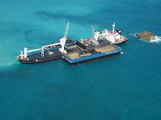
New Zealand – update on listing bulker
Maritime New Zealand issued a media release providing an update on the status of the listing bulk carrier anchored in Tasman Bay. Progress to date has steady, but slow. The list has been reduced to 11 degrees. It may take up to 10 days to fully dewater the cargo holds. (6/27/07).
Chaser Pix'sGreat pix's from Matt Ziebell!
http://limetap.com/sch/07summa
Here's Matt's rundown of where he chased and what he observed:
June 21: Black Hills supercell
June 22: Black Hills brief rotating cell and funnel
June 23: SK and MB supercells and tornado
June 24: Southeast MT supercell
June 25: Northeast WY supercell
Have A Great Weekend!
RS




















![Validate my RSS feed [Valid RSS]](valid-rss.png)