 Using synthetic aperture radar data to detect and identify ships
Vassilis Tsagaris, Giorgos Panagopoulos, and Vassilis Anastassopoulos
A novel approach shows the value of polarimetric Envisat data for a range of important security and environmental applications.
SAR images have high spatial resolution, so they can be used in sea surface ship monitoring. Ships are typically constructed from large flat metal sheets and hence are usually radar bright and detectable in SAR imagery.1 Oceangoing ships tend to be larger and made of metal, whereas coastal boats are smaller and may be made of wood or fiberglass. Moreover, when oil slicks occur, they are typically associated with ships.
A ship detection system generally consists of five stages, shown in Figure 1. After the image is registered, the land is masked, since most ship detectors produce false alarms when applied to land areas. In some cases, a preprocessing step is necessary to provide more accurately calibrated SAR data. The third step is the actual detection process, which uses constant false alarm rate (CFAR) or other detectors. Then a discrimination step is used to reject false alarms where target measurements or characterization of oceanographic or meteorological phenomena are available. Finally, the estimation algorithm provides information about the parameters of the detected ships for classification.
Methods of ship detection using SAR data are usually based either on CFAR detectors2,3 or on image transformation and, typically, the wavelet transform. Benchmarking for operational detection systems was carried out in the Detection and Classification of Maritime Traffic from Space project.4
The detection module of the system we developed5 is based on a modification of the Search for Unidentified Maritime Objects (SUMO) detector introduced by the Joint Research Center of the European Community. In our approach, the detection process is applied to small parts (1500(×)400 pixels) of a SAR image from Envisat, one of the European Earth observation satellites. The mean brightness and standard deviation are calculated for each tile, and its value is compared with three different thresholds to determine whether it can be characterized as a target. In the SUMO detector, three region-dependent factors are used, and these need to be calculated for the sea area of interest. In our work we use data from the Automatic Identification System (AIS), operating at the University of Patras, as ground truth data in order to calculate these factors for the sea region of the Patraikos Gulf, as illustrated in Figure 2.
The AIS provides information about the length, width, speed, and latitude and longitude coordinates of each ship in the area covered. Thus we can form a vector with the ground truth information for each ship, and use the vectors to test the entire ship detection system.

A key stage in our team's research is the development of the feature extraction process. To form a reliable and robust feature vector, the information contained in both vertical transmitted, vertical received (VV) and vertical transmitted, horizontal received (VH) polarizations should be used. The characteristics that we used and tested were the total area of the ship, the eccentricity, the γ ratio, the pecstrum (pattern spectrum), the length of the largest ship's axis, the ratio of the image intensity in the center and edge points of the ship, and the ratio of the total intensity in VV and VH polarizations.
These features are tested in order to assess their robustness in the thresholding and detection process. The length of the ship's axis and the ratio of the image intensity have been shown to be the most effective features in different threshold levels. This is because these features describe the ship's silhouette, which remains almost invariant at different threshold levels. On the other hand, the eccentricity, pecstrum, and γ ratio are very sensitive to different threshold levels. The feature vector we use for vessel identification is

From the available scenes from the Patraikos Gulf, 92 vessels were identified and stored in our vessel database as the signature data set. Based on AIS information, the 92 ships were separated into seven categories. Classification experiments were carried out using a simplified Bayesian classifier (Euclidean distance) and the leave-one-out method. The results revealed that only 16% of the available ships were misclassified.
A prototype of the ship detection system described here is currently under development, and extensions to conventional ship detection systems are being made. A new feature of this work is the inclusion of an automated procedure for evaluating the SUMO detector factors in cases where AIS data is available. Furthermore, the proposed feature vector incorporates in compact form information from the available polarizations when it is proven to be invariant under rotation. This feature vector will be extended in the case of fully polarimetric SAR data, and the detection system will also include a decision fusion step in the case of identification in different polarizations.
Vassilis Tsagaris is a postdoctoral researcher. His research interests include remote sensing, pattern recognition, SAR data processing and classification, and data fusion. He is a reviewer for the International Journal of Remote Sensing and IEEE Transactions on Geoscience and Remote Sensing.
Giorgos Panagopoulos is currently pursuing a PhD in image processing for remote-sensing images in the Department of Physics. His main research interests include ship detection and remote sensing.
Vassilis Anastassopoulos is a professor with research interests in digital signal processing, image processing, radar signal processing, data fusion, and pattern recognition and classification. He is a member of IEEE and a reviewer for several scientific journals.
doi:10.1117/12.737570
WEATHER NOTES
Cyclone disrupts Vladivostok-Russky isle ferry service
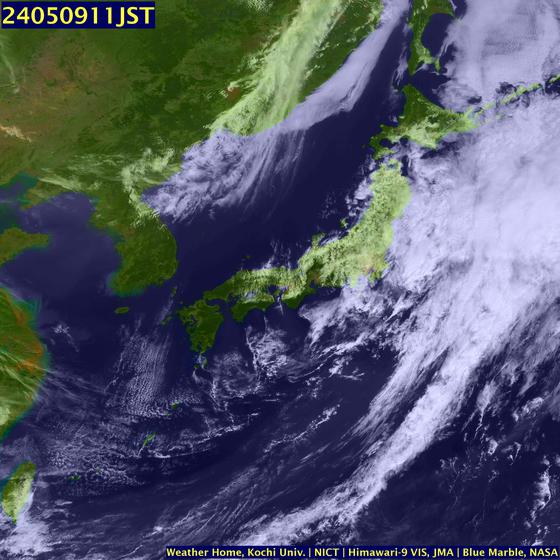
 VLADIVOSTOK, March 13 (Itar-Tass) - A cyclone that came to Russia's Primorsky (maritime) Territory (or Primorye, for short) from the Amur Region disrupted the ferry service between Vladivostok and the Russky Island on Thursday. It is raining heavily here now, with storm wind gusts of up to 22 metres per second. According to the Territorial hydrometeorological center, it is overcast weather in Primorye. It is currently raining in the western part of the Territory. Rainy weather is expected to spread over to the rest of the Territory later in the day. In the evening the atmospheric front is expected to move to the eastern areas of Primorye and it will be raining there throughout the night. The cyclone that brought rains is the first one in more than two months. Full lack of precipitations was recorded in January and February, for the first time over the entire period of meteorological observations throughout the Territory. Such phenomenon had been recorded in Vladivostok only once -- in 1947. The rainfall is also expected to ease the forest fire situation. Owing to dry and warm weather, a fire-hazard season began in Primorye one month and a half earlier than usual |
National Flood Safety Awareness Week March 17-21, 2008
Northern Illinois and northwest Indiana experienced record and near record flooding over portions of the Kankakee, Iroquois, and Vermilion Rivers this past winter. Ice jam flooding occurred along the Kankakee, Fox, and Rock Rivers. Flooding is a coast to coast threat to the United States in all months of the year.
National Flood Awareness Week is intended to highlight the many ways floods can occur, the hazards associated with floods, and what you can do to save life and property. Flooding in northern Illinois and northwest Indiana can include flash flooding especially in the highly urbanized areas, ice jam flooding, and river flooding. During Flood Safety Awareness Week, a different threat will be discussed each day. A Public Information Statement will be issued each morning during Flood Safety Awareness Week and aired on NOAA All Hazards Radio. (continued)
MARITIME NOTES
A new plan has been put together to move the stricken ferry Riverdance from a Blackpool beach.Storms and high tides have delayed hopes of refloating the ferry, which has been on the sands at Cleveleys since the end of January.
An action plan is now being put forward for Hugh Shaw, the Secretary of State's Representative for Maritime Salvage and Intervention, (SOSREP) to look at.
The vessel is now on its side and has sunk into the sand.
The ferry had been heading from Warrenpoint, County Down, to Heysham, Lancashire, when it was hit by a freak wave on 31 January.
Trade boost
But high winds, rain and spring tides have thwarted efforts to get the Riverdance moving.
It has now become a tourist attraction with an estimated 100,000 onlookers having visited it, boosting local trade.
Mr Shaw said the priority was moving the vessel.
"I look forward to receiving a revised outline plan with options early next week for my consideration," he said.
FROM HOLLAND AND KNIGHT
Today, March 17th, is celebrated as St. Patrick’s Day. There are numerous legends surrounding this day, as you learn from any Irishman. All are true!
HAPPY ST. PAT'S DAY!
RS












![Validate my RSS feed [Valid RSS]](valid-rss.png)