 How Strong Is That Hurricane? Just Listen.
 ScienceDaily (Apr. 10, 2008) — Knowing how powerful a hurricane is, before it hits land, can help to save lives or to avoid the enormous costs of an unnecessary evacuation. Some MIT researchers think there may be a better, cheaper way of getting that crucial information.
So far, there's only one surefire way of measuring the strength of a hurricane: Sending airplanes to fly right through the most intense winds and into the eye of the storm, carrying out wind-speed measurements as they go.
That's an expensive approach--the specialized planes used for hurricane monitoring cost about $100 million each, and a single flight costs about $50,000. Monitoring one approaching hurricane can easily require a dozen such flights, and so only storms that are approaching U.S. shores get such monitoring, even though the strongest storms occur in the Pacific basin (where they are known as tropical cyclones).
Nicholas Makris, associate professor of mechanical and ocean engineering and director of MIT's Laboratory for Undersea Remote Sensing, thinks there may be a better way. By placing hydrophones (underwater microphones) deep below the surface in the path of an oncoming hurricane, it's possible to measure wind power as a function of the intensity of the sound. The roiling action of the wind, churning up waves and turning the water into a bubble-filled froth, causes a rushing sound whose volume is a direct indicator of the storm's destructive power.
Makris has been doing theoretical work analyzing this potential method for years, triggered by a conversation he had with MIT professor and hurricane expert Kerry Emanuel. But now he has found the first piece of direct data that confirms his calculations. In a paper accepted for publication in Geophysical Research Letters, Makris and his former graduate student Joshua Wilson show that Hurricane Gert, in 1999, happened to pass nearly over a hydrophone anchored at 800 meters depth above the mid-Atlantic Ridge at about the latitude of Puerto Rico, and the same storm was monitored by airplanes within the next 24 hours.
The case produced exactly the results that had been predicted, providing the first experimental validation of the method, Makris says. "There was almost a perfect relationship between the power of the wind and the power of the wind-generated noise," he says. There was less than 5 percent error--about the same as the errors you get from aircraft measurements.
Satellite monitoring is good at showing the track of a hurricane, Makris says, but not as reliable as aircraft in determining destructive power.
The current warning systems are estimated to save $2.5 billion a year in the United States, and improved systems could save even more, he says. And since many parts of the world that are subject to devastating cyclones cannot afford the cost of hurricane-monitoring aircraft, the potential for saving lives and preventing devastating damage is even greater elsewhere.
"You need to know, do you evacuate or not?" Makris explains. "Both ways, if you get it wrong, there can be big problems."
To that end, Makris has been collaborating with the Mexican Navy's Directorate of Oceanography, Hydrography and Meteorology, using a meteorological station on the island of Socorro, off Mexico's west coast. The island lies in one of the world's most hurricane-prone areas--an average of three cyclones pass over or near the island every year. The team installed a hydrophone in waters close to the island and are waiting for a storm to come by and provide further validation of the technique.
Makris and Wilson estimate that when there's a hurricane on its way toward shore, a line of acoustic sensors could be dropped from a small plane into the ocean ahead of the storm's path, while conditions are still safe, and could then provide detailed information on the storm's strength to aid in planning and decision-making about possible evacuations. The total cost for such a deployment would be a small fraction of the cost of even a single flight into the storm, they figure.
In addition, permanent lines of such sensors could be deployed offshore in storm-prone areas, such as the Sea of Bengal off India and Bangladesh. And such undersea monitors could have additional benefits besides warning of coming storms.
The hydrophones could be a very effective way of monitoring the amount of sea salt entering the atmosphere as a result of the churning of ocean waves. This sea salt, it turns out, has a major impact on global climate because it scatters solar radiation that regulates the formation of clouds. Direct measurements of this process could help climate modelers to make more accurate estimates of its effects.
The research has been supported by the U.S. Navy's Office of Naval Research, ONR Global-Americas, MIT Sea Grant and the Department of Homeland Security Science and Technology Directorate.
WEATHER NOTECold-air funnel forms in West Valley
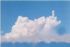
 This cold-air funnel was spotted Wednesday evening in the West Valley. No, this is not a tornado. Levente Csaplar photo |
The Daily Inter Lake
A stunning meteorological phenomenon formed Wednesday in the West Valley area.
A cold-air funnel formed at about 6 p.m. in the open fields west of U.S. 93 at the intersection of West Reserve Drive
Cold-air funnels most often occur under large, slow-moving low-pressure systems in the upper atmosphere. They tend to form during the cooler months of the year, when cold air meets warm, unstable ground air — prompting the growth of towering cumulus clouds. Small-scale wind shear associated with cold, slow-moving low-pressure systems generates spin, allowing funnels to form.
Cold-air funnels are generally weak, short-lived, and produce only minor damage.
“This is a pretty rare case, since it’s actually touching the ground,” said National Weather Service meteorologist Jeff Kitsmiller.
Those that do reach the ground behave like weak tornadoes, with winds often 50 mph or slower.
Because the West Valley cold-air funnel touched down, the spinning air mass picked up dirt and small debris.
“That’s why you can see it all the way up,” Kitsmiller said.
Like waterspouts and land spouts, cold-air funnels tend to form under cumulus congestus clouds. Unlike waterspouts, land spouts, and tornadoes, cold-air funnels typically aren’t associated with severe weather. They form from temperature imbalances between the ground and the subsequently created fair-weather cloud rather than from thunderstorms or supercells — essentially being produced from the bottom up, rather than the top down.
Dust devils are vortexes that start on the ground, fizzle out into clear sky, and aren’t connected to any clouds.
| 1 Dead, Hundreds Injured in Possible Tornadoes in Virginia |
| |
| Last Edited: Monday, 28 Apr 2008, 5:51 PM CDT |
| Created: Monday, 28 Apr 2008, 5:51 PM CDT |
| Associated Press Writer RICHMOND, Va -- Authorities say one person has died and at least 200 injured as severe storms cut through central and southeastern Virginia. Suffolk city spokeswoman Dana Woodson says the death occurred when two apparent tornadoes passed through the city Monday afternoon. Bob Spieldenner from the Virginia Department of Emergency Management says at least 200 others were injured in Suffolk. Spieldenner says at least 18 others were injured in Colonial Heights. |
Firefighters gather to brush up on shipboard procedures
THE LOG STAFF
April 25, 2008 at 11:01AM AKST
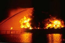
The Prince William Sound Regional Citizens’ Advisory Council is sponsoring the fifth Land-Based Marine Firefighting Symposium May 5-7 in Valdez.
Firefighters, oil spill response personnel, and other emergency services providers from Prince William Sound and other Alaska coastal communities will receive hands-on classroom and field training for fire response on oil tankers and other ships.
Participants from American Salvage Association, the Coast Guard, the Southwest Alaska Pilots Association, and the state fire marshal’s office will be included in this year’s event, along with firefighters from Anchorage, Cordova, Haines, Homer, Hoonah, Nikiski, Ketchikan, Petersburg, Port Graham, Seldovia, Seward, Sitka, Unalaska, Valdez, Whittier and Alyeska Pipeline Service Co.
Five instructors will provide coursework and seminars on operations and command procedures used in real events. Topics include basic shipboard firefighting and vessel familiarization; tank farm, cruise ship, small boat and marina awareness; fire safety/fire prevention planning and ship’s crew coordination; and the politics of a marine incident including regulatory authority and plan implementation. New to this year’s symposium is a panel discussion on the initial incident command system that would be established during a marine fire event.
There is no cost to the firefighters’ home departments – expenses are paid by the council and the Alaska Division of Homeland Security and Emergency Management, with supplemental support in the form of sponsorships.
While there are no more sponsored slots, space is available for firefighters who wish to attend the symposium and provide their own travel, lodging and meals. Tuition is free for all participants. Interested firefighters should contact the council’s Valdez office for information.
More information on the symposium is available online at Next Marine Firefighting Symposium: or by calling the council’s Valdez office at (907) 834-5000.
RS

















![Validate my RSS feed [Valid RSS]](valid-rss.png)