 EC unveils new EU maritime policy
12 October 2007
The European Commission has adopted an Integrated Maritime Policy for the European Union, which has the world’s largest maritime territory, marking the first time in its 50 years that it will have a strategic approach to decision-making in Maritime Affairs. The policy was unveiled at a press conference on 10 October in Brussels, Belgium.
European Commissioner in charge of Fisheries and Maritime Affairs Joe Borg said: "This is a crucial first step for Europe's oceans and sea – unlocking the potential and facing the challenges of a Maritime Europe will be our common goal. It will allow us to make the most of the geopolitical realities of our continent and will help Europe face some of the major challenges before it. "At the European level, it is clear the transnational character of maritime affairs demands a European approach: shipping and traffic corridors cross the waters of our Member States, oil spills and pollution know no borders in Europe's waters and illegal activities … are transnational by nature, affecting all of Europe."
 | |
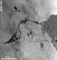
| Prestige oil spill |
The European Commission (EC) said the new policy will build on Europe's strengths in marine research, technology and innovation and will be anchored in the European Union's (EU) overarching commitment to ensuring that economic development does not come at the price of environmental sustainability. Under the European Space Policy, ESA is responsible for implementing space capabilities that respond to EU policy needs. The Integrated Maritime Policy will facilitate efficient exploitation of space systems in the maritime sector, which ESA has been actively involved in over the last 25 years.
ESA’s ERS satellites have been the main vehicles for testing and demonstrating the feasibility of using satellite Earth Observation (EO) data in different maritime policy areas. The ERS missions supported developments in oil slick detection, sea ice monitoring, wind and wave forecasting, regional ocean current forecasting, coastal bathymetry mapping and vessel detection. Because both ERS-1 and ERS-2 significantly exceeded their original design lifetime of three years, it was possible to build an extended, continuous and homogeneous time series of oceanographic measurements, which were not previously possible.
|  |
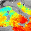
Sea surface temperature map |
|
In particular, accurate measurements of sea surface height variation by the radar altimeter instrument provided a unique capability to monitor variations in currents at the regional level while the Along Track Scanning Radiometer (AATSR) series of instruments have delivered a highly accurate time series of sea surface temperature variations over a 16-year period. In addition, satellite data from the radar altimeters onboard ESA’s ERS-1, ERS-2 and Envisat and NASA/CNES’ Topex-Poseidon detected a trend in sea level rise between 2.64 and 3.29 mm/year over the last 15 years.
In 2002, the newly launched Envisat acquired images of the Prestige oil spill in Spain with its Advanced Synthetic Aperture Radar (ASAR) instrument. Since this time, ESA has been working within the Global Monitoring for Environment and Security (GMES) Services Element to demonstrate and qualify the capacity for pan-European oil spill surveillance. Last year, an operational satellite-based oil slick detection service based on SAR data from Envisat and the Canadian Radarsat satellite was set up for all European waters under the European Maritime Safety Agency (EMSA). The service, named CleanSeaNet, is the first operational pan-European satellite based surveillance service for European waters.
 | |
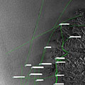
| CleanSeaNet service |
Under this service, a notification of a pollution event can be provided within 20 to 30 minutes of the satellite overpass. By integrating the SAR oil slick information with vessel information, it becomes possible to identify potentially responsible vessels. "This is a first, and significant, step in the process whereby EMSA assists Member States and the Commission in detecting illegal and accidental discharges at sea," Willem de Ruiter, Executive Director of EMSA said.
Intentional and accidental discharges threaten fragile coastal ecosystems, impact on tourism and generate significant clean-up costs. The European policy goal, as stated in the Marine Thematic Strategy of the 6th Environment Action Plan is a complete elimination of discharges into the marine environment by 2020. Effective surveillance such as CleanSeaNet is essential if this objective is to be met. However, oil spill detection is not the only area where satellite based SAR surveillance is being applied.
There is growing interest in the use of satellite SAR for fisheries and for maritime border control. In particular, the Integrated Surveillance System for Europe’s southern maritime borders as requested by the European Council is intending to integrate satellite based surveillance with conventional vessel tracking systems.
|  |
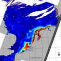
Chlorophyll-a concentrations in the Dutch coast |
|
Routine monitoring of water quality in European coastal areas is important to effectively protect fragile coastal ecosystems. Within the MARCOAST Consortium under the GMES Services Element, most European coastal states are provided with key parameters, including chlorophyll-a concentration, transparency and suspended sediment load, for their region of interest several times per week. Due to the extensive winter transport levels in the Baltic Sea, Europe hosts the largest volume of commercial shipping activity in ice-infested areas. The timely delivery of accurate, up-to-date sea ice information by national ice services is critical in maintaining the security and efficiency of this transportation. Many national ice services have routinely integrated Envisat and Radarsat SAR imagery into their operational sea ice charts for several years.
These capabilities are based on EO satellites that have already been operating for some time. ESA is working to ensure continuity of the key data streams underpinning these services within the framework of GMES. The Sentinel missions will ensure that SAR, ocean colour, radar altimeter and sea surface temperature observations will be continued beyond the lifetime of the current missions. In addition, ESA is working with the European scientific community to bring new observation techniques, the so called Earth Explorers, to support research in critical Earth science issues such as global change and biodiversity.
ESA welcomes the Integrated Maritime Policy and intends to work with the different actors involved in areas where it sees current or potential future demand for space-based capabilities in the maritime sector.
Tsunami Early Warning Centre inaugurated
Hindu Times Special Correspondent | It will take 30 minutes to analyse the seismic data following an earthquake of more than magnitude 6 |
— PHOTO: K. RAMESH BABU

MEETING A CHALLENGE: Union Minister for Science and Technology Kapil Sibal at the inauguration of the Tsunami Early Warning System centre in Hyderabad on Monday. HYDERABAD: A state-of-the-art National Tsunami Early Warning Centre, which has the capability to detect earthquakes of more than 6 magnitude in the Indian Ocean was inaugurated here on Monday by Union Minister for Science & Technology Kapil Sibal. He asked experts to improve the system and further reduce the time for disseminating information to the targeted people.
Lauding various agencies involved in establishing the Rs. 125-crore tsunami warning system without time and cost overruns, he said it was the most modern one in the world. It would now take 30 minutes to analyse the seismic data following an earthquake. The next task was to reduce the time to six to seven minutes, he said. The Centre was set up by the Ministry of Earth Sciences in the Indian National Centre for Ocean Information Services (INCOIS) here.
Mr. Sibal later announced that two more centres of excellence — Joint Marine Meteorological Organisation and Operational Oceanography — would be set up on the INCOIS campus after Chief Minister Y.S. Rajasekhara Reddy instantly agreed to allot 10 acres to the institution.
He said a system was being put in place for collaborating with all neighbouring countries for sharing data. He said four Bottom Pressure Recorders (BPRs) were now deployed in the Bay of Bengal, two in the Arabian Sea and another six would be installed in five to six months. He stressed that technology must be used to provide information to the people through SMS in the local languages.
Real-time network According to an INCOIS release, the warning system comprises a real-time network of seismic stations, BPRs and 30 tide gauges to detect tsunamigenic earthquakes and monitor tsunamis. The tsumanigenic zones that threaten the Indian Ocean were identified by considering past tsunamis, earthquakes, their magnitudes, and the location of the area relative to a fault and also by tsunami modelling.
The east and west coasts of India and the island regions are likely to be affected by tsunamis generated by earthquakes from two potential sources — the Andaman-Nicobar Sumatra island arc and the Makran subduction zone, north of the Arabian Sea.
Integrated Coastal and Marine Area Management (ICMAM) customised and ran the tsunami model for five ‘historical earthquakes’ and predicted inundation areas. The inundated areas are being overlaid on cadastral level maps of 1:5,000 scale. These community-level inundation maps are extremely useful for assessing the population and infrastructure at risk, the release added. Apart from Dr. Reddy, P.S. Goel, Secretary, Ministry of Earth Sciences, Peter Koltermann, Head, Tsunami Unit, Inter-governmental Oceanographic Commission, and Shailesh Nayak director, INCOIS, spoke.
From the Legal Beagles
Senate hearing on implementing the SAFE Ports Act The Senate Committee on Homeland Security and Government Affairs conducted an oversight hearing on Implementation of the SAFE Ports Act. The Act assigned approximately 100 maritime security tasks. Mr. Stewart Baker, Department of Homeland Security (DHS), testified that the Department has completed half of the assigned tasks and is on track to complete most of the remainder within the statutory timeframe. He specifically cited the Secure Freight Initiative (SFI), Long-Range Tracking and Identification (LRIT), and Transportation Worker Identification Credential (TWIC) programs as high priority. He also discussed the gap between the pace of technology and the legislative mandates. Mr. Reginald Lloyd, Department of Justice, testified that Project Seahawk in the Port of Charleston has successfully integrated work of the various federal, state, and local agencies. Mr. Stephen Caldwell, Government Accountability Office (GAO), testified that the Department has made significant progress in enhancing maritime security, but that challenges remain, particularly with regard to meeting statutory deadlines. Captain Jeffrey Monroe, City of Portland, Maine, testified that increased emphasis is needed with regard to cargo security. (10/16/07).
Senate hearing on implementing 9/11 Commission recommendations
The Senate Committee on Commerce, Science, and Transportation conducted an oversight hearing on Implementation of the 9/11 Commission Recommendations Act. The focus of this hearing was security in the aviation and surface transportation sectors. Mr. Edmund "Kip" Hawley, Transportation Security Administration (TSA), testified that drafting and implementing regulations is time-consuming. The Department utilizes risk management principles in its security programs, focusing on high-threat, high-consequence events. He mentioned that the TWIC rollout has commenced. Ms. Cathleen Berrick, Government Accountability Office (GAO), testified that the Department has made significant progress in its transportation security efforts, but that many challenges remain. The GAO strongly endorses use of risk management principles with regard to transportation security. (10/16/07).
Weather NoteIAEM Discussion Group:
From the International Data Links Symposium in Washington DC.
TUNISIA: Tunisia: Head of State Gives Instructions to Dispatch Emergency Relief to People in Stricken Areas
Following the exceptional torrential rains that have fallen over the country on Saturday evening and that have affected some of the capital's suburban areas, causing a number of casualties and material damages, President Ben Ali has given instructions to the competent services to closely monitor the situation, while providing emergency relief to the areas concerned. The spokesman for the Presidency of the Republic also announced the cancellation of the ceremony the Head of State was to chair on Monday October 15, on the occasion of the commemoration in Bizerta of Evacuation Day. Search and rescue operations for missing persons, are mostly focusing over the Cebalat Ammar area, north - west of the capital. So far 3 bodies have been found bringing the death toll to 11 people. Civil protection and national guard units are still searching the area, taking advantage of the sunny spell that is affecting the capital this Monday morning.
Bangladesh/India (16 Oct 2007) Monsoon flooding mainly in Bangladesh and parts of India- Reports indicate that 1071 person(s) have been killed and 5000000 have been displaced since late July. Source:
http://www.gdacs.org/reports.asp?eventType=FL&ID=129&country=Bangladesh%20India&location=&system=asgard&alertlevel=Red&glide_no=THAILAND: Northern Thailand is also affected by flooding caused by heavy monsoon rain. Reports indicate that 10 person(s) have been killed and 17000 have been displaced.
KENYA & UGANDA: Ongoing floods because of heavy rains in Kenya and Uganda during the last 61 days have caused a red flood alert. Reports indicate that 52 person(s) have been killed and 340000 have been displaced. It is the heaviest flood in eastern Uganda floods in 35 years which affected 22 districts.
GULF OF MEXICO: Low-pressure system emerged from the Yucatan Peninsula in Mexico into the southwestern Gulf of Mexico and could develop into a tropical cyclone over the next day or two, the U.S. National Hurricane Center said Monday.
Arthur Rabjohn
Visit
http://www.iaem.com/regions/iaemeuropa/ and see what we are up to......
RS
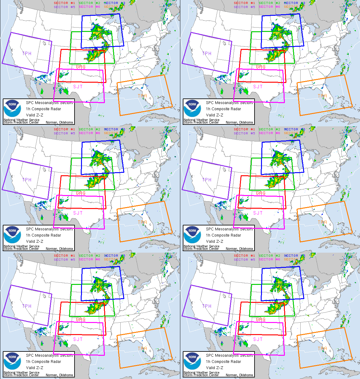
 Widespread severe weather is likely through tonight from the southern Plains to Missouri, southern Iowa, Illinois and Western Kentucky as a deepening storm tracks through western Kansas and a powerful jet stream moves overhead.

















![Validate my RSS feed [Valid RSS]](valid-rss.png)