 Experts: Twisters Getting Larger, Deadlier
No End in Sight for Tornado-Ravaged Nation
By ASHLEY PHILLIPS
May 12, 2008 —
As communities rebuild after deadly tornadoes bulldozed their way from Oklahoma to Georgia and North Carolina over the weekend, experts say that this tornado season is bigger and deadlier than last year's, with little relief in sight.
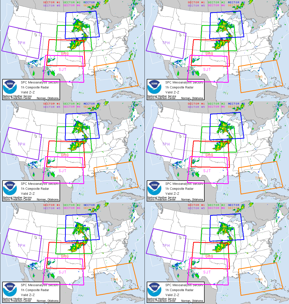
Seventy-seven tornadoes tore through the country the past few days, according to preliminary reports at the National Oceanic and Atmospheric Administration Storm Prediction Center. In Georgia, more than 180,000 people were left without power, while 15 fatalities were reported in Missouri.
This year's count is already twice the number of tornadoes logged during last year's U.S. tornado season, which generally runs from mid-spring to early summer.
"So far, in terms of the number of tornadoes, this is one of the most active years to date," said Harold Bloom, a meteorologist at the National Severe Storms Laboratory in Norman, Okla.
Tornadoes develop from large, powerful thunderstorms known as super cell thunderstorms.
"One super cell thunderstorm can move many miles and can produce several tornadoes, a family of tornadoes," said Henry Margusity, a meteorologist at Accuweather.
"These thunderstorms will produce one tornado. It will develop, mature and dissipate and another will fall right behind it. & You're getting a lot of these very large thunderstorms developing."
The larger thunderstorms are producing more families of tornadoes earlier than before and the tornadoes themselves are staying on the ground longer than ever before in regions outside of "tornado alley," Margusity said.
Kansas, Oklahoma and parts of Texas officially make up this area, although the southeastern United States experiences its fair share of tornadoes during the season.
With more tornadoes have come more deaths. So far, 96 people have died this year. Last year, the entire tornado season end with 81 fatalities.
"This year everything's been shifted to the east, & which is why we've seen a higher death toll," he said. "They're happening in very highly populated areas of our country."
"The damage that you see is just incredible," he added.
And some people are at greater risk than others.
"If people didn't live in mobile homes or if they had a more permanent shelter to get into you could cut the deaths in half," said Paul Markowski, a Penn State meteorologist and a veteran storm chaser.
Of the 81 people who died in tornadoes in 2007, 52 were killed in a mobile home, according to National Oceanic and Atmospheric Administration statistics. Markowski and other scientists suggest creating permanent underground shelters in areas like mobile home parks that are more vulnerable to tornado damage.
"That's what's frustrating as scientists. &The reality is for a lot less money than the millions spent on science research, for a much smaller investment, you could probably have a much bigger impact," he said.
Different meteorologists offer different possible reasons for the tornado increase, from the jet stream pattern to changing water temperatures.
"There are several things going on the atmosphere: a progressive pattern in jet stream. & There's also plenty of fuel for these storms in the form of a sharp temperature contrast in the United States," said Jay Searles, a meteorologist at Pennsylvania State University. "There's been record heat and record cold over the month of April and the first part of May. Last year & everyone got warm in the same time. The temperature difference wasn't as strong."
Those extremes may be attributable to La Nina, a cooling of the Pacific Ocean, that has happened in the past year, Searles said.
"It's a normal phase," he said. "There may be a connection."
There may also be a connection to a warming Gulf of Mexico, which in the winter had temperatures that were a bit warmer than normal, Penn State's Markowski said. "The warmer that the ocean is the more water evaporates to its surface," Markowski said. Moisture is a key ingredient of tornado development.
"Years when the Gulf of Mexico is really warm, we tend to have more tornadoes."
Despite this, Markowski stressed that there is no proven connection between global warming and tornado development.
"People have bent over backwards to try to come up with generalizations about tornado activity," he said. "That's one of the biggest areas of uncertainly in the climate change community. There's no doubt that the earth is warmer than it has been. There's extremely high confidence that humans have contributed to warming. & What that warming means and how it translates in tornadoes and hurricanes, especially tornadoes, we don't know." What meteorologists do know, however, is that for now, there's no end in sight.
Severe thunderstorms, like those that produced the weekend's tornadoes are expected in Texas, Mississippi, Illinois and Iowa, according to Joe Schaeffer, a meteorologist at the Storm Prediction Center. On Wednesday, NOAA is predicting severe storms over central Alabama.
Although several meteorologists said that the tumultuous storm season could continue even through the end of summer, accurately predicting the outcome of a tornado season is near impossible.
"Anything beyond day three is a flip of the quarter," Penn State meteorologist Searles said.

PORTSMOUTH, Va., - The Coast Guard urges mariners to exercise extreme caution when transiting coastal and inland waterways as severe weather passes through the mid-Atlantic region today.
A gale warning is currently in effect for the inland and coastal waters of Virginia and North Carolina with northeastern winds forecasted to reach 30-35 m.p.h.
The Coast Guard has saved or assisted 17 people since the severe weather system entered the mid-Atlantic region earlier this weekend.
To prepare for severe weather, the Coast Guard urges to always:
-Wear their life jackets on the water.
-Check their current and expected weather and water conditions before heading out.
-File a float plan with friends, family members and their local marina before heading out. The list should include the number of passengers onboard the vessel, their destination and expected time of return.
-Always have a working radio onboard their vessel as cell phone coverage varies from region to region.
-Carry marine flares onboard their vessels to signal rescuers in distress and emergency situations.
-Boat owners are encouraged to check their mooring lines to insure their vessels do not break free during the sever weather.
Mariners are reminded that drawbridges along the coast may deviate from normal operating procedures and are generally authorized to remain closed up to eight hours prior to the approach of gale force winds of 34 knots or greater.
The gale warning is in effect until tuesday.
For current and detailed weather information in your area, consult the National Oceanagraphic and Atmospheric Administration website. http://www.noaa.gov/
MARAD – National Maritime Day eventsOn May 22, the United States celebrates National Maritime Day. In Washington, DC, a Eucharistic liturgy will be celebrated at St. Joseph’s Roman Catholic Church; a seminar will be conducted at the Rayburn House Office Building on environmental issues; and an observance ceremony will be conducted at the Roosevelt Memorial. (5/11/08).
RS













![Validate my RSS feed [Valid RSS]](valid-rss.png)