 Atlantic Hurricane Season Sets Records
 November 26, 2008
The 2008 Atlantic Hurricane Season officially comes to a close on Sunday, marking the end of a season that produced a record number of consecutive storms to strike the United States and ranks as one of the more active seasons in the 64 years since comprehensive records began.
A total of 16 named storms formed this season, based on an operational estimate by NOAA's National Hurricane Center. The storms included eight hurricanes, five of which were major hurricanes at Category 3 strength or higher. These numbers fall within the ranges predicted in NOAA’s pre- and mid-season outlooks issued in May and August. The August outlook called for 14 to 18 named storms, seven to 10 hurricanes and three to six major hurricanes. An average season has 11 named storms, six hurricanes and two major hurricanes.
“This year’s hurricane season continues the current active hurricane era and is the tenth season to produce above-normal activity in the past 14 years,” said Gerry Bell, Ph.D., lead seasonal hurricane forecaster at NOAA's Climate Prediction Center.
Overall, the season is tied as the fourth most active in terms of named storms (16) and major hurricanes (five), and is tied as the fifth most active in terms of hurricanes (eight) since 1944, which was the first year aircraft missions flew into tropical storms and hurricanes.
For the first time on record, six consecutive tropical cyclones (Dolly, Edouard, Fay, Gustav, Hanna and Ike) made landfall on the U.S. mainland and a record three major hurricanes (Gustav, Ike and Paloma) struck Cuba. This is also the first Atlantic season to have a major hurricane (Category 3) form in five consecutive months (July: Bertha, August: Gustav, September: Ike, October: Omar, November: Paloma).
Bell attributes this year’s above-normal season to conditions that include:
- An ongoing multi-decadal signal. This combination of ocean and atmospheric conditions has spawned increased hurricane activity since 1995.
- Lingering La Niña effects. Although the La Niña that began in the Fall of 2007 ended in June, its influence of light wind shear lingered.
- Warmer tropical Atlantic Ocean temperatures. On average, the tropical Atlantic was about 1.0 degree Fahrenheit above normal during the peak of the season.

Download as Quicktime (Credit: NOAA)
NOAA's National Hurricane Center is conducting comprehensive post-event assessments of each named storm of the season. Some of the early noteworthy findings include:
- Bertha was a tropical cyclone for 17 days (July 3-20), making it the longest-lived July storm on record in the Atlantic Basin.
- Fay is the only storm on record to make landfall four times in the state of Florida, and to prompt tropical storm and hurricane watches and warnings for the state’s entire coastline (at various times during its August lifespan).
- Paloma, reaching Category 4 status with top winds of 145 mph, is the second strongest November hurricane on record behind Lenny in 1999 with top winds of 155 mph).
Much of the storm-specific information is based on operational estimates and some changes could be made during the review process that is underway.
“The information we’ll gain by assessing the events from the 2008 hurricane season will help us do an even better job in the future,” said Bill Read, director of NOAA's National Hurricane Center. “With this season behind us, it’s time to prepare for the one that lies ahead.”
NOAA will issue its initial 2009 Atlantic Hurricane Outlook in May, prior to the official start of the season on June 1.
NOAA understands and predicts changes in the Earth's environment, from the depths of the ocean to the surface of the sun, and conserves and manages our coastal and marine resources.
WEATHER NOTEMother nature on display

A DALYELLUP resident in the right place at the right time witnessed a marvel of Mother Nature on the weekend – a waterspout off Bunbury’s coast.
Jaco Bosman was driving past Dalyellup Beach on Saturday evening when the meteorological phenomenon caught his eye.
Mr Bosman pulled over and watched the water spout for about a minute or two before it disappeared out of sight.
“I just caught the last of the show,” he said.
“It is the kind of thing you see on the Discovery Channel.
“I didn’t expect to see it happen in real life.”
A waterspout is an intense columnar vortex usually appearing as a funnel-shaped cloud that occurs over a body of water and is connected to a cumuliform cloud.
Waterspouts have long been recognised as serious marine hazards and history is filled with examples of ships being destroyed or damaged by them.
Meteorologist Joe Courtney said the waterspout formed due to unstable weather conditions on Saturday and rotating columns of air.
MARITIME NOTENews from Holland and Knight
DOJ – tanker firm pays additional fine
The US Attorney for the Eastern District of Texas issued a news release stating that an oil tanker firm an additional $3 million fine after pleading guilty to additional charges relating to false entries in the oil record book of one of the company’s tankers. Prosecutors previously credited the company’s self-disclosures, cooperation, and compliance measures by proposing fewer charges and reduced criminal fines. (11/24/08).
IMO – SAR agreement between Australia & New Zealand
The IMO issued a circular forwarding an agreement between Australia and New Zealand on search and rescue (SAR) regions and coordination. SAR.6/Circ.31 (10/21/08).
THE REMAINS OF THE KURSK
The scrapping of the Kursk.
Special Thanks to Bud Shortridge
U.S. Naval Ship Research Hobbiest
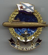
The K-141 Kursk sank on August 12, 2000 in the Barents Sea with all hands. These photo's below are from the salavge of the K-141 (Kursk).
The bow of the Kursk was sawed off with a diamond rope while she sat on the bottom of the Arctic Sea. You can see the antiship missiles still in their launchers all foamed in. And there is a nuclear power plant in in the wreckage.
The K-141 Kursk was a Russian nuclear cruise missile submarine which was lost with all hands when it sank in the Barents Sea on August 12, 2000. It was named after the Russian city Kursk, around which the largest tank battle in military history, the Battle of Kursk, took place in 1943.
The Kursk sailed out to sea to perform an exercise of firing dummy torpedoes at Pyotr Velikiy, a Kirov class battlecruiser. On August 12, 2000 at 11:28 local time , the missiles were fired, but an explosion occurred soon after on Kursk. The only credible report to-date is that this was due to the failure and explosion of one of Kursks new/developmental torpedoes.
The blast from the explosion registered 2.2 on the Richter scale. The submarine sank to a depth of 108 metres (354 feet), approximately 135km (85 miles) off Severomorsk. Severomorsk is a closed town in Murmansk Oblast, Russia and is located about 25 kilometers (16 mi) north of Murmansk along the Kola Bay. This is the main administrative base of the Russian Northern Fleet.Severomorsk has the largest dry dock in the Kola Peninsula.
A second explosion occured on the K-141, 135 seconds after the initial event and measured between 3.5 and 4.4 on the Richter scale, equivalent to 3-7 tons of TNT. Either this explosion or the earlier one propelled large pieces of debris far back through the submarine. The Kursk was eventually raised from her grave by the Dutch team, Smit International. using the barge Giant 4, and 115 of the 118 dead were recovered and laid to rest in Russia .
Russian officials have strenuously denied claims that the sub was carrying nuclear warheads. When the boat was raised by a salvage operation in 2001 there were considerable fears moving the wreck could trigger explosions.
The Salvage of the k-141 Kurst.


May her lost and brave souls rest in peace.
RS


![[Valid RSS]](valid-rss.png "Validate my RSS feed")