 2008 tornado season could blow away records
 (USA TODAY) The 2008 tornado season is on track to set a record for the number of tornadoes in the USA, according to National Weather Service data.
Through July, 1,390 tornadoes were officially recorded in the first seven months of a year - the most ever. The annual record for tornadoes in the USA is 1,817, set in 2004.
"This year, every month has been above average for tornadoes," says Greg Forbes, of the Weather Channel.
"The 123 deaths so far this year are the second most in the Doppler-radar era, behind only 1998, when tornadoes killed 130," Forbes says.
Official numbers from the weather service's Storm Prediction Center since Aug. 1 aren't available yet, but preliminary reports for the period since then show as many as 300 tornadoes could be added. On top of that, October and November are usually very active for tornadoes.
"We tend to see a peak in the central Plains and Midwest in October, and the Southeast USA in November," says meteorologist Gregory Carbin at the Storm Prediction Center in Norman, Okla. This month, the center says there have been 17 preliminary reports of tornadoes. Preliminary reports must be checked for duplication.
The number of tornadoes this year already is well above the 1,270 tornadoes the nation normally sees in a year, according to the National Weather Service.
"2008 will compete with 2004 as far as total numbers for the year," Carbin says. "There's a good chance that 2008 will see the greatest number of observed tornadoes on record."
February saw 148 tornadoes, by far a record; the February average is 28, Forbes says. May's 460 tornadoes made it the third most active May on record.
"The pattern in May and June was quite active" Carbin says. "We'd have two to three strong storm systems a week."
Although the number of reports has risen sharply since the early 1990s, Forbes says many of the weaker tornadoes probably would not have been recorded in earlier decades. Reliable tornado records in the USA go back to 1950.
An increase in national Doppler radar coverage, population sprawl into previously little-occupied areas and greater attention to reporting have contributed to the rising number of tornado reports, according to the National Climatic Data Center.
WEATHER NOTE
Format Change for Terminal Aerodrome Forecasts (TAFs) From 24 Hour Format to 30 Hour Format: Effective November 5 2008.
| ||
MARITIME NOTE
From Freaque Waves....
Friday, October 10, 2008
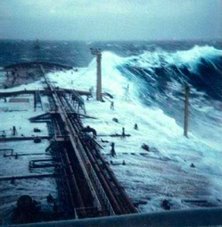
Another small boat capsizing ascribed to a freaque wave
Similar story, different part of the world oceans. This time it happens in Victoria, Australia. According to The Standard:
A CATAMARAN dubbed 'Battle Cat' felt the full fury of the sea when it was capsized and destroyed off The Flume yesterday.The bad news is that's another case ascribed to a freaque wave with no particular details. The good news is that both boaters are "escaped from the wreckage relatively unscathed." Thanks be to God!The catamaran was travelling west 300 metres off the coast from Granny's Grave to The Flume at 5.30pm when a strong wind dropped and a freak wave capsized the boat.
The occupants of the vessel, Warrnambool's Kevin Chisholm, 26 and Jack Curwen-Walker, 19, escaped from the wreckage relatively unscathed.
NOAA – new GPS reference stations added
The National Oceanic and Atmospheric Administration (NOAA) issued a news release stating that it recently incorporated 43 new GPS tracking sites into the Continuously Operating Reference Station (CORS) network. These GPS correctors enable users to determine three-dimensional locations with an accuracy of a few meters. (10/8/08).
RS



















![Validate my RSS feed [Valid RSS]](valid-rss.png)