 Destructive waves discussed
 On some days, it was a howling wind, one that makes the ocean mist feel like tiny pricks of ice on your skin. On others, the wind was calmer and the waves came in 6- to 8-foot sets, about 45 minutes apart. The water hovered around 60 degrees. But the surf, consistently big, sets consistently far apart, had people saying they’d never seen anything like it in Newport Beach.
When a storm originating in Antarctica sent huge swells thousands of miles up to Newport Beach last year, two people fishing were swept off the eastern jetty in Corona del Mar.
“That was the first day the swell got farther apart,” said lifeguard Skeeter Leeper, who was there that day. “It probably took them five minutes to walk to where they were.”
The sets were coming in about 15 minutes apart, Leeper said. They probably didn’t see the surf only minutes earlier.
“Then all of a sudden you got a 10-foot wave coming out,” and they were taken by surprise, he said.
The only traces Fremont resident 53-year-old Sean Shungfei Yeh and 49-year-old Irvine woman Yi Ni Kwong left that day were a straw hat and a shoe.
Retelling that story with pictures from the next day’s headlines, Craig Smith reiterated the unpredictable power of the ocean to nearly 100 people in Newport Beach Central Library on Thursday night.
Smith, an author, engineer and amateur yachtsman, told them about rogue waves, mythical giant walls of water that mangle steel, snap ships in half and swallow whole crews in one fell swoop and tsunamis and how they could affect Newport Beach.
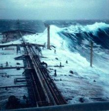
Thanks to science, the once-mythical rogue wave — the one that towers over all others in the ocean — is finding its way it to many unsolved mysteries in the ocean. Waves that measure up to 120-feet high have been blamed for sinking ships of more than 500 tons.
Their only warning, the “hole in the sea” ships fall into as the wave overwhelms. Scientists have not yet found an accurate way to predict when they’ll form, Smith said.
“It’s the capricious nature of them that makes them so problematic,” he said. “It’s only a problem if you’re in the wrong place at the wrong time that they become a problem.”
Newport Beach doesn’t have to worry about rogues so much, he said. But, Smith said, if Alaska, a country off the coast of South America or a tectonic plate in the Pacific were to slip, a tsunami could become a reality. Most seemed fascinated, but a bit surprised the potential disasters out in the sea that could hit home in Southern California, audience members said.
“The threat is remote, but it’s real,” said audience member Doug West.
WEATHER NOTE
Tornado season arrives - be prepared
Spooked in the past by scary dark clouds and high winds, Monroe County area residents should not ignore siren blasts when they go off this spring.
It could mean a tornado is approaching, a nuclear plant accident just happened or a hazardous waste spill has occurred. In either case, citizens should prepare for the worst, local civil preparedness authorities say.
Glenda White, interim director of the county Emergency Management Division in Monroe, said it's easy to be complacent when sirens are sounded. But that's why the county and state have declared this week (April 6-12) Severe Weather Awareness Week.
"We've had our share of tornadoes, floods and thunderstorms," Ms. White said. "You can't take the sirens for granted. You have to be ready ... we've been lucky we haven't had an F3 tornado or higher recently."
Tornadoes have ravaged the county in the past and could do so again, she cautioned. In fact, this is the start of the season for tornadoes.
On April 3, 1974, two twisters touched down in Erie and Berlin townships, destroying two homes and sending two people to the hospital for serious injuries. The tornado that touched down in Erie was later classified as an F3 twister, meaning it packed winds of between 158 and 206 mph.
These were only two of nearly 150 tornadoes that pummeled the nation that day, killing 315 people, injuring 6,000 and causing $600 million in property damage.
There have been other twisters in the county in April. The worst was the Palm Sunday storm on April 11, 1965, that killed two people in Lost Peninsula in Erie Township. On that evening, a twister killed 11 people in Lenawee County and smashed through Milan, causing $19 million in damage along its path. The storm hit about 8:25 p.m.
About an hour later, another twister, accompanied by golf ball-sized hail, landed in Lost Peninsula and caused about $1 million in damage. The same funnel cloud killed 13 people in and near Toledo.
Another April tornado struck in 1963 in Frenchtown Township. Both Grand Beach and Stony Point were pummeled and one person was injured. It caused about $60,000 in damage.
The most savage twister to hit the county came June 8, 1953, when four people were killed and 15 injured when a funnel cloud formed over Petersburg about 6 p.m. and then raked through Erie Township a half hour later. Some 20 homes along Baycreek, E. Temperance and Substation Rds. were demolished. Damage exceeded $1 million.
Tornadoes develop during severe thunderstorms. A funnel that forms is not actually classified as a twister until it touches earth. A violently rotating column of air trailing from a thunderstorm, but not in contact with the ground is known as a funnel. Other terminology and information about tornado safety, lightning and other severe storms can be found on the weather service Web site at www.weather.gov.
Area communities no longer may be put on alert for a tornado warning when the sun is shining and there is no apparent threat of a storm approaching.
The National Weather Service changed its tornado alert and thunderstorm warning system last fall to make them more geographically specific.
This will be the first spring the new system is in place, meaning a difference when a tornado or thunderstorm alert is issued.
The weather service has stopped issuing countywide severe weather warnings and instead will issue "storm-based warnings" for tornadoes, severe thunderstorms, flash floods and marine hazards for specific areas within the county. The new warning system, for example, may include well-known landmarks in the region such as I-75 or M-50 or the River Raisin or Huron River.
The change should be fairly easy for the public to understand, said David Kohler, a meteorologist for the weather service near Pontiac.
"We're going to fine-tune our warnings so they don't unnecessarily warn people in areas that won't be affected," Mr. Kohler said.
Weather forecasters still will have the flexibility to recommend warnings that cover a wide enough area in case the weather takes an unexpected turn.
Severe thunderstorms can bring many dangers in addition to occasional tornadoes.
Other hazards include damaging winds and large hail. Some severe storms can produce winds of more than 100 miles an hour, resulting in damage equal to that of a tornado.
Since 1970, high winds - mostly from severe thunderstorms - were responsible for 118 weather-related deaths in Michigan, the weather service said. During that same period, there were 23 tornado-related deaths. Lightning resulted in one death and several injuries in 2007 compared to three deaths and eight injuries in 2006.
Flash floods can be dangerous, too, and can happen any time of year. Rapid flooding of low-lying areas accompanied by swift currents can quickly lead to life-threatening situations. Flash flooding is the No. 1 weather-related killer.
Doppler 7 Xtreme HD- Severe Weather Guide
| Click to download the Doppler 7 Xtreme HD Severe Weather Guide (8.6MB) |
Here are some severe weather facts and advice so that you can recognize dangerous weather conditions and act accordingly.

Click to download the Doppler 7 Xtreme HD Severe Weather Guide
Owner of Beached Ferry Riverdance Presents Plans to Dismantle Her
April 10, 2008
After a lengthy evaluation process, the owner of the Riverdance ferry, now lying on Blackpool beach, has produced plans to dismantle the ship in situ on the grounds that this represents the best option available in the interests of safety and protecting the environment.
Hugh Shaw, the Secretary of State’s Representative for Maritime Salvage and Intervention (SOSREP), has been involved throughout and has informed the owner that he has no objection to the plans.
Weather permitting, it is estimated that the project will take approximately 12-14 weeks.
Options examined ranged from righting the vessel (known as par-buckling), cutting up in situ or a combination of both. The preferred method will involve cargo, trailer and machinery removal, including any debris and any pollutants, whilst maintaining the integrity of the hull. The vessel will be stripped down internally until only the shell remains. The hull will then be cut into manageable pieces and transported for recycling.
The Environment Group have been advised as well as Defra, the Environment Agency, the Marine and Fisheries Agency and Natural England. All parties (including Defra, the Environment Agency, the Environment Group, the Marine and Fisheries Agency and Natural England) recognize that, due to the uncertainty and technical difficulties of righting the vessel, cutting up in situ is now the best option.
Until the new contract for demolition is awarded, SMIT Salvage remain on contract to carry out caretaking duties only.
Hugh Shaw said
“I look forward to being able to brief officers and elected members of the local authorities to explain how and why the forthcoming works will be carried out. I also look forward to working closely with all interested organisations such as the police and local transport services to ensure that minimum disruption is caused to residents and local people.”
The original plan to reduce the list using tidal and internal buoyancy was abandoned due to the additional structural damage sustained during storms on 12 March. The vessel remains lying on the beach with a list of 100 + degrees. In addition the vessel continues to sink deeper into the sand. It is estimated that at least 4 meters of the bridge / wheelhouse is now under the sand.
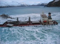
On Thursday 31 January 2008, the vessel’s crew, on passage from Warren Point to Heysham, reported that she had developed a 40 degree list and was drifting towards the Lancashire coast. The vessel subsequently grounded at Cleveleys Beach, North Shore, Blackpool.
Source: Maritime and Coastguard Agency
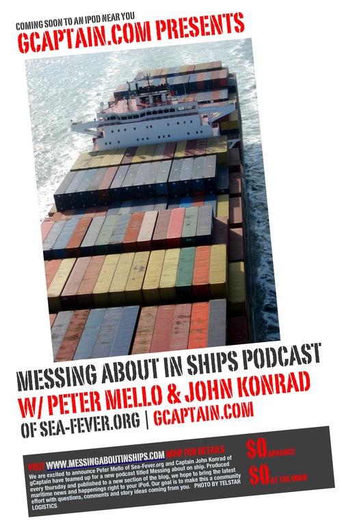
Messing About In Ships Episode 18
Messing About In Ships podcast episode # 18 has launched.
(56 minutes)
Download MP3 file: Messing About In Ships Episode 18 (April 10, 2008)
Subscribe Via iTunes HERE
Enjoy a safe weekend!
RS











![Validate my RSS feed [Valid RSS]](valid-rss.png)