 CODAR stands for Coastal Ocean Dynamics Applications Radar, or in short, Coastal RADAR.
 According to the CoolRoom, CODAR is a High Frequency (HF) radar system that remotely measures ocean surface currents. The system allows one to get a complete map of ocean currents (left) without stepping foot aboard a boat or deploying an expensive array of current meters. Each map has a range of about 50 kilometers (about 30 miles) from the coast with a measurement every 1.5 kilometers ( 0.9 miles). The Rutgers University CODAR system, deployed along the New Jersey coast, is the only operational HF-Radar system of its kind in the entire eastern United States. It consists of two remote sites, located in Brant Beach and Brigantine New Jersey, and a central site in Tuckerton, New Jersey.
How does it all work??
Each remote site contains two antennas and a small 6'x 8' shed. One antenna (left) transmits a radio wave out across the ocean surface. The power of this transmitted signal is only 40 watts. Therefore this antenna behaves like a household lamp with a 40 watt light bulb. Unlike radio stations that only transmit a signal, CODAR uses the second antenna (far left) to listen for and measure the transmitted signal. So that the part of the transmitted signal that is reflected back toward the site by the ocean waves can be recorded and processed. It is this returned signal that is used to measure the moving ocean surface.

 The shed (right) contains a weatherproof box (lower right) that houses all of the equipment necessary for transmitting, receiving and processing the radio signal. Within this box (from top to bottom) there is a Macintosh computer, responsible for processing the incoming signal, a transmitter and a receiver.

How can we get ocean currents from the beach?
CODAR uses the theories of the Doppler Shift to determine the surface current from the backscattered radio wave. The Doppler shift explains the change in frequency of a signal scattered off a moving object. For example, a train whistle or ambulance siren sounds different depending on the speed and direction of the vehicle. Doppler theory can be used to determine if a scattering object is moving toward or away from an observer as well as the speed at which it is moving. These theories also apply to the ocean surface.
By measuring the return signal, the CODAR system can determine the speed of the ocean waves that scattered the signal. From this wave speed a surface current can be calculated. One limitation to Doppler theory is that it only explains the velocity of the train in the direction of the observer.

Consequently, a remote site can only measure how fast the water is moving toward or away from the antennas (left). The net movement of the water (shown in red) can only be determined using information collected from each of the two sites (shown in green and yellow), as illustrated in the figure to the left.
CODAR Applications
- Safe and efficient navigation and marine operations
- Efficient oil and hazardous material spill trajectory prediction and clean up
- Monitoring, predicting and mitigating coastal hazards
- Military operations
- Education
- Scientific research
- Search and rescue
The Future of CODAR along the New Jersey Coast
The future of the CODAR system along the New Jersey coast involves plans to increase the present area of coverage. To accomplish this, several adaptations will be made to the present system. The first will add two additional transmit antennas offshore. In addition to extending the coverage in both the along-shore and cross-shore directions, this improved system will be able to measure surface currents right to the beach (left). By measuring these currents, one can begin to examine storm effects on beach erosion as well as complicated inlet dynamics influencing commercial traffic.

The second adaptation changes the frequency of the transmitted radio wave so that the signal will travel further offshore resulting in a much larger coverage area. The figure to the right illustrates the present configuration in yellow. Using three of these new long-range systems, the coverage area will be extended to include those areas shaded in red, blue and green. Also shown in the illustration is the location of three recent ship sinkings off the New Jersey coast. One can easily see that with the larger coverage area perhaps current maps could have been used by the Coast Guard to more efficiently aid those in distress.
CODAR Ocean Systems website.CODAR surface current maps powered by Google™
Underwater glider studies the sea
A seafaring glider that draws its energy from the ocean has become the first so-called "green" robot to monitor the undersea environment. The glider powers itself by harnessing the temperature difference felt at different depths. It has crisscrossed a deep undersea basin near Puerto Rico more than 20 times for a study on ocean circulation, say researchers at Woods Hole Oceanographic Institution and Webb Research Corp. in Massachusetts. The glider should be able to work around the clock in all weather conditions.
Weather spotter classes offered
Henderson Gleaner - Henderson,KY,USA
The training sessions are offered throughout the region, mostly during January through March to prepare for peak severe weather season.
MARITIME NOTES:
Ocean Dead-Zones May Be Linked To Global Warming (February 15, 2008) -- A review of all available ocean data records concludes that the low-oxygen events which have plagued the Pacific Northwest coast since 2002 are unprecedented in the five decades prior to that, and may well be linked to the stronger, persistent winds that are expected to occur with global warming. In a new study in Science, researchers outline a "potential for rapid reorganization" in basic marine ecosystems and the climatic forces that drive them, and suggest that these low-oxygen, or "hypoxic" events are now more likely to be the rule rather than the exception. ... full story
EMSA – report on pollution preparedness and response
The European Maritime Safety Agency (EMSA) issued its annual report for 2007 on Pollution Preparedness and Response. The report focuses on the network of stand-by oil recovery vessels around Europe and the European satellite oil spill monitoring and detection service – CleanSeaNet. (1/31/08).
On February 15, 1996, the tanker SEA EMPRESS grounded off the mouth of the Cleddau Estuary as it was making its way to Milford Haven, Wales to offload a cargo of crude oil. The ship eventually spilled an estimated 73,000 tons of crude oil in an event that was widely televised around the UK and the world. The primarily cause of the casualty was found to be an error in judgment by the pilot. A root cause was found to be inadequate training and examination of pilots by the Milford Haven Port Authority. This casualty was a significant factor in the subsequent enactment of legislation in the UK clarifying the authority for overseeing spill response and salvage. Further information may be found in the MAIB Report.
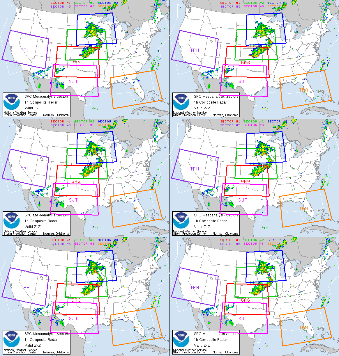
TV stations are streaming various in-house news feeds live on the 'net, and the network has decided to experiment to let you see them all on a real-time basis. Some of them are just test patterns or dark screens when nothing is going on; others are web feeds of their radar, and some are live video streaming tower cams. Several are from "Tornado Alley", including Denver, CO and Dallas and Austin, TX. All of it is raw, so anything goes; whatever they decide to spit out, you see it. Live NewsCarmeras.com
Jim C, asks.
"Robin,
I am baffled by the fact that in tornado alley each house or permanent structure doesn't have a tornado shelter, storm cellar, or basement.
I live in Denver Colorado and cannot imagine not having a basement to go to when the weather turns severe. We are not even as prone to it as some areas of the country.
To me, not having a storm shelter in tornado alley makes about as much sense as not having a snow shovel here in Denver."
Jim, good question. So I posed this to my peers on the WX-Chase listserve. The response was across the board. Most folk do not have basements in tornado alley because of either the geology ( either poor soil or heavy rock) or very high water table, while the cost of putting one in would be excessive. Though one experienced storm spotter/chaser did correct me when I exempted mobile homes, by saying nope, if the ground is doable they can have mobile homes mounted over basements.
FINALLY
Ferry mess mired in myopic decision-making
COUPEVILLE, Washington (STPNS) -- I am a former officer with the National Oceanic and Atmospheric Administration, having sailed the Pacific from Alaska to Midway to Hawaii to Tahiti to Chile. I have sailed in storms with 50-foot swells and 80-mph winds in which all one can do in a 300-foot ship with twin screws and a bow thruster is keep the bow into the swells to prevent being rolled over and pray the engines don't quit.
I am not sure why the US Coast Guard considers the waters of Admiralty Inlet "protected waters" unless it is simply because it is not the open ocean. This is the same Coast Guard that failed to detect, during numerous inspections, the massive pitting in the hulls of the 80-year-old boats from the Keystone-Port Townsend run. (STORY)
HAVE A GREAT A ENJOYABLE WEEKEND!
RS














![Validate my RSS feed [Valid RSS]](valid-rss.png)