 He is smiling now! Hope it stays that way! Good Luck Bill Read!
January 25, 2008
(Bill Read at the National Hurricane Center forecast desk.)
+ High Resolution (Credit: NOAA)
NOAA officials today named Bill Read as the new director of its Tropical Prediction Center, which includes the National Hurricane Center and two other divisions, in Miami. Read has served as the center’s acting deputy director since August 2007.
“Bill has what it takes be the nation’s hurricane center director. He’s spent 30 years of his career as a weather professional with NOAA dedicated to protecting lives from severe weather, much of it hurricanes and tropical storms,” said retired Navy Vice Admiral Conrad C. Lautenbacher, Ph.D., under secretary of commerce for oceans and atmosphere and NOAA administrator. “Bill has been a trusted consultant to emergency managers in and around Houston and I’m sure he will foster that type of goodwill in communities vulnerable to hurricanes. He will find the job as rewarding as it is demanding.”
Tropical storms and hurricanes have frequently played a major role in Read’s professional life. Read and his team were at the forefront in July 2003 as Hurricane Claudette made landfall on the Texas coast. He also was part of the Hurricane Liaison Team at the National Hurricane Center in Miami when Hurricane Isabel came ashore on the Outer Banks of North Carolina and raced northeast in September 2003.
Read was appointed to direct the Houston/Galveston weather forecast office of NOAA’s National Weather Service in 1992 and led it through the challenges of the National Weather Service modernization and restructuring program in the mid 1990s.
“Bill brings a wealth of experience in meteorology and management to this position. He has a clear understanding of the needs of staff, the emergency management community and the public in fulfilling our mission of saving lives and property,” said Jack Hayes, director of NOAA’s National Weather Service. “Bill has a proven track record of pulling people together – from the forecaster to the emergency manager – as severe weather threatens.”
Prior to joining NOAA’s National Weather Service, Read served in the U.S. Navy, where his duties included an assignment as an on-board meteorologist with the Hurricane Hunters. He began his career in 1977 with the National Weather Service test and evaluation division in Sterling, Va., developed his forecasting skills in Fort Worth and San Antonio, Texas; and, served as severe thunderstorm and flash flood program leader at the National Weather Service headquarters in Silver Spring, Md.
NOAA’s Tropical Prediction Center contains three divisions – 1.) the National Hurricane Center provides forecasts of the movement and strength of tropical weather systems and issues watches and warnings for the U.S. and surrounding areas, 2.) the Tropical Analysis and Forecast Branch provides support for satellite and radar analyses, and 3.) the Technical Support Branch provides support for the Center’s computer and communications systems and develops new techniques for tropical cyclone and tropical weather analysis and prediction.
The National Oceanic and Atmospheric Administration, an agency of the U.S. Commerce Department, is dedicated to enhancing economic security and national safety through the prediction and research of weather and climate-related events and information service delivery for transportation, and by providing environmental stewardship of our nation's coastal and marine resources. Through the emerging Global Earth Observation System of Systems (GEOSS), NOAA is working with its federal partners, more than 70 countries and the European Commission to develop a global monitoring network that is as integrated as the planet it observes, predicts and protects.
ILLINOIS TORNADO TALLY 2007 - a Quiet Year
The tornado statistics for Illinois for 2007 are as follows:
MAR 4
APR 2
MAY 5
JUN 4
JUL 0
AUG 2
SEP 4
OCT 2
DEC 0
TOTAL 23
By EF Scale
EF0 22
EF1 1
EF2 - EF5 0
Total by NWS office area of responsibility
Chicago (northeast/north central IL) 5
Quad Cities (northwest IL) 3
Lincoln (central/southeast IL) 6
St. Louis (southwest IL) 7
Paducah (southern IL) 2
The 30 year running annual average for the state of IL from 1978-2007 is 41.
NWS CHIGAGO/ROMEOVILLE - Looking for River Watchers
River Watchers Wanted
The National Weather Service (NWS) in Chicago/Romeoville, IL is looking for individuals that live or work along the Kankakee River to become part of a river watcher network. Ice jams can result in rapid and devastating flooding. Although the NWS does monitor a small number of automated river gages, they typically do not accurately reflect the current conditions upstream and downstream due to the isolated nature of ice jams. It is also important to know extent of the current ice cover and conditions. That kind of information can only be obtained from visual observations. Under no circumstances are river watchers to actually go out on the ice! Your safety is important to us. Observations should be made from a safe location on the bank or perhaps from your home.
River watchers will receive basic training that will cover ice formation and ice reporting procedures. We hope to expand the network to other rivers in northern Illinois prone to ice jam flooding including the Rock and Fox Rivers.
If you are interested please contact Bill Morris, Hydrologist at the National Weather Service Chicago/Romeoville office. Please include your name, address, phone number, and email.
211 WEATHER CENTER
State Unveils 211 Storm Emergency Number
New Number Aims To Reduce Calls To 911
BOSTON -- There's a new phone number to call during storms or disasters in Massachusetts: 211. Officials at the Massachusetts Emergency Management Agency said 211 is designed to reduce the number of non-emergency calls made to 911.
By dialing 211, people can get updated disaster information and post-disaster programs, as well as volunteering and donation opportunities. The 211 call center operates weekdays 8 a.m. to 8 p.m., providing information about social services. It can be staffed around the clock during emergencies. The state is operating the 211 system with the Council of Massachusetts United Ways.
TORNADO WARNINGS
From Journal Sentinel readers
Jan. 26, 2008
Use phones to create a better system for severe weather emergency warnings
We live in the Town of Dacada, east of Random Lake. There are no sirens in our area, and back in 1996, we had a "tornado." It was called "straight-line winds," and we lost our 40-by-70-foot barn, and a cow was killed when the barn went down.
Earlier that night, the storm was in the Dakotas, and then it went through Minnesota and east into Wisconsin. It hit the Random Lake region around 2 a.m.when everyone was asleep. Thirteen barns went down that night.
Our answer to the problem of an audible warning siren is to set up a system that will warn people who are sleeping or out of earshot of sirens. The phone company could set up a system to send 15 fast rings, awakening residents to alert them to the approaching danger. Residents then could turn on the radio or television to find out what they should do.
This system also could be used during the daylight hours to alert the elderly who might not have the radio or television on. Neighbors without phones could be warned by their neighbors, and even cell phones could be notified. This should solve the problem without the huge expense of a siren system.
Jerry and Kathy Daddato
Dacada
TYPHOONS 2007
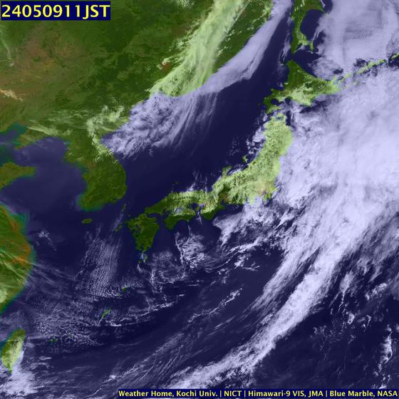
NW Pacific Typhoons 2007 Summary of 2007 NW Pacific Typhoon Season and Verification of Authors' Seasonal Forecasts. Published 9th January 2008
MARITIME NOTES FROM HOLLAND AND KNIGHTThe US Coast Guard issued a press release stating that, on January 24, the orange-juice tanker ORANGE SUN collided with the dredge NEW YORK in Newark Bay. The US Coast Guard also issued a video release which you may find interesting. No injuries were reported. The incident is under investigation. A subsequent press release reports on steps take to minimize the impact of the hydraulic fluid that was released into the water and the initial survey of the damaged dredge. (1/26/08).
USCG – ISPR report to be released
The US Coast Guard issued a press release stating that the Incident Specific Preparedness Review (ISPR) Phase I report will be released in San Francisco at 1:00 p.m. local time on Monday, January 28. The report concerns the first two weeks of the response operation to the COSCO BUSAN oil spill. It does not address the cause of the spill, only the preparedness for and response to the spill. A second report on the remainder of the response will be released at a later time. (1/25/08).
San Francisco Bay – update n COSCO BUSAN clean-upThe Unified Command issued a news release providing an update on the clean-up of the oil spill from the COSCO BUSAN. Reading between the lines, it appears that the active response is largely complete. (1/24/08).
RS




















![Validate my RSS feed [Valid RSS]](valid-rss.png)