 Satellite View Of Cloud Tops Might Warn Of Storms
ScienceDaily (July 11, 2008) — For three years, a new way to use data collected by NOAA weather satellites has been giving North Alabama short-term warnings of "pop-up" thunderstorms.
Developed by scientists at The University of Alabama in Huntsville, this new computer program is now spreading to other parts of the U.S. and the world. Later this summer a version of the UAHuntsville weather program will begin forecasting storms throughout Central America, Southern Mexico and the Dominican Republic.
The UAHuntsville Satellite Convection AnalySis & Tracking System (SATCASTS) monitors cumulus clouds as they develop, move and grow through time, according to the person who brainstormed the idea behind the program, Dr. John Mecikalski, an assistant professor of atmospheric science at UAHuntsville.
The program uses data from NOAA’s GOES weather satellites to provide 15-minute to one hour warnings of local thunderstorms. This is the first time forecasters anywhere have had a tool to forecast storms that develop locally. This differs from Doppler radar, which only tracks rain after it starts to fall.
"The radar tells you what's happening, but not what's going to happen," said Wayne MacKenzie, a research associate in UAHuntsville's Earth System Science Center and a member of the SATCASTS development team.
Operated by UAHuntsville scientists for the National Weather Service forecast office in Huntsville for about three years, SATCASTS has been accurate in its storm forecasts between 65 and 75 percent of the time. It has successfully identified hazards generated by thunderstorms, including lightning, hail, high wind, flash floods and turbulence.
Mecikalski got the idea for SATCASTS in 2001, when he was affiliated with NOAA’s Cooperative Institute for Meteorological Studies. He was looking for a way to determine which of the thousands of cumulus clouds present on any given summer afternoon will become thunderstorms. (One percent or less of clouds develop into rain clouds.) He has continued his research since joining the faculty at UAHuntsville in January 2004.
Using data from the GOES visible and infrared sensors, SATCASTS tracks changes in both cloud temperature (height) and water vapor. This data is updated every 15 minutes.
The UAHuntsville team has determined that one of the most important factors in predicting thunderstorms is temperature change. If the top of a cloud cools by 4 C (about 7.2 degrees Fahrenheit) or more in 15 minutes, that means the cloud is growing quickly and there is a growing probability of rain beginning within 30 minutes to an hour. A 4 C drop in temperature typically means a cloud top has climbed between 1/4 to 1/3 of a kilometer.
Based on its success in the Huntsville forecast office, scientists at UAHuntsville are working with the National Weather Service to transition SATCASTS into the storm prediction systems in forecast offices in Birmingham, AL, and Nashville, TN, as well as both Melbourne and Miami, FL.
The UAHuntsville team is also working with NASA and the Federal Aviation Administration (FAA) to test SATCASTS' possible utility in aviation and air traffic control. The system is being tested at the FAA’s New York City air traffic control center. If successful, SATCASTS might be used worldwide to warn pilots of storms, turbulence and other weather threats before they occur.
Other organizations evaluating the operational implementation of the SATCASTS algorithm include the European Meteorological Satellite agency and the South African Weather Service. Discussions are also under way to bring SATCASTS capabilities to East Africa.
While SATCASTS joins a sophisticated and extensive network of weather monitoring systems in the U.S., it is expected to have special value in regions where storm forecasting and monitoring have been limited or non-existent. The system is relatively inexpensive to install and operate, since it uses freely distributed weather data from existing satellite sensors.
NOAA-funded research at UAHuntsville will focus on expanding SATCASTS' capabilities. In areas where Doppler radar networks do not exist, SATCASTS might be used in the future to track frontal storm systems and provide severe weather warnings that are not presently available, Mecikalski said.
"This makes SATCASTS and satellite-based rainfall predictions very relevant in many developing countries, when ground-based radar is absent but high quality satellite data are in place."
The UAHuntsville SATCASTS team includes Mecikalski, two other scientists and three graduate students. The project has been supported by more than $1 million in funding from NOAA, NASA and the FAA.
Research on improving SATCASTS is ongoing and is expected to continue for at least five years. New areas of research include 30-to-90-minute lightning and flash flood forecasts.
The UAHuntsville team is also working on a next generation SATCASTS, which will take advantage of the improved sensing systems that will be available when NOAA launches it GOES-R series of satellites beginning in 2016. Sensors on those satellites will collect data in more channels, more often and at higher resolution.
WEATHER NOTE
Thunderstorms and Camping Safety
When folks go camping, whether into the wilderness or just locally, they have to be prepared to deal with whatever weather happens to be going on during their campout. If you've done any camping at all, chances are you've experienced a few thunderstorms, up close and personal in a tent, or while hiking and otherwise enjoying the outdoors.
It's my "day job" to be involved in hazardous weather, mostly from thunderstorms. Thunderstorms have a beneficial side, but on some occasions, they become more than a minor inconvenience for campers and those involved in outdoor activities. Through my Scouting experiences, I've had many opportunities to see how young people and their adult leaders operate during a campout.
Teenage boys are legendary for trying to act "macho" and getting stuck in situations that have become dangerous. Unfortunately, adult leaders sometimes can be just as silly and ignorant as the boys. It's often said "What you don't know can't hurt you." Absolutely wrong!! Ignorance and macho trips can result in terrible tragedies once in a while, and I doubt that anyone would want that on their conscience.
Lightning hazards
Thunderstorms all produce lightning in varying amounts ... sometimes there's just an odd flash or two ... other times, the storms produce lightning nearly continuously, with lots of flashes to ground. It's the flashes from the cloud to the ground (CG flashes, for short) that create problems. They typically are only a small percentage of the total flashes produced by a thunderstorm; most lightning stays within the clouds. But it only takes one CG flash to get you! The human body is basically a bag of salty water, which conducts electricity a lot better than air, so the lightning will often try to travel through you to reach the ground.
Lightning and thunder are so common as to seem just part of the background. Often, as children, lightning and thunder frighten us. As young people mature (especially boys), it becomes a "macho" thing to show they are not afraid of a thunderstorm. Well, I'm certainly not advocating that we over-react, and head for home at the first sign of any thunderstorm ... but I want to suggest that we not go to the opposite extreme and pay virtually no attention to the threat that lightning strikes pose. Any thunderstorm should be a matter of concern, and the campers should already know what to do if the situation becomes hazardous.
It's pretty unlikely that you'll ever be struck by lightning. Scientists cannot make accurate predictions of when and where lightning will strike or how often, so for all practical purposes, it looks pretty random. Nevertheless, more people are killed by lightning year in and year out than by any other weather phenomenon; typically on the order of 100 people or so annually in the United States. Furthermore, lightning does not have to kill you to create major problems in your life. Several hundred people are affected by lightning in the U.S. every year, short of being killed. To get some idea of the non-fatal hazards of lightning from a medical point of view, check out this site and/or this one. Being struck is no joke and can affect you adversely for the rest of your life.
Anytime you're outdoors, you've increased your risk of being struck by lightning. For example, some golfers are struck every year ... many of you may have heard the story of Lee Trevino's non-fatal encounter! Another category of those who are at relatively high risk includes those who climb mountains. Since a lot of wilderness adventure camping includes hiking and camping at high elevations, campers and hikers are considerably at risk, whether they realize it or not. Consider the following statement from the 1997 Philmont Scout Ranch "Guidebook to Adventure": READ MORE
MARITIME NOTE
PRINCESS OF THE STARS : ‘You’re better off texting coordinates’
MANILA, Philippines—The ill-fated MV Princess of the Stars had all the fancy communications systems in the world, but for some weird reasons they all failed when they were needed, except for an antiquated single side band radio and the ubiquitous cell phones.That’s the contention of Ernelson Morales, safety officer of Sulpicio Lines Inc.
The device that automatically submits a distress signal via satellite didn’t work.
There was no SOS received by maritime agencies or ships that could have immediately gone to the aid of the 860 people aboard the vessel only 56 of whom survived.
The ship also had a Navtex, used to get weather reports from nearby countries, Morales says. But Sulpicio chose to rely on the single side band radio and the cell phone to get reports from the Philippine Atmospheric, Geophysical and Astronomical Administration (PAGASA). Its weather data are more localized, he says.
In addition, the ferry had a medium-frequency, a high-frequency (HF) radio and a very-high-frequency (VHF) radio along with a two-way radio tuned in to the emergency channel and an emergency position indicating radio beacon (EPIRB) that, once immersed in three meters of water, would automatically send a distress signal.
These were all required by maritime regulations, Morales says. “You won’t be allowed to sail if you don’t have complete equipment,” he said.
But apparently, these communication systems proved unreliable when the vessel was getting the brunt of Frank’s fury.
He theorizes that the strong winds damaged the antennas and transmitters, thus rendering the vessel incommunicado.
A distress signal sent by the EPIRB, installed outside the bridge on the top deck, would have been picked up by nearby countries with the capability to receive such data.
Winds knocked out system
“I was wondering why it did not send a signal. My presumption is, since it is outside, the strong winds knocked it out of its position and sent it hurtling against a wall, thus breaking it. That’s the only way for it not to send a signal because it’s automatic,” Morales says.
Sulpicio Lines senior vice president Edgar Go told the Board of Marine Inquiry (BMI) that the company used the single side band and cell phone to communicate with the ship captain during the emergency.
Retired Commodore Amado Romillo, who resigned from the BMI after being accused of being biased by Sulpicio, criticizes the ship’s reliance on the single side band radio to communicate with the ports.
Romillo also says there were hours when nobody was manning Sulpicio’s radio at the port.
The Philippine Coast Guard only has VHF and HF radios and has also taken to relying on cell phones, says PCG spokesperson Lt. Armand Balilo.
“As far as I know, the Philippine authorities have no capability to get the signal from EPIRB. Sometimes we ask, what’s the need for this EPIRB? You’re better off texting your coordinates, get it through your GPS,” Morales said.
P739-M distress system
Under the Global Maritime Distress and Safety System (GMDSS), vessels are required to secure certain communication equipment, including satellite-based ones, which enable them to transmit and receive distress information quickly or automatically, and to receive maritime safety information such as weather reports and navigation warnings.
But along with these requirements for ships, the country’s maritime agency should also have the counterpart equipment.
In 1998, the Department of Transportation and Communications (DoTC) signed a contract for the installation of 19 GMDSS stations nationwide with Thomson CSF NCS-France under a 25-year loan of 106.53 million francs, or P739 million, from the French government at 1.5 percent interest.
“It remains a big mystery why a contract was approved but no useful equipment ever came out of it,” says Sen. Manuel Roxas II, who is calling for an investigation of the deal, which he says could have avoided a string of sea disasters.
“Did the contractor deliver on their obligations, and if so, what happened to the GMDSS? If the winning bidder failed to comply, why didn’t the DoTC run after them? On the finance side, are we still paying off a foreign loan for an invisible GMDSS?” Roxas said, noting a 2006 Commission on Audit report saying the contractor abandoned the project in 2000 “due to a billing dispute.”
‘We really lack equipment’
At present, the Philippine Coast Guard (PCG) is equipped only with 108 VHF and 78 HF radios for communication. Sixteen other VHF radios are not working, says Lt. Cmdr. Daniel Gayosa of the PCG Weapons, Communications, Electronics and Information System Command.
These radios, which are used mostly for administrative matters, are inadequate for the PCG’s 10 districts, 52 stations and 180 detachments in the country’s more than 7,100 islands, Gayosa noted.
“The radios we have are not enough. We really lack equipment, and we have no budget to buy all that we need,” Gayosa says. He says far-flung PCG offices are supposed to be equipped with the HF radios, but many of them lack this basic tool.
Balilo says many Coast Guard detachments have taken to using cellular phones to communicate.
To monitor distress calls, the PCG listens in to the emergency channel on their radios, according to Gayosa. A good number of times, they also learn of maritime incidents through calls relayed by the vessel owners, other ships, local authorities and even international maritime organizations to the PCG’s offices.
The PCG’s land stations also do not have the capability to receive messages from the digital selective calling (DSC) radio, a device that automatically sends a distress alert and the ship’s identification, says Gayosa.
FROM gCaptain......
A Secret Look At Golden Shellback Water Resistant Coating
July 26th, 2008 ·
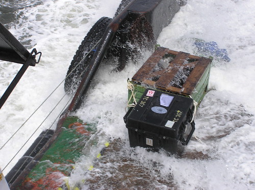
Photo By Tom Jervis
Last year Sid Martin, Director of Technology at Northeast Maritime Institute was faced with a dilemma. He had been hired to spearhead a project bringing the latest technology to the field of Maritime Security and test it in the field. Martin was the perfect candidate for this job. Prior to working at NMI he was a member of the project team responsible for the wheel bearings on the Mars Lander and in doing so became familiar with the obstacles faced in developing products for use in harsh environments. But the project was nearing completion and he needed to find new ways to use his experience at the institute. MORE
RS













![Validate my RSS feed [Valid RSS]](valid-rss.png)