 Well March 1st was the official start of twister season. The lead article below is very appropriate for the start of twister season...Tornado Images May Lead To Precise Storm Warnings.
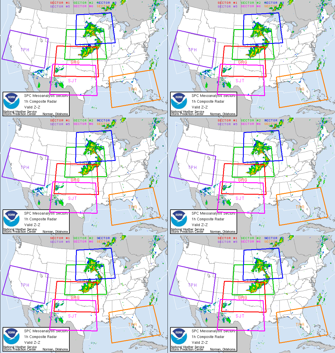
Let the chase begin! MESO outlook!
Again I remind all my readers "Be Ready!"
Meteorologist Craig Koplien of Craig Koplien: Weather or Not, writes, Lots of Tornadoes This Spring?
It is pretty widely accepted that La Nina is one of the key reasons we’ve had such a snowy winter. The unusually cool temperature of the water in the Pacific Ocean near the equator has had a significant impact on the weather pattern across the . It has caused a persistent jet stream to carry snow-producing weather systems across
National Weather Service meteorologists have been investigating past springs that followed La Nina winters, to determine if they can tell us anything about what to expect this spring. The information uncovered is cause for some concern. Studies have shown a strong correlation between La Nina winters and an increased frequency of spring tornadoes in the
It is important to note that this is far from a forecast of what to expect this spring. The number of stormy days, and the potential for tornado-producing storms, is influenced by many factors. The exact location of potential tornado outbreaks cannot be made with any certainty either. However, the relationship between La Nina winters and a high number of spring tornadoes in the
Lead Story
Tornado Images May Lead To Precise Storm Warnings
ScienceDaily (Feb. 20, 2008) — An unexpected radar image of airborne debris from the Feb. 6 tornado that killed four people in Lawrence County, Ala., might help scientists develop better tools for warning the public when and where strong tornadoes are on the ground.
(Radar images from the morning of Feb. 6 show the mesocyclone forming over Lawrence County, Ala., left, and the unexpected indication of debris jetted as much as two miles high, right. (Credit: Image courtesy of University of Alabama Huntsville)
Scientists in the Earth System Science Center at The University of Alabama in Huntsville (UAHuntsville) are studying radar data from the early morning tornado to see if the radar signature from the debris is so distinctive that computers can be programmed to instantly recognize it, so more timely and precise warnings might be issued.
"The real advantage would be the precision," said Dr. Walt Petersen, the UAH research scientist leading the radar data analysis. "These events are usually going to be associated with large scale mesocyclones, so tornado warnings would probably already have been issued. But those large scale rotation features can cover several miles.
"With this debris signal, we might be able to pinpoint the precise spot where a tornado is on the ground. It would be great to be able to say, 'The tornado is right there, at that town.' If you could automate a system to do that, it would be quite handy and useful."
Two of Petersen's UAH graduate students, Chris Schultz and Elise Johnson, used laptop computers to monitor the radar that morning from the safety of their temporary operations center -- the bathroom in Schultz' apartment, "in case we had to dive into the bathtub."
Later Schultz suggested to Petersen that there might be a debris signature associated with the Alabama storm.
This was the first time a significant tornado has hit within range of the advanced radar unit at the Huntsville International Airport since it was put in service in late 2004. Other storm-related debris sightings using similar radar technology at the National Severe Storms Laboratory in Norman Oklahoma have been rare, so every sighting adds substantially to the paltry information previously available.
The Advanced Radar for Meteorological and Operational Research (ARMOR) was developed jointly, with UAHuntsville and a Huntsville television station collaborating to upgrade a decommissioned former National Weather Service Doppler radar unit.
ARMOR is a dual polarimetric radar, while most other weather radar units are single polarity. Dual polarization gives ARMOR the ability to gather more data about the size and shape of particles in the air. Initially it was thought the dual polarization capability would help scientists learn more about severe storms, identify hail or snow, and better estimate rainfall.
The ability to recognize flying debris wasn't something scientists really expected.
"This was totally serendipitous," said Dr. Larry Carey, an ESSC scientist working with Petersen. "Everything else we've done (with ARMOR) were things we pretty much expected. This wasn't really planned. It is just an added benefit of the technology."
If computers can be programmed to recognize debris in the radar data, that programming might be a standard feature when the National Weather Service upgrades its existing nationwide NEXRAD radar network to dual polarimetric capabilities beginning in 2009.
While the debris feature might not reduce the number of false tornado warnings, it could add a level of urgency and precision to warnings when tornadoes do occur, Petersen said.
ARMOR picked up the radar reflection of debris thrown as much as two miles into the air by the tornado. The funnel-shaped plume first shows up on the radar screen above the Pinhook community in Lawrence County, close to the time that the tornado was rated as very intense (EF-3 on the extended Fujita scale).
"There's nothing else we can come up with to explain this," Petersen said. "Things match up so well, this is not coincidence. We think our first impressions were correct, that this is indeed a debris signature."
In addition to improving warnings, the ARMOR data may provide other insights into how and why tornadoes form when and where they do. Preliminary radar data from the storm, for instance, shows an area of exceptionally heavy rain (at the rate of six to eight inches per hour) falling immediately behind where the tornado appeared.
The scientists wonder if vertical air movements associated with rainfall that heavy might contribute to shifting horizontal turbulence in the storm front into vertical rotation.
"Also, is it just coincidence that this tornado spun up as it came out of the Bankhead Forest over a slight down slope?" Carey asked. "There are so many factors involved - wind shear and rainfall and topography — it wouldn't surprise me if it takes a concurrence of all of them to spin up a significant tornado."
The data analysis and related work are supported by funding secured by U.S. Sen. Richard Shelby for the Tornado and Hurricane Observations and Research Center (THOR) test bed facility at UAHuntsville.
Adapted from materials provided by University of Alabama Huntsville.
NSSL PODCASTS - Tornado Research
Research Meteorologist Dr. Harold Brooks discusses tornado research conducted by the National Severe Storms Laboratory. Recorded 8 November 2007
- Section 1 - How we get tornadoes (3:53)
- Section 2 - Tornado alley and the Enhanced Fujita Scale for estimating a tornado’s intensity (4:09)
- Section 3 - What we know and don’t know about tornadoes (3:27)
- Section 4 - Harold discusses his career and the prospects for people interested in careers in the atmospheric sciences (4:32)
![]() LISTEN TO THE COMPLETE PODCAST RUNTIME 16:03 TEXT TRANSCRIPT
LISTEN TO THE COMPLETE PODCAST RUNTIME 16:03 TEXT TRANSCRIPT
You're invited to our Fermilab/WGN-TV Tornado and Severe Weather Seminar!
8:57 p.m.: Preparedness in tornado season
By Crystal Ingram
— Before April showers and May flowers, Indiana kicks off spring with March Severe Weather Preparedness Week. While tornadoes are not limited to springtime, it is the time when the chance for severe weather peaks.
Frank Dick is Anderson’s director of emergency management and the facilitator of new emergency sirens for the city.
“Two new sirens were installed last year, and we have the equipment for two more, but no installation date yet,” Dick said.
The new sirens are slated for installation at the intersections of 46th Street and Columbus Avenue, and 25th and Dewey streets, Dick said. The city will get two more sirens next year.
Each siren has an audible reach of about one mile, and the new ones are being placed in locations where the original sirens’ sounds were weakest, Dick said.
Another safety measure the city observes is acting as a liaison between the county and the National Weather Service by sending out severe weather spotters, Dick said. The program is called Anderson Sky Warn and a trained team of emergency personnel and volunteers are dispatched throughout the area during severe weather. The teams communicate by using ham radios on a shared frequency, he added.
The city will also be cooperating with the National Weather Service in a statewide emergency test. On Wednesday, residents can expect to hear the sirens sound once just after 10:30 a.m. and again after 7 p.m. to check communication and response time between the National Weather Service and Indiana communities.
Anderson Community Schools will also be participating in some severe weather emergency preparation for the unpredictable spring weather.
Mark Hodson, the principal at Tenth Street Elementary School, said the schools have two tornado drills each semester. The school has 561 students enrolled, and Hodson said they are able to have them all in position in under two minutes. The children must walk quietly to their designated location, brace themselves against the wall and protect their heads and necks with their arms. Hodson added that the schools cannot release children until the warning has been canceled.
Timothy L. Holbert, safety director for Anderson Community Schools, said that the school system has incorporated several new systems in its safety program.
“This year we went to an instant messaging system called Honeywell,” Holbert said. “We can now send an e-mail or phone message to every employee, parent and guardian within four to five minutes for any emergency.”
Messages received from the National Weather Service or local police department can be relayed through Honeywell, emergency radios and/or Sprint phones to every school.
Holbert said that crisis management books have been prepared that are building-specific for each school, so that emergency responders can react faster, and all corporation employees had to attend a safety and crisis workshop in August.
The Anderson Emergency Management Agency recommends that, during severe weather, residents keep their radios turned on for updates. Anderson’s designated emergency alert station is WQME-FM 98.7.
-------------
BREAKOUT:
The American Red Cross says the best way to be prepared in a tornado is by following these tips:
- Seek shelter: A basement is preferable. If there is no basement, have a designated hallway, closet or bathroom on the lowest level. Make certain that this area stays clear of clutter. In a high-rise building, pick an interior hallway away from windows if you are not able to get to the lowest level. Never remain in your car or mobile home. Seek shelter in a nearby, sturdy building. If no building is close, lie flat in a ditch or low-lying area.
- Prepare a disaster-supply kit: Have a first-aid kit, which should include an emergency supply of essential medications you need. Store canned food and a can opener as well as at least three gallons of water per person per day. Have protective clothing, bedding and/or sleeping bags. Have a battery-powered radio and flashlights. Have extra batteries. Include special items for special needs family members such as infants, elderly or disabled. Have written instructions on how to shut off the gas, electricity and water in case you are asked to do so by authorities.
- Stay tuned: Listen to local radio or watch local television stations. Know that a “watch” means a tornado is possible, and a “warning” means a tornado has been sighted in your area. Seek shelter immediately when a warning is issued.
- After the storm: Do not use candles in case of gas leaks. Use your flashlight. Watch out for fallen power lines and stay away from damaged areas. Continue listening to the radio for further instructions.
Weather NotesEuorpean Weather
Hurricane Emma cuts swath across Europe
My good freind at Freaque Waves has an analysis ....

MARITIME NOTES:
Insurance Australia H1 profit down 68pct on claims
SYDNEY, Feb 29 (Reuters) - Insurance Australia Group Ltd (IAG) (IAG.AX: Quote, Profile, Research), Australia's top car and home insurer, said on Friday first-half profit fell 68 percent on heavy weather related claims.
IAG, which is expanding into Europe to battle sluggish domestic market conditions, reported a net profit of A$110 million ($105 million) for July-December, down from A$345 million reported a year earlier. Five analysts on average had projected IAG's profit at A$154 million.
IAG shares are down 7.5 percent in 2008, compared with a 10.8 percent fall in the benchmark S&P/ASX 200 index . ($1=A$1.05) (Reporting by Denny Thomas;) ((denny.thomas@reuters.com; +61 2 9373 1812; Reuters Messaging: denny.thomas.reuters.com@reuters.net))
* Reuters 3000 Xtra clients can now view daily data on how reported Asian company earnings compare with analysts' forecasts, as measured by Reuters Estimates. Double click on [ASIA-HITS-'MISSES']


















![Validate my RSS feed [Valid RSS]](valid-rss.png)