Thursday, May 31, 2007

The Story of the Sailing Vessel Sean Seamour II

We see and hear of the destruction that Mother Nature can rain on homes and people shore-side. But little is blogged about what Mother Nature does to people, ships and boats ( for the record, the difference between a boat and a ship, is that a boat fits onto a ship.) where seeking cover is really very limited and in most cases non-existent. As in Hollywood's version of "The Prefect Storm". Of course most of the Perfect Storm is based on third party reports as well as NOAA/NWS and USCG reports.

Just maybe the story of the s/v Sean Seamour II compares with the story plot in the Perfect Storm.
Listed here is the log entry from the s/v Sean Seamour II Skipper. The crew was rescued by the United States Coast Guard during Sub-Tropical Storm Andrea. If you remember my posting of 12 May 2007 where the USCG was searching for the s/v Flying Colours. See Subtropical Storm Andrea .

Also running afoul of Andrea was the Hapag-Lloyd Paris Express and during the storm she lost some 21 containers as I also posted on 12 May 2007. Though not unusual for container ships to loose containers during a storm, since wave effects especially those associated with signifiant wave heights (SWH) can and do a lot of damage.

This is a copy of the USCG's Press Release of the days rescues; (Thanks Dennis!)

Portsmouth, VA

The Coast Guard rescued nine people today from three sailboats off the coast of North Carolina. A Coast Guard HH-60 Jayhawk helicopter crew based out of Air Station Elizabeth City, N.C., landed at Marine Corps Air Station Cherry Point with the latest survivors, who were plucked from their sailboat about 120 miles off shore. This was Air Station Elizabeth City's third rescue today. A rescue helicopter crew hoisted three people from the sailboat Seaker at approximately 7:30 a.m. in the vicinity of Diamond Shoals, N.C. The air crew transported the rescued to Air Station Elizabeth City where they were evaluated by medical crews and released.

In addition to the Seaker rescue, three people were rescued from a makeshift life raft about 160 nautical miles east of Cape Hatteras in 34-foot seas. They were aboard the sailboat Lou Pantai when rough seas and heavy winds forced the three sailors to abandon ship. A Coast Guard helicopter crew transported the rescued to Marine Corps Air Station Cherry Point. The sailors are suffering from hypothermia.

The story of the s/v Sean Seamour II is about not just how mother nature can spin a storm but its about the survivors and there experience. Fortunately the crew was rescued after a harrowing time at sea. To date the Flying Colours remains lost at sea.

Weather wise the log is a very interesting read and tells a tale of how mother nature can just as easily spring up at sea as she does on land. Remember Sub-Tropical Storm Andrea formed off our southern east coast not in the tropics as these storms normally do, but still had an impact on shore lines, ships and people.

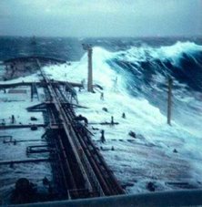
One of the interesting weather phenomenon that is being explored in the case of the s/v Sean Seamour is what we in the maritime community know as the 'rogue wave" or "freak wave". These waves are relatively large and spontaneous ocean surface waves, which are a threat even to large ships.

T
hese waves are more precisely defined as waves that are more than double the significant wave height (SWH), which is itself defined as the average height (trough to crest) of the one-third highest wave valid for a 12 hour period. During the last 20 years more than 200 supertankers or ships over 200 meters (656 feet) long, have sunk beneath these waves. This is somtimes known as "submarining". Rogue waves are thought to have caused many of these incidents. A ladened vessel enters the wave never to been seen again or in some cases is sunk by shear flooding of massive volumes of water or is just broken in half by the shear stress and weight of the wave and its actions.

Most of these waves occur far out at sea. But Andrea was providing us with a very interesting wave actions along the coast. Sea States along Florida, Georgia North and South Carolina were fluxing between a Sea State of 4 to 8.
We are currently investigating the possibility that the s/v Sean Seamour II was struck by one of these rogue or freak waves. We are also investigating whether or not the Hapag-Lloyd Paris Express was also in the same general area that the s/v Sean Seamour II was sailing at eventful day and was struck by the same wave.

Anyone with any information please feel free to post here or contact me.


"ENTRY LOG

By
Jean Pierre de Lutz
The vessels particulars
s/v Sean Seamour II
Last known location n34.04 /w72.24

Cape Cod, May 12th 2007


This is the log of actions and events driven by the only-subsequently named Sub-tropical Storm Andrea, leading to the sinking of s/v Sean Seamour II and the successful rescue of its entire crew on the early morning of May 7th 2007. We departed from Green Cove Springs on the Saint Johns River in the early morning of May 2nd, 2007.

Gibraltar was our prime destination with a planned stopover in the Azores for commissioning and eventually fuel. The vessel, on its second crossing was fully prepared and some of the recent preparations done by Holland Marine and skipper with crew were as follows:
Full rig check, navigation lights, new wind sensor, sheet and line check / replacement new autopilot, stuffing box and shaft seal, house battery bank, racor fuel filtering system, bottom paint, new rudder bearing and check, new auxiliary tiller, full engine maintenance, recertification of life raft and check of GPIRB (good to November 2007), update and replacement of all security equipment (PFDs, flares, medical, etc). Although paper charts were available for all planned destinations, with increased dependence on electronic navigational aids, two computers were programmed to handle both the MaxSea navigation software (version 12.5) as well as the Iridium satphone for weather data (MaxSea Chopper and OCENS).

A full electronic systems checkout and burn trial was done during the days prior to departure.
For heavy weather and collision contingencies cutter rigged Sean Seamour II was equipped with two drogues (heavy and light), collision mat, auxiliary electric pump, as well as extensive power tools to enable repairs at sea with the 2.4kva inverter. Operational process and use of this equipment was discussed at length with the crew in anticipation. Other physical process contingencies such as lashing, closing seacocks, companionway doors, etc. were equally treated. The 7 day weather GRIBs downloaded almost daily from April 25th onwards showed no inconsistencies, with the two high and two low pressure systems fairly balanced over the western Atlantic.

Only the proximity of the two low pressure systems seemed to warrant surveillance as the May 5th GRIB would indicate with a flow increase from the N,NO from 20 to 35 knots focused towards coastal waters.
Already on a northerly course some 200 nautical miles out, I maintained our navigational plan with a N,NE heading until increased winds warranted a more easterly tack planned approximately 300 nautical miles north of Bermuda towards the Azores. Wind force increased about eight hours earlier than expected and later shifted to the NE reaching well into the 60 knots range by early afternoon, then well beyond as the winds shifted. Considering that we were confronted with a sustained weather system that was quite different from the gulf stream squall lines we had weathered previous days, by mid afternoon I decided to take appropriate protective measures.

From our last known position approximately 217 nautical miles east of Cape Hatteras I reversed course, laying my largest drogue off the starboard stern while maintaining a quarter of the storm jib on the inner roller furl. This was designed to balance the boat's natural windage due in large part to its hard dodger and center cockpit structure. By late afternoon the winds were sustained at well over 70 knots and seas were building fast. I estimate seas were well into 25 feet by dusk but after adding approximately 150 feet of drogue line the vessel handled smoothly over the next eight hours advancing with the seas at about 6 knots (SOG).

By late evening the winds were sustained above 74 kts and a crew member recorded a peak of 85.5 kts.
Growing and irregular seas were the primary concern as in the very early hours of the morning the boat was increasingly struck by intermittant waves to its port side. Crew had to be positioned against the starboard side as both were tossed violently across the boat. Water began to accumulate seemingly fed through the stern engine-room air cowls. I believe in retrospect the goosenecks were insufficient with the pitch of larger waves as they were breaking onto the stern. At approximately 02.45 hours we were violently knocked all the way down to starboard. It appears that the resulting angle and tension may have caused the drogue line to rupture (clean cut), perhaps as it rubbed against the same engine-room air-intake cowl positioned just below the cleat.

The line was attached to the port side main winch then fed through the cleat where it was covered with anti-chaffing tape and lubricant. Before abandoning ship I noticed the protected part of the line was intact and extended beyond the cleat some five inches. Its position in the cleat rather than retracted from it also supports this theory.
After the knockdown I knew there was already structural damage and that we had lost control of the vessel. I pulled the GPIRB (registered to USCG documented Sean Seamour II) but I suspect that the old EPIRB from 1996 (Registered to USCG documented Lou Pantai, but kept as the vessel was sold to an Italian national in 1998) might have been automatically launched first.

I kept this unit as a redundancy latched in its housing on the port side of the hard dodger; it may have been ejected upon the first knockdown as Coast Guard Authorities questioned relatives with this vessel name versus Sean Seamour II. Herein lies a question that needs to be answered, hopefully it will be in light of the USCG report.
The GPIRB initially functioned but the strobe stopped and the intensity of the light diminished rapidly to the extent that I do not know if the Coast Guard received that signal. At the time were worried the unit was not emitting and I reinitiated the unit twice.

The unit sent for recertification with the life raft a few weeks prior had been returned from River Services. They had responded to Holland Marine that the unit was good until this coming November, functioned appropriately, and that the battery had an extra five year life expectancy. I will await reception of the Coast Guard report to find out if one or both signals was processed as all POCs were questioned regarding Lou Pantai and not my current vessel Sean Seamour II (both vessels had been / in the case of Sean Seamour II is US Coast Guard documented).


Expecting worse to come I re-lashed and locked all openings and the companionway. At 02:53hours we were struck violently again and began a roll to 180 degrees. As the vessel appeared to stabilize in this position I unlocked the companionway roof to exit an see where the life raft was. It had disappeared from its poop deck cradle which I could directly access as the helm and pedestal had been torn away. When I emerged to the surface against the boat's starboard (in righted port position) it began its second 180 degree roll.

As it emerged the rig was almost longitudinal to the boat barely missing the stern arch. Spreaders were arrayed over cockpit and port side, mast cleanly bent at deck level, forestays apparently torn away.
I ordered the crew to start all pumps. By their own volition they also cut out 2.5 gallon water bottles to enable physical bailing while I continued to locate the liferaft. It finally appeared upside down under the rig.

As its sea anchors and canopy lines were entangled in the rig and partially torn by one of the spreaders I decided to cut them away in an effort to save time and effort. I needed the crew below and had to manage the rig entanglement alone. This done I managed to move the unit forward and use its windward position to blow it over the bow to starboard, attaching it still upside down.
Below, water was being stabilized above the knees. The new higher positioned house battery bank was not shorted by the water level but the engine bank was flooded not enabling us to start the engine and pump from the bilge instead of the seacock.

In retrospect this was not a loss as having to keep one of the companionway doors off for bailing and to route the Rule pump pipe, the water pouring in from here and the through-deck mast hole were no match for the impeller' volume. Plugging the mast passage was also not a solution as it was moving and hitting violently against the starboard head wall and was dangerous to try to cope with.
I knew the situation was desperate but it was still safer to stay aboard than to abandon ship, let alone in the dark any earlier than necessary. Estimating daylight at about 05:30 hours, we needed to hold on for at least another two hours.

As the boat shifted in the waves it became increasingly vulnerable to flooding from breaking waves. One such wave at about 05:20 added about 18 inches of water, as the bow was now barely emerged these two factors triggered my decision to abandon ship. I exited first knowing that the raft was still upside down. In addition, some of the canopy lines still needed to be cut from the rig entanglement. In the precipitation the grab bag containing Iridium phone, VHF, GPS and all our personal and ship documents was lost.
As we boarded the now upturned raft it immediately flooded with the breaking waves and once unprotected from the wind by the hull structure was prone to turn over (no sea anchors nor canopy to roll over on).

Hypothermia was already gaining upon one of my crew and myself and our efforts to right and re-enter the raft drained strength. Periods spent lying on the overturned raft exposed to the wind seemed to further weaken us."
Sean Seamour II sank a few minutes after we abandoned ship fully disappearing from view after the second wave crest. We became aware of fixed wing overflight sometime between 06:00 and 07:00 hours and estimate that the Coast Guard helicopter arrived some time around 08:30 hours. As seemingly the most affected by hypothermia and almost unconscious the crew had me lifted out first.

It was a perilous process during which Coast Guard AST2 Dazzo was himself injured (later to be hospitalized with us). The liferaft was destroyed and abandoned by AST2 Dazzo as the third crew member was extracted. He also recouped the GPIRB which remained in USCG custody.
The emotions and admiration felt by my crew and myself to the dedication of this Coast Guard team is immeasurable, all the more so when hearing them comment on the severity and risk of the extraction, perhaps the worst they had seen in ten years (dixit SAT2 Dazzo).

They claim to have measured 50 plus foot waves which from our perspective were mountains. We measured after the first knockdown and before loosing our rig winds still in excess of 72 knots.
Also to be commended are the medical teams involved, from our ambulatory transfer of custody from the rescue team to the personnel awaiting us at Cherry Point Naval Hospital.

There the personnel under Director for Administration CDR Robert S. Fry sought not only to address our physical and medical trauma, but preempted the humanitarian crisis we were facing after all this loss and anguish by bringing in the disaster relief assistance of the American Red Cross to whom we owe the clothes, shelter and food that helped us survive this ordeal."


Additional Research:
Rogue Waves and Explorations of Coastal Wave Characteristics

More to come so standby!
RS

Wednesday, May 30, 2007

Where does the time go?


Its been a while since I blogged. Memorial Day weekend was a interesting weather weekend. Some interesting storms and one very note worthy one in east central Illinois along the Indiana boarder on the 25th at approximately 1500 hrs. What is being called a potential "gustnado" since this tornado happened on the leading edge of a cell and not the south west quadrant . NWS had issued a tornado warning for the area. I am checking with NWS to see what they are saying now. (Picture by Curt Coffey and Tom Skilling of WGN Weather Blog). GRLevel3, Stormlab and Interwarn were very active. Hopefully I will be able to write a little more in detail about some of the occurrences along the eastern seaboard during Andrea shortly.

For those of you "Pirates of the Caribbean" fans here is a note from MARAD on some real priates. Yes Dorothy, there are real live pirates! And they are worse than Hollywood wants to project!

MARAD Advisory – piracy off coast of Somalia The US Maritime Administration issued an advisory to operators of US-flag and effective US-controlled vessels warning of increased activity by pirates in waters off the east coast of Somalia. Pirates have recently launched armed attacks on merchant ships up to 190 nautical miles off Somalia. Mariners in the vicinity of Somalia are advised to maintain as much distance as reasonably possible off the coast and to be vigilant for approaches by pirate vessels. MARAD Advisory 07-02 .Thanks again Dennis!

Stay Tuned

Monday, May 21, 2007

Maritime News!

Bill introduced to establish ocean observation system Representative Allen (D-ME) introduced the National Integrated Coastal and Ocean Observation Act of 2007 (H.R. 2342) to direct the President to establish a National Integrated Coastal and Ocean Observation System, and for other purposes.

USCG Commandant supports UNCLOS accession The US Coast Guard issued a statement by Admiral Thad Allen supporting United States accession to the United Nations Convention on the Law of the Sea (UNCLOS). Accession to UNCLOS would promote critical US interests, such as protecting coastal assets and promoting freedom of navigation.

Thursday, May 17, 2007

T-Storms Race Across Chicago Area

Thunderstorms race across Chicago area for second day.


A line of powerful storms swept across the Northern burbs of Chicago yesterday late afternoon. For about two hours starting around 1530hrs and beginning north of Rockford strong winds battered the local area. NEXLAB radar indicated t-storms up to 30,000ft. Damage was reported in Mc Henry, Cook, DuPage, Kane and DeKalb counties.

Yesterday's storm reports;

000
NWUS53 KLOT 170044
LSRLOT

PRELIMINARY LOCAL STORM REPORT...SUMMARY
NATIONAL WEATHER SERVICE CHICAGO/ROMEOVILLE IL
744 PM CDT WED MAY 16 2007

..TIME... ...EVENT... ...CITY LOCATION... ...LAT.LON...
..DATE... ....MAG.... ..COUNTY LOCATION..ST.. ...SOURCE....
..REMARKS..

0528 PM TSTM WND DMG HUNTLEY 42.17N 88.42W
05/16/2007 MCHENRY IL LAW ENFORCEMENT

POWER LINES DOWN IN PARTS OF CITY.

0550 PM TSTM WND DMG SCHAUMBURG 42.03N 88.08W
05/16/2007 COOK IL AMATEUR RADIO

ROOF BLOWN OFF BUILDING AT WYSE RD AND MITCHELL RD.
SCHAUMBURG FIRE DEPT REPORT RELAYED BY HAM RADIO.

0555 PM TSTM WND DMG HANOVER PARK 41.98N 88.14W
05/16/2007 DUPAGE IL LAW ENFORCEMENT

LARGE TREE LIMBS DOWN IN HANOVER PARK. REPORT RELAYED BY
PUBLIC.

0600 PM HAIL PALATINE 42.11N 88.04W
05/16/2007 E0.75 INCH COOK IL TRAINED SPOTTER

PENNY SIZE HAIL.


&&
THIS WILL BE UPDATED IF/WHEN ADDITIONAL REPORTS ARE RECEIVED.
$$

NMARSILI

Maritime notes from Holland & Knight ;

National Maritime Day, honoring the contributions of the American Merchant Marine, consisting of civilians who have defended the freedom of the United States since 1776, will be celebrated on May 22. An Observance, sponsored by the Maritime Administration (MARAD), will be held at the FDR Memorial in Washington, DC on that date. That will be followed by presentation of the Shippers Award and a Wreath-laying Ceremony at the Washington Navy Yard. On May 21, the

EC – public funding needed for Galileo

The European Commission issued a press release stating that attempts to construct the Galileo satellite radio navigation system by means of private sector funding have reached a stalemate. Thus, it will be necessary to utilize public funding for the construction phase of the program. Galileo is intended to provide an alternative to the US-operated GPS and current plans call for the system to be in operation by 2012.

Wednesday, May 16, 2007

Storm Report for May 15, 2007 Chicago

The line of powerful T-Storms that raced across South Central Chicago yesterday blasted winds above 60mph. Rains totaled ch as much as 1.1 inch in Will County, Illinois. Here are the latest reports.

NWUS53 KLOT 161331
LSRLOT

PRELIMINARY LOCAL STORM REPORT
NATIONAL WEATHER SERVICE CHICAGO/ROMEOVILLE IL
830 AM CDT WED MAY 16 2007

..TIME... ...EVENT... ...CITY LOCATION... ...LAT.LON...
..DATE... ....MAG.... ..COUNTY LOCATION..ST.. ...SOURCE....
..REMARKS..

0300 PM HAIL COAL CITY 41.29N 88.28W
05/15/2007 M0.75 INCH GRUNDY IL CO-OP OBSERVER

HAIL OBSERVED FOR APPROXIMATELY 2 MINUTES. MOSTLY PENNY
SIZED. HAIL COVERED THE GROUND AND STRIPPED LEAVES OFF
TREES IN COAL CITY NEAR GARFIELD STREET AND ILLINOIS
ROUTE 113.

&&

$$

MERZLOCK

**********************************************************************
NWUS53 KLOT 161024
LSRLOT

PRELIMINARY LOCAL STORM REPORT...SUMMARY
NATIONAL WEATHER SERVICE CHICAGO/ROMEOVILLE IL
524 AM CDT WED MAY 16 2007

..TIME... ...EVENT... ...CITY LOCATION... ...LAT.LON...
..DATE... ....MAG.... ..COUNTY LOCATION..ST.. ...SOURCE....
..REMARKS..

0125 PM TSTM WND GST DWIGHT 41.10N 88.42W
05/15/2007 M60.00 MPH LIVINGSTON IL PUBLIC

60 MPH WIND GUST MEASURED AT DWIGHT, IL AIRPORT

0138 PM HAIL MORRIS 41.37N 88.43W
05/15/2007 E0.75 INCH GRUNDY IL TRAINED SPOTTER

PENNY SIZE HAIL.

0143 PM HAIL COAL CITY 41.29N 88.28W
05/15/2007 E0.88 INCH GRUNDY IL TRAINED SPOTTER

NICKEL SIZE HAIL REPORTED IN COAL CITY

0215 PM TSTM WND DMG PEOTONE 41.33N 87.80W
05/15/2007 WILL IL FIRE DEPT/RESCUE

1 MILE NORTH OF I-57 AND WILL-PEOTONE RD - A SEMI-TRUCK
TIPPED OVER. TREES AND LIMBS DOWN IN TOWN.

0230 PM TSTM WND DMG 5 SSE MANHATTAN 41.36N 87.95W
05/15/2007 WILL IL EMERGENCY MNGR

Tuesday, May 15, 2007

TORANDO WARNING - WILL COUNTY, IL CANCELED

TORNADO WARNING
INC091-MIC021-152115-
/O.NEW.KIWX.TO.W.0012.070515T2013Z-070515T2115Z/

BULLETIN - EAS ACTIVATION REQUESTED
TORNADO WARNING
NATIONAL WEATHER SERVICE NORTHERN INDIANA
313 PM CDT TUE MAY 15 2007

THE NATIONAL WEATHER SERVICE IN NORTHERN INDIANA HAS ISSUED A

* TORNADO WARNING FOR...
NORTHERN LA PORTE COUNTY IN NORTHWEST INDIANA
SOUTHWESTERN BERRIEN COUNTY IN SOUTHWEST MICHIGAN

* UNTIL 415 PM CDT(515 PM EDT)

* AT 312 PM CDT...NATIONAL WEATHER SERVICE DOPPLER RADAR INDICATED A
LINE OF SEVERE THUNDERSTORMS WITH STRONG ROTATION. THESE SEVERE
STORMS WERE LOCATED ALONG A LINE EXTENDING FROM 14 MILES WEST OF
MICHIGAN CITY TO 4 MILES WEST OF WESTVILLE...OR ALONG A LINE
EXTENDING FROM 6 MILES NORTHWEST OF PORTER TO 4 MILES WEST OF
WESTVILLE...AND MOVING EAST AT 35 MPH.

* LOCATIONS IN THE PATH OF SEVERE STORMS INCLUDE...
OTIS AND WESTVILLE...
PINHOOK...
WATERFORD...PINOLA AND TRAIL CREEK...
LONG BEACH...POTTAWATTOMIE PARK AND LA PORTE...
MICHIANA SHORES...MICHIANA AND GRAND BEACH...

IN ADDITION TO THE TORNADO...THIS STORM IS CAPABLE OF PRODUCING
DESTRUCTIVE STRAIGHT LINE WINDS IN EXCESS OF 70 MPH.

THE SAFEST PLACE TO BE DURING A TORNADO IS IN A BASEMENT. GET UNDER A
WORKBENCH OR OTHER PIECE OF STURDY FURNITURE. IF NO BASEMENT IS
AVAILABLE...SEEK SHELTER ON THE LOWEST FLOOR OF THE BUILDING IN AN
INTERIOR HALLWAY OR ROOM SUCH AS A CLOSET. USE BLANKETS OR PILLOWS TO
COVER YOUR BODY AND ALWAYS STAY AWAY FROM WINDOWS.

IF IN MOBILE HOMES OR VEHICLES...EVACUATE THEM AND GET INSIDE A
SUBSTANTIAL SHELTER. IF NO SHELTER IS AVAILABLE...LIE FLAT IN THE
NEAREST DITCH OR OTHER LOW SPOT AND COVER YOUR HEAD WITH YOUR HANDS.

LAT...LON 4191 8660 4178 8644 4166 8649 4159 8649
4153 8651 4152 8693 4172 8694 4176 8685

$$

TORNADO WARNING - WILL COUNTY IL

TORNADO WARNING
ILC197-152015-
/O.NEW.KLOT.TO.W.0004.070515T1933Z-070515T2015Z/

BULLETIN - EAS ACTIVATION REQUESTED
TORNADO WARNING
NATIONAL WEATHER SERVICE CHICAGO/ROMEOVILLE IL
233 PM CDT TUE MAY 15 2007

THE NATIONAL WEATHER SERVICE IN ROMEOVILLE HAS ISSUED A

* TORNADO WARNING FOR...
EAST CENTRAL WILL COUNTY IN NORTHEAST ILLINOIS...

* UNTIL 315 PM CDT

* AT 229 PM...A TRAINED SPOTTER REPORTED A TORNADO JUST SOUTH OF
UNIVERSITY PARK...MOVING NORTHEAST AT 35 MPH.

* THE TORNADO WILL BE NEAR...
BEECHER BY 240 PM...
CRETE BY 245 PM...

TAKE COVER NOW! IF NO BASEMENT IS AVAILABLE...MOVE TO AN INTERIOR
ROOM ON THE LOWEST FLOOR. MOBILE HOMES AND VEHICLES SHOULD BE
ABANDONED FOR MORE SUBSTANTIAL SHELTER. AVOID WINDOWS!

A SEVERE THUNDERSTORM WATCH REMAINS IN EFFECT UNTIL 900 PM TUESDAY
EVENING FOR NORTHEASTERN ILLINOIS.

LAT...LON 4146 8780 4130 8780 4131 8755 4146 8755

$$

WILSON


Chicago Makes the Record Book

Yes the Sun bathers were out in force on Chicago beaches Monday. Temperatures reached 2007’s highest levels. Southwest winds gusted to over 37 mph and brought the city’s earliest 90° temperature in almost 13 years. It was the first official 90° high since a 97° reading on Aug 2, 2006. Highs of 90° were also recorded at Midway Airport and Northerly Island on Chicago’s lakefront. The current along the lakefront was excessively strong and coming home from Northwestern University yesterday, I noticed Chicago Police massed at Howard Park staring out over the lake. It seems that a couple of guys decided to take a two man raft out for a trip. Well they were struggling to paddle back to shore and did get caught in the current and undertow and needed to be rescued by the USCG.

Guess spring has sprung!

This little note came in from Holland & Knight this morning.. Thanks Dennis!

NOAA – “Forecast” newsletter

The National Oceanic and Atmospheric Administration (NOAA) commenced publication of its “Forecast” newsletter. The goal is to keep the agency’s stakeholders aware of current issues and developments.

Here is the latest from NWS Chicago Extended.

NZUS51 KLOT 150804
WRKLFP
ILZ005-006-012>014-022-INZ001-152130-

CHICAGO METROPOLITAN FORECAST
NATIONAL WEATHER SERVICE CHICAGO/ROMEOVILLE IL
303 AM CDT TUE MAY 15 2007

.TODAY...NOT AS WARM. OCCASIONAL SHOWERS AND THUNDERSTORMS
LIKELY. HIGHS IN THE UPPER 70S. WEST WINDS 10 TO 15 MPH SHIFTING
TO THE NORTH TOWARD EVENING.

TONIGHT...MOSTLY CLOUDY. A 30 PERCENT CHANCE OF LIGHT SHOWERS IN
THE EVENING. COOLER. LOWS IN THE UPPER 40S. NORTH WINDS 10 TO
15 MPH.

WEDNESDAY...MOSTLY CLOUDY. A 30 PERCENT CHANCE OF LIGHT SHOWERS
IN THE AFTERNOON. COOLER. HIGHS IN THE MID 60S. NORTH WINDS 10 TO
15 MPH BECOMING LIGHT AND VARIABLE TOWARD EVENING.

WEDNESDAY NIGHT...MOSTLY CLOUDY WITH A 30 PERCENT CHANCE OF
LIGHT SHOWERS IN THE EVENING...THEN MOSTLY CLEAR AFTER MIDNIGHT.
LOWS IN THE LOWER 40S. LIGHT AND VARIABLE WINDS IN THE EVENING
BECOMING NORTHWEST AROUND 10 MPH AFTER MIDNIGHT.

THURSDAY...MOSTLY SUNNY. HIGHS IN THE UPPER 50S NEAR THE LAKE TO MID
60S WELL INLAND. NORTHEAST WINDS 10 TO 15 MPH.

THURSDAY NIGHT...MOSTLY CLEAR. LOWS IN THE MID 40S.

FRIDAY...MOSTLY SUNNY. WARMER. HIGHS IN THE LOWER 70S.

FRIDAY NIGHT...MOSTLY CLEAR. LOWS AROUND 50.

SATURDAY...PARTLY CLOUDY. HIGHS IN THE MID 70S.

SATURDAY NIGHT...PARTLY CLOUDY. LOWS IN THE LOWER 50S.

SUNDAY...PARTLY CLOUDY. HIGHS IN THE MID 70S.

SUNDAY NIGHT...PARTLY CLOUDY. LOWS IN THE LOWER 50S.

MONDAY...PARTLY CLOUDY. HIGHS IN THE MID 70S.

$$

RS


Monday, May 14, 2007

Illinois Outlook Next 24 Hours and Andrea

Well it could start to get interesting in Chicago! We'll see what develops. Jacksonville, Florida reporting surf at 6 to 8 feet with no beach closures yet.

FLUS43 KLOT 141726 AAA
HWOLOT

HAZARDOUS WEATHER OUTLOOK...UPDATED
NATIONAL WEATHER SERVICE CHICAGO/ROMEOVILLE IL
1230 PM CDT MON MAY 14 2007

ILZ003>006-008-010>014-019>022-023-032-033-039-INZ001-002-010-011-
019-142130-WINNEBAGO-BOONE-MCHENRY-LAKE IL-OGLE-LEE-DE KALB-KANE-DU PAGE-COOK-LASALLE-KENDALL-GRUNDY-WILL-KANKAKEE-LIVINGSTON-IROQUOIS-FORD-LAKE IN-PORTER-NEWTON-JASPER-BENTON-1230 AM CDT MON MAY 14 2007

THIS PORTION OF THE HAZARDOUS WEATHER OUTLOOK IS FOR NORTH CENTRAL
AND NORTHEAST ILLINOIS...AND NORTHWEST INDIANA.

.DAY ONE... THIS AFTERNOON AND TONIGHT

NO HAZARDOUS WEATHER IS EXPECTED AT THIS TIME.

.DAYS TWO THROUGH SEVEN... TUESDAY THROUGH SUNDAY

THERE IS A CHANCE OF THUNDERSTORMS TUESDAY INTO TUESDAY NIGHT.
THERE IS A SLIGHT RISK OF SEVERE THUNDERSTORMS SOUTH AND EAST OF A
LINE FROM OHARE AIRPORT TO PLAINFIELD TO SENECA TO DANA.

.SPOTTER INFORMATION STATEMENT...
SPOTTER ACTIVATION MAY BE NECESSARY ON TUESDAY.

Saturday, May 12, 2007

Subtropical Storm Andrea

Subtropical Storm Andrea continues to create havoc to shipping along the East Coast. Its present location places its center about 170 miles East of Daytona Beach, Florida. The system is re-organizing and could reform into a Tropical Storm. Buoy Station 41010 - Canaveral East -120NM East of Cape Canaveral is reporting wave height's of 4.5 feet with Wind Speeds of 15.5ktswith Wind Gusts of 19.4kts.

The US Coast Guard issued a Press Release stating that the Hapag-Lloyd Paris Express lost 21 containers overboard in the storm while on a voyage from Savannah to Norfolk. None of the cargo is listed as hazardous, although some Styrofoam packing material has washed ashore. The responsible party has engaged a contractor to remove the debris.

The United States Coast Guard continues its search for the sailboat
Flying Colours. The cutter "Tampa" along with a C-130 search aircraft, and J-Hawk helicopters have combined to search more than 10,000 square miles near where the boat's beacon was heard last Monday.

RS

Friday, May 11, 2007

Welcome to Robin Storm

After taking a long time and thinking about blogging, while reading the many interesting and zany storm related blogs. I decided that after 25 years of running onto ships, while everyone else was running off. I might as well have some fun and journal some of the adventures I get myself into. Especially with mother nature at her spectacular worse. I guess my biggest fear was my writing skills. I am a technical writer not a story teller. But the love of my life, convinced me that I would just do fine, as long as, I wrote just the way I verbalize. So I decided to give it a whirl.

I have the utmost respect for professional storm chasers and weather spotters, they perform a valuable and noble service to the public. They are some of the most unsung hero's I have ever encountered. Though I do admit that some of them are, one tree short of a hammock. I say that because some of us spot weather or chase as a secondary issue. Many in my business do not necessarily chase storms or spot weather as a choice. It's not like you have a choice when your in the middle of the pond and mother nature decides to make your day. Normally one that makes you wonder (many times using some very colorful metaphors) what your doing there in the first place. Most of the storm chasers I have encountered are a zany bunch and I do make the distinction between Professional, NOAA/National Weather Service and University Chasers who chase because of the science, while the others chase because, that's where the storms are. Though they are all a great group.

While I have chased shore-side, most recently spotting a twister in southern Mississippi. I consider myself a rookie. Though I am trained in radar operations and in basic meteorology I have been on only three shore-side chases. At Sea? Oh hell I lost count of how many times I broke my promise to God asking him to get me out of a heavy sea state. Nothing like standing on the bridge of a 750 ft container ship with one engine operational and watching a wave make your bow disappear, praying you don't submarine. For those of you who don't believe in God, I can't tell you what your missing. I am not ashamed to say that during these times I hum the "Saving Grace".

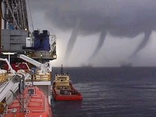
It is funny though. I have been asked how many twisters I have seen and when I say just three, most chasers just smile. But I smile when I ask them how many tornadic waterspouts, not fair weather waterspouts, they have seen. Most chasers and spotters forget that 71% of the earth is covered by water and most do not realize that sub-sea weather systems even exist. We only process thought on what we can see and sometimes only on one plane of thought. While many times what we can't see is far worse. I have seen clear sky's with a calm sea state and 200 feet below? A raging sub-sea storm. These type of storms we are now just beginning to understand. Mother nature is just fascinating and as dangerous as you can't imagine. Greensburg, Kansas was just the tip of Mothers powers and my prayers go to all in Greensburg

Most of the storm blogs on the web are shore-based. It is my hope that this blog will be a combination of both shore-side and at-sea reports. I am expected back at sea in late August. But for now I am getting prepared for a road trip in July.

Of course like anything else the devil is always in the details. And planning is key. So we are in the planning stages of our trip. Our SUV besides having the normal survival and first aid gear will be equipped with a JRC MK1500 portable radome radar and I use StormLab, GRLevel3, Interwarn and Digital Atmosphere as applications. We will also have a satellite phone available just in case. I also get a great deal of information from the four chaser list-servers I monitor. And yes as one WCM told me, great stuff, flame wars and all..

I am hoping that we will also have the pleasure of running into some other storm chasers on the road. Until then as this site develops, I hope I can provide its readers with some good data and some great pictures.

Your comments and assistance are always welcomed.

God Bless