Friday, October 31, 2008

Progress reported in UN-backed efforts to reduce pollution, emissions from ships

Progress reported in UN-backed efforts to reduce pollution, emissions from ships

The United Nations International Maritime Organization (IMO) has reported major progress on efforts to cut polluting and global warming emissions from ships, achieve more environmentally friendly recycling of vessels and prevent contamination from harmful organisms in ballast.

Under amendments to the so-called MARPOL (marine pollution) accords unanimously adopted by IMO's Marine Environment Protection Committee (MEPC) earlier this month, emissions of sulphur oxide (SOx), nitrogen oxide (NOx) and particulate matter from ships will be progressively reduced.

"The MEPC maintained momentum on the issue and made substantive progress in developing technical and operational measures to address such emissions, including the development of an energy efficiency design index for new ships and an energy efficiency operational index, with associated guidelines for both," the agency said in a news release.

According to a consensus estimate for 2007, CO² emissions from international shipping amounted to 843 million tons, or 2.7 per cent of global CO² emissions, as compared to the 1.8 per cent estimate in 2000. In the absence of regulation, such emissions were predicted to increase by a factor of 2.4 to 3.0 by 2050.

MARPOL Annex VI Regulations for the Prevention of Air Pollution from Ships entered into force in May 2005 and has so far been ratified by 53 countries, representing some 81.88 per cent of the gross tonnage of the world's merchant shipping fleet.

The MEPC discussed whether the application of measures to reduce or limit greenhouse gas emissions from ships should be mandatory or voluntary for all States. Several delegations spoke in favour of limiting mandatory reductions to those countries, mainly the more developed industrial nations countries listed in Annex 1 of the UN Framework Convention on Climate Change (UNFCCC).

But several other delegations said the regulatory framework should be applicable to all ships, irrespective of the flags they fly, noting that as three-quarters of the world's merchant fleet fly the flag of countries not listed in Annex I, any regulatory regime would be ineffective if it were made applicable only to Annex I countries.

On the issue of harmful aquatic organisms in ballast water, the MEPC adopted guidelines for ballast water sampling and approval of ballast water management systems as well as arrangements for responding to emergency situations involving ballast water.

It also agreed on a guidance document on minimizing the risk of ship strikes with cetaceans, such as whales. With regard to recycling, ships will be required to carry an inventory of hazardous materials, specific to each ship.

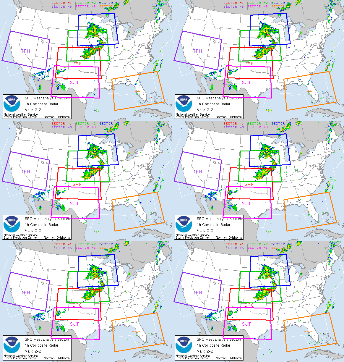
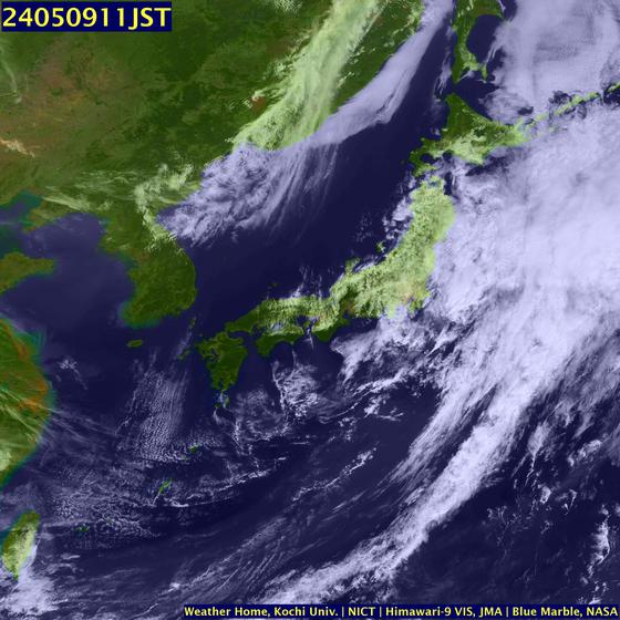
WEATHER NOTE

Emergency preparedness: Best-laid plans for worst-case disaster

By James Dowd

The message was simple and direct: Plan now to act later.

For about 150 business professionals at the second annual Emergency Preparedness and Incident Conference, the program couldn't have been more timely.

"In difficult economic times like these, companies try to stretch their dollars as far as possible and unfortunately, that means some don't invest in an emergency continuity plan," said Billy Freeman, communications specialist with Tennessee Task Force 1, an urban search-and-rescue team sponsored by the Memphis/Shelby County Emergency Management Agency.

"If it seems daunting to think about training people and implementing a comprehensive response program, then just take it a bit at a time. Just be sure to start somewhere."

That includes training employees how to respond in the event of disasters such as earthquakes, fires, floods and tornadoes, Freeman said. Companies should also maintain recovery plans with regular updates about how to resume business following a crisis.

The daylong conference, held recently at the FedEx Institute of Technology on the University of Memphis campus, featured a variety of disaster-preparedness booths and more than a dozen crisis-management and response seminars.

Organizers of the event, which was coordinated by the Mid-South Association of Contingency Planners, stressed that the best time to address an emergency is before one occurs, particularly in a region situated along the New Madrid fault line.

"In the best-case scenario, disaster planning is like insurance and you hope you never have to use it," said Ron Smith, the organization's vice president. "But you can't just close your eyes and hope for that. We don't preach gloom and doom; instead, we encourage responsibility and preparedness."

Shelby County Mayor AC Wharton, who delivered opening remarks at the conference, agreed.

"It used to be that contingency planning was something you stumbled into when there was nothing else to do," Wharton said. "Now more people are starting to plan for the unexpected and the question is not what if something happens but what might happen and what will we do when it does?"

Association leaders promote that discussion and hope more businesses -- especially smaller ones -- will join the conversation.

Founded in 2004, the group is the local chapter of the International Association of Contingency Planners. From the original 20 members, the group has more than tripled in size and is stepping up efforts to heighten public perception of disaster and emergency awareness.

"It's about having a strategy," said Damian Walch, one of the conference speakers and a nationally recognized expert in continuity and disaster planning. "We have to react differently from the way we did 10 or 15 years ago. The business supply chain is increasingly complex and it requires greater resiliency."

Gary Patterson, geologist and information-services director at the Center for Earthquake Research and Information at the UofM, praised the efforts.

"People don't like to think about this subject because it's something they can't control, but what they can control is being as prepared as possible," Patterson said. "We're doing a lot to inform people, but we've got a long way to go. Events like this help get the message across."

Most of the group's programs, such as the recent conference, are free. Annual dues are $80. The group's next meeting will be Nov. 12.

MARITIME NOTE

A ship graveyard


by JANET HOWITT of the ESG


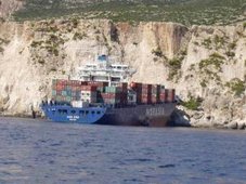
The ESG would first like to commend the efforts of emergency and rescue teams whose efforts secured the lives of the crew from the stricken vessel, Fedra in unbelievably difficult conditions.

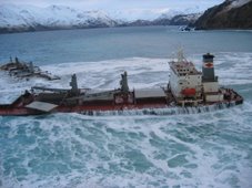
The sight of the massive metal structure brought to its knees at Europa Point, in what is fast becoming a ship graveyard has shocked and horrified all who have seen her split in two.

The area is in fact one of Gibraltar's most important ecological and historical sites and the ESG hopes that Govt plans to designate this area as an exclusion zone to all ships will go some way in avoiding certain types of accidents in the future. However that measure would not have avoided Fedra'66s crash and hopefully the ongoing police and maritime investigation will reveal some reason for this latest tragedy.

What is also of concern and has been raised by the ESG with Govt recently is the large number of vessels anchored in an off-limits zone on the eastern side of the Rock. This potential problem was also highlighted in the report into the Samothraki accident by the Maritime Administration. Several recommendations were made within that report into how ship movements and monitoring could be improved both from the Gibraltar port side and at cross border level. It is understood that the Gibraltar Govt will be applying all recommendations made.

It is hoped that authorities from both sides of the border will address the serious environmental challenges posed by the dense level of shipping activity in the Bay and avoid an ecological disaster.

Finally, the ESG has already notified the Minister for the Environment's offices that a growing number of volunteers are signing up to help clean the beaches of oil- it is a reminder yet again that there are many in the community who care and are willing to lend a hand in a time of crisis. We are now waiting for their call.

BACKGROUND:

THE REPORT INTO THE GROUNDING OF THE OIL TANKER 'SAMOTHRAKI' ON 17 MARCH 2007 MADE THE FOLLOWING RECOMMENDATIONS:

The Gibraltar Port Authority is recommended to:

1. Consider a port control policy aimed at providing a navigational assistance service.

2. Consider establishing a Southerly limit to the Eastern anchorage

3. Consider requiring all vessel anchoring within 3 miles of Gibraltar on the Eastern side to report to GPA with anchor position and basic ship information

4. Consider establishing an exclusion zone in the vicinity of Europa Point, up to 1 n.mile from the shore. 5. Consider requiring off-port limits transfers to be completed further offshore, and to the South East of Europa Point.

Managing Maritime Emergencies
Download Brochure

Identifying risk, planning and managing emergencies, crisis communication

Monday 24th - Wednesday 26th November 2008
Bonhill House, London, UK

Register Now Buy Papers


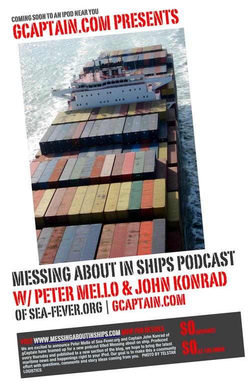
Messing About In Ships Podcast


Have a safe and enjoyable weekend!
RS

Thursday, October 30, 2008

Thunderous storm-chasing vacations

Thunderous storm-chasing vacations. From Tornado Alley to Australia, 10 twisted trips for weather junkies

By Jacquelyn Lewis
Forbes Traveler.com

This year, storm season in the United States was a particularly active one, with more than 1,000 twisters and countless storms that churned, crashed and flashed across the country. But not everyone in Tornado Alley—roughly defined as the vast landscape between the Rockies and Appalachian Mountains—was running away. Some weather-crazy storm chasers actually rushed toward Mother Nature's worst, clamoring to get an up close and personal look at the pulse-pounding action.

“There are a lot of adrenaline junkies out there,” says Roger Hill, a Denver-based storm chaser of more than 22 years. “A lot of people are just fascinated by severe weather.” He should know—for more than 11 years, he has been leading groups of them on storm-chasing vacations organized by Silver Lining Tours, a company he co-owns with fellow chaser David Gold.

Silver Lining is one of several companies that, for a few thousand dollars, will take you on the ride of your life, tailing twisters and tempests through Tornado Alley in a vehicle equipped with high-tech equipment. You'll get closer to the action than you ever could—or should—on your own.

Hill has seen interest in storm-chasing vacations explode over the past few years, with weather junkies from all walks of life—and from all over the world—signing on. In fact, if you want to join a 2009 tour, you’ll need to sign up now, as most companies’ offerings are filling up fast. If you’re new to the experience, prepare to be awed, especially the moment you see a tornado from less than a mile or two away.

“You can hear the roar, you can feel some of the wind, and you can see the debris flying,” Hill says. “The first time you see a big, violent tornado up close, it’s a life-changing experience. The power is amazing.”

Though it sounds scary, it's clearly not enough to scare away customers. Gregg Potter, lead meteorologist and president of F5! Storm Chasing Safaris, says at least half of that company’s business comes from repeat customers. “Some people come back for a sixth, even a seventh or eighth time.”

Tours range from a few days to a few weeks, and cater to a variety of interests. If you’re really curious about how wild weather forms, for example, you can take an educational storm vacation, such as Silver Lining’s Northlands Lecture Tour or Tempest Tours’ F5 Classroom Tour. Almost all storm tours include a little education on weather and chasing storms, but these go more in-depth, with detailed lessons and workbooks in addition to actual storm chasing.

What's the fun of seeing a tornado if you can't prove you were there? Shutterbug storm chasers should sign up for a photo tour that focuses on photography and includes expert instruction from professional weather photographers. If comfort is your main concern, F5! Storm Chasing Safaris offers luxury storm tours with smaller groups and cushy Suburban SUVs. And if your schedule is flexible and you like to fly by the seat of your pants, several companies have an on-call option, where customers sign up to be notified of last-minute mini-chases via email, just a few days before a storm is set to hit. In addition, some companies can arrange private, custom excursions upon request. The price tag for any tour usually covers the vehicle, guide and hotels, but not airfare or food.

While increasingly sophisticated technology such as mobile broadband internet and satellite radio has heightened tour guides’ ability to find the best storms, not all groups get to see a tornado. Roughly speaking, you have a 50 to 70 percent chance of encountering a twister, say the tour operators. “You might have one tour that sees 10 and the next might not see any,” Potter says.

Increase your odds by booking your trip during prime tornado time (May and June), taking longer expeditions and researching potential tour companies beforehand. You can also head to Canada and even Australia, where storm-chasing vacations are also on the rise. But there’s no guarantee—after all, unpredictability is one of the things that makes the tours exciting in the first place.

What you can count on is meeting new people, taking in gorgeous landscapes and experiencing some killer weather systems up-close. Virtually all witness some kind of severe weather, and most get to see the biggest, baddest supercell thunderstorms—the kind that can produce baseball-sized hail and 80-mile-an-hour winds.

“Everyone wants to see a tornado,” Hill says. “It’s the ultimate prize, but it should be the icing on the cake.”

WEATHER NOTE

DIRECTV and The Weather Channel Provide New Severe Weather Alerts and Localized Weather Applications

October 15, 2008 - DIRECTV's interactive customers now have multiple methods for receiving vital local weather information from The Weather Channel(R) (TWC).

New services include a severe weather alert product, ZIP code-specific weather information during the popular "Local on the 8s" segments, a "Local on Demand" TV service available while watching TWC and through the newly designed DIRECTV ACTIVE(TM) portal. The new interactive local weather services, which launched earlier this month on DIRECTV, include:

-- Alert Ticker - For certain severe weather conditions, TWC viewers will see the Alert Ticker appear at the bottom of their screen. This ticker will give them information on the current weather alert(s) and provide a link to the "Local On Demand" application to get more information.

-- "Local on the 8s" Application - DIRECTV viewers of The Weather Channel can now view the popular "Local on the 8s" segments for their specific locale. Presented six times each hour at :08, :18, :28, :38, :48 and :58 minutes past the top of the hour on The Weather Channel (not yet available on TWC HD), viewers can see current conditions, radar maps, details for the day's forecast and the seven-day forecast automatically for their local area. This content is presented with the iconic "Local on the 8s" jazz soundtrack.

-- "Local On Demand" Application - While watching TWC, DIRECTV viewers can access a menu of interactive weather features for their ZIP code including current conditions, the five-day forecast, regional radar maps, weather alerts and weather for up to five other cities they can 'save' as favorites - all while continuing to watch live TWC programming on the same screen. Additionally, DIRECTV customers will be able to access localized weather information for more than 40,000 ZIP code locations across the United States.

-- DIRECTV ACTIVE(TM) Application - The Weather Channel is now the featured provider of weather content on the newly designed DIRECTV ACTIVE portal providing similar weather information detailed in the "Local On Demand" application. Viewers can access this application by pressing the ACTIVE button on the remote.

"Working with partners to provide up to the minute localized weather content through new technologies has been a hallmark of The Weather Channel," said Becky Powhatan, executive vice president of distribution and business affairs and general counsel for The Weather Channel. "DIRECTV and its cutting edge applications are a natural fit for TWC, and DIRECTV viewers will reap the benefit, gaining access to the relevant weather information - including severe weather alerts -- on TWC during 'Local on the 8s,' 'Local On Demand,' or through the DIRECTV ACTIVE portal."

"DIRECTV has made a commitment to our customers to help them be better prepared for a weather emergency," said Eric Shanks, executive vice president, DIRECTV Entertainment. "Providing this new alert product plus the ability to pull up a variety of local on demand weather information from The Weather Channel are ways we hope to deliver on that commitment."

About The Weather Channel

The Weather Channel, a 24-hour weather network, is seen in more than 98 million U.S. households. The Weather Channel reaches more than 38 million unique users online per month through weather.com and products including The Weather Channel Desktop making it the most popular source of online weather, news and information according to Nielsen//Net Ratings. The Weather Channel also operates The Weather Channel HD; Weatherscan, a 24-hour, all-local weather network; The Weather Channel Radio Network, The Weather Channel Newspaper Services, and is the leading weather information provider for emerging technologies. This includes broadband and interactive television applications and wireless weather products including the most popular content site on the Mobile Web. In September 2008, The Weather Channel Companies were purchased by a consortium made up of NBC Universal and the private equity firms The Blackstone Group and Bain Capital. For more information, visit www.weather.com/press.

MARITIME NOTE

3 Brits saved by RNLI's new satellite system

The lives of three UK fishermen have been saved thanks to the RNLI's new and unique MOB Guardian man overboard and vessel locater alert system. This is the first time that the system has demonstrated its full effectiveness in helping to save lives in a real emergency situation.

The RNLI Operations Room in Poole, Dorset received a vessel overdue alert off Sark at 18:00, 24 June. After verification the alert was transferred to the agencies responsible for coordinating maritime search and rescue - first to Falmouth Coastguard, who then passed it to the Channel Islands Search and Rescue authority. The RNLI St Peter Port lifeboat from Guernsey was then tasked to search for the missing fishing vessel, Guyona.

Using the last MOB Guardian verified position and taking into account weather and tides, the RNLI lifeboat worked out the likely position of the fishing vessel. At the time the lifeboat was on exercise only 12 miles away from the predicted position and the fishermen were located in a liferaft at 18:50, 25 minutes after the lifeboat was alerted.

The MOB Guardian system, which has been developed by the RNLI gives an early alert to an emergency, helps reduce search time and provides the rescuers with an up to date position for the vessel or man overboard by satellite. It means search and rescue agencies including RNLI volunteer crews on lifeboats don't have to start a search with little or no information about the location of the casualty. If a single-handed fisherman falls over the side of their vessel the system will automatically alert search and rescue agencies and can also shut down the boats engine remotely.

A fob can also be worn incorporating a panic button, so should a crewmember become ill or caught in machinery, they can easily request help. The system is confidential so location information about a particular vessel is not available publicly.

RS

Wednesday, October 29, 2008

2008 tornado season could blow away records

2008 tornado season could blow away records

(USA TODAY)
The 2008 tornado season is on track to set a record for the number of tornadoes in the USA, according to National Weather Service data.

Through July, 1,390 tornadoes were officially recorded in the first seven months of a year - the most ever. The annual record for tornadoes in the USA is 1,817, set in 2004.

"This year, every month has been above average for tornadoes," says Greg Forbes, of the Weather Channel.

"The 123 deaths so far this year are the second most in the Doppler-radar era, behind only 1998, when tornadoes killed 130," Forbes says.

Official numbers from the weather service's Storm Prediction Center since Aug. 1 aren't available yet, but preliminary reports for the period since then show as many as 300 tornadoes could be added. On top of that, October and November are usually very active for tornadoes.

"We tend to see a peak in the central Plains and Midwest in October, and the Southeast USA in November," says meteorologist Gregory Carbin at the Storm Prediction Center in Norman, Okla. This month, the center says there have been 17 preliminary reports of tornadoes. Preliminary reports must be checked for duplication.

The number of tornadoes this year already is well above the 1,270 tornadoes the nation normally sees in a year, according to the National Weather Service.

"2008 will compete with 2004 as far as total numbers for the year," Carbin says. "There's a good chance that 2008 will see the greatest number of observed tornadoes on record."

February saw 148 tornadoes, by far a record; the February average is 28, Forbes says. May's 460 tornadoes made it the third most active May on record.

"The pattern in May and June was quite active" Carbin says. "We'd have two to three strong storm systems a week."

Although the number of reports has risen sharply since the early 1990s, Forbes says many of the weaker tornadoes probably would not have been recorded in earlier decades. Reliable tornado records in the USA go back to 1950.

An increase in national Doppler radar coverage, population sprawl into previously little-occupied areas and greater attention to reporting have contributed to the rising number of tornado reports, according to the National Climatic Data Center.

WEATHER NOTE

Format Change for Terminal Aerodrome Forecasts (TAFs) From 24 Hour Format to 30 Hour Format: Effective November 5 2008.


MARITIME NOTE

From Freaque Waves....

Friday, October 10, 2008

Another small boat capsizing ascribed to a freaque wave


Similar story, different part of the world oceans. This time it happens in Victoria, Australia. According to The Standard:
A CATAMARAN dubbed 'Battle Cat' felt the full fury of the sea when it was capsized and destroyed off The Flume yesterday.

The catamaran was travelling west 300 metres off the coast from Granny's Grave to The Flume at 5.30pm when a strong wind dropped and a freak wave capsized the boat.

The occupants of the vessel, Warrnambool's Kevin Chisholm, 26 and Jack Curwen-Walker, 19, escaped from the wreckage relatively unscathed.

The bad news is that's another case ascribed to a freaque wave with no particular details. The good news is that both boaters are "escaped from the wreckage relatively unscathed." Thanks be to God!

NOAA – new GPS reference stations added

The National Oceanic and Atmospheric Administration (NOAA) issued a news release stating that it recently incorporated 43 new GPS tracking sites into the Continuously Operating Reference Station (CORS) network. These GPS correctors enable users to determine three-dimensional locations with an accuracy of a few meters. (10/8/08).


RS

Tuesday, October 28, 2008

Hurricanes, high winds and heavy seas in the Gulf of Mexico

Hurricanes, high winds and heavy seas in the Gulf of Mexico

October 13, 2008 (Computerworld) When Lance Gibson talks about a storm knocking out his systems, he doesn't mean the infamous worm. He might be referring to the latest hurricane to sweep through the Gulf of Mexico or to the lightning accompanying a vicious thunderstorm.

Gibson is the offshore infrastructure communications supervisor for Chevron Corp.'s oil fields in the Gulf of Mexico, overseeing the IT needs of the company's offshore production facilities as well as its onshore support centers.

"Basically, I'm responsible for the entire infrastructure delivery," he says, "from the servers onshore all the way to the microwave, wireless and satellite communications we use for our voice and data communications offshore." We spoke with Gibson in mid-August; joining the conversation was Chevron public affairs representative Qiana Wilson.

A couple of weeks after our conversation, Hurricane Gustav provided a dramatic reminder of the kinds of situations Gibson has to deal with. Chevron and other companies with facilities in the Gulf evacuated their workers and shut down their oil platforms in advance of the threatening storm.

Once Gustav passed, Chevron began assessing its facilities and planning on remobilization of personnel, but Hurricane Ike put an end to that and forced another evacuation. At the time of this writing, Chevron reports that although several of its platforms were toppled by the storms, the company has once again started remobilizing its personnel.

Where are the offshore oil facilities that you support?

Gibson: We support the entire Gulf of Mexico region, from offshore Texas to offshore Alabama, whether our operations are on the OCS [Outer Continental Shelf] or in the deepwater areas of the Gulf of Mexico. That includes all of our offshore production platforms and drilling rigs, as well as our onshore operations that pertain to our Gulf of Mexico business units.

Gulf of Mexico

[Editor's note: The Gulf measures about 1,000 miles east to west and more than 500 miles north to south from Louisiana to the Yucatan Peninsula.]

How many installations are there?

Wilson: We don't like to say how many offshore installations we actually have. But I can tell you that Chevron is the largest leaseholder in the Gulf of Mexico shelf.

How far offshore is the farthest one?

Wilson: Right now, the farthest offshore is [the platform named] Genesis, which is about 150 miles from New Orleans. When Tahiti and Blind Faith come online, they'll be still further out and in deeper water.

NOAA map of oil platforms in Gulf of Mexico
The Gulf of Mexico has around 4,000 active oil and gas platforms. Click to view larger image.

How deep?

Gibson: The water depth can range from 10 feet near the shore all the way to 3,000 or 4,000 feet in the deeper waters. We're constantly moving out deeper.

How many people work on each platform?

Wilson: It varies from platform to platform; we don't really like to divulge that information.

Do you travel around from platform to platform, or are you stationed on land?

Gibson: I'm stationed on land -- my home office is here in Lafayette, Louisiana. My group is primarily stationed on land also.

We take a tiered, or layered, approach to support. We do most of our troubleshooting "on the beach," and if we cannot resolve the problem, then we'll dispatch one of our technicians offshore. But we try to do most of our support from onshore, to save money.

What's the communications setup on the platforms?

Gibson: A typical facility will have a wireless LAN installed, with all your standard network gear -- routers and switches and all that. And then they have microwave and VSAT [Very Small Aperture Terminal] satellite communications systems. But we house our servers on land, in either our Lafayette or Covington [Louisiana] locations.

Chevron's Genesis oil platform
Genesis, currently Chevron's farthest offshore oil platform. Click to view larger image.

What kind of data travels over your network?

Gibson: Mostly your typical business data -- Microsoft Word, Excel, that sort of data. And then we have specific application data -- real-time drilling information, automated monitoring of the status of the platform and so on.

What's the biggest challenge you face?

Gibson: Trying to do wireless communications over water. Moving voice and data via wireless connectivity over water poses a lot of difficulties. The technology is there, but it can be done with greater reliability in other environments than in the tropical environment we have here in the Gulf.

For one thing, the heat is a big concern. All of our systems are in controlled environments, of course, but we have to ensure that those environments are operating on a daily basis. Summer temperatures are in the mid- to upper 90s, and the equipment on the platforms is surrounded by steel, which heats up in the sun and magnifies the effect.

Salt's another issue. When we transport equipment, it's subjected to salt air. The salt attaches itself to the circuitry and corrodes it.

microwave antenna
A microwave antenna on Genesis.
Click to view larger image.

But probably our biggest problems with the environment have to do with [specific weather conditions]. In the spring and fall, we have a lot of issues with fog. The network relies primarily on microwave communications, and weather conditions can disrupt the signal between two physical connection points and cause our networks to fade in and out. Rain, too, can cause fading issues with our backup satellite systems.

We also have temperature-inversion problems. With the Mississippi River bringing cold water down from the north and dumping it into the warm water of the Gulf, it causes a lot of temperature inversions [when warmer air sits on top of cooler air]. They distort the microwave frequencies, so the connections drop in and out.

And then there's lightning -- that causes us a lot of trouble on our offshore installations. We've got a steel platform sitting out in the middle of the open ocean, so it attracts lightning. If you're not properly grounded -- and grounding equipment to a facility and then grounding the facility itself is definitely a challenge -- you can lose your equipment entirely.

Is the wave motion a problem?

Gibson: For our shelf platforms, that's not really a concern. Those are fixed-leg platforms -- they're sitting on the sea floor. But our deepwater facilities are primarily floaters, and microwave communications need a fixed line of sight. We have been able to establish microwave communications using a floating facility, but it does have its issues.

There's a new technology we're looking at deploying that we hope will help fix these issues. It uses a stabilized antenna mount that will actually move with the platform. It's an approach that's already used in VSAT communications. Cruise liners, for example, have stabilized units that stay locked onto the satellite no matter how the boat is moving. This would act in the same manner -- as the platform moves, the mount for the microwave dish would compensate and hold its line of sight with whatever it's shooting to.

stabilized VSAT antenna inside a radome
A radome, or weatherproof enclosure for radar antennas, protects a stabilized VSAT antenna on Genesis.

What about the hurricanes?

Gibson: Hurricanes are events that pass through and in a few days, they're gone. Sometimes they wreak havoc, and sometimes they don't. But they're weather events that pass through, unlike the other, ongoing issues.

When we have weather events, whether it's a major hurricane or a simple thunderstorm, we just have to wait for them to move out of the way so we can get back out there to assess what just happened to us. First, we have to see if the platform still exists. Then, the high winds -- even from a thunderstorm -- may have blown the microwave antennas right off the platform, or just blown them out of alignment to the next platform. We might have to go back out and reposition the dish.

Hurricane Ike satellite image
Clouds from the recent Hurricane Ike fill the Gulf of Mexico; rainfall data is superimposed.
Click to view larger image.

When that happens, do you have to go out and physically inspect each one, or is there another way to determine what the problem is?

Gibson: That's a tough question. It all depends on the platform. If the platform has a backup communications system, typically a satellite system, we're able to see the platform and make some assessment of what just happened to the primary communications. Naturally, you want to make just one trip with all the right equipment.

But not all platforms have satellite backups. So if there are still personnel out there, we'll rely on them to tell us -- we'll ask them to go look at it and try to describe what it looks like, so we can make some determination and then make a trip out.

How are they communicating with you if all the communications are out?

Gibson: We still have other ways. We have a very extensive two-way radio system, so they may be talking to the platform next to them, and that platform's relaying the information to us. We also have handheld satellite phones, and we're able to get in touch with the field that way.

So what's your work schedule like?

Gibson: We are a 24/7/365 support group. Our industry does not go to sleep -- our production facilities still flow oil and gas at night, and our drilling operations are drilling 24 hours a day. So we have to be readily available to support their needs during any crisis they might have, at any time.

We typically work a normal workday, but we have folks on call after hours. And we officially work a 40-hour week, but I'd say 50 to 60 hours is more of a typical week for me or most of the people in our IT group.

I don't think that's going to come as a surprise to Computerworld readers.

Qiana Wilson: We do offer 9/80 compressed workweeks. In other words, if you choose to, you can work nine hours a day and have every other Friday off.

Gibson: So in a two-week period, you work nine days rather than 10 days. It should be a worldwide standard. Four tens would be even better.

Wilson: I'm working on that.

Monitoring software for Genesis
Oil platform monitoring software.
Click to view larger image.

How long have you had your position?

Gibson: I've been in this position for four years, but I've worked in IT with Chevron for 27 years. Actually, 27 years ago, it really wasn't IT. I'm a former Tenneco employee, and when Chevron acquired us in the '80s, we were just touching on information technology.

At the time, we were concerned more with the geological and geophysical support roles, so I was in more of a data management position. I moved from data management to applications support and programming, and from there into the infrastructure roles.

What's the most outrageous thing that's happened to you in this job?

Gibson: I would have to say the 2005 hurricane season. We were just coming out of the 2004 season, with a few bad ones in Ivan and Dennis. Then the '05 season started early, in July.

As the season progressed and built up into the Katrina/Rita-class hurricanes, we lost better than 90% of our communications infrastructure offshore. We lost our main office in New Orleans, and we lost a lot of the communications that went into that city.

Hurricane Rita's path and rainfall accumulation
Hurricane Rita's 2005 path and rainfall accumulation. Click to view larger image.

[Editor's note: See Timoney Group's Google Map of the Gulf oil platforms that were damaged or destroyed by Hurricanes Katrina and Rita.]

Reconnecting our facilities and reestablishing communications took us all the way into the early part of 2007. We had to stop working on other optimization efforts we had going on just to focus on re-establishing communications to our environment offshore. It was definitely a big challenge for this group -- in fact, we're just really coming out of it now.

What's the biggest thing you've learned from your work?

Gibson: I would say it's the constant change in the oil industry. We're always looking to make ourselves more efficient. We're constantly moving out further and further into deeper water, so we're always having to look for technology to adapt to those environments. There's just no room for complacency. We have to be able to adapt and adjust.

The other thing I've learned is that in IT, you tend to want to chase technology a lot because you like the new gadgets. But the oil industry is the wrong place to chase technology. We need good, stable communications and infrastructure so we can keep our business operating. Chevron prides itself on being a very technological company. We don't lead, but we follow very closely.

Jake Widman is freelance writer in San Francisco.

WEATHER NOTE

Seminar addresses businesses preparing for disasters

GREEN BAY — Some businesses owners don’t believe a disastrous event will happen to them and their business.

And, while many equate disasters to earthquakes, hurricanes and terrorist attacks, disasters come in many forms. Fires, floods and tornados are the most common events in this part of the country, but the Ellison Bay gas explosion was a reminder of the unseen hazards present in every-day life.

The University of Wisconsin-Green Bay and the Door County Health Department are holding a regional emergency preparedness conference on Nov. 14, at the Landmark Resort in Egg Harbor.

“Survival Against the Odds: Business Disaster Planning” will give business owners the tools to guide them through the recovery process.

Surveys show, 30 percent of businesses are not prepared for the unexpected. Nearly 60 percent of businesses say they have plans, but only 41 percent of them have even tested them.

Participants will learn from Lisa Pentony, Wisconsin pandemic influenza expert, what the chances are for a flu pandemic.

Don Miller from Infinity Technology will give an update on how to keep business records safe.

Lenora Borchardt, president of Emergency Planning, Training & Exercise Consulting (EPTEC), will conduct an interactive workshop teaching participants how to do emergency continuity planning.

Fear of Thunderstorms: Three Simple Ways To Overcome Your Phobia Of Thunderstorms

We’ve all experienced thunderstorms in our lives. Some people find the loud noises and flashes of light exhilarating - heck, there are even storm chasers out there - but quite a lot of other people are disturbed and worried, even scared, of thunderstorms.

If you’re in the second group and have a phobia about thunderstorms, what can you do to help overcome your fear?

1. Learn to relax

This likely won’t be something you’d start learning at the peak of a thunderstorm, the deep noise of thunder echoes all around. But when you’re not in the middle of a thunderstorm, start to learn how to relax yourself. Weirdly, it takes effort to relax properly (most likely because our modern way of life does its level best to make sure we don’t ever relax). But with a little bit of practice, you’ll soon re-learn the trick of being able to relax whenever you want to. If that’s not an option at the moment, put your favorite music on your MP3 player, draw the curtains and concentrate on the music instead of nature’s display outside your home.

2. Face your fear

Ouch! This probably sounds difficult to do. But our fear usually isn’t rational, so when you greet your fear in person, you’re very likely to find your fear turns around and runs away. If your fear takes the form of a nagging voice in your head, don’t forget that it’s not a real voice - you’re creating it. So have fun with it rather than being scared by it. Change the voice so it sounds like a cartoon mouse. Spray paint it like a teenage graffiti artist would. Anything to make fun of the fear you’re creating. Sounds daft? Try it and see how well it works!

3. Get some help

Maybe a work colleague or a trusted friend to talk to - vocalizing our fears often helps expose them for the imposters they are. Or get hold of a hypnosis fear of thunderstorms MP3, specially designed to help you. These tracks work very well and are easily affordable. Get your instant download of a hypnosis for thunderstorms track here.

MARITIME NOTE

Warming likely to affect fishing, shipping industries

A tug guides a freighter to a Maumee River dock, where shipping is dependent on frequent dredging of the channel.
( THE BLADE/DAVE ZAPOTOSKY )

Walleye and yellow perch - the backbone of the Great Lakes region's multibillion dollar recreation and tourism industry - will likely be harder to catch as the lakes warm.

Algae will proliferate, sucking more oxygen from the water. Walleye and yellow perch are two cool-water species that likely will be out-competed for food by warm-water fish. Lake trout and brook trout are two others.

And the issue that scientists now view as the No. 1 threat to the ecological balance of the lakes - invasive species - will likely get worse as shipping seasons are extended and more exotic fish adaptable to warmer water enter the lakes.

The devastation, though, could be overshadowed by what happens to the shipping industry if lake levels become chronically lower, as predicted under the current regime of climate-change scenarios.

The two issues could work in tandem to wreak havoc on the region's economy.

Lake levels have risen and fallen in 30-year cycles since at least 1860, records show, but a study last fall issued by 75 area scientists from nearly 50 government, business, academic, and public-interest groups claimed warming and evaporation trends could cause Lake Erie water levels to drop 3.28 feet to 6.56 feet by 2066.

The estimates were based on findings by the Intergovernmental Panel on Climate Change, the world's most prestigious group of climatologists.

A subsequent paper that appeared in Environmental Science & Technology suggested Lake Erie and Lake Ontario water levels will become largely dependent on the rainfall they pick up from additional hurricanes and tropical storms. More violent weather is anticipated as the climate warms. Lakes Superior, Michigan, and Huron are too far north to pick up substantial amounts of rain from storms, the report stated.

Every inch lake levels fall affects the shipping industry and its economy by millions of dollars a year. That's especially true in Toledo, the most heavily dredged harbor in the Great Lakes.

"I don't think there has been much thought put into it by anybody," said Scott Thieme, chief of the U.S. Corps of Engineers' Great Lakes hydraulics and hydrology office.

He said he's aware of forecasts for water-level declines and perplexed why the government hasn't taken the issue more seriously, given what's at stake.

A big enough drop in water could even affect the future of the U.S.-Canada tunnel between Detroit and Windsor, he said.

Even now, the Corps of Engineers spends $20 million a year to dredge 4 million cubic yards of sediment from all Great Lakes harbors and channels, the equivalent of 400,000 truckloads of soil.

Nearly a quarter of all Great Lakes dredging occurs in the Toledo area. The 800,000 to 900,000 cubic yards of silt removed from the Toledo shipping channel in a typical summer is about three times as much as that taken from Cleveland-area waters.

The silt is mostly northwest Ohio farm soil that was blown or carried into the Maumee River by rain.

The solution isn't simply more dredging.

The Corps of Engineers is struggling to find places to put dredged silt from the Toledo shipping channel.

About two-thirds of it is redeposited in Lake Erie, a practice that Michigan and Ohio have been trying to get the federal government to phase out since the 1980s. The states say open-lake dumping hurts the region's fishing industry by muddying the water. But nobody has offered plans to build a confined disposal facility on land, either, because of the projected $200 million cost.

There is a bigger problem in the Detroit River, where only so much more dredging can occur before hitting bedrock. The river bottom was blasted in the 1920s and 1930s for a shipping channel. Blasting it deeper today would be a multibillion dollar project.

Toledo is one of several harbors with pipelines beneath their shipping channels. The lines carry chemical products, natural gas, as well as electrical, phone, and fiber optic cables. The cost of relocating those would be astronomical.

Even if relocating pipelines and blasting deeper through the Detroit River bedrock became viable, there "would be an awful lot of concern and resistance for environmental issues that there weren't years ago," Mr. Thieme said.

The Great Lakes region accounts for 70 percent of the nation's steelmaking capacity, 70 percent of its automobile production, and 55 percent of all heavy manufacturing. But it hasn't been moving cargo for such manufacturing as efficiently as it could.

Three of every four vessels leave their docks "light loaded" because of the lack of channel depth, according to testimony delivered to the House subcommittee on Energy and Water Development last year by James Weakley, president of the Lake Carriers' Association.

The 63 U.S.-flagged vessels represented by the association leave behind more than 8,000 tons of cargo per trip for every inch of lost channel depth.

Eight thousand tons of iron ore is enough to build 6,000 vehicles. Eight thousand tons of coal is enough to produce three hours of electricity for the Detroit metro area. And in the housing industry, 8,000 tons of limestone is enough to build 24 homes, according to Mr. Weakley's testimony.

"We might not lose the Port of Toledo, but it would need to accommodate wider ships or be bypassed," said Frank Quinn, a retired National Oceanic and Atmospheric Administration hydrologist who has studied lake levels since the 1960s.

EMSA Assists in Spanish Oil Recovery Operations

Source: EMSA

In the late evening on Friday 10th October, after two ships ran aground and spilled oil in heavy weather off southern Spain, the Spanish authorities requested the assistance of EMSA. As a result, the EMSA contracted vessel Bahia Tres, which is operated by Mureoil and operates in Algeciras Bay, was converted into an oil recovery vessel within hours and put at the disposal of Spanish maritime safety organisation SASEMAR.

Full text available here & in the Press Releases section of this website.


RS

Monday, October 27, 2008

Bays On US Gulf Coast Vulnerable To Flooding

Bays On US Gulf Coast Vulnerable To Flooding

ScienceDaily (Oct. 14, 2008) The most comprehensive geological review ever undertaken of the upper US Gulf Coast suggests that a combination of rising seas and dammed rivers could flood large swaths of wetlands this century in one or more bays from Alabama to Texas.

The findings, which will be presented at next week's annual meeting of the Geological Society of America in Houston, stem from bayfloor sediment samples, radiocarbon tests and seismic surveys compiled over 30 years.

"In terms of sea-level increases and river sediments flowing into the bays, we're rapidly approaching a time when bays will face conditions they last saw in the Holocene, from about 9,600 until 7,000 years ago," said lead researcher John Anderson, the W. Maurice Ewing Professor in Oceanography and professor of Earth science at Rice University. "That period was marked by dramatic and rapid flooding events in each of these bays -- events that saw some bays increase their size by as much as one-third over a period of 100 or 200 years."

Anderson is presenting the findings at next week's annual meeting of the Geological Society of America (GSA) at Houston's George R. Brown Convention Center. Anderson said the magnitude of flooding seen in bays during the Holocene -- the geological epoch that began 10,000 years ago -- would be noticeable and apparent, even on a year-to-year timescale.

"If you lived at the head of Galveston Bay, near Anahuac (Texas), you could see the bayhead move northward by as much as the length of a football field each year," Anderson said.

Anderson and colleagues, including Antonio Rodriguez of the University of North Carolina at Chappell Hill, compiled their research in a new 146-page monograph published by the GSA, "Response of Upper Gulf Coast Estuaries to Holocene Climate Change and Sea-Level Rise."

Their findings stemmed from an analysis of 30 years of data from hundreds of bayfloor sediment samples, radiocarbon tests and seismic surveys from Galveston, Matagorda and Corpus Christi bays in Texas, Mobile Bay in Alabama, Calcasieu Bay in Louisiana and Sabine Lake on the Texas-Louisiana border.

"There is no question that sea levels are rising in this region at a rate today that approaches what we saw in the Holocene," Anderson said.

He said the Holocene was also marked by alternating wet and dry periods upstream, particularly in central and western Texas. There was significantly less sediment flowing into the bays during the dry periods, and the researchers found that the most dramatic flooding events occurred when less sediment was flowing into the bays at the same time that sea levels were rising faster than four millimeters per year.

Anderson said that's a particularly troubling finding because several recent studies have confirmed that the rate of sea-level rise along the Gulf Coast has doubled in the past century to a current rate of about three millimeters per year. At the same time, the installation of dams upstream has slashed the amount of sediment flowing into every southern U.S. bay.

"Our research paints a pretty clear picture of what happened in these bays the last time they encountered the circumstances that we expect to see during the coming century," Anderson said. "Our hope is that policymakers will take note of the potential danger and take steps to help alleviate it."

For example, Anderson said it doesn't make environmental sense to keep a navigation channel open between the lower Trinity River and upper Galveston Bay because the channel diverts the sediment that is flowing into the bay, preventing it from replenishing the upper bay wetlands near Anahuac.

"Now that we're aware of the dangers, there are clearly things we can do to try and avoid them," he said.

WEATHER NOTE

NOAA: Ninth Warmest September for Global Temperatures

October 15, 2008

The combined global land and ocean surface average temperature for September 2008 tied with September 2001 as the ninth warmest since records began in 1880, according to an analysis by NOAA’s National Climatic Data Center in Asheville, N.C.

Temperature Highlights

  • The combined global land and ocean surface temperature for September was 59.79 F — this is 0.79 degree F above the 20th century mean of 59.0 degrees F.
  • Separately, the global land surface temperature was 54.50 F — this is 0.90 degree F above the 20th century mean of 53.6 degrees F, tying September 2004 as 11th warmest on record.
  • The global ocean surface temperature of 61.86 F tied September 2001 as seventh warmest on record and was 0.76 degree F above the 20th century mean of 61.1 degrees F.

Global Highlights for September

  • Arctic sea ice coverage during September was at its second lowest extent since satellite records began in 1979, according to the National Snow and Ice Data Center. Average ice extent during September was 1.80 million square miles, which is 34 percent below the 1979-2000 average and is part of an 11.7 percent decline in extent per decade over the past 30 years. The record lowest extent, set in 2007 was 1.65 million square miles.
  • In early September, Hurricane Gustav impacted the Caribbean. Flooding associated with Hurricane Hanna claimed more than 500 lives in Haiti. In the middle of the month, Hurricane Ike claimed about 145 lives, many in Haiti. Near the end of September, Hurricane Kyle brought torrential rain and flooding to Puerto Rico and Hispaniola before heading north. It made landfall in Nova Scotia, Canada as a Category 1 hurricane.
  • In the Pacific, Typhoon Sinlaku brought flooding to the Philippines before striking Taiwan and Japan. Parts of Taiwan received more than 40 inches of rain. Then, Typhoon Hagupit hit the Philippines and Taiwan before making landfall in southeastern China with winds of 121 mph. Other typhoons included: Super Typhoon Jangmi, which made landfall in Taiwan, with 130 mph winds. Jangmi was the most intense tropical cyclone and first Category 5 storm in any basin during 2008.
  • Heavy rain across southern Chile spawned flooding and mudslides that claimed four lives and damaged more than 10,000 homes. Severe storms in the United Kingdom brought widespread flooding that forced the evacuation of thousands of residents and claimed six lives. Heavy downpours across northern Iraq and Iran destroyed several hydroelectric facilities and claimed 16 lives. And more than 200 fatalities were associated with flooding from monsoonal rains across Malaysia, Thailand, and India.
  • With just 0.47 inch of rain, Melbourne, Australia had its driest September since records began in 1855, according to the Australian Bureau of Meteorology. The states of South Australia and Victoria had their eighth driest September on record.
  • Fast-moving wild fires raged across parts of southern Africa during the first week in September. The fires claimed 89 lives in Mozambique, Swaziland, and South Africa, and killed hundreds of livestock.

NOAA understands and predicts changes in the Earth's environment, from the depths of the ocean to the surface of the sun, and conserves and manages our coastal and marine resources.

MARITIME NOTE

Round-the-world yachting adventure under way

Mon, Oct 13, 2008

Thunder and lightning marked Saturday's start of the prestigious Volvo round-the-world race, writes Lorna SigginsMarine Correspondent,in Alicante, Spain

GUNS AND thunder, fireworks and lightning marked the start of 10th Volvo Ocean Race in the southeast Spanish harbour of Alicante at the weekend.

Smoking out of the bay, the convoy of eight boats, with Irish sailors on three, was reefed for a fresh 25-knot northeasterly wind. It was enough to sweep the fleet down the Mediterranean, transforming Alicante's imposing Carthaginian citadel, Castillo de Santa Barbara, into a tiny speck in their wake.

Irish-Chinese entry Green Dragonappeared to be the only vessel with a full headsail as the gun was fired by King Juan Carlos.

An hour before, the vessel's two bowmen, Wexfordman Justin Slattery and British sailor Freddie Shanks, had been hoisted some 23m (75ft) up the mast to check a halyard block.

There was momentary silence and some anxious glances on board one of the Irish spectator boats as the Volvo 70 moved out of sheltered water to the starting line, marked by Spanish warship Principe de Asturias.

Inis Oirr musicians Micheál Ó hAlmhain and his two sons struck up a few chords, while Lets Do It Globalchairman Enda Ó Coineen tried to persuade Mayor of Galway Cllr Pádraig Conneely to dance the "Walls of Alicante".

There had been a strained waves, lumps in throats, as Green Dragonand its fellow Irish competitor, Team Delta Lloyd, left the pontoons several hours before.

Green Dragonskipper Ian Walker made light of the heavy moment, joking about his swimming practice with seven-year-old daughter Zoe and four-year-old Emilia.

Green Dragoncrew members Justin Slattery and Damian Foxall had spent their last half-hour on shore, strolling up to the Irish base holding their toddlers, Molly and Oisín. Manned by Tourism Ireland, the base was enlivened by the stilt-walking, U2 imitating antics of street theatre troupe Arcana.

No Government Minister had travelled out for the start, but former minister and sailor Bobby Molloy was present with Galway Harbour Board members, along with a Galway city council delegation, and several Dublin sailors, including yachtsman Michael O'Leary.

Most of the Volvo race entries sail under flags of convenience secured by multinational companies like Ericsson, Telefonica and Puma.

Thus, the Irish base, shared with the Dutch and Russians, had been one of few to provide some national hospitality over the previous days, thanks to the Good Food Ireland network.

For race start morning, however, the Irish base was invaded by an army of 90 Dutch Team Delta Lloydstaff - some of whom were a little surprised to learn that their €5 million sponsorship deal was really "Irish". What's more, Kilrush skipper Ger O'Rourke had adopted a village banking NGO, the Foundation for International Community Assistance, as his boat "charity".

Downstairs, supporters of Team Russia were collecting signatures to save the Orca whale after which their boat Kosatkais named. Even here, there is Irish infiltration. Team Russia's sail designer and trimmer is Kinsale yachtsman Jeremy Elliott.

Out at the bumpy start, spectators endured their own small endurance test as the boats completed a two-mile course, rounding a windward mark and leaving for the first "gate" between the Valencian coast and the island of Tabarca, 11 miles southeast.

By this stage, thunder and lightning had arrived, and a large yellow object had been flung from the Green Dragondeck.

A buoy? A bale? No, just Tom Roche of National Toll Roads, wearing a bright yellow drysuit.

Roche is one of a syndicate of Irish businessmen, including Denis O'Brien, who had promised €100,000 each to finance the Green Dragonbid.

Mr Roche's receipt comprised a 90-minute "race start" experience, followed by a high-speed ducking - there being no time to stop - and his retrieval from the ocean by Green Dragonshore manager Johnny Smullen.

Roche left behind 11 crew who will spend nine months and 37,000 nautical miles living in two metres of space, equivalent to life in a carbon fibre "phone box".

Heading for north Africa, the fleet hopes to picks up the trade wind, navigate the doldrums, and catch a glimpse of Capetown's Table Mountain, marking the first stopover in South Africa, in early November.

The Volvo Ocean Race berths in Galway from May 23rd next year. Further details on websites www.greendragonracing.com and www.volvooceanrace.org

RS

Friday, October 24, 2008

CG funds turbine impact on radar study

CG funds turbine impact on radar study

The Coast Guard revealed this week that it has contracted for a study of the effects on marine radar from the wind farm proposed for Nantucket Sound.

At the end of a radar and navigation forum Tuesday in North Falmouth, Raymond Perry, captain of the port for Sector Southeastern New England, announced the study, Coast Guard Senior Chief Richard Uronis said yesterday.

The $100,000 study should be completed by December, Uronis said. It will be performed by Maryland-based Technology Service Corp.

A second forum on radar and navigation issues is being planned after the study is complete, he said.

Cape Wind Associates wants to build 130 wind turbines on 25 square miles in the middle of Nantucket Sound. Advocates say it would provide clean energy with minimal impact on the local environment and maritime safety.

Opponents have decried the plan, citing concerns ranging from the impact on endangered birds to navigational and safety issues discussed at Tuesday's forum.

As part of a draft environmental impact statement released in January by U.S. Minerals Management Service — the lead agency reviewing Cape Wind — the Coast Guard placed a list of conditions on its approval of the project. The conditions required the Minerals Management Service and Coast Guard to determine whether "identified impacts, if any, allow for an acceptable risk to navigation safety."

The Minerals Management Service expects to issue a final report on Cape Wind by the end of the year. Agency officials did not return messages yesterday seeking comment on whether the Coast Guard radar study would influence their review of Cape Wind.

At Tuesday's forum, dueling radar analyses were presented to Perry that drew different conclusions on the impact of the proposed wind turbines.

According to Raytheon principal engineering fellow Eli Brookner, there are three potential problems Nantucket Sound wind turbines could pose for radar.

"If you had a small vessel located in what we call the side lobes you wouldn't see it, and so it could be a hazard not seeing that target," Brookner said in a telephone interview yesterday.

Side lobes are radar beams that spill over from the main beam and can cause "clutter," Brookner said.

Additionally, so-called "shadowing" can occur when turbines or ships behind the closest turbines may be obscured on radar screens, he said.

Finally, radar systems that automatically track targets may "swap" a moving target such as a ship with a stationary turbine, Brookner said.

Brookner said he studied maritime radar issues at the request of a friend whom he did not identify and was not paid for his work.

Glenn Wattley, the president and CEO of the region's main anti-Cape Wind group, the Alliance to Protect Nantucket Sound, said his organization asked Brookner to look at the radar issue but did not pay him.

Capt. Dennis Barber, a British ship captain who has worked as a consultant for Cape Wind, presented an opposing view of the impact of the proposed turbines Tuesday, saying that mariners could easily determine the location of nearby boats near the proposed wind farm, according to attendees of the forum. Barber could not be reached for comment yesterday.

About 20 panelists debated other navigational issues Tuesday, including whether there should be a wider buffer zone between the wind turbines and ferry routes, Uronis said.

"We need a proper spacing between the ferry route and the wind towers," Edmund Welch, a spokesman for the Passenger Vessel Association, a trade group that represents the Woods Hole, Martha's Vineyard and Nantucket Steamship Authority and the Hy-Line ferry lines, said in a telephone interview yesterday.

A Cape Wind spokesman did not return a telephone call last night seeking comment.

WEATHER NOTE

Future risk of hurricanes

Scientists focus on hurricane-prone Gulf of Mexico and Caribbean Sea to assess likely changes

Researchers are homing in on the hurricane-prone Gulf of Mexico and Caribbean Sea to assess the likely changes, between now and the middle of the century, in the frequency, intensity, and tracks of these powerful storms. Initial results are expected early next year.

The National Center for Atmospheric Research (NCAR) in Boulder, Colo., working with federal agencies as well as the insurance and energy industries, has launched an intensive study to examine how global warming will influence hurricanes in the next few decades.

The goal of the project is to provide information to coastal communities, offshore drilling operations, and other interests that could be affected by changes in hurricanes.

"This science builds on years of previous investment," said Cliff Jacobs, program director in the National Science Foundation (NSF)'s Division of Atmospheric Sciences, which is funding the project. "The outcome of this research will shed light on the relationship between global warming and hurricanes, and will better inform decisions by government and industry."

The project relies on an innovative combination of global climate and regional weather models, run on one of the world's most powerful supercomputers.

"It's clear from the impacts of recent hurricane activity that we urgently need to learn more about how hurricane intensity and behavior may respond to a warming climate," says NCAR scientist Greg Holland, who is leading the project. "The increasingly dense development along our coastlines and our dependence on oil from the Gulf of Mexico leaves our society dangerously vulnerable to hurricanes."

The new study follows two major reports, by the U.S. Climate Change Science Program (CCSP) and Intergovernmental Panel on Climate Change (IPCC), that found evidence for a link between global warming and increased hurricane activity.

But many questions remain about future hurricane activity. For example, the CCSP report concluded that future changes in frequency were uncertain, and that rainfall and intensity were likely to increase, but with unknown consequences.

Improved understanding of climate change and hurricanes is an especially high priority for the energy industry, which has a concentration of drilling platforms, refineries, pipelines and other infrastructure in the region that are vulnerable to severe weather.

Hurricanes Gustav and Ike damaged offshore oil production and several refineries, disrupting gasoline supplies.

The project is part of a larger effort examining regional climate change between 1995 and 2055.

The simulations are being run on NCAR's bluefire supercomputer with support from NSF, NCAR's sponsor, and through a long-term collaboration with the insurance industry through the Willis Research Network.

"This research program by NCAR is a major contribution to the insurance industry and public policy makers," says Rowan Douglas, managing director of Willis.

"The primary way to improve our understanding of present and future hurricane risk is to generate computer simulations of storms in unprecedented detail."

For the project, the model will examine three decades in detail: 1995-2005, 2020-2030, and 2045-2055. Scientists will use statistical techniques to fill in the gaps between these decades.

A major goal is to examine how several decades of greenhouse-gas buildup could affect regional climate and, in turn, influence hurricanes and other critical weather features. Scientists will also investigate the impact of the powerful storms on global climate.

One of the most difficult technical challenges for such a project is to create a model that can capture both the climate of the entire world and the behavior of a single hurricane.

To get around this roadblock, NCAR has developed an approach called Nested Regional Climate Modeling (NRCM). The center "nests" a special version of its high-resolution weather model (the Weather Research and Forecasting model, or WRF) inside its lower-resolution, global climate model (the Community Climate System Model, or CCSM).

The resulting simulations show fine-scale detail for certain regions, like the Gulf of Mexico, while also incorporating global climate patterns.

For each of its decade-long time slices, the NRCM's resolution will be about 20 miles across Africa, Europe, and the South Atlantic, 7.5 miles across the tropical Atlantic and northeastern United States, and an even sharper 2.5 miles over the Caribbean and Gulf of Mexico, southeastern United States, and drought-prone western United States.

"Combining weather and climate models in this way enables more detailed projections of hurricanes in a warming world than any study to date," says Holland. "These projections will help reduce the uncertainty of current assessments, and they also serve the very important role of providing experience about applying future predictions of changes to high impact weather systems in general."-National Science Foundation

MARITIME NOTE

U. S. Coast Guard Rescues Sailors Remotely from 3,500 Miles Away - it's AMVER!


The following Coast Guard story was spotted in Euroweekly News, the English news source in Spain for Mallorca, Costa Blanca, Costa de Almeria, Costa del Sol, Heart of Andalucia and Algarve.

The U. S. Coast Guard's sophisticated AMVER system enabled a daring sea resuce to take place 3,500 miles from the Coast Guard AMVER Center on Governor's Island in New York.
.
Four Swedish sailors were rescued last week by the Greek tanker, ‘Parthenon’, in a dramatic high-seas rescue which was hampered by weather so rough that a rescue helicopter had to return to shore.

Swedish Sailboat, Sun Chaser, in distress
.
The US Coast Guard revealed in a press release that Captain Vasileiadis Lazaros, master of the Greek-flagged tanker, was sailing to the Port of Setubal when his crew picked up a distress call from the Swedish sailboat, ‘Sun Chaser’ which was in difficulties approximately 84 miles west of the Algarve’s Cape Saint Vincent. Within two minutes of receiving the call, Captain Lazaros was on the bridge, directing the ship to proceed to the stricken sailboat.
.
The distress call was received through the ‘Automated Mutual Assistance Vessel Rescue System’ (AMVER), sponsored by the United States Coast Guard, a computer-based, voluntary global ship-reporting system used worldwide by search and rescue authorities to arrange for assistance to persons in distress at sea. The ‘Parthenon’ has been an AMVER participant since 2003.
.
Greek Tanker Races to the Scene
.
Steering the 800 foot tanker, managed by the Tsakos Group of Athens, towards the distress location, Captain Lazaros notified Portuguese rescue authorities. “I ordered all crew to stand-by on deck,” stated Captain Lazaros as he began preparing to rescue the four Swedes. Coordinating his efforts with Radio Lisbon, Captain Lazaros overheard a Portuguese rescue helicopter order the Swedish sailors into a lifeboat.
.
“The sailors radioed the rescue helicopter and said they could not abandon ship in the rough weather because their lifeboat had been ripped from the sailboat and drifted away,” Captain Lazaros added. As the weather conditions deteriorated, the helicopter was unable to safely hoist the sailors and returned to base, leaving the 107,000 ton dead- weight tanker the only means of rescue for the sailors.
.
“I ordered the Sun Chaser to make fast to our port side amidships and had the crew lay down the pilot ladder,” Captain Lazaros recounted in an email to the U. S. Coast Guard AMVER center. Within two minutes of lowering the pilot ladder, the first survivor was safely on board the Parthenon. Within three hours of receiving the initial call for help, the Parthenon had rescued all four Swedish sailors.
.
The Survivors
.
The survivors, two men and two women, were cared for aboard the Parthenon before being taken to Setubal, where they were met by Portuguese officials. With the AMVER system, rescue coordinators can identify participating ships in the area of distress and divert the best-suited ship or ships to respond. Prior to sailing, participating ships send a sail plan to the Amver computer centre. Vessels then report every 48 hours until arriving at their port of call. This data is able to project the position of each ship at any point during its voyage and, in an emergency situation, any rescue coordination centre can request this data to determine the relative position of AMVER ships near the distress location. On any given day, over 3,300 ships are available to carry out search and rescue services.
.
About AMVER:
.
AMVER, sponsored by the United States Coast Guard, is a unique, computer-based, and voluntary global ship reporting system used worldwide by search and rescue authorities to arrange for assistance to persons in distress at sea.With AMVER, rescue coordinators can identify participating ships in the area of distress and divert the best-suited ship or ships to respond.
.
AMVER's mission is to quickly provide search and rescue authorities, on demand, accurate information on the positions and characteristics of vessels near a reported distress.

Weather Eye: noisy oceans threaten life under water


he world’s oceans are growing noisier, thanks to the rising levels of carbon dioxide. This could create a cacophony of sounds that will make life difficult for whales and dolphins, which use their shrills and rumbles for navigation and communication and, rather like a room full of people shouting at each other, their calls could get lost in an underwater din.

It seems unbelievable that carbon dioxide would make a difference to anything on Earth because it only makes up about 0.04 per cent of the atmosphere. But when air dissolves in water, the carbon dioxide makes carbonic acid. Although a very weak acid, it slowly eats away chalk and limestone, which is how Cheddar Gorge and its caves were made.

As carbon dioxide dissolves in the oceans it is turning the water more acidic. This has an impact on sound travelling through the water, because sound waves are absorbed by certain types of charged molecules that stick together in seawater. As the sea becomes acidic, the charged molecules absorb less sound, and so the sound waves travel further.

A recent study has found that carbon dioxide absorbed by the oceans has increased sound travel by about 10 per cent throughout the Atlantic and Pacific. And by mid-century this is expected to rise up to 70 per cent further. With noise travelling further, this could create an underwater din that will make life much more difficult for whales and fish that live on reefs that also use sound.

The increasingly acid oceans are also hurting sea creatures such as diatoms and corals. Their shells are made of carbonate that is corroded by carbonic acid.


Messing About In Ships Podcast

Have a great and safe weekend!

RS


Thursday, October 23, 2008

New International Building Codes Address Fire Safety And Evacuation Issues For Tall Structures

New International Building Codes Address Fire Safety And Evacuation Issues For Tall Structures

ScienceDaily (Oct. 10, 2008)
Future buildings—especially tall structures—should be increasingly resistant to fire, more easily evacuated in emergencies, and safer overall thanks to 23 major and far-reaching building and fire code changes approved recently by the International Code Council (ICC) based on recommendations from the Commerce Department's National Institute of Standards and Technology (NIST).

The recommendations were part of NIST's investigation of the collapses of New York City's World Trade Center (WTC) towers on Sept. 11, 2001. The changes, adopted at the ICC hearings held Sept. 15-21, 2008, in Minneapolis, Minn., will be incorporated into the 2009 edition of the ICC's I-Codes (specifically the International Building Code, or IBC, and the International Fire Code, or IFC), a state-of-the-art model code used as the basis for building and fire regulations promulgated and enforced by U.S. state and local jurisdictions. Those jurisdictions have the option of incorporating some or all of the code's provisions but generally adopt most provisions.

The new codes address areas such as increasing structural resistance to building collapse from fire and other incidents; requiring a third exit stairway for tall buildings; increasing the width of all stairways by 50 percent in new high-rises; strengthening criteria for the bonding, proper installation and inspection of sprayed fire-resistive materials (commonly known as "fireproofing"); improving the reliability of active fire protection systems (such as automatic sprinklers); requiring a new class of robust elevators for access by emergency responders in lieu of an additional stairway; making exit path markings more prevalent and more visible; and ensuring effective coverage throughout a building for emergency responder radio communications.

Nine additional code change proposals based on the NIST WTC recommendations were not approved for the 2009 edition of the I-Codes.

These proposals address areas such as designing structures to mitigate disproportionate progressive collapse, mandating the use of a nationally accepted standard for conducting wind tunnel tests (routinely used for determining wind loads in the design of tall buildings), limiting the length of horizontal transfer corridors in stairways, installing stairway communication and monitoring systems on specific floors of tall buildings, and requiring risk assessments for buildings with substantial hazard (such as buildings more than 420 feet high with occupant loads exceeding 5,000 persons).

Changes to U.S. Model Building and Fire Codes

The following are the 23 model building and fire code changes consistent with the NIST WTC investigation recommendations now required by the I-Codes (changes displayed in italics are ones that were approved at previous ICC hearings and incorporated at the Minneapolis hearing into the 2009 I-Codes):

  • An additional (third) exit stairway for buildings more than 420 feet high.
  • An increase of 50 percent in the width of exit stairways in new sprinklered buildings.
  • Permitting the use of elevators for occupant evacuation in fires and other emergencies for all buildings, and as an alternative to the required additional exit stairway for buildings more than 420 feet high. Passenger elevators must meet specific criteria to be used for evacuation purposes.
  • Hardening of exit stairway and passageway enclosures, and elevator shaft enclosures, in buildings—for all buildings more than 420 feet high, for buildings 75-420 feet high where failure of the enclosure would substantially jeopardize human life, and in essential facilities such as hospitals.
  • Separating exit stairway enclosures by a distance not less than 30 feet or not less than one-fourth of the maximum building diagonal, whichever is less. For example, a building with a 50-foot by 50-foot floor plan would have a diagonal of about 70 feet. One-fourth of 70 is 17.5 feet, which would be the minimum distance required between exits (since it is less than 30 feet).
  • A minimum of one fire service access elevator for buildings more than 120 feet high.
  • Fire service access elevator lobby sizes that are a minimum of 150 square feet in area with sides at least 8 feet long.
  • Keeping fire service access elevator lobbies free of storage.
  • Greater reliability of sprinklers with a minimum of two water supply risers for each sprinkler zone in buildings more than 420 feet high. Each riser is required to supply sprinklers on alternate floors and will be placed in remotely located stair enclosures.
  • Providing minimum structural integrity for framed and bearing wall structures
  • A one-hour increase in the fire-resistance rating of structural components and assemblies in buildings more than 420 feet high.
  • Explicit adoption of the "structural frame" approach to fire resistance ratings that requires all members of the primary structural frame to have the higher fire resistance rating commonly required for columns. The primary structural frame includes the columns; other structural members including the girders, beams, trusses and spandrels having direct connections to the columns; and bracing members designed to carry gravity loads.
  • Broadening the definition of the primary structural frame to include bracing members essential to vertical stability (such as floor systems or cross bracing) whether or not they carry gravity loads.
  • Increasing bond strength for fireproofing to nearly three times greater than currently required for buildings 75-420 feet high and seven times greater for buildings more than 420 feet high.

Field installation requirements for fireproofing to ensure that:

  • installation complies with the manufacturer's instructions;
  • the substrates (surfaces being fireproofed) are clean and free of any condition that prevents adhesion;
  • testing is conducted to demonstrate that required adhesion is maintained for primed, painted or encapsulated steel surfaces; and
  • the finished condition of the installed fireproofing, upon complete drying or curing, does not exhibit cracks, voids, spalls, delamination or any exposure of the substrate.

Special field inspections of fireproofing to ensure that its as-installed thickness, density and bond strength meet specified requirements and that a bonding agent is applied when the bond strength is less than required due to the effect of a primed, painted or encapsulated steel surface. The inspections are to be performed after the rough installation of mechanical, electrical, plumbing, sprinkler and ceiling systems.

Luminous markings delineating the exit path (including vertical exit enclosures and passageways) in buildings more than 75 feet high to facilitate rapid egress and full building evacuation.

Broadening the use of luminous markings to identify obstacles, exit doors, exit signs and floor numbers in the exit path in buildings more than 75 feet high.

Luminous exit path markings in existing buildings more than 75 feet high with the exception of open, unenclosed stairs in historic buildings.

Increasing the area of the Fire Command Center (the area from which all fire department operations are directed and usually housing the control panel for alarms, sprinklers, etc.) from 96 square feet to 200 square feet with at least one side 10 feet long in buildings more than 75 feet high.

Approved radio coverage for all buildings for emergency responders within the building based upon the existing coverage level of public safety communications systems at the exterior of the building. Approved coverage includes specific requirements for signal strength, system design, installation and maintenance.

Installing an emergency responder radio communications system to provide the required level of radio coverage throughout a building. Typical hardwired communications systems would be replaced.

Additional Proposed Changes to U.S. Model Building and Fire Codes

The following are the nine model building and fire code change proposals consistent with the NIST WTC investigation recommendations that were not approved for the 2009 edition of the I-Codes but will be considered for resubmission at a later date after being amended:

  • Requiring buildings more than 420 feet high to be designed to survive a building contents fire to burnout without more than local failure of the structural frame.
  • Requiring structures not to suffer a collapse disproportionate to a local initiating failure caused by an accident or incident.
  • Requiring a risk assessment and acceptable mitigation of risks for buildings more than 420 feet high with an occupant load greater than 5,000; for buildings with an occupant load greater than 10,000; and for buildings determined to be at higher than normal risk.
  • Requiring use of a new standard for conducting wind tunnel testing.
  • Requiring installation of stairway communication and monitoring system at every fifth floor of each exit stairway. Also requiring, in buildings more than 75 feet high, a video surveillance system in each exit stairway, elevator lobby, elevator hoistway and elevator machine room to enhance situational awareness of emergency responders.
  • Requiring fire safety and evacuation plans for all occupancies and buildings where required by the International Fire Code (the International Building Code is more widely adopted across the country than the IFC; this would ensure all situations are covered).
  • Requiring detailed schematic building plans, including an approved Building Information Card, to be located in fire command centers to show the type of construction, stairway access and pressurization, fuel oil tank and hazardous materials locations, standpipe availability and locations, in addition to typical floor plan and details of the building core, means of egress, elevator locations, fire protection systems, firefighting equipment and fire department access.
  • Limiting the length of horizontal transfer corridors used to connect a stairwell to 50 feet or less in buildings more than 75 feet high.
  • Allowing the option to design buildings more than 420 feet high using the ICC Performance Code, instead of the high-rise provisions of the International Building Code. This change will allow the performance-based NIST WTC recommendations to be considered in a holistic manner.
WEATHER NOTE

Boy Scout Camp Rebuilds After June Tornado Destruction


The rebuilding process is underway at the Little Sioux Boy Scout camp in northwest Iowa. Saturday, marks the 4 month anniversary after a tornado ripped through the summer retreat. Four scouts died that night, and dozens of others were injured.

An array of builders, community members, and even storm chasers are now giving back to keep the retreat, and Boy Scout tradition, alive.

Downed trees, crushed buildings, and rubble are the pictures etched in people's minds, including the boy scouts who lived through this disaster. When an EF4 tornado hit the Little Sioux Boy Scout Camp with little warning, the young men reacted quickly. Their motto "be prepared" helped them help each other.

"Some of them, they took a big step into manhood that night,” Rex Gochenour, Chairman of the Little Sioux Scout Ranch Committee said.

That was June 11th, a Wednesday night that people at the camp will never forget. And neither will storm chasers Kory Hartman and Kenny Allen. They drove right into the middle of the same tornado that went though western Iowa and damaged the camp. Since that deadly night, the two men have been hard at work, raising donations for the scouts.

"There's been a lot of healing that's happened, and we're happy that we're able to present some money,” Kenny Allen, Severestudios.com, said.

Hartman and Allen raised 3-thousand-5-hundred and 27 dollars. For Allen, this effort is close to his heart. As a former Eagle Scout himself, he knows firsthand, that the training, education, and experience for these boys pays off.

"This organization teaches boys and young men at a very early age, community responsibility and that it's important to take care of others, especially in times of need, and we saw that here this night on June 11th, “Allen said.

Boy Scout leaders say they all learned from that night and now they're working hard to rebuild their camp to keep the tradition going.

"The boys that have been up here, they want to come back, they want to make sure this camp goes on forward,” Gochenour said.

Now, the Rangers house, which was flattened by the tornado, is rebuilt. And soon, new storm shelters, and new p-a system will be in place.

"Your past is very much part of the present, and by learning from the past, we prepare for the future, and we'll be better prepared if that ever comes again,” Gochenour said.

And now, they know, that no matter what is thrown their way again, they will "be prepared".

Despite the tragedy they lived through, they're thankful of the help and support they've received. The Chairman of the Little Sioux Ranch committee says their next project is the visitor center. That will also double as a storm shelter.

MARITIME NOTE

Fedra crew rescued as vessel breaks up

Fedra: broke in two off Europa Point in Gibraltar

THE crew of a cargo ship that ran aground in Gibraltar was plucked to safety in a perilous nighttime rescue by Gibraltarian and Spanish emergency services last Friday.

Defying extreme gale force winds, a Spanish maritime rescue helicopter airlifted five men from the bow of the 24-year old bulk carrier Fedra as it lay pinned by pounding waves at the base of sheers cliffs in Europa Point.

But the savage weather played havoc with the helicopter’s engine, forcing the pilot to make an emergency landing and leaving teams on land to find another way of getting the men off the ship.

Using a crane positioned on the cliff edge above the bow, Gibraltarian rescuers rigged a cradle that was lowered to the seafarers below.

In small groups throughout the night, they were hauled up wet, shivering and terrified.

At one point, with 11 men still on board, the operation had to be suspended as the storm intensified.

"We thought we were going to lose them," said one exhausted rescuer. "But at around 7am, we had a small weather window."

"We knew this was the only chance they had."

In a dramatic end to the operation, all remaining 11 men were winched to safety in one hoist. The men, mostly Filipino sailors, were treated in hospital but were later released and taken to a local hotel.

By mid Saturday morning the Liberian-flag Fedra had been ripped apart by the sea, the vessel torn in two close to the accommodation block.

Both sections of the ship remained trapped against the cliffs, heaving and hammering violently in the pitching seas.

The Fedra was one of two weekend casualties in this region, which was battered by a force 11 gale for much of Friday and Saturday.

In nearby Algeciras, the Liberian-flag bulk carrier Tawe ran aground and sustained hull damage, leaking fuel oil onto nearby beaches.

There were 22 seafarers on board but tugs were in assistance and the situation appeared stable.

Over in Gibraltar, the focus now is on a salvage operation to remove the wreck of the Fedra, which could pose a danger to navigation if either section breaks free of the rocks.

But no action is likely until after the weekend, when the weather is expected to ease significantly.

The Fedra ran aground after suffering engine failure on Friday morning and dragging its anchor until it came perilously close to the shore.

All through Friday afternoon, tugs laboured to secure towlines to the crippled vessel but these repeatedly failed. Efforts to repair the ship’s engine also proved futile.

The 36,000-tonne ship was empty at the time of the casualty and is believed to be carrying only a small amount of fuel for its own consumption.

According to the EU shipping database Equasis, it is managed by the Greek company Dilek Shipping.

The ship has a chequered port state control background and was last detained in August by Chinese inspectors who found 18 deficiencies, including three retaing to its propulsion systems.

The grounding, which happened just metres from where the New Flame foundered just over a year ago, will once again renew calls for tighter controls on shipping in the area.

RS