Showing posts with label disaster response. Show all posts

Monday, December 15, 2008

Keeping an eye on Wilkins Ice Shelf

Keeping an eye on Wilkins Ice Shelf

As the Wilkins Ice Shelf is at risk of breaking away from the Antarctic Peninsula, ESA’s Envisat satellite is observing the area on a daily basis.

The satellite acquisitions of the ice shelf are updated automatically on this website to monitor the developments immediately as they occur.

In late November, new rifts developed on the ice shelf that scientists warn could lead to the opening of the ice bridge that connects the ice shelf to the Charcot island. If the ice bridge were to open, it could put the entire ice shelf at risk of further disintegrating.

The island visible in the upper left of the image is Charcot Island. The Wilkins Ice Shelf is connected to these by an ice bridge which is approximately 100 km long and only few km wide. Should the ice bridge break up due to increasing temperatures in the Antarctic spring, this would remove the stabilising factor that has been keeping the ice sheet grounded to the peninsula.

The above animation is comprised of images acquired by Envisat’s Advanced Synthetic Aperture Radar (ASAR) in the Antarctic spring and summer of 2008. The ice bridge is visible as a narrow white strip in the image centre.

The animation will be updated daily as new ASAR acquisitions become available. The individual images that make up the animation are also available in the image archive on the right navigation bar.

WEATHER NOTE

Top billing for maritime disaster site

The site of New Zealand’s worst civilian maritime disaster in Southland has received national recognition with its registration by the New Zealand Historic Places Trust (NZHPT).

The NZHPT Board today approved the Category I registration status, reflecting the special or outstanding historical and cultural heritage significance and value of the site.

In April 1881 the SS Tararua hit Otara Reef off Waipapa Point in Southland, with 131 men, women and children losing their lives. This registration includes the wreck of the SS Tararua, Tararua Acre – the cemetery where 64 bodies, many unidentifiable, were laid to rest – and the Waipapa Point Lighthouse that was built in response to the disaster.

Next month will mark 125 years since the first light was erected on Waipapa Point – 1 January 1884 the first day seafarers were afforded such protection on this part of the southern coast.

Owen Graham, NZHPT Otago/Southland area manager, said the shipwreck, burial site and lighthouse have significant historical value for their association with the tragedy and the resulting response which led to the improvement of maritime safety. The now automated Waipapa Lighthouse still sends out its beam to warn of hazards nearby.

“Having New Zealand’s leading heritage agency recognising this site is fitting,” Mr Graham said.

“For the people of Southland, particularly, this area has special historical and heritage significance given the loss of so many lives. The Tararua Acre remains a significant landmark recalling the wreck and has a plaque commemorating the disaster, put up by members of the local community and supported by the New Zealand Historic Places Trust.”

Mr Graham said to ensure the long-term conservation of this site NZHPT would be supportive of the Southland District Council adding it to its schedule of Registered Historic Buildings, Places and Sites and recognising their link to each other of the three heritage features.

“This site met NZHPT criteria for registration in a number of areas – aesthetic, archaeological, architectural, historical and technological values. The community holds this place in high esteem – evidenced by their extensive lobbying for the preservation of the lighthouse – and it is an educational reminder of our early maritime history.”

Maritime New Zealand, who manages the Lighthouse reserve that includes the access road and lighthouse, recently undertook upgrading work on the lighthouse. The Department of Conservation manages the surrounding recreation reserve and is undertaking further development there.

MARITIME NOTE

Injured Seaman Rescued from Ship

A crewman injured on a merchant vessel was rescued by two Royal Navy Sea King helicopters in severe weather from a 14,000 ton cargo vessel.

The ship was roughly 200 miles from the Isle of Scilly when the man was rescued. His injury was a complex fracture to the thigh. While ordinary fractures can be dealt with easily, complex fractures are more difficult s they are open wounds where infection can easily occur.

The 48-year old crewman was injured when he fell through a vent shaft in the ship’s engine room. After receiving medical treatment on the ship, he was lifted onto one of the helicopters and taken to the Royal Cornwall Hospital in Truro.

The first helicopter, which had a doctor on board, had to refuel in the Scillies and wait until the ship came into range.

The rescue was particularly difficult due to the severe weather that was in the area at the time.

Support the rescue helicopter

Last summer was the busiest on record for the Westpac rescue helicopter.

With this summer getting into full swing and the prospect of a holiday season similar to last year, demand for the rescue helicopter looks likely to set new records.

"When the sun’s shining we tend to try to get out of town in too much of a hurry, hence the high number of motor vehicle accidents that our crews are asked to attend," says helicopter rescue trust marketing and fundraising manager John Hooper.

"Once people get to their destination safely they dust off their recreational pursuits and, as a natural consequence, accidents happen."

Alastair Mason of Warkworth is not only helping by way of a generous donation to the trust but is also donating items for an auction and raffle being held at Matakana House on December 30.

From noon to midnight, Matakana House is holding its second Matakana Big Day Out where live bands will perform throughout the day and evening.

"It’s only logical that the more people in town, the more rescues the helicopter is going to perform," says Matakana House owner Gerry Pole.

Mr Pole will meet all the operational and overhead costs so all proceeds from the event, including the $5 cover charge, raffle proceeds and any other sponsorships, will go in their entirety to the rescue helicopter appeal.

If you’ve ever wanted to learn to fly a helicopter this would be your opportunity. The Westpac rescue team is bringing along their helicopter simulator to take supporters for a ‘flying lesson’.

"The event raised about $3000 in 2006, and this year the target is $5000 which will fully fund the next mission to the district. When that happens, Mr Pole gets a plaque to share with his supporters setting out the bare bones of the mission on which the money was spent," says Mr Hooper.

Coast Guard Urges “Best Safety Practices” for Upcoming Winter Storms

SAN FRANCISCO - As the winter storm season approaches, the Coast Guard is urging the boating public to exercise responsible practices, and to keep beach safety guidelines in mind.

Each year, the Coast Guard responds to reports of vessels and objects breaking free from moorings, anchorages, and piers. Such derelict vessels may result in a hazard to navigation and become a potential pollution risk.

Mariners are urged to ensure anchor and mooring lines are in good condition, and to remove all oil and hazardous materials from vessels as poor weather approaches. Additionally, all loose materials and supplies left onboard should be securely stowed to prevent shifting, which may cause instability.

Boaters are encouraged to stay off the water if poor weather is forecast. Should it become necessary to leave the dock, mariners should ensure that all safety and navigation equipment, such as lifejackets, marine radios, and distress signals, are in proper working condition. Mariners should always carry registered, 406-Mhz Emergency Position Indicating Radio Beacons (EPIRB) as well as cold weather immersion suits to protect against the elements, especially when sailing offshore.

During winter weather, the public should also avoid beaches and rocky shorelines, as the surf will be unpredictable, increasing the likelihood of being swept into the sea.

The public is reminded that Bay Area storms occasionally result in wave heights and wind conditions that can exceed the operating limitations of Coast Guard search and rescue assets, making it difficult and dangerous to respond to situations of distress. The public should always check weather conditions and stay off of the water and away from beaches and rocky shorelines unless to ensure their safety as well as the safety of emergency responders.

For more information on safe boating practices, visit www.uscgboating.org . For updated weather forecasts, check www.weather.gov.

RS

Friday, December 12, 2008

Aid agencies say overwhelmed by rising climate disasters

Aid agencies say overwhelmed by rising climate disasters

POZNAN, Poland, Dec 3 (AlertNet) -
The humanitarian community is overwhelmed by rising weather-related disasters and tens of billions of dollars are needed each year to reduce the risks from global warming, aid officials at U.N. climate change talks said on Wednesday.

The number of natural disasters had doubled in the past 20 years from around 200 to 400, Kasidis Rochanakorn, director of the U.N. Office for the Coordination of Humanitarian Affairs (OCHA) in Geneva, told journalists.

There were 200 floods in 2005 compared with 50 in 1985, and they were damaging larger areas, he said. "Floods, droughts, storms do not have to end in disaster, they don't have to kill, people don't have to die. They die because they are not prepared," he said. "The problem today is that capacity has been overwhelmed because of the frequency and intensity of natural disasters." He called on governments negotiating a successor pact to the Kyoto Protocol on global warming to provide more support for the humanitarian community to improve its ability to prepare and respond.

Maarten van Aalst of the Red Cross/Red Crescent Climate Centre said it was not clear what proportion of the increase in weather-related disasters was due to global warming, but "we do know that climate change is already playing a role". The U.N. climate change panel has predicted that rising global temperatures will bring more heatwaves, droughts, heavy rains and stronger storms.

Reid Basher, policy coordinator for the U.N. International Strategy for Disaster Reduction (ISDR), warned that harmful development practices - such as stripping forests, destroying wetlands and poor construction - are making disasters more likely just as the impact of climate change begins to bite. "We are making things worse for ourselves and really putting almost like a time bomb there, waiting for climate change to reveal the hazards and the risks that we have been developing over many years," he said.

Basher said a large proportion of the estimated $50 billion needed each year to cover the cost of adapting to climate change would be required to cut the risk of disasters. The humanitarian community knows how to help people prepare for increasing disasters - including giving them better climate information and strengthening early warning systems - but there is a lack of capacity to put this into practice on a large enough scale, he added. José Riera, policy adviser for the U.N. refugee agency, said aid agencies and governments should sit down and work out how to deal with the increasing number of people who will be forced to flee their homes by climate change. "Climate has always been one of the reasons forcing people to move ... but what we risk seeing in the coming months and years is climate suddenly becoming the main driver of population movements," he said. Riera said climate change could increase the number of displaced people by around 6 million per year.

Statistics from the refugee agency show that 67 million people were uprooted around the world at the end of 2007, 25 million of them because of natural disasters. The aid officials called on the international community not to treat climate change only as an environmental issue but to focus on the needs of vulnerable people. "They know that disasters are coming with more intensity, more severity, they want to be supported, and governments around the world ... have to consider seriously the humanitarian aspects, because in the final analysis people matter," said Bekele Geleta, secretary-general of the International Federation of Red Cross and Red Crescent Societies.

WEATHER NOTE

Mother nature on display

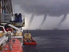
Dalyellup resident Jaco Bosman snapped this image of a water spout forming off the coast of Bunbury on Saturday afternoon.

A DALYELLUP resident in the right place at the right time witnessed a marvel of Mother Nature on the weekend – a waterspout off Bunbury’s coast.

Jaco Bosman was driving past Dalyellup Beach on Saturday evening when the meteorological phenomenon caught his eye.

Mr Bosman pulled over and watched the water spout for about a minute or two before it disappeared out of sight.

“I just caught the last of the show,” he said.

“It is the kind of thing you see on the Discovery Channel.

“I didn’t expect to see it happen in real life.”

A waterspout is an intense columnar vortex usually appearing as a funnel-shaped cloud that occurs over a body of water and is connected to a cumuliform cloud.

Waterspouts have long been recognised as serious marine hazards and history is filled with examples of ships being destroyed or damaged by them.

Meteorologist Joe Courtney said the waterspout formed due to unstable weather conditions on Saturday and rotating columns of air.

Lockheed wins $1.1 billion weather satellite contract

NEW YORK (MarketWatch) -- Lockheed Martin Corp. has scored a $1.1 billion U.S. contract to build the country's next-generation of weather satellites, beating out rivals Boeing Co. and Northrop Grumman Corp. in a three-way race.

In a news release late Tuesday, Bethesda, Md., Lockheed (LMT) said it would build two generation-R spacecraft for the Geostationary Operational Environmental Satellite system. The deal also provides for an option to build one additional craft.

The first satellite is scheduled for delivery in 2014 with the second satellite's delivery a year after that. Launch of the first satellite is planned for 2015.

(
NOC
)
had built the most recent generation in series.Shares of Lockheed were up a fraction at last check to $73.92. Shares of Boeing Boeing Co. (BABA) slipped 2% to $39.80 and Northrop fell 1.3% to $38.70, trending the wider market.

GOES satellites circle the Earth at 22,300 miles above the surface and scan for severe weather conditions such as tornadoes, flash floods, hail storms, and hurricanes. The first in the series was launched in 1994.

NASA and the National Oceanic and Atmospheric Administration said the new generation of GOES satellites will result in more timely and accurate weather forecasts, directly affecting public safety and ultimately, economic health and development.

The contract value includes options. Last year Lockheed sales were $41.9 billion.

MARITIME NOTE

IMO CHIEF'S “GROUNDS FOR CONCERN”

Thursday, 27 November 2008

OPENING IMO's Maritime Safety Committee meeting this week the body's secretary general Efthimios Mitropoulos has expressed concern at the number of seafarers killed at sea this year, mainly in domestic ferries and small vessel, and at the prospect of the economic crisis leading to dangerous practices.

He said that there are grounds for genuine concern over a number of issues, one of them being the overall safety record of certain sectors of the shipping industry. He continued: “While the recent delivery of many new ships built to the highest IMO standards has injected a welcome element of youth into the age profile of the world merchant fleet and, as a consequence, a higher degree of safety, we cannot ignore the fact that, since the beginning of the year, well over 1,600 seafarers are estimated to have lost their lives in accidents mainly involving ferries in domestic service and small cargo ships caught up in adverse weather conditions.”

Mr Mitropoulos said: “I find these figures both disturbing and unacceptable – a real setback at a time when so many efforts are being made to enhance safety at sea and so many endeavours are coming to fruition, including the International Safety Management Code, the first phase of which entered into force 10 years ago.”

“Also of concern,” he said, “is the current financial crisis, which analysts predict will continue for some time to come and which is already negatively impacting on economies worldwide, triggering fears of a global recession. A prolonged crisis of the sort we have been experiencing since the summer will leave no sector unscathed and, along with the world trade, it has already affected the shipping industry. The situation may be exacerbated by the release of new tonnage into the market place from the recent years’ unprecedented world order book, which, in spite of the anticipated withdrawal of further single-hull tankers in 2010, may lead to a substantive imbalance between supply and demand of shipping capacity worldwide forcing ships to lay up.”

He cautioned: “In this difficult time ahead, when it will be prudent to seek economies to face the storm, it would also be necessary to guard against measures that may have a negative impact on the safety of ships and shipping operations. While recommending that we should all exercise patience and perseverance in weathering the crisis, I would advise against adhering to savings and practices that might play a contributory part in any decline in the safety record of shipping and in the efforts of the maritime community to protect and preserve the marine environment.”

Antarctic cruise vessel refloated

CHILEAN NAVY PHOTOGRAPH

December 9, 2008

The Antarctic cruise vessel MV Ushuaia has been successfully refloated. The ship grounded December 4 at position 64¼35.5'S 062 ¼25'W, at the entrance of Wilhelmina Bay near Cape Anna in the NW Antarctic Peninsula. On board were 82 passengers and 42 crew.

Two diesel tanks were punctured and/or damaged (tank Nr.4 port side, and Nr.5 center), and spilled MGO.

The passengers, who may have gotten a little more adventure than they signed on for, were transferred to Chilean Naval Vessel Achiles next day using Zodiac landing craft from the MV Ushuaia and from another Anarctic tourist vessel, the MV Antarctic Dream, which had been standing by. The crew of the Ushuaia remained on board.

On the afternoon December 7, the crew of the MV Ushuaia and the crew of the Chilean Naval Tug Lautaro started to transfer 120 cu.m of diesel from MV Ushuaia to storage tanks on the Lautaro and 100 cu.m of fresh water was discharged into the sea. This was done to improve the buoyancy of the MV Ushuaia. Transferring fuel off the vessel also reduced the potential for additional spillage should anything go wrong with the refloating.

Efforts to refloat the vessel began at high tide (approximately 0400UTC/0100LT). The vessel was fully free at 0545UTC/0245LT. Escorted by Lautaro, MV Ushuaia began making way under its own steam towards Paradise Bay. No oil has been seen leaking from the vessel while underway; however, this could be due to wind and wave action causing any fuel leaked to be rapidly dispersed. To minimize any further oil spill, fuel from the damaged tanks is being transferred into tanks that are not compromised. Once the MV Ushuaia is in the relatively sheltered waters of Paradise Bay, a further inspection of the hull will take place.

You can read a blow by blow account of the incident from the International Association of Arctic Tour Operators HERE

You can get a somewhat different perspective on the incident from the Antarctic and Southern Ocean Coalition HERE.

The Ushuaiia is the former NOAA vessel Baldridge, which was retired from the agency in 1996 and which was originally delivered to NOAA as the Researcher from American Shipbuilding, Toledo, Ohio in 1978.


Messing About In Ships Podcast


12 more days to Christmas! Enjoy!

RS

Tuesday, November 25, 2008

Deep Sea Expedition Sets Sail

Deep Sea Expedition Sets Sail

ScienceDaily (Nov. 11, 2008)Setting sail on the Pacific, a University of Delaware-led research team has embarked on an extreme adventure that will find several of its members plunging deep into the sea to study hydrothermal vents on the ocean floor.

The team, which will be conducting research in environments that include scalding heat, high pressure, toxic chemicals and total darkness, is part of the National Science Foundation-funded "Extreme 2008: A Deep-Sea Adventure."

The scientists are being joined by students from around the world on dry land who have signed up for an exciting virtual field trip. More than 20,000 students from 350 schools in the United States, Aruba, Australia, Canada, Costa Rica, Great Britain and New Zealand are participating.

The expedition, led by Craig Cary, professor of marine biosciences in the University of Delaware's College of Marine and Earth Studies, left Monday, Nov. 10, aboard the research ship Atlantis from a port in Manzanillo, Mexico, with an expected return date of Dec. 1.*

Team members – researchers and graduate students – are from the University of Delaware, the University of Colorado, University of North Carolina, University of Southern California, J. Craig Venter Institute, Universidad Nacional Autónoma de México and the University of Waikato, New Zealand.

The team is heading to destinations at two hydrothermal hot spots: Guaymas Basin in the Gulf of California and a group of vents in the eastern Pacific Ocean about nine degrees north of the equator.

Once above the vents, the researchers will take the submersible Alvin down from one to nearly two miles below the surface. Built to withstand crushing pressures and to pierce the utter blackness of the deep, Alvin will let the scientists observe life around the steaming vents and collect samples for analysis. Both Atlantis and Alvin are owned by the U.S. Navy and operated by the Woods Hole Oceanographic Institution.

The scientists' focus will be marine viruses and other tiny life called protists. These organisms prey on bacteria, the primary food for vent dwellers ranging from ghost-white vent crabs to bizarre-looking tubeworms.

"For many years, the vents have been explored with little to no attention to viruses and protists," Cary says. "Yet because these organisms eat bacteria, they have the most dramatic effect on the bacterial communities that support the vent system. Our research programs are among the first to focus on these remarkable scavengers."

Eric Wommack, an associate professor with joint appointments in both the College of Agriculture and Natural Resources and the College of Marine and Earth Studies, will join Cary in leading the UD contingent.

Wommack, who is based at the Delaware Biotechnology Institute, is an expert on marine viruses and will be deploying specialized equipment to capture them for analysis in the shipboard lab.

Wommack says hydrothermal vents, although characterized by caustic chemistry, hot temperatures and high pressure, are oases of life in the deep sea. The vents provide an ecosystem for ancient and unusual microbes that are capable of extracting energy from volcanic rather than solar energy, and are home to viruses.

"As a group, viruses are the most abundant biological entities on Earth and contain its largest reservoir of unknown genes," Wommack says. "We know that bacteria at the deep-sea hydrothermal vents are intimately associated with relatively abundant populations of viruses. Our goal is to explore the wilderness of viral genes existing at the vents."

David Caron, professor of biological sciences in the Wrigley Institute for Environmental Studies at the University of Southern California, will be studying protozoa, a class of protists that feed on other organisms and that may form a crucial bridge between bacteria and animal life.

If Caron is correct, the samples from the deep will show that protozoa feed on bacteria or on the products of bacterial activity and are in turn eaten by larger life forms. The most surprising thing about the theory may be the lack of evidence for it. While other studies have found a protozoan-animal link in surface waters, the analogous middle step in the deep ocean has been overlooked.

"Protozoa are everywhere and they're in virtually every environment. They play this intermediate food web role in a number of these environments, and there's no reason to believe that they aren't doing the same thing in the vents. It simply hasn't been looked at to any degree," Caron said.

As the scientists work at sea, they will be connected to students via an interactive Web site, where blogs, dive logs, video clips, photos and interviews will be posted daily. Students also will be able to write to the scientists, design experiments and participate in a virtual science fair.

A capstone experience for selected schools will be a "Phone Call to the Deep," linking classrooms with researchers working live in the submersible Alvin on the seafloor.

The University of Delaware and the National Science Foundation are sponsoring the expedition. Additional support is being provided by Olympus and by MO BIO Laboratories.

* For those interested in following the scientists, they will blog regularly about the voyage at the Extreme 2008 Web site . The program, coordinated by the Office of Communications & Marketing, is the sixth in UD's popular "Extreme" series, which has won state and national awards for public education.

WEATHER NOTE

Indiana Department Of Homeland Security Implements GIS-Based Disaster Response System

November 8, 2008

The Indiana Department of Homeland Security (IDHS) recently embarked on an ambitious campaign that provides a communication network built using ESRI geographic information system (GIS) software. The system takes advantage of a Web portal for linking local resources with state and federal stakeholders in the event of a large-scale emergency. This two-way stream of information flow is vital to disaster response. "We wanted to leverage resources already in place with other state agencies and in the universities across the state," says Roger Koelpin, GIS/critical infrastructure planner, Indiana Department of Homeland Security. "We are able to work with those partners as resources for our internal disaster recovery strategy and continuity of operations planning. Ultimately, we hope to turn this into a viable process for bottom-up reporting of data to meet federal data calls and to keep our federal partners informed as part of our routine, authoritative, common operating picture."

IDHS selected ESRI for its GIS software and services. ESRI Professional Services staff worked with IDHS staff to incorporate ESRI software, including ArcView, ArcEditor, and ArcInfo, into its disaster response system. The system's technology framework involves ESRI business partner ESi and its WebEOC Web-enabled crisis management system. In addition, FME from Safe Software, Inc, was selected to help extract data from stakeholders' Web feature services and transform the data to the U.S. Department of Homeland Security data model.

The enterprise disaster response system provides several functions. First, it is used for mitigation, with state agencies identifying high-risk populations, infrastructure, natural resources, and other assets. Second, it provides instant-response capabilities. When a disaster strikes, real-time situational awareness occurs. Commanders make quick decisions on where to send law enforcement, fire personnel, emergency medical services staff, and other responders. They can instantly see available resources, prioritize activities, and monitor events in real time as they unfold. This capability also helps with long-term recovery.

A major component of the system comes from Indiana university partners who are already using GIS and related technologies to publish IndianaMap: a single, statewide geospatial resource for Indiana that includes a wide variety of information in a format that is accessible to both expert GIS users and the general public. IDHS is currently working with county stakeholders to more fully integrate their GIS efforts with its own. Presently, 23 counties offer data in support of the IDHS disaster response system. Roughly one-third of Indiana's 92 counties host their own GIS software and databases. Another third of the counties have vendors hosting their data in proprietary 911 call-center applications. Some of these counties are working with their vendors so that they may help maintain the IDHS common operating picture. Some of the counties in the remaining third are using grants to bolster GIS operations, either with vendor support or on their own.

IDHS is also working to extend the system with more applications and data than are currently available.

About ESRI
Since 1969, ESRI has been giving customers around the world the power to think and plan geographically. The market leader in GIS, ESRI software is used in more than 300,000 organizations worldwide including each of the 200 largest cities in the United States, most national governments, more than two-thirds of Fortune 500 companies, and more than 7,000 colleges and universities. ESRI applications, running on more than one million desktops and thousands of Web and enterprise servers, provide the backbone for the world's mapping and spatial analysis. ESRI is the only vendor that provides complete technical solutions for desktop, mobile, server, and Internet platforms. Visit us at www.esri.com.

SOURCE: ESRI

MARITIME NOTE

Poor communication cited in tall ship training fatality

By Canadian OH&S News

FEDERAL (Canadian OH&S News) -- A Transportation Safety Board of Canada (TSB) investigation into the sailing death of Laura Gainey has determined that insufficient crew communication and inadequate ship safety features were among the factors that lead to her death.

Gainey, the daughter of Montreal Canadiens general manager Bob Gainey, was swept off the deck of the Picton Castle tall ship by a large wave during a fierce storm on December 8, 2006. The foreign-registered ship had departed Lunenburg, Nova Scotia three days earlier and was en route to Grenada in the eastern Caribbean Sea. The body of Gainey, a deckhand on the vessel, was never recovered despite search and rescue efforts.

Gainey was carrying out a ship check — likely at the port breezeway section of the ship — when the wave struck. She was probably unaware of a temporary order to steer clear of the breezeway, which had been implemented because of the rough seas, the TSB notes in a final report released on October 30.

“A number of [past] TSB investigations have highlighted the fact that accidents are often the product of ineffective, incomplete, untimely, or misunderstood communications,” board investigators write.

The TSB also notes that important safety equipment was either missing or was not properly used on the Picton Castle.

“Despite the large amount of water being shipped on deck, safety nets were not rigged above the bulwarks of the main deck and breezeway,” the board states. It adds that “safety lines had been rigged inboard on the main deck, but their effectiveness was diminished because safety harnesses were not worn. The absence of established fastening points to which safety harnesses could be attached also negated the effectiveness of wearing a harness.”

Given unfavourable long-range weather forecasts, the ship’s departure from Nova Scotia should have been delayed, the TSB suggests. Heeding the forecasts would have been particularly advisable considering the “limited training of the crew in emergencies and the limited experience of the trainees.” The report says that time and financial considerations contributed to the decision to set sail.

Fatigue among Picton Castle crew members was another issue identified by the TSB. It notes that under the storm conditions, the crew — including Gainey — was unable to rely on the 16 trainees onboard. “Consequently, the crewing level became inadequate — with the result that crew members had to rely on each other to perform duties during off-watch periods.”

A general concern noted by the board is that neither Canada northe Cook Islands (where the Picton Castle is registered) require tall ship operators to have safety management systems in place. “Effective safety management requires all organizations, large or small, to be cognizant of the risks involved in their operation, to be competent to manage those risks, and to be committed to operating safely,” the TSB states.

New volunteer standards may be ineffective: TSB

Though the federal transportation department, Transport Canada, is in the process of updating voluntary safety standards related to tall ship construction and operation, this “may not result in the adoption of effective safety management systems,” the board worries.

Maryse Durette, a spokeswoman for Transport Canada, notes that the department has 90 days to review and respond to the TSB findings. The department, she adds, is already developing “a policy with respect to registration, crew training/certification, and requirements for foreign-registered sail training vessels entering and operating in Canada.”

Simon Fuller, president of Ottawa-based Bytown Brigantine Inc, a charitable organization that operates two tall ships, says that although Canadian-registered ships are not required by regulation to have formal crew training and safety programs, they typically do.

Nonetheless, Fuller, who is also secretary of the Canadian Sail Training Association, says he would support the formalization of crew training and safety program requirements through the creation of a legislated standard. “Let’s define once and for all what a responsible sail training program should look like and what it should comprise,” he says.

RS

Friday, October 24, 2008

CG funds turbine impact on radar study

CG funds turbine impact on radar study

The Coast Guard revealed this week that it has contracted for a study of the effects on marine radar from the wind farm proposed for Nantucket Sound.

At the end of a radar and navigation forum Tuesday in North Falmouth, Raymond Perry, captain of the port for Sector Southeastern New England, announced the study, Coast Guard Senior Chief Richard Uronis said yesterday.

The $100,000 study should be completed by December, Uronis said. It will be performed by Maryland-based Technology Service Corp.

A second forum on radar and navigation issues is being planned after the study is complete, he said.

Cape Wind Associates wants to build 130 wind turbines on 25 square miles in the middle of Nantucket Sound. Advocates say it would provide clean energy with minimal impact on the local environment and maritime safety.

Opponents have decried the plan, citing concerns ranging from the impact on endangered birds to navigational and safety issues discussed at Tuesday's forum.

As part of a draft environmental impact statement released in January by U.S. Minerals Management Service — the lead agency reviewing Cape Wind — the Coast Guard placed a list of conditions on its approval of the project. The conditions required the Minerals Management Service and Coast Guard to determine whether "identified impacts, if any, allow for an acceptable risk to navigation safety."

The Minerals Management Service expects to issue a final report on Cape Wind by the end of the year. Agency officials did not return messages yesterday seeking comment on whether the Coast Guard radar study would influence their review of Cape Wind.

At Tuesday's forum, dueling radar analyses were presented to Perry that drew different conclusions on the impact of the proposed wind turbines.

According to Raytheon principal engineering fellow Eli Brookner, there are three potential problems Nantucket Sound wind turbines could pose for radar.

"If you had a small vessel located in what we call the side lobes you wouldn't see it, and so it could be a hazard not seeing that target," Brookner said in a telephone interview yesterday.

Side lobes are radar beams that spill over from the main beam and can cause "clutter," Brookner said.

Additionally, so-called "shadowing" can occur when turbines or ships behind the closest turbines may be obscured on radar screens, he said.

Finally, radar systems that automatically track targets may "swap" a moving target such as a ship with a stationary turbine, Brookner said.

Brookner said he studied maritime radar issues at the request of a friend whom he did not identify and was not paid for his work.

Glenn Wattley, the president and CEO of the region's main anti-Cape Wind group, the Alliance to Protect Nantucket Sound, said his organization asked Brookner to look at the radar issue but did not pay him.

Capt. Dennis Barber, a British ship captain who has worked as a consultant for Cape Wind, presented an opposing view of the impact of the proposed turbines Tuesday, saying that mariners could easily determine the location of nearby boats near the proposed wind farm, according to attendees of the forum. Barber could not be reached for comment yesterday.

About 20 panelists debated other navigational issues Tuesday, including whether there should be a wider buffer zone between the wind turbines and ferry routes, Uronis said.

"We need a proper spacing between the ferry route and the wind towers," Edmund Welch, a spokesman for the Passenger Vessel Association, a trade group that represents the Woods Hole, Martha's Vineyard and Nantucket Steamship Authority and the Hy-Line ferry lines, said in a telephone interview yesterday.

A Cape Wind spokesman did not return a telephone call last night seeking comment.

WEATHER NOTE

Future risk of hurricanes

Scientists focus on hurricane-prone Gulf of Mexico and Caribbean Sea to assess likely changes

Researchers are homing in on the hurricane-prone Gulf of Mexico and Caribbean Sea to assess the likely changes, between now and the middle of the century, in the frequency, intensity, and tracks of these powerful storms. Initial results are expected early next year.

The National Center for Atmospheric Research (NCAR) in Boulder, Colo., working with federal agencies as well as the insurance and energy industries, has launched an intensive study to examine how global warming will influence hurricanes in the next few decades.

The goal of the project is to provide information to coastal communities, offshore drilling operations, and other interests that could be affected by changes in hurricanes.

"This science builds on years of previous investment," said Cliff Jacobs, program director in the National Science Foundation (NSF)'s Division of Atmospheric Sciences, which is funding the project. "The outcome of this research will shed light on the relationship between global warming and hurricanes, and will better inform decisions by government and industry."

The project relies on an innovative combination of global climate and regional weather models, run on one of the world's most powerful supercomputers.

"It's clear from the impacts of recent hurricane activity that we urgently need to learn more about how hurricane intensity and behavior may respond to a warming climate," says NCAR scientist Greg Holland, who is leading the project. "The increasingly dense development along our coastlines and our dependence on oil from the Gulf of Mexico leaves our society dangerously vulnerable to hurricanes."

The new study follows two major reports, by the U.S. Climate Change Science Program (CCSP) and Intergovernmental Panel on Climate Change (IPCC), that found evidence for a link between global warming and increased hurricane activity.

But many questions remain about future hurricane activity. For example, the CCSP report concluded that future changes in frequency were uncertain, and that rainfall and intensity were likely to increase, but with unknown consequences.

Improved understanding of climate change and hurricanes is an especially high priority for the energy industry, which has a concentration of drilling platforms, refineries, pipelines and other infrastructure in the region that are vulnerable to severe weather.

Hurricanes Gustav and Ike damaged offshore oil production and several refineries, disrupting gasoline supplies.

The project is part of a larger effort examining regional climate change between 1995 and 2055.

The simulations are being run on NCAR's bluefire supercomputer with support from NSF, NCAR's sponsor, and through a long-term collaboration with the insurance industry through the Willis Research Network.

"This research program by NCAR is a major contribution to the insurance industry and public policy makers," says Rowan Douglas, managing director of Willis.

"The primary way to improve our understanding of present and future hurricane risk is to generate computer simulations of storms in unprecedented detail."

For the project, the model will examine three decades in detail: 1995-2005, 2020-2030, and 2045-2055. Scientists will use statistical techniques to fill in the gaps between these decades.

A major goal is to examine how several decades of greenhouse-gas buildup could affect regional climate and, in turn, influence hurricanes and other critical weather features. Scientists will also investigate the impact of the powerful storms on global climate.

One of the most difficult technical challenges for such a project is to create a model that can capture both the climate of the entire world and the behavior of a single hurricane.

To get around this roadblock, NCAR has developed an approach called Nested Regional Climate Modeling (NRCM). The center "nests" a special version of its high-resolution weather model (the Weather Research and Forecasting model, or WRF) inside its lower-resolution, global climate model (the Community Climate System Model, or CCSM).

The resulting simulations show fine-scale detail for certain regions, like the Gulf of Mexico, while also incorporating global climate patterns.

For each of its decade-long time slices, the NRCM's resolution will be about 20 miles across Africa, Europe, and the South Atlantic, 7.5 miles across the tropical Atlantic and northeastern United States, and an even sharper 2.5 miles over the Caribbean and Gulf of Mexico, southeastern United States, and drought-prone western United States.

"Combining weather and climate models in this way enables more detailed projections of hurricanes in a warming world than any study to date," says Holland. "These projections will help reduce the uncertainty of current assessments, and they also serve the very important role of providing experience about applying future predictions of changes to high impact weather systems in general."-National Science Foundation

MARITIME NOTE

U. S. Coast Guard Rescues Sailors Remotely from 3,500 Miles Away - it's AMVER!


The following Coast Guard story was spotted in Euroweekly News, the English news source in Spain for Mallorca, Costa Blanca, Costa de Almeria, Costa del Sol, Heart of Andalucia and Algarve.

The U. S. Coast Guard's sophisticated AMVER system enabled a daring sea resuce to take place 3,500 miles from the Coast Guard AMVER Center on Governor's Island in New York.
.
Four Swedish sailors were rescued last week by the Greek tanker, ‘Parthenon’, in a dramatic high-seas rescue which was hampered by weather so rough that a rescue helicopter had to return to shore.

Swedish Sailboat, Sun Chaser, in distress
.
The US Coast Guard revealed in a press release that Captain Vasileiadis Lazaros, master of the Greek-flagged tanker, was sailing to the Port of Setubal when his crew picked up a distress call from the Swedish sailboat, ‘Sun Chaser’ which was in difficulties approximately 84 miles west of the Algarve’s Cape Saint Vincent. Within two minutes of receiving the call, Captain Lazaros was on the bridge, directing the ship to proceed to the stricken sailboat.
.
The distress call was received through the ‘Automated Mutual Assistance Vessel Rescue System’ (AMVER), sponsored by the United States Coast Guard, a computer-based, voluntary global ship-reporting system used worldwide by search and rescue authorities to arrange for assistance to persons in distress at sea. The ‘Parthenon’ has been an AMVER participant since 2003.
.
Greek Tanker Races to the Scene
.
Steering the 800 foot tanker, managed by the Tsakos Group of Athens, towards the distress location, Captain Lazaros notified Portuguese rescue authorities. “I ordered all crew to stand-by on deck,” stated Captain Lazaros as he began preparing to rescue the four Swedes. Coordinating his efforts with Radio Lisbon, Captain Lazaros overheard a Portuguese rescue helicopter order the Swedish sailors into a lifeboat.
.
“The sailors radioed the rescue helicopter and said they could not abandon ship in the rough weather because their lifeboat had been ripped from the sailboat and drifted away,” Captain Lazaros added. As the weather conditions deteriorated, the helicopter was unable to safely hoist the sailors and returned to base, leaving the 107,000 ton dead- weight tanker the only means of rescue for the sailors.
.
“I ordered the Sun Chaser to make fast to our port side amidships and had the crew lay down the pilot ladder,” Captain Lazaros recounted in an email to the U. S. Coast Guard AMVER center. Within two minutes of lowering the pilot ladder, the first survivor was safely on board the Parthenon. Within three hours of receiving the initial call for help, the Parthenon had rescued all four Swedish sailors.
.
The Survivors
.
The survivors, two men and two women, were cared for aboard the Parthenon before being taken to Setubal, where they were met by Portuguese officials. With the AMVER system, rescue coordinators can identify participating ships in the area of distress and divert the best-suited ship or ships to respond. Prior to sailing, participating ships send a sail plan to the Amver computer centre. Vessels then report every 48 hours until arriving at their port of call. This data is able to project the position of each ship at any point during its voyage and, in an emergency situation, any rescue coordination centre can request this data to determine the relative position of AMVER ships near the distress location. On any given day, over 3,300 ships are available to carry out search and rescue services.
.
About AMVER:
.
AMVER, sponsored by the United States Coast Guard, is a unique, computer-based, and voluntary global ship reporting system used worldwide by search and rescue authorities to arrange for assistance to persons in distress at sea.With AMVER, rescue coordinators can identify participating ships in the area of distress and divert the best-suited ship or ships to respond.
.
AMVER's mission is to quickly provide search and rescue authorities, on demand, accurate information on the positions and characteristics of vessels near a reported distress.

Weather Eye: noisy oceans threaten life under water


he world’s oceans are growing noisier, thanks to the rising levels of carbon dioxide. This could create a cacophony of sounds that will make life difficult for whales and dolphins, which use their shrills and rumbles for navigation and communication and, rather like a room full of people shouting at each other, their calls could get lost in an underwater din.

It seems unbelievable that carbon dioxide would make a difference to anything on Earth because it only makes up about 0.04 per cent of the atmosphere. But when air dissolves in water, the carbon dioxide makes carbonic acid. Although a very weak acid, it slowly eats away chalk and limestone, which is how Cheddar Gorge and its caves were made.

As carbon dioxide dissolves in the oceans it is turning the water more acidic. This has an impact on sound travelling through the water, because sound waves are absorbed by certain types of charged molecules that stick together in seawater. As the sea becomes acidic, the charged molecules absorb less sound, and so the sound waves travel further.

A recent study has found that carbon dioxide absorbed by the oceans has increased sound travel by about 10 per cent throughout the Atlantic and Pacific. And by mid-century this is expected to rise up to 70 per cent further. With noise travelling further, this could create an underwater din that will make life much more difficult for whales and fish that live on reefs that also use sound.

The increasingly acid oceans are also hurting sea creatures such as diatoms and corals. Their shells are made of carbonate that is corroded by carbonic acid.


Messing About In Ships Podcast

Have a great and safe weekend!

RS


Monday, October 6, 2008

Why Disasters Are Getting Worse

Why Disasters Are Getting Worse

In the space of two weeks, Hurricane Gustav has caused an estimated $3 billion in losses in the U.S. and killed about 110 people in the U.S. and the Caribbean, catastrophic floods in northern India have left a million people homeless, and a 6.2-magnitude earthquake has rocked China's southwest, smashing more than 400,000 homes.

If it seems like disasters are getting more common, it's because they are. But some disasters seem to be affecting us in worse ways — and not for the reasons you may think. Floods and storms have led to most of the excess damage. The number of flood and storm disasters has gone up 7.4% every year in recent decades, according to the Centre for Research on the Epidemiology of Disasters. (Between 2000 and 2007, the growth was even faster, with an average annual rate of increase of 8.4%.) Of the total 197 million people affected by disasters in 2007, 164 million were affected by floods.

It is tempting to look at the lineup of storms in the Atlantic Ocean (Hanna, Ike, Josephine) and, in the name of everything green, blame climate change for this state of affairs. But there is another inconvenient truth out there: We are getting more vulnerable to weather mostly because of where we live, not just how we live.

In recent decades, people around the world have moved en masse to big cities near water. The population of Miami-Dade County in Florida was about 150,000 in the 1930s, a decade fraught with severe hurricanes. Since then, the population of Miami-Dade County has rocketed 1,600%, to 2,400,000.

So the same-intensity hurricane today wreaks all sorts of havoc that wouldn't have occurred had human beings not migrated. (To see how your own coastal county has changed in population, check out this cool graphing tool from the National Oceanic and Atmospheric Administration.)

If climate change is having an effect on the intensities of storms, it's not obvious in the historical weather data. And whatever effect it is having is much, much smaller than the effect of development along coastlines. In fact, if you look at all storms from 1900 to 2005 and imagine today's populations on the coasts, as Roger Pielke Jr., and his colleagues did in a 2008 [ITALIC "Natural Hazards Review"] paper, you would see that the worst hurricane would have actually happened in 1926.

If it happened today, the Great Miami storm would have caused from $140 billion to $157 billion in damages. (Hurricane Katrina, the costliest storm in U.S. history, caused $100 billion in losses.) "There has been no trend in the number or intensity of storms at landfall since 1900," says Pielke, a professor of environmental studies at the University of Colorado. "The storms themselves haven't changed."

What's changed is what we've put in storms' way. Crowding together in coastal cities puts us at risk on a few levels. First, it is harder for us to evacuate before a storm because of gridlock. And in much of the developing world, people don't get the kinds of early warnings that Americans get. So large migrant populations — usually living in flimsy housing — get flooded out year after year. That helps explain why Asia has repeatedly been the hardest hit area by disasters in recent years.

Secondly, even if we get everyone to safety, we still have more stuff in harm's way than ever before. So each big hurricane costs more than the big one before it, even controlling for inflation.

But the most insidious effect of building condos and industry along water is that we are systematically stripping coasts of the protection that used to cushion the blow of extreme weather. Three years after Katrina, southern Louisiana is still losing a football field's worth of wetlands every 38 minutes.

Human beings have been clearing away our best protections all over the world, says Kathleen Tierney, director of the Natural Hazards Center at the University of Colorado, Boulder. "The natural protections are diminishing — whether you're talking about mangrove forests in areas affected by the Indian Ocean tsunami, wetlands in the Gulf Coast or forests, which offer protection against landslides and mudslides."

Before we become hopelessly lost in despair, however, there is good news: we can do something about this problem. We can enact meaningful building codes and stop keeping insurance premiums artificially low in flood zones.

But first we need to understand that disasters aren't just caused by FEMA and greenhouse gases. Says Tierney: "I don't think that people have an understanding of questions they should be asking — about where they live, about design and construction, about building inspection, fire protection. These just aren't things that are on people's minds."

Increasingly, climate change is on people's minds, and that is for the better. Even if climate change has not been the primary driver of disaster losses, it is likely to cause far deadlier disasters in the future if left unchecked.

But even if greenhouse gas emissions miraculously plummet next year, we would not expect to see a big change in disaster losses. So it's important to stay focused on the real cause of the problem, says Pielke. "Talking about land-use policies in coastal Mississippi may not be the sexiest topic, but that's what's going to make the most difference on this issue," he says.

WEATHER NOTE

After Hurricane Ike, Finding the Coastline Rearranged, Again

From the plane flying over the Gulf Islands National Seashore, scientists from the United States Geological Survey were scanning the ocean, trying to find Ship Island. Their maps and G.P.S. system told them they were over its eastern end, but there was no sign of it.

“I don’t see Ship anywhere,” said Asbury H. Sallenger, a oceanographer at the Geological Survey who was sitting in the co-pilot’s seat and had the best view. "On the map we see it, but all I see is breakers. There is just zip left of this thing."

Eventually, the scientists spotted the western part of Ship, but its eastern half had all but disappeared. A small patch of land and whitecaps breaking on underwater shoals were all that remained.

The damage was considerable, but it was the kind of land loss they would see often on their flight, which they made about 48 hours after Hurricane Ike struck the Gulf Coast, as part of the survey’s long-standing effort to track storm damage on the coast.

The geologists should not have been surprised. Scientists studying the way stormy weather erodes the coast have long been able to identify regions at risk for inundation if sea-level rise continues, an inevitability in a warming world.

For example, researchers have estimated that large stretches of another barrier chain, the Outer Banks of North Carolina, will vanish if seas rise more than two feet, which many scientists consider quite likely by 2100.

But on the Gulf Coast, “we are not talking 100 years,” Dr. Sallenger said, “we are talking three years,” the time since Hurricane Katrina and a parade of other storms, including Hurricanes Gustav and Ike this year, virtually destroyed several islands running west into Louisiana. Among them are the Chandeleur Islands, a barrier chain formed thousands of years ago in a now-defunct delta of the Mississippi River, and other islands in the Breton National Wildlife Refuge.

Storms and climate change are partly to blame. But the region as a whole is subsiding. And in some areas, some critics contend, federal dredging projects are robbing islands of sand.

The result is a chain of feeble island remnants. In many places, as Dr. Sallenger observed at one point, “there ain’t nothing here but white water.”

So Karen Morgan, a geologist at the Geological Survey making still photos of the landscape, at times found herself instructing the pilot, Rob Kent, to navigate not by a shoreline but by a line of white water breaking over the submerged shoals that are the islands’ remains. In some places, there were not even breakers to show where dry land had been.

These islands are uninhabited, but they are valuable nonetheless, and not just for storm protection. With their extensive dunes and vegetation, the islands were once an important nesting place for brown pelicans and a variety of other birds. In the last few years, Dr. Sallenger said, the Chandeleurs have lost about 85 percent of their land mass, and with this loss “the habitat for birds on the flyway has decreased by an enormous percentage.”

Of course, the islands have not vanished altogether. And the scientists, who fly this coast regularly, have many times seen islands in these chains erode in storms and then recover — at least somewhat. But that can happen only as long as their underlying platforms of marsh remain intact, providing a place for sand to collect. In many places today, those platforms are “frail and really beaten down,” Dr. Sallenger said.

Dr. Sallenger said the Geological Survey scientists would try to advise officials at the Fish and Wildlife Service, which administers the refuge, what they could expect in the next 5 to 10 years. The outlook is grim.

Storms have already lopped miles off each end of the largest island in the Chandeleur chain. Will the islands bounce back? “We are going to look at the data again,” Dr. Sallenger said. “It looks very tenuous.”

The outlook for Ship Island is similarly daunting, in large part because of the difficulty of finding the necessary sand. “This is a very big operation to put this back together,” Dr. Sallenger said. “It’s not a small deal.”

MARITIME NOTE

New Edition of International Maritime Dangerous Goods (IMDG) Code Available From Labelmaster

Publication is a must for anyone handling packaged dangerous goods and maritime pollutants by sea

Chicago, Illinois (Vocus/PRWEB ) October 2, 2008 -- Many maritime countries have taken steps to regulate the carriage of marine pollutants in packaged form. Shippers can turn to the International Maritime Dangerous Goods (IMDG) Code as the authoritative text on all aspects of handling packaged dangerous goods and marine pollutants by sea. The new edition of the IMDG Code will be available from Labelmaster®, a U.S.-based manufacturer of hazardous materials and regulatory compliance products, on October 27. You can start using the publication from January 1st 2009, but usage is mandatory as of January 1st 2010.

News Image

Included in the IMDG Code are detailed requirements for labeling, marking, and documentation, and training provisions for articles defined as dangerous. The Code also includes packaging requirements for each article, as well as testing procedures for large and small packages.

First published in 1965, the 34th edition of the IMDG Code includes the following new features:

  • EmS numbers are added to Column 15 of the Dangerous Goods List
  • Substantial changes to the Dangerous Goods List
  • Revisions to the construction and testing of packages and IBCs
  • New recommendations for the training needs of shore side personnel

The IMDG Code is available at $219.00 for a two-volume, perfect-bound set, or on a USB drive or CD at $495. The IMDG Code Supplement is also available for $109.00 each. Special pricing is available for five copies or more. To order, please call 1-800-621-5808 or email sales@labelmaster.com.

For additional information on IMDG Code products visit:

IMDG Code: www.labelmaster.com/IMDGCode

IMDG Code Supplement: www.labelmaster.com/IMDGCodeSupplement

IMDG Code USB Drive: www.labelmaster.com/IMDGRegstick

IMDG Code Software: www.labelmaster.com/IMDGCodeCD

Labelmaster, established in 1967, is a developer, manufacturer, distributor, and marketer of hazardous materials compliance products, including labels, forms, packaging, software, and publications. The company's 40 years of experience in providing regulatory information and products for all transportation modes make it especially qualified as a total compliance resource. For additional information visit www.labelmaster.com.

RS

Monday, September 29, 2008

New approach to warning siren activation unveiled

New approach to warning siren activation unveiled

Oakland County officials have announced and implemented a new countywide severe weather warning system that involves activating existing and future tornado sirens before a tornado is spotted in the field or indicated on radar.

County Executive L. Brooks Patterson and Emergency Response and Preparedness Director Mike Sturm detailed the sweeping change in the county's outdoor warning siren system on Wednesday, Sept. 10. Under the new approach, sirens will be activated when winds of 70 mph have been recorded in or around the immediate county borders.

"In the past, the sirens have only been activated when a tornado has been sighted or indicated on radar," Patterson said. "Henceforth, the outdoor warning system will be activated when severe thunderstorms with damaging winds at or near 70 mph are in Oakland County or within a 10-mile buffer around the county."

If a 70 mph standard had been in place, Oakland County would have activated warning sirens an additional half a dozen times since January 2006, rather than just the three times the sirens were sounded during the same period of time based on National Weather Service standards.

Sturm said it was felt that any severe weather condition that could result in widespread or severe damage, injury or loss of life or property should warrant activation of the outdoor warning system. He added that winds of 65 mph or more could do as much damage as a low-grade tornado.

The previous outdoor warning system began in 1977. There are 228 sirens in place across the county, with two more about to be installed. The total cost of siren installation is around $20,000, according to county officials.

Last October, three new tornado sirens were slated to be installed in three lakes area communities. Commerce, Highland, and Waterford townships netted the warning devices in the last year after the county received a $68,000 Urban Area Security Initiative Grant — federal money passed to the state and then passed on to the county — that made the purchase and installation of the sirens possible.

WEATHER NOTE

Response agencies scramble to keep up with storm season

For the fourth time in as many weeks federal disaster response officials found themselves shifting gears to address a storm.

As Hurricane Ike barreled toward the Gulf Coast of Texas, the Federal Emergency Management Agency was already moving its rapid response teams into southern Texas in advance of the storm, repeating preparations it made in recent weeks for Hurricane Fay in Florida, Hurricane Gustav in Louisiana, and Tropical Storm Hanna in North Carolina.

A new approach

“The lesson learned is we must plan for these events well in advance of the event,” said Glenn Cannon, assistant FEMA administrator for disaster operations. “We plan for different events and scenarios … so we have the same game plan and are on the same page.”

The ad hoc, independent response that marred FEMA’s response to Hurricane Katrina is a thing of the past, he said. “We don’t need to relearn that lesson.”

That’s why, since August, FEMA has conducted daily — and sometimes more frequent than daily — videoconference calls to coordinate state and federal response for tasks as diverse as medical evacuations, supply delivery and rescue teams staging, he said.

As the chief coordinator for disasters, FEMA makes sure all local and federal agencies come in with the necessary resources and staffing. FEMA has developed more than 220 prescriptive mission assignments for its partners. The plans contain everything from checklists to draft documents so nobody is starting the process from scratch, Cannon said. Before Katrina, there were fewer than 30 such plans, he said.

The General Services Administration, which supports FEMA’s supplies purchasing, is one of the agencies dialed in on the daily phone call. Its Office of Emergency Response and Recovery, set up after Katrina, is getting its first real test this year with the battery of storms slugging the Gulf Coast.

The daily video teleconferences have allowed agencies on the federal, state and local level to reach out to one another and discuss what is needed and who can provide it, said Joshua Sawislak, acting director of the Office of Emergency Response and Recovery at GSA. The briefings ensure that agencies like GSA, which is responsible for trucking supplies into disaster areas, coordinate with, say, the Transportation Department, which knows which roads are closed, or the National Hurricane Center, which knows where storms are heading.

Role of technology

Technology has also provided real-time situational awareness, Sawislak said. During the evacuation of New Orleans in advance of hurricane Gustav, Customs and Border Protection and military reconnaissance technology helped give responders real-time knowledge of where ambulances transporting patients were and whether additional aircraft were needed to evacuate them, he said.

“Cooperation and communication has made the biggest difference,” Sawislak said. “FEMA can roll in mobile command centers with full capability and show us video of what is going on. … We don’t have to rely on CNN.”

The centralized emergency management office has also helped GSA coordinate internally, Sawislak said. The office is in charge of mobilizing GSA’s regional emergency response teams and reservists to make sure the right people with the right skills are in the right place at the right time, he said.

A deep bench

Although Ike is the second major storm this season to hit areas within GSA’s Fort Worth, Texas region, the regional emergency staff is ready to respond in full force, he said.

GSA staff from California, working with FEMA at the time, had deployed in response to Hurricane Gustav, relieving some of the pressure on the region, he said.

But GSA has a plan in place to supplement people from regions outside of the storm zone in order to give those in the storm zone a break, he said.

“The hardest part is to make sure people understand we’re in it for the long haul, and they need rack time … so they don’t get burned out,” Sawislak said.

At the same time FEMA is planning for the response, it is also working with partner agencies to plan for recovery, Cannon said.

FEMA is already planning for mass feeding and sheltering should Ike wipe out homes in the affected area. The agency is also working to ensure temporary housing is available should anyone be left homeless from the storm, he said.

The Small Business Administration, which administers home and business recovery loans, is also planning for the day after.

The agency has 1,500 of its 3,500-plus reserve staff on call to respond to Ike within 24 hours, said James Rivera, deputy associate administrator for SBA’s Office of Disaster Assistance. SBA has trained 3,500 people for its disaster recovery reserve force, which is used to staff up regions during times of emergency.

The reservists process loans, inspect property damage and perform other recovery duties. That reserve staff is 18 times larger than the reserve available during Hurricane Katrina, he said.

Although SBA has been part of the responses to many of this year’s natural disasters, employee fatigue has not yet been an issue, said Sandy Baruah, acting SBA administrator.

“But if Ike packs a punch and we’re dealing with it for a long time, or if it is followed by another serious hurricane, we do have this 3,500-person team of active reservists to work through the system,” Baruah said.

In addition to people power, the agency is also prepared to respond with technology. The agency has beefed up its loan processing system now allows 12,000 users to run cases simultaneous, 10,000 more than were allowed in the system during Katrina, Baruah said. People seeking assistance can also apply for their loans online, a development made in response to the long-distance evacuations after Katrina where many loan seekers couldn’t go to disaster recovery offices in person.

24-hour hurricane center

Whether agencies are involved in the response or the recovery phase, they rely heavily on the forecasts from the National Hurricane Center, which is staffed around the clock, to determine where to stage its crews and when to begin evacuations.

The Hurricane Center has two specialists tracking Ike at any given hour, but while Ike was being tracked alongside Hurricane Gustav and Tropical Storm Hanna, each storm had its own team working overtime, said Bill Read, the center’s director. “It is a bit of a balancing act,” but because hurricanes are the agency’s business, there isn’t a lot of staff shuffling going on, Read said. The agency is always prepared to give officials briefings at any time of the day or night. “For some reason, the storms won’t take off on weekends, so we work weekends,” Read said. “Hurricanes don’t go to sleep at night

World is Now Committed to a Significant Warming

Even if greenhouse gas concentrations would remain constant at 2005 levels for the next century, which is a highly optimistic scenario, according to a group of researchers from the Scripps Institution of Oceanography, the earth will still warm about 4.3 degrees F (2.4 C) above pre-industrial levels.

According to Climate Sciences professor V. Ramanathan and co-author Yan Feng, 90% of this warming will most likely be experienced in the 21st century.

Below are exerpts from the ScienceDaily article...............

"This paper demonstrates the major challenges society will have to face in dealing with a problem that now seems unavoidable," said Ramanathan. "We hope that governments will not be forced to consider trade-offs between air pollution abatement and mitigation of greenhouse gas emissions."

The authors point out that the real problem is not the reduction of air pollution, but it is the lack of comparable reductions in emissions of CO2 and other greenhouse gases to offset the reductions in the surface cooling effect of fog. The paper also offers potential solutions.

There's a special room at the Marshall Space Flight Center. Researchers call it the "Anechoic Chamber" and they love to test their high-tech instruments there. Normal people think it's just plain spooky.

"In here, no one can hear you scream," says engineer Mark James as he opens the door on the surreal:

The door creaks shut behind James and suddenly it's like someone hit the mute button. Dead silence. Pyramids on the wall seem to be closing in. The urge to scream ... hard to resist.

James just gets on with the job. He's lead engineer on a research team using this cavernous facility to test a prototype hurricane sensor called HIRAD. Short for Hurricane Imaging Radiometer, HIRAD is designed to scan large areas of ocean for microwave signals that portend storm strength and dynamics. By collecting and transmitting these data to forecasters, HIRAD could reduce property damage and even save lives.

The Anechoic Chamber is the perfect place to check HIRAD's antenna.

Weird shapes lining the chamber's walls are made of a radio-frequency damping material arranged in a pattern akin to soundproof rooms. The shapes minimize microwave reflections and eliminate electromagnetic interference.

"The electromagnetic quiet allows us to test and fully characterize the HIRAD antenna," explains James. "Lack of sound is just a weird bonus."

A microwave source at one end of the chamber sends signals to the HIRAD antenna at the other end. In this way, engineers can explore the antenna's beam pattern to check that it meets the requirements of the mission ahead.

Using microwaves, "HIRAD will be able to map out wind speeds on the ocean's surface--in particular the hurricane strength within the eye wall and elsewhere," says Tim Miller, HIRAD principal investigator at the National Space Science and Technology Center in Huntsville, Alabama. "We can also determine how heavy the rain is and the temperature of the ocean surface, more indicators of hurricane characteristics."

Because of its design, HIRAD can make observations over a wider swath of area than instruments currently used by NOAA. And by using electronic rather than mechanical means to scan and create a two-dimensional image of the storm's dynamics, HIRAD can operate on less power than current wind measuring instruments. It's also smaller, lighter, and relatively inexpensive to build.

"HIRAD's observations will not only give weather officials more and better real-time information on storm strength, but it will also help them determine how the storm will develop and where it will go," says Miller. "All of this adds up to more advanced warnings to the public."

How is HIRAD doing so far in the "bat cave" testing?

"We're still reviewing our test data, but so far HIRAD is passing with flying colors," says Robbie Hood of the MSFC, former principle investigator for the project and still intimately involved in its development.

The next step, she says, "is to build the real thing. This is just a test unit – a laboratory prototype. Ultimately, HIRAD will be more compact and lighter weight than the unit we're testing now."

The team hopes to have HIRAD ready to fly checkout tests onboard an aircraft by fall 2009, and ready for its first hurricane experiment in 2010. HIRAD will have to compete with other candidate instruments for the hurricane experiment.

The whole team feels confident that their instrument is going to succeed. "We've got top-notch personnel working long hours to make it happen," says Miller. "We all know that HIRAD is a valuable instrument, and we want to place it in the hands of weather officials so it can do its work -- saving lives."

The trick, says James with a smile, "is not getting locked in the bat cave."

What?

MARITIME NOTE

Ship with 10 crew sinks off Black Sea coast

SOFIA (Reuters) - A North Korean-registered cargo ship with 10 Ukrainian and Russian crew on board sank in rough waters in the Black Sea early on Saturday, Bulgarian authorities said.

Rescuers have so far failed to find any survivors as stormy conditions hampered rescue operations, said Nikolay Apostolov head of Bulgaria's Maritime Administration Agency. Rescue workers have also not found any bodies.

Efforts to save the crew, which consisted of nine Ukrainian and one Russian seamen, will be halted for the night because of the bad weather, he said.

The Tolstoy, which carried 2,500 tonnes of metal scarp and was sailing from Russia to Turkey, sank at about 4 a.m. (0100 GMT) some 12 miles off Cape Emine on Bulgaria's Black Sea coast, officials said. It issued no SOS call, they said.

"We received the exact crew list from the authorities in Rostov (Russia). It shows the ship had 10 not 12 crew, which was the preliminary information," Apostolov said.

He said the vessel was owned by an Ukrainian company and sailed under the North Korean flag.

Nine dead after Indonesian ferry catches fire, sinks

AP, JAKARTA Rescuers were searching yesterday for a missing two-year-old boy after a packed ferry caught fire and sank in eastern Indonesia, killing at least nine people, an official said. The wooden boat, the Usaha Baru, was traveling between two coastal villages in Maluku province carrying 77 passengers and crew when a fire broke out in the engine, local search and rescue agency head Eddy Paays said.

Most of the passengers were Muslims traveling home to celebrate Id al-Fitr, marking the end of Ramadhan, Paays said.

Panicked passengers started jumping into the sea after the fire broke out in the engine as the boat traveled on Friday between two coastal villages in the Maluku islands, he said, adding that fisherman helped pluck many from the sea.

Rescuers continued to search for a missing toddler near the fishing village of Salahutu, he said.

At least nine people were killed in the accident and 35 others were being treated at a hospital for burn injuries, Paays said.

Ferries and passenger boats are a major form of transportation in Indonesia.

Maritime Expert Witness On Reconstruciton of Collision

Both Robert LaPointe and Terry Raye Trott apparently violated boating safety rules prior to a fatal boat crash on Long Lake, Maine, last summer, witnesses for the state testified at LaPointe's manslaughter trial Tuesday. Milford Daily News writes:

LaPointe, 39, of Medway, Mass., was going too fast at night and did not exercise care to avoid a collision when he came up on Trott's boat from behind, said Maine Warden Kevin Anderson and boat reconstruction expert William Chilcott.

Trott was in violation because his rear "all-around" light was not working, and he may not have had a sounding device on his motorboat, they said.But both witnesses agreed that under federal navigation rules, LaPointe was at fault for the Aug. 11, 2007, crash. His obligation as the boat coming up from behind superseded the obligation Trott had to maintain proper lighting, they said.

"Mr. LaPointe was driving too fast at night," said Anderson, who conducted a reconstruction of the collision using the salvaged boats. "He wasn't able to avoid the collision. He ran over a boat." Boaters on Maine's lakes are required to obey the navigation rules maintained by the U.S. Coast Guard, and any other state laws or local ordinances specific to each body of water.

Anderson said boaters must travel at speeds low enough to avoid a collision with another boat, a log, a loose dock, a swimmer or any other hazard that might present itself. Anderson estimated LaPointe was going between 40 and 50 mph at the time of the crash, and Trott was going between 10 and 20 mph.


RS