 Food Safety Tips during Ike and other hurricanes, tornadoes
 Sept. 11, 2008 - The U.S. Department of Agriculture is providing recommendations to those in the projected track of Hurricane Ike, which could produce severe storms and tornadoes in Texas, as well as other Gulf coast states. USDA is hopeful this information will help minimize the potential for foodborne illnesses due to power outages and other problems that are often associated with severe weather events.
“Power outages can occur at any time of the year and it often takes from a few hours to several days for electricity to be restored to residential areas,” said USDA Under Secretary for Food Safety Dr. Richard Raymond. “Without electricity or a cold source, foods stored in refrigerators and freezers can become unsafe. Bacteria in food grow rapidly at temperatures between 40 and 140 °F, and if these foods are consumed, people can become very sick.”
Steps to follow to prepare for a possible weather emergency:
–Keep an appliance thermometer in the refrigerator and freezer. An appliance thermometer will indicate the temperature in the refrigerator and freezer in case of a power outage and help determine the safety of the food.
–Make sure the freezer is at 0 °F or below and the refrigerator is at 40 °F or below.–Freeze containers of water for ice to help keep food cold in the freezer, refrigerator or coolers after the power is out.
–Freeze refrigerated items such as leftovers, milk and fresh meat and poultry that you may not need immediately — this helps keep them at a safe temperature longer.
–Plan ahead and know where dry ice and block ice can be purchased.
–Store food on shelves that will be safely out of the way of contaminated water in case of flooding.
–Have coolers on hand to keep refrigerator food cold if the power will be out for more than 4 hours. Purchase or make ice cubes and store in the freezer for use in the refrigerator or in a cooler. Freeze gel packs ahead of time for use in coolers.
–Group food together in the freezer — this helps the food stay cold longer.
Steps to follow after the weather emergency:
–Keep the refrigerator and freezer doors closed as much as possible to maintain the cold temperature.
The refrigerator will keep food safely cold for about 4 hours if it is unopened. A full freezer will hold the temperature for approximately 48 hours (24 hours if it is half full) if the door remains closed.
–Discard refrigerated perishable food such as meat, poultry, fish, soft cheeses, milk, eggs, leftovers and deli items after 4 hours without power.
–Food may be safely refrozen if it still contains ice crystals or is at 40 °F or below when checked with a food thermomete..
–Never taste a food to determine its safety!
–Obtain dry or block ice to keep your refrigerator and freezer as cold as possible if the power is going to be out for a prolonged period of time. Fifty pounds of dry ice should hold an 18-cubic-foot full freezer for 2 days.
–If the power has been out for several days, check the temperature of the freezer with an appliance thermometer. If the appliance thermometer reads 40 °F or below, the food is safe to refreeze.
–If a thermometer has not been kept in the freezer, check each package of food to determine its safety. If the food still contains ice crystals, the food is safe.
–Drink only bottled water if flooding has occurred.
–Discard any food that is not in a waterproof container if there is any chance that it has come into contact with flood water. Discard wooden cutting boards, plastic utensils, baby bottle nipples and pacifiers.
Undamaged, commercially prepared foods in all-metal cans and retort pouches (for example, flexible, shelf-stable juice or seafood pouches) can be saved. Follow the Steps to Salvage All-Metal Cans and Retort Pouches in the publication “Keeping Food Safe During an Emergency”
–Thoroughly wash all metal pans, ceramic dishes and utensils that came in contact with flood water with hot soapy water and sanitize by boiling them in clean water or by immersing them for 15 minutes in a solution of 1 tablespoon of unscented, liquid chlorine bleach per gallon of drinking water.
–When in Doubt, Throw it Out!
You all be careful out there…
Weather Eye: Galveston prepared for Hurricane Ike
WEATHER NOTE
Fly Over South Eastern Texas Coastline (IKE)
Galveston Cleans Up After Ike
IKE UPDATE FROM BIG MEDICINE
Gulf Coast: Selected updates from Sept 13 - Hurricane Ike [Sep 14]--
NEMRC Alert - TX - Summary of reports 07.44
Special thanks to Vic Healey for monitoring multiple feeds overnight.
Warning no one needs to be out. Danger from live wires down in dark. ( Side note - from my experience in being sent to Miami area after a hurricane many serious traffic accidents from lack of traffic signals BE CAREFUL next several weeks)
Reporters from all channels expressing feeling that they will never do this again. Fearful experience to be out reporting on this storm. Trucks getting flat tires from debris in road. Continue Reading
HURRICANE IKE FROM THE DUNDEE TRACKING STATION


LATEST IKE IMAGE
- More quicklook images: Geostationary Archive / GOES East / 2008 / 9 / 14 / 1500

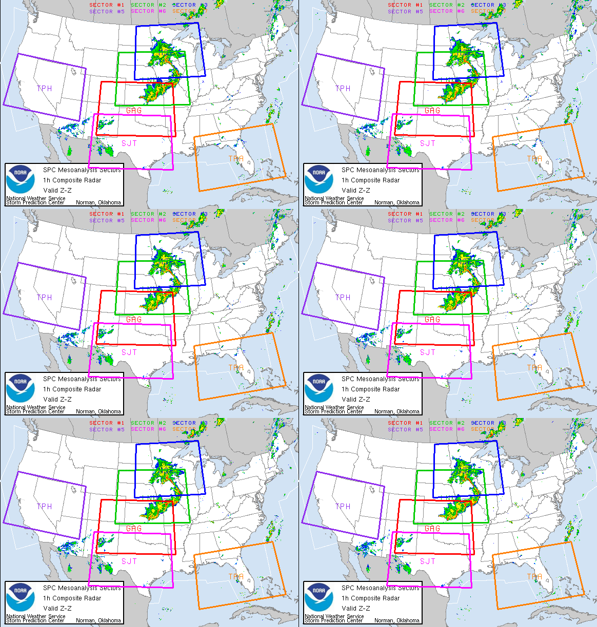
IKE SIMULATIONS BY STORM LABORATORY

IKE TAKING A HIKE!

CHICAGO RAIN FALL TOTALS - IKE
Rainfall amounts for the last 24 hours!
Here are 24 hour rainfall reports from our Cooperative Observers and CoCoRaHs observers.
Thanks to all our observers for their reports and participation in the program!
MAXIMUM/MINIMUM TEMPERATURE AND PRECIPITATION TABLE
NATIONAL WEATHER SERVICE CHICAGO/ROMEOVILLE IL
1000 AM CDT SUN SEP 14 2008
TEMPERATURES AND 24 HOUR PRECIPITATION ENDING AT INDICATED TIME. THIS MORNING. LOCATIONS GROUPED BY CLIMATIC DIVISION. DATA PROVIDED BY NATIONAL WEATHER SERVICE COOPERATIVE OBSERVERS.
Storm update: Some evacuated as Chicago River crests on NW Side
Evacuations and sandbagging were under way in the Albany Park neighborhood on the city's Northwest Side Sunday morning as a section of the Chicago River crested.
The Chicago Fire Department evacuated some residents who live in the 5100 block of North Avers Avenue, south of West Foster Avenue, according to CLTV. The number of people being evacuated was not immediately known.
At the corner of Avers and West Carmen Avenue, water was up to 2-feet deep, and vehicles were moving slowly through the flooded area. The water had reached all the way up to nearby homes, mostly 2-story, brick townhouses. The entire area near Avers and Carmen had been closed off to anyone other than local residents. Police barriers were blocking streets.
Streets and Sanitation bulldozers were dropping sandbags along Avers, and Peoples Gas workers were turning off gas service due to the flooding.
From Tribune reporter Emily Achembaum.
The National Weather Service has issued a flash flood warning until 4:30 Sunday afternoon for large portions of northern Illinois, plus several counties of northwestern Indiana. The warning covers all or parts of the following Illinois counties: Ford, Iroquois, Boone, DeKalb, LaSalle, Lee, Ogle, Winnebago, Cook, DuPage, Grundy, Kane, Kankakee, Kendall, Lake, McHenry, and Will, plus the Indiana Counties of Jasper, Newton, Lake and Porter.
City officials scheduled a news conference at 9 a.m. at the Office of Emergency Services headquarters at 1411 W. Madison to provide a flooding update. CLTV will carry the news conference live.
Roadways: On the Bishop Ford Freeway, a flooded section near 130th Street was affecting traffic in both directions. Northbound at the steel bridge, the left lane was closed, and about a half mile south of the 130th Street exit the right lane was closed, pushing all the traffic into the center lane. Traffic was slowly passing through about 8 inches of water in the center lane, which was the shallowest lane. Southbound lanes were open, but vehicles were sending huge sprays of water into the air as they hit the flooded patch south of 130th.
IDOT's list of road closings due to flooding.
And more on chicagotribune.com's traffic report (right side of page).
The Greater Chicago Red Cross has opened four shelters for people displaced by flooding in the city and suburbs. The shelters are located at:
-- North Park College at 5801 N. Pulaski. The shelter was opened early Sunday to care for people who were evacuated from parts of the Albany Park neighborhood when the Chicago River crested.
-- The Des Plaines Park District at 515 E. Thacker in Des Plaines.
-- St. Stevens Lutheran Church at 14700 S. Kildare in Midlothian in the south suburbs.
-- Mt. Carmel School, 1101 N. 23rd Avenue in Melrose Park.
Cancellation: The fourth annual Lakeview East Festival of the Arts in the city's Lake View neighborhood canceled its second day of events Sunday due to the weather. Know of a canceled event? Send a notice to chicagobreaking@tribune.com
Saturday's rainfall, as measured at O'Hare International Airport, was at least 6.63 inches, breaking the city calendar-day record of 6.49 on Aug. 14, 1987. Records have been kept since 1871. (Read full coverage of Saturday's deluge).
Expect widespread rain Sunday morning, then scattered light showers in the afternoon. There could be an additional 2 to 3 inches of rain in some areas, the National Weather Service predicted. High temperatures will be in the 60s. There is a 30 percent chance of light showers Sunday night, with low temperatures in the 50s. The region should begin to dry out Monday. Cloudy skies are forecast but no new rainfall.
The storms claimed at least one victim. Divers recovered the body of Alan Byrd, 28, of Rolling Meadows, who tried to swim with a friend across a flooded retention pond near Kirchoff and South New Wilke Roads in Arlington Heights.
Towed vehicles: The city's Department of Streets and Sanitation said dozens of vehicles have been towed in flooded areas. Relocated vehicles that were south of the Chicago River are being taken to 4958 N. Springfield, the department said in a news release. Vehicles that were relocated from north of the river are being taken to the Northeastern Illinois University Parking Lot, Lot "L."IT AIN'T JUST IKE
China's coastal provinces evacuate thousands in path of Typhoon Sinlaku 
FUZHOU/HANGZHOU, Sept. 14 (Xinhua) -- Fujian and Zhejiang provinces in east China evacuated about 230,000 people from low-lying coastal regions, as typhoon Sinlaku is approaching, after it pounded Taiwan early Sunday morning.
In Zhejiang alone, nearly 200,000 residents have been evacuated and 30,000 fishing boats have been recalled to harbor, according to the provincial headquarters for flood control.
The approaching of Sinlaku has led to winds of up to 126 km per hour off the coast of Zhejiang and brought about downpours in some areas.
"We must do the utmost to minimize the losses...and guard against flash floods and landslides," said Zhao Hongzhu, secretary of the Zhejiang Provincial Committee of the Communist Party of China.
The flood control headquarters in Zhejiang warned that Sinlaku could cause serious geological disasters on its possible course through Ningbo, Taizhou and Wenzhou cities as well as the Zhoushan Islands.
Local authorities in the province have also urged all coastal scenic spots to shut down business, and persuade tourists to stay in safe places or return home.
Sinlaku is the 13th tropical storm to hit the Chinese mainland this year. It landed at Taiwan's Yilan County early Sunday morning.
The eye of the typhoon was reported to be about 305 km to the southeast of Wenzhou in southeastern Zhejiang at 6 p.m. on Sunday, according to the local weather authorities, and it was moving northwestward to the area at a speed of 10 km per hour.
The observatory in Fujian gave yellow alert, or the second-degree disaster weather warning, to the storm on Sunday, forecasting winds close to hurricane force and heavy rains in the sea area of the Taiwan Straits from Sunday to Monday.
"The typhoon is moving to northern Fujian and Wenzhou. But it's still hard to predict whether it will make a landfall on the mainland or the specific location it will land at," said Chen Hui, vice mayor of Fuding in northern Fujian.
"Yet it will cause losses to the city even if the typhoon doesn't land at Fuding," he said, adding that all public servants in the city have been ordered to cancel their three-day Moon Festival holiday to prepare for combating the typhoon.
Few people were seen walking on the streets of Fuding's Shacheng Township Sunday afternoon and almost all shops had closed. Latest developments about Sinlaku could be heard via loudspeakers incessantly.
"I'll go nowhere tonight. Just stay at home. I have bad memories about typhoons," local resident Yao Rihua, while putting up reinforcement panels on his doors and windows. Continue Reading
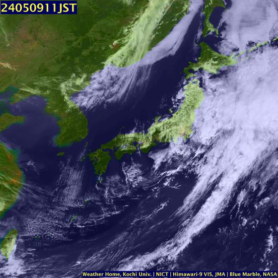
LATEST IMAGE ON TYPHOON SINLAKU

MARITIME NOTE

LYDIA — Hurricane Ike’s wrath has forced road blockades and added law enforcement to flood-devastated parts of the Teche Area, but hasn’t stopped residents from staying for the aftermath of a surge that could bring Rita-like destruction. The devastation included a rogue barge that destroyed the Warehouse Bayou bridge on Louisiana 83.
State police officers and Louisiana National Guard soldiers continuously turned away vehicles and residents trying to get to their homes at Patoutville Road and Louisiana 83 in Lydia because of high water.
An officer at the blockade said he received reports of a man driving an airboat through the flooded areas, creating dangerous waves for residents who stayed in their homes.
Iberia Parish Sheriff’s Office Public Information Officer Wendell Raborn said deputies arrested the driver of the boat, Harold Dauterive, 49, for curfew violation and trespassing.
There is a 24-hour curfew in effect for flooded areas of the parish, and Sheriff Louis Ackal set a bond of $50,000 for curfew violators.
A few blocks past the blockade, Dwayne and Connie Eskind and their niece Layla Fargo waded through the rising water in their yard to check the flood levels in their home.
“We have water coming into one side of our home right now,” Eskind said at midday Saturday. “But not as much as Rita yet. The water from Rita came all at once.”
A CLECO employee trying to rescue his dogs from his home near the blockade in Lydia said the electric company planned to shut off all power to flooded areas to prevent house fires.
CLECO reported at 4 p.m. Saturday that 866 homes in Iberia were without power.
A few miles south of the blockade, the bridge over Warehouse Bayou was destroyed by an unattended barge that crashed into it Saturday morning during the storm.
Robert Freeman, an environmental science manager with the state Department of Environmental Quality, said the barge appeared to have broken loose and wiped out the bridge.
Half of the barge was stuck against the bridge and the other half was sunken, Freeman said.
The crash also caused a small amount of old diesel fuel and hydraulic fluid to spill into the bayou. Freeman described the barge as a “keyway” barge used to put rigs on for drilling.
No injuries were reported.
Six campers from southeast Texas and a few from Delcambre sought refuge from Ike on Highway 89 near Lake Peigneur, where flood waters had already risen to nearly 6 feet on some areas along the lake’s banks.
Early Saturday morning, Jackie Delcambre of Orange, Texas, watched the white-capped waves on the lake smash around the roof of a flooded building where campers are typically parked.
“The water never crests like this,” said Lisa Broussard, who lives along Lake Peigneur. “The camping spots for RVs are underwater. There was grass there yesterday (Friday).”
Officials to begin surveying Texas waterwaysOfficials on Sunday were planning to survey Texas waterways in the aftermath of Hurricane Ike.
``Our goal is to get these waterways open as soon as possible,'' said Col. David C. Weston, commander for the Corps of Engineers Galveston District. ``We know how critical they are to our nation's economy and industry, and, weather permitting, we will begin today.''
Other agencies who will be taking part in the project are the U.S. Coast Guard, the National Oceanic and Atmospheric Administration, pilots, and the Gulf Intracoastal Canal Association and Terrasond, a contractor.
Officials plan to conduct hydrographic and side scan sonar surveys of the Houston/Galveston Bay complex and the Sabine Neches Waterway in the next two days.
Other waterways to be surveyed include Freeport, Matagorda, the Corpus Christi Ship Channel, the Victoria Barge Channel, and Chocolate Bayou.
Seventeen survey survey boats are being used.
The Houston/Galveston Bay complex includes the Port of Houston, Port of Galveston, Port of Texas City, Green's Bayou, Bayport and Barbers Terminals, and the Sabine Neches Waterway includes the Ports of Orange, Beaumont, and Port Arthur.
The Corps partners with the Coast Guard, NOAA, and the Gulf Intracoastal Canal Association as part of the Texas Joint Hurricane Response Team during hurricanes to work to survey and open the coastal waterways.
RS












![Validate my RSS feed [Valid RSS]](valid-rss.png)