Tuesday, January 15, 2008

Tornado Safety and the "Be Ready Campaign"!

Well who would have thought I would be blogging about tornado safety in January?

But as I blogged on January 11, 2008 we in Illinois and Wisconsin in fact had some very rare weather events resulting in at least three tornadoes. So did many other parts of the United States.

Its important to remember that mother nature can surprise everyone at anytime, so we all must be prepared for unusual weather and severe weather anytime.

One of the issues that developed after these rare tornado events occurred were people calling their local 911 system when they heard the tornado sirens of which both Chicago and Milwaukee utilize blasting away.

I cannot stress enough that calling the 911 system to find out what the sirens are for is not a smart idea. First your wasting time. Once you hear these sirens your instructed to "take cover immediately", not call 911 for information and potentially tie up a system designed for dispatching emergencies. We all have to remember that while we are calling 911 seeking information they just might be kind of busy with the results of the reason why the sirens are going off in the first place and we just might take away a 911 operator from dispatching emergency services to someone in need.

For example, here are two recordings of the recent 911 calls into the Kenosha, Wisconsin 911 system during the recent tornado events. Listen to the calls and realize what was really happening while people were calling in seeking information.


| | | | | |

OK, so what do we really need to do when this happens? Well first we all must "Be Ready" for severe weather at all times. Secondly, we all have smoke detectors in our homes to alert us from the beginning stages of a fire. Well we should all also have a Weather Radio as well. These radio's are inexpensive most cost around $20.00. Small investment to keep you and your family safe.

Like a smoke detector keeps you warned a weather radio will keep you alert to developing severe weather and warn you to take action when weather becomes dangerous. Third, have a plan ready, including a communications plan for all family members. This communications plan should also include a rallying point, after the all clear signal has been issued, in case communications is cut due to down wires or lost of cell towers for family member caught outside and away from your home. Finally, if you hear sirens don't call the 911 system, be ready, tune into your local radio and TV news outlets and if you must call someone, use the "non-emergency" number for your local police department". NOT THE 911 NUMBER! Unless your calling in to report a emergency!

But remember while your making this call mother nature can be in your backyard bearing down on you! So more importantly we all have to "Be Ready"!

Storm Spotter/Chaser Richard Niemeyer alerted me to the next “BE READY CAMPAGIN”, for Southern Illinois. This is a FREE PROGRAM! So take advantage of it!

PRESS RELEASE

For Immediate Release

January 14, 2008

SI-CERT Announces the 2008, “BE READY CAMPAGIN”, for Southern Illinois. Do not make Preparedness an After Thought!

Would you place your very survival and that of your family in the Hands of a Stranger?

You would probably respond with “NO”, or, “I hope that I never have to rely on a complete stranger to save my life or that of my family.” However, each of us does this daily with our personal safety.

Do you have life insurance, homeowners insurance, and auto insurance? Would you go even one day of your life without them? Of course not; the financial risk is too great to you and your family. One accident and everything is lost.

But there is another assurance that you have not taken out that could cost you and your loved ones lives. Do you Give Up?

It’s DISASTER PREPAREDNESS!

There are no special books to buy, and the resources and training are available FREE of charge. So let’s make today the first day of that new assurance, the day that Citizens must take personal responsibility for disaster preparedness. Prepare, Protect, and assure yourselves for disasters and emergencies. Remember when disasters or emergencies occur time is of the essence, and if professions are backed up and can’t get there, you may make the difference in the live and death of a loved one. So think about it, do you still want to live without an assurance that could be so costly? Think about it, educate yourself on what to do, so that you can better assure yourself and your loved ones when a disaster or emergency occurs!

SI-CERT Announces the 2008, “BE READY CAMPAGIN” for Southern Illinois. The Southern Illinois Community Emergency Response Team prays that the Citizens of Southern Illinois will join us in improving the safety and readiness of all who live and work here in Southern Illinois. Don’t be left out, take the responsibility that will reward you and your family with increased security and Peace of Mind.

As responsible community minded Citizens it is very important that you attend the 4th Annual Meeting of the “Housing and Neighborhood Action Group”- “Carbondale Conversations for Community Action” as this year’s important topic is Emergency Preparedness. This meeting will provide you with some wonderful resources for both you, and your Neighborhoods. The meeting is 9:30 AM Saturday morning January 19th at the First United Methodist Church, 214 East Main Street, Carbondale, Illinois. The Housing and Neighborhood Action Group - Carbondale Conversations for Community Action has the eventual goal of developing a Community Emergency Response Team (CERT) for Carbondale.

The Southern Illinois Community Emergency Response Team has become a part of a national network of CERT communities. SI-CERT has developed a program that is designed to help communities prepare for and respond after catastrophic disasters such as earthquakes, tornadoes, and other major emergencies. We need you, the Citizen Volunteers, those of civic mind and pride in country, to commit to a life of service in preparation for a day that we all hope will never come. The day of a catastrophic disaster right here in your home town and neighborhood.

The mission of SI-CERT is to be a conveyor for the community, a catalyst for social action and the key resource for Citizen Volunteer involvement in disaster preparedness, response, mitigation and recovery. To be the premier provider of volunteer services through innovative program development with volunteers who are not only prepared for a disaster; but, are trained and equipped to respond with compassion and dedication to help those in need and answer the call to service.

SI-CERT will serve all of the Residents, the Citizen Volunteer’s and the Non-Profit Groups, Governmental Agencies, and the Profit Organization’s in the Sixteen (16) Southern Most Counties of Illinois; namely Alexander, Franklin, Gallatin, Hamilton, Hardin, Jackson, Johnson, Massac, Perry, Pope, Pulaski, Randolph, Saline, White, Williamson, and Union.

SI-CERT will promote, recruit and develop Citizen Volunteers for involvement in charitable service to their communities in times of disaster or community need in all the communities we serve.

SI-CERT will meet the educational needs of the Citizen Volunteers through innovative training programs that will provide them with the skills to be effective in their service to their community in time of disaster and/or community need.

SI-CERT will promote preparedness and development of response capabilities in the counties that we serve and this will be done by the coordination and administration of Citizen Volunteers through Community Emergency Response Teams and Non-Profit Organizations that are active in disaster preparedness, response, mitigation and recovery.

To learn more about SI-CERT go to our new web site at: http://www.sicertinc.org/ or call Richard Niemeyer, KC9JMW at (618)-319-9206 or email richardniemeyer@mchsi.com .

To learn more about the upcoming 4th Annual Meeting of the Housing and Neighborhood Action Group - Carbondale Conversations for Community Action contact Carbondale Conversations for Community Action: at 549-5302 x 386 or studycircles@ci.carbondale.il.us

MISSISSIPPI TORNADO UPDATE

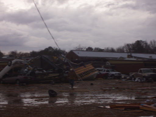
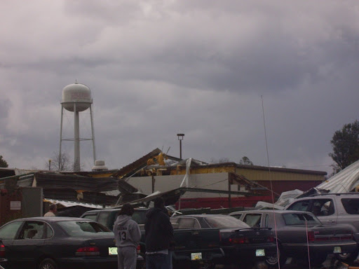
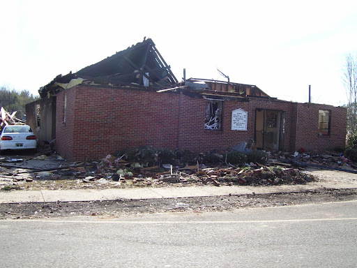
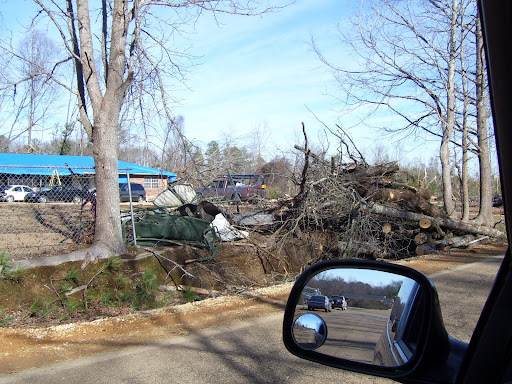
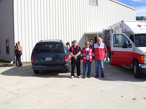
Storm Spotter and emergency aid worker Pauline Redmond was kind enough to send me these photo's of the aftermath of the Caledonia, Mississippi Tornado.


REMEMBER
"Be Ready"!

RS

Monday, January 14, 2008

NOAA: Sunspot is Harbinger of New Solar Cycle, Increasing Risk for Electrical Systems

A new 11-year cycle of heightened solar activity, bringing with it increased risks for power grids, critical military, civilian and airline communications, GPS signals and even cell phones and ATM transactions, showed signs it was on its way late yesterday when the cycle’s first sunspot appeared in the sun’s Northern Hemisphere, NOAA scientists said.

“This sunspot is like the first robin of spring,” said solar physicist Douglas Biesecker of NOAA’s Space Weather Prediction Center. “In this case, it’s an early omen of solar storms that will gradually increase over the next few years.”

A sunspot is an area of highly organized magnetic activity on the surface of the sun. The new 11-year cycle, called Solar Cycle 24, is expected to build gradually, with the number of sunspots and solar storms reaching a maximum by 2011 or 2012, though devastating storms can occur at any time.

During a solar storm, highly charged material ejected from the sun may head toward Earth, where it can bring down power grids, disrupt critical communications, and threaten astronauts with harmful radiation. Storms can also knock out commercial communications satellites and swamp Global Positioning System signals. Routine activities such as talking on a cell phone or getting money from an ATM machine could suddenly halt over a large part of the globe.

“Our growing dependence on highly sophisticated, space-based technologies means we are far more vulnerable to space weather today than in the past,” said Vice Admiral Conrad C. Lautenbacher, Jr., under secretary of commerce for oceans and atmosphere and NOAA administrator. “NOAA’s space weather monitoring and forecasts are critical for the nation’s ability to function smoothly during solar disturbances.”

Last April, in coordination with an international panel of solar experts, NOAA issued a forecast that Solar Cycle 24 would start in March 2008, plus or minus six months. The panel was evenly split between those predicting a strong or weak cycle. Both camps agree that the sooner the new cycle takes over the waning previous cycle, the more likely that it will be a strong season with many sunspots and major storms, said Biesecker. Many more sunspots with Solar Cycle 24 traits must emerge before scientists consider the new cycle dominant, with the potential for more frequent storms.

The new sunspot, identified as #10,981, is the latest visible spot to appear since NOAA began numbering them on January 5, 1972. Its high-latitude location at 27 degrees North, and its negative polarity leading to the right in the Northern Hemisphere are clear-cut signs of a new solar cycle, according to NOAA experts. The first active regions and sunspots of a new solar cycle can emerge at high latitudes while those from the previous cycle continue to form closer to the equator.

SWPC is the nation’s first alert for solar activity and its effects on Earth. The center’s space weather forecasters issue outlooks for the next 11-year solar “season” and warn of individual storms occurring on the sun that could impact Earth. SWPC is one of NOAA’s nine National Centers for Environmental Prediction and is also the warning agency of the International Space Environment Service (ISES), a consortium of 11 member nations.

The National Oceanic and Atmospheric Administration, an agency of the U.S. Commerce Department, is dedicated to enhancing economic security and national safety through the prediction and research of weather and climate-related events and information service delivery for transportation, and by providing environmental stewardship of our nation's coastal and marine resources. Through the emerging Global Earth Observation System of Systems (GEOSS), NOAA is working with its federal partners, more than 70 countries and the European Commission to develop a global monitoring network that is as integrated as the planet it observes, predicts and protects.

Mississippi Twister News!

Picking Up the Pieces After Tornado Damage

In the aftermath of Thursday's tornadoes, many Mississippians are now in recovery mode. The storms left injuries and widespread destruction in several areas of the state. Four counties are a under a governor-issued state of emergency.

Those counties are Attala, Choctaw, Holmes and Lowndes county. Governor Haley Barbour says declaring a state of emergency will help the counties get the assistance they require. Thursday's destructive storms are also blamed for a least two fatal traffic accidents in Mississippi.

In Lowndes County alone, at least 25 homes were destroyed, 22 suffered major damage and 59 had minor damage, according to the Mississippi Emergency Management Agency. MEMA also says one Lowndes County business was destroyed, two had major damage and two had minor damage. Also, 11 people were injured - three serious enough to go to the hospital but none with life-threatening injuries.

In the Caledonia community in Lowndes county, a school is one place that suffered very noticeable damage. The strong winds picked up school buses -- tossing one onto a roof. At least two students suffered injuries. Friday, Skycopter 3 flew over Caledonia, and clearly the twisters left a path of flattened buildings and snapped trees. At least two tornadoes touched down in the Caledonia community as they roared through.

The Red Cross has moved into Holmes County to assist those made homeless by the tornado. One of the most serious injuries in that area was to a 52 year old woman who lived alone in a trailer that was destroyed, just south of Goodman. Deb Smith is in fair condition at University Medical Center in Jackson.

The steel frame of the trailer where she lived is twisted around a huge tree like a pretzel. Miraculously, fire personnel from Goodman were able to pull her out of the wreckage and get her to a hospital in Holmes County. She was later airlifted to U.M.C.

In Choctaw County, storms not only left two people injured and some homes damaged -- but also left 10 cows dead and about 70 cows injured. The storms also created power outages in various areas of the state.

International News from IAEM

AUSTRALIA: Severe storm leaves scores of homes damaged
Emergency crews are working to fix homes and restore power to properties affected by a severe storm that hit parts of western Sydney yesterday afternoon. The State Emergency Service (SES) says it received more than 200 calls for help in the Penrith and Blacktown areas, many from people whose homes had been damaged by heavy rain and strong winds.

RS

Friday, January 11, 2008

Rare January Tornado in Northern Illinois Monday Afternoon Rated EF3

Rare January Tornado in Northern Illinois Monday Afternoon Rated EF3

NWS REPORT
Updated: January 9, 2008

A weather pattern more typical of early May than early January across northern Illinois brought severe weather to the area Monday afternoon. Originally two tornadoes were reported with these storms in Boone County and McHenry County along the Wisconsin border. On Tuesday, damage surveys conducted by National Weather Service personnel revealed one long continuous path from a single tornado. The tornado started at 3:30 PM about 1.2 miles north of Poplar Grove in Boone County and ended at 3:48 PM about 3.2 miles north-northeast of Harvard in McHenry County.

Tornado Rating --- EF3 on the Enhanced Fujita Scale

Maximum winds --- 136 to 165 MPH

Path Length --- 13.2 miles

Maximum width --- Around 100 yards

There were four injuries reported in Boone County and one in McHenry County.

Please refer to the full Public Information Statement for additional details.

This weather event was unusually intense and climatologically very rare. The National Weather Service has tornado records dating back to 1950. In this 58 year period of record, only one other tornado has ever been documented anywhere in north central or northeast Illinois in the month of January. That tornado occurred on January 25, 1950 at Momence in Kankakee County. It was rated F2 on the Fujita scale. It was a day similar to Monday with temperatures in the middle 60s. In fact, Chicago set the all time record high for the month of January, with a temperature of 67 degrees, on that date.

Damage Photos from Ground and Aerial Surveys

Conducted by NWS Personnel and Illinois Group 22 of the Civil Air Patrol

<span class=EF2 Tornado Damage at Edwards Apple Orchard" height="427" width="640">
EF2 damage at Edwards Apple Orchard northeast of Poplar Grove near the intersection of Beaverton Road and Centerville Road.

House destroyed by <span class=EF3 tornado northeast of Poplar Grove." height="427" width="640">
House destroyed by EF3 tornado, also near intersection of Beaverton Road and Centerville Road.

House destroyed by <span class=EF3 tornado." height="480" width="640">
Ground-level view of house northeast of Poplar Grove destroyed by EF3 tornado.


House at Edwards Apple Orchard
House damaged by EF2 tornado at Edwards Apple Orchard.


Hay bales rolled across field by <span class=tornadic storm." height="427" width="640">
Tracks showing where large hay bales were rolled through a field by the storm, near Boone School Road.


Garages and machine shed destroyed by tornado
Garages and machine shed destroyed by EF1 tornado on Leroy Center Road.


Hay barn collapsed on <span class=Capron Road" height="427" width="640">
Hay barn collapsed on Capron Road.


Homes damaged and train derailed at Lawrence
Homes damaged and train derailed at Lawrence.


Snow debris
The climatologically unusual nature of this event is illustrated by a large pile of leftover snow covered by tornado debris and surrounded by topped trees and twisted metal siding.

TWISTER IN MISSISSIPPI!


Storms, Possible Tornadoes Hit Mississippi

At Least 2 Injured By Powerful Storms Thursday

POSTED: 4:05 pm EST January 10, 2008

At least two people were injured Thursday as powerful thunderstorms packing heavy rain and possible tornadoes pushed across Mississippi.There were numerous reports of scattered property damage around the state, including at a school in Caledonia, Miss."Schools and buses are damaged and one of the old gyms there could be destroyed so we've got an area coordinator on the way there to check it out," said Lea Stokes, a spokeswoman for the Mississippi Emergency Management Agency.Choctaw County Medical Center in Ackerman, Miss., said it had received reports of two storm injuries but that they did not appear to be serious.Steve Montgomery, an emergency management spokesman in Choctaw County, Miss., said one woman was injured and a large dairy barn was heavily damaged during the peak of the storms Thursday afternoon.Montgomery said he had no additional information on the woman or the extent of her injuries.A dispatcher at the Ackerman Police Department said the dairy was located near Weir, Miss., and, from police radio reports, it appeared several barns at the farm had blown down.
ALABAMA TWISTERS!

WSBTV.com

Tornadoes Close Alabama Schools

POSTED: 5:56 am EST January 11, 2008
Two apparent tornadoes toppled trees and caused scattered damage today as strong storms moved into Alabama where thousands of students were sent home early as a precaution. Jim Westland is a meteorologist with the National Weather Service office in Birmingham. He said this evening that suspected twisters touched down in the Lamar County town of Sulligent and in the Wiley community in northern Tuscaloosa County. Westland said storm survey teams would be sent to those areas tomorrow to determine whether tornadoes actually touched down. Downed trees and power lines, structural damage and power outages were reported in various parts of the state. Severe weather warnings are continuing into the evening for some areas. The University of Alabama suspended classes and the University of North Alabama shut down in Florence. A number of public and private schools from the state line to Birmingham dismissed classes early because of the threat of severe weather. At least two people were killed in traffic accidents and more than a dozen injured in Mississippi, where more than 100 homes were also damaged or destroyed and power outages were widespread. The storms were ahead of a cold front that is expected to drop high temperatures into the low 50s across much of the state tomorrow.

MARITIME NOTES

Maritime Security: Federal Efforts Needed to Address Challenges in Preventing and Responding to Terrorist Attacks on Energy Commodity Tankers, GAO-08-141, December 10, 2007

Have a great weekend!
RS


Thursday, January 10, 2008

Air-drop in effort to free trawler from ice

New Zealand Herald - New Zealand Sunday January 06, 2008

The Antarctic ice is unforgiving to stranded ships.


United States Air Force loadmasters dropped an engine piston and casing from approximately 121m above the Ross Sea ice this morning to a British fishing boat which has been stranded in the ice for a week.

USAF Lieutenant Colonel Jim McGann, the New Zealand-based Deep Freeze commander, told Radio New Zealand that repairs using the parts should enable the trawler to sail back to Christchurch.

The C-17 Globemaster III flew out of Christchurch with the 68kg parts at the request of the New Zealand Rescue Coordination Centre, which had been told the Argos Georgia, lost all main engine power a week ago and became frozen in the ice floes off the Ross Ice Shelf, north of Scott Base.

The US Air Force said other options to rescue the ship were either no longer available or would have taken another 10 days, the Seattle Post Intelligencer newspaper reported.

The 36m vessel had been chartered for long-lining for toothfish and is registered in St Helena, an island in the South Atlantic, and owned by the Argos Group, based in the Falklands

The flight crew, from the USAF 446th Airlift Wing and 62nd Airlift Wing, dropped the parts while travelling at a speed of 220km/h just after midnight.

New Zealand is responsible for coordinating rescues and marine safety in the Ross Sea.

Argos Oceanic Ltd of Bermuda, which chartered the vessel for toothfish voyages, was last year fined $13,500 in the Christchurch District Court for spilling fuel oil in Lyttelton Harbour.

The Argos Georgia Ltd fishing company recently joined two New Zealand fishing companies, Sanford Ltd and New Zealand Long Line Ltd, in applying for assessment of the Antarctic toothfish longline fishery in the Ross Sea by the Marine Stewardship Council.

The fishery is made up of 21 vessels from nine countries.

MARITIME NOTES

Try handling these waves!


Ship In Rough Water - Watch more free videos


And then there is the....
http://www.gonhs.org/images/NewFlameWreck_000.jpg

Costa de la Luz
New Flame salvage operation reported to be underway off Gibraltar
By m.p.
Jan 6, 2008 - 7:38 PM

The Warrior, a specialised tow boat which flies under a United States flag, arrived on Saturday to assist in the salvage operation for the stricken cargo ship, the New Flame, which has been lying half sunken off Gibraltar since it was hit by a tanker last August. The vessel broke in two in heavy weather on 22nd December.

Titan Maritime, one of the largest companies in the field of marine salvage, is now in charge of the operation to recover the New Flame and its cargo of 42,000 tons of scrap metal.

The Mayor of Algeciras, Tomás Herrera, has meanwhile said that work to clean up La Concha Beach is proceeding well, and said there have been no new spills on the local beaches. The Environment Ministry said last Thursday that a team of 10 personnel from the Coastal Authority remains on standby in the area to take immediate action in the case of any further pollution. The Ministry said 239 tons of polluted material have been removed from the beaches in Algeciras, which authorities in Spain believe came from the New Flame.


Volunteer Efforts...

A volunteer cleanup effort will be held Saturday to help pick up after a tornado tore through northern Boone County on Monday. The cleanup will start at 8 a.m. at the Poplar Grove Fire Station on Illinois 173 in Poplar Grove. Lt. Phil Beu of the Boone County Sheriff’s office released totals for injuries and damage today. Four homes were determined to be uninhabitable, four others sustained major damage and nine homes received minor damage. There were 38 structures, including outbuildings and silos, and nine vehicles that were also harmed by the storm. Four people were injured, none fatally. The most seriously injured was Jeannette Nichols, who sustained broken ribs, broke her collarbone in two places and had a punctured lung, among other injuries. One horse, belonging to George Conley of Capron, was killed.

LASTLY
Thursday, 03 January 2008200801030500

Round-the-world skipper hails 'guardian angel'

Record-breaking British sailor Dee Caffari has been reunited with her "guardian angel" in Wellington.

She embraced Westpac rescue helicopter crewman Dave Greenberg for the first time yesterday after he plucked one of her crew from the Pacific Ocean in a dramatic rescue during the Global Challenge almost three years ago to the day.

Ms Caffari was delighted to finally meet her friend's saviour, who now holds a special place in her heart.

"He is my southern hemisphere guardian angel. I owe a lot to Dave and we will always be friends because of what happened," she said.

"Whenever I am in the water I think of guys like him that make everything okay."

The rescue helicopter flew overhead as the pair embraced, and Ms Caffari remarked that three years ago it was the best sight she could have seen.

The rescue was sparked after John Masters, a crew member on her yacht, was thrown into a cabin when a rogue wave hit the boat off the Chatham Islands. He was later found to have potentially fatal peritonitis.

Mr Masters, a 59-year-old Kiwi-born Essex teacher, who was also suffering from an abdominal infection, was lifted off the yacht by helicopter before being flown the 600 kilometres to Wellington by fixed-wing aircraft for treatment.

The mercy mission, involving four aircraft, was the third-longest-distance rescue in the history of Wellington's Life Flight service.

Mr Greenberg said he looked back proudly on the rescue. "But I hope we never meet again in those circumstances. She is a very remarkable woman, and I wish her all the best in her future endeavours."

Mr Greenberg was invited to launch Ms Caffari's new Kiwi-built 20-metre yacht, Aviva, at Chaffers Wharf. She will race the boat in the Vendee Globe non-stop solo round-the-world race in November. The Ocean 60 yacht was built by Hakes Marine in Seaview, Lower Hutt.

The 33-year-old from Hampshire, the first woman to sail around the world alone going west, is now aiming to become the first to complete the voyage both ways.

She decided to have the yacht built in New Zealand because of the technology and craftsmanship available.

She will spend the few weeks getting acquainted with Aviva, which took seven months to build, before it is shipped to Europe. She will then compete in a race from France to the United States to prepare for the Vendee Globe.

The Open 60s are some of the fastest boats in sailing, created for solo sailors who push their machines to the limit.

"This boat rocks, it is really fast. I will spend the next couple of weeks sailing it to see if there are any issues, but, fingers crossed, it is okay."


RS

Wednesday, January 9, 2008

Black Sea Storms

Back on Tuesday, November 13, 2007 we reported on a severe storm that sunk several Russian ships on the Black Sea ( See Mother and Her Fury!). We recently reported on severe weather grounding the vessel Vanessa, (See Dar be Storms Ablow'in! ) and severe weather effecting Bulgaria and Romania. These at-sea storms have a deadly impact on ships and their crews while most of the incidents go unreported by electronic media outlets both in the United States and worldwide. For example, Cargolaw reported on the Vanessa,

"Bulgarian cargo M/V Vanessa, with 10 crew and a pilot aboard and cargo of scrap metal, sank in the Kertch Strait in severe seas on Jan 3 at 0600LT. There were 11 people on board the ship -- 10 Bulgarian crewmen and a Ukrainian pilot. Two ships proceeded to M/V Vanessa after its SOS-call but were unable to help due to the storm. Rescuers found only one survivor and the bodies of three crew. The bodies were taken aboard a rescue speedboat. Before the sinking the bulwark was torn from the ship. From our Sr. Correspondent Tim Schwabedissen and our Moscow Correspondent Mike Voitenko (Thurs. Jan 3 2008)."

Anyone remember seeing this report on any of the US major news outs? At-Sea Storm reports are just as critical if not even more critical than shore-side reports, since severe weather happens at sea more often than on shore. I include subsea storms or weather pattens exclusive to the oceans. Of course chasing these weather systems is not that easy either.

Chasing maritime weather systems is very different from chasing shore-side storms. Normally a seaman is not chasing, he is normally being chased or caught in the storm with limited escape possibilities. Meaning he is forced to ride out the storm. I can assure you that riding out one of these storms is not pleasant and scary. Like the old saying, "there is no atheists in a fox hole", well there are no atheists at sea either... As its been said, "Ship Happens!"

Thanks to my good friend and shipmate Captain John Konrad of gCaptain.com, These dramatic pictures are from Novembers storm.

storm in Ukraine 2


storm in Ukraine 2


storm in Ukraine 4

storm in Ukraine 5

storm in Ukraine 6

storm in Ukraine 7

storm in Ukraine 8


storm in Ukraine 6

storm in Ukraine 7


MARITIME NOTES

Cargolaw has a posting asking for assistance in solving this mystery. Dr. Beach Asks: What Vessel Lost This?

This little note from our British friends...

Gale-force winds of more than 75mph buffeted parts of Scotland and Northern Ireland today, causing flooding and danger on the roads. Ferry services between Northern Ireland and Scotland were suspended last night because of the weather conditions, which reached 78mph in the Isle of Islay off the west coast of Scotland. The Forth Road Bridge remained closed to all vehicles except cars, and Fife Constabulary said roads in the area suffered from minor flooding. The high winds would continue today, shifting further north as the day continues, leading to a bright day with blustery showers, forecaster said. The Met Office issued a severe weather warning of winds up to 80mph with the the prospect of structural damage. Tony Conlan, a forecaster with MeteoGroup, the Press Association's weather division, said the highest gust measured 78mph in the Isle of Islay. He said even stronger gusts were expected today across Northern Ireland and central Scotland. He said that by the evening most places will have seen the last of the bad weather, for now. Stena Line cancelled both fast ferry and conventional ferry services between Belfast and Stranraer because of the severe weather.

The firm warned of further possible disruptions today. Police warned of a road closure in Lisburn, County Antrim, Northern Ireland after power cables were brought down. The Foyle Bridge in Londonderry, Northern Ireland was closed to all traffic. A spokeswoman for Fife Police said: "Numerous trees have been blown down blocking the roads and we have had some minor flooding across the region. "But it has not been a disaster, it has just been a bad winter night due to high winds and sweeping rain." Rough sea conditions in the English Channel were causing delays this morning to some ferry services, the Port of Dover said. All sailings from the Eastern Docks with P&O Ferries were running about 90 minutes late. Norfolkline services to Dunkerque were also experiencing some disruption to their timetables, a port spokeswoman said.


RS

Tuesday, January 8, 2008

CRAZY WEATHER!

Tornadoes in January? You ain't just Whistling Dixie!

WBBM Chicago reported up to ten (10) possible tornadoes touched down between Northern Illinois and Southern Wisconsin!

The last time the area experienced tornadoes in January dates back to 1950. It certainly has been a day from records. Temp high 68 degrees!

Currently we have a flood watch until this afternoon.

(Photos taken by Valpo University student Aron Brackett)

chicagotribune.com

Rare tornadoes rake the area

Kenosha area gets worst of twisters

By Tara Malone, Andrew L. Wang and Jeff Long

Tribune staff reporters

11:31 PM CST, January 7, 2008


Monday in northern Illinois and southern Wisconsin, as tornadoes and high winds destroyed buildings, left scores of families homeless and derailed freight cars.

Funnel clouds—as rare of a January occurrence as people jogging along Lake Michigan in short sleeves—came as the downside of record-breaking warm weather across the area. With the date's previous high of 59 degrees shattered by 9:56 a.m. at O'Hare International Airport, winter-weary Chicagoans shed their heavy coats and ventured outside, when temperatures hit a high of 65.

A tornado watch went into effect at 2:35 p.m. and winds reached dangerous speeds. Lightning ended bike rides and playground visits in the city and suburbs, while darkening skies in parts of northern Illinois and southern Wisconsin introduced a storm so severe it derailed a freight train, forced an elementary school's lockdown and sent people fleeing for cover.

There were no reported fatalities or serious injuries.

In Kenosha County, authorities said about 100 people had been forced out of their homes, and a twister damaged at least 26 houses, including at least a half-dozen that were severely damaged or destroyed.

"So far I think it's rather miraculous" that injuries weren't worse, said Sgt. Gil Benn of the Kenosha County Sheriff's Department. "I can only venture a guess, but a forewarning from the sirens must have played a role in getting people into basements. That may have been a significant factor in saving lives."

The funnel clouds marked the Chicago area's first January tornado since the National Oceanic and Atmospheric Administration began tracking in 1950.

Wisconsin had not experienced a January tornado since Jan. 24, 1967, when funnels touched down in Rock and Green Counties, as part of an eight-funnel-cloud storm system in Wisconsin and Illinois that killed one person and injured 21 others.

"It's unusual, but it does happen," said Greg Carbin, NOAA's warning coordination meteorologist.

Monday's storm tore through the southwest part of Kenosha County around 4 p.m., then headed northeast, causing damage in a swath about a quarter- to a half-mile wide. Trees were uprooted. Homes were destroyed or left without power. A Wheatland, Wis., elementary school was locked down when the sirens sounded during an after-school basketball game.

Many homes remained out of reach for emergency crews late Monday because of debris and downed power lines, Kenosha County Sheriff David Beth said.

"I have never, ever seen damage like this," he said. "We have homes in Kenosha County that have just been flattened. . . . To have this happen in January is just mind-boggling."

The American Red Cross and Salvation Army were on the scene to help those whose homes were destroyed.

Jason and Jodie Hammock were at a family funeral in nearby Paris, Wis., when their 11-year-old daughter, who was at their Wheatland house alone, called to say she heard a tornado warning. The couple sped home and pulled into their driveway when they saw the funnel cloud bearing down.

"It was just a huge white thing. And you can't even describe the sound," Jason Hammock said.

He rushed his wife and daughter into a basement crawl space. Jodie Hammock attempted to console the weeping girl as he stayed outside.

In the crawl space, the mother and daughter heard an enormous roar, followed by what sounded like a pop.

Then silence.

"I thought everything was fine," Jodie Hammock recalled. "Then Jason opened up the garage door and he was like, 'Oh, my God.' It was just like the movies. It was scary."

Much of the family's home was undamaged. But the roof of the garage collapsed on their vehicles and a patch of roof over the kitchen was gone. A 50-foot-tall oak tree was felled in their back yard.

Across the border near Poplar Grove in Boone County, Ill., apple orchard owners Barb and Ken Hall headed toward the basement after an employee called from the road to report he had just seen a twister barreling their way. The couple reached the cellar just as the funnel cloud roared across their property, heavily damaging their two-story home and destroying a neighbor's house across the road.

The tornado knocked down buildings at the orchard as well as their store, Barb Hall said. It also uprooted several stands of tall pine and oak trees on their property but spared most of the apple trees.

"Things were flying all over," she said. "If you go into the house, it looks like a bomb went off in there."

The strong winds also caused a potentially hazardous freight train derailment in McHenry County, leading police to evacuate a small town.

Authorities asked 500 Lawrence residents to vacate their homes as a precaution after several cars—including one tank containing flammable material—derailed.

The derailment, which occurred at about 4 p.m. in nearby Harvard, involved a Union Pacific locomotive and 12 cars.

A tank car containing ethylene oxide, a flammable liquid, had rolled onto its side but did not appear to have sprung any leaks, Davis said. Another tank car was carrying shock fluid.

The storms knocked out power across the area and, as of 7 p.m., about 11,000 Commonwealth Edison customers were without power across Illinois, with nearly 9,200 customers in the south suburbs, spokesman Luis Diaz-Perez said.

"The hardest hit areas appear to be Richton Park, Monee and Oak Forest," Diaz-Perez said.


(Photo's by Aron Brackett)


FROM THE CHICAGO SUN TIMES

BY NORMAN PARISH Staff Reporter/nparish@suntimes.com

Tornadoes severely damaged dozens of homes, a semi-truck and an electrical transformer in northern Illinois and southern Wisconsin this afternoon, officials said.

Illinois State Police said they believe storms triggered a train derailment in McHenry County, causing nearly 200 people to be evacuated from 70 to 80 homes, said Sgt. Chris Melvin, of the state police.

In Kenosha County, tornadoes severely damaged nearly 50 houses, as well as an apartment complex, Kenosha County sheriff' officials said.

As of 8:30 p.m, there were no fatalities there but possibly some injuries after tornadoes struck the area just after 4 p.m., officials said. Dozens of families were displaced following the storms, officials added.

Near Poplar Grove in Boone County, three people suffered minor injuries when six or seven houses were severely damaged by tornadoes before 4 p.m., officials said. Some of the houses were "totally leveled," said Lt. Perry Gay of the Boone County sheriff's department.

A locomotive and seven train cars also derailed, Union Pacific officials said. It is unclear whether the derailment at about 4 p.m. just north of Harvard in McHenry County was because of storms, said Mark Davis, a spokesman for the railroad.

One car was carrying ethylene oxide - a flammable substance that is used to sterilize medical supplies. Officials don't believe there were any leaks in that car. But state police said the area was evacuated because they feared that when the car is removed, a leak could occur. Many residents were staying at Harvard High School.

One car carrying hydraulic fluid was leaking, Davis acknowledged.

The train was heading from North Lake to Janesville, Wis. No one was hurt during the incident, he said.

Also north of Harvard, tornadoes flipped over a semi-truck and damaged an electrical transformer. Officials said they didn't know of any injuries.

Fire departments from across Lake County (Ill.) responded to a "disaster box" call to assist in rescue efforts following the tornadoes that swept southeast Wisconsin.

Fire Marshal Steve Lenzi of the Waukegan Fire Department said crews from as far south as Lincolnshire responded to the call that was sent out at about 5:15 p.m. by the Kenosha Fire Department.

"This is the first one I can recall since the flood down in Chicago back in 1992," Lenzi said. " ... As I understand it, a lot of Kenosha's resources were sent out to Wheatland, so they needed assistance to cover Kenosha."

At Kenosha's request, Waukegan sent its heavy rescue squad, which Lenzi described as "a huge toolbox" for responding to structural collapses, trench cave-ins and hazardous material spills. A field command center was set up near Interstate 94 and Route 50.

Waukegan also sent a haz-mat technician to assist in Harvard, site of the McHenry County train derailment.

Contributing: Dan Moran, News Sun

FROM NWS CHICAGO

Rare January Tornadoes Produce Heavy Damage in Northern Illinois Monday Afternoon

January 7, 2008

A weather pattern more typical of early May than early January across northern Illinois brought severe weather to the area Monday afternoon. Two tornadoes were reported with these storms in counties along the Wisconsin border. The tornadoes were north of Poplar Grove in Boone County and north of Harvard in McHenry County.

The National Weather Service has tornado records dating back to 1950. In this 58 year period of record, only one other tornado has ever been documented anywhere in north central or northeast Illinois in the month of January. That tornado occurred on January 25, 1950 at Momence in Kankakee County. It was rated F2 on the Fujita scale. It was a day similar to Monday with temperatures in the middle 60s. In fact, Chicago set the all time record high for the month of January, with a temperature of 67 degrees, on that date.


National Weather Service survey crews will be mapping the damage paths during the day on Tuesday and determining more information about these tornadoes, including path length, path width, and severity on the Enhanced-Fujita (EF) Scale.

Preliminary Local Storm Reports

 0335 PM     TORNADO          POPLAR GROVE            42.37N 88.82W
01/07/2008 BOONE IL EMERGENCY MNGR

TWO HOUSES WITH MAJOR DAMAGE.

0335 PM TORNADO POPLAR GROVE 42.37N 88.82W
01/07/2008 BOONE IL TRAINED SPOTTER

WIND DAMAGE REPORTED NEAR 7061 CENTERVILLE RD. NORTH OF
POPLAR GROVE.

0335 PM TORNADO POPLAR GROVE 42.37N 88.82W
01/07/2008 BOONE IL TRAINED SPOTTER

TREES AND POWER LINES DOWN. A BARN AND APPLE ORCHARD
DAMAGED.

0335 PM TORNADO POPLAR GROVE 42.37N 88.82W
01/07/2008 BOONE IL TRAINED SPOTTER

TORNADO REPORTED ON THE GROUND.

0340 PM TORNADO POPLAR GROVE 42.37N 88.82W
01/07/2008 BOONE IL LAW ENFORCEMENT

PRELIMINARY PATH LENGTH OF 3 MILES.

0353 PM TORNADO N HARVARD 42.42N 88.62W
01/07/2008 MCHENRY IL BROADCAST MEDIA

HOUSE DAMAGED AND TRAIN TURNED OVER.

0353 PM TORNADO N HARVARD 42.42N 88.62W
01/07/2008 MCHENRY IL TRAINED SPOTTER

TORNADO REPORTED NORTH OF HARVARD CROSSING ROUTE 14. SEMI
TURNED OVER AND TRANSFORMER DOWN.


Evolution of Storm on NWS Doppler Radar

325 PM Z at 325 PM CST.
330 PM Z at 330 PM CST.
335 PM Z at 335 PM CST.
339 PM Z at 339 PM CST.
345 PM Z at 345 PM CST.


RS

Monday, January 7, 2008

Three crew airlifted to hospital as freak wave hits vessel

My good friend Freague Waves has a very interesting story and commentary posted about a reported large wave striking a ship.

By CHARLOTTE THOMSON

THREE offshore workers were airlifted to hospital yesterday after a freak wave hit their ship in a storm.
They were securing cargo on the storage offloading vessel Bleo Holm when the incident occurred, 50 miles north-east of Aberdeen.

The three were taken to Aberdeen Royal Infirmary by air ambulance but the extent of their injuries was not clear last night.

The vessel, owned by Talisman Energy (UK), had a crew of 70 on board.

A spokeswoman for the firm said: "We can confirm that four personnel have sustained injuries following an incident on board the Bleo Holm.

"All 70 people on board have been accounted for.

"The injuries were sustained after items broke free on the deck of the vessel during bad weather, with wind speeds in excess of 40 knots and a swell of nine metres.

"One person sustained minor injuries and has remained on board. Three personnel were airlifted onshore by helicopter for medical treatment."

Last year the firm admitted its safety procedures needed to be improved following the death of an employee on the same vessel on 6 January.

Matthew Grey, 59, of Darlington, suffered fatal injuries while fitting pipes in one of the cargo tanks.

Nick Walker, Talisman UK's vice-president, later admitted that some of its safety systems were not sufficiently robust.

The full article contains 228 words and appears in The Scotsman newspaper.
Last Updated: 04 January 2008 9:38 PM

MARITIME NOTES

More on the Vanessa incident.

Relatives of Bulgarian sailors want to know more about safety of life rafts 6 January 2008 | 11:59 | FOCUS News Agency

Burgas. In the seaside city of Burgas the relatives of the Bulgarian sailors from the Vanessa ship have met with officials with the Executive Agency “Maritime Administration”, Focus News Agency’s correspondent reported.

Besides relatives, other seamen from Board Marine Burgas Company, which operated the ship, attended the meeting. One of them is Nikolay Stoyanov. He told journalists that the questions the relatives asked during the meeting were the same that we all had recently asked. It’s very important for the relatives to hear the answers from the administration officials. Most of the questions were about the life rafts and their safety.

“The life rafts are safe. Once they are in the water they cannot be overturned,” said seaman Ivan Hristov, brother of Adrian Hristov, one of the missing crewmembers.
Katya NIKOLOVA


RS