Wednesday, February 20, 2008

How to Survive Travel Disasters: Lessons from Hurricane Katrina

Once again we promote "Be Ready" with this series from Carly Blatt, Disaster Zone and the AMS.

February 3, 2008
By Carly Blatt

There are certain types of minor travel disasters that travelers figure go with the territory: the occasional bag going missing, a lost reservation, nonstop rain at a beach resort, or a bad stomach from eating street food. For most of these, we have backup plans or can easily improvise a solution.

But for many travelers, the most significant type of travel disaster is the one for which we’re the least prepared: a natural disaster that occurs during a trip. I learned firsthand the importance of preparing for disasters while traveling when I was on vacation with a friend in New Orleans when Hurricane Katrina hit. Although no one could have been fully prepared for Katrina’s wrath, we quickly learned that as travelers we were even more in the dark about what plan of action to take.

Next time you’re planning a trip, consider putting together a basic disaster plan and disaster supply kit so you’ll be prepared if the unthinkable happens. Below, I’ve incorporated a few suggestions from the “[2] Family Disaster Plan” developed by the Federal Emergency Management Agency and the American Red Cross, as well as my own experience.

1. Prepare a disaster plan. Know what to do if you’re separated from your traveling partner. Most formal [3] disaster plans are geared for preparing for the natural disasters at home, but they can easily be altered to fit your travel needs.

2. Meeting Places.
The Red Cross suggests picking two places to meet up with your traveling companions if you’re separated during an emergency. One of these can be obvious, like your hotel, but be sure to have an alternate location in case your hotel is directly affected by the disaster. Don’t forget to also pick a reliable contact back home who you each can call to check in with if you get separated. After the tsunami in Asia, many friends and families became separated and had no way to easily reconnect.

3. Communication. Even if all of your traveling companions have a cell phone, chances are the service might go down in a disaster. Also, after a disaster it’s often easier to make a long distance call than a local call. If you’re traveling solo, keep a contact back home updated on your situation so they can fill in others with the latest information. When I was in New Orleans the day before Katrina hit, I realized that cell service would soon disappear and gave my parents a list of people to keep updated since I knew I didn’t have the time – or battery juice – to call them each directly. I also discovered mass text messages were effective for quickly sending out information without wasting my battery. This only worked until the actual hurricane hit, though, when all communication came to a halt.

4. Emergency info. Have a hard copy of important phone numbers and keep it in an obvious place. Chances are, many of your frequently dialed phone numbers are carefully saved in your cell phone rather than your own memory. Which is fine until a disaster-related power outage happens and suddenly turning on your phone wastes valuable juice. A hard copy list of important numbers serves two purposes – it’s an additional resource for you, and it’s helpful in case you’re injured and someone needs to know who to call. Write “ICE” – which stands for In Case of Emergency – next to your emergency contacts. If you’re hurt, this will help English-speaking emergency personnel who are trained to look for this information know immediately how to contact the right person. FEMA has a [4] ready-made card that you can cut out and personalize. If your traveling companion has a cell phone or if you have friends in the area that you’re traveling, specify that clearly next to their names and numbers. When you’re abroad, know the number for emergency services in each country you visit.

5. Carry cash. Travelers often avoid carrying extra cash because they’re worried about theft. But if you’re stuck in a natural disaster and a power outage occurs, your ATM cards and credit cards may be completely useless. Trying to finding anyone who will exchange a traveler’s cheque during a crisis may be even more challenging. Carry change for a few phone calls in case you can find a coin-operated phone that works – land lines often continue to work when cell service goes down.

6. Learn about your surroundings.
If you’re staying at a hotel or hostel, learn what their emergency plan is, if any. The Red Cross suggests determining the best escape routes and finding [5] two ways out of each room. Get to know the general area as well. If you had to leave town quickly, what are your options? How could you get to a train or bus station? Carry hard copies of a city map along with your hotel or hostel’s address with you at all times. Learn as much as you can about evacuation routes by listening to news reports and speaking with knowledgeable locals, when possible.

7. Keep important documents and extra medical supplies handy. The Red Cross suggests including special needs items such as prescription medications, extra eye glasses, and contact lens solution in your [6] Disaster Supply Kit. This is imperative if you want to stay as healthy as possible during a disaster. If you take a certain medication regularly, plan to bring double the supply, if possible, than you’ll actually need for the length of your trip. That way, if you’re stranded because of a disaster you won’t have to worry about missing doses. Also, have extra copies of your prescriptions in case you need an emergency refill. Even if you’re not able to fill them abroad, it will help give local doctors information on what you need. Keep photocopies of your itineraries, travel insurance information, passport, etc. in each of your bags. Large, clear bags are great for these, and help protect them from water.

You can read the full Disaster Supply Kit list [7] here. Keep in mind however that it’s geared toward people at home, not on the road, so you’ll need to make a few adjustments based on your particular travel situation.:

FROM Disaster Zone

How to Survive Anything Mother Nature Throws at You


One hundred years of technological progress can be erased in minutes by nature’s fury. Recent disasters have left not only destruction, but also heroism in their wake, and we can learn from the experiences of the survivors. The right tools, skills and mind-set—the survival worldview—will help you withstand the worst.

SCOTT REINECKE: Where's Home: Greensburg, Kan. What Happened: On May 4, 2007, Reinecke rode out one of the worst tornadoes ever recorded, sheltering in his basement with his wife and parents. “When we came out, the debris was piled 5 ft. high inside our house.” His Advice: “Think about what to do ahead of time, not on the spur of the moment. Have a safe place to go, and be ready to get there.”

AMS - Taking Shelter: Estimating the Safety Benefits of Tornado Safe Rooms
ABSTRACT

Over the past several decades, engineers have made significant progress in the design and construction of structures able to withstand tornadic winds and debris. The aftermath of the 3 May 1999 F5 tornado in Moore, Oklahoma, highlighted the modest market penetration of tornado shelters in metropolitan areas. The authors use historical data from Oklahoma to estimate the potential casualties that tornado shelters could prevent and calculate that the cost per fatality avoided in single-family homes is $29 million while the cost per fatality avoided for mobile homes is $2.6 million. The estimates are sensitive to the proportion of strong (F3 or stronger) tornadoes and the choice of an interest rate for present-value calculations. If the F-scale distribution of Oklahoma tornadoes resembled a reported national frequency distribution and fatalities per category storm are held constant, the permanent home cost per fatality avoided triples to $88 million. (Full Report)

Crisis Leadership: Making a Difference When Disaster Strikes

Anyone may be a "first responder" when crisis hits close to home. As a leader, how prepared are you to deal with crisis? How prepared is your organization? In this issue of Leading Effectively, we bring you lessons of leadership from people who made a difference when Hurricane Katrina hit Mississippi and Louisiana on August 29, 2005. While few of us may be called to lead in a crisis of the magnitude of Katrina, we will all almost certainly face significant and unexpected crises in our work and lives. Our ability to be effective in a crisis can fundamentally shape the course of our lives after the crisis. What can we learn from a crisis like Katrina about being better prepared?

The "Crisis Leadership: Lessons from the Frontlines" forum was made possible by a gift from the Marrow family to encourage the Center to facilitate conversations about important leadership issues.


Severe Storm Conferences

TESSA
The Texas Severe Storms Association

2008 National Storm Conference Agenda

MARITIME NOTES

Bosphorus Channel Remains Closed Due to Bad Weather

The Bosporus shipping channel between the Mediterranean and the Black Sea is still closed, a source at the Master Maritime Agency, which provides transit services in the area.

"The Bosporus Strait was shut on Saturday because of bad weather," the source said. "It has remained closed since and we are not sure when it will reopen." Transit through the Turkish Straits as a whole (both the Dardanelles and Bosporus) was reported to be delayed by nine days on Friday, but early Monday morning the closure had increased the estimated delay to around 10 days.

According to Mastership there were were presently 12 northbound and 10 southbound tankers awaiting or expected for transit through the Bosporus. The most recent passage had been on Saturday when three northbound tankers managed transits before the closure.

Due to ongoing work on the Marmaray underwater tunnel, traffic through the strait is only permitted in one direction at a time and tankers may only pass through the Bosporus between 06:00 and 16:00 local time (04:00-14:00
GMT).

However, the Dardanelles Strait, which makes up the southern portion of the Turkish Straits, separated from the Bosporus by the Sea of Marmar, remained open to shipping, the agent confirmed. Here delays were much shorter with six northbound tankers waiting for passage and no southbound tankers either waiting or expected.

USA. Lloyd's Register Educational Trust announces Maritime Technology Student Award in North America

Monday, 18 February 2008

The Lloyd's Register Educational Trust (LRET) has signed an agreement with the Society of Naval Architects and Marine Engineers (SNAME) in the United States of America to sponsor a Maritime Technology Student of the Year competition and award in North America. Designed to highlight excellence, the award will encourage students to showcase their research and investigative studies on various topics in the areas of naval architecture and marine engineering and promote leadership in the industry.

The 'Lloyd's Register Educational Trust Maritime Technology Student of the Year Award' is a collaborative effort between SNAME, which is dedicated to advancing the art, science, and practice of naval architecture, shipbuilding, and marine engineering,and the LRET, which supports science, engineering, and technical education programs worldwide. The award is based on an existing scheme that the LRET has funded in the UK for ten years.

"The success of students in this field of study will be vitally important to the maritime industry as they apply engineering and science to design, build, and operate the huge variety of vessels and structures on or under the sea's surface," says Michael Franklin, LRET Director. "The Lloyd's Register Educational Trust is very pleased to further its commitment to improving the quality and safety of the maritime industry worldwide by sponsoring this award."

"We believe it is essential to encourage, inspire, and recognize the work of young men and women who have chosen naval architecture or marine engineering as their course of study," says SNAME's Executive Director, Phil Kimball. "We are delighted that the Lloyd's Register Educational Trust has chosen to work with us on this prestigious award."

The competition is open to undergraduates at academic institutions throughout the US and Canada that offer programs in naval architecture and marine engineering, and provides a cash award to a first and second place winner selected by a judging panel of industry experts.

M/F Riverdance - UPDATE

Monday 18 February 2008 11:48
Maritime And Coastguard Agency (National)

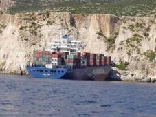
The Ro Ro ferry 6,041 ton `Riverdance' still remains firmly aground on the North Shore at Blackpool. The vessel still remains in a precarious position. Currently the vessel is maintaining a significant list to starboard. The main cargo deck, lower hold, engine room and steering gear room are currently interconnected and therefore flood with the tide and the watertight integrity of the hull is subject to further investigation by salvors.

The salvage control unit, chaired by Hugh Shaw, the Secretary of States Representative in Maritime Salvage and Intervention (SOSREP) recently reported that over the past weekend all bunker fuels have been successfully removed from the most vulnerable tanks. Operations will now concentrate on stabilising the vessel by making the hull watertight and transferring water ballast to reduce the list. The severe list has made the access to the double bottom tanks much easier and safer than before.

Work continues on the further removal of a number of trailers from the main deck, but efforts are being hampered by the tide levels at low water which is restricting the safe working time on scene. The Environment Group continues to monitor and risk assess the situation and are satisfied with the progress being made to date.

Additional security staff remain in place to cover the 'low water' periods supported by HM Coastguard personnel and vehicles when the vessel presents dangers to onlookers who stray too close the site.

An outline traffic management plan is being discussed between Lancashire Police and the local authorities for the refloating operation which, due to ongoing work on board the vessel, will not take place for at least the next two weeks. A number of road closures and restrictions will be put in place at that time and the plan will be implemented for the period covering the refloat.


"Be Ready"

RS

Tuesday, February 19, 2008

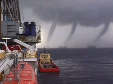
Spectacular Waterspout

Twister "as high as the eye could see".

A spectacular waterspout amazed Kapiti Coast residents as it snaked off the sea, releasing heavy rain and hailstones as big as marbles.

View video View gallery

The twister was seen to form off Kapiti Island about 7pm, before coming ashore between Paekakariki and Raumati South.

It dispersed over the land. Police said it caused no damage, though traffic on State Highway 1 slowed as motorists stopped to watch it.

Raumati South resident Nick Swan said he saw the waterspout at Queen Elizabeth Park and stopped his car to take pictures.

"I've seen waterspouts before and this was by far the widest and highest," he said. "It was as high as the eye could see. It was huge and I could see it snaking very slowly from side to side."

Kapiti Boating Club vice-commodore Peter Kortens saw a cloud slowly developing into "a long black spiral".

"Within a few minutes it touched down on the sea and sucked up seawater," he said. "As it hit the ground it released the water - we could see it fall. We've never seen an event from the boat club like that."

Mr Kortens said the twister moved across State Highway 1 and slowly disappeared.

MetService spokesman William Nepe said a complex trough of low pressure over New Zealand was a factor. Warm air from the tropics hitting cold air and sea-surface temperatures of about 20 degrees also contributed.

CHASERCON

The 10th Annual National Storm Chaser Convention

Storm Chaser Phil Kurimski
has pix's of ChaserCon which was held in Colorado over the weekend.

MARITIME NOTES:

Russian navy ship under tow after Aegean rescue - Summary

Europe World News | Home Athens - A Russian auxiliary ship that issued distress calls during rough seas in the Aegean was being towed to a safe island harbour, reports said. Greek coastguard officials rushed to send rescue helicopters and a coast guard frigate to assist a Russian navy ship, with 88 crew on board, after it was caught in strong winds and engine problems in the Aegean Sea, approximately 15 nautical miles south of the Ikaria. A Greek navy frigate was towing the Russian repair vessel, belonging to Russias Black Sea fleet, to a safe harbour on the island of Hios, just north of Ikaria.

Officials said the operation would take several hours due to the bad weather. Coastguard officials said the ship was an auxiliary vessel that was carrying fuel and was drifting out of control due to engine problems. All the crew were reported safe. The Ministry of Merchant Marine said the vessel had been heading to the base of the Black Sea fleet in Savastopol, Ukraine from Syria. Heavy snowfall, gale force winds and freezing temperatures have hit Greece for the past two days, forcing ships to ports across the country, and paralyzing air and land transport.

MARINE WX NEWS BRIEFS

Soon I will be doing a weekly maritime podcast compliments of Messing About In Ships highlighting maritime weather news, severe weather at sea and topics such as rogue waves. So visit Messing About In Ships often to keep updated.

RS

Monday, February 18, 2008

THETA-E: The Un-used Parameter

A while back storm spotters and chasers had a discussion on the Theta-E Parameter.

Ok so what is the Theta-E and why is it used?


Meteorologist Jeff Haby explains.

1. What is THETA-E?

THETA-E (Equivalent Potential Temperature) is the temperature that results after all latent heat is released in a parcel of air and the then brought adiabatically to the 1000 mb level. THETA-E increases as dewpoint


2. How is THETA-E determined?

First determine the pressure level of interest. Locate the temperature and dewpoint at that pressure level. Raise that parcel adiabatically from that pressure level to the 200-mb level. Next, bring the parcel down dry adiabatically to the 1000 mb level. The temperature once the parcel is at 1000 mb is the THETA-E.

3. Operational significance of THETA-E:

INSTABILITY- A region with a relatively high THETA-E is often the region with the most instability. Warmer low level temperatures and higher low level dewpoints increase instability.

LOW LEVEL JET- A low level jet from a moisture source will often bring in higher THETA-E values and thus increased instability.

THETA-E RIDGE- These are regions with higher THETA-E. They are often the burst point for convective activity.

4. Pitfalls:

a. If a strong cap is in place, convective storms will not occur even if THETA-E is high.


What does this mean to Storm Chasers? Storm Chaser Steve Sponsler explains...

"THETA-E: The Un-used Parameter

Have you ever wondered where a true frontal boundary or the dry-line exists? Why ask?

When it comes to chasing...you have to know these factors along with many others...but this discussion is focused only on Theta-E for discussions sake:

The Theta-E advection parameter could be a major clue. It combines what surface analysis provides as well as the dewpoint forecast parameter.

It also works in tandem with injecting dry slots...and what I often think of as "pressure points". One must combine these two to "brew" the secret ingredient.

What are "pressure points"? Microscale low pressure areas. Those are areas where micro-scale low pressure areas form, particularly in the Plains...formed mostly from downslope winds off the Rockies ALONG with the Coreollis Force...concurrent with upslope, moist air from the GOM (Gulf of Mexico) and forcing upper level winds from the WNW. SEE IT IN YOUR MIND.

VISUALIZE...and work it...Dry Slots swiping up moisture and being forced to rotate because of the earth's rotation..
in reality..it makes perfect sense.

And for chasing purposes...PLAN your road networks in advance.

I surmise that anyone here already does that.

It COULD be a "secret" ingredient to what might overlie all the other parameters provide. But then again...I please hope than no one denies that luck in all cases is involved in a successful chase."

CASE STUDY-1

A relationship between a surface theta-e ridge and dominant lightning polarity

Nettie R. Lake, Lyndon State College, Lyndonville, VT; and D. R. MacGorman

For many years, it was believed that cloud-to-ground lightning lowered only negative charge to the ground (-CG flashes). In the past twenty years, however, flashes lowering positive charge (+CG flashes) have been documented and studied. This presentation summarizes positive correlations between +CG flashes, hail, and tornadoes.

Recent studies have reported that in some cases, dominant storm polarity reverses from positive to negative. Additionally, it has been observed that 50% of such storms are tornadic, and that tornadoes usually occur during or after the reversal. Smith et al. (2000) observed that polarity reversals often occur at surface equivalent potential temperature (theta-e) ridges. This study examined dominant polarity patterns of severe storms during the entire year 1999. Similar to Smith et al. (2000), this study found that 82% of polarity reversals occur at a theta-e ridge.

Furthermore, positively dominated storms that move parallel to a ridge axis seldom reverse polarity. Also, negative storms do not reverse polarity relative to a theta-e ridge. Explanations for why polarity reversals may occur at a theta-e ridge will also be discussed.

extended abstract Extended Abstract (68K)

CASE STUDY - 2

WMSI - A New Index For Forecasting Wet Microburst Severity

Kenneth L. Pryor and Gary P. Ellrod
Office of Research and Applications (NOAA/NESDIS)
Camp Springs, MD
Date Submitted: November 20, 2003

Abstract

A new index to assess the potential and severity of wet microbursts is currently under development. The index, designated as the Wet Microburst Severity Index (WMSI), accounts for the physical processes of convective storm development and downburst generation by incorporating such parameters as convective available potential energy (CAPE), to represent the process of updraft formation, and Theta-e Deficit (TeD), to represent downburst development.

Since convective storm updrafts require buoyant energy, a very important parameter used in the analysis of convection is CAPE, which is easily computed from Geostationary Operational Environmental Satellite (GOES) sounding data. Since updraft strength is proportional to CAPE, large CAPE would result in strong updrafts that could lift the precipitation core within a convective storm to the mid-level dry air layer. CAPE also plays a major role in the formation of precipitation.

The strong updrafts resulting from large CAPE will increase the size of precipitation particles, which, in turn, will then enhance the effect of precipitation loading. The amount of mid-level water vapor relative to the low-level water vapor in the atmosphere as indicated by a sounding profile is important in the determination of the strength of downdrafts that occur in convective storms. This condition is modeled by the Theta-e Deficit (TeD), represented by the algorithm TeD = theta-emax - theta-emin, where (theta-emax) refers to the maximum value of theta-e at the surface and (theta-emin) refers to the minimum value of theta-e in the mid-levels of the troposphere.

TeD serves as an important indicator of the difference in water vapor concentration (plus thermal energy cpT) between the surface and mid-levels. Large TeD values imply the presence of relatively dry air at mid levels that will result in evaporative cooling and the generation of large negative buoyancy as the dry air is entrained into the convection cell. The WMSI algorithm is given as the following expression: WMSI = (CAPE)(theta-emax - theta-emin)/1000.

CASR STUDY - 3

Midlevel Dry Intrusions as a Factor in Tornado Outbreaks Associated with Landfalling Tropical Cyclones from the Atlantic and Gulf of Mexico.


Lon Curtis

KWTX-TV, Waco, Texas

ABSTRACT


Midlevel dry intrusions have been mentioned as a factor in tornado outbreaks associated with landfalling tropical cyclones for more than three decades, but a systematic analysis of historical outbreak cases with respect to this pattern has been missing.

Herein, following an examination of all named tropical cyclone landfalls from the Atlantic and Gulf of Mexico for the period 1960–99, 13 “outbreak” cases (defined as storms producing 20 or more tornadoes) have been identified with 11 of the cases offering clear evidence of a dry intrusion at midlevels over the outbreak area. The outbreaks all occurred when the favored area for tornadogenesis (the right-front or northeast quadrant of the storm) coincided with a pronounced gradient of relative humidity, with the gradient best reflected at the 700- and/or 500-hPa level(s).

Two distinct patterns were identified with respect to the origin of the midlevel dry air involved in these cases: in one, a mass of dry air that impinged on much of the northern or northwestern semicircle of the storm's outer circulation gradually divided into two separate areas (one to the northwest and the other to the northeast of the storm center) as the storm advanced; the other involved ingestion of a lobe of dry air from a reservoir most often located in the eastern semicircle of the storm.

The outbreak cases were determined to have a strong diurnal signal detected in the temporal distribution of the tornadoes, as almost two-thirds (65%) of the tornadoes in the 11 “positive” cases occurred between 1500 and 2400 UTC (daylight hours in the region examined). A review of all tropical cyclone landfall events since 1960 revealed that there are only three cases with clear evidence of a midlevel dry intrusion that were not accompanied by an outbreak as defined herein.

TORNADO OUTBREAK

30 Twisters in Al, Ga and Fla for 17 February 2008

Meteorologists Study Deadly Tornado Outbreak

Warm moist air and a shifting weather pattern courtesy of the La Nina phenomenon aided in the development of the Feb. 5 tornadoes, which killed at least 50 people and were among the 15th deadliest in U.S. recorded history. But meteorologists are now trying to explain why the tornadoes occurred so early in the year.


It was farther north than most February tornadoes and stronger, Joseph Schaefer, director of the Storm Prediction Center in Norman, Okla., told Associated Press.


Tornadoes do occur in February. In 1971, a deadlier February outbreak in the Mississippi Delta killed 121 people. A study conducted by Schaefer two years ago, found that winter tornadoes in parts of the South occur more frequently and are stronger when there is a La Nina, a cooling of Pacific waters that is the flip side of the better known El Nino.


February tornadoes usually pop up near the Gulf Coast, not in Kentucky or Tennessee, said University of Oklahoma meteorology professor Howard Bluestein.


A heavy contributing factor was the warm weather. It was 84 degrees in Oklahoma before the storm front moved through on its path of destruction. On Tuesday, 97 weather stations broke or tied records in Arkansas, Alabama, Tennessee and Kentucky - the hardest-hit states, according to Associated Press.


Still, meteorologists said there is not enough recorded historical evidence of such storms to blame global warming at this point, but Tuesday’s tornadoes had all of the key deadly elements: warm air near the ground; high winds; and warm moist air coming north from the Gulf of Mexico.


Schaefer told Associated Press, La Nina doesn’t specifically cause tornadoes, it helps shift the jet stream, pushing storms from the West and moisture from the Gulf into the necessary collision course over the South.
El Nino, La Nina occurs every few years, and has been changing global weather patterns for a few months now, Mike Halpert, deputy director of the Climate Prediction Center, which monitors La Nina, told Associated Press.

Preliminary figures for January show 136 tornadoes, five tornado deaths and three killer tornadoes, although these figures tend to drop after closer analysis.


Between 1997 and 2007, the average February has 30 tornadoes, killing 9 people. Early reports tallied 68 tornadoes so far this month.
"We're off to a big start for the year," said Greg Carbin, a meteorologist at the storm center. Meteorologists said that the patterns point to the likelihood of more tornado outbreaks this season. "As long as the pattern remains the same it can be very active," Schaefer said. "It's not a time to let down your guard."

MARITIME NOTES:

Shell Oil to put sensors on Gulf rigs to gauge storm strength, share data with forecasters

Maya Bell
Sentinel Staff Writer
February 14, 2008

MIAMI - It's a Gulf Coast nightmare: A moderate hurricane crosses a pocket of deep warm water in the Gulf of Mexico and explodes into a top-of-the-chart Category 5 monster.

Exactly how and why that happens may become a bit clearer one day, thanks to new undersea sensors Shell Oil Co. has agreed to install on one of its oil platforms in the Gulf south of New Orleans.

Known as "thermistors," the instruments will measure heat content of the water to a depth of 100 meters, or about 330 feet, and may be operable by this fall, in time for the peak of the 2008 hurricane season. The data could help hurricane scientists measure the effects of warmer water on storm intensity.

They are one piece of a nearly $1 million investment the oil company is making to collect data for hurricane research, forecasting and coastal-resource management.

Marking the first private-public partnership of its kind, Shell has agreed to acquire and install weather and oceanic data-collecting sensors on seven of its oil and gas facilities in deep waters off the Gulf Coast from Texas to Alabama.

The National Oceanic and Atmospheric Administration has agreed to make the data available in real time to its National Weather Service forecast offices, the National Hurricane Center west of Miami and the public.

"This is very significant," said David Miller, a NOAA spokesman in Washington. "These platforms are designed for maximum survivability, and having an uninterrupted data stream even in the height of a hurricane could have untold value."

Under federal law, 59 deep-water gas and oil platforms operating in the Gulf already are required to collect and transmit observations of ocean currents to NOAA's National Data Buoy Center. But the agreement between NOAA and Shell, forged after NOAA administrator Conrad Lautenbacher and Shell President John Hofmeister met at a 2006 summit on the Gulf and discussed how their organizations could leverage their strengths, goes much further.

In addition to the ocean heat sensors, by next spring Shell will install transmitters, complete with battery-backup power, on four platforms that will send sea-surface and air temperatures, pressure and wind speed to NOAA's geostationary satellites -- even if the platforms are evacuated because of a hurricane. Tethered to the sea bottom by cables, the platforms can twist in a figure eight to withstand storm-force currents and winds.

Shell also has agreed to collect and share meteorological data from two Continental Shelf locations off Louisiana and install high-frequency radar transmitters on platforms off the Texas coast. Specific locations have yet to be identified.

Because Florida waters are off limits to oil drilling, only one of the platforms scheduled for the enhancements is near its coast, south of the Alabama-Florida border. Still, the Sunshine State should benefit.

"Think about it: More than half of Florida's real estate is on the Gulf of Mexico," said hurricane-center spokesman Dennis Feltgen. "And storms don't always move west. Sometimes they come from the west. Remember Wilma," a reference to the 2005 late-season storm that swept across southwest Florida and exited over Broward and Palm Beach counties.

While Shell spokeswoman Darci Sinclair said the thermal sensors should help hurricane forecasters improve on their weakest skill -- predicting the intensity of storms -- forecasters said the data will likely be of more use to researchers. But they'll be glad to have it.

"Every meteorologist always wants every bit of data he or she can get," hurricane specialist James Franklin said.

Maya Bell can be reached at mayabell@orlandosentinel.com or 305-810-5003.

Riverdance bye-bye

GROUNDED cargo ship, the Riverdance, is expected to set sail this week - and it couldn't come quick enough for local residents.

Locals living in the English holiday town of Blackpool have experienced the same tourism fever Newcastle locals had when the Pasha Bulker ran aground last year.

Blackpool's promenade has become a "nightmare" with locals complaining of traffic jams as people across England travel to see the Riverdance, an Irish-owned ship which has been grounded for 17 days.

"When it first happened it took me 45 minutes to get down the road to get home. The parking is a nightmare too," Blackpool local Steven Wilkinson said.

"It'll be worse this week with half term holidays. You can't blame people for coming to see the ferry though. It's a one off and their kids want to see it."

It's not only the locals who are complaining. Sightseers say they are finding it difficult to park in the small seaside town.

"I've come every day to see the ferry. It's jolly good to see so many people here. But there are a lot of cars. People living here know where to go for parking spaces, but visitors wouldn't know where to park. There aren't enough spaces," visitor Clarice Dale told the Blackpool Gazette.

Small business owners will be sad to see the Riverdance go.

"Our business has doubled. The longer it's here, the better it is for us. It's been great for business, you don't need to advertise the area - just put a boat on the beach! " Ann Wilkinson, owner of Blackpool's The Eating House said.

Four passengers and 10 crew were airlifted off the Riverdance in a rescue which included the coastguard, the Royal Air Force and lifeboat services.


RS

Friday, February 15, 2008

CODAR And Marine Operations.

CODAR stands for Coastal Ocean Dynamics Applications Radar, or in short, Coastal RADAR.

What is CODAR?

According to the CoolRoom, CODAR is a High Frequency (HF) radar system that remotely measures ocean surface currents. The system allows one to get a complete map of ocean currents (left) without stepping foot aboard a boat or deploying an expensive array of current meters. Each map has a range of about 50 kilometers (about 30 miles) from the coast with a measurement every 1.5 kilometers ( 0.9 miles). The Rutgers University CODAR system, deployed along the New Jersey coast, is the only operational HF-Radar system of its kind in the entire eastern United States. It consists of two remote sites, located in Brant Beach and Brigantine New Jersey, and a central site in Tuckerton, New Jersey.

How does it all work??
Each remote site contains two antennas and a small 6'x 8' shed. One antenna (left) transmits a radio wave out across the ocean surface. The power of this transmitted signal is only 40 watts. Therefore this antenna behaves like a household lamp with a 40 watt light bulb. Unlike radio stations that only transmit a signal, CODAR uses the second antenna (far left) to listen for and measure the transmitted signal. So that the part of the transmitted signal that is reflected back toward the site by the ocean waves can be recorded and processed. It is this returned signal that is used to measure the moving ocean surface.

The shed (right) contains a weatherproof box (lower right) that houses all of the equipment necessary for transmitting, receiving and processing the radio signal. Within this box (from top to bottom) there is a Macintosh computer, responsible for processing the incoming signal, a transmitter and a receiver.

How can we get ocean currents from the beach?
CODAR uses the theories of the Doppler Shift to determine the surface current from the backscattered radio wave. The Doppler shift explains the change in frequency of a signal scattered off a moving object. For example, a train whistle or ambulance siren sounds different depending on the speed and direction of the vehicle. Doppler theory can be used to determine if a scattering object is moving toward or away from an observer as well as the speed at which it is moving. These theories also apply to the ocean surface.

By measuring the return signal, the CODAR system can determine the speed of the ocean waves that scattered the signal. From this wave speed a surface current can be calculated. One limitation to Doppler theory is that it only explains the velocity of the train in the direction of the observer.

Consequently, a remote site can only measure how fast the water is moving toward or away from the antennas (left). The net movement of the water (shown in red) can only be determined using information collected from each of the two sites (shown in green and yellow), as illustrated in the figure to the left.

CODAR Applications

  • Safe and efficient navigation and marine operations
  • Efficient oil and hazardous material spill trajectory prediction and clean up
  • Monitoring, predicting and mitigating coastal hazards
  • Military operations
  • Education
  • Scientific research
  • Search and rescue

The Future of CODAR along the New Jersey Coast
The future of the CODAR system along the New Jersey coast involves plans to increase the present area of coverage. To accomplish this, several adaptations will be made to the present system. The first will add two additional transmit antennas offshore. In addition to extending the coverage in both the along-shore and cross-shore directions, this improved system will be able to measure surface currents right to the beach (left). By measuring these currents, one can begin to examine storm effects on beach erosion as well as complicated inlet dynamics influencing commercial traffic.

The second adaptation changes the frequency of the transmitted radio wave so that the signal will travel further offshore resulting in a much larger coverage area. The figure to the right illustrates the present configuration in yellow. Using three of these new long-range systems, the coverage area will be extended to include those areas shaded in red, blue and green. Also shown in the illustration is the location of three recent ship sinkings off the New Jersey coast. One can easily see that with the larger coverage area perhaps current maps could have been used by the Coast Guard to more efficiently aid those in distress.

CODAR Ocean Systems website.

CODAR surface current maps powered by Google™

Underwater glider studies the sea

A seafaring glider that draws its energy from the ocean has become the first so-called "green" robot to monitor the undersea environment. The glider powers itself by harnessing the temperature difference felt at different depths. It has crisscrossed a deep undersea basin near Puerto Rico more than 20 times for a study on ocean circulation, say researchers at Woods Hole Oceanographic Institution and Webb Research Corp. in Massachusetts. The glider should be able to work around the clock in all weather conditions.

Weather spotter classes offered
Henderson Gleaner - Henderson,KY,USA
The training sessions are offered throughout the region, mostly during January through March to prepare for peak severe weather season.


MARITIME NOTES:

Ocean Dead-Zones May Be Linked To Global Warming (February 15, 2008) -- A review of all available ocean data records concludes that the low-oxygen events which have plagued the Pacific Northwest coast since 2002 are unprecedented in the five decades prior to that, and may well be linked to the stronger, persistent winds that are expected to occur with global warming. In a new study in Science, researchers outline a "potential for rapid reorganization" in basic marine ecosystems and the climatic forces that drive them, and suggest that these low-oxygen, or "hypoxic" events are now more likely to be the rule rather than the exception. ... full story

EMSA – report on pollution preparedness and response

The European Maritime Safety Agency (EMSA) issued its annual report for 2007 on Pollution Preparedness and Response. The report focuses on the network of stand-by oil recovery vessels around Europe and the European satellite oil spill monitoring and detection service – CleanSeaNet. (1/31/08).

SEA EMPRESS casualty

On February 15, 1996, the tanker SEA EMPRESS grounded off the mouth of the Cleddau Estuary as it was making its way to Milford Haven, Wales to offload a cargo of crude oil. The ship eventually spilled an estimated 73,000 tons of crude oil in an event that was widely televised around the UK and the world. The primarily cause of the casualty was found to be an error in judgment by the pilot. A root cause was found to be inadequate training and examination of pilots by the Milford Haven Port Authority. This casualty was a significant factor in the subsequent enactment of legislation in the UK clarifying the authority for overseeing spill response and salvage. Further information may be found in the MAIB Report.

Live NewsCarmeras.com

TV stations are streaming various in-house news feeds live on the 'net, and the network has decided to experiment to let you see them all on a real-time basis. Some of them are just test patterns or dark screens when nothing is going on; others are web feeds of their radar, and some are live video streaming tower cams. Several are from "Tornado Alley", including Denver, CO and Dallas and Austin, TX. All of it is raw, so anything goes; whatever they decide to spit out, you see it. Live NewsCarmeras.com

READERS COMMENTS:

Jim C, asks.

"Robin,

I am baffled by the fact that in tornado alley each house or permanent structure doesn't have a tornado shelter, storm cellar, or basement.

I live in Denver Colorado and cannot imagine not having a basement to go to when the weather turns severe. We are not even as prone to it as some areas of the country.

To me, not having a storm shelter in tornado alley makes about as much sense as not having a snow shovel here in Denver."

Jim, good question. So I posed this to my peers on the WX-Chase listserve. The response was across the board. Most folk do not have basements in tornado alley because of either the geology ( either poor soil or heavy rock) or very high water table, while the cost of putting one in would be excessive. Though one experienced storm spotter/chaser did correct me when I exempted mobile homes, by saying nope, if the ground is doable they can have mobile homes mounted over basements.

FINALLY

Ferry mess mired in myopic decision-making


COUPEVILLE, Washington (STPNS) -- I am a former officer with the National Oceanic and Atmospheric Administration, having sailed the Pacific from Alaska to Midway to Hawaii to Tahiti to Chile. I have sailed in storms with 50-foot swells and 80-mph winds in which all one can do in a 300-foot ship with twin screws and a bow thruster is keep the bow into the swells to prevent being rolled over and pray the engines don't quit.

I am not sure why the US Coast Guard considers the waters of Admiralty Inlet "protected waters" unless it is simply because it is not the open ocean. This is the same Coast Guard that failed to detect, during numerous inspections, the massive pitting in the hulls of the 80-year-old boats from the Keystone-Port Townsend run. (STORY)


HAVE A GREAT A ENJOYABLE WEEKEND!

RS

Thursday, February 14, 2008

Improving ship safety and efficiency with proactive use of Voyage Data Recorders

Todd Ripley, Maritime Administration, Washington, DC

Thomas King, Litton Marine Systems Inc., Charlottesville, VA., Henry Chen, Ocean Systems, Inc., Oakland, CA

INTRODUCTION

The use of Shipborne Voyage Data Recorder (VDR) in the commercial maritime industry can raise both safety and operation efficiency levels. Although it is late coming compared with aviation industries, the International Maritime Organization (IMO) has recently passed the resolution A.861(20) Performance Standards for Shipborne Voyage Data Recorders. The International Electrotechnical Commission (IEC) is currently finalizing the technical specification of the VDR for type approval. Carriage requirements are now under discussion at IMO and will become a reality in the near future.

While mandatory carriage requirement is still years away, some progressive shipping companies have already started to install VDR as part of an advanced Integrated Bridge System (IBS). Actual field experience shows that cost-effective VDRs can be built and maintained to meet reasonable performance requirements with today's technology. Although the primary purpose of the VDR is for accident investigation after the fact, innovative uses of the VDR by the operators both in real-time and post voyage modes have demonstrated VDRs can improve safety as well as efficiency of operations. The concept is similar to the use of flight recorder to store engine data for maintenance in the aircraft industry. This paper describes several areas of proactive use of VDRs for central alarm management, performance efficiency monitoring, heavy weather damage avoidance and seamanship skill training.

SAFETY

The safe operation of commercial ships is most important to ship operators, regulators and the private sector. Just as in other industries, the prudent operator strives for a high degree of safety in its transportation operations. Operating safely and efficiently is a basic business requirement, which must be met just to stay in business. Today's legal liabilities make it non-profitable to operate unsafely, and can soon put sub-standard operators out of business. The risk of fighting law suits and paying judgements and fine for loss of life, injuries, damage to property, and damage to the environment make it impractical and foolish to operate un-safely.

Tools that encourage and ensure that shipping operations are conducted safely must be a priority. The VDR and its potential for improving marine transportation safety are far reaching. The extensive recording of ship navigation equipment, propulsion system and bridge command as well as alarm status provides a comprehensive analysis database. The data could be used to aid investigators in identifying causes of the accident. More important, it can also be used to study trends and precursor events, which lead to an incident, thereby assist in formulating proper procedures to avoid future similar scenarios. Incident data could be used as a training tool to make operators aware of potential hazards and assist in the avoidance of incidents. Data could also be used in the evaluation of certain critical equipment, to ensure proper maintenance and operation or to install added redundancy to further improve safety.

Furthermore, in the real-time mode and without affecting the recording function of the VDR, data can be made available for viewing by the operator to prevent accidents. The following are a few examples of the real-time use of VDR data:

    Heavy Weather Damage Avoidance

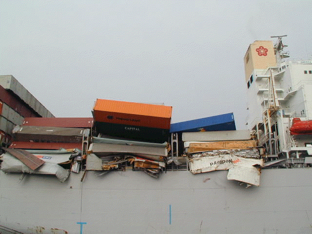
    Containers are lost and ships are damaged in severe sea states. Monitoring of vessel motion and hull stress can alert the operator when the safe operating threshold is about to be exceeded. The real-time display and analysis coupled with analytical prediction of motion and sea load with observed or forecast sea and swell condition can reduce the risk of heavy weather damage. Using these tools, the operator will be able to answer many "what if" questions on changing ship speed and heading to reduce motion and stress before it is carried out. The sensors will further confirm the operator's actions.

    Central Alarm Management

    With the proliferation of alarm signals on each piece of equipment and sensors on a modern ship, the sound and light signals quickly become confusing and unmanageable. The crew may take days to become familiar with the alarms and how to turn them off. Since the VDR is already monitoring all the major alarms, a Central Alarm Management System can automatically monitor, record and display ship's alarm at a central location so that the crew can easily identify the alarm and manage the condition in a timely manner. The entire system is designed to assist the mariner in overcoming the uncontrolled proliferation of alarms and warning sounds on modern ships by displaying the alarm status so that:

    · Alarms are easily distinguishable

    · Alerts or informs which important actions are to be taken

    · Non-important action can be postponed or transferred

    · Responsibilities, procedures, and routines are easily understood through the use of check lists and graphic display including video

    · Records are kept for later investigation and training

    Directional Stability

    A large vessel with blunt hull form can sometimes exhibit directional instability in slow forward speeds. When ship's turning is not responding to the rudder action, it can lead to collision in congested waters and grounding in narrow waterways. Real time display of turn rate, rudder angle and other factors influencing the ship's maneuver can alert the operator of potential dangers.

    Incident Investigation

    As in other transportation incident investigations, the marine incident requires accurate data records in order to gauge system and personnel performance as well as operating status prior to an incident. In maritime industry, most of these incidents are not fatal, the actions taken by the crew after the incident is also important. The VDR can record and save the data so that analysis can be made when the ship arrives next port. The determination of factors, which caused, or contributed, to an incident is most important in the prevention of similar future incidents.

    Perhaps the most notable are maritime investigation involve passenger vessels and the loss of human life. It is critical to determine which regulations, equipment, and operational procedures require modification to prevent these incidents. Also incidents which damage the environment have a "high profile" with a lot of public demand to find ways to prevent future incidents. For the operator, all ship incidents are important if lessons can be learned to avert damage in a potentially dangerous situation. The second by second replay of important ship data recorded by the VDR could be a critical tool for the marine accident investigator in the determination of specific precursor events, sources causing incidents, and subsequent actions taken to avert the incident.

    Bridge Team Training

    Shipping companies spend a great deal of effort in bridge team resource management training to ensure safe operation. Playback of VDR recording of actual operation data can provide realistic scenario to improve bridge team effectiveness and evaluate procedures for accident prevention. Corrective measures can then be reinforced via training.

EFFICIENCY

Operating efficiency is another important element in the competitive commercial shipping industry. In the long run, only the safe and efficient operator will survive in business. Efficiency can be improved only when the management can compare performance to an established base line standard. Ship operators currently rely on the crew to make observations of time, ship position, speed, engine output and other pertinent voyage data, then record them on a sheet of paper or input them into a computer data base. Uncertainties in weather conditions, effect of current, averaging process used to determine SHP, speed etc on once or twice a day basis degrade the overall data integrity. Since there is no way to check the validity of each input, the data is often of little use in performance monitoring except for record keeping purpose.

The continuous monitoring of navigation and engine data by the VDR creates an ideal database for performance evaluation in an automated fashion. Passage reports can be generated from past time history records on any selected data fields. Inferences can be made regarding the hull, engine, and propeller efficiencies as well as fuel consumption. The results can assist the management in making optimum dry-docking schedules, choosing fuel types, as well as validating claims of energy saving devices. In the real-time mode the VDR can supply critical engine data to alert operator of abnormal operating conditions before they result in engine damage. The following are a few examples of the use of VDR data in enhancing operation efficiencies:

    Engine overload

    Ships with low sea margin design of fixed pitch propeller and low speed diesel engine combination can often lead to engine overload when encountering head sea conditions. Monitoring of Shaft horsepower and RPM and displaying them on an engine overload diagram can alert the operator when approaching such conditions. The engineers can then take appropriate actions to minimize the engine wear when operating in restricted zones.

    Hull and propeller roughness monitoring

    An increase in Hull and propeller roughness can result in a large increase in fuel consumption over time. In the worst scenario, the added resistance will also cause frequent engine overload even in favorable weather conditions resulting in reduction of operating speed. The detailed recording of engine SHP, propeller RPM, and ship speed just after dry-docking can be used as a baseline for comparison with current conditions. Savings in fuel cost can be traded-off between early dry-docking, using long lasting anti-fouling paint and underwater propeller polishing.

    Performance evaluation

    Ship performance evaluation has been an elusive target due to lack of detailed navigation and engine data. Uncertainties on the effect of weather and ship's loading on fuel consumption plus changes in schedule requirement makes the performance evaluation difficult if not impossible.

    With the VDR recording actual ship position, speed, engine RPM, SHP and wind speed, it is possible to compare the performance to a known based line standard. Charter party speed claims can now be based on actual recorded ship speed and wind measurements. For owner operated ships, management can compare performance of sister ships running on the same trade route and identify deficient operating practice to improve efficiency. Historical data can also help the company naval architect in specifying proper sea margin when building new ships.

BEYOND VDR BASICS: ADDED ECONOMIC BENEFITS

Although the primary purpose of VDR is to record data for accident investigation, many real-time applications of the VDR can lead to improved safety by identifying and warning of impending danger or organize the alarms. VDR data could prove valuable for the training and education of mariners. Real life data of unfolding events could be used to simulate actual problematic situations and the decision of the student could safely be evaluated and guidance provided. Data could be used and reviewed by crews who operate in a problematic area to improve their decisions. VDR data can play a key roll in the education and training of our mariners to enhance the safety of operations.

Companies trying to become more efficient could also use VDR's information. Data collected and analysis performed by companies could be used to increase their competitive advantage. Historical vessel operating efficiency data could be collected and monitored to determine the need for vessel maintenance or modification to reduce operating cost. Performance evaluation could be carried out to identify operating deficiency. By using the VDR data, companies can improve their operating efficiencies. Safer and more efficient operations can be directly translated into cost-saving and increased profitability of those shipping companies utilizing the VDR technology.

CONCLUSION

Carriage requirements for commercial vessels will happen. It is not a question of if there will be a VDR requirement, just when. IMO has passed resolution on Performance Standards of VDR and encourages member states to vote for mandatory carriage of VDR. Discussions are focusing on passenger vessels, which have potentially the greatest impact on human life; followed by vessels which have the potential for environment impacts, such as tankers and chemical carriers, then cargo vessels. Progressive IMO implementation of carriage requirements is expected in the near future.

Currently the IEC is completing the final draft of the technical standard for the VDR. The specifications will have to be consensus standards developed collaboratively by all parties with an interest. They must allow for the cost-effective production VDRs, which can be used by the majority of the commercial shipping industry. In addition, innovative use of VDR data in both real-time and archived mode should be encouraged to bring about added benefits for the owner and operators.

In conclusion, VDRs can positively impact the commercial maritime industry. Safety will be increased just by the awareness of their existence. The utilization of VDR's in the commercial shipping industry will be a plus for the maritime industry. Just through the awareness of their existence, they will heighten operator's diligence in operating their vessels safely and efficiently. With the carriage requirements for the maritime industry coming out in the near term, the industry must be prepared for their implementation. As ships are required to carry such recording equipment, operators should take advantage of the VDR hardware and derive added benefits in enhanced safety as well as efficiency.

Acknowledgements

The research and development effort of VDR described in this paper is partially funded by an ARPA/Maritech project. Opinion expressed in this paper however, may not necessarily reflect that of Maritime Administration.

References

Chen, H. Cardone, V. and Lacey, P. "Use of Operation Support Information Technology to Increase Ship Safety and Efficiency", Society of Naval Architect and Marine Engineers, Annual Meeting 1998.

Biographies

Todd Ripley is a Naval Architect at the Maritime Administration under the U.S. Department of Transportation. He is the Maritime Administrations representative for technology development programs involving shipboard information systems and shipboard bridge systems. He is a member of ASTM and ISO and is engaged in shipbuilding and maritime standards development both at the national and international level.

Tom King is the Director of Marketing and System Sales for Litton Marine Systems. Litton Marine Systems, headed in Charlottesville, Virginia is a trade name of Litton Industries, representing the three legacy companies of Sperry Marine, Decca Marine and C. Plath.

Henry Chen is the President of Ocean Systems Inc. of Oakland, California. He has actively participated in the development of VDR hardware and software during the last 5 years. He is a member of the IEC committee formulating the draft technical requirement of VDR. His background is in naval architecture and marine systems engineering. He has a Ph.D. from MIT.

WEATHER NOTES:

The History Channel and Rogue Waves

"Join us for the amazing story of one of nature's most terrifying forces. With striking visuals from ships in storm-tossed seas, the special presents dramatic tales of rogue wave disasters throughout history, and explores the astonishing scientific discoveries surrounding this deadly phenomenon. Aided by mind-blowing CGI footage from the motion picture Poseidon by Wolfgang Petersen, director of The Perfect Storm, we reveal the awesome power of this ocean menace as it really is--a monster rising from the deep!"

STORM SPOTTER BEAU DODSON


February 12, 2008: MAJOR ICE STORM DAMAGE - WESTERN KENTUCKY

FROM THE TULLAHOMA NEWS

Sirens working, but take extra precautions against tornadoes


MARITIME NOTES


Smaller ferries in Admiralty Inlet would be dangerous


A former NOAA officer, otherwise anonymous, has filed an interesting report about weather conditions in Admiralty Inlet, where the Port Townsend-Whidbey Island ferry route runs (when it does). His verdict: the state's plans to replace the current ferry with a smaller boat would risk lives, due to the mighty winds and waves prevalent in the area.

The blogger describes, with detailed records, how the wind comes around the Olympics and creates intense pressure and high waves. That calls for boats that are "large, powerful, and sturdy," he writes. Here's his scary weather report:
By David Brewster, Ferries
Posted on February 13, 2008, Printed on February 13, 2008
http://www.crosscut.com/ferries/11537/

A former NOAA officer, otherwise anonymous, has filed an interesting report about weather conditions in Admiralty Inlet, where the Port Townsend-Whidbey Island ferry route runs (when it does). His verdict: the state's plans to replace the current ferry with a smaller boat would risk lives, due to the mighty winds and waves prevalent in the area.

The blogger describes, with detailed records, how the wind comes around the Olympics and creates intense pressure and high waves. That calls for boats that are "large, powerful, and sturdy," he writes. Here's his scary weather report:

When Southwest storm winds off the Pacific are forced to divide around the Olympic Mts., the eastern branch of these winds blows up Hood Canal. Because the mountains have forced the moving air aside, it is compressed, and by a well-known principle of fluid dynamics called the Bernoulli Principle, a flowing fluid (in this case air) that is compressed and subjected to higher pressure by dividing around an object speeds up in the immediate vicinity of the object. This is why Hood Canal experienced 100 mph winds in 1979, winds which broke apart and sank the original bridge. When this eastern branch of the “fluid” reaches the northern end of Hood Canal at the NE corner of the Olympic Peninsula and north end of the Kitsap Peninsula, it spews forth into Admiralty Inlet like water out of a fire hose and slams into the southwest side of Whidbey Island.

In calling for bigger boats to replace the scrapped small Port Townsend ferry, the writer also says there will need to be an expanded terminal at Port Townsend and a new terminal outside the tiny Keystone Harbor on Whidbey. He stresses that the Inlet is "a wild and dangerous place," as some recent episodes demonstrate:

The experience of the Keystone-Port Townsend passenger-only ferry the other day is a case in point, with the entire bow going under dark green water for what seemed like an eternity, flooding water into the passenger cabin and striking terror among the passengers. They literally thought they were about to die, screaming and helplessly running “up hill” toward the back of the boat. Another case in point is the recent event that damaged cars on a much larger San Juan Islands ferry.

The comments appear on a blog called Bitter End, run by a rescue tug captain, Richard J. Rodriguez. It's an interesting source of detailed information about our ferries, from the helm, as it were.

FINALLY

We have been blogging about the rescue of the s/v Sean Seamour II by the United States Coast Guard for some time now. The crew that rescued the sailors of this stricken sailboat were recently decorated for heroism. ( See Saved from the Angry Atlantic )

Well we are pleased to announce that USCG Rescue Swimmer Drew Dazzo is up for another award from the Naval Helicopter Association. Here is the announcement;

AST2 DREW DAZZO: 2007 NAVAL HELICOPTER ASSOCIATION RESCUE SWIMMER OF THE YEAR, REGION FOUR* - Recognized for saving 3 lives on 7 May 2007 180NM east of MCAS Cherry Point, NC.

AIRCREW OF 6003 (LCDR ADAM KERR, LT ANDY SCHANNO, AET1 THOMAS ROMERO, AST2 MIKE ACKERMANN): 2007 NAVAL HELICOPTER ASSOCIATION AIRCREW OF THE YEAR (NON-DEPLOYED), REGION FOUR* - Recognized for saving 2 lives on morning of
20 Feb 2007 200NM east of Bermuda.

Banquet to be held at 1100 on Friday, 21 March at the Vista Point All HandsClub in Norfolk. RSVP NLT 13 March. See below for details. Uniform foraward winners, military/civilian guests TBD.

*Region 4 is the Mid-Atlantic Region of the United States.


Way To GO.. Drew Dazzo!

RS

Wednesday, February 13, 2008

U.S. aims to give wake-up alerts on storms

By Jim Loney

MIAMI (Reuters) - In the not-too-distant future, the U.S. government would like to be able to wake up residents in the middle of the night when a hurricane or tornado threatens, perhaps by sounding the alarm on a cellphone.

The birth of a twister or the sudden, overnight intensification of a hurricane while people are sleeping, are the nightmare scenarios facing storm forecasters as they lay plans to strengthen America's natural disaster defenses.

"I'm worried about waking you up," Mary Glackin, a Bush administration official responsible for the day-to-day operations of the National Oceanic and Atmospheric Administration, said on Tuesday. "I call that completing the forecast."

The U.S. government is ready to spend more money on tracking satellites, sea buoys and research on hurricanes, Glackin said as she briefed south Florida officials on the administration's proposed fiscal year 2009 budget.

The disastrous 2004 and 2005 Atlantic hurricane seasons sent shock waves through global energy, insurance and commodities markets. Four powerful hurricanes struck Florida in 2004, causing a combined $35 billion in damage.

In 2005 a record-breaking 28 tropical cyclones formed, including some of the most intense hurricanes on record. Katrina killed 1,500 people and caused $80 billion in damage when it swamped the U.S. Gulf coast, bursting the levees protecting New Orleans and flooding the famous jazz city.

One of the biggest threats from hurricanes is the explosive intensification of a cyclone close to shore after residents have gone to bed, shortening the time available to safely evacuate millions of people from the crowded Atlantic and Gulf of Mexico coasts.

WAKE-UP CALL

Bill Read, the new director of the National Hurricane Center, said he would like to see a wake-up system, perhaps Internet-based and delivered by cellphone, within a decade.

"Look what can be delivered by cellphone now," Read said. "We ought to be there in 10 years."

In order to improve hurricane intensity forecasts, NOAA plans to deploy three new hurricane-monitoring buoys at sea this year, bringing to 15 the number in the Gulf of Mexico, Caribbean and Atlantic. They can measure wind speeds, wave heights, sea temperatures and other critical data.

Read said he hopes for a 3 percent yearly increase in the accuracy of intensity forecasts, the same as forecasters have been able to achieve in predicting hurricane tracks. The aim is to buy residents a little extra time to react to a storm.

"We're not going to solve the intensity problem if we don't do the research," he said.

The agency's budget for hurricane-hunter airplane flights into hurricanes is increasing, and it plans to equip a Gulfstream-IV jet with a new Doppler radar system, giving forecasters better data on a storm's wind field, Glackin said.

Researchers eventually hope to deploy unmanned aircraft like those used by the U.S. military in Iraq for hurricane research missions that are "dirty, dull or dangerous," she said. Such a drone was sent into Hurricane Noel last year.
The fiscal year 2009 budget, proposed by President George W. Bush and subject still to Congressional approval, would boost funding from $3 million to $6.3 million for the drones. Glackin said full deployment is "several years down the road."

The 2009 spending plan includes a huge $242 million increase for the GOES-R (Geostationary Operational Environmental Satellite) program, which is scheduled to put a new string of satellites into orbit starting in 2014.