Thursday, October 23, 2008

New International Building Codes Address Fire Safety And Evacuation Issues For Tall Structures

New International Building Codes Address Fire Safety And Evacuation Issues For Tall Structures

ScienceDaily (Oct. 10, 2008)
— Future buildings—especially tall structures—should be increasingly resistant to fire, more easily evacuated in emergencies, and safer overall thanks to 23 major and far-reaching building and fire code changes approved recently by the International Code Council (ICC) based on recommendations from the Commerce Department's National Institute of Standards and Technology (NIST).

The recommendations were part of NIST's investigation of the collapses of New York City's World Trade Center (WTC) towers on Sept. 11, 2001. The changes, adopted at the ICC hearings held Sept. 15-21, 2008, in Minneapolis, Minn., will be incorporated into the 2009 edition of the ICC's I-Codes (specifically the International Building Code, or IBC, and the International Fire Code, or IFC), a state-of-the-art model code used as the basis for building and fire regulations promulgated and enforced by U.S. state and local jurisdictions. Those jurisdictions have the option of incorporating some or all of the code's provisions but generally adopt most provisions.

The new codes address areas such as increasing structural resistance to building collapse from fire and other incidents; requiring a third exit stairway for tall buildings; increasing the width of all stairways by 50 percent in new high-rises; strengthening criteria for the bonding, proper installation and inspection of sprayed fire-resistive materials (commonly known as "fireproofing"); improving the reliability of active fire protection systems (such as automatic sprinklers); requiring a new class of robust elevators for access by emergency responders in lieu of an additional stairway; making exit path markings more prevalent and more visible; and ensuring effective coverage throughout a building for emergency responder radio communications.

Nine additional code change proposals based on the NIST WTC recommendations were not approved for the 2009 edition of the I-Codes.

These proposals address areas such as designing structures to mitigate disproportionate progressive collapse, mandating the use of a nationally accepted standard for conducting wind tunnel tests (routinely used for determining wind loads in the design of tall buildings), limiting the length of horizontal transfer corridors in stairways, installing stairway communication and monitoring systems on specific floors of tall buildings, and requiring risk assessments for buildings with substantial hazard (such as buildings more than 420 feet high with occupant loads exceeding 5,000 persons).

Changes to U.S. Model Building and Fire Codes

The following are the 23 model building and fire code changes consistent with the NIST WTC investigation recommendations now required by the I-Codes (changes displayed in italics are ones that were approved at previous ICC hearings and incorporated at the Minneapolis hearing into the 2009 I-Codes):

  • An additional (third) exit stairway for buildings more than 420 feet high.
  • An increase of 50 percent in the width of exit stairways in new sprinklered buildings.
  • Permitting the use of elevators for occupant evacuation in fires and other emergencies for all buildings, and as an alternative to the required additional exit stairway for buildings more than 420 feet high. Passenger elevators must meet specific criteria to be used for evacuation purposes.
  • Hardening of exit stairway and passageway enclosures, and elevator shaft enclosures, in buildings—for all buildings more than 420 feet high, for buildings 75-420 feet high where failure of the enclosure would substantially jeopardize human life, and in essential facilities such as hospitals.
  • Separating exit stairway enclosures by a distance not less than 30 feet or not less than one-fourth of the maximum building diagonal, whichever is less. For example, a building with a 50-foot by 50-foot floor plan would have a diagonal of about 70 feet. One-fourth of 70 is 17.5 feet, which would be the minimum distance required between exits (since it is less than 30 feet).
  • A minimum of one fire service access elevator for buildings more than 120 feet high.
  • Fire service access elevator lobby sizes that are a minimum of 150 square feet in area with sides at least 8 feet long.
  • Keeping fire service access elevator lobbies free of storage.
  • Greater reliability of sprinklers with a minimum of two water supply risers for each sprinkler zone in buildings more than 420 feet high. Each riser is required to supply sprinklers on alternate floors and will be placed in remotely located stair enclosures.
  • Providing minimum structural integrity for framed and bearing wall structures
  • A one-hour increase in the fire-resistance rating of structural components and assemblies in buildings more than 420 feet high.
  • Explicit adoption of the "structural frame" approach to fire resistance ratings that requires all members of the primary structural frame to have the higher fire resistance rating commonly required for columns. The primary structural frame includes the columns; other structural members including the girders, beams, trusses and spandrels having direct connections to the columns; and bracing members designed to carry gravity loads.
  • Broadening the definition of the primary structural frame to include bracing members essential to vertical stability (such as floor systems or cross bracing) whether or not they carry gravity loads.
  • Increasing bond strength for fireproofing to nearly three times greater than currently required for buildings 75-420 feet high and seven times greater for buildings more than 420 feet high.

Field installation requirements for fireproofing to ensure that:

  • installation complies with the manufacturer's instructions;
  • the substrates (surfaces being fireproofed) are clean and free of any condition that prevents adhesion;
  • testing is conducted to demonstrate that required adhesion is maintained for primed, painted or encapsulated steel surfaces; and
  • the finished condition of the installed fireproofing, upon complete drying or curing, does not exhibit cracks, voids, spalls, delamination or any exposure of the substrate.

Special field inspections of fireproofing to ensure that its as-installed thickness, density and bond strength meet specified requirements and that a bonding agent is applied when the bond strength is less than required due to the effect of a primed, painted or encapsulated steel surface. The inspections are to be performed after the rough installation of mechanical, electrical, plumbing, sprinkler and ceiling systems.

Luminous markings delineating the exit path (including vertical exit enclosures and passageways) in buildings more than 75 feet high to facilitate rapid egress and full building evacuation.

Broadening the use of luminous markings to identify obstacles, exit doors, exit signs and floor numbers in the exit path in buildings more than 75 feet high.

Luminous exit path markings in existing buildings more than 75 feet high with the exception of open, unenclosed stairs in historic buildings.

Increasing the area of the Fire Command Center (the area from which all fire department operations are directed and usually housing the control panel for alarms, sprinklers, etc.) from 96 square feet to 200 square feet with at least one side 10 feet long in buildings more than 75 feet high.

Approved radio coverage for all buildings for emergency responders within the building based upon the existing coverage level of public safety communications systems at the exterior of the building. Approved coverage includes specific requirements for signal strength, system design, installation and maintenance.

Installing an emergency responder radio communications system to provide the required level of radio coverage throughout a building. Typical hardwired communications systems would be replaced.

Additional Proposed Changes to U.S. Model Building and Fire Codes

The following are the nine model building and fire code change proposals consistent with the NIST WTC investigation recommendations that were not approved for the 2009 edition of the I-Codes but will be considered for resubmission at a later date after being amended:

  • Requiring buildings more than 420 feet high to be designed to survive a building contents fire to burnout without more than local failure of the structural frame.
  • Requiring structures not to suffer a collapse disproportionate to a local initiating failure caused by an accident or incident.
  • Requiring a risk assessment and acceptable mitigation of risks for buildings more than 420 feet high with an occupant load greater than 5,000; for buildings with an occupant load greater than 10,000; and for buildings determined to be at higher than normal risk.
  • Requiring use of a new standard for conducting wind tunnel testing.
  • Requiring installation of stairway communication and monitoring system at every fifth floor of each exit stairway. Also requiring, in buildings more than 75 feet high, a video surveillance system in each exit stairway, elevator lobby, elevator hoistway and elevator machine room to enhance situational awareness of emergency responders.
  • Requiring fire safety and evacuation plans for all occupancies and buildings where required by the International Fire Code (the International Building Code is more widely adopted across the country than the IFC; this would ensure all situations are covered).
  • Requiring detailed schematic building plans, including an approved Building Information Card, to be located in fire command centers to show the type of construction, stairway access and pressurization, fuel oil tank and hazardous materials locations, standpipe availability and locations, in addition to typical floor plan and details of the building core, means of egress, elevator locations, fire protection systems, firefighting equipment and fire department access.
  • Limiting the length of horizontal transfer corridors used to connect a stairwell to 50 feet or less in buildings more than 75 feet high.
  • Allowing the option to design buildings more than 420 feet high using the ICC Performance Code, instead of the high-rise provisions of the International Building Code. This change will allow the performance-based NIST WTC recommendations to be considered in a holistic manner.
WEATHER NOTE

Boy Scout Camp Rebuilds After June Tornado Destruction


The rebuilding process is underway at the Little Sioux Boy Scout camp in northwest Iowa. Saturday, marks the 4 month anniversary after a tornado ripped through the summer retreat. Four scouts died that night, and dozens of others were injured.

An array of builders, community members, and even storm chasers are now giving back to keep the retreat, and Boy Scout tradition, alive.

Downed trees, crushed buildings, and rubble are the pictures etched in people's minds, including the boy scouts who lived through this disaster. When an EF4 tornado hit the Little Sioux Boy Scout Camp with little warning, the young men reacted quickly. Their motto "be prepared" helped them help each other.

"Some of them, they took a big step into manhood that night,” Rex Gochenour, Chairman of the Little Sioux Scout Ranch Committee said.

That was June 11th, a Wednesday night that people at the camp will never forget. And neither will storm chasers Kory Hartman and Kenny Allen. They drove right into the middle of the same tornado that went though western Iowa and damaged the camp. Since that deadly night, the two men have been hard at work, raising donations for the scouts.

"There's been a lot of healing that's happened, and we're happy that we're able to present some money,” Kenny Allen, Severestudios.com, said.

Hartman and Allen raised 3-thousand-5-hundred and 27 dollars. For Allen, this effort is close to his heart. As a former Eagle Scout himself, he knows firsthand, that the training, education, and experience for these boys pays off.

"This organization teaches boys and young men at a very early age, community responsibility and that it's important to take care of others, especially in times of need, and we saw that here this night on June 11th, “Allen said.

Boy Scout leaders say they all learned from that night and now they're working hard to rebuild their camp to keep the tradition going.

"The boys that have been up here, they want to come back, they want to make sure this camp goes on forward,” Gochenour said.

Now, the Rangers house, which was flattened by the tornado, is rebuilt. And soon, new storm shelters, and new p-a system will be in place.

"Your past is very much part of the present, and by learning from the past, we prepare for the future, and we'll be better prepared if that ever comes again,” Gochenour said.

And now, they know, that no matter what is thrown their way again, they will "be prepared".

Despite the tragedy they lived through, they're thankful of the help and support they've received. The Chairman of the Little Sioux Ranch committee says their next project is the visitor center. That will also double as a storm shelter.

MARITIME NOTE

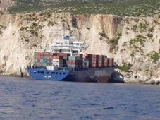
Fedra crew rescued as vessel breaks up

Fedra: broke in two off Europa Point in Gibraltar

THE crew of a cargo ship that ran aground in Gibraltar was plucked to safety in a perilous nighttime rescue by Gibraltarian and Spanish emergency services last Friday.

Defying extreme gale force winds, a Spanish maritime rescue helicopter airlifted five men from the bow of the 24-year old bulk carrier Fedra as it lay pinned by pounding waves at the base of sheers cliffs in Europa Point.

But the savage weather played havoc with the helicopter’s engine, forcing the pilot to make an emergency landing and leaving teams on land to find another way of getting the men off the ship.

Using a crane positioned on the cliff edge above the bow, Gibraltarian rescuers rigged a cradle that was lowered to the seafarers below.

In small groups throughout the night, they were hauled up wet, shivering and terrified.

At one point, with 11 men still on board, the operation had to be suspended as the storm intensified.

"We thought we were going to lose them," said one exhausted rescuer. "But at around 7am, we had a small weather window."

"We knew this was the only chance they had."

In a dramatic end to the operation, all remaining 11 men were winched to safety in one hoist. The men, mostly Filipino sailors, were treated in hospital but were later released and taken to a local hotel.

By mid Saturday morning the Liberian-flag Fedra had been ripped apart by the sea, the vessel torn in two close to the accommodation block.

Both sections of the ship remained trapped against the cliffs, heaving and hammering violently in the pitching seas.

The Fedra was one of two weekend casualties in this region, which was battered by a force 11 gale for much of Friday and Saturday.

In nearby Algeciras, the Liberian-flag bulk carrier Tawe ran aground and sustained hull damage, leaking fuel oil onto nearby beaches.

There were 22 seafarers on board but tugs were in assistance and the situation appeared stable.

Over in Gibraltar, the focus now is on a salvage operation to remove the wreck of the Fedra, which could pose a danger to navigation if either section breaks free of the rocks.

But no action is likely until after the weekend, when the weather is expected to ease significantly.

The Fedra ran aground after suffering engine failure on Friday morning and dragging its anchor until it came perilously close to the shore.

All through Friday afternoon, tugs laboured to secure towlines to the crippled vessel but these repeatedly failed. Efforts to repair the ship’s engine also proved futile.

The 36,000-tonne ship was empty at the time of the casualty and is believed to be carrying only a small amount of fuel for its own consumption.

According to the EU shipping database Equasis, it is managed by the Greek company Dilek Shipping.

The ship has a chequered port state control background and was last detained in August by Chinese inspectors who found 18 deficiencies, including three retaing to its propulsion systems.

The grounding, which happened just metres from where the New Flame foundered just over a year ago, will once again renew calls for tighter controls on shipping in the area.

RS

Wednesday, October 22, 2008

How Many Earthquakes Are There?

How Many Earthquakes Are There?

ScienceDaily (Oct. 8, 2008) — A new method for estimating the capability of a network to detect earthquakes suggests that the seismic monitoring network for Southern California, as an example, does not accurately reflect all earthquakes that register a magnitude of 3.3 or smaller within southern California, thereby giving seismologists an incomplete picture of recent and current seismicity.

The study, published in the October issue of the Bulletin of the Seismological Society of America, provides a new empirically-based approach for seismologists to understand the detection capabilities of seismic networks.

While today's improved seismic networks detect earthquakes down to low magnitudes in regions of the densest coverage, seismologists need to estimate the completeness magnitude which varies in space and time. This magnitude of completeness indicates the magnitude below which the earthquake catalog does not contain all events that occurred..

D. Schorlemmer of the University of Southern California (USC) and J. Woessner of the Swiss Seismological Service present a new approach to estimate the magnitude of completeness which will enable scientists to develop a richer understanding of the distribution of smaller earthquakes. The authors' new approach uses an analysis based on the actual performance of seismic stations rather than a theoretical assessment based on sampling of earthquakes.

This advancement is important because one way scientists estimate the number of large, damaging earthquakes is to study the distribution of small earthquakes. Without an accurate understanding of how likely the seismic networks are detecting earthquakes of different magnitudes, scientists may obtain incorrect seismic hazard estimates for an area.

WEATHER NOTE

Researchers study global warming impact on hurricanes

Florida Today

BREVARD COUNTY, Florida -- Federal researchers hope a supercomputer that crunches 76 trillion equations per second can shed light on whether global warming might lead to fewer, yet more powerful hurricanes.

The federal government has launched an intensive study of how global warming might impact hurricanes in coming decades.

The goal of the study is to better warn coastal communities, offshore Gulf of Mexico oil drilling operations, and other interests that could be affected by increased hurricane activity.

The National Center for Atmospheric Research (NCAR), will conduct the study, along with other federal agencies, universities, as well as the insurance and energy industries.

The Georgia Institute of Technology and several other universities are also collaborating on the research.

The project will use global climate and regional weather models, run on one of the world’s most powerful supercomputers. The models will examine future hurricane activity “in unprecedented detail,” according to a press release issued Wednesday by NCAR.

The study, which centers on the Gulf of Mexico and the Caribbean Sea, is part of a larger study of regional climate change between 1995 and 2055. Researchers will look at three decades in detail: 1995-2005, 2020-2030, and 2045-2055.

The simulations will run on NCAR’s flagship bluefire supercomputer. Manufactured by IBM, it is ranked as one of the 30 most powerful computers on Earth and can solve up to 76 trillion equations every second.

Researchers will analyze changes in hurricane frequency, intensity, and paths from now to the middle of the century. A major goal is to examine how several decades of greenhouse-gas buildup could affect regional climate and influence hurricanes and other critical weather patterns.

Preliminary results are expected early next year.

“It is clear from the impacts of recent hurricane activity that we urgently need to learn more about how hurricane intensity and behavior may respond to a warming climate,” NCAR scientist Greg Holland said in the release.

“The increasingly dense development along our coastlines and our dependence on oil from the Gulf of Mexico leave our society dangerously vulnerable to hurricanes,” said Holland, who is leading the project.

The new study follows reports by the U.S. Climate Change Science Program and Intergovernmental Panel on Climate Change, that found evidence for a link between global warming and hurricane activity.

MARITIME NOTE

Maritime Organization Seeks to Cut Air Pollution From Oceangoing Ships

The International Maritime Organization on Thursday adopted stringent new controls on airborne pollution from the world’s 300,000 oceangoing vessels.

Emissions from ships steaming into ports from Rotterdam to Shanghai to Long Beach, are blamed for about 60,000 premature deaths around the world annually.

The new rules, which differ little from proposals the group approved in April, would cut the sulfur content of the fuels ships use in controlled areas along coasts by 63 percent as of July of 2010, and by more than 95 percent as of January 2015.

Oceangoing ships are largely propelled by bunker fuel, which is one of the most cost-effective — it provides more energy per gallon than the distilled products used in other diesel and gasoline engines — and environmentally destructive fuels in use anywhere.

Sulfur emissions are a major source of airborne fine particulates, which have been associated with pulmonary and cardiovascular disease. In some ports in Europe and in the United States, environmental groups, using the courts, and local governmental bodies have required ships to shut off their engines and plug in to the local electrical grid to keep ship operations functioning while in port.

The international group approved the measure with little discussion late Thursday at its meeting in London, according to Janea Scott, a lawyer with the Environmental Defense Fund who attended the meeting. Ms. Scott spoke by telephone from London.

Both shipping interests and environmental groups had been unsure if any major last-minute changes would be made, but with the exception of changes of a few months in two of the deadlines, the original proposals were approved.

Now individual countries must set the boundaries of the so-called emission control areas in which the new, stringent fuel standards apply. This sets the stage for a renewed tug of war as environmental advocates are likely to seek to include as much of a country’s offshore waters as possible in the emission control areas, while shipping interests are likely to call for far more limited boundaries.

Andreas Chrysostomou, the chairman of the Marine Environment Protection Committee, hailed the decision as “an historical moment,” Ms. Scott said.

T. L. Garrett, vice president of the Pacific Merchant Shipping Association, an industry trade group, said Thursday: “This is good news — we are fully supportive of this. We think the international approach that creates uniformity is the way to approach the issues.”

Ms. Scott of the Environmental Defense Fund said, “It’s really impressive when 168 nations can come together and agree on protective measures for the environment.” She added that the Environmental Protection Agency, which will propose the boundaries of the emission control areas, “should apply as soon as possible.”

In addition to setting limits for the offshore areas, the organization also cut the allowable standards for midocean operation. Currently, even though the average sulfur content of bunker fuel is about 27,000 parts per million, the rules allow fuel with up to 45,000 parts per million. This will be reduced to 35,000 parts per million in 2012 and to 5,000 parts per million in 2020, providing that a review demonstrates that there will be enough of the fuel available.


RS

Tuesday, October 21, 2008

On Hard-Hit Galveston, Researchers Regroup

On Hard-Hit Galveston, Researchers Regroup

By Rachel Zelkowitz
ScienceNOW Daily News
26 September 2008

Virologist Scott Weaver set off to survey the damage at the University of Texas Medical Branch (UTMB) labs in Galveston just 1 day after the last squalls from Hurricane Ike passed over the island on 13 September. Although Galveston was hammered, the scene that greeted him at the UTMB labs was not as bad as he had feared, he says. With residents now pouring back in, Weaver and other Galveston researchers report that cleanup efforts at their labs and homes are proceeding more rapidly than they had expected.

"The mood is very, very up," says UTMB Associate Dean of Research David Gorenstein. As of Thursday, cleanup crews had dried out about two-thirds of the campus, and emergency generators were cranking out electricity, he says.

The UTMB campus stands on the eastern portion of the island, behind the seawall the city constructed after a hurricane devastated the town in 1900. The wall held during Ike, sparing the campus much of the destruction experienced across the rest of Galveston, where whole neighborhoods washed away. Overall, Hurricane Ike killed 50 people in the Gulf Coast and left millions more without power for a week. But the Galveston National Laboratory, a $167 million facility designed for the study of biohazards, suffered minimal damage, says the lab's associate director, James LeDuc. UTMB's biosafety level 4 lab, which holds samples of microbes such as anthrax and plague bacteria, also emerged unscathed. Elsewhere on the island, Texas A&M University's Galveston research facilities suffered virtually no damage, says campus CEO R. Bowen Loftin.

But back at UTMB, Keiller Building, the school's oldest research facility for virology and microbiology, did not fare as well. The building sits only about 2.5 meters above sea level and experienced more than 1 meter of flooding in its basement, Weaver says. Dehumidifiers hummed throughout Keiller and other UTMB buildings this past week, as work crews raced to rip out soggy flooring and dry wall, Gorenstein says: "Down in Galveston, we know all about mold."

Meanwhile, Weaver and his assistants made rounds to ensure that freezers stayed on and that animal colonies evacuated from the basement labs survived in their temporary facilities as the campus ran on backup generators. Of particular concern was a colony of Mexican mosquitoes that had taken 2 years to amass. "We're giving them a lot of TLC to keep them going," Weaver says, explaining that he feeds the larvae multiple times a day and ensures that the adults' supply of sugar water doesn't run low.

Weaver estimates that replacing some of the lab equipment that got soaked, plus repair efforts to Keiller's basement, could cost more than $1 million and mean weeks of lost time for the researchers. But LeDuc noted that research facility repair costs would amount to just a fraction of UTMB's overall losses from Ike. The school estimates it could lose some $600 million, much of that in lost revenue from closing hospital clinics for repairs, he says.

UTMB and Texas A&M researchers know that, for them, the greatest cost of Hurricane Ike will be time lost away from the lab bench rather than repair expenses. Weaver says they hope to have most of the labs across campus fully cleaned and operational within a month: "[Research] is very competitive. We can't afford to lose much time."

WEATHER NOTE

The Bow Echo: Observations, Numerical Simulations, and Severe Weather Detection Methods

ABSTRACT

Bowing convective line segments (bow echoes) are often associated with swaths of damaging downburst winds and are sometimes accompanied by tornadoes that may reach violent (F4) intensity. Bow echoes range in length from less than 20 km to more than 100 km, the latter forming a broad bowing line segment. In this manuscript, both past and recent observations of bow echo convective systems will be reviewed. The meteorological environments of long-lived derecho-producing convective systems will also be presented. This will be followed by recent conceptual models and numerical simulations of bowing convective systems. Finally, the evolution of two large-scale bow echo convective systems, which produced extensive wind damage and weak tornadoes, will be described. With the ongoing installation of a comprehensive network of Doppler radars, the National Weather Service forecaster will be required to know more about conceptual storm structure models of severe convective storms. It is hoped that this literature review will result in a greater understanding of such convective systems that are often known producers of significant severe weather events.

MARITIME NOTE

NTSB Advisory: NTSB to Offer New Course in Cooperation with NJ State Police


Thursday, October 9th, 2008

The National Transportation Safety Board is offering a two-day course - Transportation Disaster Response - A Course for Emergency Responders, at its NTSB Training Center in Ashburn, Virginia on November 18-20, 2008.

This course is designed specifically for emergency responders and planners; this course provides participants with the tools to most effectively manage a major transportation disaster. Audio/video materials, case studies, recent examples and panel discussions are employed to illustrate key principles of the unique aspects of responding to major transportation disasters.

Some of the key points that will be covered will be:

•Integrating Incident Command System and investigative processes during a transportation disaster;
•Responding to transportation events involving terrorism and/or hazardous materials;
•Maximizing resources in site security and support Staffing;
•Responding to media inquires and managing press at the Scene;
•Communicating with the local community and families of the victims;
•Providing assistance to family members;
•Forensic aspects of recovery and identification;
•Long-term issues facing the affected community following a major disaster;


Instructors will be from the NTSB, New Jersey State Police, Minneapolis Police Department and specialized FBI units. For more information please go to: http://ntsb.gov/Academy/CourseInfo/TDA402_2008.htm or contact Erik Grosof at the NTSB's Office of Transportation Disaster Assistance 202-314-6189.

Media Contact: Keith Holloway, (202) 314-6100

RS

Monday, October 20, 2008

Global Warming Will Have Significant Economic Impacts On Florida Coasts, Reports State

Global Warming Will Have Significant Economic Impacts On Florida Coasts, Reports State

ScienceDaily (Oct. 1, 2008) — Leading Florida-based scientific researchers released two new studies today, including a Florida State University report finding that climate change will cause significant impacts on Florida's coastlines and economy due to increased sea level rise.

A second study by researchers at Florida Atlantic University recommends that the state of Florida adopt a series of policy programs aimed at adapting to these large coastal and other impacts as a result of climate change. Key findings of the FAU report were included just this week by Florida Gov. Charlie Crist's Climate and Energy Action Team when it adopted the "Adaptation" section of its final report.

"The impacts of climate change on Florida's coasts and on our economy will be substantial, persistent and long-term, even under our conservative estimates," said Julie Harrington, director of the Center for Economic Forecasting and Analysis at FSU. "Should, as many models predict, sea level rise, and hurricane strength and other factors become more extreme, much greater economic impacts will occur along many parts of Florida's coast in this century."

The second new study, by researchers at FAU, focused on state adaptation policies needed as Florida faces the impacts of climate change.

"The goal of our study is to help the state of Florida adapt, in the most effective way possible, to climate change impacts that are now inevitable," said Jim Murley, director of Florida Atlantic University's Center for Urban and Environmental Solutions and leader of the study. "These approaches must be comprehensive and strategic, not piecemeal and episodic. Governor Crist and other leaders have rightly identified adapting to climate change as one of the state's greatest challenges -- we look forward to working with the state to protect our people, natural splendor, and economic livelihood. There is real work to be done."

This research was supported by a grant from the National Commission on Energy Policy, a project of the Bipartisan Policy Center.

About the FSU study

This study uses current estimates of sea level rise from Florida State University's Beaches and Shores Resource Center and 2001 estimates from the Intergovernmental Panel on Climate Change to evaluate the effect of sea level rise on the six coastal counties. The results show projected trends in storm-surge flood return periods associated with hurricanes, damage costs associated with flooding from major storm events, and the value and area of land at risk.

Under the FSU study's estimates for sea level in Dade County, the value of land at risk totals $6.7 billion in 2080 (in 2005 dollars). (By comparison, using International Panel on Climate Change sea level estimates, the value of land at risk in Dade County ranges from $1 billion to $12.3 billion in 2080). The study also calculated the effect of storm surge and sea level rise on future damage costs, finding that if a storm like Hurricane Wilma from 2005 occurred in 2080, the cost to Dade alone would be from 12 percent to 31 percent higher (in 2005 constant dollars). While these findings do not account for adaptive strategies or potential future increases in property values, they still provide valuable information about potential impacts and resources that are put at risk from sea level rise.

About the FAU study

Key findings of the report have been included by Gov. Crist's Climate and Energy Action Team as it adopted the "Adaptation" section of its final report this week in Tallahassee. Important findings from the FAU study call for major state environmental, growth management and public infrastructure decision-making processes to be adjusted so they are responsive to future climate change impacts.

"FAU will continue to research how Florida can be a leader in providing guidance to other states on how best to put in place workable solutions that will help communities adapt to future climate change impacts," Murley said.

"Storm events associated with certain levels of storm surge could increase in frequency in the future, due to sea level rise," Harrington said.

"As sea level rises, damage costs associated with extreme storm events increases significantly for the Florida counties examined in this study," she said.

WEATHER NOTE

My Personal Close Calls With Tornadoes
By Michelle Dyer
Special Corespondent to Robin Storm

What is the dream of a storm chaser? To get close to a large and dangerous tornado! Many attempts have been made to accomplish this goal, much of the time, the mighty twisters go unseen. Oh, but what if you've been close to a tornado without looking for it? I have done just that!

This month's article will be the focus of four rather compelling stories of mine. These personal accounts involve my close encounters with tornadoes. Each story is different and unique, but will contain common threads. Please come with me as we walk through these personal experiences together.

http://web2.airmail.net/danb1/tornado.jpg

My First Ever Tornado Warning


This first encounter took place when I was four years old. Before I go on, I must state that things in this memory are a bit sketchy because of my young age, but I remember just enough to tell the story. In spite of that, I hope you will enjoy reading about it.

The first thing I remember is being placed inside of what looked like a utility room. This small enclosure was cluttered with furniture, tools and other things that I can't currently recall. There was a small window for which I could somewhat see out of, however, it was way too high, so I couldn't climb up onto anything to completely watch the weather that was unfolding at that time. If I had been able to see everything at that point, I might not have been so unsure of what really took place that particular day.

After my Mom placed me in this small and cluttered room, she left, closing the door slightly behind her. I asked her if she'd be back, and she told me she would return. Unfortunately, this did not happen.

While waiting in this small room, I could hear the radio playing. The announcer came on and mentioned about a Tornado Warning. My Mom, by this point, was getting ready for work as well as listening to the radio. She wanted to hear what was going on with the weather, but I recall wishing that she'd come to the room I was in so she could be safe.

Even as I was being placed in this room, I knew about this Tornado Warning.You might be wondering then, did I know what a Tornado Warning meant? Well, at that age, I knew that such a circumstance meant that a tornado was coming, and that one needed to find a safe place to go. I also knew, even at that age, that tornadoes killed or injured folks that refused to seek
protection.

While waiting in this small room, I watched as the darkening sky cast a reflection on everything around me. The more the sky darkened, the more scared I became. As a result of this fear that I felt, I some how thought to move behind some of the furniture in the room. I stood behind a glass table and trembled with great fear as the storm moved on passed.

When the sky got brighter, I then felt like things were safe. My Mom then came to tell me that the Tornado Warning was over, and that I could leave the room in question. What a relief! The tornado didn't hurt us! I hoped that it didn't hurt anyone else either.

Now, I don't really know if a tornado took place that day or not. I'm not even sure of the date or time. Heck, I don't even know what direction the storm moved in, or if the tornado ever touched the ground. All I can say is, that I knew what to do, which is amazing for being a small child living in Northern Virginia at the time.

My Experience With A Mysterious Pea Green Sky


This particular experience was preceded by what was a calm, but cloudy afternoon. I had been sitting out on the front porch with my Grandparents while watching the sun take on a milky look. Then, as the sun completely disappeared behind a thickening cloudbank, we all decided to head in doors.

The next thing I remember, my Grandparents had left for the store for groceries. While they were gone, I hung out in the living room area and played with my toys, for I was only 4 or 5 years old at the time. As a matter of fact, I loved placing my babies into my little brother's baby swing. This way, I could be like my Mom who had just given birth to my brother.

Well, as I continued playing with the baby swing, I heard this strange noise fill the room. I turned my head to the right of me, and saw the sky turn the strangest shade of green. Along with this, I watched as heavy rain poured in like a waterfall through the open window. Wind blew the rain in through the open window horizontally, and I could not see the neighbors that were situated at the bottom of a hill behind our house.

My Dad noticed what was happening, and ran like mad from the kitchen to the living room to close the window. The rain was still pouring so hard, it took on a silver like look. Even the sky got hard to see at points!

This strange shade of green looked like someone had blended grayish-blue with a creamy yellow. When you blend those two colors together, you can get a putrid pea grayish-green shade. I even recall seeing dark green swirls within the clouds. As I looked more toward the horizon, these green swirls seem to gather up into a bulge that was darker than any other part of the
sky.

As the storm moved on, I could see more white clouds starting to fill the sky. First these white clouds moved in from the west, replacing the green clouds as the storm moved to the east. Then these white clouds seemed to make the greener clouds look lighter. The strangest thing I must point out though is how weird the edge of the green clouds looked while taking on a razor sharp straight edge appearance. This split look had made it impossible for the green and white clouds to mix, which seemed to reveal an apparent dry line effect.

I happened to get a good look at this sky formation because I was standing out in the rain, holding the door open for my Grandparents after they arrived home from shopping. They had arms full of groceries which needed to be brought inside rather quickly. This was due to the fact that large raindrops continued to fall.

So, you might be asking, was there a tornado in that storm? The answer is, I don't really know for sure. When I've told this story to friends of mine over the years, they seem to think that a tornado hit close by to me. I can not confirm or deny this claim. All I know is what I saw, felt and experienced.

The Tornado That Didn't Take Place

Now we will jump ahead to another strange close encounter I had with a tornado. Back in the late summer of 1985, we experienced the storm of storms. This event would break a six week heat wave that crippled the eastern United States with high temperatures and severe drought.

The date was Tuesday, September 9, 1985. I had come home from school like any other day. The only difference was, after I arrived home, the weather began to change.

I could sense that something was wrong, like the feeling of pending danger. We new that a storm was coming, but we were unable to follow it's progress after losing our cable connection. There's nothing quite like feeling helpless in a situation like that, especially since I could sense the approach of a tornado.

A few minutes later, I looked up at the sky and saw something that frightened me greatly! The leading cloud edge of this approaching storm took on a bulging appearance. These bulges had shown as this grayish emerald green color. I was sure then that a tornado was bound to happen.

As the storm moved closer, the emerald green clouds gave way to grayish ones. Once this occurred, the entire sky filled up with constant flashes of blue lightning. The weird thing was that this lightning had not been accompanied by thunder. I had read somewhere that lightning without thunder often meant that a tornado was present.

Along with the eerie blue lightning came a huge wall of rain. This rain was so heavy that I could not see the neighbor's behind our house. This rainfall took on the same appearance as the pea green sky storm I experienced as a youngster. Unlike that storm with the pea green sky though, I don't recall any wind blowing. Regardless of this fact, I'm sure a tornado hit somewhere close to us.

Well, after the storm was over, we turned on the news to find out what had happened. To my utter surprise, we heard that no tornado had taken place. According to the National Weather Service, the damage done was caused by straight line winds. This particular damage area was about a mile from where I lived at that time.

In spite of this NWS ruling, I will always wonder if a tornado happened in that storm. I say this because of the heavy rainfall and the silent blue lightning. My theory is that a tornado started to form, and then when it got close to us, began to fall apart. This would have still left behind the microburst that created the damage in question.

Here's The Closest Encounter Yet!

Please allow me to now share with you about my closest tornado encounter to date! This particular experience became my piece of what ended up being one of Central Florida's deadliest tornado outbreaks thus far. Out of these four encounters, this one scared me the most.

It was February 22, 1998, and we were expected to see some kind of severe weather that day. At first, the weather was expected to arrive by mid afternoon. However, the cold front expected to bring these storms to our area had stalled out over North Florida, causing the storms to build from the heating of the day.

At first, the Storm Prediction Center had placed us under one tornado watch, which yielded no real severe weather. By early evening, we were beginning to think that these storms were not ever going to arrive. Unfortunately, by 9 p.m. that Sunday evening, we were back under another tornado watch. This concerned us, because this line of severe storms was taking on more of a bow echo appearance as the day progressed.

By 11:00 p.m., we were beginning to see the squall line move in closer to our location. As it did, tornado warnings started to be issued throughout Central Florida. First, we started following tornadoes coming up from the Kissemmee area, moving into Orange County. From there, we listened as the weather service kept issuing tornado warnings for Seminole and Volusia Counties.

When the squall line approached Seminole County, we became rather nervous. This is because Sanford/Lake Mary, the area my family and I live in, was the next target for these tornadoes. The radio announcer had stated that a tornado had touched down on Lake Mary BLVD., which is where my neighborhood is located.

My house does not have a basement, so my brother and I sat huddled in my bedroom closet Before we knew it, thunder was rumbling to our north and west. This created within us a great deal of fear for which we could not shake. What would we do if a tornado actually hit? How would we really handle the situation?

By the time we began to see this line of storms, it was well past midnight. I think it was closer to 1 a.m. or something. I wasn't really sure at that point. All I knew was that things turned real weird, really fast.

Like I stated earlier, we started out hearing thunder off in the distance. Then, as the storm got closer, the sound of the rain and thunder disappeared. As the thunder faded away, it was replaced with an eerie silence. Following the silence was this strange swishing and tearing sound that was accompanied by a hissing noise.

This hissing sound wasn't around long, but the swishing and tearing noise lingered. My brother could see flashes of silent lightning embedded within this storm, creating a wall of blue-green light that was constantly flashing. We seemed to be surrounded as the massive element continued to hang overhead.

While this ordeal was occurring, I began to notice that the room around us grew silent. I could no longer hear the television set coming from the living room, and the bedroom seemed to be unusually still. It was not a peaceful stillness, it felt more like being inside of a vacuum tube. It just seemed as if everything stopped, and that the world had dropped us off somewhere in the twi-light zone.

At this point, my brother and I began to shake and tremble. The only thing I knew to do was to pray. So, I grabbed my brother's hands and did just that! After all, we were thinking the worst at that point. What else could we do!

Before we knew it, the swishing sound was replaced with the rain and thunder. We rejoiced over the fact that the strangeness was behind us. All we could do at that point was to climb out of the closet and take a deep breath.

Once the storm left our location, it went to a neighborhood to our east. Those folks weren't so fortunate because some lost their lives when the tornado hit them. It was weird because once the storm left the area, the weather became so nice, that you wouldn't have known that a tornado was even there!

After everything was over, we spent all night listening to the news. I was so traumatized that I couldn't sleep. I couldn't believe what had happened and that I had survived it. What an unbelievable night for us all!

The next day, my parents went outside to assess what the tornado had done. Even though we did not sustain any damage, some strange things did occur. The tree out in front of our home had been stripped of all it's leaves. The top of the tree had been twisted around, as if someone had taken it and turned it around in a not. Twigs were left standing upright, embedded into the ground. If that wasn't all from a tornado, then what was it?

This particular tornado outbreak produced seven tornadoes. There were fourty-two persons that lost their lives that night, making that outbreak one of the deadliest in Central Florida history. A lack of Weather radios, along with the late hour, were the main culprits to why so many deaths occurred that night. From then on, there's been a campaign to encourage Central Floridians to use their NOAA radios, especially if severe weather is expected in the middle of the night.

I, to this day, am grateful to be alive, but feel guilty for having prayed that we'd be spared. For if I had not prayed, the souls to our east may not have died that night. I know that sounds ridiculous, but that's how I feel!

Michelle Dyer is a Special Corespondent to Robin Storm and is a blind weather reporter.


Portable Imaging System Will Help Maximize Natural Disaster Response

Researchers at the Georgia Tech Research Institute (GTRI) have developed a low-cost, high-resolution imaging system that can be attached to a helicopter to create a complete and detailed picture of an area devastated by a hurricane or other natural disaster. The resulting visual information can be used to estimate the number of storm refugees and assess the need for health and humanitarian services.

Aid organizations currently don’t have a quick and accurate way to determine how many people need assistance. Satellites can collect images of areas affected by a natural disaster, but there are dissemination restrictions and cloud cover can prevent collection of images.

“Without a real-time map, it’s very hard to do population estimates and demographic estimates to figure out where people are, how they’re moving, how they’re spaced out and even how many people you have on the ground,” said Benjamin Sklaver, a project officer from the Centers for Disease Control and Prevention (CDC) International Emergency and Refugee Health Branch. “This technology does not exist currently, so GTRI’s imaging system is really an innovative project.”

The imaging system was developed with funding from the CDC, and agency officials would like to begin using this device as soon as possible. After responding to the recent devastation caused by Hurricanes Hanna and Ike, the CDC asked GTRI to accelerate delivery of the imaging device for use during the 2008 hurricane season.

“We plan to package the system for use on Coast Guard UH-60J Black Hawk helicopters, which were among the first to fly over Haiti following Hanna’s devastation,” said David Price, a GTRI senior research technologist.

The imaging system – designed by Price and senior research engineer Gary Gray – is called the “Mini ModPOD,” which stands for “Miniature Modular Photographic Observation Device.” It consists of an off-the-shelf Canon Digital Rebel XTi digital camera, a global positioning system receiver, a small circuit board that uploads mission parameters, and an inertial measurement unit that measures the aircraft’s rate of acceleration and changes in rotational attributes, including pitch, roll and yaw. The images collected from the system can be stitched together to create a complete picture of the affected area.

The research team has tested the device on several flights, selecting areas with large populations of people likely to be outdoors.

“During the first test flight, we wanted to test the clarity and resolution of the images collected during the run, and we were very pleased,” said Price. “We could see tennis balls on the ground and people reading books at outdoor tables. This was sufficient detail to allow accurate counting the number of people in an area.”

After the first flight, the researchers reduced the weight of the device and developed a more accurate geo-referencing capability, which allowed the physical location of the scenes shown in each photograph to be determined with precision. With the modifications made, the researchers went for a second flight test in July.

The research group selected a rectangular zone of interest and loaded the latitude and longitude coordinates of the zone into the system from a USB drive. As soon as the helicopter flew into the zone, the camera began snapping pictures. The electronics were set to measure the speed of the aircraft so that each photo overlapped 60 percent of the preceding photo, making it easier to stitch together the photos to create a complete picture. The pilot made two passes, at altitudes of 500 and 1,000 feet above ground level.

“This test flight was successful in confirming the Mini ModPOD’s ability to activate the camera within the zone of interest. The resulting photos were extremely sharp and clear – they were free of any vibration or motion effects,” added Price.

The photos were successfully matched to the flight data, which enabled the CDC to adjust them for geospatial reference. However, due to a software glitch, they were not overlapped as planned. The researchers made a small adjustment to the software and completed a third a third test flight in August.

“This flight resulted in images that were 60 percent overlapped, enabling CDC engineers to build a high-resolution mosaic image,” noted Price. “Individuals on the ground were easily distinguishable as people separate from other objects.”

The imaging system will also be available to the CDC and other agencies, such as the American Red Cross, to count people in refugee camps in order to plan for health and humanitarian services.

The research described in this article was supported by cooperative agreement #U38 EH000363 from the CDC. Its contents are solely the responsibility of the authors and do not necessarily represent the official views of the CDC.

MARITIME NOTE

Maritime groups: Icebreakers needed on Great Lakes

MILWAUKEE -- Several maritime groups say shipping on the Great Lakes could be disrupted this winter because of a shortage of U.S. Coast Guard icebreakers.

Lake Michigan covers 22,300 square miles, with more than 1,640 miles of shore in Michigan, Wisconsin, Illinois and Indiana.In Wisconsin, there's only one Coast Guard icebreaker to help vessels on the lake.Port of Green Bay director Dean Haen says mechanical problems have taken that ship out of service, and there have been times when it was reassigned elsewhere. That leaves the Green Bay port and others in Wisconsin without any icebreaker.Shipping industry representatives say two more icebreakers are needed _ one on Lake Michigan and one assigned to Duluth, Minn., for service on Lake Superior


RS

Friday, October 17, 2008

Cloud Radar: Predicting The Weather More Accurately

Cloud Radar: Predicting The Weather More Accurately

ScienceDaily (Oct. 1, 2008) — The weather. It’s the one topic of conversation that unites Britain – umbrella or sun cream? Now scientists at the Science and Technology Facilities Council have developed a system that measures the individual layers of cloud above us which will make answering the all-important weather questions much easier in future.

The Cloud Radar will not only allow forecasters to predict the weather more precisely, the information gathered will also enable aircraft pilots to judge more accurately whether it is safe to take off and land in diverse weather conditions, offering a powerful safety capability for civil airports and military air bases.

Developed over 10 years by researchers and engineers at the STFC Rutherford Appleton Laboratory, in collaboration with the Met Office, the Cloud Radar can take a complete and accurate profile of cloud or fog up to 5 miles overhead. Operating at 94 GHz, 50 times higher in frequency than most mobile phones, the radar measures the cloud base height, its thickness, density and internal structure as well as providing similar information on cloud layers at higher altitudes.

The earliest version of the cloud radar was built to demonstrate that a low power system operating at high frequency could compete with more common radar types. It was built from the spare components of a radar altimeter designed to operate on a satellite, so that it used small, low-power components in contrast to previous cloud radars that use expensive pulsed sources which consume many times more power and have limited lifetimes.

Brian Moyna, Senior Systems Engineer at STFC said: “In a nutshell, our Cloud Radar takes a slice of cloud and provides a complete and accurate vertical profile. Compared to conventional pulsed radar instruments, this radar is a low power, high sensitivity, portable instrument that uses all solid state components for lower cost and increased reliability.”

The Met Office has just purchased a Cloud Radar which is being trialled at sites around Britain. Additionally, a Cloud Radar has also been acquired by the University of Marburg in Germany.

The radar consists of a millimetre-wave frequency source that continuously emits a low power signal in the vertical direction that is frequency modulated. A signal is returned, mainly due to what is known as ‘back-scattering’ from water droplets and ice crystals in the atmosphere. This signal is picked up by a receiver and converted to a microwave signal, which is then digitised, analysed and a real-time image of the returned signal intensity versus altitude is displayed for the user.

The new Cloud Radar is the result of several hundred thousands of pounds of investment into the Space Science & Technology Department at STFC with proof of concept funding from CLIK, STFC’s wholly-owned technology exploitation company, along with the Met Office.

WEATHER NOTE

Global Warming Will Have Significant Economic Impacts On Florida Coasts, Reports State

ScienceDaily (Oct. 1, 2008) — Leading Florida-based scientific researchers released two new studies today, including a Florida State University report finding that climate change will cause significant impacts on Florida's coastlines and economy due to increased sea level rise.

A second study by researchers at Florida Atlantic University recommends that the state of Florida adopt a series of policy programs aimed at adapting to these large coastal and other impacts as a result of climate change. Key findings of the FAU report were included just this week by Florida Gov. Charlie Crist's Climate and Energy Action Team when it adopted the "Adaptation" section of its final report.

"The impacts of climate change on Florida's coasts and on our economy will be substantial, persistent and long-term, even under our conservative estimates," said Julie Harrington, director of the Center for Economic Forecasting and Analysis at FSU. "Should, as many models predict, sea level rise, and hurricane strength and other factors become more extreme, much greater economic impacts will occur along many parts of Florida's coast in this century."

The second new study, by researchers at FAU, focused on state adaptation policies needed as Florida faces the impacts of climate change.

"The goal of our study is to help the state of Florida adapt, in the most effective way possible, to climate change impacts that are now inevitable," said Jim Murley, director of Florida Atlantic University's Center for Urban and Environmental Solutions and leader of the study. "These approaches must be comprehensive and strategic, not piecemeal and episodic. Governor Crist and other leaders have rightly identified adapting to climate change as one of the state's greatest challenges -- we look forward to working with the state to protect our people, natural splendor, and economic livelihood. There is real work to be done."

This research was supported by a grant from the National Commission on Energy Policy, a project of the Bipartisan Policy Center.

About the FSU study

This study uses current estimates of sea level rise from Florida State University's Beaches and Shores Resource Center and 2001 estimates from the Intergovernmental Panel on Climate Change to evaluate the effect of sea level rise on the six coastal counties. The results show projected trends in storm-surge flood return periods associated with hurricanes, damage costs associated with flooding from major storm events, and the value and area of land at risk.

Under the FSU study's estimates for sea level in Dade County, the value of land at risk totals $6.7 billion in 2080 (in 2005 dollars). (By comparison, using International Panel on Climate Change sea level estimates, the value of land at risk in Dade County ranges from $1 billion to $12.3 billion in 2080). The study also calculated the effect of storm surge and sea level rise on future damage costs, finding that if a storm like Hurricane Wilma from 2005 occurred in 2080, the cost to Dade alone would be from 12 percent to 31 percent higher (in 2005 constant dollars). While these findings do not account for adaptive strategies or potential future increases in property values, they still provide valuable information about potential impacts and resources that are put at risk from sea level rise.

About the FAU study

Key findings of the report have been included by Gov. Crist's Climate and Energy Action Team as it adopted the "Adaptation" section of its final report this week in Tallahassee. Important findings from the FAU study call for major state environmental, growth management and public infrastructure decision-making processes to be adjusted so they are responsive to future climate change impacts.

"FAU will continue to research how Florida can be a leader in providing guidance to other states on how best to put in place workable solutions that will help communities adapt to future climate change impacts," Murley said.

"Storm events associated with certain levels of storm surge could increase in frequency in the future, due to sea level rise," Harrington said.

"As sea level rises, damage costs associated with extreme storm events increases significantly for the Florida counties examined in this study," she said.

MARITIME NOTE

Navy Confirms Sunken Submarine Is Grunion

ScienceDaily (Oct. 4, 2008) — Commander, Submarine Forces Pacific Fleet (COMSUBPAC), Rear Adm. Douglas McAneny announced October 2 that a sunken vessel off the coast of the Aleutian Islands is in fact the World War II submarine USS Grunion (SS 216).

The submarine Grunion arrived at Pearl Harbor on June 20, 1942. The vessel completed pre-patrol training before departing on its first war patrol June 30. Grunion's commanding officer, Lt. Cmdr. Abele, was ordered to proceed to the Aleutian Islands and patrol westward from Attu on routes between the Aleutians and the Japanese Empire. On July 10, Grunion was reassigned to the area north of Kiska. Over the next 20 days, the submarine reported firing on an enemy destroyer, sinking three destroyer-type vessels, and attacking unidentified enemy ships near Kiska.

Grunion's last transmission was received on July 30, 1942. The submarine reported heavy antisubmarine activity at the entrance to Kiska, and that it had 10 torpedoes remaining forward. On the same day, Grunion was directed to return to Dutch Harbor Naval Operating Base. There was no contact or sighting of the submarine after July 30, and on August 16, Grunion was reported lost.

"I am honored to announce that, with records and information provided by the Abele family and assistance from the Naval Historical Center, USS Grunion has been located," said McAneny. "We are very grateful to the family of Grunion's Commanding Officer Lt. Cmdr. Mannert L. Abele for providing the underwater video footage and pictures that allowed us to make this determination. We also appreciate the efforts of the USS Cod Submarine Memorial for their assistance in this matter. We hope this announcement will help to give closure to the families of the 70 crewmen of Grunion."

Abele was posthumously awarded the Navy Cross for heroism. A destroyer, USS Mannert L. Abele (DD 733), was commissioned in his honor, and was later lost in action off Okinawa in 1945. Japanese anti-submarine attack data recorded no attack in the Aleutian area at the time of Grunion's disappearance, so the submarine's fate remained an unsolved mystery for more than 60 years.

After discovering information on the internet in 2002 that helped pinpoint USS Grunion's possible location, the sons of Grunion's commanding officer, Bruce, Brad, and John Abele, began working on a plan to find the submarine. In August 2006, a team of side scan sonar experts hired by the brothers located a target near Kiska almost a mile below the ocean's surface. A second expedition in August 2007 using a high definition camera on a remotely operated vehicle (ROV) yielded video footage and high resolution photos of the wreckage of a U.S. fleet submarine.

"This discovery has come about through a stream of seemingly improbable events; it's like we won the lottery 10 times in a row," said Bruce Abele, eldest son of Grunion's commanding officer. "It is so dramatic to see the underwater photo and be certain it was in fact Grunion; not only is this announcement important for the families of the crew members, it's also important for the Navy and the country."

The Abele brothers then contacted the USS Cod Submarine Memorial for assistance in identifying the wreckage. The vessel is lying at a depth of about 3,200 feet. Very cold water and lack of significant currents has preserved much of the wreckage.

Dr. John Fakan, director of the USS Cod Submarine Memorial, remarked about the importance of having an unmodified example in USS Cod, a fellow Gato-class submarine, in identifying the wreckage of USS Grunion.

"USS Grunion and USS Cod shared the same blueprints," he said. "It is very gratifying for me and my crew to help with the identification of the submarine."

With the information provided by the Abele family and the USS Cod Submarine Memorial, COMSUBPAC and the Naval Historical Center examined the evidence and historical records and determined that the submarine found at the reported position could only be USS Grunion.

"The synergy of our group working together with the Navy for the common cause has been a wonderful group effort," Bruce Abele said. "The teamwork combined with everyone's compassion and wisdom has resulted in our success."

According to Bruce's brother John Abele, those responsible for contributing to this discovery included historians and engineers from the United States, Australia, Israel and Japan. Of particular note was the involvement of Japanese naval architect Yutaka Iwasaki, who provided information critical to pinpointing the location of the submarine.

Bruce and John's brother, retired Lt. Brad Abele, who recently passed away, also played a significant role in the find. As his brother John explained, "Brad's experience as a Naval aviator helped a great deal by helping us to plot the strategy for the discovery."

Unfortunately, the cause of Grunion's sinking remains a mystery. No matter what the cause, the end result was the loss of all hands. As the Naval Historical Center noted, "no amount of analysis or speculation will change or alter the fact that families lost fathers, husbands, uncles and brothers… the Navy and the nation will always be grateful for their service and their sacrifice."

Former Commander-in-Chief of the U.S. Pacific Fleet Admiral Chester Nimitz once said, "When I assumed command of the Pacific Fleet on 31 December 1941 our submarines were already operating against the enemy, the only units of the Fleet that could come to grips with the Japanese for months to come. It was to the Submarine Force that I looked to carry the load until our great industrial activity could produce the weapons we so sorely needed to carry the war to the enemy. It is to the everlasting honor and glory of our submarine personnel that they never failed us in our days of great peril."

By the end of World War II, submarines had made more than 1,600 war patrols. Pacific Fleet submarines like Grunion accounted for more than half of all enemy shipping sunk during the war. The cost of this success was heavy: 52 U.S. Pacific Fleet submarines were lost, and more than 3,500 submariners remain on "eternal patrol."

A representative of the submarine force will speak on behalf of the U.S. Navy at a memorial service in Cleveland, Ohio, Oct. 11. The service, hosted by the USS Cod Memorial, will honor the 70 crewmembers killed when USS Grunion was sunk near the Aleutian Islands on or about July 30, 1942.

"To provide ourselves and the families this closure, it's icing on the cake," said John Abele. "The memorial service is a symbolic event; we've discovered family we didn't know we had. Not only is this an honor for all of us, it increases the feeling of community we've been able to achieve."


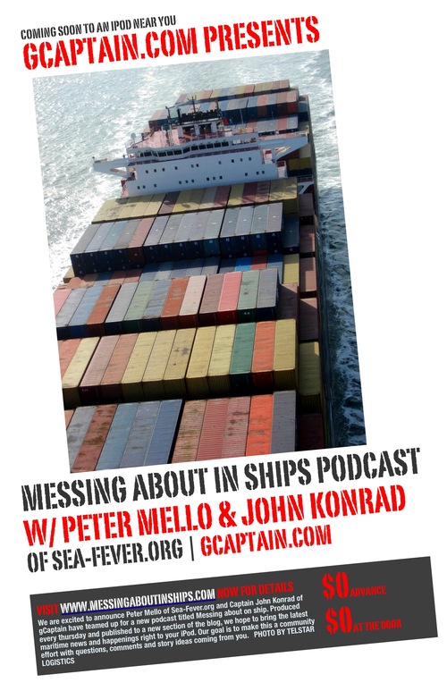
Messing About In Ships Podcast

HAVE A SAFE AND GREAT WEEKEND!
RS

Thursday, October 16, 2008

Why Hurricane Ike's "Certain Death" Warning Failed

Why Hurricane Ike's "Certain Death" Warning Failed

As residents of Galveston, Texas, were allowed to return to the devastated island this week, experts puzzled over why tens of thousands of others had remained during Hurricane Ike—despite the National Weather Service's "certain death" warning.

Among the possible explanations: memories of a chaotic 2005 evacuation, an anti-government attitude, and a false sense of security fueled by TV news and the abundance of hurricane data on the Web.

(See full Hurricane Ike coverage: photos, stories, and videos.)

Avoiding Chaos

Gene Hafele, director of the Houston-Galveston National Weather Service office, said about 500,000 people in and around Galveston were in a mandatory evacuation zone, and only about 300,000 left.

Bill Read, director of the National Hurricane Center in Miami, estimated there were about 140,000 people in the smaller, "certain death" zone. About 70 percent of those residents evacuated. That left nearly 40,000 people to contend with the worst of the storm surge.

There is "no one answer" why so many Texas residents ignored the evacuation order, Read said.

Some probably refused to leave because they'd been caught in the chaotic evacuation for Hurricane Rita in 2005, he said.

During that event, roads out of Houston became gridlocked. Officials later estimated that about 90 people died during the 2005 evacuation because of heatstroke, dehydration, and other causes.

Read also said that some of those who refused to leave during Hurricane Ike stayed because they have an intense anti-government attitude. "They think, No one tells me what to do," Read said.

The National Weather Service's Hafele said officials decided to issue the "certain death" evacuation warning because the storm surge from Hurricane Ike would be unlike anything seen on the Texas coast since an unnamed hurricane in 1915.

"People who were living in the storm surge zone had never experienced a surge like this and had no way of knowing how severe this could be," Hafele said.

Hafele said he was puzzled by why some residents of Bolivar Peninsula—a low-lying, more rural community just north of Galveston—defied the evacuation order.

The peninsula took the worst of Ike's storm surge, and dozens of homes and other buildings there simply disappeared after the hurricane (photo: the peninsula before and after Hurricane Ike).

"The people who live on Bolivar understand their vulnerability," Hafele said. "Some have lived out there an unusually long time, and they've experienced a lot of storms. Why some of those people decided not to leave really is beyond me."

False Sense of Security

Jay Baker, a professor of geography at Florida State University in Gainesville, has studied how people respond to hurricane warnings.

The main reason people don't comply with evacuation orders is because they think they will be safe despite the warning to leave, Baker said.

"They think the storm will miss them, or they think they will be safe in their homes even if the storm does hit," Baker said.

There's also the fact that evacuating can be an expensive and very difficult task, and that can prompt people to decide not to leave, Baker said.

In addition, the National Hurricane Center's Read added, live news reports from the ground in Galveston may have given some viewers a false sense of security. "Viewers think, It's OK for the cameraman to stay there, why not me?"

Florida State's Baker said, "I'm not convinced that there's any kind of deep-seated psychological reason. People just make poor judgments. They don't know how bad it can get if they stay."

Billy Wagner is the chief emergency management specialist for Early Alert, a private hurricane warning and emergency management consulting service based in Tampa, Florida.

The availability of so much hurricane information on the Internet may be another reason why some people decide to ignore evacuation orders, Wagner said.

Amateur forecasters don't have the skill and training to evaluate hurricane data and make sound decisions about whether they should evacuate, he added.

The National Hurricane Center, on the other hand, has the "overall picture" of the approaching storm and also is communicating with local officials about whether to issue evacuation orders, he said.

"They need to listen to public officials," Wagner said. "I'm always concerned that too many people think they're tropical meteorologists now and are second-guessing what's taking place."

Read, the National Hurricane Center director, said forecasters will be taking a "cold, hard" look after the hurricane season at hurricane warnings and how people responded to them. The review could prompt changes in how the center issues warnings, he said.

Willie Drye is author of Storm of the Century: the Labor Day Hurricane of 1935, published by National Geographic Books.

HURRICANE BASICS


WEATHER NOTE

Arctic Sea Ice Hits Second-lowest Recorded Extent, Likely Lowest Volume

ScienceDaily (Oct. 3, 2008) — Arctic sea ice extent during the 2008 melt season dropped to the second-lowest level since satellite measurements began in 1979, reaching the lowest point in its annual cycle of melt and growth on Sept. 14, according to researchers at the University of Colorado at Boulder's National Snow and Ice Data Center.

Preliminary data also indicate 2008 may represent the lowest volume of Arctic sea ice on record, according to the researchers. The declining Arctic sea ice is due to rising concentrations of greenhouse gases that have elevated temperatures across the Arctic and strong natural variability in Arctic sea ice, according to scientists.

Average sea ice extent during September, a benchmark measurement in the scientific study of Arctic sea ice, was 1.8 million square miles. The record monthly low, set in 2007, was 1.65 million square miles. The third lowest monthly low was 2.15 square miles in 2005, according researchers at the center.

The 2008 low strongly reinforces the 30-year downward trend in Arctic sea ice extent, said CU-Boulder Research Professor Mark Serreze, an NSIDC senior scientist. The 2008 September low was 34 percent below the long-term average from 1979 to 2000 and only 9 percent greater than the 2007 record. Because the 2008 low was so far below the September average, the negative trend in the September extent has been pulled downward, from a minus 10.7 percent per decade to a minus 11.7 percent per decade, he said.

"When you look at the sharp decline we have seen over the past 30 years, a recovery from lowest to second lowest is no recovery at all," Serreze said. "Both within and beyond the Arctic, the implications of the decline are enormous."

Conditions in the spring, at the end of the growth season, played an important role in the outcome of this year's melt, the researchers said. In March 2008, thin first-year ice covered a record high 73 percent of the Arctic basin. While it may appear to be a recovery of the sea ice, the large extent masked an important aspect of sea ice health since thin ice is more prone to melting during the summer. The widespread thin ice in spring 2008 set the stage for extensive ice loss during the melt season, according to the NSIDC researchers.

Through the 2008 melt season, a race developed between the melting of thin ice and gradually waning sunlight, said CU-Boulder Research Associate Walt Meier, a research scientist at NSIDC. Summer ice losses allowed significant solar energy to enter the ocean and heat up the water, melting even more ice from the bottom and sides. Warm oceans store heat longer than the atmosphere does, contributing to melt long after the sunlight has begun to wane, Meier said. In August 2008, the Arctic Ocean lost more ice than any previous August on record.

"Warm ocean waters helped contribute to ice losses this year, pushing the already thin ice pack over the edge," said Meier. "In fact, preliminary data indicate that 2008 probably represents the lowest volume of Arctic sea ice on record, partly because less multiyear ice is surviving now and the remaining ice is so thin."

In 2008, summer conditions worked together to save some first-year ice from melting and to "cushion" the thin ice pack from the effects of sunlight and warm ocean waters, preventing the "perfect storm" for ice loss seen in 2007, according to the researchers. Temperatures in 2008 were cooler than in 2007, although still warmer than average.

Cloudier skies also protected the ice from some melt, and wind patterns spread the ice pack out, leading to higher extent numbers, according to CU-Boulder Research Associate Julienne Stroeve, an NSIDC research scientist. The end result was the natural variability of short-term weather patterns provided enough of a "brake" to prevent a new record-low ice extent from occurring, she said.

"I find it incredible that we came so close to beating the 2007 record, without the especially warm and clear conditions we saw last summer," said Stroeve. "I hate to think what 2008 might have looked like if the weather patterns had set up in a more extreme way."

The melt season of 2008 reinforces the decline of Arctic sea ice documented over the past 30 years, said CU-Boulder Senior Research Associate Ted Scambos, NSIDC lead scientist. "The trend of decline in the Arctic continues, despite this year's slightly greater extent of sea ice," said Scambos. "The Arctic is more vulnerable than ever."


MARITIME NOTE

Maritime Casualties and Homeland Security


Shortly after 1:30 A.M. of July 23, 2008, two vessels were transiting the Mississippi River. The Motor Tanker TINTOMARA, a 600-foot tanker was heading down river on a transit that seemed perfect for the early morning sail. The sky was clear with a three-quarter moon, 82 degrees with a light wind and ten-mile visibility. Lighting from the New Orleans Riverfront and two separate spans of the Crescent City Connection Bridges lit the waterway. The transit should have been enjoyable; the type of sail that sailors reminisce about years later.

Yet, another vessel, the MEL OLIVER, a Towboat pushing a loaded barge with over 400,000 gallons of No. 6 oil was heading upriver in the path of the tanker. The bridge crew on the TINTOMARA called out a warning via the radio to the smaller vessel. The MEL OLIVER seemed to ignore the call and continued into a deadly path. The U.S. Coast Guard Vessel Traffic Service (VTS) tasked as the traffic controller of the busy waterway also called out to the Towboat, “Mel Oliver, Come in, cap! You’re crossing the bottom of a ship coming at you!” The towboat once again ignored the call and took aim at the larger ship.

The TINTOMARA had few options given the location of this unfortunate meeting on the water. Given the strong current at that location and two bridges ahead, there were two choices: run the vessel aground to avoid the towboat and bridges, or stay on track and wish for the best. The vessel characteristics of the TINTOMARA show the ship operates on a single shaft and propeller. If the Pilot of the larger ship opted to slow down, they would lose bare steerageway, the needed force against the rudder to allow controllability. Putting the engines into reverse with a single screw ship risked loss of control, a grounding or an allision with one of the two bridge spans ahead. The Master continued ahead. Moments later, the TINTOMARA called the Coast Guard VTS, “This ain’t good, man! … We just took his tow. The barge is right in front of us and we’re running it over!”


The tanker hit the loaded barge and literally cut it in half. As the oil was quickly spread by the rapid current, the two oily hulks of steel rested near the first span of bridges. The investigation shows the TINTOMARA was in good mechanical and electrical condition. There were no competency issues with the crew. In the case of the MEL OLIVER, the Pilot of the towboat was unlicensed.

Another maritime tragedy occurred 15-years earlier when the pilot of the towboat MAUVILLA hit a rail bridge separating the tracks near Mobile, Alabama. Shortly after the strike, the Amtrak “Sunset Limited” plunged into water below killing 47 people. The towboat pilot was unfamiliar with the waterway and became disoriented in the fog. Rather than turn right, he went left. The bridge was seen on the radar; unfortunately, the pilot was untrained and couldn’t discern the radar image on the scope. The loss of life and the economic cost of diverting rail systems, response and recovery cost the U.S. economy millions. It took eight years for the enactment of regulation requiring training and record keeping for towboat pilots.

The MEL OLIVER case shows that there are existing holes in the regulations; in fact, sometimes they are ignored. As it turns out, the same company that operated the MEL OLIVER, DRD Towing had another incident just ten days earlier when the pilot of the RUBY E was also unqualified. In that case, the towboat sunk, again requiring response and a diversion of U.S. Coast Guard assets. Now is the time to amend the existing regulations requiring towboats to “check-in” with the Coast Guard prior to sailing. The Coast Guard operates the Maritime Information for Safety and Law Enforcement (MISLE) database. This information resource provides a detailed listing of mariners and their qualification status. Prior to moving barges with potentially hazardous cargoes on navigable waterways, operators should be held responsible to prove they have a qualified crew.

Hundreds of barges move along our waterways and nearby populated areas each day. As I describe in my book, “Terrorism and the Maritime Transportation System” many times these large vessels carry dangerous caustic chemicals that could kill thousands. The same chemical mixture that killed in 20,000 people in Bhopal, India is moved along our waterways. It’s best to have qualified crews capable of safely handling these vessels.

Whenever there is a significant marine casualty, vital assets normally available to respond to a serious homeland security situation or terror attack are diverted leaving gaps in our national security. According to the Coast Guard, in the case of the MEL OLIVER, there were over 2,000 personnel involved in the operation including the USCG Gulf Strike Team from Mobile, Alabama; USCG District Eight Response Teams; the Coast Guard Cutter Razorbill; multiple 41-foot patrol boats; regular HH-65 helicopter flights; Unified Command Personnel and State and Local response units.

The incident closed 97-miles of the Mississippi River to maritime shipping for six days. When I asked the Coast Guard for an estimated cost to our national economy, I was told the New Orleans Port Authority assessed a national cost of $275 million per day. Over the six-day period, the cost to maritime commerce and response totaled over $1.6 billion; all because one person opted to ignore maritime safety regulations. Let’s put this amount into perspective. Comparing against the 2008 Department of Homeland Security budget, the cost of this one maritime casualty exceeds the following budgets:

  • All US Customs and Border Protection Air and Marine Interdiction operations ($528M).
  • The entire U.S. Coast Guard Marine Safety program ($728M), and
  • The entire Federal Law Enforcement Training Center ($274M - effectively trained 60,458 law enforcement agents in 2007)

Our nation cannot afford to relinquish vital resources to protect our national security. Rather than pursue earmarks to support local economies, our elected leaders should come together in a bi-partisan effort and amend 46 Code of Federal Regulations, parts 10 and 12 requiring that mariners acting in Bridge crew positions of commercial vessels check in with Coast Guard or appropriate local port authorities prior to sailing. Will this prevent maritime accidents from happening? No, but it will severely hamper the attempts by unqualified mariners to operate vessels. When local budgets are not lost and resources expended unnecessarily, they are available for homeland security issues.

In the case of the MEL OLIVER, the entire incident was (literally) on the radar of the USCG VTS. While the Coast Guard attempted to intervene and avert a casualty, the towboat pilot ignored the call. Coast Guard and marine patrols cannot be everywhere at every time. Looking back at this case, what if a terrorist group knowing quick intervention is unlikely attempted to duplicate this incident? If the target was a vital bridge or the intent to shut down a navigable waterway, it impacts maritime commerce and our national homeland security posture. Look at the cost. As we’ve seen in recent days, people are nervous about the economy. If a terror incident can shake the economic front, it would also shake the confidence of citizens.

Smoldering containers removed from APL Peru

SEATTLE - Four containers that were putting off alarmingly high heat since Sunday were removed from the APL Peru Saturday.

Members of the Seattle Fire Department cut holes into the containers and sprayed water inside in order to extinguish the smoldering contents of what is believed to be clothing, shoes, and appliances. No other source of heat or smoke has been detected aboard the vessel and the remaining containers will be offloaded according to schedule.

The cause of the fire is under investigation.


RS