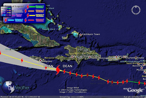
 Dean's still a Category 4 storm is posed to strike Jamaica.
Its current storm position as of Aug 19 - 12:00 UTC is Lat 17.0 N/Long 75.1 W or about 130 miles/210km east southeast of Kingston, Jamaica.
Maximum winds of 145 mph and a pressure of 926mb..27.34 inches.
Dean's outer bands have reach the Island and the Jamaican government urged people to flee low-lying and landslide-prone areas, put troops and police on alert and bussed people to evacuation centers. (see story).
According to The Weather Channel, "as Hurricane Dean heads west-northwest, the northern end of its eyewall will likely strike a destructive blow to Jamaica later this afternoon. Rainfall amounts will be in the 5 to 10 inch range with some areas receiving as much as 20 inches. The heavy rains will lead to life-threatening mudslides.
Dean could be the strongest hurricane to strike Jamaica since 1950: stronger than Hurricane Gilbert in 1988 which was a category three when it crossed the island from end to end."

(Sat photo by GOES EAST)
Where will Dean go after Jamaica? Senior Director of Weather Communications for the Weather Channel discusses this on the Weather Channel Blog.

Super Typhoon SEPAT struck China's coase killing 15 and forcing the evacuation of 90,ooo.
We'll keep you posted!
RS


![[Valid RSS]](valid-rss.png "Validate my RSS feed")
No comments:
Post a Comment