Thursday August 16, 2007 4:16 AM
By LYNN BREZOSKY
Associated Press Writer
SOUTH PADRE ISLAND, Texas (AP) - South Texas braced Wednesday for Tropical Storm Erin to bring torrential downpours to a state that already has had one of its rainiest summers on record.
As the storm's outermost bands of rain touched the Texas coast early afternoon, homeowners had already started heading to hardware stores in the Rio Grande Valley for supplies to board up their houses.
``They know the drill; they're familiar with it,'' said Ruben Dimas, assistant store manager at a Home Depot in Harlingen.
Gov. Rick Perry ordered emergency vehicles and personnel, including National Guard troops, to the Harlingen and Corpus Christi areas.
``Because storms have saturated much of our state this summer, many communities in this storm's projected path are at high risk of dangerous flash flooding,'' Perry said in a statement.
Cameron County Judge Carlos Cascos, the top elected official for the state's southernmost county, urged residents to evacuate trailers and mobile homes on South Padre Island, but he said that the storm appeared to have veered northward and that few vacationers appeared nervous enough to leave.
``About the only thing we're doing is picking things up off the ground so they don't blow around,'' said Caroline Douglas, a Kentucky resident who was with her husband Delbert at the island's KOA recreational vehicle park. ``Hopefully it won't be too bad.
But Mike and Rhonda Cates, visiting South Padre Island in their recreational vehicle, decided not to take any chances.
``We live in Lufkin and we went through Rita two years ago,'' Rhonda Cates said, recalling the 2005 hurricane that slammed into East Texas, jammed highway traffic and sent evacuees pouring into her small city.
``We're still cleaning up trees from that,'' she said. ``I thought, it may not be bad here, but it may flood along the way in Corpus. It's getting home that we're worried about.''
Out in the Gulf, Shell Oil Co. evacuated 188 people from offshore facilities in the storm's path.
Erin formed late Tuesday as the fifth depression of the Atlantic hurricane season and was upgraded to a tropical storm Wednesday when its maximum sustained speed hit 40 mph, the National Hurricane Center said. The threshold for tropical storm status is 39 mph.
At 11 p.m. EDT, the storm was centered 140 miles southeast of Corpus Christi and about 200 miles south-southwest of Galveston, according to the National Hurricane Center in Miami. Its top wind speed remained at 40 mph.
Erin was moving toward the northwest at around 14 mph and was expected to continue following that track for at least 24 hours. Erin's center was expected to be very near the Texas coast on Thursday morning, the center said.
Erin was likely too close to land to gain enough wind speed to become a hurricane, with sustained wind of at least 74 mph, said National Weather Service forecaster Tony Abbott in Brownsville. But the center said late Wednesday it could strengthen slightly before landfall.
Isolated tornadoes also were possible along the middle Texas Gulf on Thursday, the center said.
A tropical storm warning was posted for the Texas coast from San Luis Pass, about 50 miles southwest of Houston, southward to the border. The tropical storm watch for northern Mexico was canceled. A tropical storm watch means that tropical storm conditions are possible within 36 hours.
Three to 8 inches of rain was possible along the middle Texas coast, the hurricane center said.
A series of storms this summer poured record rainfall across Texas and parts of Oklahoma and Kansas, with one July storm dropping 17 inches of rain in 24 hours. Flooding was widespread across all three states. It brought Texas out of drought status for the first time in more than a decade.
At least 16 deaths have been blamed on flooding since mid-June.
Meanwhile, a hurricane watch was issued late Wednesday for a portion of the Lesser Antilles in the Caribbean as Tropical Storm Dean gained strength, forecasters said.
The watch, in effect for St. Lucia, Martinique, Guadeloupe and it's dependencies, Saba and St., Eustaties, was issued by local governments. A hurricane watch means hurricane conditions are possible in the next 36 hours.
As of 11 p.m. EDT, Dean was centered about 625 miles east of Barbados, according to the National Hurricane Center. It was moving west near 23 mph, and was expected to continue the same path over the next 24 hours.
Maximum sustained winds were near 70 mph. Dean was expected to become a hurricane sometime Thursday, forecasters said. A hurricane has maximum sustained winds of 74 mph.
In the Pacific, Flossie was downgraded from a hurricane to a tropical storm after sideswiping Hawaii's Big Island with only intermittent rain and moderate winds.
It was a close call: Flossie approached the biggest and southernmost of the Hawaiian Islands with winds as high as 140 miles per hour earlier in the week, making it a Category 4 storm. If it had made landfall, the powerful hurricane would have been the first to hit the isles since Iniki slammed Kauai in 1992, killing six people.
``The storm that never was,'' said Karin Funai as she chatted with friends over coffee at the Pahala Town Cafe. ``This was nothing.''
Hurricane specialists expect this year's Atlantic hurricane season - June 1 to Nov. 30 -to be busier than average, with as many as 16 tropical storms, nine of them strengthening into hurricanes. Ten tropical storms developed in the Atlantic last year, but only two made landfall in the United States.
---
Associated Press writer Audrey McAvoy in South Point, Hawaii, contributed to this report.
Strike Map
![[Image of 3-day forecast, and coastal areas under a warning or a watch]](http://www.nhc.noaa.gov/storm_graphics/AT05/refresh/AL0507W_sm2+gif/023524W_sm.gif)
Retirement note:
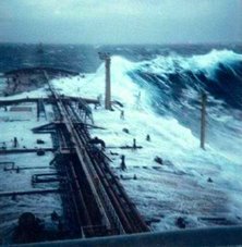
After 42 years of federal service our internet friend and colleague Dr. Paul C. Liu, a Research Physical Oceanographer with NOAA;s Great Lakes Environmental Research Labotatory and the blogger of Freaque Waves, will be retiring at the end of August. Dr. Liu tells us that he will not be going to far away and will remian as a Scientist Emeritus so that he will still be around his research efforts.
He is conducting research into Rogue Waves and Explorations of Coastal Wave Characteristics. So please continue visiting Freaque Waves, and see what Paul is up too.
Congratulations Paul you have earned it! Keep us posted!
Our best always!
RS













![Validate my RSS feed [Valid RSS]](valid-rss.png)
No comments:
Post a Comment