Friday, July 25, 2008

Early Warning System For Earthquakes: Seismic 'Stress Meter' Warned Of Earthquake 10 Hours In Advance`

Early Warning System For Earthquakes: Seismic 'Stress Meter' Warned Of Earthquake 10 Hours In Advance

ScienceDaily (July 10, 2008) — Using remarkably sensitive new instruments, seismologists have detected minute geological changes that preceded small earthquakes along California's famed San Andreas Fault by as much as 10 hours. If follow-up tests show that the preseismic signal is pervasive, researchers say the method could form the basis of a robust early warning system for impending quakes.

"We're working with colleagues in China and Japan on follow-up studies to determine whether this physical response can be measured in other seismically active regions," said Rice University seismologist Fenglin Niu, the study's lead author. "Provided the effect is pervasive, we still need to learn more about the timing of the signals if we are to reliably use them to warn of impending quakes."

Today's state-of-the-art earthquake warning systems give only a few seconds' warning before a quake strikes. These systems detect P-waves, the fastest moving seismic waves released during a quake. Like a flash of lightning that arrives before a clap of thunder, the fast-moving P-waves precede slower moving but more destructive waves.

Findings from the new study indicate that the stresses measured by the new instruments precede the temblor itself, so a warning system using the new technology would be fundamentally different from current warning systems.

"Detecting stress changes before an earthquake has been the Holy Grail in earthquake seismology for years and has motivated our research," said study co-author Paul Silver of the Carnegie Institution of Science's Department of Terrestrial Magnetism. "Researchers have been trying to precisely and continuously measure these velocity changes for decades, but it has been possible only recently, with improved technology, to obtain the necessary precision and reliability."

In experiments near Parkfield, California, in late 2005 and early 2006, Niu, Silver and colleagues from Lawrence Berkeley National Laboratory (LBNL) gathered two months of measurements at the San Andreas Fault Observatory at Depth, or SAFOD, a deep well seismologists use to make direct measurements of the fault.

The team installed a high-precision seismic source made by a stack of donut-shaped piezoelectric ceramic cylinders that expand when voltage is applied -- a sophisticated device akin to a stereo speaker -- about one kilometer beneath the surface. At the same depth in an adjacent well, the scientists set up an accelerometer to measure the rhythmic signals from the source device.

When rocks are compressed, the stress forces air out of tiny cracks in the rock. This causes seismic waves to travel slightly faster through the rock. Niu said the variations are so slight they can be measured only with very precise instruments. For example, though the Parkfield instruments were more than a half mile below ground, the setup was sensitive enough to measure fluctuations in air pressure at the Earth's surface.

"Scientists tried as early as the 1970s to measure changes in wave speed that are associated with the stress changes that precede seismic activity," Niu said. "For a variety of reasons, their measurements were inconclusive. Using the precision instruments built by our collaborators at Lawrence Berkeley National Laboratory, along with new signal enhancement techniques, we were able to reach the fine level of precision required."

In analyzing the seismic data, Niu and colleagues found that a distinct change occurred in the rock before each of the minor earthquakes near Parkfield during the test period. A measurable change preceded a magnitude 3 quake on Christmas Eve 2005 by 10 hours. This was the largest local event during the observation period. A smaller but closer magnitude 1 temblor five days later was preceded by a signal about two hours before the quake.

Additional co-authors include Rice graduate student Xin Cheng and LBNL scientists Tom Daley and Ernest Majer. The research was supported by the National Science Foundation, Rice, the Carnegie Institution and LBNL.

WEATHER NOTE

2008 Lightning Fatalities

Lightning deaths have occurred in 16 states. Ohio and South Carolina lead the nation with 2 fatalities.

lightning fatalities map, see list above


CBS4 Hurricane Specialist Bryan Norcross Ends 20 Years Forecasting Hurricanes

Plans To Devote Time To New Business Enterprise

Chief Meteorologist David Bernard To Direct Storm Team

MIAMI (CBS4) ― He has helped South Floridians face hurricane season for nearly 2 decades, becoming a household word after people huddled in the dark with him as Hurricane Andrew blew down their homes around them. But now, CBS4 Hurricane Specialist Bryan Norcross has made the decision to step away from round-the-clock coverage in the event a hurricane threatens to focus on a new business he hopes will make all Floridians safer if disaster strikes.

MARITIME NOTE

Port of New Orleans is formulating emergency plan

Posted by Jen DeGregorio, The Times-Picayune

July 10, 2008 5:00PM

After Hurricane Katrina wiped out electric controls and flood pump machinery at the Port of New Orleans, officials in charge of the cargo agency were left wondering whether better emergency planning could have prevented some of the storm's fallout.

The memory of Katrina's chaos has spurred the port to look more closely at its risk for future hurricanes and other disasters and to shore up facilities, which incurred nearly $250 million worth of damage during the storm. The analysis, which has been underway for more than six months, will ultimately take the shape of a formal hazard mitigation plan that would be the first of its kind for the Port of New Orleans. Although the port has protocols for disaster operations, officials have never before undertaken an inventory of its infrastructure or considered its chances for destruction during various types of emergencies.

In years past, hazard mitigation for the port was lumped in with overarching plans for Orleans Parish. But Katrina showed port officials that they needed more specific information than the summary provided in the New Orleans plan, said Deborah D. Keller, director of port development.

"We know it's going to generate ideas for projects" to protect the port, Keller said.

Scheduled for completion by the end of the year, the document will analyze data from the state and other sources to determine the port's penchant for different disaster scenarios, ranging from acts of terrorism to lightning. It will then outline steps for the port to fortify its assets from floods, fire and other catastrophes. Measures could be as simple as sealing windows or as complicated as repositioning power generators and controls.

Mitigation does not come cheap, and the port's plan could come with a hefty price tag. But with a formal report in place, the port would be eligible for mitigation funds from the Federal Emergency Management Agency.

Shenetia Henderson, a planner with the Governor's Office of Homeland Security and Emergency Preparedness, said there is no doubt that better planning could have minimized the consequences of Katrina at the port and around New Orleans. Since the storm, more local governments, universities and other entities have embarked on mitigation planning efforts.

Indeed, better planning could have prevented the levee breaches that caused the flooding of August 2005. The Army Corps of Engineers found that poor maintenance of levees as well as failure to build levees as part of an integrated system caused the tragic ruptures that destroyed so much of New Orleans.

"It's always good to plan," Henderson said.

The port held a public meeting Thursday to announce the planning process and seek comment about strategies for the mitigation plan, which can be submitted through Aug. 1. To qualify for federal mitigation funds, the port's plan needs approval from FEMA and the Governor's Office of Homeland Security and Emergency Preparedness.

Marine Safety Investigation Report - Final

Independent investigation into the near collision between the bulk carrier Ormiston and the roll-on/roll-off general cargo ship Searoad Mersey in Port Phillip, Victoria 16 May 2007

ABSTRACT
At about 0230 on 16 May 2007, the bulk carrier Ormiston sailed from Melbourne, Victoria, bound for Thevenard, South Australia. At about 0512, the ship rounded the Hovell Pile beacon and entered the South Channel in Port Phillip. At about 0521, Ormiston entered 'The Cut', the narrowest part of the channel, from the east making good about 15 knots.

At about 0230, the second mate on board the roll-on/roll-off general cargo ship Searoad Mersey contacted Point Lonsdale vessel traffic service (VTS) to provide an estimated time of arrival at the entrance to Port Phillip and was advised of the traffic movements within the port. At about 0420, Searoad Mersey's master, who also held a pilotage exemption for Port Phillip and had conducted over 1300 transits of the port, contacted VTS and received updated traffic information, including Ormiston's estimated movements.

At about 0435, Searoad Mersey passed Point Lonsdale lighthouse and entered Port Phillip. At about 0521, when the ship entered 'The Cut' from the west making good about 15 knots, the master had forgotten that Ormiston was approaching and did not see the approaching ship until immediately before the two ships passed. At about 0523, Searoad Mersey and Ormiston passed within 20 metres of each other in 'The Cut' at a combined speed of about 30 knots.

The ATSB investigation found that Searoad Mersey's bridge team members had not effectively implemented bridge resource management principles, were not keeping an adequate lookout and had lost situational awareness. The investigation also found that the ships did not communicate with each other until after the incident and that the Point Lonsdale VTS was not aware of the incident until after it had occurred.

The ATSB has issued four recommendations and one safety advisory notice to address the safety issues identified in the report.

Download complete report [PDF 1.9 MB]

OFF TO SEA WITH A SAILORS SKY.....


Photo by Robin Storm


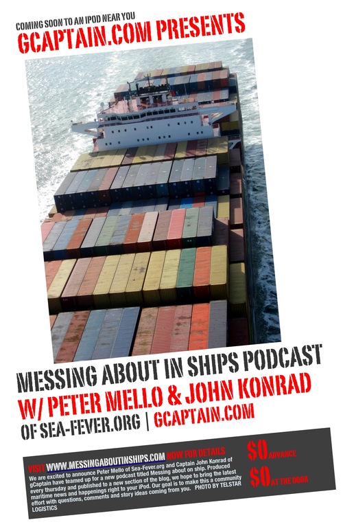
Messing About In Ships Podcast


Have a wonderful weekend!
RS


Thursday, July 24, 2008

Large Cargo Ships Emit Double Amount of Soot Previously Estimated

Large Cargo Ships Emit Double Amount of Soot Previously Estimated

ScienceDaily (July 11, 2008)
—Tugboats puff out more soot for the amount of fuel used than other commercial vessels, and large cargo ships emit more than twice as much soot as previously estimated, according to the first extensive study of commercial vessel soot emissions. Scientists from NOAA and the University of Colorado conducted the study and present their findings in the July 11 issue of the journal Geophysical Research Letters.

The primary sources of soot, or small particles of black carbon, are fossil fuel combustion, wildfires, and burning vegetation for agricultural purposes. In the Arctic, an increase in soot may contribute to climate change if shipping routes expand, according to the study.

“Commercial shipping emissions have been one of the least studied areas of all combustion emissions,” said lead author Daniel Lack, of NOAA’s Earth System Research Laboratory (ESRL) and the NOAA-CU Cooperative Institute for Research in Environmental Sciences. “The two previous studies of soot emissions examined a total of three ships. We reviewed plumes from 96 different vessels.”

Lack and his colleagues observed emission plumes from commercial vessels in open ocean waters, channels, and ports along the southeast United States and Texas during the summer of 2006. From the NOAA research vessel, Ronald H. Brown, the team measured black carbon emitted by tankers, cargo and container ships, large fishing boats, tug boats, and ferries, many of them in the Houston Ship Channel.

Commercial shipping releases roughly 130,000 metric tons of soot per year, or 1.7 percent of the global total — much of it near highly populated coastlines, the authors estimate. In the coming years global shipping is expected to grow two to six percent annually.

Tugs emit nearly a gram of soot per kilogram of fuel burned — twice as much as any other vessel type, the authors found. The high levels point to their low-quality fuel — a thick, black tar left over from crude oil after the gasoline and kerosene have been removed. Engine age and maintenance also play a role. Tugboats have a disproportionate impact on air quality because they travel within ports, emitting potentially harmful particles near populous urban areas, according to the authors.

“Tugboats are a huge source of black carbon that may be under-reported or not reported at all in emissions inventories compiled by ports,” said Lack.

Oceangoing tankers and container ships emit half a gram per kilogram of fuel burned when at dock and slightly less when traveling, according to the study. That’s more than twice as much as previously estimated.

A 2007 study by American and German scientists linked particle pollution from shipping to tens of thousands of premature deaths each year, most of them along coastlines in Europe, East Asia, and South Asia. Soot makes up a quarter of that pollution, said Lack.

On a global scale, soot currently traps about 30 percent as much heat as does carbon dioxide, the most important greenhouse gas, according to the latest assessment of the Intergovernmental Panel on Climate Change. The small dark particles absorb sunlight, create haze, and affect how clouds form and make rain, further altering a region’s heat balance, according to the new NOAA study. If commercial shipping extends new routes through Arctic waters as they become navigable, soot emissions there could increase

WEATHER STORY

Hurricane Season: Disaster Readiness Tips from James Lee Witt


James Lee Witt, director of the Federal Emergency Management Agency under President Clinton and now a disaster recovery consultant, talks about readiness during this hurricane season


Diann Daniel, CSO

August 01, 2006

CSO: What should security executives be doing for hurricane season?

James Lee Witt: The first thing is to make sure that you have the insurance coverage you need, whether it's for wind or whether it's flood insurance if your business is in a 100-year flood plain. Second, I would make sure that every employee understood that if we had to evacuate, where we would go, where we would reconvene our business so that we could continue to operate. Then, I'd make sure that I [could] send out alerts to all my employees—particularly if it was during a weekend or if employees were traveling—about what was going on and what they needed to do.

So many times we forget that every dollar we invest in prevention or preparedness could potentially save us $3 to $5 in future losses, and with the business interruption side of it, it could be even higher.

I would also make sure that all my customers and suppliers understood my plan—what I would need to do, how I would do it—and then I'd ask them to do likewise to make sure that the supply chain wasn't broken.

Why do you think that some businesses don't prepare?

The biggest problem I have seen is getting the buy-in and support from upper management. When I was director of FEMA, we did a survey of small businesses after disasters and found that 20 percent to 25 percent of those businesses affected by a catastrophic event never reopened.

During Hurricane Fran in North Carolina, GE had a plant there. They had retrofitted their plant for hurricane resistance, and after the hurricane was over, their plant was still OK, but there were no employees to come back to work for the next two days because they were taking care of their families and their homes. Anheuser-Busch in Pasadena, Calif., before the Northridge earthquake, spent $25 million to retrofit their plant for an earthquake, and they were open and operating two days after the earthquake, making canned water for victims in the community. They said that $25 million probably saved them $150 million.

Every business should help their employees develop a plan for their families, so everybody has a contact place to call to [let family] know that they're OK. If you have a catastrophic event and you need to go back in to check your business, you need to work with your local government's fire, emergency management, police, and you need to meet with the fire chief and police chief and say, "OK, here's our plan. Can we get credentials to allow us back in to check on our business?"

Who has developed a great disaster recovery plan?

I think Chicago probably has developed the best public-private partner concept, particularly ChicagoFirst working with the city and private sector. They have brought the private sector to the table, sat them down and just really developed a very good concept of how they both could help each other. What are you going to do if you need ice? What are you going to do if you need water? What are you going to do if you need a generator? Just all the kinds of things that might help you get through the first five days. That's all part of that planning process.

What would you recommend businesses think about?

I would look at what resources and capabilities I have within the company, and then I would look at what resources I would need [from] outside of the company. Then, if I needed to, I would look at having pre-event contracts set up to provide those resources and capabilities. Then I would work with the state or local government and say, "Here's my plan, here are the resources that we have that we would have available to help if we survive an event, but here's the type of resources that we may need."


Published July 13, 2008

With the 25th anniversary of Hurricane Alicia approaching, many residents are discussing whether the Texas Coast is ready for the next big storm. John Simsen, emergency management coordinator for Galveston County, talked about the county’s plans.

Q: How would you rate our preparedness for hurricane season?

A: From a government standpoint, I would give us a B+. We have detailed local and regional plans for coordinating evacuations, identifying and assisting those with special needs, locating transportation resources and accommodating pets. We have excellent emergency facilities that can weather a severe storm, and we have public and private partners ready to launch a massive recovery effort if needed. But there is always more work to be done. You can never be completely prepared for a significant hurricane.

Q: Where do we get our highest grades?

A: Cooperation between the cities and counties in our region has never been better, in part because of the Hurricane Rita “wake-up call” and the strong influence of our local elected leaders. Galveston County’s conference call process for making evacuation and re-entry decisions has been embraced by the region, ensuring that our need to evacuate ahead of the Houston population is properly communicated.

We have countywide contracts in place for buses to help transport special needs residents to safety and agreements with UTMB and the city of Austin to help care for them. And for the first time in county history, every community in Galveston County has a contract in place to assist with debris cleanup after a major storm — a critical component of the recovery process.

Q: How about the lowest?

A: Public perceptions about government’s ability to coordinate a smooth evacuation of the Houston region remain low, despite significant improvements since Hurricane Rita.

The state, through partnerships with public agencies and private industry, is prepared to provide adequate fuel, wrecker services, welcome centers and shelters to assist the evacuating population along the primary evacuation routes.

A refined “contra-flow” or reverse-flow traffic plan is set for implementation 36 hours prior to landfall to help reduce traffic bottlenecks, and local and regional efforts to coordinate a phased evacuation of those areas susceptible to storm surge are now in place.

Yet citizens tell us at community meetings that they are worried about getting stuck in traffic or running out of fuel. Many say they just won’t leave if asked to do so. This is a dangerous position to take in a county that absolutely must evacuate when a Category 4-5 storm threatens. I lose sleep worrying about these citizens and hope their families and friends will convince them to leave when the time comes.

Q: Are we set to help out the most vulnerable populations — those that can’t get out of danger without help?

A: Galveston County has a robust plan to move upward of 6,000 special-needs evacuees from two departure points – the Island Community Center at 4700 Broadway and the Doyle Center at 2010 Fifth Ave. N. in Texas City. Rising gas prices may force more citizens to use this evacuation option, and emergency managers are preparing for this possibility by factoring in additional buses and shelter space.

Each city in the county maintains its own special-needs registry and takes responsibility for either transporting these citizens to the embarkation points or arranging other assistance such as an ambulance. Though we try to stay in touch with the citizens on our special-needs lists, some are hard to reach because they are transient and distrustful of government. We urge them or their families to call 211 or their local office of emergency management to register for assistance. They need to register today, not when a hurricane threatens.

Q: The 25th anniversary of Alicia is getting some attention. How has the picture changed since then? What should we be worried about now?

A: Emergency managers have spent countless hours preparing for the next massive, Rita-like hurricane. But the odds are just as good that the next hurricane to impact Galveston County will form on our doorstep, like Hurricane Alicia, and leave us with little time to react.

Hurricane Humberto formed in the Gulf just south of Galveston and reached Category 1 strength in 19 hours last September, making landfall on High Island and causing millions of dollars worth of damage. Had it formed a little farther south and west in the Gulf, it could have made landfall directly over Galveston Island as a Category 2 storm, with substantially more devastation.

The explosive population growth in Galveston County since 1983 makes it imperative that all citizens have both a well-stocked disaster supply kit and a family evacuation plan. We can’t pour enough concrete to make an evacuation through the nation’s third largest city trouble-free. Delays are inevitable, and so are false alarms. Take steps to minimize the impacts on your family by staying prepared and informed.

Q: If there were one thing you could convince the average resident of the county of, what would that be?

A: Galveston County is a beautiful place to live, work and raise a family. But with the good comes the bad — the ever-present threat of severe weather events. If you choose to live here, you must accept personal responsibility for the safety of your family, relatives and pets. At some point, government will not be able to assist, and your attention to details today will ensure your personal safety down the road.

MARITIME NOTE

USCG – AMVER anniversary

The US Coast Guard issued a press release stating that July 18 marked the 50th anniversary of Automated Mutual Vessel Rescue System (AMVER). As the only worldwide voluntary ship reporting system for safety of life and property at sea, AMVER was involved in 181 calls for assistance in 2007 and contributed to saving 450 lives. (7/18/08).

Chesapeake Bay – “smart buoy” deployed

The National Oceanic and Atmospheric Administration (NOAA) issued a news release stating that a “smart buoy” has been deployed at Stingray Point at the mouth of the Rappahannock River is Chesapeake Bay. The buoy collects weather, oceanographic, and water-quality observations and transmits this data wirelessly in near-real time. The measurements can be accessed at Buoy-Bay. (7/18/08).

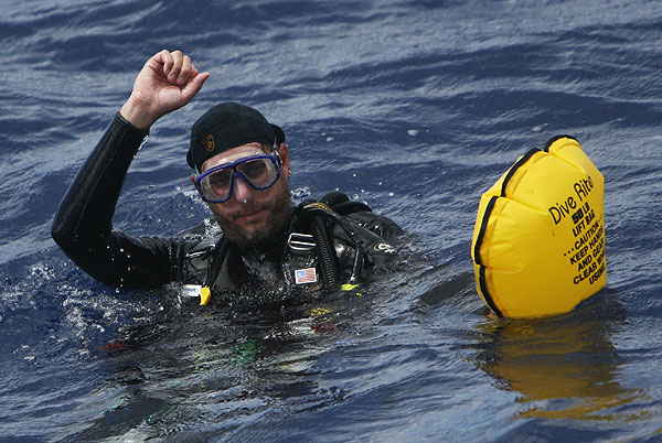
Cleveland firefighter still missing in Lake Erie

By CORY FROLIK
frolik@sanduskyregister.com

Monday July 21 2008, 10:46pm

SANDUSKY

A search covering 12-square nautical miles of Lake Erie that used divers, sonar and a helicopter was unable to locate the body of a Cleveland firefighter who went overboard Saturday evening.

The search for Kenneth Alderman, a 44-year-old Cleveland firefighter, was suspended at 3 p.m. Sunday. The hunt will not resume until further evidence of his location is discovered, authorities said.

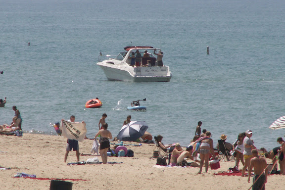
Alderman went missing after he fell in the lake about two miles east of the Sandusky break wall shortly before 8 p.m. Saturday, said U.S. Coast Guard Petty Officer William Mitchell. He was aboard a 30-foot recreational boat with three other people, including his fiancĂ©e and the boat’s owner. He was not wearing a safety vest.

The circumstances that led to the firefighter ending up in the water still are not clear. Authorities said only that witnesses saw Alderman struggle in the water and then go under.

“The people on the boat tried to save him after he fell in the water ... but he was in a state of panic when he fell in and tried to fight off the people who tried to rescue him,” Mitchell said. “They saw him actually go underwater — fall beneath the surface of the water.”

Jim Kennedy, fleet manager with Lake Erie Towing, was the first on scene Saturday night and sent a distress signal to the Coast Guard. After releasing green dye into the water to mark the position of the boat, which he described as a white express cruiser with blue trim, Kennedy started searching for Alderman.

His efforts proved unsuccessful, and he found no sign of the man.

Many hours later, the efforts of many agencies were as fruitless. A boat from the Huron Fire Department used a side-scanner to survey Lake Erie’s murky depths. The Cleveland Fire Department sent divers searching for Alderman, and cadaver dogs were used to locate his scent. The Coast Guard continued its search through the late afternoon using two boats and a helicopter.

The search was finally called off after more than 18 hours.

All four people on deck of the recreational vessel were not wearing life vests, Mitchell said. Things may have ended differently if they had, he added.

“This is a typically tragic Great Lakes’ case, where you have people going out to enjoy the weather and have a good time, but because they don’t take precautions — a lifejacket, which would have changed the outcome of the night — it ended in death,” Mitchell said.

Larry Gray, spokesman with the Cleveland Fire Department, said Alderman has 21 years of experience as a firefighter, of which the last 17 he’s spent in the same station.

A RARE SUN SETS BEHIND CHICAGO

PHOTO BY TEAM ROBIN STORM


RS


Wednesday, July 23, 2008

NOAA goes diving for U-boats in North Carolina

NOAA goes diving for U-boats in North Carolina
Politicizing Marine Safety – Never a Good Idea

As the Massachusetts Legislature tightens its death grip around the port of Boston, a key 'niche' intermodal hub in the northeast teeters on the brink of obsolescence.

I owe everyone an apology this week. Last week, as a sign-off from my weekly column, I trumpeted, "Massachusetts legislators vote to move Boston Harbor to Long Island Sound. Stay tuned!" Now, everyone knows that you can't vote to physically move a port from one place to another. That's just silly. The port of Boston will always reside right where it is at, just as it has for the past 400 years. Twenty years from now, however, and if the current situation on Beacon Hill does not radically change, Boston's waterfront will consist primarily of luxury, pier side condominiums, trendy shops and maybe a pleasure boat marina or two. It doesn't have to be this way.

As one of the more unusual ports in the country, and not coincidentally one of its safest, Boston is home to a myriad of cargo interests, from LNG to automobiles to gasoline and a raft of other miscellaneous goods. A popular and profitable cruise ship trade also makes port calls here. The port will never be a major cargo hub, but it is a key cog in the local MASSPORT machine and is, in no small part, important to local economy. The past three years have seen much turmoil in the harbor, most of it based around local disputes centering on who should and should not dock vessels, under what authority that might occur and at what price and under what conditions all of that might happen. But, there's more than one issue on table.

At issue (and most visible) is the question of whether the Commonwealth should license local so-called "docking masters," especially in the roiled wake of the COSCO BUSAN incident. The local contractors – most of whom work for one local tug boat company – dock and undock large, deep draft traffic. None of them are certificated by the state to do so. Boston marine pilots, in contrast, all licensed by the state, guide traffic in and out Boston. They are also qualified to dock and undock these vessels, and often do so. To my knowledge, there hasn't been a single accident of note associated with the pilots over the course of the last ten years. They charge the state-mandated fee of $350 per movement to dock or undock vessels; a private docking master bill can triple that amount.

Few in the Boston maritime community would dispute that the local, so-called docking masters should be licensed in Massachusetts. That they are allowed to direct ships without these certifications arguably leaves the Commonwealth open to significant liability on the very waters that they are supposed to be controlling commerce. The problem stems from the terms under which docking masters could eventually be licensed. These individuals want to remain virtually independent of the existing regulatory environment, charge fees to shippers unencumbered by state oversight and operate under conditions that would exclude them from the same degree of liability that local harbor pilots toil under. With few exceptions, the balance of the waterfront community opposes these terms.

The effort to certify the docking masters has failed miserably in the past, and when bill(s) tailored to meet the criteria of the docking masters have been turned aside in the Legislature, attempts to attach similar language to other, unrelated bills have become the weapon of choice. At the same time, the local harbor pilots are desperately trying to enact the first fee increase in ten years for local pilotage. That effort remains stymied and the bill held hostage in the State House. Today, special interests have attached a rider to that bill which would likely signal the end of competitive vetting of future pilot candidates. The implications for the port of Boston, down the road, are ominous.

The proposed rider to Pilot's rate bill (S 515) reads as follows: "…the pilot commission shall adopt regulations providing for preference to veterans as defined in clause Forty-third of section 7 of chapter 4 of the General Laws and those who were honorably discharged from or currently serving in the Armed Forces of the United States, including the Army, Navy, Air Force, Marine Corps and Coast Guard and the National Oceanic and Atmospheric Administration Officer (sic) Corps. If an active duty member or veteran applicant has a valid United States Coast Guard-issued Unlimited (sic) Master's License or First Class Federal Pilotage endorsement for any part of Boston Harbor, he shall be eligible for preference for appointment as a state-commissioned pilot apprentice." In general terms, the provisions of this language are tailored specifically for one or two individuals who probably could not otherwise make the bar. If the language is enacted, any individual with veteran status with twelve trips in and out of the harbor will now move to the front of queue, regardless of his or her experience in matters of shiphandling or other related skillsets.

The proposed amendment has put the local pilot association in an unenviable position. Like their Coast Guard brethren who were, earlier this year, reluctantly forced to oppose their own authorization bill due to several flawed amendments, the Boston Marine Pilots may now be forced to abandon a pay raise or allow the beginning of the degradation of local pilot skills. The proposed "preference" language, wrapped in red, white and blue, will not serve the common good in terms of safety, transparency of the pilot selection process, or the needs of a port that needs to continue to show itself as a safe and attractive place to deliver and load cargo. At a time when the national scrutiny of pilot credentials and certifications is ramping up significantly, the Commonwealth of Massachusetts is preparing to dumb down the curriculum.

The future of Boston Harbor as a viable commercial cargo hub can be summed up neatly by three matters now before the state legislature; namely, (a.) the licensing of docking masters, (b.) a rate hike for the local marine pilots, and (c.) an effort to politicize the selection of future marine pilots. And, the rate bill isn't going anywhere unless everyone else gets what they want. In the meantime, the ability of local pilots to adequately fund the infrastructure necessary to a safe and efficient pilotage system has been seriously crippled.

No doubt, the laughter in Portland, ME, Providence, RI and other nearby ports carries long and loud across the water. And, if anyone doubts the errant course that Massachusetts find itself headed on, they need to look no farther than Long Island Sound, where 25 years of benign regulatory neglect has left the pilot system in organizational shambles, with no viable apprentice candidates to take the place of the remaining pilots when the bulk of them reach retirement age in the not-too-distant future.

Within the past two weeks, a bill designed to eliminate the Harbor Maintenance Tax was introduced in Washington. The bipartisan legislation, introduced in the U.S. Senate, would exempt coastwise shipping of containerized cargo from the Harbor Maintenance Tax (HMT). Stated simply, the law, if enacted, would almost instantly revitalize the domestic, so-called "Shortsea Shipping" trades. The effort is right at the top of the U.S. Maritime Administration's wish list and Transportation Secretary and highway guru Mary Peters has to be absolutely delighted at the fact that the bill is now in play.

For Massachusetts, the exemption could remove literally tens of thousands of trucks from its highways that emanate up and down the I-95 & 128 corridor daily. The savings in air emissions, related health problems, highway wear and tear and a thousand other things would be substantial. For the port of Boston, a relatively shallow draft niche port, the change would be even more significant. Suddenly, commerce on coastwise, handy-sized vessels would explode and the port would be a logical place to bring that traffic. If only someone on Beacon Hill was listening…

I thought about writing a fiction piece this week depicting the events that would precede the death of a port. In the end, I knew that the real story in Boston, if written by Hollywood playwrights, wouldn't get much play in theatres, because it is just so unbelievable. In Arthur Miller's masterpiece, "Death of a Salesman", the main character, Willy Loman, is (arguably) used to illustrate how compromised ideals and missed opportunities could eventually yield tragic results. It is not a stretch to say that the same thing is underway in the Bay State. It IS silly to think that a port can be "voted" from one place to another. But, that won't stop Massachusetts legislators, spurred on by well-funded special interests, from trying. – MarEx

Joseph Keefe is the Managing Editor of THE MARITIME EXECUTIVE. A native of the Bay State, Keefe has followed and reported on the situation in Boston and Long Island Sound extensively over the past three years. He can be reached with comments on this or any other article in this e-newsletter at jkeefe@maritime-executive.com.

Rules of the Road quiz. Whats wrong with this picture? Just drop me a note.....Winner gets a surprise.....


RS

Tuesday, July 22, 2008

NOAA Predicts Largest Gulf Of Mexico 'Dead Zone' On Record

NOAA Predicts Largest Gulf Of Mexico 'Dead Zone' On Record

ScienceDaily (July 16, 2008) — NOAA-supported scientists from the Louisiana Universities Marine Consortium and Louisiana State University are forecasting that the "dead zone" off the coast of Louisiana and Texas in the Gulf of Mexico this summer could be the largest on record.

The researchers are predicting the area could measure a record 8,800 square miles, or roughly the size of New Jersey. In 2007, the dead zone was 7,903 square miles. The largest dead zone on record was in 2002, when it measured 8,481 square miles. The official measurement of this year's dead zone is slated to be released in late July. Researchers began taking regular measurements of the dead zone in 1985.

"The prediction of a large dead zone this summer is due to a combination of large influx of nitrogen and exceptionally high flows from the Mississippi and Atchafalaya rivers," said LSU scientist R. Eugene Turner.

The dead zone is an area in the Gulf of Mexico where seasonal oxygen levels drop too low to support most life in bottom and near-bottom waters. This low oxygen, or hypoxic, area is primarily caused by high nutrient levels, which stimulates an overgrowth of algae that sinks and decomposes. The decomposition process in turn depletes dissolved oxygen in the water. The dead zone is of particular concern because it threatens valuable commercial and recreational Gulf fisheries.

Research indicates that the nearly tripling of nitrogen levels into the Gulf over the past 50 years from human activities has led to a dramatic increase in the size of the dead zone. Various models are useful in evaluating the influence of nitrogen loads and other factors on the size of the dead zone. The LSU model has a strong track record of accurately predicting the dead zone's size.

"The strong link between nutrients and the dead zone indicates that excess nutrients from the Mississippi River watershed during the spring are the primary human-influenced factor behind the expansion of the dead zone," said Rob Magnien, director of the NOAA Center for Sponsored Coastal Ocean Research. "This analysis will greatly inform the development of federal, state and local efforts to reduce the dead zone's size."

The forecast is based on a mathematical model developed by LSU through NOAA's long-term research investment by CSCOR's Gulf of Mexico Ecosystems and Hypoxia Assessment. The model incorporates U.S. Geological Survey data on the amount of nitrogen reaching the Gulf of Mexico in May. NOAA has been funding investigations into the dead zone since 1990.

WEATHER NOTE

Tornado sirens questioned on Iron Range

VIRGINIA, Minn. (AP) - Officials in the Virginia area are discussing what should be done about malfunctioning tornado sirens.

During tornado alerts Monday evening, some of Virginia's warning sirens didn't go off. While funnel clouds were reported, no tornadoes reportedly touched down.

Virginia Mayor Steve Peterson says it's a wake-up call for the city. He says city officials and residents are fortunate nothing happened.

Some of Virginia's sirens are more than 40 years old.

Peterson says Virginia will likely have to replace the sirens, because he says it doesn't make much sense to repair such old equipment.

In nearby Eveleth, the sirens did sound. But sirens in Gilbert were silent because of a mixup, and Mountain Iron doesn't have an alarm system

Officials agree that Wisconsin’s disaster laws need an overhaul.

A new panel of legislators, emergency management officials and relief workers will start meeting July 30 to suggest ways to streamline those laws.

It would have been almost impossible to hold a session a month ago when floods closed many roads in southern Wisconsin.

It’s been 20 years since the state’s emergency laws have gotten a comprehensive review.

Since then, lots of things have been added piecemeal.

For one thing, the law does not define “homeland security.”

Homelands used to be where our ancestors were from, until President Bush made it part of the post-Sept. 11 lexicon and state and local governments created their own homeland security agencies that seem to include everything under the sun.

Sen. Bob Jauch, D-Poplar, chairs the new study panel. He wants to examine the state’s response to recent disasters, including the floods, and the February snowstorm in which thousands of motorists were left stranded for up to 12 hours on Interstate 90 south of Madison.

Jauch also wants to find out if local agencies have the resources they need to recover from emergencies.

MARITIME NOTE

Unsecured cargo may have led to vessel sinking
MANILA, Philippines - Loose cargo on board the ill-fated M/V Princess of the Stars may have led to its sinking on June 21 while it was being lashed by typhoon Frank (international codename: Fensheng).

Philip Vasquez, a resident of Cebu and one of 28 people aboard a life raft that was swept to the coastal town of Mulanay in Quezon province, told the Board of Marine Inquiry (BMI) Friday that he was awakened at about 3 a.m. when waves as tall as the vessel continuously hit the seven-storey ferry.

The sun suddenly came out and the seas became calm at about 8 a.m. and he was sure that they were at the center of the typhoon at that time, said Mr. Vasquez, a graduate of maritime education at the University of Cebu. Thirty minutes later, the weather became worse and the boat eventually sank, taking with it some 500 lives.

When the interisland ferry was being battered by giant waves before noon, he said he heard that the cargo move as the vessel swayed. He said the moving cargo caused the tilting of the ship and led to its sudden capsizing.

His statement was supported by an earlier one made by a maritime expert who said the reason the doomed ferry lost its stability was because of the weight of "unsecured" cargo.

Nelson P. Ramirez, president and chairman of the United Filipino Seafarers, had said some of the vessels of Sulpicio Lines lack the proper equipment to ensure the safety of cargo — an observation made when he joined a team from the Maritime Industry Authority (MARINA) conducting an inspection to check the ships’ seaworthiness. MARINA is also investigating the possible need to cancel the certificate of public convenience issued to Sulpicio Lines.

Meanwhile, the broker contracted by Del Monte Philippines, Inc. to handle the documents regarding the toxic chemical shipment of Del Monte Philippines, Inc. (DMPI) appeared at the BMI hearing.

Dante Macaisa, CEVA Philippines country manager, told the board that Sulpicio Lines had prior knowledge of the contents of the 40-foot container van. He said the broker had presented several documents indicating that the shipment contained dangerous materials to a representative of the shipping firm.

After giving the local pro-forma bill of lading, Mr. Macaisa said the official stated that other documents were "not necessary" and gave them back to the broker.

Sulpicio Lines spokesperson Ma. Victoria Lim-Florido said there were no acknowledgment receipts executed by the broker.

"If there is an acknowledgment receipt, then that is proof that Sulpicio received [the documents from the broker]. But our position is [that] we never received the ocean bill of lading," she told reporters.

Mr. Macaisa confirmed they did not issue an acknowledgment receipt. In other transactions, Ms. Lim said, they execute acknowledgment receipts, especially as regards dangerous cargo. — Bernard U. Allauigan, BusinessWorld

RS


Monday, July 21, 2008

Improved Tsunami Early Warning With New Software System

Improved Tsunami Early Warning With New Software System

ScienceDaily (July 14, 2008)
— After completing their simulation component in the German-Indonesian Tsunami Early Warning System (GITEWS), the team for tsunami modelling of the Alfred Wegener Institute for Polar and Marine Research in the Helmholtz Association has presented the currently leading software system for tsunami events with the potential for catastrophe. It is now being integrated into the Decision Support System (DSS) of the German Aerospace Center in Oberpfaffenhofen. It is to resume its test mode in Indonesia in November.

"Within slightly more than two years, my team has developed, with the help of current software technology, the most modern and flexible simulation system for one of the most dreaded natural disasters of the world", explains Dr. Jörn Behrens, Head of the Tsunami Modelling Group of the Alfred Wegener Institute. "In contrast to other currently available Tsunami Early Warning Systems, it does not only use earthquake data for its ultra-fast situational analysis, but it combines various measurements to a robust, precise, and quick situation report."

Next to seismic data (earthquake parameters), also gauge and buoy data (wave heights), and GPS data (deformations of the earth's crust) can be incorporated into the calculations. All these data run together in the DSS, and the picture of the general situation supports decision-makers -- for example after a seaquake -- to evaluate more reliably and quicker than before, whether it poses a threat for residents of the bordering coastline in the form of rising water waves. Accordingly, warnings reach affected persons earlier than before, and it leaves more time to take disaster prevention measures.

Furthermore, simulation results from different institutes can seamlessly be integrated into the system. The team from the Alfred Wegener Institute will provide the warning system until November 2008 with already around 1500 high-resolution tsunami scenarios. The newly developed simulation system compares these scenarios with incoming real measurement data in a matter of seconds and deduces its forecast. The Indonesian partners work on the completion of the database at the same time.

Together with colleagues from the Indonesian "Institute of Technology Bandung", a connection to approximately 160.000 local tsunami scenarios they calculated is now being incorporated into the system developed at the Alfred Wegener Institute in Bremerhaven. They allow an essential expansion of the database."In regard to the interface to other programs, we adhere to open standards, which control the exchange of data in the world of computers. This way, external scenarios can seamlessly be integrated, and we can adapt the simulation model quickly to other marine areas of the world, for instance the Mediterranean Sea," says Behrens about the perspective for further early warning systems.

The Tsunami Modelling group consists of seven researchers and PhD students, among them one PhD student from Indonesia. It was established at the beginning of 2006, and has developed, next to the simulation system presented here, the simulation software TsunAWI, which is one of the bases for the computation of tsunami scenarios. The software has mastered its practical test: it computed the resulting wave heights precisely, when an earthquake of magnitude 7,9 near Bengkulu/Western Sumatra triggered a tsunami on September 13th 2007.

The aim of GITEWS is to minimize the consequences of natural disasters by means of an early warning system. Nevertheless, a natural phenomenon like the tsunami in the year 2004 cannot be prevented, and catastrophes of this kind will always cause casualties, regardless of a perfectly working alarm system. GITEWS is developed by several scientists and engineers from the Helmholtz Centre Potsdam German Research Center for Geosciences (GFZ), the Alfred Wegener Institute for Polar and Marine Research in the Helmholtz Association (AWI), the German Aerospace Center (DLR), the Research Center in Geesthacht (GKSS), the German Marine Research Consortium (KDM), the Leibniz Institute of Marine Sciences (IFM-GEOMAR), the United Nations University (UNU), the Gesellschaft fĂĽr Technische Zusammenarbeit (GTZ), and the Federal Institute for Geosciences and Natural Resources (BGR), as well as Indonesian and international partners. The project is financed by the Federal Ministry of Education and Research (BMBF).

WEATHER NOTE

Twisters Hit Insurers With Worst Profit Dip Since '02 (Update3)

By Erik Holm

July 17 (Bloomberg) -- Record tornado damages, the weakening economy and a drop in premiums may reduce insurers' earnings by 30 percent, the steepest second-quarter decline since 2002.

The industry's slump in profits is worse than all 24 groups in the Standard & Poor's 500 Index except for banks, financial- services firms and automobile companies, analysts surveyed by Bloomberg said. Sixteen of 20 insurers in the S&P 500, led by American International Group Inc. and Allstate Corp., may report lower net income or a loss.

Losses from catastrophes, including the most tornadoes in the U.S. since at least 1950, were about $5.5 billion. At the same time, investment returns and opportunities to sell residential and corporate coverage declined as the economy slowed and home sales dropped.

``We're going to see amazingly bad numbers from the property insurers in the second quarter,'' said Meyer Shields, an analyst at Stifel Nicolaus & Co. in Baltimore. ``There are lots and lots of losses out there.''

The estimated decline in profit, the most since earnings per share fell about 45 percent in 2002, may be driven by tornado losses at insurers such as Allstate, lower investment returns for companies like AIG and falling rates at commercial insurers including Travelers Cos., said Paul Newsome, an analyst at Sandler O'Neill & Partners in Chicago.

``You rarely get all three of those factors at once,'' Newsome said.

Allstate Corp.

Second-quarter results typically include fewer catastrophe costs than the third and fourth quarters, when the Atlantic hurricane season peaks, he said. Researchers at Colorado State University and AccuWeather.com predict an above average number of hurricanes will form this year, driven in part by higher ocean temperatures.

Allstate, the largest publicly traded U.S. home and auto insurer, may report profit of $1.35 a share, down 23 percent from a year earlier, according to the average estimate of 20 analysts surveyed by Bloomberg. The insurer, based in Northbrook, Illinois, will report results on July 23.

``I'm kind of crossing my fingers for Allstate,'' said Jim Ryan, an insurance analyst at Morningstar Inc. in Chicago. ``They haven't said anything to give us a hint about what their catastrophe losses might be.''

Costs Double

Hartford Financial Services Group Inc., the insurer based in the Connecticut city of the same name, said yesterday in an e- mailed statement that it had $171 million of costs from natural disasters in the second quarter. That compares to $177 million in all of 2007.

Cincinnati Financial Corp. and Harleysville Group Inc. of Harleysville, Pennsylvania, said catastrophe costs more than doubled in the quarter as an estimated 1,164 tornadoes struck the U.S., hitting towns from Colorado to Minnesota to Texas and killing 49 people, including four boys at an Iowa scout camp in June.

In last year's second quarter, industrywide catastrophe costs were 60 percent less, according to Insurance Services Office Inc. in Jersey City, New Jersey.

As the U.S. economy slowed in the second quarter, foreclosures reached new peaks. Insurers, including Allstate, drop coverage when policyholders lose their houses and also have fewer opportunities to attract new clients. New home sales will fall 26 percent this year to 573,000, New York-based Fitch Ratings estimated on July 11.

``This seems to be the worst housing market I've ever seen,'' said George Ruebenson, the president of Allstate's home and auto unit, in a May 29 interview. ``Our ability to expand the homeowners business for Allstate is severely limited by this economy.''

Underestimated

Expenses also may rise as the economy sours, said Bill King, senior executive vice president at State Farm Mutual Automobile Insurance Co., the No. 1 home insurer.

``The slowing of the economy could put people in more desperate financial situations that might cause a difference in claim behavior,'' King said.

When the economy slows, policyholders are more likely to reduce the amount of coverage they buy, resort to fraud or submit claims for smaller-than-usual losses, he said. State Farm of Bloomington, Illinois, is owned by its policyholders and has no publicly traded debt.

Analysts' estimates may understate the industry's decline in net income because their predictions don't account for the falling value of securities tied to home loans. Insurers have written down more than $77 billion of holdings since last year, including mortgage-backed assets, equity investments tied to the housing market and contracts that protect fixed-income investors, according to data compiled by Bloomberg.

Investment Losses

Insurers may lower the value of the assets further as they announce second-quarter results, said Shields of Stifel Nicolaus.

Investment losses helped push down stock prices, with every insurer in the S&P 500 Insurance Index declining this year except auto insurer Progressive Corp. and Seattle-based Safeco Corp., which agreed in April to be purchased by Liberty Mutual Group Inc. of Boston.

AIG, the world's largest insurer by assets, has written down more than $39 billion, higher than any other company in the insurance business, Bloomberg data show. The New York-based insurer has dropped about 57 percent this year.

Prices Fall

AIG and business insurers including Travelers of St. Paul, Minnesota, and Warren, New Jersey-based Chubb Corp. are charging less for commercial coverage in an attempt to win market share. Prices for such coverage fell 11 percent in the U.S. during June from a year earlier, according to MarketScout, the Dallas-based electronic insurance exchange. Prices have fallen for 40 consecutive months, MarketScout reported.

Rates will continue to fall and U.S. property and casualty insurers may pay more in claims and expenses than they collect in premiums by the time 2008 is over, Fitch Ratings said last month.

``You usually see large catastrophe losses in the third quarter when the hurricanes hit,'' said Morningstar's Ryan. ``I think it only gets worse from here.''

To contact the reporter on this story: Erik Holm in New York at eholm2@bloomberg.net.

MARITIME NOTE

Cruise West already under Coast Guard watch
FLEET OPERATOR: Ships are being inspected and crew members questioned.

By JAMES HALPIN
jhalpin@adn.com

The Spirit of Glacier Bay's grounding July 7, 2008, is the latest in a series of problems on ships owned by Cruise West in Alaska.


(07/08/08 00:12:43)
The number of mishaps aboard Cruise West vessels so far this season has landed the company on a special program to review the ships' safety and maintenance procedures, according to the U.S. Coast Guard.

Seattle-based Cruise West ships have so far suffered three mechanical failures and two groundings, including the most recent that took place Monday morning when the Spirit of Glacier Bay ran aground in Tarr Inlet near its namesake bay.

The Coast Guard began talking to the company about the trend after its ships suffered the second mechanical failure of the season, said Capt. Scott Robert, Coast Guard sector Juneau commander.

Mechanical problems are common on ships, and the Coast Guard in Alaska responds to hundreds of such calls each season, he said. But the number specifically on Cruise West ships this season prompted the extra attention, he said.

"After the third mechanical failure and the (first) grounding is when we started to take a very proactive approach on looking at the safety systems on board those vessels," Robert said. "These safety stand-downs are above and beyond what we, the Coast Guard, typically do with this industry."

The Coast Guard frequently holds surprise spot inspections and evaluates vessels at the beginning of the season, Robert said. The "safety stand-downs" are an added layer of oversight to promote safety and prevent serious accidents, he said.

As part of the plan, all of Cruise West's ships are being inspected by Coast Guard personnel, who are examining safety plans, equipment and maintenance policies, Robert said. The boardings also entail talking to crew members to improve their awareness of safety conditions, he said.

Cruise West officials are working in partnership, with its vice president "actively participating" in the stand-downs, Robert said. The boardings are scheduled in advance and take about two or three hours on average, he said. They are being held wherever the ships are -- in Alaska and elsewhere.

"This is a Coast Guard-wide issue," Robert said. "This is a combined, overarching look (at) Cruise West across the entire Coast Guard."

The agency plans to continue with the stand-downs until it is convinced Cruise West vessels are being operated and maintained safely, Robert said.

Jerrol Golden, spokeswoman for Cruise West, which operates nine small cruise ships, would not comment on the Coast Guard program, though she said safety is a top priority for the company. She stressed none of the incidents this season involved any injuries.

"Each incident is different, and there's definitely lessons learned immediately," she said. "There's no doubt the management system is under review by us, for sure."

She would not elaborate.


RS

Friday, July 18, 2008

How Intense Will Storms Get? New Model Helps Answer Question

How Intense Will Storms Get? New Model Helps Answer Question

ScienceDaily (July 9, 2008)
— A new mathematical model indicates that dust devils, water spouts, tornadoes, hurricanes and cyclones are all born of the same mechanism and will intensify as climate change warms the Earth's surface.

The new equation, developed by University of Michigan atmospheric and planetary scientist Nilton Renno, could allow scientists to more accurately calculate the maximum expected intensity of a spiraling storm based on the depth of the troposphere and the temperature and humidity of the air in the storm's path. The troposphere is the lowest layer of Earth's atmosphere.

This equation improves upon current methods, Renno says, because it takes into account the energy feeding the storm system and the full measure of friction slowing it down. Current thermodynamic models make assumptions about these variables, rather than include actual quantities.

"This model allows us to relate changes in storms' intensity to environmental conditions," Renno said. "It shows us that climate change could lead to increases in how efficient convective vortices are and how much energy they transform into wind. Fueled by warmer and moister air, there will be stronger and deeper storms in the future that reach higher into the atmosphere."

Renno and research scientist Natalia Andronova used the model to quantify how intense they expect storms to get based on current climate predictions. For every 3.6 degrees Fahrenheit that the Earth's surface temperature warms, the intensity of storms could increase by at least a few percent, the scientists say. For an intense storm, that could translate into a 10 percent increase in destructive power.

Renno's model is what scientists call a "generalization" of Daniel Bernoulli's 18th-century equation that explains how airplane flight is possible. Bernoulli's equation basically says that as wind speed increases, air pressure decreases. It leaves out variables that were considered difficult to deal with such as friction and energy sources (which, in the case of a whirling storm, is warm air and condensation of water vapor.) And in certain idealized situations, omitting that information works fine.

But by including these additional variables, Renno was able to broaden Bernoulli's equation to apply it to more general phenomena such as atmospheric vortices.

"The laws of physics are generally very simple," Renno said. "When you make assumptions, you are not representing the simple, basic law anymore. If you don't make assumptions, your equations have those simple, basic laws in them. It gets a little more complicated to get to the solution, but you don't introduce error, and you answer is more elegant, more simple."

Renno's work bolsters studies by others who say hurricanes have grown stronger over the past 50 years as sea surface temperatures have risen. This effect has not been extreme enough for humans to notice without looking, scientists say. Hurricane Katrina and Cyclone Nargis were not the most intense storm to hit land in the past half century. Other factors contributed to the devastation they caused.

This new model helps explain the formation of spiral bands and wall clouds, the first clouds that descend during a tornado. It's clear now that they are the result of a pressure drop where the airspeed has increased.

Renno says unifying convective vortices from dust devils to cyclones will help scientists better understand them.

"This is the first thermodynamic model that unifies all these vortices," he said. "When you unify them, you can see the big picture and you can really understand what makes them form and change."

A co-investigator on NASA's Mars Phoenix Lander mission, Renno has used his new model to calculate the intensity of dust storms in Mars' polar regions. He found that at the Phoenix landing site dust storms can have winds in excess of 200 mph.

Renno is an associate professor in the Department of Atmospheric, Oceanic and Space Sciences. Andronova is a research scientist in the Department of Atmospheric, Oceanic and Space Sciences.

WEATHER NOTE

Spotting Storms?

This is from a Wisconsin storm spotter/chaser on June 27, 2008. Talk about an unusual radar target!


"My bother called from Antigo to say he has been watching three triangular shaped UFO's flying a little north of Antigo the past hour. I don't have time to look outside but check out this radar loop from Green Bay.."

You never know......

World weather expert says El Nino, La Nina outlook mild


The World Meteorological Organisation said Tuesday that 2008 was proving a year of respite from natural climatic phenomena identified by scientists as causing havoc with weather patterns.

The effects of El Nino and La Nina, respectively the warming and related cooling of Pacific sea surface temperatures, are felt in many parts of the globe, and have been blamed for a lengthy drought in Australia, flooding in the Horn of Africa and Bolivia, and more severe winter monsoons in South Asia in 2006-2007.

However, WMO official Rupa Kumar Kroll said that effects over the coming months are expected to be mild.

"Near neutral conditions are considered the most likely outcome for the middle part of the year and shortly thereafter," Kroll said, adding that La Nina "gradually weakened from its peak strength in February."

"Rapid development of El Nino or re-development of La Nina is not considered likely for the middle part of the year," he said.

The expert nevertheless cautioned that other factors which also influence seasonal climatic patterns could still trigger extreme weather conditions.

MARITIME NOTE

Riverdance ferry contractors praised after Cleveleys clear up

The contractors charged with cutting up the stricken Riverdance ferry have been praised for their work in keeping the beach clear of oil.

Nearly all of the oil has now been removed from the ship by Hancock’s Contractors Ltd and sub-contractor PGC Demolition Ltd, and the firms have been congratulated for their work.

Hugh Shaw, the secretary of state's representative for the operation, said: “The progress that has been made during the operation has been excellent and we are delighted that the beach has been kept free of oil.

“The contractors have gone to a great effort on the environmental side of things and they deserve full credit for that.”

Work is set to start soon on the removal of the engine and the remaining fuel tanks from the vessel, which ran aground just south of Cleveleys on January 31.

Cruise West already under Coast Guard watch
FLEET OPERATOR: Ships are being inspected and crew members questioned.

By JAMES HALPIN

The number of mishaps aboard Cruise West vessels so far this season has landed the company on a special program to review the ships' safety and maintenance procedures, according to the U.S. Coast Guard.

Seattle-based Cruise West ships have so far suffered three mechanical failures and two groundings, including the most recent that took place Monday morning when the Spirit of Glacier Bay ran aground in Tarr Inlet near its namesake bay.

The Coast Guard began talking to the company about the trend after its ships suffered the second mechanical failure of the season, said Capt. Scott Robert, Coast Guard sector Juneau commander.

Mechanical problems are common on ships, and the Coast Guard in Alaska responds to hundreds of such calls each season, he said. But the number specifically on Cruise West ships this season prompted the extra attention, he said.

"After the third mechanical failure and the (first) grounding is when we started to take a very proactive approach on looking at the safety systems on board those vessels," Robert said. "These safety stand-downs are above and beyond what we, the Coast Guard, typically do with this industry."

The Coast Guard frequently holds surprise spot inspections and evaluates vessels at the beginning of the season, Robert said. The "safety stand-downs" are an added layer of oversight to promote safety and prevent serious accidents, he said.

As part of the plan, all of Cruise West's ships are being inspected by Coast Guard personnel, who are examining safety plans, equipment and maintenance policies, Robert said. The boardings also entail talking to crew members to improve their awareness of safety conditions, he said.

Cruise West officials are working in partnership, with its vice president "actively participating" in the stand-downs, Robert said. The boardings are scheduled in advance and take about two or three hours on average, he said. They are being held wherever the ships are -- in Alaska and elsewhere.

"This is a Coast Guard-wide issue," Robert said. "This is a combined, overarching look (at) Cruise West across the entire Coast Guard."

The agency plans to continue with the stand-downs until it is convinced Cruise West vessels are being operated and maintained safely, Robert said.

Jerrol Golden, spokeswoman for Cruise West, which operates nine small cruise ships, would not comment on the Coast Guard program, though she said safety is a top priority for the company. She stressed none of the incidents this season involved any injuries.

"Each incident is different, and there's definitely lessons learned immediately," she said. "There's no doubt the management system is under review by us, for sure."

She would not elaborate.


Messing About In Ships Podcast


Have a really great weekend!

RS