Thursday, April 17, 2008

Hurricane Watching on the Cheap

Hurricane Watching on the Cheap

By Phil Berardelli
ScienceNOW Daily News
15 April 2008

It might be much less adventurous than piloting an aircraft directly into the eye of a Category 5 hurricane, but researchers have found that simply listening to a storm using underwater microphones can provide much of the same information about its destructive power.

Over the past several decades, scientists have vastly improved their ability to track hurricanes and cyclones. The best tools are weather satellites, which photograph the storms from various Earth orbits, and so-called hurricane hunters, rugged research aircraft filled with iron-nerved crew members. Aircraft are particularly important, because they can provide precise information about the intensity of the storm, which satellites cannot. These details help officials in coastal areas make critical decisions about whether to order evacuations as the storms bear down. But flying the aircraft costs millions of dollars per year.

Now a team from the Massachusetts Institute of Technology (MIT) in Cambridge has developed what might become a bargain-basement way to stay on top of hurricane intensity. The solution is a Cold War leftover: sensitive hydrophones that can perceive underwater sounds--whether generated by enemy submarines or an approaching tempest.

"We had a couple of strokes of good luck," says ocean scientist Nicholas Makris of MIT's Laboratory for Undersea Remote Sensing. He and former graduate assistant Joshua Wilson ran across some acoustic data collected in 1999 by sensors in deep water along the mid-Atlantic ridge. The National Oceanic and Atmospheric Administration (NOAA) put them there to monitor seismic activity, but the sensors happened to record the noise of winds as Hurricane Gert passed overhead. Then, within a day, a NOAA aircraft flew into Gert's eye. "There was almost a perfect correlation" between the wind speeds interpreted from the hydrophone data and the speeds collected by the aircraft, says Makris, who, along with Wilson, will report the findings in an upcoming issue of Geophysical Research Letters.

The technology is so inexpensive that just about any nation can use it routinely, Makris says. At its simplest, it requires only a small plane to drop a submerged hydrophone array in the path of an approaching storm and then collect the data by retrieving the sensors. A more elaborate variation is to station a permanent array that is wired to the mainland along known hurricane paths. That is what Makris has been planning to do in cooperation with the Mexican navy. They have planted such sensors near Isla Socorro, off the country's west coast, which is reputed to experience more hurricanes than anywhere on Earth--although the region has been untouched now for months. "We're still waiting," Makris says.

The technique is a "novel and practical approach" to gauging hurricane intensity safely and cheaply, says applied physicist Jeffrey Simmen of the University of Washington, Seattle. Simmen, an underwater acoustics specialist, says he likes the idea that the sensing technique is "truly passive," using the noise generated by hurricanes to collect data. That makes it nondisruptive to whales and other sound-sensitive marine creatures, he says.

WEATHER NOTE

Canyoners on fatal trip missed severe weather warning

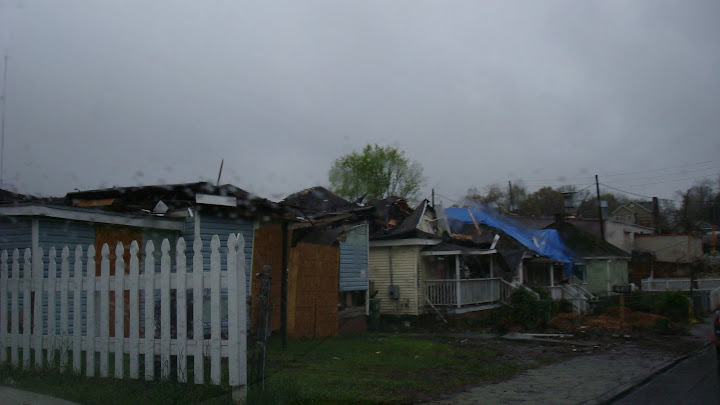
As Elim Christian College in Auckland grieves over the deaths of six students and a teacher in a flash flood in on Tuesday, questions have been asked about the response to a severe weather warning.

The students and teacher were on a canyoning trip run by the Sir Edmund Hillary Outdoor Pursuits Centre near the Tongariro National Park.

The centre says it did not receive a weather forecast predicting heavy rain.

However, the MetService says it issued a severe weather warning - the most serious caution possible - for the area at 8.30am on Tuesday, forecasting steady rain with sudden pockets of heavy downpours. MetService forecasting manager Peter Kreft says the warning contained an extra comment to watch for rapidly rising rivers.

The centre's chief executive, Grant Davidson, says a MetService fax at 6.15 that morning, which was used to brief staff, had no indication of heavy rain warnings. He says the issue surrounding the forecast will be investigated in a review of the tragedy.

Recovery of the victims

Five of the group, including an adult instructor, were rescued on Tuesday night. Four students and a teacher were found dead at the same time. Search teams later found the bodies of two other teenagers, at about 4am on Wednesday.

Police released the names of the victims on Wednesday. They were: Natasha Bray, of Pakuranga; Portia McPhail, of Manurewa; Huan (Tom) Hsu, of Farm Cove; Anthony Mulder, of Howick; Floyd Fernandez, of Howick; and Tara Gregory, of Mt Wellington. All were 16. The teacher was Anthony McLean, 29, of Howick.

The deaths have been referred to the Palmerston North Coroner for investigation.

School community mourns

Hundreds of supporters and mourners gathered on Wednesday at Auckland's Elim Christian College and special assemblies were held as the tragedy hit home.

Principal Murray Burton says the school has lost "a fine bunch of students". He says all had great leadership skills and their teacher was "an incredible person" who was in charge of redeveloping sports.

Prime Minister Helen Clark says the deaths are an unspeakable tragedy. She has pledged support from government agencies for the affected families and the school community, and is sending her condolences.

The Minister of Education Chris Carter visited the school on Wednesday, and says a trauma response team has been there since Tuesday night and extra staff will be provided if required. He would not be drawn on whether there will be an investigation by education authorities into health and safety issues around the adventure course.

Parliament passed a notice of motion expressing its deep sorrow at the deaths. The leaders of all political parties voiced their sympathy in Parliament for those affected by the tragedy.

Students wore lifejackets

The Outdoor Pursuits Centre's chief executive, Grant Davidson, says the wave of water that swept away the group was a freak occurrence. He says a young girl also died in the area after slipping under a log in the water in 1976.

Mr Davidson says the instructor leading the group had been working with the centre for several months and was fully qualified. He says the students were equipped and all were wearing wetsuits, lifejackets and helmets.

He says staff and the centre's trustees are devastated by the tragedy. The centre will investigate what happened and fully co-operate with all other investigations.

The Outdoor Instructors Association says the canyon where the group got into difficulty usually provides for a fairly straightforward trip. Chief executive Matthew Cant worked at the centre some years ago and says the Mangatepopo Gorge is relatively easy to navigate. He says the river is not a huge challenge to somebody who is well prepared and is being led.

Mr Cant says the centre has been conducting the Upstream Gorge trip for 36 years, giving tens of thousands of young people a "terrific" experience.

Ruapehu police district commander Steve Mastrovich says it appears the group was simply caught in the wrong place at the wrong time. "This is an alpine environment, so weather and other conditions are subject to pretty rapid change. This tragedy is completely unusual."

MARITIME NOTE

From gCaptain: What Went Wrong Aboard the MV Pasha Bulker?


Pashabulker1_2

While we're on the subject of management lessons, Master Mariner John Konrad, our esteemed colleague over at gCaptain, has some harsh words to say about the captain of the MV Pasha Bulker, a 225 meter bulk cargo ship that ran agound on Nobby's Beach in Newcastle, New South Wales, Australia last summer when the area was hit by a major storm that generated gale force winds and extremely high seas.

Pasharescue_2 There were 56 ships moored at Newcastle when the storm warning was issued by local authorities, and all but 10 of them sailed far offshore to avoid the heavy weather. The captain of the Pasha Bulker decided to stay, but when the huge storm finally struck, he then tried desperately to head out to sea — but it was too late. The ship ran aground at 9:15 am on a public beach not far from downtown Newcastle, and shortly thereafter it "hogged" — meaning, the spine of the ship cracked under the stress of the crashing waves. How embarrassing.

Pashabulk2 The ship was eventually refloated and salvaged, but not before it provided a bonanza for dozens of Australian Flickr photographers. Now a formal investigation of the incident is underway, and the judgment of the Pasha Bulker's captain has been called into question. Indeed, though gCaptain's MM Konrad is normally quite mild-mannered, as an expert mariner himself, the reports prompted him to issue some stern words about the management decisions that were made aboard the Pasha Bulker. Regarding the decision not to head out to sea, MM Konrad says:

46 ships decide to leave port to avoid dragging anchor in an unprotected harbor and the Pasha Bulker stays, while this action is questionable the decision is not necessarily breaking the rule of prudent seamanship. The next morning Port Authorities “try again” to evict the remaining ships. I do not have details on the warning but it’s normal procedure to give the availability of tug boats that could help a ship in danger. Either way rescue tugs never showed and were apparently not requested by the captain.

At this point in the time line the captain became a danger to the vessel and crew. A master’s disagreement with port authority suggestions is understandable and the choice to ignore the warnings are his prerogative but one necessary step was not taken; vigilance. This is the time for a captain to ask himself the questions mentioned above, this is the moment to question your own decision, this is your chance to solidify a bridge team management plan and put the crew on high alert.

Pashaprop The chronology from here was a comedy of errors, but the the Pasha Bulker soon ran aground, and when it did, the captain ordered his crew to abandon ship even though the engines were still sound and the ship was resting securely on the beach. To which MM Konrad says:

Panic is the number enemy number one in an emergency situation. While some have more difficulty than others avoiding it a captain should never panic. This is a primary reason it takes 10 years of sailing experience and school to obtain a master’s license. In these 10 years you will be exposed to situations at sea that test your panic trigger, if you are unacceptable to panic or indecision at the time if crisis you should not take command of a ship. Many mariners face difficulty getting promoted to second mate for this very reason, as this officer position is the highest pay grade obtainable without the need for making life threatening decisions in the face of danger. I have met few captains to which the Peter Principal applies.


RS

Wednesday, April 16, 2008

'Well Above-average' Hurricane Season Forecast For 2008

'Well Above-average' Hurricane Season Forecast For 2008

ScienceDaily (Apr. 10, 2008) The Colorado State University forecast team upgraded its early season forecast today from the Bahamas Weather Conference, saying the U.S. Atlantic basin will likely experience a well above-average hurricane season.

"Current oceanic and atmospheric trends indicate that we will likely have an active Atlantic basin hurricane season," said William Gray, who is beginning his 25th year forecasting hurricanes at Colorado State University.

The team's forecast now anticipates 15 named storms forming in the Atlantic basin between June 1 and Nov. 30. Eight of the storms are predicted to become hurricanes, and of those eight, four are expected to develop into intense or major hurricanes (Saffir/Simpson category 3-4-5) with sustained winds of 111 mph or greater. Long-term averages are 9.6 named storms, 5.9 hurricanes and 2.3 intense hurricanes per year.

"Based on our latest forecast, the probability of a major hurricane making landfall along the U.S. coastline is 69 percent compared with the last-century average of 52 percent," said Phil Klotzbach of the Colorado State hurricane forecast team. "We are calling for a very active hurricane season this year, but not as active as the 2004 and 2005 seasons."

Current conditions in the Atlantic basin are quite favorable for an active hurricane season. The current sea surface temperature pattern in the Atlantic - prevalent in most years since 1995 - is a pattern typically observed before very active seasons. Warm sea surface temperatures are likely to continue being present in the tropical and North Atlantic during 2008 because of a positive phase of the Atlantic Multidecadal Oscillation (AMO). Also, the currently observed weak Azores High will likely promote weaker-than-normal trade winds over the next few months enhancing warm SST anomalies in the tropical and subtropical Atlantic.

Additionally, the team expects neutral or weak La Nina conditions in the tropical Pacific, which, combined with a predicted warm north and tropical Atlantic, is a recipe for enhanced Atlantic basin hurricane activity. These factors are similar to conditions that occurred during the 1950, 1989, 1999, and 2000 seasons. The average of these four seasons had well above-average activity, and Klotzbach and Gray predict the 2008 season will have activity in line with the average of these four years.

The hurricane forecast team predicts tropical cyclone activity in 2008 will be 160 percent of the average season. By comparison, 2005 witnessed tropical cyclone activity that was about 275 percent of the average season.

The hurricane forecast team reiterated its probabilities for a major hurricane making landfall on U.S. soil:

  • A 69 percent chance that at least one major hurricane will make landfall on the U.S. coastline in 2008 (the long-term average probability is 52 percent).
  • A 45 percent chance that a major hurricane will make landfall on the U.S. East Coast, including the Florida Peninsula (the long-term average is 31 percent)
  • A 44 percent chance that a major hurricane will make landfall on the Gulf Coast from the Florida Panhandle west to Brownsville (the long-term average is 30 percent).

The team also predicted above-average major hurricane landfall risk in the Caribbean.

"The United States was quite fortunate over the last two years in that we had only one hurricane landfall (Humberto - 2007)," Klotzbach said. "None of the four major hurricanes that formed in 2006 and 2007 made U.S. landfall."

The Colorado State hurricane forecast team has cautioned against reading too much into the hurricane seasons of 2004 and 2005 when Florida and the Gulf Coast were ravaged by four landfalling hurricanes each year. Hurricanes Charley, Frances, Ivan and Jeanne caused devastating damage in 2004 followed by Dennis, Katrina, Rita and Wilma in 2005.

"The activity of these two years was unusual, but within the natural bounds of hurricane variation," Gray said.

Probabilities of tropical storm-force, hurricane-force and intense hurricane-force winds occurring at specific locations along the U.S. East and Gulf Coasts within a variety of time periods are listed on the forecast team's Landfall Probability Web site. The site provides U.S. landfall probabilities for 11 regions, 55 sub-regions and 205 individual counties along the U.S. coastline from Brownsville, Texas, to Eastport, Maine. The Web site, available to the public at http://www.e-transit.org/hurricane, is the first publicly accessible Internet tool that adjusts landfall probabilities for regions, sub-regions and counties based on the current climate and its projected effects on the upcoming hurricane season. Klotzbach and Gray update the site regularly with assistance from the GeoGraphics Laboratory at Bridgewater State College in Massachusetts.

The hurricane team's forecasts are based on the premise that global oceanic and atmospheric conditions - such as El Nino, sea surface temperatures and sea level pressures - that preceded active or inactive hurricane seasons in the past provide meaningful information about similar trends in future seasons.

The team will issue seasonal updates of its 2008 Atlantic basin hurricane activity forecast on June 3, Aug. 5, Sept. 2 and Oct. 1. The August, September and October forecasts will include separate forecasts for each of those months.

Tropical Cyclone Forecast for 2008

(1950-2000 Averages in parenthesis)

  • Named Storms 15 (9.6)*
  • Named Storm Days 80 (49.1)
  • Hurricanes 8 (5.9)
  • Hurricane Days 40 (24.5)
  • Intense Hurricanes 4 (2.3)
  • Intense Hurricane Days 9 (5.0)
  • Net Tropical Cyclone Activity 160 (100%)

* Numbers in ( ) represent average year totals based on 1950-2000 data.

The entire report is available on the Web at http://hurricane.atmos.colostate.edu.

Adapted from materials provided by Colorado State University.

MARITIME NOTE

MSC Napoli is dismantled piece by piece

Part of the wreckage of the container ship Napoli has been stripped apart in a dockyard 15 months after it was grounded along the Jurassic coast.


In pictures: MSC Napoli is dismantled

Contractors used cutting charges to remove the propeller and rudder and to sever the main drive shaft of the ship, which is stranded off the coast of Branscombe, east Devon. Explosives are also being used to dismantle the vessel so that it can be taken to land by barge and recycled.

The Maritime and Coastguard Agency said that contingency plans were in place to minimise any environmental impact that the operation may have.

Contractors say the operation will take about five months and is the final part of a multi-million-pound salvage project. After the stern is taken from the seabed, underwater surveys of the site will be carried out to ensure that all the debris is removed.

The front section is being cut apart at the Harland and Wolff shipyard in Belfast after being towed there last August. The Napoli started breaking up in bad weather in the Channel in January 2007 and was deliberately beached because it was feared that it would break up and sink. Some of its containers washed ashore and were looted.

MW motorcycles were among items taken before police moved in to close the beach.


Salvage Law and Practice Seminar
Thursday 19th - Friday 20th June 2008
Lloyd's Maritime Academy Training Suite, London

To download the brochure, click here.

Lloyd’s Maritime Academy is delighted to announce details of the Salvage Law and Practice seminar. This popular and comprehensive two day seminar will provide you with the opportunity to examine some of the most important and complex topics relating to international salvage law and salvage awards.

Whether you are an established player or new to the salvage & wreck removal arena, this seminar is an essential date for your professional diary giving you the opportunity to examine some of the most important and complex topics relating to international salvage law and salvage awards.

The programme has been specifically designed to include case studies and practical sessions, enabling you to gain a first hand understanding of the subject area.


RS

Tuesday, April 15, 2008

How to Read Sea Surface Temperature Images

How to Read Sea Surface Temperature Images

Now we're going to give you all the information you need to know to become an expert at reading these images.

There are 3 simple steps:

  1. Image Navigation,
  2. Is that a cloud?
  3. How do I find favorable currents?

1) Navigation - One of the most important things to remember in life is not to believe everything you read. Well, with satellite images, you shouldn't believe everything you see. The satellites are 500 miles up in space and moving at speeds of around 20,000 mph. Because of this excessive speed and some tilt and roll in the satellite, the image isn't exactly in the right spot most of the time. How will you know that? You must look at the image very carefully.

This SST image is not quite right. If you look at arrow A, you will see the coastline in the Cape May area. Now look carefully at the image itself. Notice that the deep red pattern is the same shape as the coast, but doesn't match up. This deep red area (hot temperature) is land. You can see that the coastline near point B should be matched up with the image near point C.

Now let's move the coastline to the correct spot.

Now you can see what it should look like. Notice that when we move the coast, the Latitude/longitude grid also moves. As a web site user, you can't move the coast, but you can now estimate how much error there is in the image navigation when planning your boat trip.

A good thing to note: Land appears much warmer than the coastal water in this image because the satellite pass was taken on a hot summer afternoon. Land heats up a great deal on a hot day while water does not. Just think about when you walk across a beach on a hot day. The sand can burn your feet, but when you run down to the water, it's about the same temperature all day long. The opposite is true with night time images. Land can get very cool at night, while the ocean water will not change more than 4 or 5 degrees over a day.

These two images are a good example of this diurnal (night/day) heat difference.

2) Is that a cloud? - As I've already said, the satellites are 500 miles up in space. These satellites cannot see through clouds, so when there is a cloud above the earth, the satellite sees the temperature of the cloud and not the earth below it. Clouds are high up in the sky and are almost always cooler than the earth below. The farther you go up in altitude, the cooler it gets. Just ask a mountain climber.

So, knowing that clouds are cool, look at the image to the left. The areas marked a, b, and c are definitely clouds. They are so cold, they are off the temperature scale (white). Meanwhile, all of the ocean around them is green and yellow. Unless something very strange is going on, white areas in our imagery are RARELY water.

There is one other way of identifying a cloud. Clouds move rapidly over the earth at speeds between 15 to 50 mph. Water currents move at only 2-3 mph. So, the temperature patterns in the ocean should not change quickly. If you can compare two images that are less than 24 hours apart, you will know if a pattern is a cloud because it will not be in one of the two images. For example, look at these two images, specifically the areas marked D and E. In image 1, there is a cloud there (blue/purple), while in image 2 it has moved off to the east (marked cloud).

THE TEMPERATURE EXCEPTION - Upwelling - Sometimes during the summer, water from the ocean floor rises quickly from the bottom and can cool water temperatures 15 degrees in one day. These two images (area B) show one such upwelling event. They are only 20 hours apart, but the coastal water temperature dropped 10 degrees. In our area, these upwellings only occur along the coast. Find out more on Upwelling.

3) How do I find favorable currents? - If you are going out on the ocean in a sailboat, then you may know plenty about navigating coastal and deep water currents to your advantage. If not, think about it this way… If you were riding a bike down the street, would you get to your destination faster with the wind gusting in your face or at you back? We are going to do all we can to teach you how to keep that wind (currents) at your back so you can save time, money and boat fuel. It's a practical advantage, isn't it? So let's get to it.

Now, for the currents in shallow water, or water less than 600 feet (the depth of the continental shelf edge), we suggest you go to our CODAR Coastal Radar tutorial. Here we are going to give you a brief introduction on how to read a satellite image and determine the surface currents in deep water (i.e. waters more than 600 feet deep).

The image above is a simple view of the waters off of the Northeast US, showing the major current in the area known as the Gulf Stream (the red snakelike line in the picture). Here, the arrows indicate the direction of ocean currents. The Gulf Stream moves generally from west to east at about 4 knots. It contains areas called meander troughs, where it moves to the south and back to the north, and meander troughs which first move north, then back to the south again. If the trough gets too deep, it collapses and breaks off from the stream becoming a cold ring. If a crest gets too high, it too collapses and becomes a warm ring. Below is an animation showing how this happens. Warm rings (north of the Stream) rotate clockwise at about 2-3 knots while cold rings rotate counter clockwise at about 2-3 knots.

The final image is a piece of a surface temperature satellite image from our web site. We have overlaid arrows and text explaining the current speeds and directions. There are two additional features here. One is a frontal eddy, which is north of the stream and rotates counter clockwise. These small eddies stay attached to the northern edge of the stream and generally rotate at about 1 knot. The other is the arrow showing the counter current just north of the continental shelf edge (black line). This is the typical direction of surface current flow along the northern edge of the continental shelf.

All of our Sea Surface Temperature (SST) images come from NOAA/AVHRR satellites, which you can learn more about.

Maritime Notes

UK. Ro-Ro ferry Riverdance to be dismantled on Blackpool beach
Thursday, 10 April 2008

After a lengthy evaluation process, the owner of the Riverdance ferry, now lying on Blackpool beach, has produced plans to dismantle the ship in situ on the grounds that this represents the best option available in the interests of safety and protecting the environment.

Hugh Shaw, the Secretary of State's Representative for Maritime Salvage and Intervention (SOSREP), has been involved throughout and has informed the owner that he has no objection to the plans.

Weather permitting, it is estimated that the project will take approximately 12-14 weeks.

Options examined ranged from righting the vessel (known as par-buckling), cutting up in situ or a combination of both. The preferred method will involve cargo, trailer and machinery removal, including any debris and any pollutants, whilst maintaining the integrity of the hull. The vessel will be stripped down internally until only the shell remains. The hull will then be cut into manageable pieces and transported for recycling.

The Environment Group have been advised as well as Defra, the Environment Agency, the Marine and Fisheries Agency and Natural England. All parties (including Defra, the Environment Agency, the Environment Group, the Marine and Fisheries Agency and Natural England) recognise that, due to the uncertainty and technical difficulties of righting the vessel, cutting up in situ is now the best option.

Until the new contract for demolition is awarded, SMIT Salvage remain on contract to carry out caretaking duties only.

Hugh Shaw said : "I look forward to being able to brief officers and elected members of the local authorities to explain how and why the forthcoming works will be carried out. I also look forward to working closely with all interested organisations such as the police and local transport services to ensure that minimum disruption is caused to residents and local people."

The original plan to reduce the list using tidal and internal buoyancy was abandoned due to the additional structural damage sustained during storms on 12 March. The vessel remains lying on the beach with a list of 100 + degrees. In addition the vessel continues to sink deeper into the sand. It is estimated that at least 4 metres of the bridge / wheelhouse is now under the sand.

On Thursday 31 January 2008, the vessel's crew, on passage from Warren Point to Heysham, reported that she had developed a 40 degree list and was drifting towards the Lancashire coast. The vessel subsequently grounded at Cleveleys Beach, North Shore, Blackpool.


RS

Monday, April 14, 2008

Atlantic water temperatures climbing, storm experts warn

Atlantic water temperatures climbing, storm experts warn
April 5, 2008

ORLANDO — There is good news and bad news on the hurricane front: Water in the Pacific could be shifting to create less-hospitable conditions for the storms to form, but things in the Atlantic seem to be perking up.

Cool water in the Pacific Ocean seems to be warming slightly, though La Niña is expected to linger through the spring. This weather pattern's disappearance would make it harder for storms to form.

The water in the tropical Atlantic Ocean is also warming, however, and other conditions are in place in the Atlantic to keep water temperatures rising. That is good for hurricanes.

That is the assessment of Phil Klotzbach with Colorado State University, speaking at Friday's closing session of the National Hurricane Conference.

Klotzbach is assuming much of the forecasting work done until now by William Gray, the Colorado State professor who has issued forecasts of hurricane seasons since 1984. The pair's next forecast will come Wednesday at a hurricane conference in the Bahamas.

Their last forecast in December called for 13 named storms and seven to become hurricanes. Three of those are expected to grow to storms of Category 3 or larger. That is slightly above the long-term average for a season.

It does not appear that the numbers will go down in the new forecast, said Gray, who also spoke at the conference's closing session.

Gray said active seasons are likely to be with us in coming years.

"We have this multi-decadal cycle that's bringing many more storms to the Atlantic, particularly category 3, 4 and 5 storms," Gray said.

Hurricane frequency in the Atlantic swings from calm to active over periods that last 20 to 25 years. The Atlantic entered an active phase in 1995.

Much of the swing in activity depends on ocean circulation driven by changes in salinity, Gray said.

While one part of the globe may be drifting into neutral conditions for hurricanes, neither aiding their formation nor hindering them, the opposite side of the world is starting to favor hurricanes.

La Niña, when water in the tropical Pacific cools below normal, is still in place though weakening slightly, according to the Climate Prediction Center. It may wane by the end of spring. Forecast models are split on whether it will stay through summer.

Klotzbach said spring is a difficult time for forecasters to predict what La Niña will do in the summer. The cool water of La Niña weakens the jet stream that blows from the west, seven miles above the earth. The weaker jet stream means those winds that normally can inhibit hurricane growth are not in place, and it is easier for storms to form.

Even if La Niña weakens and the Pacific returns to neutral conditions, water temperatures in the eastern Atlantic have risen in the past few months, Klotzbach said. Also, trade winds moving from the east have diminished, and air pressures have dropped.

"Traditionally, when you see that warming, especially in the eastern Atlantic, you see more hurricane activity," Klotzbach said.

He said water temperatures in the Atlantic were lower in 2007, one reason many of the storms that formed did not become too powerful.

WEATHER NOTE

Preparing for the next storm: Tips on readying for disaster

By the Daily News

A family preparedness plan needs to be in place for all hazards, natural or manmade, and should contain a kit to sustain a family for 72 hours.

Ronnie Pearson, director of Warren County Emergency Management Services, said if a disaster is severe enough, it could take that long for emergency service personnel to reach someone.

That’s why it’s also a good idea for residents to become involved in a Community Emergency Response Team that provides training on how to use a fire extinguisher, basic first aid and light extrication, Pearson said.

Kits should contain food and water - one gallon of water per person per day - canned staple foods, a first aid kit, a battery-powered AM/FM radio and any type of important medical documentation.

“They also need to have drills similar to fire drills so that everyone knows where to go in the case of an emergency so everyone can be accounted for,” Pearson said.

“And everyone should have a NOAA weather radio,” he said.

Those radios can be purchased at just about any discount store or electronics store for as little as $29.99. Those with SAME technology will allow owners to go the NOAA Web site and program in the codes for the counties which they wish to be alerted about. Those without SAME technology will probably alert for a 14 or so county area, Pearson said.

Kentucky Cabinet for Health and Family Services has several online publications that can help families in formulating their plans, he said. The state Department of Homeland Security also offers tips.

The cabinet also recommends having the following items prepared:

Clothing, blankets and sleeping bags

Battery-powered flashlight with extra batteries

Candles and matches

Sanitation supplies, including iodine tablets and bleach to disinfect water

Toilet articles and special needs items for infants, older adults or disabled family members

Extra sets of car keys and eyeglasses

If you have a car, try to keep at least 1/2 tank of gas in it at all times

Important family documents in a waterproof container

For more information, visit chfs.ky.gov/dph/epi/ preparedness/WhatYouCanDo ToBePrepared.htm or homeland security.ky.gov/. For information about weather radios, go to www.nws.noaa.gov/nwr/nwr rcvr.htm.

RS

Friday, April 11, 2008

Destructive waves discussed

Destructive waves discussed

On some days, it was a howling wind, one that makes the ocean mist feel like tiny pricks of ice on your skin. On others, the wind was calmer and the waves came in 6- to 8-foot sets, about 45 minutes apart. The water hovered around 60 degrees. But the surf, consistently big, sets consistently far apart, had people saying they’d never seen anything like it in Newport Beach.

When a storm originating in Antarctica sent huge swells thousands of miles up to Newport Beach last year, two people fishing were swept off the eastern jetty in Corona del Mar.

“That was the first day the swell got farther apart,” said lifeguard Skeeter Leeper, who was there that day. “It probably took them five minutes to walk to where they were.”

The sets were coming in about 15 minutes apart, Leeper said. They probably didn’t see the surf only minutes earlier.

“Then all of a sudden you got a 10-foot wave coming out,” and they were taken by surprise, he said.

The only traces Fremont resident 53-year-old Sean Shungfei Yeh and 49-year-old Irvine woman Yi Ni Kwong left that day were a straw hat and a shoe.

Retelling that story with pictures from the next day’s headlines, Craig Smith reiterated the unpredictable power of the ocean to nearly 100 people in Newport Beach Central Library on Thursday night.

Smith, an author, engineer and amateur yachtsman, told them about rogue waves, mythical giant walls of water that mangle steel, snap ships in half and swallow whole crews in one fell swoop and tsunamis and how they could affect Newport Beach.

Thanks to science, the once-mythical rogue wave — the one that towers over all others in the ocean — is finding its way it to many unsolved mysteries in the ocean. Waves that measure up to 120-feet high have been blamed for sinking ships of more than 500 tons.

Their only warning, the “hole in the sea” ships fall into as the wave overwhelms. Scientists have not yet found an accurate way to predict when they’ll form, Smith said.

“It’s the capricious nature of them that makes them so problematic,” he said. “It’s only a problem if you’re in the wrong place at the wrong time that they become a problem.”

Newport Beach doesn’t have to worry about rogues so much, he said. But, Smith said, if Alaska, a country off the coast of South America or a tectonic plate in the Pacific were to slip, a tsunami could become a reality. Most seemed fascinated, but a bit surprised the potential disasters out in the sea that could hit home in Southern California, audience members said.

“The threat is remote, but it’s real,” said audience member Doug West.

WEATHER NOTE

Tornado season arrives - be prepared

Spooked in the past by scary dark clouds and high winds, Monroe County area residents should not ignore siren blasts when they go off this spring.

It could mean a tornado is approaching, a nuclear plant accident just happened or a hazardous waste spill has occurred. In either case, citizens should prepare for the worst, local civil preparedness authorities say.

Glenda White, interim director of the county Emergency Management Division in Monroe, said it's easy to be complacent when sirens are sounded. But that's why the county and state have declared this week (April 6-12) Severe Weather Awareness Week.

"We've had our share of tornadoes, floods and thunderstorms," Ms. White said. "You can't take the sirens for granted. You have to be ready ... we've been lucky we haven't had an F3 tornado or higher recently."

Tornadoes have ravaged the county in the past and could do so again, she cautioned. In fact, this is the start of the season for tornadoes.

On April 3, 1974, two twisters touched down in Erie and Berlin townships, destroying two homes and sending two people to the hospital for serious injuries. The tornado that touched down in Erie was later classified as an F3 twister, meaning it packed winds of between 158 and 206 mph.

These were only two of nearly 150 tornadoes that pummeled the nation that day, killing 315 people, injuring 6,000 and causing $600 million in property damage.

There have been other twisters in the county in April. The worst was the Palm Sunday storm on April 11, 1965, that killed two people in Lost Peninsula in Erie Township. On that evening, a twister killed 11 people in Lenawee County and smashed through Milan, causing $19 million in damage along its path. The storm hit about 8:25 p.m.

About an hour later, another twister, accompanied by golf ball-sized hail, landed in Lost Peninsula and caused about $1 million in damage. The same funnel cloud killed 13 people in and near Toledo.

Another April tornado struck in 1963 in Frenchtown Township. Both Grand Beach and Stony Point were pummeled and one person was injured. It caused about $60,000 in damage.

The most savage twister to hit the county came June 8, 1953, when four people were killed and 15 injured when a funnel cloud formed over Petersburg about 6 p.m. and then raked through Erie Township a half hour later. Some 20 homes along Baycreek, E. Temperance and Substation Rds. were demolished. Damage exceeded $1 million.

Tornadoes develop during severe thunderstorms. A funnel that forms is not actually classified as a twister until it touches earth. A violently rotating column of air trailing from a thunderstorm, but not in contact with the ground is known as a funnel. Other terminology and information about tornado safety, lightning and other severe storms can be found on the weather service Web site at www.weather.gov.

Area communities no longer may be put on alert for a tornado warning when the sun is shining and there is no apparent threat of a storm approaching.

The National Weather Service changed its tornado alert and thunderstorm warning system last fall to make them more geographically specific.

This will be the first spring the new system is in place, meaning a difference when a tornado or thunderstorm alert is issued.

The weather service has stopped issuing countywide severe weather warnings and instead will issue "storm-based warnings" for tornadoes, severe thunderstorms, flash floods and marine hazards for specific areas within the county. The new warning system, for example, may include well-known landmarks in the region such as I-75 or M-50 or the River Raisin or Huron River.

The change should be fairly easy for the public to understand, said David Kohler, a meteorologist for the weather service near Pontiac.

"We're going to fine-tune our warnings so they don't unnecessarily warn people in areas that won't be affected," Mr. Kohler said.

Weather forecasters still will have the flexibility to recommend warnings that cover a wide enough area in case the weather takes an unexpected turn.

Severe thunderstorms can bring many dangers in addition to occasional tornadoes.

Other hazards include damaging winds and large hail. Some severe storms can produce winds of more than 100 miles an hour, resulting in damage equal to that of a tornado.

Since 1970, high winds - mostly from severe thunderstorms - were responsible for 118 weather-related deaths in Michigan, the weather service said. During that same period, there were 23 tornado-related deaths. Lightning resulted in one death and several injuries in 2007 compared to three deaths and eight injuries in 2006.

Flash floods can be dangerous, too, and can happen any time of year. Rapid flooding of low-lying areas accompanied by swift currents can quickly lead to life-threatening situations. Flash flooding is the No. 1 weather-related killer.

Doppler 7 Xtreme HD- Severe Weather Guide


Click to download the Doppler 7 Xtreme HD Severe Weather Guide (8.6MB)
We all plan the course of our day by checking out the weather. But when nasty storms threaten, it’s really time to sit up and take notice. Spring and summer storms can dangerous, if not downright deadly. Jerry Hodak, Dave Rexroth and the rest of the Doppler 7 Extreme Weather Team have the skill and experience to help keep you safe in these fast-changing weather events.

Here are some severe weather facts and advice so that you can recognize dangerous weather conditions and act accordingly.


Click to download the Doppler 7 Xtreme HD Severe Weather Guide


MARITIME NOTE

Owner of Beached Ferry Riverdance Presents Plans to Dismantle Her

April 10, 2008

After a lengthy evaluation process, the owner of the Riverdance ferry, now lying on Blackpool beach, has produced plans to dismantle the ship in situ on the grounds that this represents the best option available in the interests of safety and protecting the environment.

Hugh Shaw, the Secretary of State’s Representative for Maritime Salvage and Intervention (SOSREP), has been involved throughout and has informed the owner that he has no objection to the plans.

Weather permitting, it is estimated that the project will take approximately 12-14 weeks.

Options examined ranged from righting the vessel (known as par-buckling), cutting up in situ or a combination of both. The preferred method will involve cargo, trailer and machinery removal, including any debris and any pollutants, whilst maintaining the integrity of the hull. The vessel will be stripped down internally until only the shell remains. The hull will then be cut into manageable pieces and transported for recycling.

The Environment Group have been advised as well as Defra, the Environment Agency, the Marine and Fisheries Agency and Natural England. All parties (including Defra, the Environment Agency, the Environment Group, the Marine and Fisheries Agency and Natural England) recognize that, due to the uncertainty and technical difficulties of righting the vessel, cutting up in situ is now the best option.

Until the new contract for demolition is awarded, SMIT Salvage remain on contract to carry out caretaking duties only.

Hugh Shaw said

“I look forward to being able to brief officers and elected members of the local authorities to explain how and why the forthcoming works will be carried out. I also look forward to working closely with all interested organisations such as the police and local transport services to ensure that minimum disruption is caused to residents and local people.”

The original plan to reduce the list using tidal and internal buoyancy was abandoned due to the additional structural damage sustained during storms on 12 March. The vessel remains lying on the beach with a list of 100 + degrees. In addition the vessel continues to sink deeper into the sand. It is estimated that at least 4 meters of the bridge / wheelhouse is now under the sand.

On Thursday 31 January 2008, the vessel’s crew, on passage from Warren Point to Heysham, reported that she had developed a 40 degree list and was drifting towards the Lancashire coast. The vessel subsequently grounded at Cleveleys Beach, North Shore, Blackpool.

Source: Maritime and Coastguard Agency

Messing About In Ships Episode 18

April 10, 2008, 9:01 am
Filed under: podcast, shownotes

Messing About In Ships podcast episode # 18 has launched.

(56 minutes)

Download MP3 file: Messing About In Ships Episode 18 (April 10, 2008)

Show Notes: coming soon

Subscribe Via iTunes HERE


Enjoy a safe weekend!

RS


Thursday, April 10, 2008

Shipwrecks a time capsule of the Great Lake

Shipwrecks a time capsule of the Great Lakes

Posted by Eric Gaertner | The Muskegon Chronicle April 05, 2008 22:48PM

Not far from the Hackley and Hume historic sites and the Muskegon County Museum downtown are structures waiting to provide visitors a look at a different time in our history.

Yet few people realize the existence of these structures, some more than 100 years old and hundreds of feet long, unseen by the naked eye.

They are shipwrecks that reside at the bottom of Lake Michigan off the West Michigan coastline -- underwater historical exhibits telling tales of tragedy, history and, in some cases, survival.

These local wrecks from Grand Haven to Pentwater cover a wide range of sizes, shapes and shipping eras. They are found in various depths, from just off the shoreline in 15 feet of water to hundreds of feet below the surface where only the most advanced divers are able to descend.


Watch the underwater video of dives on the Anna C. Minch and the Novadoc near Pentwater. Both sank on Nov. 11, 1940.

Diving on shipwrecks


Despite their differences, the wrecks provide a time capsule of Great Lakes shipping and their crews.

An abundance of wrecks

There have been about 8,000 Great Lakes wrecks, according to researchers, and the cold, fresh water keeps them better preserved than those found in oceans.

Though Lake Michigan is considered the most dangerous of the Great Lakes, the West Michigan area has a wreck density that is slightly less than other parts of the Big Lake and is not considered a top dive destination, said shipwreck historian and researcher Brendon Baillod.

Baillod is also an author who is working on a book about Oceana County's shipwrecks, "Ghosts of the Oceana Coast." Still, there are plenty of "notable" wrecks off the coast from Pentwater to Grand Haven, Baillod said.

Among the most interesting wrecks and divable points along the West Michigan shoreline are:

• The Armistice Day wrecks off Pentwater.
• The State of Michigan off the White Lake Channel.
• The Ironsides off Grand Haven.
• The Brighty off the Oceana County coast.
• The Neptune near the Little Sable Point.

The area isn't home to widely famous wrecks such as the Edmund Fitzgerald or the Carl D. Bradley, the two largest ships to sink on the Great Lakes that took the lives of many sailors. Area wrecks mainly came from the local traffic of lumber schooners or small passenger steamers and vessels in transit from Milwaukee or Chicago to the Straits of Mackinac, Baillod said.

"Storms would tend to blow vessels ashore on your stretch of beach," Baillod said.

Another view of the Henry Cort.

Based on his research, Baillod estimates that about 250 wrecks -- not all of which have been found and documented -- are located off the shoreline from Oceana south to Ottawa County.

For some local divers, the history and research make the dives worthwhile. For others, the opportunity to dive and view a unique underwater structure supersedes the actual story behind the wreck.

John Hanson, 54, of Montague, reads about all the local shipwrecks before diving them. In some cases, he also talks with museum workers and relatives of those who served on the ship.

"I like doing the research, finding out the history of the wreck," Hanson said. "It brings you in touch with the people who served on them."

Colin DeVries, 66, of Whitehall Township, also enjoys the historical nature of shipwreck diving. As a diver for 45 years and a travel coordinator for West Michigan Dive Center for 30 years, DeVries has been to countless wrecks in locations covering six of the seven continents.

"I've always had an interest," DeVries said of shipwrecks and their histories. "The idea of any diver is to find something new yourself, but that's usually left to a few."

Valerie van Heest is one of those few. Along with her Holland-based group, Michigan Shipwreck Research Associates, she searches for undocumented shipwrecks, some in deep water off West Michigan, mainly from Pentwater to the Indiana border. The group uses its research to pinpoint the best locations to search and publicizes the history of a ship when it discovers a new wreck.

MSRA has discovered or rediscovered nine shipwrecks in its 10 years of Lake Michigan exploration. MSRA uses its historical research and specialized sonar equipment to explore specific areas.

Dan Bloom, 48, of Roosevelt Park, leaves the research and history to others. He reads books about some wrecks, but mainly he just enjoys the "peaceful, natural feeling" he gets from being underwater.

"I like to go down and look at the vessel and appreciate what is there," said Bloom, who owns West Michigan Dive Center Travel.

Some wrecks to remember

Local divers have their favorites, some based on the ship's history and some based on the look of the wreck now.

The State of Michigan, near the White Lake Channel, is among the top shipwreck dive sites, according to the local divers. It sank in 1901 and sits on the bottom of Lake Michigan in about 65 feet of water.

Bloom describes the wreck as having the starboard side of the hull and the propellor still intact, while the bow is pointed toward the shore. He cautioned that divers will encounter the ship's boiler at about 47 feet down.

"There's a lot still there," Bloom said. "It's an enjoyable wreck."

"There's a real neat deck cart there, and, of course, it's now covered by zebra mussels," Hanson said. "The wreck now looks like a giant row boat. There's no deck on it anymore."

The Ironsides, off Grand Haven, also is considered one of the prime local dive sites, because the ship is in relatively good condition for a wooden steamer that sank in 1873. The wreck is in about 110 feet of water.

"That one's probably the most intact," DeVries said. "It's made of wood and most usually fall apart over the years and this one hasn't."

"It's nice because it's a little deeper, a more advanced dive so not everyone goes out there," Bloom said.

The 420-foot William B. Davock sank in the "Armistice Day" storm, with the loss of 32 lives. Enlarge photo

The 380-foot long Anna C. Minch sank off of Pentwater on Nov. 11, 1940 with the loss of 24 men. Enlarge photo

The 252-foot Novadoc also sank in the Ludington-Pentwater vicinity on Nov. 11, 1940. The 17-man crew survived. Enlarge photo

Three ships that sank during the devastating Armistice Day storm of 1940 near Pentwater also rank among the most famous wrecks in the area. The William B. Davock was the second largest ship ever lost in Lake Michigan, while the Anna C. Minch is considered a quality dive site with a large steel wreckage. The Novadoc wreck is notable because it is in shallow water, 12-15 feet, and can be viewed with a snorkel.

The wreck of the Henry Cort off the north side of the Muskegon Channel is quite historic because of the story behind its sinking. The 320-foot whaleback steamer hit the heavy stone breakwater after encountering a storm packing 45 mph winds on Nov. 30, 1934.

The incident featured an amazing rescue by the U.S. Coast Guard that saved the 25 men on board, but one of the Coast Guard members died after being washed out of the boat.

Hundreds on shore watched as the Coast Guard shot a line from the pier to the Henry Cort and all 25 men climbed hand over hand along the line to the pier. From there, the men huddled together and slowly made the trek along the slippery rocks of the breakwater, oftentimes as huge waves broke over their heads.

The wreck sits on the outside of the north breakwater in about 30 feet of water. DeVries said the wreck is partially covered up now with some anchor chain still visible, but he cautioned that divers must be careful with the boat traffic using the channel.

A natural museum

All of these area shipwrecks would be part of a proposed underwater preserve. A local group, including divers, is attempting to get the area from just south of Grand Haven to Pentwater established as the West Michigan Underwater Preserve. The group's goal is to help protect the shipwrecks, highlight the area as a tourism diving destination and sink a cleaned vessel as an artificial shipwreck.

A state-recognized preserve also would help recognize the stories behind these area wrecks and how the sinkings occurred.

Like the Cort, vessels being driven ashore by storms is considered one of the main reasons for the shipwrecks on the Great Lakes. Baillod said waves, which tend to be steeper and occur on shorter intervals than those on the ocean, and the sudden, severe weather that often hits the region, especially in November, are major factors.

"November storms on the Lakes blow in unabated across the Great Plains and strike with incredible fury," Baillod said. "Fall was also the season when cargoes were most in demand, such as grain and crops needed over the winter, coal needed for heating, etc. There was a tremendous incentive for ships to go out during the most dangerous season."

The state government deems these shipwrecks unique resources that can trace the history of Michigan. As such, state officials manage shipwrecks as public trust resources that must be protected for future generations to explore and study.

To protect those publicly owned resources, the state legislature amended a law in 1994 that established fines and penalties for "illegally removing, altering or destroying artifacts" from shipwrecks. The law does not restrict searching for, diving on or photographing shipwrecks.

WEATHER NOTE

Dealing with disaster
Preparation is The Best Defense

(NAPSI)-The United States
had the most natural disasters of any country in 2007. According to the United Nations, the U.S. had 22 natural disasters, followed by China with 20 and India with 18.

According to the U.S. Department of Homeland Security (DHS), flooding is the nation's single most common natural disaster and can happen in every state. Tornados are nature's most violent storms and can happen anywhere. Hurricanes can cause storm surge, high winds, tornadoes and flooding. Wildfires are a major concern in drought-prone regions. And don't forget mudslides and blizzards.

Should you have to evacuate, the DHS (Ready.gov) recommends that you carry enough emergency supplies to make it on your own for at least three days. A basic emergency kit should include water, 1 gallon per person per day for drinking and sanitation; nonperishable food; battery-powered radio and flashlight; extra batteries; first-aid kit; whistle to signal for help; dust mask to help filter the air; moist towelettes; and cash or travelers checks, appropriate clothing, diapers, medications, glasses, pet food, etc.

"Think of food as fuel when you're shopping for your emergency kit," says Sunbelt Snacks Registered Dietitian Joanne V. Lichten, Ph.D., R.D., author of "Dr. Jo's How To Stay Healthy & Fit on the Road." She recommends the following items to fuel your engine during an emergency:

• Multivitamins.

• Ready-to-eat canned (or vacuum-packed) meats including tuna, salmon, sardines and kippers.

• Canned (or ready-to-eat vacuum-packed) fruits such as peaches, fruit cocktail and apple sauce.

• Canned vegetables including corn and green beans.

• Peanut butter and jelly.

• Dried fruit including raisins, cranberries, peaches and apricots.

• Nuts.

• Whole-grain crackers, crisp flatbread.

• 100 percent fruit juice and sports drinks.

• Nonperishable pasteurized milk or powdered milk (to add to safe water source).

• Granola cereal, granola bars or fruit-filled cereal bars.

Sunbelt offers granola bars that have received the Whole Grains Council basic stamp, available only to products containing a half serving (8 grams) or more of whole grains. The bars are individually wrapped for freshness. Visit SunbeltSnacks.com for more information.

Flooding is the nation's single most-common natural disaster and can happen in every state.

RS

Wednesday, April 9, 2008

Hurricane forecasters' emergency network system going public

Hurricane forecasters' emergency network system going public

By Arlene Satchez
South Florida Sun-Sentinel"

It gave us the best opportunity to raise money and make it a viable business," said Norcross of the dealwith publicly traded Brampton.

Norcross, WFOR's hurricane specialist, will be company president and chief executive officer. With almost 40 years in broadcasting, he's experienced some of the frustrations caused by a communications disconnect among the media, government and the community during a disaster.

He became known in South Florida after delivering around-the-clock coverage when Hurricane Andrew hit sections of Miami-Dade County in August 1992.

Mayfield, who retired last year from the hurricane center, spent 34 years with the National Weather Service and is the hurricane specialist for WPLG-Ch. 10. He'll be senior vice president of government relations, working with emergency management agencies.

Despite the media's best efforts during a disaster, there are not enough reporters to cover all emergency operation centers in affected areas, Mayfield said.

The inability for emergency managers to communicate with the public or with other government agencies during disasters can hinder rescue or relief efforts.

Case in point: Hurricane Katrina in August 2005. The federal government's lack of response in devastated areas of the Gulf Coast immediately after the hurricane triggered national outrage.

The forecasters worked with Jackson, Miss.-based technology company Global Security Systems to develop blueprints for a communications network that is expected to fill crucial gaps in emergency management communications nationally.

Global Security's Alert FM system, a segment of the network, uses signals from local FM stations to transmit messages instantly to the community or a target audience. Information can also be sent as text or voice messages to mobile phones.

The communications network also will include a Web site with video footage and advisories from emergency management offices and other government agencies (free to the public) and a TV channel, broadcasting news conferences and other critical information.

Online segments of the network will be tested in April and May in nine emergency management locations, most of which will be in South Florida, and a new satellite system to broadcast videos should be running by June 1, in time for hurricane season, Norcross said.

To seal the deal, Brampton exchanged 100 million of its common stock shares. A recent $1 million private placement of Brampton shares will also be used to finance the emergency network and shareholders are expected to vote on the deal in June. Pending approval, the merged company will be renamed The AEN Group Inc.

"I believe the public will buy into this," Mayfield said. "It'll be my true legacy when all is said and done. I'm really committed to making it happen."

Arlene Satchell can be reached at asatchell@sun-sentinel.com or 954-356-4209.

WEATHER NOTES

Preparing for spring severe weather

By ALEX DOTY
Sentinel-Standard writer
Published: Monday, March 31, 2008 11:28 PM CDT

I
ONIA - April showers bring May flowers, but they can also bring severe weather that can have a negative impact on residents across Ionia County.

“I think everyone should be preparing for severe weather right now,” Ionia County Emergency Management Coordinator Rick Norman said.

According to information released from the State of Michigan, in 2007 there were 11 injuries and four deaths as a result of severe weather.
Additionally, severe weather resulted in about $150 million in property damage across the state during the same time period.

To prepare for this year's onslaught of potential severe weather, officials are beginning to keep their proverbial eye to the sky.

Norman said he keeps in touch with the National Weather Service on a frequent basis and they have special meetings if severe weather is imminent.


In addition to keeping in touch with the weather service, local residents can play an integral role in helping warn residents about dangerous weather.

There will be a special training session held 7 p.m. April 10 at the Ionia County Intermediate School District facility to train people to become severe weather spotters.

“I would guess about 40 to 60 people will take the training,” Norman said.<>


People without a amateur radio can call or use the Internet to make reports to the weather service.

“The National Weather Service is able to issue localized warnings based on that stuff,” Norman said of the weather reports.

These warnings include outdoor sirens, television messages and alerts on the radio.


“You can't rely on one method of warning for severe weather,” Norman said.

He also said that in the future there will be the opportunity to notify people of impending severe weather via the City Watch system, which could potentially warn people with text messages and phone calls.


To close for comfort!


Experts say faulty storm predictions get too much press

Palm Beach Post Staff Writer

Thursday, April 03, 2008

ORLANDO — Is too much Gray clouding hurricane forecasts?

Some storm experts think so. And on Wednesday, they urged the news media to pay less attention to the hurricane season predictions that have made veteran researcher William Gray one of the nation's most prominent weather prognosticators.

The problem, the critics say: Gray's forecasts have been wrong in the past few seasons, predicting too few hurricanes for the record-setting 2005 season and too many storms since.

In addition, they say the hoopla about Gray's number of projected storms obscures the urgent message of preparing for every season - even the quiet ones.

The criticism emerged at the National Hurricane Conference, an annual gathering where Gray is one of the brightest stars and traditionally gives the closing speech.

"I think the seasonal forecasts are a travesty for us to show," meteorologist Jim Cantore, a popular storm chaser for The Weather Channel, said during a morning chat session. "That's something we need to stop doing."

Jim Poling of the Florida News Network agreed: "I really like the idea of not publishing Dr. Gray's forecast. ... I think it's part of the hype."

Bob Breck, a longtime television meteorologist in New Orleans, even argued that Gray's predictions bite homeowners with higher insurance premiums.

"The insurance companies are using these numbers to keep our rates high," Breck said.

Gray shrugged off the brickbats, saying he's used to receiving "hate mail" for his work. He attributes much of it to the past two quiet seasons.

"Wait till we have an active season - then they'll change their minds," said Gray, a Colorado State University researcher whose next forecast comes out Tuesday.

His predictions draw on clues such as ocean temperatures and global air currents. After each season, Gray and his team publish an analysis of where they went wrong.

"I'm amazed what I've learned over 25 years," he said.

Gray's defenders include former National Hurricane Center Director Neil Frank, who said the forecasts have performed well in predicting whether a season will be calmer or busier than average.

"He's been very, very good," said Frank, who led the center from 1974 to 1987. "But it's a forecast, which means you're going to have some errors."

Bill Read, the new director, declined to comment on Gray's work. But he said the center's parent agency will seek less publicity than usual when it issues its own hurricane-season forecast later this spring.

Read urged the media to push a different message: "It only takes one storm to ruin your day."

RS

Tuesday, April 8, 2008

Hurricane Spawned Biggest Waves Ever Measured, Study Says

Hurricane Spawned Biggest Waves Ever Measured, Study Says

Hurricane Ivan, which struck U.S. shores September 15, 2004, kicked up the tallest, most extreme waves ever measured, scientists announced today.


At more than 90 feet (27 meters) tall from crest to trough and 600 feet (183 meters) long, the massive waves would "wipe out" a commercial fishing boat, said Douglas Mitchell. Mitchell is an oceanographer with the U.S. Naval Research Laboratory at the Stennis Space Center in Mississippi.
he researchers estimated the wave heights using water pressure data from undersea sensors that had been placed in the Gulf of Mexico for a separate project. "Have you seen The Perfect Storm?" Mitchell said when asked to describe the extreme waves. The reference is to the Hollywood movie based on Sebastian Junger's best-selling book about an October 1991 storm in the Atlantic Ocean. In the movie, waves the size of ten-story buildings swamp a 70-foot long-liner (a type of fishing boat) and its six-person crew. Mitchell and Naval Research Laboratory colleagues David Wang, William Teague, Ewa Jarosz, and Mark Hulbert report their findings in tomorrow's issue of the journal Science.

The tallest measured wave was 91 feet (28 meters). The researchers believe they likely missed even larger waves because their sensors shut down before the most powerful region of the storm passed over them.
"If we had been fortunate enough to sample the waves when peak winds were overhead, we'd expect to have seen waves in excess of 130 feet [40 meters] from crest to trough," team member William Teague said. At its peak intensity, the hurricane was a Category Five storm—the most powerful—with sustained winds of 161 miles an hour (259 kilometers an hour). Hurricane Ivan tore a deadly path across the Caribbean and Gulf of Mexico in 2004. It struck the Gulf Coast on September 15 with 130 mile an hour (209 kilometer an hour) winds and was directly resposible for 92 deaths. But the extreme waves disintegrated in the choppy waters of the Gulf of Mexico, never making landfall.

Extreme Waves

The Naval Research Laboratory team obtained their wave measurements when Ivan passed directly over a series of six concrete-ringed instrument packages deployed on the ocean floor about 75 miles (121 kilometers) south of Gulfport, Mississippi. Scientists call these moorings "barnys" because they are shaped like barnacles. The barnys, which sat at depths between 196 and 295 feet (60 and 90 meters), collect current and water pressure data. They were placed in the gulf for a six-month-long project to form a comprehensive profile of the region's currents, Mitchell said. The timing and passage of the hurricane directly over the sensors was a fortuitous coincidence, Teague said.

An added bonus is that all the instruments survived the storm.
The scientists calculated the wave heights from the changes in water pressure recorded by the sensors as waves passed overhead. "As waves go by, the pressure rises and falls," Teague said. To last for the six-month ocean current project, the barnys' batteries were designed to turn on for 8.5 minutes every 8 hours—long enough to record the passage of about 50 waves. Even though the barnys' operational time was staggered, none of the sensors were on when the strongest part of Ivan passed overhead.

Wave Science

cientists know little about the biggest ocean waves because most attempts to measure them have failed. For example, wave-measuring equipment attached to oil-drilling platforms often snaps off before a storm peaks. Prior to Ivan, computer models of wave formation during a hurricane suggested that monster waves topping 90 feet (27 meters) tall were rare. Thanks to the fortuitous placement of the barnys, this assumption is beginning to change. "The implication is waves generated by hurricanes are much larger than previously suspected.

Waves in excess of 90 feet aren't rogue but are fairly common during hurricanes," Teague said.
According to team member David Wang, these insights will allow scientists to create better computer models of hurricane impacts. Such models, for example, could prompt engineers to build sturdier oil-drilling platforms. "The models can only be as good as the data provided," Wang said. "And we always want more [data]. There's more to be learned about how waves do form under hurricanes."

WEATHER NOTE

Storm chaser Bob Wade of Wisconsin sends us a couple of pix's of the twister damage to downtown Atlanta and Cabbage Town.


RS