Wednesday, February 27, 2008

First Spring Flood Outlook Released

First Spring Flood Outlook Released

The first 2008 Spring Flood Outlook was released February 22, 2008 and indicates the potential for minor to moderate flooding on streams within northern Illinois and northwest Indiana. The complete report can be viewed here.

We also urge those with river interests to view our Advanced Hydrologic Prediction Service (AHPS) web pages, for probabilistic flood outlook information through the spring, or anytime heavy rain occurs or flooding is possible.

The amount or severity of spring flooding depends on the following factors:

  • Current snow depth
  • Liquid equivalent of the snow
  • Current river levels and streamflow
  • Melting rate (how fast the snow melts)
  • Future precipitation
  • Soil moisture and frost depth
  • Ice jams (can lead to flash flooding)

Additional Spring Flood Outlook information is available from the North Central River Forecast Center.

The next scheduled spring flood outlook with be issued on Friday, March 7th.

Fermilab Severe Storm Seminar Info - A Sure Sign of Spring!

The annual Fermilab Tornado and Severe Storm Seminar will be Saturday April 5 at 1200 Noon and again at 600 PM. The program will be held at the Ramsey Auditorium at the Fermi National Accelerator Laboratory in Batavia, Illinois. The program lasts about 4 hours, its free and open to anyone. Seating is first come, first served. The program is hosted by WGN TV’s Chief Meteorologist, Tom Skilling and is put on by the Fermilab Visual Media Services Department.

This year’s speakers include;

Tom Skilling - Chief Meteorologist WGN TV

Dr. Joseph Schaefer - Director of the NWS Storm Prediction Center

Dr. Mary Ann Cooper - University of Illinois, Chicago

Brian Smith - Warning Coordination Meteorologist, Omaha, NE

Ed Fenelon - Meteorologist in Charge, NWS Chicago

Gino Izzi - Lead Forecaster, NWS Chicago

Jim Allsopp - Warning Coordination Meteorologist, NWS Chicago

More information to come!


SKYWARN TRAINING

NWS Chicago (KLOT) Severe Weather Spotter Talk Schedule


NSSL PODCASTS - Flash Floods

Estimating Precipitation and Improving Flash Flood Forecasting with Radar Kevin Kelleher, Deputy Director of the NOAA National Severe Storms Laboratory and Dr. Suzanne Van Cooten, NSSL Research Hydrometeorologist, discuss using radar to estimate precipitation and improve flash flood forecasting. Recorded 8 November 2007

  • Section 1 - Research in using radar to estimate precipitaton (2:44)
  • Section 2 - Research on flash flood forecasting and a demonstration project in the southeast United States (6:14)
  • Section 3 - Research on debris flow and mudslides (1:51)
  • Section 4 - How NSSL’s research benefits forecasters (2:08)
  • Section 5 - Kevin discusses his career path (4:08)
  • Section 6 - Suzanne discusses her career path (5:32)

headphonesLISTEN TO THE COMPLETE PODCAST RUNTIME 23.01 TEXT TRANSCRIP
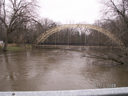
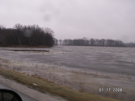
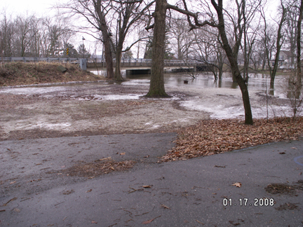
FLOOD PIX'S FROM DUNNS BRIDGE -PORTER/JASPER COUNTIES INDIANA


MARITIME NOTES:

Dar’s Maritime Institute to offer new courses for seamen

By MOHAMED ISSA MOHAMED
Special Correspondent

The Dar es Salaam Maritime Training Institute has introduced new training programmes to allow workers to keep abreast with international trends.

Two new courses were launched ordinary seafarers, officers at ports and onboard ships, cargo clearing and forwarding agents and ship fleet-freight operators.

Until recently, workers at sea and lake transport regimes in the country were employed without necessarily having qualifications.

But the country’s increased trade with advanced shipping nations like China, Netherlands, the United Kingdom, Japan, and the United States has put it under pressure to adopt international acceptable employment guidelines or risk its seamen and port being blacklisted.

According to Dar es Salaam Maritime Institute principal Thomas Mayagilo, the two new courses will add life to the industry.

The logistics and transport international diploma will provide a seamless transport convenience whose holder will professionally be able to arrange for a cargo from a port of loading abroad destined to inland Tanzania,” he said.

He added that the system would help the delivery of cargo without delay and the importer will not be obliged to travel all the way to Dar es Salaam to chase his merchandise.

Seafarers will train on fire fighting techniques, response during life-threatening instances at sea or inland waters, safe cargo deployment on decks or hatches among other skill-instigated job requirements.

Many seafarers get injured or are the cause of fatal ship accidents due to lack of proper training before they are signed in to man the vessels.

Tanzania liberalised the water transport sub sector in 1990s. The country has in its jurisdiction an 800-km shore strip facing the Indian Ocean and several inland water bodies.

The institute is among a few such institutes in sub-Saharan Africa mandated by the International Maritime Organisation to offer marine engineering courses and certificates of competency.

Tanzania had until recently 320 marine engineers, most of them graduates of the institute. About 62 per cent of them work aboard locally registered ships; seven per cent on shore while four per cent on board foreign ships.

Tanzanians risked a forfeiture of 420 international jobs after those who worked with international shipping lines were found to have not undergone courses that conform to the standards of training, certification and watch keeping (STCW).

Tanzania later adopted the STCW signed the International Ship and Port Security (ISPS) Code.

Established in 1991, DMI took over the responsibility of designing the STCW and ISPC oriented training programmes. It trains company security officers, ship security officers and port security officers as a result.

Besides offering advanced diploma courses in marine transportation and engineering, the institute trains deck officers and marine engineers at the operational level and other shipboard personnel at the supporting level.

The basic operational objectives of DMI being however to train seafarers to the requirements of the 1978 international convention on “Standards of Training Certification and Watch keeping for Seafarers as amended in 1995, it trains students up to level of class 3 Certificate of Competency for both engineers and deck officers.

In 1996, the now East African Community designated the Dar es Salaam Maritime Institute as the regional maritime training centre.

The institute, funded by the Tanzanian government, and the Norwegian International Development Agency, admits students from all over including Uganda, Zimbabwe, Zambia, Malawi and Namibia among others.

NATIONAL MARITIME FESTIVAL 2008

Jeanne Walls, 22 Feb. 2008

The annual National Maritime Festival will be held this year at the Newcastle foreshore on SUNDAY 12 OCTOBER 2008. Erica Townsend has been appointed as the new Event Manager. Erica has commenced planning for the Festival and the Grand opening of the Maritime Centre.

The National Maritime Festival celebrates Newcastle’s rich maritime history and is not only the longest running event but one of Australia’s largest maritime festivals.

This year promises to be the best Maritime Festival “Spectacular” to date and will herald The Grand Opening Exhibition of The Maritime Museum at Lee Wharf, Honeysuckle - this $800,000 exhibition is currently in progress with Convergence Design Consultants/Melbourne .

Newly appointed Event Manager for 2008 is Erica Townsend who coincidentally is the daughter of the late Captain Kenneth Hopper OAM. Captain Hopper was Newcastle Harbour Master from 1966 till retirement in 1980. In 1973 Captain Hopper was the founder and first President the Regional Maritime Museum and was responsible for resurrecting The Newcastle Harbour Regatta (now Festival). The ‘Regatta’ was first held in 1984 and was disbanded during World War II.

Erica comes with a heartfelt passion for the Maritime Festival as well as 25 years in Hospitality, Event Management and Tourism. Erica returned to the Hunter in 2000 to open and manage Len Evan’s iconic hotel in the vineyards, The Tower Lodge.

Erica says “this years Festival will be especially significant with the Grand Opening of the Maritime Museum Exhibition which will proclaim the opening of the National Maritime Festival weekend . The fun-for-all harbour celebration will include many of the favorite on-shore and on-water events and activities of past years as well as a few ‘spectacular’ surprises.”

A FREE shuttle service will be running on the day to transfer visitors and spectators from Various points along the foreshore in a continuous loop from 10am till 5pm.

It is expected that this unique and growing event will attract visitors from around the State including the Upper and Lower Hunter, Central Coast, Mid North Coast and Sydney Regions.

For more information and PHOTO opportunities please contact: Event Manager ERICA TOWNSEND 0411 461 075 Event Director JEANNE WALLS 0412275 707


Life and Death on the Bering Sea Deadliest Catch Alaskan Storm for Xbox 360 and PC

SEATTLE (February 26, 2008) - Battle 40-foot waves, storms, ice and a nearly 100-percent crewmember injury rate in the dangerous hunt for undersea riches on the Bering Sea with the new video game Deadliest Catch Alaskan Storm, to be launched on the Xbox 360®video game and entertainment system from Microsoft and PC in April 2008.

The game was inspired by Sig, Edgar and Norman Hansen - three brothers who have made their living crab fishing on the Bering Sea aboard their family's fishing vessel, the Northwestern. The Hansen brothers started game development with Liquid Dragon Studios in October 2005.


Shipping firms neglecting safety as top priority: NMSA


By MADELEINE AREK

SHIPPING companies have in the past, had a tendency of turning a blind eye to the safety of their vessels, putting the lives of the travelling public at risk.

The laxity of PNG’s shipping laws and of enforcing agencies in policing these laws, had allowed companies to operate unseaworthy vessels as well as bringing in very old ships and “treating us as a dumping ground for old vessels” National Maritime Safety Authority general manager Chris Rupen, said yesterday.

According to Mr Rupen, because monitoring agencies were ill-equipped to effectively carry out regular safety inspections, these companies got away with using vessels that were not seaworthy, often putting the lives of the travelling public and of thousands of kina worth of cargo at risk.

While it was not the intention of NMSA to delay the shipping operations of companies, it was important that regular safety checks were done so that the safety of the travelling public was not compromised, Mr Rupen said.

He said his office had the responsibility of policing shipping rules and regulations and that was what they have been doing over the three years since their establishment in 2006.

“Our officers carry out routine checks on all shipping vessels. Sometimes the deficiencies are minor and take a few minutes to rectify. At other times, they take a few hours and we tell the master to rectify the situation. If the deficiency is major, we ground the vessel,” he said.

“We work with these companies and not against them. We do what we do to make them more responsible and often, they are happy with what our officers do and comply.”

He said it was their duty to make sure shipping companies took responsibility of the safety of their ships; that they did not let defects go by.

“We do random inspections on all shipping vessels, foreign and local. On foreign vessels, we carry out port state control inspections while on domestic vessels, our officers’ carry out flag state control inspections. These checks are done to make shipping companies responsible,” he said


RS

Tuesday, February 26, 2008

New Radar Technology Can Increase Tornado Warning Lead Times

Navy's phased array radar being adapted for weather use

A National Weather Radar Testbed has been established at the National Oceanic and Atmospheric Administration's National Severe Storms Laboratory to provide the meteorological research community with the first surveillance phased array radar facility available on a full-time basis.

Norman is already known as a national center for weather radar research and development. NSSL's research in Doppler radar led to one of the most successful and significant technology advancements since the launching of the first weather satellite.

Nearly 30 years ago, NSSL was a major participant in the development of Doppler technology that became the heart of the WSR-88D radar, or NEXRAD.

The deployment of a system of 120 NEXRAD radars across the United States was the cornerstone of the modernization of the National Weather Service.

Installation of the SPY-1A antenna and radome on the NWRT

Navy supply ship showing SPY-1 radar that is currently used to support tactical operations.

Phased array radar is currently used on Navy ships to support tactical operations.

Phased array radar technology may help forecasters of the future provide earlier warnings for tornadoes and other types of severe and hazardous weather. Researchers are adapting the SPY-1 radar technology, developed by Lockheed Martin to support tactical operations aboard Navy ships, to weather detection. The phased array radar project has begun a new stage in NSSL's leadership in the research and development of future generations of weather radar.

Research Partnerships

A unique federal, private, state and academic partnership is developing the phased array radar technology. Participants include NOAA's National Severe Storms Laboratory and National Weather Service Radar Operations Center, Lockheed Martin, U.S. Navy, University of Oklahoma's School of Meteorology and School of Electrical and Computer Engineering, Oklahoma State Regents for Higher Education, the Federal Aviation Administration, and Basic Commerce and Industries. The project - from research and development to technology transfer and deployment throughout the U.S. - is expected to take 10 to 15 years at an initial cost of approximately $25 million for the facility in Norman.

Promising New Radar Technology

Early tests of the phased array radar system show that the technology has the potential to vastly improve upon the capabilities of the national NEXRAD radar network for all weather radar applications. Using multiple beams and frequencies, phased array radar reduces the scan time of weather from five or six minutes for NEXRAD radar to less than one minute, producing fast updates of weather data.

The National Weather Radar Testbed allows NSSL and other meteorologists to determine if phased array radar will become the next significant technology advancement to improve our nation's weather services.

Schematic shows how the radar might scan storms as well as clear air, and also track aircraft and uncooperating targets.

The rapid scanning ability of phased array radar gives it the potential to be a multi-use, adaptively scanning radar.

Improved Warning Lead Time

In addition to faster updates, the new system can scan the atmosphere with more detail at lower elevations than current radar allows. It can also re-scan areas of severe weather very quickly, potentially increasing forecasters' warning lead times as storms rapidly transition to severe modes.

PAYOFF: This technology has the potential to increase the average lead time for tornado warnings well beyond the current average of 11 minutes. Other technology being developed at NSSL will extend lead times even farther.

Improved Understanding and Forecasts

The new technology will gather storm information not currently available, such as rapid changes in wind fields, to provide more thorough understanding of storm evolution. Researchers and forecasters can then improve conceptual storm models and use that knowledge to evaluate and improve stormscale computer models. The data will also be used to initialize computer models and improve forecasts.

PAYOFF: Phased array technology will increase fundamental understanding of storm evolution, in turn leading to improved computer models, more accurate forecasts and earlier warnings.

Reflectivity display from first tornado captured by the NWRTVelocity display from the first tornadic storm captured by the NWRT
Reflectivity and velocity displays of the first tornadic storm captured with the NWRT

NSSL RADAR RESEARCH

WSR-88D Improvements
  • Implementing range and velocity ambiguity mitigation techniques in the WSR-88D radar network will result in an improved ability for the WSR-88D to detect severe weather, flash floods, winter storms, and provide aviation forecasts.
  • An increased ability to identify aviation weather hazards and to track, classify and identify aircraft will improve airline safety and help fill gaps in homeland security.
Phased Array Radar
  • Phased array technology could significantly extend warning lead times, increase accuracy, and reduce the uncertainty of predicting severe weather events.
  • Adapting phased array technology to both weather observation and aircraft surveillance will provide significant cost benefits and a higher level of security to the nation
Real-time Applications
  • Researching and prototyping new severe weather warning applications using WDSS-II multi-sensor technology will help fast-track improvements into operations and provide a robust decision support system for forecasters.
Testbeds
  • The National Weather Radar Testbed at NSSL will shorten the cycle time from weather radar research to National Weather Service operations, leading to increased accuracy and lead-times, and reducing the uncertainty of predicting severe weather events.
  • A cost-effective network of many small radars that can scan lower regions of the atmosphere will provide better weather coverage in high population or weather-sensitive areas.
Mobile Doppler Radars NSSL PODCAST - Radar Research

National Severe Storms Laboratory Chief of Radar Research and Development Doug Forsyth discusses aspects of radar research and what’s in store for the next generation of weather radar. Recorded 8 November 2007

  • Section 1 - Types of radar research done at NSSL (5:43)
  • Section 2 - Transition of research to operations for new radar applications (3:11)
  • Section 3 - Doppler radar and new radar technologies being researched and how they compare (8:39)
  • Section 4 - Advantages of collaborative radar research (3:24)
  • Section 5 - Doug discusses his career and his advice for people considering a career in the atmospheric sciences (6:09)

headphonesLISTEN TO THE COMPLETE PODCAST RUNTIME 27:08 TEXT TRANSCRIPT


BE READY CAMPAIGN

Tennessee Severe Weather Awareness Week: Feb. 24-29

The National Weather Service, the Tennessee Emergency Management Agency and other supporting organizations are working together to help in providing the public with information about severe weather safety. Advance planning and increased awareness will help Tennesseans survive these deadly storms. Governor Phil Bredesen has proclaimed February 24-29, 2008, as "Severe Weather Awareness Week" in Tennessee.As we move into our Spring, now is the time to prepare ourselves for the hazards and dangers associated with severe weather. Severe weather can and does occur any time of the day and anytime during the year. Are you prepared?

Click on the link to download the booklet. Severe Weather Awareness Week Booklet 2008

MS Severe Weather Awareness Week
Sunday, Feb 24, 2008 - 10:30 PM
By AnneMarie Crumby
Governor Haley Barbour declares this week Severe Weather Awareness Week in Mississippi. The National Weather Service will issue a statewide test tornado warning on NOAA Weather Radios Wednesday morning.Schools, government agencies and businesses throughout the state are encouraged to participate in a tornado drill. Everyone is asked to buy a NOAA Weather Radio. It sounds an alarm when local severe weather watches and warnings are issued. These radios range in price from $30 to $70.

Emergency Management Looking for Severe Weather Spotters

Towson, Md. (February 7, 2008) – Local weather buffs have an opportunity to put their interest in meteorology to valuable practical use.

The Baltimore County Office of Homeland Security and Emergency Management is recruiting volunteers to help spot severe weather. The volunteers would be part of SKYWARN, a national network of amateur severe weather spotters, trained by the National Weather Service to spot severe thunderstorms, tornadoes, hail and flooding, snowfall and ice accumulation.

Along with the National Weather Service, the Office of Emergency Management will sponsor a SKYWARN and Spotter Class on Tuesday, March 11, 2008, 7 to 10 p.m., at the Baltimore County Public Safety Building, 700 E. Joppa Rd., Towson. The class will be held in the 6th floor conference room.

The class is free of charge

To register, email tbrush@baltimorecountymd.gov, or call the Office of Homeland Security and Emergency Management at 410-887-5996.

INTERNATIONAL WEATHER
By Arthur Rabjohn CEM

ENGLAND: Council flood funding payments exceed £15million Floods Recovery Minister John Healey today announced over £2.5million funding for six authorities across the country, to help them get back on their feet following last summer's floods. This means that over £15million has now been paid out under the Bellwin scheme, which covers costs incurred by local authorities during immediate action to safeguard residents and property or prevent suffering as a result of a disaster or emergency. This money is on top of up to £63million of other Government support made available to help flood-hit communities. FULL ITEM AT: http://www.communities.gov.uk/news/corporate/703254?version=1

USA: Night of Texas Wild Fires followed by fog chaos. Closure of Houston Hobby Airport led to major disruption as a result of dense fog. Planes were diverted to other airports, mainly DFW, and passengers sat on the tarmac for over two hours in some cases. Following a night of wildfires was there a connection?

NAMIBIA: Emergency Management Gets Blasting Omusati Governor Sackey Kayone has criticised the Regional Emergency Management Unit (REMU) for lack of means to respond to emergency situations. In a speech delivered on his behalf by Outapi Councillor Simon Shileka, he expressed reservations with the way finance is centralized at the expense of regional emergency units. MORE AT: http://allafrica.com/stories/200802251264.html

INDONESIA: A powerful earthquake hit off the coast of Indonesia's Sumatra island. The quake was centered about 160km south-southwest of Padang and had a magnitude of 7.3, and occurred at about 10km beneath the seabed. There are no reports of casualties or damage. A local tsunami watch has been issued and lifted after.

CHINA: China has forecast heavy snow and blizzards across its industrial and agricultural heartland over the next three days. At least 129 people have died. Transport is in chaos and cut off power and water appeared. Severe weather damaged millions of hectares of crops and killed more than 70 million animals. Snow and sleet would hit six provinces spanning China's central, eastern and northern regions. Blizzards were also expected in the northwestern part of central Hubei province, already plagued by winter storms earlier this month.

MADAGASCAR: Nearly 145,000 people have been left homeless by a cyclone that tore through Madagascar, killing 44 people. Cyclone Ivan struck the island's east coast last Sunday, and was followed by torrential rains which caused flooding. Winds gusting at more than 230km/h caused widespread damage. Infectious diseases such as diarrhoea are reported to be on the rise. The cyclone season is not expected to end until April, so the government has warned that further storms could follow.

ECUADOR: Persistent rains and floods have left Ecuador in a state of disaster as concern aver food shortages grows. Rains and swollen rivers have caused flooding in 13 of the country's 24 provinces, destroying homes, crops and infrastructure. At least 300,000 people have been affected, including 20,000 evacuated. 110,000 hectares of crops, including rice, coffee, corn, banana, cacao and sugar cane have been destroyed. A national emergency has been declared. EU MIC is monitoring the situation.

MARITIME NOTES:

Lack of talent blamed for shipping accidents
By Nadim Kawach on Sunday, February 24 , 2008


Shipping accidents have increased sharply worldwide over the past few years because of the introduction of complex systems and a lack of experienced crew abroad vessels, according to a specialised organisation.

The surge in accidents has boosted business at shipping yards and consequently pushed up the cost of vessel repair and maintenance, the Singapore-based DNV company said in a report sent to Emirates Business.


“Updated figures for 2007 show that the losses from navigational accidents within the shipping industry are continuing to increase. This trend was also confirmed by the insurance industry. Premiums may increase by as much as 30 per cent in 2008,” DNV said in the report, presented at a shipping conference yesterday.


“DNV monitors the frequency of serious accidents. Over the past five years, there has been an increasing incidence of serious navigational accidents in several shipping segments. This increase is confirmed by many insurance companies such as Skuld, Norwegian Hull Club and The Swedish Club,” said DNV, which covers a wide range of services including classification, certification, consulting, training, asset operations, verification, laboratory testing and technology qualification.


In addition to the increasing frequency of navigational accidents, the cost of each repair caused is rising.


The yards are overbooked, making it hard to find a repair slot, resulting in increased prices for firms. Collisions, groundings and contacts now account for 60 per cent of the most expensive accidents.


The report quoted Torkel Soma, principal safety consultant at DNV Maritime, as saying: “DNV’s statistics show a ship is twice as likely to be involved in a serious grounding, collision or contact accident today compared to only five years ago. In addition, estimates show the cost of these accidents has doubled. Since this is the general trend for the international commercial fleet, the maritime industry needs to act on this immediately.”


According to the report, the boom in the shipping market and increased deliveries of new ships have resulted in pressure on crews.


It says the shortage of officers has resulted in lower retention and faster promotion, adding that as a result, the general level of experience is decreasing on board. At the same time new technical solutions have also been introduced, which might have increased the complexity of operations.


“Reliable technology and complying manuals are no assurance against making errors. Collisions, groundings and contact accidents do almost always involve human acts,” Soma says.


Helge Kjeøy, regional manager DNV Maritime South East Asia, said: “The main factor explaining the negative developments over the past few years is the undersupply of crew worldwide. This results in reduced experience and the high commercial pressure results in high workload. Adding new and more complex equipment does not only help the situation. Avoiding accidents under such situations requires a good safety culture, something which the maritime industry evidently needs to focus more on.”


The experience of leading shipping companies shows the focus has to be turned more in the direction of human elements and organisational factors, including all those involved – from the directors of the company to the officers on the bridge.


Soma adds: “Safety improvements with reduced accident frequency have been achieved through a structured approach addressing behaviour and culture. For the industry to maintain its traditionally good track record, the resilience of operations has to be addressed on a larger scale.”


THE DNV REPORT

Singapore: Updated figures for 2007 show that the losses from navigational accident within the shipping industry are continuing to increase.


RS

Monday, February 25, 2008

UK RNLI: 7834 People Rescued, but 'too many MOB's

7834 People Rescued, but 'too many MOB's

In 2007, 'one of the busiest years on record', a whopping 7,834 people were rescued by the UK's Royal National Lifeboat Institution (RNLI) lifeboats and over half of lifeboat launches were to leisure craft However, the most worrying news was the increase in Man Overboard rescues

The final RNLI rescue figures for 2007 also show an increase in the number of man overboard incidents for leisure craft – rising from 161 (2006) to 201 (2007), up 25% from 2006. Commenting on the rise in RNLI rescues to man overboard incidents, RNLI Sea Safety Manager, Peter Chennell says: Although only a relatively small percentage of the total reasons for lifeboat call-outs to leisure boaters, it’s worrying to see such a large increase in man overboard incidents.

It is hoped the boating public have started to take on board the RNLI’s lifejacket awareness campaign message, useless unless worn. We’re aiming to encourage more of the boating community to automatically put their lifejackets on when they go to sea and decide when to take them off, because experience tells us that in an emergency there is not always time to make sure your lifejacket is securely and correctly fitted. Wearing a lifejacket is one of the RNLI’s five sea safety tips along with: checking your engine and fuel; telling others where you’re going; carrying some means of calling for help; and keeping an eye on weather and tides.’ Final figures show that the RNLI’s lifeboats were launched 8,141 times during 2007, rescuing 7,834 people. More than half of the 8,141 RNLI lifeboat launches – 4,287 – were to recreational sea users in leisure craft. This figure is down slightly on 2006 rescues (4,361), perhaps due to the unseasonable weather in the early summer months. Of the 4,287 RNLI lifeboat launches to leisure craft in 2007 almost half (43%) were to powered craft2, well over a third (40%) of lifeboat launches were to the aid of sailing craft3 and 17% were to manual leisure craft4.

The major cause for RNLI lifeboat launches to (manual, power and sailing) leisure craft, as in previous years, was overwhelmingly machinery failure (29% of incidents), this is followed by craft being stranded or grounded (13%) and vessels meeting adverse weather conditions (9%) as the three main causes for lifeboat launches to leisure craft in 2007.

The top three reasons for lifeboat launches to each specific type of leisure craft in 2007 were machinery or engine failure for both power and sailing leisure craft, while the impact of adverse weather conditions was the main reason for lifeboat launches to manual leisure craft। Despite fewer visitors to the coast during the early summer months5 due to the unseasonable weather, RNLI lifeboats and lifeguards continued to respond to a high number of calls for help, as more and more people are using the water and beaches for leisure pursuits. RNLI lifeguards, who were operational on 71 beaches in the south west of England and East Anglia, rescued 1,350 people, came to the aid of a further 9,883 people and responded to 8,201 incidents. The wet summer weather also meant that the RNLI’s Flood Rescue Team and volunteer lifeboat crews were particularly active inland, rescuing another 200 people in flood hit areas across the UK during the summer months.

Lunar Eclipse - Gallery Images

Brian A. Morganti posted a couple of gallery images from the total lunar eclipse he observed in southeastern PA this past Wednesday evening, February 20th.

BE READY CAMPAIGN

EMA wants churches to be safe in severe weather

So much severe weather awareness information is geared toward the home. Experts urge families to put together safety plans and stock up on supplies in case the unexpected happens.

But what if you are not in your home when severe weather strikes? What if, like many church congregations in Chilton County this past Sunday, you find yourself in your place of worship?

Chilton County Emergency Management/Homeland Security Director Bill Collum says churches need to make sure they have a way of being alerted when severe weather warnings are given.

"We have a basement in our church," said Collum, who attends Heritage Church of the Nazarene in Clanton. "Our plan is when the warning siren goes off, everyone goes to the basement."

But what if no one hears the outdoor warning system go off? The sirens are intended only to warn those who happen to be outdoors at the time of warning.

Tragically, that was the case on March 24, 1994 when a tornado outbreak resulted in several fatalities at Goshen United Methodist Church in Piedmont.

Collum doesn't want history to repeat itself here in Chilton County. He has already worked with several local churches to develop safety plans including Liberty Hill, Mars Hill and Verbena Baptist Church.

Church safety plans require key people to be trained in helping direct the congregation to safety. This includes assisting the elderly, manning a flashlight and monitoring a weather radio.

A NOAA weather radio would be a wise investment for any church, Collum noted.

"It's the same stuff you would do with a home plan, except you're in a church," he said.

Because many churches already keep a steady supply of food and water on hand, being prepared wouldn't require too many purchases, he added.

Any church is encouraged to contact the Chilton County EMA if they are interested in developing a safety plan for their congregation. The EMA office may be reached at 755-0900.

"We would love to get it in every church," Collum said. "We want to make all churches aware of the need to be prepared."

March 2-8 is severe weather week in Indiana

From Gov. Mitch Daniels’ office:


To focus Hoosiers’ attention on the threats posed by tornadoes and thunderstorms, Governor Mitch Daniels has proclaimed March 2-8, 2008, as Severe Weather Preparedness Week. The National Weather Service will conduct a statewide test of communication systems on Wednesday, March 5 between 1030 AM and 1100 AM EST and between 700 PM and 730 PM EST. Friday March 7 is the make-up drill day if weather postpones Wednesday’s drill.


These tests should be used as times to practice your plan.


The goal of Severe Weather Preparedness Week is to better educate people about the hazards of severe thunderstorms and tornadoes, and to help everyone be prepared should severe weather occur.


The Indiana Department of Homeland Security (IDHS) is offering these tips during times of severe weather.


Tornado Safety Tips

*Basements, inner rooms of a house, and storm cellars provide the best protection.

*Stay away from exterior walls, windows, and doors. Stay in the center of the room.

*If you are in your car do NOT try and outrun the tornado because it can switch direction and can cover lots of ground quickly.

*Get out of vehicle and go into a strong building if possible. If not, lie flat in a ditch or low area and cover your head.

*Do NOT go under overpasses, wind speeds actually increase under them and can suck you out!

*If you live in a mobile home, get out IMMEDIATELY. Take shelter in a building with a strong foundation.

*Listen to radio or watch TV so you can be alerted about your current situation.


Thunderstorm Safety Tips

*If a thunderstorm is coming postpone or cancel outdoor activity.

*Do NOT go near tall trees or any other tall objects.

*Seek shelter inside a building or in a hardtop vehicle, but don’t touch any of the metal inside.

*Do NOT use the telephone. Stay away from other electronic devices, bare metal, and water.

*Do NOT go near downed power lines.

*Keep your eye on the sky as well listen to weather reports on the radio or TV.

*If caught out in the middle of a large body of water, return to shore as soon as possible. Get off the water immediately.

*If caught out in middle of an open field: If walking with others stay a minimum of 10 feet apart; Also, keep low and move quickly to seek shelter. If there is no shelter lay in a ditch or get to the lowest place around.


For more information about preparedness for severe weather and other emergencies, go to Indiana Department of Homeland Security (IDHS).


MICHIGAN SKYWARN TRAINING

Severe weather watchers training Tuesday

Thomas Marcetti, Staff Writer


The National Weather Service is offering its SkyWarn training in Hillsdale Tuesday evening.

Doug Sanford, Hillsdale County Emergency Management director, said the training is normally done every year, but they missed last year because of adverse weather.

“The training is for public safety and amateur radio operators, but is open to the public,” he said. “These are the people who are going to give us advance warnings about serve weather.”

Severe weather spotter training offered in Fishers, Indiana


The National Weather Service will conduct severe weather spotter training from 7 to 9 p.m. March 6 at the Fishers Town Hall auditorium.

The training session, hosted by the Fishers Fire Department, is free and is open to the general public.

A representative from the National Weather Service will describe cloud and wind patterns associated with severe weather, how to interpret weather radar data, and how to remain safe during severe weather.

“This is a great opportunity for anyone with an interest in weather, or who is expected to be able to identify and report severe weather at an official level,” said Ron Lipps, public information officer for the Fishers Fire Department.

Additional information about this and other National Weather Service presentations can be found at www.weather.gov/ind.

Alabama Severe Weather Awareness Week is Next Week

There's kind of a sad irony here, but next week is Severe Weather Awareness Week in the State of Alabama. The week for Tennessee occurs the following week (February 24-29).

The sad irony comes, of course, because of the extraordinary circumstances of the now-infamous "Super Tuesday" tornado outbreak last week. For many of us, the EF-4 tornadoes that devastated parts of Lawrence and Jackson counties served as a terrible wake-up call that such tornadoes can indeed happen here (though we had dodged bullets for so long). Even worse, they occurred in the middle of the night, outside of the traditional spring severe weather "season".

Each day next week will be devoted to a different severe weather topic, whether it's hazards like severe thunderstorms or lightning, or awareness tools such as NOAA All-Hazards Weather Radio. If you don't have one already, this is a good time of year to buy a weather radio in preparation for the spring season--or to check the batteries in your radio in case of a power outage. If you have a new weather radio, be sure to check the NWS Huntsville weather radio page--it has recently been double-checked and expanded with more information, including a helpful programming guide for some common radios.

MARITIME NOTES:

Opening Ceremony of "K" Line Maritime Academy - Philippines

Tokyo, Japan, Feb 22, 2008 - (JCN Newswire) - In May 2006, Kawasaki Kisen Kaisha, Ltd. ("K" Line) introduced "K" Line Maritime Academy (KLMA) for securing and fostering "K" Line Seafarers as the principle and one of the various initiatives in the establishment of a ship management structure geared to sustain safety and quality and to promote the planned expansion of business operations advocated in the company's revised interim management plan "K" LINE Vision 2008+.

"K" Line established "K" Line Maritime Academy (Philippines) as a main focus of this concept at Pasay City in The Philippines, and "Opening Ceremony" was held on 22nd February 2008 at the Academy with Her Excellency President Gloria Macapagal Arroyo and many delegations from The Philippine Government, Seafarers Educational Institution and other related interests in attendance.

The Academy is the key facility of KLMA and each training course will be carried out in accordance "K" Line's fundamental philosophy that fosters the development of "K" Line Seafarers regardless of nationality by using KLMA Basic Training Matrix and Syllabus.

As for navigation officers, the Academy will conduct training for prevention of ship collision and grounding in congested waters and narrow straits, using the new ship handling simulator, and will ensure that trainees thoroughly understand the "do's and don'ts" concerning safety and quality. With an LNG training course in accordance with SIGTTO Standard and using cargo handling simulator of LNG carrier, the Academy will conduct training in order to secure thoroughly safe and efficient cargo works.

As for engineers, the Academy will conduct training for maintenance of piston, cylinder and so on using the actual main engine with two cylinders. By using a learning system incorporating full-mission engine room simulator, the Academy will conduct training in order to acquire basic knowledge of Engine Room Systems and Machineries as well as exercise on trouble shooting of various systems. In addition, the Academy will conduct training using actual vessel equipment and also stress management training, team work training and so on.

In addition to providing the above latest simulator at KLMA (Philippines), we have installed accommodations and dining room for 110 people, and will be able to accept a total of 10,000 trainees per year regardless of nationality.

Furthermore, a clinic furnished with modern equipment has been set up and will manage the health of all seafarers who go onboard "K" Line group vessels.

To supply highly-skilled seafarers, various "K" Line groups are at work and are the main force behind the training center project, aiming to assure maintenance and further improvement of the "K" Line brand of Security, Safety and Trust.

"What if...The Cosco Busan Happened in New York Harbor??"

NEW YORK, February 7, 2008: On February 27th, the North American Maritime Ministry Association (NAMEPA), in conjunction with New York Maritime Inc. (NYMAR), will be presenting a Response Simulation "What if…the Cosco Busan happened in New York Harbor. Will we be prepared??" Developed by the USCG Sector New York, the Simulation will replicate the events of the Cosco Busan incident which occurred last year in San Francisco - but in New York. The various stakeholders including owners, responders, cargo interests, and government agencies will be participating at the event which will be held in midtown at 4:00PM. (Continued)


THE CROSSING - A TRIBUTE TO ALL MARINERS
By Kristi Bitgood Kelty


RS

Friday, February 22, 2008

TRAGEDY SPAWNS HEROES: THE MAKING OF THE COAST GUARD HELICOPTER RESCUE SWIMMER PROGRAM

TRAGEDY SPAWNS HEROES:
THE MAKING OF THE COAST GUARD HELICOPTER RESCUE SWIMMER PROGRAM


By Petty Officer 2nd Class Christopher Evanson Fifth District Public Affairs


5 years ago, a tragic event claimed the lives of 31 Merchant Marines, and the Coast Guard Helicopter Rescue Swimmer Program was conceived to prevent such disasters from ever happening again. The program has been a guardian angel to many fates nearly taken by the sea.


On the morning of Feb. 12, 1983, gale force winds and 40-foot waves wreaked havoc off the coast of the small Eastern Shore community of Chincoteague, Va. Conditions were the perfect recipe for disaster, a recipe that eventually claimed the lives of 31 mariners by day's end. This tragic event proved to be more catastrophic because the Coast Guard was not prepared to respond. The sad conclusion of the S.S. Marine Electric served as a humbling blow to Coast Guard readiness, and the motto of Semper Paratus. The sacrifice of these mariners, however, indirectly saved the lives of thousands of men and women who would confront the mercy of the sea in the years to follow. The doom of the Marine Electric spawned the Coast Guard Helicopter Rescue Swimmer Program, and a new generation of lifesavers at sea.

Tragedy at Sea

The S.S. Marine Electric, a 587-foot motor vessel transporting coal departed Norfolk, Va., for Brayton Point, Mass., on Feb. 10, 1983. Thirty-four merchant mariners were aboard as a winter storm pummeled the lower Chesapeake Bay.If four-foot seas within the bay were harsh, the seas awaiting the Marine Electric in the open ocean were in excess of 40 feet.

On Feb. 12, 1983, at approximately 2:51 a.m., a Coast Guard watch stander in Ocean City, Md., was notified by the master of the Marine Electric, reporting his vessel was taking on water near the front end of the ship. By 3 a.m., the entire crew was mustered on deck near the starboard lifeboats preparing to abandon ship. At a quarter after 4 a.m., as the merchant mariners were preparing the lifeboats, the ship was struck by a powerful jolt, possibly a rogue wave, capsizing the vessel to the starboard side. The Marine Electric crew was thrown into the frigid Mid-Atlantic waters recorded at 37 degrees Fahrenheit approximately 30-miles off the coast of Chincoteague. What was an initial distress call now became a massive search and rescue case, but the following events proved far more difficult than ever imagined.

At the time, Coast Guard flight crews did not have the ability or power to deploy rescue swimmers in the sea to recover victims. As strange as it may seem, a crewmember simply lowered a rescue basket from the helicopter in the vicinity of a distressed person in the water. The rescue relied almost entirely on the victim mustering the strength to get in the basket on his or her own. In cold temperatures where shock and hypothermia were prevalent, this practice proved futile.

When a Coast Guard helicopter crew based at Air Station Elizabeth City, N.C., arrived on-scene shortly after 5 a.m., the water was flush with strobe lights, yet little sign of life existed. Not until 6:05 a.m. was a Navy rescue swimmer able to assist with the recovery. The Navy dispatched a helicopter crew from Naval Air Station Oceana in Virginia Beach, Va., which had rescue swimmers trained for search and rescue. One-by-one with the help of the crew of the 82-foot Coast Guard Cutter Point Highland, the Navy rescue swimmer recovered the bodies of the Marine Electric crew from the surface; nearly three hours after the vessel capsized.

Of the 34-crewmembers aboard the Marine Electric, 27 people were recovered; only three survived. Seven Marine Electric crewmembers were never found, possibly still aboard the ship. The deceased were later pronounced dead by medical examiners who indicated the cause of death to be hypothermia and or drowning. Meanwhile, as the sun rose, the Marine Electric had already begun a slow descent into oblivion, beneath the sea where it lay in perpetuity.

Aftermath

Following this tragedy, the Coast Guard launched one of the biggest Marine Board of Investigations in its history. Making the case more overwhelming were congressional representatives seeking to know how such a disaster could happen, and more importantly how can a similar scenario be averted. After several congressional hearings, the Coast Guard Authorization Act of 1984 was passed to ensure the Coast Guard was properly equipped to respond to such cases. An excerpt of the act reads, "The Commandant of the Coast Guard shall use such sums as are necessary, from amounts appropriated for the operational maintenance of the Coast Guard, to establish a helicopter rescue swimmer program for the purpose of training selected Coast Guard personnel in rescue swimming skills."

Introduction of the Guardian

"The Aviation Survival Technician (AST) rating's job which was created in 1969 has always been to inspect and maintain life support equipment, perform ground handling and servicing of aircraft, and conduct aviation administration duties," said Master Chief Petty Officer Donald Murray, Coast Guard Aviation Survival Technician Rating Force Manager.

The Coast Guard Helicopter Rescue Swimmer Program would become an extension of the AST mission objective, beginning very subtly in the fall of 1984, as a result of the Marine Electric tragedy. The Coast Guard joined forces withthe Navy, which permitted prospective Coast Guard helicopter rescue swimmers to train with fellow Navy swimmers at the U. S. Navy Rescue Swimmer School at Naval Air Station Pensacola, Fla. The rating initially known as Aviation Survivalman or ASM graduated five members in this first class.

After a few years of training with the Navy, it became apparent the Coast Guard needed to make modifications because some of the methods taught at the joint service school were not applicable to the Coast Guard search and rescue mission. These methods included scuba, deploying parachutes, tree extraction, and mountain rescue. The Coast Guard's main emphasis is peacetime rescues, not downed military recovery methods. In addition, the program was not without its challenges. The new feature to Coast Guard aviation generated hesitation and concern from pilots with deploying swimmers in hazardous conditions.

"When the program first became operational, there was considerable reluctance to deploy rescue swimmers except under generally favorable conditions, but it soon became apparent, however, that Coast Guard rescue swimmers would frequently be utilized in extreme weather conditions," said retired Lt. Cmdr. Richard M. Wright, in a 1996 article he authored titled "Coast Guard Rescue Swimmer Program".

Rescue swimmers assigned to Air Station Elizabeth City officially became the first operational unit with helicopter rescue swimmers March 5, 1985, with air stations throughout the country following suit throughout the following years. "The Coast Guard went fully operational with the rescue swimmer program in October of 1991 meaning all Aviation Survivalmen, [first class petty officer] and below stood rescue swimmer duty at every Coast Guard air station across the country," said Murray.

Since its inception, the Coast Guard Helicopter Rescue Swimmer program has enhanced the Coast Guard search and rescue mission. "The addition of a Rescue Swimmer asset to Helicopter search and rescue teams has had significant impact on the mission. Hurricane Katrina is our most recent reminder of the value of this asset," said Senior Chief Petty Officer Lewis Hart, who supervises the Aviation Survival Technician "A" school in Elizabeth City.

In the two-plus decades of the programs existence, several innovations in training have allowed rescue swimmers to adapt to unpredictable situations that they often encounter.

"The Rescue Swimmer Program has evolved in a number of ways but mostly in more advanced gear and training. The development of the Advanced Helicopter Rescue School in Astoria, Ore., helps train AST's in advanced techniquessuch as vertical surface rescue, sea cave rescue, heavy surf rescue, and swift water rescue," said Hart. In addition, innovations in sport science became an objective in training rescue swimmers. "The AST 'A' School has also developed a Train the Trainer 'C' School that teaches advance fitness and exercise physiology for training AST airmen and for operational fitness," added Hart.

It has been 25 years since 31 souls from the Marine Electric perished. Since this tragedy, it can be said that many lives have been indirectly saved. It is sometimes though tragedy that good can be extracted, and the Coast Guard Rescue Swimmer has fostered this. Coast Guard Helicopter Rescue swimmers have saved or assisted countless lives in the most harrowing of circumstances. In Hurricane Katrina, more than three-thousand lives were saved as the search and rescue operation unfolded on live television. In addition to survival skills in extreme elements, rescue swimmers are trained emergency medical technicians employing basic skills to victims while transporting to medical facilities ashore.

Nevertheless, perhaps the most important thing to remember is that rescue swimmers do not operate alone. It takes an entire flight crew to make saving lives a reality. "Rescue swimmers are highly visible in search and rescue cases and subsequently receive a lot of media attention," said Hart. "It would be fair to say that the media reports deemphasize the team concept with regard to the rest of the crew in such cases," he added. With lessons learned, the Coast Guard stands by for the next search and rescue case, always ready.


MARITIME NOTES:

USA. Mad Mariner introduces video Docking Game

Thursday, 21 February 2008

Mad Mariner, a leading online resource for independent reviews and in depth articles on boating, has announced the official release of The Docking Game, an Internet-based video game that allows boaters to practice and test their skills in a variety of marinas and conditions.

Chicago Maritime Festival - February 23


Coast Guard releases report on Marine Safety program

(WASHINGTON) -- The U.S. Coast Guard has released an independent study on its Marine Safety program. The report highlights the need to boost the status of Marine Safety within the Coast Guard organization. It also suggests that relations with the maritime community need to be improved. Click here to view the document.

Vessel pushed aground by ice, Azov sea - 2/15/2008 02:00
February 15, 03.15 LT –
m/v Nikolay Sutyrin was pushed aground by ice twitch in Taganrog entrance buoy area, when proceeding in ice-convoy with i/b Kapitan Demidov, in southern direction, Azov sea. Vessel got a hole in cofferdam area, hole fixed by crew. Icebreaker Kapitan Demidov returned to m/v Nikolay Sutyrin, to assist refloating. After refloating, vessel will be towed to port for repairs. M/V Nikolay Sutyrin - IMO7119460, dwt 3355 t, built 1971, river-sea type, owner Samarskaya Shipping Co., enroute Azov-Gerasun (Turkey), cargo 3225 mt coal, crew 11, flag Russia.

Messing About In Ships Podcast Episode #11
February 22, 2008, 5:43 am
Filed under: podcast, shownotes


Have a great weekend!

RS

Thursday, February 21, 2008

A wind and wave atlas for the Mediterranean Sea

Well one of my favorite subjects, that has a major impact on the maritime community, rogue waves. Here is a interesting report on wind speed and wave height measurements provided by ERS-1.

Luigi Cavaleri

ISMAR, S.Polo 1364 , 30125 Venezia, Italy

Abstract

Long term climatological data over the sea are much in demand for a number of reasons, ranging from pure scientific knowledge to the more important applications of, e.g., safety at sea and the design of sea structures. Till 15 years ago the only practical sources of the long term data required for a meaningful statistics was the collection of visual observations done from ships at sea. Starting from 1991 two new sources of data started to be available. The launch of ERS-1, and soon after of Topex-Poseidon, offered an unprecedented continuous flow of wind speed and wave height measurements. At the same time the improvements in computer power and numerical modelling led to a continuous synoptic description, typically at 6-hour interval, of the distribution of wind and wave characteristics at sea.

These two sources offered a wealth of data and today quite reliable statistics exist in the open oceans. However, the situation is less favourable in the inner seas. Here the global meteorological models exhibit a steady underestimate of the wind speeds, that in turn leads to an underestimate of the associated modelled wave heights. On the other hand the strong spatial gradients that characterise the basins with a complicated geometry, as in our case the Mediterranean Sea, imply that the spatial resolution of the altimeter ground tracks is not sufficient to provide the necessary details.

The solution lies in the complementary use of both the altimeter and the modelled data. The latter ones provide the background information, very dense in time and space, that is then calibrated using the information derived from the altimeters. This is done determining for each grid point, at 0.5 degree intervals, the series of co-located values, model and altimeter, for both wind speed and wave height. Provided the necessary reliability checks are satisfied, for each point and each parameter the best-fit slopes of the co-located data provide the correction coefficients of the model data. After some spatial averaging to avoid unrealistic local variability, long term time series of calibrated wind and wave fields have been obtained. These have been used to derive multiple long term statistics, both at synoptic and point levels. All these results have been made available in the MEDATLAS atlas of the Mediterranean Sea, available in both paper (A3) and interactive CD formats.

The results have also allowed a check of the correctness of the wind speed and wave height altimeter measurements. The direct relationship existing between these two quantities implies a consistency between their statistics. This is obviously present in the original data that are model derived, and it should be expected also in the calibrated data. On the contrary we have found that the calibrated wind speed values are lower than expected from the calibrated wave heights. As the latter ones have also been verified versus accurate buoy data, we suggest that the algorithm used to derive the altimeter wind speed provides values lower than the actual truth. ( Full paper ) pdf format.

Severe Weather Awareness Week

Tornado drill alert, Severe Weather Awareness Week

The week of Feb. 24 through Mar. 1 has been designated as “Severe Weather Awareness Week” in the state of Texas. During this week, all National Weather Service offices serving the Lone Star State will be actively involved in promoting severe weather awareness.

In addition, the NWS office in Houston/Galveston will be participating in a region-wide tornado drill for southeast Texas. At approximately 10 a.m. on Wednesday, Feb. 27, the Houston/Galveston NWS office will issue a mock tornado warning for all 23 counties in southeast Texas. The warning will be issued through broadcast on the NOAA All Hazards Weather Radio. This will give government agencies, businesses, schools and other interested parties an opportunity to practice their emergency operation plans for tornados.

If you have any questions regarding “Severe Weather Awareness Week” or the mock tornado drill, contact Gene Hafele via email at gene.hafele@noaa.gov or call 281-337-5074, ext. 223.

Arkansas Severe Weather Awareness Week Feb. 25-29th

Arkansas Governor Mike Beebe has joined the National Weather Service and the Arkansas Department of Emergency Management to urge the citizens of Arkansas to prepare for the severe weather season.

The Governor has proclaimed February 25-29, 2008 as "Severe Weather Awareness Week" in Arkansas.

Governor Beebe is encouraging citizens to use the week to review severe weather safety rules and to understand the hazards associated with severe thunderstorms.

INTERNATIONAL WEATHER BRIEFS
Arthur Rabjohn CEM


INDONESIA:
A powerful earthquake of 7.6 magnitude, 30km deep struck off the coast of Sumatra, Indonesia, prompting tsunami warnings. There are reports of at least 3 deaths. The tremor was centred about 319km west-southwest of Medan, Sumatra. The earthquake could generate a tsunami.

PHILIPPINES: Flash floods have killed at least 10 people in the central Philippines and forced tens of thousands to evacuate. Three people were injured. Nearly 140,000 people have been affected as collapsed bridges, landslides and floodwaters isolated Eastern Samar province.

PHILIPPINES: An earthquake measuring 5.6 on the Richter scale occurred west of the Philippine Batan Islands Wednesday. The earthquake hit at 0:59 a.m. Wednesday (1659 Tuesday GMT), with the epicentre initially determined to be 20.3 degrees north latitude and 121.1 degrees east longitude, about 270 km south southeast of Kaohsiung, a major town in the south of the China's Taiwan. There were no immediate reports of casualties or damages.

BOLIVIA: More than 58,000 families are affected by flooding. Hundreds are suffering from waterborne diseases and acute diarrhoea. Around 52 people have died, eight are missing and more than 616,000 hectares of crops destroyed as rivers burst their banks. The region most affected is Beni, but water levels are starting to drop in the city of Trinidad.

MOZAMBIQUE: Tropical Cyclone Ivan has weakened after killing 11 people in Madagascar, but could still cause torrential rains in Mozambique and flood many rivers in Madagascar. Cyclone Ivan was expected to lash Mozambique with heavy rains when it reached land on Tuesday as it was moving at a speed of 190 km/h.

MARITIME NOTES:

Chicago Maritime Festival - February 23


February 23 the Chicago Maritime Society will host the 6th annual Chicago Maritime Festival. Since the first festival in 2003, Torresen Marine has been a proud sponsor, providing support services to the event.

If you are in the Chicago area, please consider attending this event and learning more about our maritime heritage.

10:00 AM - 4:30 PM:
Seminars, workshops, exhibits, etc.
Common Times, in cooperation with the Chicago History Museum and The Chicago Maritime Society presents an international gathering to celebrate Chicago’s diverse marine community and maritime heritage. Daytime activities include seminars, workshops, lectures, films, and exhibits on a broad range of topics such as underwater archeology, the Eastland, the Endurance, lighthouses, ballads, shanties, life at sea, model shipbuilding, environmental issues, boating safety, weather, shipwrecks, diving, art, canoes, voyaging, and tall ships. There will also be some activities for children. Admission: $10.00 Adults, children 12 and under free.

7:00 -10:30 PM:
Maritime Music Concert

An international concert will feature critically acclaimed performers from around the country and across the sea including Dick Holdstock and Allan MacLeod (England, Scotland), Northern Neck Chantey Singers (Virginia), Debra Cowen (Massachusetts), Walter Askew (California), Tom and Chris Kastle (Chicago) and others. Admission: $20.00.

Concert and daytime activities: $25.00. ($20.00 by February 15, 2007). 10% discount for CHM or CMS members. For more information or to purchase tickets visit www.chicagomaritimefestival.org or call 773-774-7216.


RS