Showing posts with label winter weather. Show all posts

Monday, January 19, 2009

New Power Line De-icing System Developed

New Power Line De-icing System Developed

(From Storm Reports. Org )

ScienceDaily (Jan. 13, 2009) — Dartmouth engineering professor and entrepreneur Victor Petrenko—along with his colleagues at Dartmouth and at Ice Engineering LLC in Lebanon, N.H.—have invented a way to cheaply and effectively keep ice off power lines.

The new proprietary technology is called a variable resistance cable (VRC) de-icing system. With only minor cable modifications plus some off-the-shelf electronics, the system switches the electrical resistance of a standard power line from low to high. The high resistance automatically creates heat to melt ice build-up or keep it from forming in the first place.

"The beauty of the VRC system is that it's fully customizable and is an affordable addition to the current manufacturing and installation process," said Gabriel Martinez, Ice Engineering's Vice President who studied under Professor Petrenko while earning his M.S. in engineering sciences from Dartmouth. "And it works without causing any service interruption whatsoever," he added.

"The technology builds on many years of research in materials science, power electronics, and ice physics with my colleagues at Dartmouth such as Professor Charles Sullivan, an expert in power electronics and a co-inventor of the VRC de-icer," said Petrenko who is founder, Chief Technology Officer and Chairman of the Board of Ice Engineering.

Ice Engineering plans to install and test a full-scale VRC system prototype on a section of power line in Orenburg, Russia, in late January 2009. The company is also currently negotiating full-scale installations of VRC in other regions of Russia and in China.

Martinez says the changes in manufacturing and installation required to implement the VRC system would result in a less than 10 percent increase in overall cost. Since utility companies normally replace 3 percent of their cables every year, the system could be installed as part of the regularly scheduled maintenance process and still achieve a significant portion of the installation by the time the next major storm hits.

Furthermore, the life span of the de-icing system would match or exceed the life-span of the utility cable, approximately 30–50 years. The system would pay for itself during the next storm by practically eliminating the cost of fixing downed cables and power outages due to ice and snow, according to Martinez.

Another benefit to the VRC system is that utility companies using the system would have full control over its functionality, says Martinez. Time, temperature, and location can all be adjusted manually or set and controlled automatically with electronic sensors.

Ice Engineering in Lebanon, N.H. develops and licenses technology and applications that enable products that interact with ice and snow to perform significantly better than ever before. Dartmouth engineering professor Victor Petrenko is the primary inventor of the technology. Ice Engineering was founded by Petrenko as a Delaware LLC in April of 2001 to commercialize the technology in specific industries.

Weather Note

NOAA Twin Otter Aircraft to Support West Coast Ocean Research, Management

Highly capable plane will be based in Monterey, Calif.
January 12, 2009


Senior federal officials today dedicated a specially equipped twin-engine NOAA aircraft that will support ocean research and management along the West Coast. The NOAA Office of Marine and Aviation Operations is basing the plane and flight crew in Monterey, Calif., to meet the needs of NOAA programs and national marine sanctuaries.

NOAA will use the DHC-6 Twin Otter aircraft to observe marine mammals and other living ocean resources, conduct offshore and coastal surveys, and support emergency response and enforcement missions.

“The highly modified aircraft is well-suited for offshore and coastal surveys and marine resource management,” said John H. Dunnigan, NOAA assistant administrator for the National Ocean Service. “We are pleased that this valuable asset will serve the West Coast.”

Built by de Havilland Canada, the Twin Otter is a maneuverable, versatile aircraft that can be flown at slow speeds and in tight circles. The NOAA version of this high-winged turboprop plane is equipped with color weather radar, dual GPS/Loran-C navigation systems, radar altimeter, and camera ports in the nose and belly areas. A standard flight crew consists of two pilots and up to six scientists.

By basing the aircraft in Monterey, NOAA will have the ability to quickly monitor and protect the waters off the West Coast and Alaska, including five national marine sanctuaries that encompass more than 9,000 square nautical miles of open ocean and remote, rugged coastlines from Washington to the Mexico border. They include Olympic Coast National Marine Sanctuary in Washington, Cordell Bank and Gulf of the Farallones national marine sanctuaries off San Francisco, Monterey Bay National Marine Sanctuary, and Channel Islands National Marine Sanctuary off Santa Barbara.

As part of the NOAA fleet of research and survey ships and aircraft, the NOAA Twin Otter will be operated, managed and maintained by NOAA Corps officers and civilians with the NOAA Aircraft Operations Center. Specific research instrumentation or remote sensing technologies will be supplied by program scientists.NOAA understands and predicts changes in the Earth's environment, from the depths of the ocean to the surface of the sun, and conserves and manages our coastal and marine resources.

Top International Weather Events: 2008

Guest contributor Robert Henson recently ran down his selection of highest impact U.S. weather events of 2008 (1-5, 6-10), while CWG's Ann Posegate reviewed her choice of last year's top D.C. area weather stories.

Weather, of course, knows no boundaries. Year in and year out, extreme weather from around the world offers a treasure trove of fascinating phenomena, many of which have sobering consequences for those in harm's way. International weather can also have significant impacts in the U.S.

Keep reading for my selection of the top 2008 international weather events...

For example, floods and droughts in agricultural centers around the globe can lead to food shortages and price increases in supermarkets here; tropical storms that devastate foreign lands can mean massive U.S. financial aid, ultimately affecting your taxes; and ocean storms can disrupt shipping of imports and exports (and provide great waves for surfing in California and Hawaii!).

I don't ascribe significance to the ordering, since generally I find it too difficult to judge the importance of any single event -- both weather conditions and impacts on human activities, life and property must go into such judgements. Note, too, that I'm avoiding (for now) the question that some might ask about possible links between extreme weather events and climate change.
Cyclone Nargis, a monstrous Category 4 hurricane that developed over the North Indian Ocean, struck Burma (also known as Myanmar) on May 2.

It was not only 2008's most deadly tropical cyclone (estimated 150,000 people killed), but also believed to be second only to Typhoon Nina (1975) as the deadliest named storm on record. See these posts on Nargis from the Capital Weather Gang: Inside the Burma Cyclone and Bangladesh's Example for a Post-Nargis World.

On March 1-2 heavy rains accompanied by hurricane force winds (up to an estimated 125 mph) ripped across central Europe. Thirteen people were killed along the storm's trail of destruction (tens of millions of dollars), which included cars blown off roads, roofs ripped off houses, thousands of felled trees, and bridges collapsed into flooded rivers. It was this storm that led to the near crash (and remarkable, must-see video) of a Lufthansa Airbus A320 as it attempted to land at Hamburg International Airport during high winds.

Flooding of the Kosi River, between Nepal and India, on Sept. 2, 2008 (top), and pre-flood conditions in June (bottom). Courtesy NOAA. Click here to enlarge image.

The 2008 Southeast Asian Monsoon season started earlier than it has in more than a century, and was among the deadliest and most destructive seasons on record. Massive flooding from torrential monsoon rains between June and September resulted in 2,600 deaths and displaced millions of people from inundated villages throughout southern Asia, including India, Bangladesh, Pakistan, Nepal and Vietnam.

Tropical Cyclone Ivan, a borderline Category 4 hurricane, slammed into Madagascar on Feb. 17. Ivan has been described as one of the strongest ever to hit the island nation off the southeastern coast of Africa. It was blamed for at least 22 deaths.

Between Jan. 25 and Feb. 26, a series of winter storms walloped large portions of southern and central China with heavy snow, icing and extreme cold. The winter weather -- China's worst in half a century -- is blamed for 129 deaths and caused massive disruptions in power and transportation, just as millions of Chinese were traveling through the country in celebration of the Chinese New Year.

In South America, a large part of Argentina, Uruguay and Paraguay experienced a prolonged and intense drought during most of 2008, which caused severe damage to agriculture. Heavy rainfall in November caused severe flooding and deadly mudslides in southern Brazil. In what is considered the country's worst weather disaster ever, dozens were left dead and millions isolated in cities behind overflowing rivers.

Widespread heavy rains with severe thunderstorms, damaging winds, hail, and flash floods occurred across much of Australia in November. These events largely ended a long-term drought characterized by severe water shortages and extensive crop failures.Though I've not found it on any list of top weather events of 2008, my sentimental favorite goes to the remarkable and unusual hail (or was it snow?) storm in the vicinity of Exeter in southwest England.

MARITIME NOTE

Scientists Launch First-Ever Exploration of Antarctica's Deep-Sea Vents

Also see Stunning Photos of Antarctica

COMMUNITY NEWS British Antarctic Survey scientists and colleagues from the National Oceanography Centre, Southampton, the Zoological Society of London and Woods Hole Oceanographic Institution in the USA are set to be the first to investigate in detail the creatures living around hot water vents surrounding the coldest continent, Antarctica.

The team is onboard the BAS research ship the RRS James Clark Ross on a voyage to locate and explore life around two poorly understood deep-sea habitats — hydrothermal vents and cold seeps. The five-week NERC-funded project called ChESSO, or Chemosynthetic EcoSystems in the Southern Ocean, is part of a ten-year scientific initiative known as the Census of Marine Life.
The research cruise begins on 14 January and finishes on 18 February.
They will be reporting regularly on classroomatsea.net

American Meteorological Society Recognizes Navy ContributionStory

PHOENIX, Ariz. (NNS) -- The commander of the Naval Meteorology and Oceanography Command (NMOC), was named one of 28 new Fellows of the American Meteorological Society (AMS), the nation's leading professional society for scientists in the atmospheric and related sciences, at the AMS Annual meeting in Phoenix Jan. 12.Rear Adm. David W. Titley, along with other awardees, will be recognized at a banquet Jan. 14. The Fellow is given to an individual for recognition of outstanding contributions to the atmospheric or related oceanic or hydrologic sciences, or their applications, during a substantial period of years.

Only two-tenths of one percent of AMS membership is approved as Fellow each year. "I am humbled to be named an AMS Fellow. As a professional meteorologist, this is a significant honor for me," Titley said. Titley earned a doctorate in meteorology at the Naval Postgraduate School in Monterey, Calif., on tropical cyclone intensification.A native of Schenectady, N.Y., Titley was commissioned through the Naval Reserve Officers Training Commissioning program, after graduating from Pennsylvania State University. He earned a master's in meteorology and oceanography at the Naval Postgraduate School.

He attended the Massachusetts Institute of Technology Seminar XXI on Foreign Politics, International Relations and National Interest from September 2003 to June 2004.Titley's awards include the Legion of Merit, Meritorious Service Medal, Navy Commendation Medal, Navy Achievement Medal, and various unit and service awards. All awards were presented by the U.S. Navy and awarded throughout his 28-year career.NMOC, based at Stennis Space Center, Miss., is a Navy operational command with about 3,500 military and civilian personnel worldwide. The command provides weather and ocean forecasts and geospatial information and services for Navy operations.

Founded in 1919, the AMS has a membership of more than 12,000 professionals, professors, students, and weather enthusiasts. AMS publishes nine atmospheric and related oceanic and hydrologic journals, sponsors multiple conferences annually, and directs numerous education and outreach programs and services. For more news from Naval Meteorology and Oceanography Command, visit www.navy.mil/local/cnmoc/.


Container Vessel Crashes Into Barrier Reef

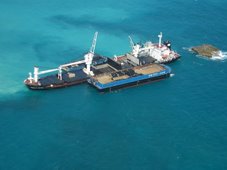
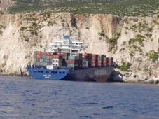
A cargo ship is tonight lodged on Belize’s barrier reef system. It is the Westerhaven – a Netherlands registered vessel that left Belize last night enroute to Santo Tomas in Guatemala. It should have been there by now but while leaving Belize it ran into bad weather and ran aground. 7NEWS travelled 32 miles from the city to the accident site and tonight we’ll show you the ship and underwater footage of the damage it did as it tore through Belize’s reef.

Keith Swift Reporting, We found the Westerhaven cargo ship where it has been since last night – stuck on the reef 32 miles from Belize City in an area near Caye Glory. It ran aground on the reef while sailing out of Belize enroute to Guatemala. This afternoon we met the coast guard on site with an assessment team.

Direl Garrido, Coast Guard“We were called out to assist the DOE and an assessment team to come and check the vessel that grounded here.”

Keith Swift,Have you been on the boat?

Direl Garrido,“No, no.”

Keith Swift,Have you spoken to anyone who has been on the boat?

Direl Garrido,“No sir, nothing. All the information we get from our headquarters.”

Keith Swift,So it is lodged on the reef?

Direl Garrido,“It is aground on the reef, yes.”

Keith Swift,Do you know what efforts are being made to move it?

Direl Garrido,“Right now the assessment team is just conducting an assessment and then based on the result then they will make a decision.”

As the footage shows- it is a large vessel – estimated to be about 100 meters long. A massive ship and it did extensive damage. Marine scientist Melanie McField accompanied us on the boat to the accident site and she says a large area of pristine reef has been destroyed. This is underwater footage she shot with her camera. She says it is the worst reef accident she has ever seen.

Melanie McField, Marine Scientist“This is by far the worst I have ever seen. I’ve never seen anything like this. It is unbelievable. I even saw blast fishing in Indonesia and this looks much worse because it is the whole area.

The reef has been completely levelled, basically from the stern to after the boat. It seems as if the boat just came in on top of, you know the reef has these spurs, it is like hills of corals, valleys of sand, and all the hills of corals have just been scraped clean, levelled. I have never seen anything like it; usually damage is a little bit spotty. And down there near the front of the boat there are areas where big coral heads are knocked over but here in the middle, the whole think is flattened, actually levelled like a parking lot.”

Keith Swift,And what is the size of the area we’re talking about?

Melanie McField,“Well it is basically it is the length of the boat, maybe a little bit less. The two ends aren’t quite as bad. The length of the boat and then out to at least this point where we are here so that’s bigger than a football field.”And as bad as it is – McField the damage has been done and it should be easily moved.

Melanie McField,“There are a few places where it actually pushed into the reef, the spurs as you get towards the reef crest there are a little bit lower but the boat is just pushed on to about two of them so I don’t think they are going to have a lot of trouble getting it off because as you pull it out there is nothing to block the path, all the coral is gone so it should be fairly easy to take it off. It is in a weird position because it is sideways to the current but I don’t think it will be too bad. All of this is levelled so they are not going to hurt much if they pull it off this way.”

Keith Swift,How far is this from the channel?

Melanie McField,“Well they came out the English Caye channel. I don’t know what the legal distance is offshore that they are supposed to travel but they shouldn’t have been travelling anywhere close to the reef crest, especially at night and they should have known where that was with their GPS equipment.”

The ship’s owner – who we are told is on his way to Belize – will be more than likely be fined but McField says no dollar amount can measure the damage.

Melanie McField,“Each square meter of reef is worth something like US$2,000. I haven’t calculated yet but we’ll get out the numbers and it is a lot of square meters that is damaged here and so there should be a considerable fine.”

Keith Swift,What will be the effect on the wider reef system?

Melanie McField,“Well the rest of the reef system, there is some sedimentation coming off of the pulverized reef but that’s pretty negligible. The main thing is that we’ve lost some important habitat. This is really healthy reef. We don’t have a lot of healthy reef, the eco-system report card that we came out with earlier this year was pretty bleak; most of our reef is in poor condition. But this particular chunk of reef is pretty healthy.

This is not the first time it has happened. There was the grounding of a cargo ship back in late November and I think we really need to be tough on our regulations and with Coast Guard, Port Authority, Fisheries, and DOE and get everyone to really come down on these ships. I don’t understand why this is happening.”

The assessment team was still onboard the ship when we left. The ship’s agent in Belize is Eurocaribe Shipping. As we mentioned it was bound for Guatemala and had stopped in Belize for only 4 hours to drop off a few containers. It is registered in the Netherlands and the captain was Fritz Schroeder. It is of note that this is only Schroeder’s 3rd trip as the captain of the Westerhaven to Belize. The owner is on his way to Belize. Tomorrow he is expected to hire a salvage company to tow the ship off the reef.

On a final note – if we use Melanie McField’s math – the ship damaged 10,000 meters of reef which would amount to US$20 million. McField is a marine research scientist with 18 years experience.

RS

Friday, January 16, 2009

UPDATE -Dangerous Wind Chills Through Friday Morning

Dangerous Wind Chills Through Friday Morning

NWS CHICAGO (KLOT)

A wind chill warning remains in effect for all of northern Illinois and northwest Indiana through Friday morning for very dangerous wind chills of 25 below to 40 below.

Some improvement is expected by Friday afternoon as air temperatures warm above zero. Please refer to the following for the latest information on the wind chill warning.

FORECAST AND WARNING INFORMATION -----------------------

Wind Chill Warning information
NWS Chicago Winter Weather Page

CURRENT CONDITIONS ---------------------------------------------------

Illinois Current Wind Chill Values, Temperatures, and Wind Speeds
Indiana Current Wind Chill Values, Temperatures, and Wind Speeds

REFERENCES ---------------------------------------------------------------

Winter Weather Definitions:

Wind Chill Warning - Extreme wind chills of -30oF or colder.A Wind Chill Warning is issued when the wind chill will be less than or equal to -30oF AND winds greater than or equal to 10 mph.

Wind Chill Advisory - Dangerous wind chills of -20oF to -30oF.A Wind Chill Advisory will be issued when the wind chill is less than or equal to -20oF AND the winds are greater than or equal to 10 mph.

Wind Chill Temperature Chart Click here for a Wind Chill Calculator

Additional References
COLD WEATHER ISSUES
COLD WEATHER SURVIVAL
Extreme Cold: A Prevention Guide to Promote Your Personal Health and Safety
Cold Weather Survival Guide - History.com
Key to battling cold: Dress warmly, experts say
Preparation key, say residents of chilliest cities


City Of Chicago
City of Chicago Warming and Cooling Centers
Where to Go for Safety in Extreme Heat or Cold


During extreme cold or hot weather, the City of Chicago offers these six warming and cooling centers. Call 311 to learn more or to schedule free transportation to the centers.

Need Transportation? CALL 3-1-1!

North Area Center
4740 North Sheridan Rd.
Chicago, IL 60640
312-744-2580

Trina Davila Center
4345-47 West Armitage Ave.
Chicago, IL 60639
312-744-2014

Garfield Center
10 S. Kedzie Ave.
Chicago, IL 60612
312-746-5400

King Center
4314 South Cottage Grove Ave.
Chicago, IL 60653
312-747-2300

Englewood Center
845 W. 69th St.
Chicago, IL 60621
312-747-0200

South Chicago Center
8759 S. Commercial Ave.
Chicago, IL 60617
312-747-0331

Keep posted to the NWS CHICAGO (KLOT) website for updates on this very dangerous weather condition.

RS

Monday, November 17, 2008

Can Pollution Cause Tornadoes?

Can Pollution Cuase Tornadoes?

Dust particles pumped out by industry, agriculture and transport could be the catalyst that makes a nasty thunderstorm switch into a spawning ground for tornadoes.


Researchers from Colorado State University who have been seeking a greater understanding of the twisters that plague the American Midwest each year believe that particulate matter could be partly to blame for the devastating problem.

Their research was based on computer modelling rather than field observations and sampling and could shed some light on the mystery of why some so-called supercell thunderstorms blow themselves out while others crank up the extreme weather a notch and generate twisters which rip through the landscape.

The team compared two computer models - one with clear air and the other with a high level of fine particulate matter.

In the clear-air model, tornadoes never quite formed, while in the pollution-heavy model, they did with some frequency.

David Lerach, leader of the research team, admits it is still unclear as to why exactly this might be but says it could be that the dust prevents water in the atmosphere from condensing into big enough droplets to fall as rain, thus stopping the storm from breaking.

Instead of falling as rain, he believes that warm air carries the tiny water droplets high into the cloud where they freeze and this process effectively leaves the way clear below for the rotating air currents that are the precursor to tornadoes.

WEATHER NOTE
TORNADOES.....TORNADOES......TORNADOES..........

Super cell on brink of tornado

A STORM chaser says a 130km/h 'super cell' that hit the northern Gold Coast and Hinterland yesterday almost turned into a tornado.

Houses and cars were severely damaged in the small rural community of Wonglepong and roofs were damaged when trees landed on cars at Mount Tamborine, Canungra and in the Ormeau and Wongawallan areas.

The Scenic Rim SES unit received more than 20 calls for jobs mainly relating to roof damage as storms moved through from the southwest about 4pm.

At one stage police told motorists to avoid travelling to Mount Tamborine due to severe storm damage and road closures throughout the area.

Powerlines were brought down on Main Western Road, Hartley Road and Lahey Road, blocking access for several hours.

A large tree fell on to the northbound lane of the M1 at Robina about 6.30pm.

A severe weather expert said the super cell had produced winds of at least 130 km/h.

Gold Coast member of the Australian Severe Weather Association Jeff Higgins, who chases storms on a regular basis, said the cell was close to becoming a tornado.

"Conditions were ripe for the formation of a tornado and this particular cell went close to producing one," he said.

"Even though a tornado didn't form, it had the same strength of being a tornado."

He said at 3pm he recorded 161 lightning strikes per minute and 70ml of rain in just 10 minutes.

"That storm was life-threatening due to the trees going down and powerlines," said Mr Higgins, who predicted similar storms on Wednesday and Thursday this week.

Scenic Rim SES local controller Brendan Guy said the Mount Tamborine area was hit hardest by the storm.

"Most of the jobs were on the mountain, they were for trees falling on roofs and skylights being damaged," he said. "There are a lot of trees down, powerlines down, it's a big mess.

"Two homes in Wongle-pong lost their roofs.

"They were on the same property.

"The family were able to go to a third house on the property for shelter for the night."

The Vonda Youngman Community Centre on Mount Tamborine was damaged when a tree fell on its roof.

Mount Tamborine resident Chris Watts reported hail the size of golf balls.

"It was pretty full on, and the wind was pretty wild," he said.

SES volunteers were expected to work through to midnight, clearing roads blocked by trees felled by the storm and repairing roofs.

Wonglepong resident Peter Brown watched as trees were blown down in his property, one narrowly missing his house before it demolished his fence and brought down powerlines.

"It sounded like a bomb going off. We thought it was lightning," he said.

"Hail was hitting the windows, I thought they were going to crack.

"We've had storms but nothing like this. It's never been this scary before."

For all the storm's fury, Mr Brown said it was over in 15 minutes, but the power was out for four hours.

Next door, Colleen Brown had the fright of her life when a large branch speared through the side of her house.

"I've never seen anything like it. We were lucky I suppose," she said.

North Carolina storm kills 2, destroys homes

KENLY, N.C. --As a tornado ripped through his North Carolina neighborhood, Curt Jernigan huddled in his bathroom, praying for the raging winds to spare him.

When Jernigan emerged from the home, he met a neighbor, his face covered in blood, who pleaded with him to help search for his wife. She had gone missing in the confusion of the storm. The 41-year-old Jernigan agreed to help out, but said he knew the effort to find the woman alive would be fruitless.

"When I saw what he had in his yard, I knew it wasn't going to be a rescue -- it was a recovery. It's just devastation," Jernigan said.

His grim thought proved correct. State police said his neighbor, Maryland Gomez, who was in her 60s, was one of two people killed by tornadoes and severe weather that swept across central North Carolina early Saturday.

Gomez's body was found amid the rubble that was once her home in Kenly, a community about 35 miles southeast of Raleigh, said state police spokeswoman Patty McQuillan. In neighboring Wilson County, authorities said a child also was killed. Several people were injured in the cluster of strong storms that hit some six counties.

The only thing left standing of Gomez's home was her front porch, one of at least a half-dozen houses destroyed by the storms that also knocked down trees and power lines. Residents emerged at daybreak to find their homes in ruins, cars flipped over and debris strewn about.

"It was pretty massive destruction," Johnston County emergency management coordinator Derrick Duggins said. "It goes to show the magnitude of what natural weather can do.

In Kenly, family and friends piled up mattresses, took pictures of the damage and filled garbage bags with trash from Mark Stephenson's one-story brick home, leveled by the storm.

Winds tossed family portraits into the woods some 200 yards away and the skeleton of a new camper the Stephensons had just bought sat nearby.

One half of Stephenson's home was flattened, while a tree had fallen through the other half, on top of his 19-year-old daughter's bedroom. She was taken to a hospital with non-life-threatening injuries.

"It's hard to believe, it's hard to take in," Stephenson said. "We've got our lives and our health, so we're good to go."

His 14-year-old son, Hunter, pointed to what used to be his bedroom -- now just a pile of bricks and beams. The room was being remodeled, so Hunter had been sleeping in the living room.

"I'm lucky," he said. "It's crazy, if I would have been in there, I would have been dead."

U.S. Rep. Bob Etheridge, who represents the area, surveyed the damage Saturday, describing beams in the home where the woman was found as spaghetti-like. Gov. Mike Easley planned to tour the area Sunday or Monday after local officials have assessed the damage.

A Red Cross shelter was opened at a church and National Weather Service officials were sending crews out to survey the damage.

The Huntsville Tornado

On the morning of Wednesday, November 15, 1989, it appeared that a significant severe weather outbreak was likely. The early morning convective outlook called for a moderate risk for severe weather over much of Alabama, Mississippi, southern Tennessee, western Georgia and the Florida Panhandle, warning that there could be significant tornadoes. The NWS Birmingham called the system impressive.

By midmorning, the risk category was upgraded to high. The system was becoming more impressive according to forecasters. All Weather Service offices in Alabama were urged to review staffing levels and bring in additional personnel for the event. Huntsville was short staffed, so an intern was dispatched from Birmingham.

PDS (Particularly Dangerous Situation) tornado watches were issued; the first coming just after noon for Northwest Alabama. At 1:20 p.m., it was noted that storms were intensifying over Northeast Mississippi. At 1:35 p.m., a tornado watch was issued for the rest of Alabama. Lifted indices over Mississippi were as low as -9. Very strong upper level winds associated with a jet max were moving into position over Alabama and Mississippi. Winds were divergent in the upper atmosphere and there was a strong dry punch moving across Mississippi.

At 2 p.m., I sat at my desk at the Sheraton Perimeter Hotel with a late lunch and plotted the latest surface observations. I drew this surface map. The dewpoint at Birmingham was an impressive 68F. As I connected the pressure plots in isobars, I gasped at the sight of a strong mesolow over Northeast Mississippi.

This meant trouble. That low would provide the backing winds at the surface that could help spin up tornadoes. I packed my things and headed home so that I could watch the situation unfold on television as the impressive squall line appraoched Northwest Alabama.

The first severe thunderstorm warning was issued for Northwest Alabama’s Colbert, Franklin and Lauderdale Counties at 2:43 p.m. It was extended to Lawrence County just after 3 p.m. At 3:40 p.m., the warning was upgraded to a tornado warning based on a hook echo indication.

Just before 4 p.m., the warning was moved over to include Limestone and Morgan Counties. At 4:13 p.m., a warning was issued for Limestone, Madison and Morgan Counties, but it was a severe thunderstorm warning since the hook had disappeared on radar.. The text did state that severe thunderstorms can and occasionally do produce tornadoes. Large hail was falling at Decatur. At 4:15, a wall cloud was observed from the NWS office at the Huntsville International Airport, but it dissipated.

At 4:20 p.m., a wall cloud was reported by NASA meteorologists at redstone Arsenal. At 4:25, rotation was observed.

By 4:27, the radar became useless as the storm moved overhead, its beam attenuated by heavy rain and hail.

The tornado was forming over the Arsenal, however, near Fowler Road and Mills Road. It touched down and started moving northeast.

The amateur radio network was up and operating in Huntsville with an operator at the NWS. At 4:30 p.m., conflicting reports came in from spotters about a tornado on the ground in the old Airport area of Huntsville.

By 4:33 p.m. as the sunset, the sky over Huntsville was ominously black. And the tornado reports were starting to pour in. The tornado had hit the Police Academy.

A deadly situation was developing, right in the middle of rush hour.

At 4:35 p.m., a meteorologist began creating a tornado warning in the SRWarn program on a PC. This allowed for rapid composition of messages. At the same time, the warning was given live on the NOAA Weatheradio with the tone alert. The location was incorrectly given. It would be corrected in the formal warning.

There was a short delay as the warning was transmitted over the AFOS computer, the backbone of the Weather Service automation at the time. The warning was sent out at 4:39 p.m.

But on WAAY, CHannel 31, meteorologist Gary Dobbs was live. He reported that there had been damage in Leighton in Colbert County, including a building collapse, as well as other damage. He have the severe thunderstorm warning for Limeston, Morgan and Madison County. He mentioned reports of funnel clouds.

A producer handed him a report of a tornado on the ground at the Huntsville Golf Course. A few seconds later, the producer told him that a tornado was on the ground at the Municipal Golf Course near the Armory.

The tornado was moving into a heavily populated area. It immediately crossed Memorial Parkway, which was highly congested with rush hour traffic.

The City of Huntsville was ensconced in an inky blackness as the 55,000 foot thunderstorm knocked out the electricity. Eerie bright flashes of light punctuated the darkness as the tornado ripped down power lines and tranformers blew.

Dobbs relayed the frightening reports to his audience as they were given directly to him. “The tornado is over the Parkway at Airport Road. Lots of damage.”

Between the Parkway and Whitesburg Road, the F4 tornado found plenty to detsroy, including apartment complexes, office buildings, churches and shoppng malls. Nineteen of the 21 fatalities occurred in this short stretch of the path, including eleven people in cars. Another fatality occurred in an automobile on Garth Road. Many never saw the tornado, and had no chance to escape.

At Jones Valley Elementary School, thirty seven students and 12 adults were present. An extended daycare program was in progress.

Principal Marilyn Dawson was concerned about the weather. Dawson was very weather aware. She had attended an emergency preparedness seminar in Birmingham in the spring.

The principal had been monitoring the NOAA Weatheradio all day. She gave the Weatheradio to lead teacher Penny Cato before leaving at 4:15 p.m.

Ms. Cato and the four other teachers led the students from their second floor classrooms to a stairwell on the lowest floor. She took the Weatheradio outside at 4:20 p.m., and heard the severe thunderstorm warning. It was raining heavily and there was lots of ligthning.

The lights flickered at 4:33. At 4:36, the tornado struck the school. The seven painters and teachers threw themselves over the kids, as glass and concrete rained down on them.

The actions of Ms. Dawson, Ms. Cato, the teachers and the painters likley saved several lives.

The tornado caused lots of destruction in the Jones Valley subdivision.

The Huntsville Tornado was on the ground for 18.5 miles. It destroyed 259 homes, 80 businesses and two schools. Twenty one people died and 463 people were injured.

Oh yeah....and a waterspout in Aussieland!

TOWERING: NEWSBREAKER Jason Rogers snapped this stunning water spout in Darwin Harbour after an early morning fishing trip to the Tiwi Islands

Water spout snakes through Darwin Harbour

DANIEL BOURCHIER

A TERRITORY fisherman has stumbled on a natural spectacle - a water spout rising from Darwin Harbour into the clouds.

NEWSBREAKER Jason Rogers spotted the towering wonder as he was returning to Darwin from an early morning fishing trip to Melville and Bathurst Islands.

Mr Rogers, 39, spotted the phenomena at 6.50am Thursday. The seasoned fisherman, who visits Darwin regularly from Brisbane, could count on one hand the times he has seen a water spout.

"It was pretty cool," Mr Rogers told the Northern Territory News.

"It went right up to the clouds.

"I would have liked to have been a bit closer - I was actually getting photos of the sunrise when I spotted it."

Weather bureau severe weather forecaster Todd Smith said the water spout was not too out of the ordinary, but they were usually only seen in the morning.

"A water spout is generally a rotating column of air that often forms under a thunderstorm," he said.

"Sometimes they move over land and can be particularly damaging.

"They can pull up mangrove trees and there have been reports of them coming ashore and tipping boats over."

Mr Smith said water spouts tend to last for as little as a few minutes.

There have been reports of water spouts dropping fish when they come over land, but Mr Smith said that sounded unlikely.

"I haven't heard of that," he said "There is potential for a bit of suction, but I imagine it would be a bit of water from the top and only for a few minutes."

Well if Waterspouts in Ausieland ain't enough?

Lightning storm 'skips' Darwin

STRIKING DISTANCE: Newsbreaker Jacci Inham captured this amazing shot of the storms from the Arnhem Highway.

THE skies over the Top End staged a lightning show a la extravagancy on Saturday night.

NEWSBREAKER Jacci Ingham captured a glimpse of the storms from the Arnhem Highway in Darwin's rural area.

The 27-year-old storm chaser and amateur photographer said the line of storms approached Darwin from the east.

"It started in the evening over Kakadu," she said.

"It was a big line of storms, but it sort of skipped Darwin."


Striking lightning images from across the Territory

Darwin airport recorded 108 lightning strikes within a 50km radius Saturday night.

The storm spent a couple of hours around Darwin, before hitting the sea where it became active again.

Despite the lightning show, most of the Top End remained dry.

Ms Ingham, of Wagaman, has lived in the Territory all her life.

She said she loved the wet season.

One last thing.....Here comes .....WINTER!

Ready or not, here it comes!

Winter is coming. Whether you love it, hate it, or just tolerate it, winter is coming. The best way to survive winter in northern Illinois and northwest Indiana is to be prepared.

November 16 through 22 is Winter Weather Preparedness Week in Illinois and Indiana

MARITIME NOTE

Members voice concern about the future of IACS


MUMBAI: Is the august body of International Association of Classification Societies (IACS) cracking up? This seems to be the dominating thought running through not only among the 10 - member group and the majority 60 odd other such societies spread across the world but also a whole lot of ship owners and shipping professionals.

Even though the reasons that led to the January raids by the European Union (EU) on IACS and its members are still a mystery, the resultant anxieties and worries are now finding expressions in the world media.

Anti-trust inspectors of EU launched dawn raids on the offices of IACS and European classification societies in January, seeking evidence of them working together to reduce competition. It has since become apparent that the societies were under instruction not to comment on the aftermath of the raids.

The murmurs that followed the dawn raids became loud with, what one newspaper reported as, 'Clash of titans' when Det Norske Veritas (DNV) maritime chief operating officer and immediate past chairman of IACS Tor Svensen refuted American Bureau of Shipping (ABS) boss Robert Somerville's observations about 'sustained campaign against class threatening safety.'

It started off with Mr Somerville telling a recent IUMI insurance conference in Vancouver that the EU campaign would erode safety at sea and Brussels' competition authority DG Competition may turn IACS into a fairly loose trade association. "EU wanted to change or end the marine classification system," he said, adding, "The campaign against the IACS will erode safety at sea by turning it into a loose trade association... so diluted as to be largely irrelevant." Mr Somerville fears that the moves from Brussels amount to an attack on the independence of the quality system, while any attempt to open up IACS to all-comers will see the association lose all of its effectiveness.

"If IACS dies, the de facto technical division of the international maritime organization closes down," said Mr Somerville. It is an argument, which many suggest, points to the kind of clout the IACS group wields over a large number of shipping companies across the maritime nations.

It also displays the skewed perception that at least some of the IACS members have about the 60 odd classification societies which are not members of the world body. Over the years some of them have proved that they are as good as if not better than some of the members of IACS.

A former IACS chairman and as someone who has been in the survey of ships for the last 38 years, Mr Somerville is not willing to see it happen. He also said there are other members who would take hard line on any dilution of IACS safety mandate as ABS.

His counterpart at DNV, Tor Svensen, labelled Somerville's remarks as "unjust" and called Somerville's observation 'wrong in approach and wrong in content'.

In fact, over the months, many classification societies have started being outspoken about communications between themselves and IACS, even at a time when all are under European investigation.

While some members within IACS want to ensure that they reach a compromise with EU authorities so as to avoid possible costly penal clauses, others are opposing the EU efforts to 'clean the stables of cartels' by tooth and nail.

According to reports, class societies found guilty under the EC's anti-trust regulations can be fined up to 10% of their turnover. However, some IACS members, like BV have said that the fines may not be that heavy.

The ongoing war of words between different members of the IACS seems to suggest that there are substantial developments happening behind the scene.

In fact, according to reliable sources, the September 19 meeting between IACS and EU competition officials, the former came under tremendous pressure.

They said, a committee of IACS has been formed along with lawyers to come to a compromise with the investigating authorities.

The panel comprising legal and industry experts, besides some IACS members has been formed to review the membership criteria of IACS, which has been a controversial subject for quite sometime. It is expected to submit its recommendations to EC shortly.

As we await the EU verdict on its probe, which is expected to take some more time, it would be interesting to see how the international institution and its members progress through the nail-biting suspense over the likely future of the world organisation.


RS

Tuesday, March 18, 2008

NOAA: Coolest Winter Since 2001 for U.S., Globe

NOAA: Coolest Winter Since 2001 for U.S., Globe

March 13, 2008

The average temperature across both the contiguous U.S. and the globe during climatological winter (December 2007-February 2008) was the coolest since 2001, according to scientists at NOAA’s National Climatic Data Center in Asheville, N.C. In terms of winter precipitation, Pacific storms, bringing heavy precipitation to large parts of the West, produced high snowpack that will provide welcome runoff this spring.

A complete analysis is available online.

U.S. Winter Temperature Highlights

  • In the contiguous United States, the average winter temperature was 33.2°F (0.6°C), which was 0.2°F (0.1°C) above the 20th century average – yet still ranks as the coolest since 2001. It was the 54th coolest winter since national records began in 1895.
  • Winter temperatures were warmer than average from Texas to the Southeast and along the Eastern Seaboard, while cooler-than-average temperatures stretched from much of the upper Midwest to the West Coast.
  • With higher-than-average temperatures in the Northeast and South, the contiguous U.S. winter temperature-related energy demand was approximately 1.7 percent lower than average, based on NOAA’s Residential Energy Demand Temperature Index.

U.S. Winter Precipitation Highlights

  • Winter precipitation was much above average from the Midwest to parts of the West, notably Kansas, Colorado and Utah. Although moderate-to-strong La Niña conditions were present in the equatorial Pacific the winter was unique for the above average rain and snowfall in the Southwest, where La Niña typically brings drier-than-average conditions.
  • During January alone, 170 inches of snow fell at the Alta ski area near Salt Lake City, Utah, more than twice the normal amount for the month, eclipsing the previous record of 168 inches that fell in 1967. At the end of February, seasonal precipitation for the 2008 Water Year, which began on October 1, 2007, was well above average over much of the West.
  • Mountain snowpack exceeded 150 percent of average in large parts of Colorado, New Mexico, Arizona, and Oregon at the end of February. Spring run-off from the above average snowpack in the West is expected to be beneficial in drought plagued areas.
  • Record February precipitation in the Northeast helped make the winter the fifth wettest on record for the region. New York had its wettest winter, while Pennsylvania, Connecticut, Vermont, and Colorado to the West, had their second wettest.
  • Snowfall was above normal in northern New England, where some locations posted all-time record winter snow totals. Concord, N.H., received 100.1 inches, which was 22.1 inches above the previous record set during the winter of 1886-87. Burlington, Vt., received 103.2 inches, which was 6.3 inches above the previous record set during the winter of 1970-71.
  • While some areas of the Southeast were wetter than average during the winter, overall precipitation for the region was near average. At the end of February, two-thirds of the Southeast remained in some stage of drought, with more than 25 percent in extreme-to- exceptional drought.
  • Drought conditions intensified in Texas with areas experiencing drought almost doubling from 25 percent at the end of January to 45 percent at the end of February.

Global Highlights

  • The combined global land and ocean surface temperature was the 16th warmest on record for the December 2007-February 2008 period (0.58°F/0.32°C above the 20th century mean of 53.8°F/12.1°C). The presence of a moderate-to-strong La Niña contributed to an average temperature that was the coolest since the La Niña episode of 2000-2001.
  • While analyses of the causes of the severe winter storms in southern China continues, NOAA Earth System Research Laboratory scientists are focusing on the presence of unusually strong, persistent high pressure over Eastern Europe, combined with low pressure over Southwest Asia. This pattern directed a series of storms across the region, while northerly low level flow introduced cold air from Mongolia. Unusually high water temperatures in the China Sea may have triggered available moisture that enhanced the severity of these storms.
  • Record Northern Hemisphere snow cover extent in January was followed by above average snow cover for the month of February. Unusually high temperatures across much of the mid- and high-latitude areas of the Northern Hemisphere in February began reducing the snow cover, and by the end of February, snow cover extent was below average in many parts of the hemisphere.
  • While there has been little trend in snow cover extent during the winter season since records began in the late 1960s, spring snow cover extent has been sharply lower in the past two decades as global temperatures have increased.

February Temperature Highlights

  • February was 61st warmest in the contiguous U.S. and 15th warmest globally on record. For the U.S., the temperature was near average, 0.2°F (0.1°C) above the 20th century average of 34.7°F (1.5°C), which was 2.0°F (1.1°C) warmer than February 2007.
  • Globally, the February average temperature was 0.68°F/0.38°C above the 20th century mean of 53.8°F/12.1°C.

WEATHER NOTES

Disasters cost taxpayers £77K

Emergency evacuations sparked by fire, flooded rivers and a burst water mains have cost Oxfordshire taxpayers more than £77,000 over the past year.

Oxfordshire County Council coordinated four emergency evacuations between January 2007 and January 2008.

Fifty people were evacuated from Normandy Crescent, in Cowley, after a water mains burst last January.

Residents were evacuated to the nearby council-owned Shotover Day Centre for one day at no cost to County Hall, but food and emergency supplies cost £380.

Some were later moved to the Premier Travel Inn, Cowley, where a few stayed for up to four months - but Thames Water picked up the bill.

Just six months later, in July, about 100 people were evacuated to the Kassam Stadium complex after floods struck the county.

The county council spent £27,550 on emergency accommodation for up to eight nights. It also spent £4,500 on transport, £1,202 on emergency supplies and £36,145 on food for evacuees and emergency workers.

In January 2008, the county council evacuated residents from Bablock Hythe, near Cumnor, due to floods but did not have to accommodate any of them because they all stayed with relatives.

The county council did spend £145 on food - transport costs are not yet known.

An explosion at a petrol station in Sutton Courtenay the same month saw 93 people evacuated to the Kassam Stadium with food and one night's accommodation costing £6,500 and emergency supplies costing £780.

The total cost to date of all four evacuations was £77,202 - but former evacuees said it was money well spent.

Yvonne Cocking, 78, was put up in a hotel at the Kassam Stadium after being evacuated from her house in Sutton Courtenay.

She said: "It sounds like a lot to an individual, but in terms of public money I suppose it is not too bad."

Normandy Crescent resident, Joseph Pearson, 77, said: "The council did all they could for us. I think it was worth every penny.

The county council's chief emergency planning officer, John Kelly, said spending the money was essential: "It is hard to see how people whose homes are plunged into the midst of an emergency can be left to fend for themselves."

6:00pm Saturday 15th March 2008

Flooding Possible Tonight into Tuesday Night

(click to enlarge)

Forecasted rainfall over the next three days from the Hydrometeorological Prediction Center

Periods of rain and isolated thunderstorms are expected over portions of northern Illinois and northwest Indiana this afternoon through Tuesday night. Total rainfall amounts through Tuesday night of 1 to 3 inches are expected. The soil moisture remains above normal in many areas from recent snowmelt. Many streams remain high from recent runoff including the Rock, Upper Des Plaines, and Kankakee Rivers. Heavy rainfall may result in renewed rises on these and other streams in the area with possible flooding. Residents in low lying flood prone areas should continue to closely monitor this developing weather situation.

For the latest outlook on the flooding potential, refer to the Flood Watch issued by the NWS Chicago.

River forecasts for locations in northern Illinois and northwest Indiana can be found by clicking on a river forecast point from the NWS Chicago Advanced Hydrologic Prediction Service page.

MARITIME NOTES

Riverdance ferry could be cut up

SALVAGE experts have admitted for the first time that the Riverdance may have to be cut up to get her off the beach.
The move would be a last resort once all options of refloating the stricken vessel had been exhausted.

But, after suffering "significant" damage in last week's storms and sinking further into the sand, the possibility of taking the ship apart is being discussed.

A meeting early this week will decide the next steps for the salvage team who have been working on righting the ferry for more than a month.

See more information on The Riverdance

View our Shipwreck online special

See The Riverdance webcam

See our Riverdance picture gallery

It is expected the destruction of the boat would come as a bitter blow to the salvors and the Riverdance fans who have come from far and wide to see her resting on the sands just south of Cleveleys.

It was hoped that flotation tanks welded to the upward side of the ferry and the pumping of water from the starboard to the port side would help right her.

The keel would then be slipped into a huge trench which has been dug along the side of the Riverdance.

But the team has been forced into a rethink after 78mph winds battered the ship last week.

The future of the vessel today seems uncertain with a range of options being considered including dragging her upright with a series of winches and taking her apart.

Donald McDonald, the coastguard's counter pollution and salvage officer, who is overseeing the operation, said: "The way that we were intending to right the vessel cannot be achieved so we are now looking at alternative methods.

"First of all we are looking at the possibility of righting her using mechanical winches then we will look at the damage she has sustained with a view to refloating her.

"If it looks like this will be impossiblethen we will have to consider cutting her up on the beach – but we are not at that stage yet. The salvage team met for discussion on Friday and will deliver their proposed plan of action in the middle of next week."

Owners Seatruck Ferrys Ltd are keen to see the ship saved. Spokesman Tony Reddings said there were a number of possibilities yet to be explored.

He said: "She suffered significant damage during the storm but we believe there are several options still open to us. The salvors might still be able to employ part of the original plan or they might have to look at using winches or even cutting her up. No decisions have so far been made, we will have a better picture after the meeting this week."

Riverdance got into trouble during high winds and story seas on January 31 while en route from Warrenpoint in Northern Ireland to Heysham, landing on the Fylde coast on February 1.

RS



Friday, February 29, 2008

Winter Weather Research at the National Severe Storms Laboratory

Improving understanding and forecasts of hazardous winter storms

NSSL (NOAA Severe Storm Laboratory) is about more than just tornadoes and thunderstorms--we are also a focal point for National Oceanic and Atmospheric Administration (NOAA) research on hazardous winter weather.


In addition to conducting research on convective storms, NSSL scientists study blizzards, freezing precipitation, and heavy snow. Radar research and development efforts also are being conducted to improve the discrimination of rain from snow, the quantitative measurements of snowfall, and the small-scale structure of winter-weather system

The Intermountain Precipitation Experiment (IPEX)

IPEX is a research program designed to improve the understanding, analysis, and prediction of precipitation and precipitation processes in the mountains of the western United States. Over 30 scientists from NOAA and the Universities of Utah, Oklahoma, and Nevada collected data in February 2000 using research aircraft, mobile radars, and weather balloons. Analysis and interpretation of this data will allow project scientists to examine the factors controlling the distribution and intensity of snow across narrow, steeply sloped mountain ranges like the Wasatch Mountains.

PAYOFF: The knowledge gained through analysis of IPEX datasets conducted by NSSL scientists will lead to better forecasts of deadly winter storms in the western United States

MORE INFORMATION:
http://www.nssl.noaa.gov/teams/ipex/

Precipitation Type

Predicting the type of precipitation (rain, snow, freezing rain, or sleet) can be a difficult forecast challenge. A first step in such predictions is understanding the climatological distribution of precipitation type. NSSL scientists are working with collaborators at the National Center for Atmospheric Research, Environment Canada, and the University of Oklahoma to compile such information for North America. The next step to improve forecasts is to develop algorithms for the prediction of precipitation type. The goal of the Precipitation-Type Algorithm Experiment (PTAX) is to determine the quality of existing algorithms and investigate ways to display the results using probabilities. Other research at NSSL showed the importance of falling snow melting aloft to changing the precipitation type observed at the surface.

PAYOFF: Better information will help forecasters provide more accurate warnings for freezing rain, sleet, and snow.

MORE INFORMATION: http://www.cimms.ou.edu/~cortinas/preprints/avi09/9aviation.html
http://www.spc.noaa.gov/exper/ptax/

Winter Lightning

Lightning is not restricted to summertime thunderstorms--sometimes snowstorms can produce lightning as well. NSSL scientists have produced maps of wintertime thunderstorms across the United States that show these storms occur most frequently in the Great Plains. Another study provides guidance for forecasters in Buffalo and Salt Lake City for determining the occurrence of lightning associated with lake-effect snowstorms in their localities. Finally, during IPEX, NSSL scientists and their collaborators obtained the first measurements of the electric field inside winter storms over the United States.

PAYOFF: This research will improve the fundamental understanding of conditions that cause wintertime lightning.

MORE INFORMATION:
http://www.nssl.noaa.gov/mag/network.shtml

Banded Precipitation Studies

When precipitation appears as organized bands on radar, accumulation at the surface can be extreme. Researchers are looking at conditional symmetric instability and frontogenesis as predictors of banded precipitation. Other studies have shown that small-scale circulations in winter precipitation can sometimes be similar to supercell thunderstorms.

PAYOFF: Studies of banded precipitation ultimately result in better mesoscale forecasts, traveler's advisories, and other detailed forecast products used by schools, businesses, transportation systems and local governments.

MORE INFORMATION: http://www.nssl.noaa.gov/csi/

Improving WSR-88D Snowfall Estimates

Data from IPEX and previous winter storm studies in the mountains of northern Utah are being used to calibrate the nearby WSR-88D. A special network of snow gauges provides snow water equivalent measurements that are used to determine correction factors for remote radar precipitation estimates.

PAYOFF: More accurate radar precipitation estimates provide forecasters with better real-time water-equivalent snowfall rates. In addition, hydrologists and water managers (e.g., reservoir operators) have more accurate knowledge of potential snow melt run-off.

Shelf Ice

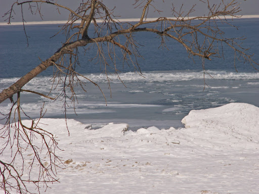
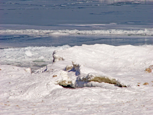
These pix's were taken at
Indiana Dunes National Lakeshore Park. Shelf Ice is a beautiful thing but extremely dangerous because of its stability or lack thereof. How a look of beauty can be so very deceiving.


TWISTER NEWS -
March 1st is here!
The Chase begins!


FEMA specialists offer help to rebuild more safely after tornadoes

FEMA hazard mitigation specialists will be at local building supply stores today through Saturday with information to help residents rebuild more safely and stronger following the severe weather of Feb. 5. (Story)


Survey Teams Confirm 3 Tornadoes in Tuesday Storms

Survey crews confirmed three tornadoes touched down early Tuesday. All were classified as E-F-One.


Tornadoes and straight line winds were blamed for causing thousands of dollars in damages in Leeds, the Pell City/Cropwell areas, Highland Lakes in northern Shelby County, northeast Talladega County and southern Calhoun County.


In Leeds, an elderly woman was killed when a tree fell on a mobile home.


Meteorologists said aerial and ground surveys determined that dozens of homes and businesses in the affected counties suffered minor to major damage.


An E-F-One tornado can generate wind speeds of between 86 to 110 miles per hour.


Forecasters say no severe weather is expected for the remainder of the week.


Houston EMA Chief Questions Siren Use

By: Lorra Lynch


Perry's fire chief turned on the tornado sirens during Tuesday's threat of severe thunderstorms. The sirens caused many people to believe there was a tornado warning.

Houston County EMA Director Jimmy Williams says he's concerned about the decision to activate sirens in Perry during Tuesday's severe weather.

Williams says Chief Joel Gray's decision to turn on the sirens to alert people about the threat of severe thunderstorms instead of tornados caused a flood of calls to the E-911 center. He called the volume of calls "very disruptive."

Chief Gray said he activates the sirens during any severe weather or homeland security threat. He said he's going by FEMA guidelines, and plans to stick with the policy until he's told to do otherwise by city management.

Williams met with Houston County Commission Chair Ned Sanders about the issue Wednesday morning. He says they plan to schedule meetings on the use of the sirens as soon as possible.

The City of Perry and Robins Air Force Base are the only areas in Houston County with access to tornado sirens.


MARITIME NOTES

UK. RNLI heroes & Coast Guard heroes honoured for MV Ice Prince rescue, read the dramatic story


The Coxswain of the Torbay RNLI lifeboat, Mark Criddle, is to be honoured by the Royal National Lifeboat Institution as the charity awards him the Silver Medal for Gallantry, recognising him for his leadership and outstanding seamanship during the rescue of eight seamen from the stricken merchant vessel Ice Prince on the night of 13 January 2008.


Coxswain Criddle’s volunteer crew on that night – Deputy Second Coxswain Roger Good, Deputy Second Coxswain John Ashford, Mechanic Mathew Tyler, Second Mechanic Nigel Coulton and Crew Members Darryll Farley and Alex Rowe – have also be recognised for their bravery and will each receive the Thanks of the Institution inscribed on Vellum.
Ice Prince with 20 crew on board was on passage 34 miles south east of Berry Head, Devon when severe gale force 9 winds and rough seas shifted its cargo of timber causing the vessel to list 25 degrees to port. (Story)

Riverdance ferry "can be righted"

By
Lisa Ettridger

BAD weather is continuing to takes its toll on the stricken ferry Riverdance – but rumours that the ship will have to be broken up and removed have been dismissed.

Officials from the Maritime and Coastguard Agency (MCA) say a 40ft diameter box which provided accommodation for drivers will be dug up from the sands at Cleveleys after falling into the sea in bad weather earlier this week.

"It's part of the accommodation, where the lorry drivers would sit to have a cup of tea," said Richard Skeats of the MCA.


Nautical Anchor


Messing About In Ships Podcast #12 - Special Interview of US Coast Guard Rescue of Sailors Aboard the Yacht Sean Seymour II

February 25, 2008, 4:33 am
Filed under: podcast, shownotes

Speaking of "winter weather"... Have a great weekend!
RS
Friday, February 8, 2008

Twister Perliminary Report. The UND Adriyatik Fire. And The Mid-West Snow Storm!

Though this report is a preliminary report since it will take the Storm Prediction Center (SPC ) sometime to tally the official count.

This is still put together very well and one heck of a snap shot for February 2008.

It sure was a Super Tuesday! There were some 211 to 215 watches and warnings issued by my count.


The below posted report was compiled by KMTV Morning Meteorologist
C.T. Thongklin of Action 3 News, and First Warning Weather Blog in Omaha, Nebraska. As far any reports of twisters in Southern Illinois. As of this writing, NWS St. Louis documented wind damage in southern IL, but no tornado.... Yet! But
I am told that while some NWS offices are still surveying damage. So far there is not as many tornadoes or as widespread as the April 3, 1974 outbreak . Though probably the worst since the May 2003 outbreak.

Remember, take a moment of your day, to remember those lost and those displaced from these Super Tuesday's twisters, heavy seas, recent floods and snow storms, worldwide. It's been one hell of a start for 2008!

C.T. Thongklin's Analysis!

Torgraph

One thing concerns me from this chart is how far the 2008 curve (red line) is above 2005, 2006, 2007 and the 10-year average. From the quantity of tornadoes the U.S. has experienced this year, we can safely classify 2008 as an anomaly so far.

Also notice that we typically experience between 1,000 and 1,300 tornadoes per year in the entire U.S.

According to the National Climatic Data Center (NCDC), 83% of all tornadoes in the U.S. are F0 (40-72 mph) and 98% are below F3 (158-207 mph) intensity. That leaves about 2% as F3 or stronger! Keep in mind that the ratings I mentioned of F0 and F3 are part of the old Fujita scale of damage. The Enhanced Fujita Scale (EF Scale) became operational on 1 February 2007.

If you are curious, the following is the severe weather climatology of the Omaha/Valley National Weather Service Forecast Area. The following images represent the climatology within the WSR-88D radar range of 124 nautical miles from the radar site in Valley.

Total Severe Weather Reports during the period 1980-2006 (red = tornado, green = hail 3/4" or larger, blue = damaging wind or 50+ kts. wind)

Oax6

Significant Severe Weather Reports during the period 1980-2006 (red = F2 or stronger tornado, green = hail 2" or larger, blue = 65+ kts. wind)

Oax7

In terms of tornado frequency, the Omaha radar site ranks 3rd out of 141 other weather radar sites across the country! #1 is the Oklahoma City NWS radar site and #2 is the Goodland, KS, NWS radar site. In the Omaha radar site, 56 tornadoes is the average, using data from 1980-2006. Despite this high number, the Omaha radar site ranks #18 for F2 or stronger tornadoes out of the other 141 sites.

Using the same data, tornado frequency is highest between 3:00 pm CDT and 11:00 pm CDT in the Omaha radar area.

The last deadly tornado to occur in our area was the Hallam tornado (22 May 2004) that killed 1 person and injured 38 people.

Lets hope that our spring won't be too active! Now is the time to prepare for "tornado season" by crafting an evacuation plan at your home and practicing drills, along with keeping an emergency kit ready to go. One possible factor into the high number of deaths into Tuesday's outbreak was the time of day...mainly after midnight. Your television set or radio can't wake you up, but your best defense is a programmable or Specific Area Message Encoder (S.A.M.E.) NOAA Weather Radio. These radios are often between $29-$69 and can be programmed exclusively for your county and even for certain types of warnings, such as a tornado warning. When the alarm sounds, you can execute your emergency plan immediately, even though you may not be aware of what the weather is doing around you at 3 in the morning. You can purchase one of these radios at sporting goods stores, big box retailers and nationwide electronics retailers.

I'll write more on weather radios and severe weather preparation in future posts, but for now, please mark this date on your calendar...Saturday, 29 March 2008. It is the Central Plains Severe Weather Symposium on the UNL campus. It is a FREE public-oriented educational event discussing tornadoes, severe weather safety and you'll also have a chance to meet your favorite television weathercasters (besides me! ha ha). At this time, I plan on being there, but Dean and even Ryan my join me at this year's symposium.

The following websites were used extensively for stating factual information for this post:

National Climatic Data Center Tornado Climatology http://www.ncdc.noaa.gov/oa/climate/severeweather/tornadoes.html

SPC OAX Severe Weather Climatology http://www.spc.noaa.gov/climo/online/rda/OAX.html

More information on weather radios can be found at http://www.crh.noaa.gov/oax/?n=nwr_mainhttp://www.weather.gov/nwr/ or

Information about the 2008 Central Plains Severe Weather Symposium can be found at http://www.cpsws.unl.edu/

KENTUCKY TORNADO UPDATE

Seems as if Storm Chaser Dan Robinson of Storm Highway has caught the EF2 Twister that struck Crofton, Ky on camera..

MARITIME NOTES

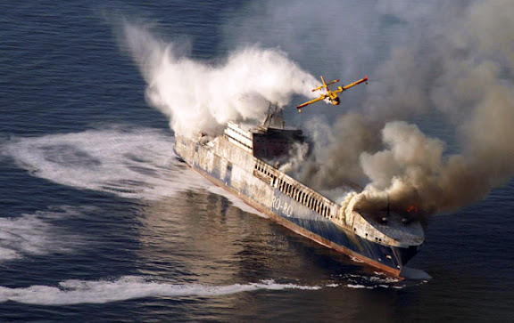
Firefight Explosion fears over Turkish ship

SPECIAL firefighting planes were dispatched off the Croatian coast after a fire broke out on a Turkish trading ship, writes Ed Holt.

The 193 m long Undadriyatik was transporting 200 trucks and 11 tonnes of oil to the Italian port of Trieste when the fire started yesterday morning as the ship was 16 nm off the western Croatian town of Rovinj.

The Greek vessel Ikarus Palace, which was nearby, answered a distress call and all 22 crew members on board and nine others on the vessel were rescued.

The upper deck of the ship had been completely burnt out by yesterday afternoon and authorities said there was a fear of an explosion if the flames reached the oil on board.

It was unclear if the fire had spread to other parts of the ship but rescue officials said they believe the ship is likely to sink.

THE M/F RIVERDANCE

Seatruck Ferries’ Riverdance, which remains aground off Blackpool, lost a further five trailers overboard on Tuesday night when the ship shifted at high water. From first light yesterday, teams worked to remove debris on the starboard side of the ferry to ensure a salvage team could access the ship by rigid inflatable. Pumps are being lifted onto the vessel as the salvors want to correct a 50° list before commencing operations to remove bunkers.

FROM HOLLAND AND KNIGHT

Casino boat blown about by Hurricane Katrina still not a vessel

In an unpublished decision, the US Court of Appeals for the Fifth Circuit ruled that a permanently-moored casino boat is not a vessel. In the instant case, the casino boat, floating in a marina in Biloxi, Mississippi, was moored to six steel dolphins using heavy “H” beams and received water and electricity from land-based sources. During Hurricane Katrina, the casino boat was ripped from its moorings, carried several thousand feet through flood waters and over a highway, and crashed into a hotel. The owner of the casino boat filed suit, seeking exoneration from or limitation of liability under the Shipowners’ Limitation of Liability Act. The hotel owner filed a counterclaim, seeking recovery of damages. The court held that a watercraft that has been permanently moored is not capable of being used in for maritime transport and, thus, is not a vessel for purposes of federal admiralty jurisdiction. Petitioner’s argument that the casino boat was “in navigation” when it struck the hotel was found to be unavailing. In the Matter of Silver Slipper Casino Venture LLC, No. 07-60330 (5th Cir., January 31, 2008).

UK – salvage begins for stranded ro-ro ferry

The UK Maritime and Coastguard Agency (MCA) issued a press notice stating that salvage has commenced on the ro-ro ferry that stranded near Blackpool. No pollution has been reported. A second press notice states that salvage gear is being placed on the ferry. (2/6/08).

USCG Marine Safety Program

Without fanfare, the US Coast Guard posted the insightful analysis of the agency’s Marine Safety Program undertaken by VADM James C. Card, USCG (ret). The major recommendations of this report are to increase the emphasis of the program within the Coast Guard, while improving interaction with the marine industry. The agency also released a one-page Marine Safety Overview, providing an indication of how it intends to achieve these goals. Related background material includes Admiral Thad Allen’s Address to the Washington, DC Propeller Club on September 19, 2007 and a Marine Safety Plan of September 25, 2007. The Coast Guard has now formally recognized that its recent relationship with the marine industry was in disrepair and can be expected to move forward with all deliberate speed to address the various issues. The agency is counting on the many segments of the marine industry to renew and enhance this long-standing and vital partnership. (2/8/08).

NOTES FROM THE BRIDGE

Maritime Affairs responds to captains' cry
Thursday February 07 2008

by Akedia Christopher

Director of Maritime Affairs McClean Hobson has thrown down a gauntlet to captains to introduce an alternative measure which they think would be more feasible to account for travelling passengers.

This came after captains expressed their disapproval in the new initiative in which passengers would be required to give their names when travelling on the ferries without having to produce photo identification.

He said if they have any information to help the process, they should contact the Maritime Department

FROM THE INTERNATIONAL DESK
by Arthur Rabjohn CEM

GLOBAL: Tipping Points Could Come This Century
The tipping points include the collapse of the Indian summer monsoon. A number of key components of the earth's climate system could pass their 'tipping point' this century, according to new research led by a scientist at the University of East Anglia. Published by the prestigious international journal Proceedings of the National Academy of Science (PNAS), the researchers have coined a new term, 'tipping elements', to describe those components of the climate system that are at risk of passing a tipping point. The term 'tipping point' is used to describe a critical threshold at which a small change in human activity can have large, long-term consequences for the Earth's climate system.

BOLIVIA; Severe flooding caused by weeks of heavy rain have left 48 people dead and some 40,000 families homeless. Two rivers in the Beni province have broken their banks. A state of emergency has been declared. Among the worst-hit areas are the eastern provinces of Beni and Santa Cruz as well as Cochabamba in central Bolivia. Several thousand people have been moved from areas at risk in Beni, where the River Mamore has broken its banks.

CHILE: Llaima volcano is erupting, prompting the evacuation of some tourists. Columns of ash and smoke rose from the crater up to 5,000m above the volcano that is located 700km south of the capital Santiago. If its activity increases, authorities will need to take evacuate the residents.

MOZAMBIQUE: Thousands of people have been evacuated from the Zambezi river valley, as Zambia would release water from the Kariba dam. The water is expected to flow down the Zambezi into areas of Mozambique already struggling to cope with high flood waters. In Mozambique there are already 100,000 evacuees and the reception centres are full to capacity. Another 40,000 will be evacuated. Mozambican authorities have managed well the crisis so far, but the pressure from the continuing rainfall is putting immense strain on the already overstretched resources.

LASTLY
From Gilbert Sebenste, Staff Meteorologist, Northern Illinois University


Illinois and Wisconsin Snow Totals

Stay dry and have a GREAT Weekend!

RS