Wednesday, July 25, 2007

More Heavy Weather

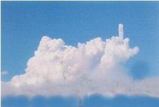
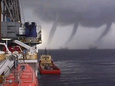
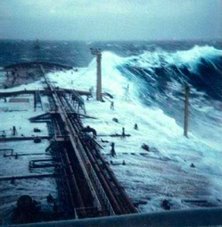
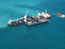
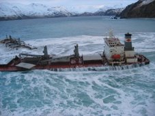
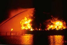
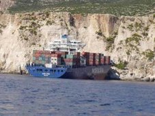
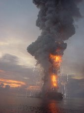
Once again, just to make a point. These pix's are ships (not boats) that encountered heavy seas. To be able to predict and "Forecasting Dangerous Waves" could very well reduce the loss of ships, cargo's and lives.

Imagine smaller vessels like the s/v Sean Seamour II and the s/v Flying Colours encountering waves that can do the damage that has been done to these ships.


Update on the
MSC NAPOLI.


Situation update regarding the MSC NAPOLI. The wreck has been separated into two, and the bow section has been towed a short distance offshore. Plans call for the stern section to be cut up in situ. The Council expressed concern over use of its shoreline to beach the vessel. The Council issued a second update stating that a decision is pending on which port to tow the bow to for recycling. The contract to remove the stern has been tendered. (7/23/07). Thanks Dennis!


RS

Tuesday, July 24, 2007

FR8 VENTURE Tragedy.

MAIB publishes report of FR8 VENTURE Tragedy.

Report into incident on tanker on 11th November 2006 which resulted in fatalities.

At about 1220 on 11 November 2006, while outbound from Scapa Flow and transiting the Pentland Firth, the 74,065 dwt Singaporean registered tanker, FR8 VENTURE, shipped two large waves over her bow. This resulted in the death of two able seamen (ABs) and serious injuries to an ordinary seaman (OS), all of whom were working on the forward mooring deck. The waves also caused minor damage to the ship.

From 10 to 11 November, FR8 VENTURE carried out a ship-to-ship transfer with another tanker, Perseverance, while at anchor in Scapa Flow, and loaded a full cargo of crude oil. The loading operations were completed at 0536, and Perseverance let go from FR8 VENTURE and left Scapa Flow. FR8 VENTURE weighed anchor at about 1054 and the two pilots disembarked near the entrance to Scapa Flow at about 1136. The wind was west to west-north-west and near gale force, with waves of about 4 to 5m high. The ship’s freeboard was about 6.6m and spray was being shipped on board. The tidal stream was flowing generally in the same direction as the wind.

After weighing anchor, the bosun and AB Kharva secured the port anchor, and began stowing three loose mooring lines down into the forward storeroom. AB Ravindra and an OS were stowing loose mooring lines away aft. At about 1210, the chief officer told AB Ravindra and the OS to go forward and help the bosun. AB Ravindra joined AB Kharva on the starboard winch platform to lash canvas covers around the mooring wires. The bosun instructed the OS to place a securing wire through the starboard anchor cable. At about 1220, just as the OS turned towards the anchor cable, a large wave was shipped over the bow. The ship pitched into the following trough and then a second larger wave was shipped on board. The two ABs were swept aft, towards and under the flying bridge. The OS was swept aft and came into contact with a protection plate for the forward liferaft. The bosun had managed to cling onto the storeroom door when the first wave was shipped, and then onto the ladder rungs of the foremast as the second wave swept over the foredeck; he remained uninjured.

The bridge team saw the seas being shipped on deck. The third officer released a manoverboard lifebuoy and smoke float from the bridge wing, and the general alarm was sounded, upon which the crew mustered at the emergency station. The OS managed to walk aft until he reached amidships, where he collapsed. All three injured men were taken to the accommodation.

FR8 VENTURE called Orkney Harbour Control to report the accident and to state that medical assistance would be needed. Orkney Harbour Control then informed Shetland Coastguard of the tanker’s emergency. Later, Shetland Coastguard arranged a radio telephone link between the ship’s master and a doctor at Aberdeen Royal Infirmary. The Longhope RNLI lifeboat took the local doctor out to meet the ship, but the rough seas prevented the doctor from boarding the ship from the lifeboat. However, the Stornoway Coastguard rescue helicopter was able to transfer her to FR8 VENTURE.

Once onboard the vessel, the doctor determined that the two ABs had died of their injuries and the OS should be taken to hospital. The helicopter returned to the ship, landed an Orkney Harbour pilot and airlifted the doctor and the OS to Aberdeen Royal Infirmary. The ship returned to Scapa Flow and anchored there at about 1800.

The investigation identified the following safety issues:

• The two large waves that were shipped over the bow could not have been considered abnormal and should have been expected in the prevailing weather conditions.
• The master should have delayed the sailing so that the ship could have been secured for sea in sheltered waters.
• Having decided to leave the shelter of Scapa Flow before the foredecks were secured for sea, the master’s assessment of the position by which the crew should have been clear of the foredeck of the ship allowed little margin for error. This should have prompted an effective plan of action.
• The plan could have concentrated the crew forward earlier, leaving the stowing of the after ropes until the fore part of the vessel had been secured.
• The plan should have prompted the need for precautionary measures, such as considering the option of turning the ship away from the weather, when safe and practicable to do so, to secure the anchors.

The managers of FR8 VENTURE have reviewed and amended their company SMS procedures for working on deck in heavy weather.

The relevant sections are as follows:

• The priority, which Master and Deck Officers should have is to ensure that when the vessel is either arriving or leaving port, the unsecuring or securing should be done as later or early as possible (basis whether vessel is arriving port or departing port) to ensure that crew are on deck and exposed to the elements for the least possible time.
• When departing port, most of the securing should be done prior leaving the berth or anchorage.
• When the vessel has left the berth or anchorage, the guiding principle should be to secure the vessel from forward to aft.
• It would be prudent to concentrate the manpower in one locale rather than spreading them out and trying to secure all over as a concentrated effort will mean a quicker securing [sic].

The MCA has issued a Safety Alert, which gives a brief outline of the accident and draws attention to the contents of Chapter 3 of the Admiralty Sailing Directions North Coast of Scotland Pilot, which warns mariners of strong tides, with large waves that frequently occur in the area of Pentland Firth.

In light of the actions taken as a result of this accident, the MAIB has issued no safety recommendations.

RS

Monday, July 23, 2007

Forecasting Dangerous Waves

Lets meet another brand of storm chaser. Unlike the ones we see chasing tornado's, these storm chasers are chasing something we normally do not see right away and that causes havoc and hell on water.

We have talked about rogue and dangerous waves. I have and will continue to post some extraordinary pictures and videos of these waves and what they can do to ships, cargos and lives. Today I want to talk about the potential of forecasting dangerous waves. This would be indeed a ma jor advancement and benefit to both meteorology and the maritime communities.

The study of rogue waves is just getting underway. As I have noted Dr. Paul C. Liu of NOAA's Great Lakes Environmental Research Laboratory (GLERL) has been studying these waves. GLERL has also been studying wave forecasting for the Great Lakes Region.

According to GLERL, " This project is designed to develop and fully implement a system of computerized models that can simulate and predict the three-dimensional structure of currents, temperatures, water level fluctuations, wind waves, ice, and sediments in the Great Lakes. The project will integrate these models with the required observational data systems into a real-time coastal prediction system. The project will make the information developed from this system available in a useful format and in a timely fashion to National Weather Service (NWS web site) forecasters, coastal users and resource managers".

NOAA/NWS has both a Ocean Prediction Center and Wavewatch III . But neither of these services accurately report on waves inside the Gulfstream. Why is this important? Currents or "moving water" play a important role in both effecting and determining dangerous waves. Why don't they report? Well its complex, they can to some degree but the technology is also not there yet to satisfy the powers to be. Maybe NOAA should consider this rather than spend $100 million on public relations? So lets take a look at another concept being proposed in wave forecasting called the; Gulfstream Hazard Scale, by professional satellite Oceanographer Jenifer Clark and husband Meteorologist Dane Clark.

In a letter date 18 July 2007 to the Director of the National Centers for Environmental Prediction, the Clark's state, "
We have become increasingly alarmed by the large numbers of vessel sinkings and loss of life and property in the Gulfstream along the U.S. East Coast over the past several years. Just this spring, four more boats were sunk and four people were killed during an east coast storm that later became Tropical Storm Andrea -- even though this system was well forecast by NWS forecast models."

After talking with hundreds of mariners who have sailed in these waters over the years and recently completing a research report for a court trial involving the cruise liner "Norwegian Dawn", which was severely damaged with 400 passenger injuries in April 2005 after encountering 40-70 foot steep waves in the Gulfstream; we have concluded that mariners are not being adequately warned about the pote ntial danger when strong winds oppose strong ocean currents in the Gulfstream System (the main Gulfstream and eddies).

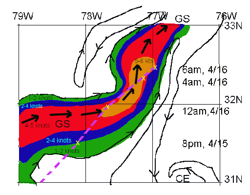
In the case of the Dawn, the Captain of that vessel testified that they had no idea they were sailing into those horrific conditions (see attached graphic). NWS forecasts indicated strong winds to 50 kts and significant wave heights to 27 feet, which were good forecasts outside the Gulfstream, but in the Gulfstream, seas were more than double that and these waves were much steeper and more difficult to navigate. Notations in the marine forecasts indicating "waves higher in the Gulfstream" were not very useful and mostly ignored since they are repeated in many offshore forecasts on a daily basis and contain no actionable data the mariner can use regarding the height or danger of these waves and their exact location.

Based on these and other cases we have examined, we feel that improvements are needed to alert mariners about specific threats about extreme and dangerous waves that exist in Gulfstream waters during these severe weather events,
The highest risk area corresponds to the area of maximum ocean currents flowing northward (estimated at 5 kts) and winds recorded on the Dawn between 4-6AM on 4/16 at 50-55 kts blowing from the north. This is where an estimated 60-80 foot wave struck the Dawn and caused most of the damage and injuries. Wave heights were observed to be as high as 40-45 feet through the Gulfstream waters that night before the larger, steeper wave hit the ship.

Recent international research efforts to examine extreme wave events, termed MaxWave, have concluded that dangerous extreme waves are much more common than historically believed (and not uncommon, as the terms "freak wave" and "rogue wave" would imply). The studies further stated that current technology is incapable of precisely forecasting these extreme waves at present, but that there are areas around the world that are known "hot-spots" for extreme waves, like the Gulfstream, where strong winds often oppose strong ocean currents.
".


(Route ( chart above ) of the Norwegian Dawn (purple) on April 15-16, 2005 superimposed on Jenifer Clark's high resolution Gulfstream Analysis. The gulfstream maximum current is indicated by large black arrows, isolines of the estimated magnitudes of ocean currents are color coded and small arrows indicate the direction of flow of all ocean currents on this meso-scale chart.)

Therefore, using our experience and information from other mariners, we have developed a Gulfstream Hazard Scale which is similar to other environmental scales (tornados, hurricanes, river rafting, avalanches, etc.,) used to educate, alert and warn.

An important aspect of this scale is the increased potential for extreme waves, as the scale increases from Cat 0 to Cat 8. These are correlated to specific recommended responses to the risk, or threat levels.

This scale is a concept and has not been used operationally. Since it is subjective in nature, we expect that modifications may be needed before it could be used to develop warning products. The most important parameters required are detailed, real-time ocean surface currents in the Gulfstream area (Jenifer has been doing this on a daily basis for nearly 30 years) and real-time and forecasts of meso-scale surface winds (available from the NWS models).

We would like to sit down with your staff and discuss the possibilities of the NWS using this scale (or a modified version) in your operations, possibly on a trial basis next year. We envision a graphical product similar to the Mariner's 1-2-3 Rule for Tropical Storms, to warn mariners of high risk areas in the Gulfstream during severe conditions. This type of precise warni ng, containing risk levels for exact locations and times, should greatly improve the mariner's ability to understand and perceive the danger. This should in turn, motivate the Captain/Navigator to avoid these threat areas, resulting in reductions in life and property losses."

As you can read in the Clark's letter and as I have pointed out in some of my past posts, the Hatteras Trench region is a very well known maritime grave yard due to the storms fueled by the gulfstream and its winds. As we can read in their letter, we do have a hole in assisting mariners in forecasting these events. Some of the factors involved in the proposed Gulfstream Hazard Scale will include;

CAT - Categories 0-8, Risk - Threat to vessels from extreme or dangerous waves -- WD/OP/CUR - wind opposing the current. DUR - duration and fetch of the wind. SIG/WV/HGT - significant wave height (as per the international definition) -- an average maximum of the highest third of the waves in the wave spectrum, X/WAVS - Extreme wave potential, Marine/Guide - situation and recommended actions per category, (*) - generally taken as surface winds blowing against or quartering against the flow of the gulfstream currents (main stream or eddies).

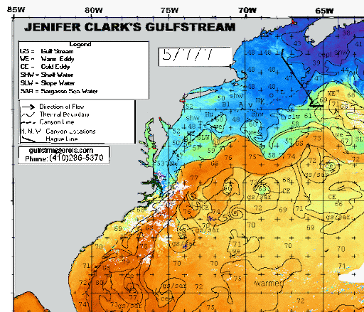
Note in the graphic above the stream encompasses both the main core (corps) and the eddies, something many mariners sometimes forget or just ignore. Now take a look at the cold eddies (below) during the 7 May 2007 Substropical storm andrea, when the s/v Sean Seamour II ran into trouble. Being able to predict the type of waves that the Sean Seamour II ran into, could have saved the sail boat from destruction and the crew from any hardships.


Also note the opposing winds to current from both northern quadrants . Remember strong winds in one direction with strong currents in the opposite direction can produce some very strong and active waves. Though some studies have shown that strong winds blowing from any directio n over gulfstream currents can also cause dangerous wave actions.

Its really this simple. Strong winds, strong currents, over time, means, very large waves. Its about being able to warn mariners in advance about these waves that can save ships, cargos and especially lives.

For further information on the Gulfstream Hazard Scale please visit,
Jenifer Clark's Gulfstream.

RS

Friday, July 20, 2007

WebExclusive: EPIRBs and the s/v Sean Seamour II - Part II

This is the second in a series of reports on the "reported" malfunction of the ACR 406 Rapidfix EPIRB that was used by the s/v Sean Seamour II when the sailboat ran in trouble during Subtropical Storm Andrea.

I say "reported" malfunction becuase as of this writing, no scientific or technical review has been completed. But we do know that something did in fact go wrong with the EPIRB.

In my last post we reviewed a statement from the Master of the s/v Sean Seamour II of what the crew experienced with one of two EPIRBs.

We reviewed what a EPIRB is and how it operates. Today we will visit how it communicates with satellites and how the satellites communicate with rescue personnel. It is important to understand what the system is and how it operates before we jump into the problem encountered by the crew of the s/v Sean Seanour II. No matter what the problem with the Sean Seamour II's EPIRB was. The system is a very valuable asset to the maritime and rescue community. Here are some statistics on just what this system has done.

To date according to COSPAS-SARSAT the system as of: June 29, 2007, the system is responsible for the rescue of 190 persons in the United States.


The breakdown is as follows:
Rescues at sea: 147 people rescued in 43 incidents. Aviation rescues: 14 people rescued in 11 incidents. PLB rescues: 29 people rescued in 14 incidents . Worldwide – Over 20,300 People Rescued (since 1982). United States – 5,586 People Rescued (since 1982). As you can see the system is extremely valuable.

So lets let NOAA Satellite Information Services explain the "search and rescue satellites".


Low-Earth Orbiting Search And Rescue (LEOSAR) Satellites

The keystone to the Cospas-Sarsat System are the low-earth orbiting (LEO) satellites from which the system takes its name. These satellites provide the ability to detect and locate 406 MHz alerts worldwide and 121.5 MHz alerts for about sixty percent of the world.

SARSAT is an instrument package flown aboard the NOAA series of environmental satellites operated by NOAA's National Environmental Satellite, Data and Information Service (NESDIS). These satellites orbit at an altitude of 528 miles and complete an orbit every 100 minutes. Their orbits are inclined 99 degrees from the equator. Typically, each satellite monitors the earth for various weather and climate data. Yet, each satellite also carries a Search and Rescue Repeater (SARR) which receives and retransmits 121.5 MHz, 243 MHz, and 406 MHz signals anytime the satellite is in view of a ground station. Also carried is a Search and Rescue Processor (SARP) which receives 406 MHz transmissions, provides measurements of the frequency and time, then retransmits this data in real-time and stores it aboard for later transmission. The satellite also stores each 406 MHz signal it receives and continuously downloads this data for up to 48 hours ensuring ground stations around the world receive it. That is, if the satellite was not in view of a ground station when it received a beacon signal, the next ground station that sees that satellite views will receive the data. This provides global coverage for 406 MHz distress signals. The SARR is provided by the Canadian Department of National Defence and the SARP is provided by the French Center National D'Etudes Spatiales (CNES).

The COSPAS instrument is carried aboard the NADEZHDA navigation satellite orbiting the Earth every 105 minutes at an altitude of 620 miles and an orbital inclination of 83 degrees. The COSPAS instrument was built by the former Soviet Union and continues to be operated by the Russian Federation. The only major difference between COSPAS and SARSAT is that the Russian satellites do not receive 243 MHz distress signals.

Geostationary Orbiting Search And Rescue (GEOSAR) Satellites

View from GOES-8As you can see from this image taken today from GOES-East, geostationary satellites are capable of continually viewing large areas of the Earth. These geostationary (GEO) satellites are also able to provide immediate alerting and identification of 406 MHz beacons. The GEO satellites are not able to use Doppler location processing since they have no relative motion between them and the emergency beacons. Therefore, they are not able to determine a location for a beacon. They can, however, provide immediate alerts. This is a valuable tool for SAR personnel since it allows them to begin their initial verification of the alert using the National 406 MHz Beacon Registration Database. Often this detective work yields a general location of the vessel or aircraft in distress and SAR assets can be readied or dispatched to that general area. Ideally, a SARSAT or COSPAS (LEO) satellite will fly over the beacon within the next hour and calculate a Doppler location which will be given to the SAR personnel who may already be enroute.

There is also one significant advantage with the GEOSAR constellation and that is the ability to use a GPS receiver with a 406 MHz beacon. Here’s how it works: specially made emergency beacons determine their location using a GPS receiver that is either integrated into the beacon (called a location protocol beacon) or fed by an external GPS receiver. This accurate location information (generally around a football field in size for positional accuracy) is then encoded into the 406 MHz signal that is transmitted by the beacon. The USMCC then receives that signal with the location and notifies the RCC accordingly. This information can often be derived in a matter of minutes! Since every second counts in reaching the scene of a distress this means that there is an increased chance of survival.

Without a doubt, the early warning capability of the GEOSAR constellation provides a valuable tool to increase the effectiveness of the Cospas-Sarsat system and, ultimately, save more lives ; First, a GPS-equipped beacon only works when the receiver has a clear view of the sky in order to permit the receiver to self-locate. Often times, conditions do not permit this which may either distort the positional accuracy or negate it altogether. Because of this, the Cospas-Sarsat System relies upon the Doppler locating effect as the primary means for locating a beacon. This process is able to overcome the limitations of a GPS unit and still generate a fairly accurate location…within a mile for positional accuracy. Secondly, the GEOSAR component only works if the beacon is registered with NOAA. Without registration, the RCCs are unable to react as quickly…and ultimately this may delay a SAR response should you be in an emergency. If you have a 406 MHz beacon and have not registered it, please do so by clicking here to access the National 406 MHz Registration Database.

For further information visit NOAAs Low-Earth Orbiting Search And Rescue (LEOSAR) Satellites page.

As you can see ther system has come a very long way since 1982 and it has experienced it share of problems. I am sure it will continue to have its problems while NOAA and
COSPAS-SARSAT continue its advances. It is my hope that these clitches are limited and without loss of life.

In Part III, we will go back to the future and visit with the pre-trip check of the s/v Sean Seamour II. One maritime note of interest. Thank to Dennis L. Bryant of
Holland & Knight LLP. UK – report on loss of lives due to large waves

The UK Marine Accident Investigation Branch (MAIB) released the joint report of the investigation undertaken by it and the Singapore Maritime and Port Authority (MPA) concerning the loss of two lives and one seriously injured crewmember on a tanker at Scapa Flow in the Orkney Islands on 11 November 2006. The tanker was outbound and four crewmembers were at the bow stowing loose mooring lines. Two large waves shipped over the bow. Three of the crewmembers were swept aft by the waves and incurred serious injuries. Two of the crewmembers died of their injuries. Investigation revealed that the two waves were not abnormal in the prevailing weather conditions. The master should have delayed sailing until the ship was secured for sea. The owners have amended their safety management system to include these recommendations. Report No. 16/2007 (7/18/07).

Have a great weekend!

RS

Previous Posts;

EPIRBs and the s/v Sean Seamour II
NHC Report on Subtropical Storm Andrea
Cheating Death On The High Seas
The s/v Sean Seamour II & The Hatteras Trench
High Sea's Update On Sean Seamour II
The Story of the Sailing Vessel Sean Seamour II


Thursday, July 19, 2007

Second in a Series; Subsea Atmospheres

To continue my series on the topic of subsea atmospheres. Not only will we focused on underwater weather systems of our oceans, but also how subsea atmosphere's extend and effect our bays.

To continue with my series here is a interesting article titled;

Predicting Underwater Weather,
By Michael W. Fincham,


There's a weather under the Bay, complete with high-pressure systems, low-pressure systems, several kinds of fronts and two kinds of slow-moving jet streams. Think of physical oceanographers as meteorologists of this underwater world. As they figure out the physics that controls the system, they should be able to predict the underwater weather more accurately - and take a lot of guesswork out of the forecasting game that so many people have to play.

Like a band of robots, CBOS buoys stand watch over the Bay. Some stay on station year after year, like the one off the Choptank River. Others come and go, moved to monitor a particular area, or pulled for fear of ice. Shown on the map are a string of buoys, some on station and some still proposed, waiting for the region's next investment in remote sensing. Artwork by Bill Boicourt.

Those were the selling points when Chesapeake Bay Observing System (CBOS) began - better physics and better forecasting. Over the last 15 years, Bill Boicourt has kept the system running despite hurricanes, lightning strikes, icy winters, vandalism and up-and-down funding cycles. Funding so far has come from more than three dozen sources. That's a lot of grant writing, but it has allowed Boicourt to keep buying new buoys, rebuilding old ones and restocking them with the latest in advanced sensing gear. In years of good funding he's had seven buoys taking data simultaneously.

Physics and forecasting, according to Boicourt, are still the selling points for CBOS-like systems expanded to cover the entire Bay and the Mid-Atlantic coastal waters. CBOS may soon morph into a newer, larger network of buoys and land-relay towers, capable of relaying even more real-time data about the weather above and below the Bay. The results could boost Chesapeake Bay science and help protect the Maryland economy.

If the future arrives according to Boicourt's forecast, CBOS could evolve into a cooperative regional system with more stable funding and more partners from academe, state and federal government, and private corporations. Players could include the Virginia Institute of Marine Science (VIMS), Old Dominion University, the Environmental Protection Agency, NOAA's National Ocean Service, the U.S. Navy, the U.S. Coast Guard, the Alliance for Coastal Technologies, and state agencies in Maryland and Virginia. The result would be a cooperative system, perhaps with a new name, that would provide real-time weather and water data from the head of the Bay all the way out onto the Continental Shelf.

There are even larger plans afloat. Congress is now considering a proposal for funding and expanding systems like CBOS and linking them together into a larger coastal network. That could mean more money and more acronyms. CBOS might be renamed and linked into something called IOOS (Integrated Ocean Observing System) or C-GOOS (Coastal Global Ocean Observing Systems), both of which would be part of an overall system called GOOS. Those plans drew a major endorsement last week in the Preliminary Report of the U.S. Commission on Ocean Policy.

The science prize is long-term data that oceanographers can use for figuring out the physics of the Bay and other coastal systems in greater detail. Better forecasts are also in those details, especially details about water temperatures, winds on the Bay, waves and currents that result from those winds.

The practical prizes are real-time products forecasting what the system is doing today and tomorrow. That's important for big commercial shippers who need to know water levels up in Baltimore Harbor and small recreational boaters who want to know wave conditions out on the mainstem. Real-time models of current flows would help with search-and-rescue missions and with emergency responses to natural disasters like storm surges and human accidents like oil spills and chemical leaks. CBOS can even help with Homeland Security with high-frequency radar that helps track large and small ships as they move about the Bay.

In my next installment we are going to talk about a new potential concept that will help warn mariners of large and dangerous waves. The Gulfstream Hazard Scale. Under development by a Oceanographer and Meteorologist, Jenifer and Dane Clark.

RS

Wednesday, July 18, 2007

WebExclusive: EPIRBs and the s/v Sean Seamour II

This is the first in a series of very serious and important reports on one of the mysteries we have not yet discussed about the sinking of the s/v Sean Seamour II and the harrowing rescue of its crew.

The potential malfunction of one of the EPIRBs that was activated after the sailboat was struck and sunk by a very powerful wave during Subtropical Storm Andrea.


In doing the research and deciding to write about this issue, let me be very clear. It is not my intention to single out any one manufacturer of EPIRBs, since there has been problems and concerns with a host of EPIRBs throughout their development and deployment. But this current issue has some very critical ramifications and lessons for all mariners who use any type of EPIRB. I will also note that as of this writing, the entire episode regarding this EPIRB is under investigation by both the United States Coast Guard and by independent technical specialists on behalf of the Master of the Sean Seamour II.

I am also very sure that ACR Electronics of Fort Lauderdale, Florida is also very concerned and interested in getting to the bottom of the cause of the potential malfunction.


Let's start by going back into the log of the s/v Sean Seamour II;

"immediately after the knockdown, I initiated the EPIRB, an ACR 406 Rapidfix. A half hour later , I realized that the strobe light was no longer functioning and that the intensity of the "on" light had dropped considerably.

I reinitialized the unit, with no further success whereas I had the unit re-certified two weeks before. But far worst yet is the fact that the Coast Guard received the signal but attributed it to another vessel! In their database my ID corresponded to a boat in Alabama. The Coast Guard immediately called the point of contact indicated in the database, having to wake up the owner at three am to be told "no I have not initiated my EPIRB.

They asked him to disconnect the battery... and the signal stop emitting at that approximate moment - about the same time my unit stopped functioning! Considering this, they decided to stop the search on this signal! What saved me, is that I had kept the EPIRB from a preceding boat, Lou Pantaï. This second EPIRB was held in its cradle on the inside of the hard dodger. Upon the first knockdown this structure was sheared off the boat and sank, but luckily, the 11 year old EPIRB went into hydrostatic release and provided the Coast Guard with Lu Pantaï ID. It is this one that they sought and found - failing that none of us would have survived.

There is therefore two faults: the first relating to the registration of the EPIRB, this was done by a UK company, the second by the manufacturer' accredited service station who pronounced the unit valid, when this was not the case."

In up coming postings we are going to take a very close look at EPIRBs and especially the ACR 406 MHz EPIRB Rapidfix with GPS Interface Category II, Emergency Position Indicating Radio Beacon (EPIRB) and the two issues as outlined by the s/v Sean Seamour II's Master. "The registration of the EPIRB, this was done by a UK company, the second by the manufacturer' accredited service station who pronounced the unit valid, when this was not the case".

Before we take a look and investigate what went wrong with this EPIRB and there are many possibilities, we must first understand what a EPIRB really is and how it works.

What is an EPIRB and how does it work?

EPIRB stands for Emergency Position Indicating Radio Beacon. An EPIRB is meant to help rescuers locate you in an emergency situation, and these radios have saved many lives since their creation in the 1970s. Boaters are the main users of EPIRBs.

A modern EPIRB is a sophisticated device that contains:

Once activated, both of the radios start transmitting. Approximately 24,000 miles (39,000 km) up in space, a GOES weather satellite in a geosynchronous orbit can detect the 406-MHz signal. Embedded in the signal is a unique serial number, and, if the unit is equipped with a GPS receiver, the exact location of the radio is conveyed in the signal as well. If the EPIRB is properly registered, the serial number lets the Coast Guard know who owns the EPIRB. Rescuers in planes or boats can home in on the EPIRB using either the 406-MHz or 121.5-MHz signal.

Older EPIRBs did not contain the GPS receiver, so the GOES satellite received only a serial number. To locate the EPIRB, another set of satellites (like the TIROS-N satellite) orbiting the planet in a low polar orbit could pick up the signal as it passed overhead. This would give a rough fix on the location, but it took several hours for a satellite to come into range.

Types of EPIRBs

Emergency position indicating radiobeacons (EPIRBs), devices which cost from $200 to about $1500, are designed to save your life if you get into trouble by alerting rescue authorities and indicating your location. EPIRB types are described below:

Class A
121.5/243 MHZ. Float-free, automatically-activating, detectable by aircraft and satellite. Coverage is limited. An alert from this device to a rescue coordination center may be delayed 4 - 6 or more hours. These devices have been phased out by the FCC and are no longer recognized.
Class B
121.5/243 MHZ. Manually activated version of Class A. These devices have been phased out by the FCC and are no longer recognized.
Class C
VHF ch15/16. Manually activated, operates on maritime channels only. Not detectable by satellite. These devices have been phased out by the FCC and are no longer recognized.
Class S
121.5/243 MHZ. Similar to Class B, except it floats, or is an integral part of a survival craft. These devices have been phased out by the FCC and are no longer recognized.
Category I
406/121.5 MHZ. Float-free, automatically activated EPIRB. Detectable by satellite anywhere in the world. Recognized by GMDSS.
Category II
406/121.5 MHZ. Similar to Category I, except is manually activated. Some models are also water activated.
Inmarsat E
1646 MHZ. Float-free, automatically activated EPIRB. Detectable by Inmarsat geostationary satellite. Recognized by GMDSS. Currently not sold in the U.S.; however, the Federal Communications Commission is considering recognizing these devices. This service will end 12/31/2006.

121.5/243 MHz EPIRBs

These are the most common and least expensive type of EPIRB, designed to be detected by overflying commercial or military aircraft. Satellites were designed to detect these EPIRBs, but are limited for the following reasons:

  1. Satellite detection range is limited for these EPIRBs (satellites must be within line of sight of both the EPIRB and a ground terminal for detection to occur),
  2. Frequency congestion in the band used by these devices cause a high satellite false alert rate (99.8%); consequently, confirmation is required before search and rescue forces can be deployed,
  3. EPIRBs manufactured before October 1989 may have design or construction problems (e.g. some models will leak and cease operating when immersed in water), or may not be detectable by satellite. Such EPIRBs may no longer be sold,
  4. Because of location ambiguities and frequency congestion in this band, two or more satellite passes are necessary to determine if the signal is from an EPIRB and to determine the location of the EPIRB, delaying rescue by an average of 4 to 6 hours. In some cases, a rescue can be delayed as long as 12 hours.
  5. COSPAS-SARSAT is expected to cease detecting alerts by 2008.

One November 3, 2000, the National Oceanic and Atmospheric Administration (NOAA) announced that satellite processing 121.5/243 MHz emergency beacons will be terminated on February 1, 2009. Class A and B EPIRBs must be phased out by that date. The U.S. Coast Guard no longer recommends these EPIRBs be purchased.

As part of the United States efforts to prepare beacon users for the end of 121.5 MHz frequency processing by satellites, the FCC has prohibited the use of 121.5 MHz EPIRBs as of January 1, 2007 (47 CFR 80.1053, .1055, and .1059)

406 MHz EPIRBs

The 406 MHz EPIRB was designed to operate with satellites. The signal frequency (406 MHz) has been designated internationally for use only for distress. Other communications and interference, such as on 121.5 MHz, is not allowed on this frequency. Its signal allows a satellite local user terminal to accurately locate the EPIRB (much more accurately -- 2 to 5 km vice 25 km -- than 121.5/243 MHz devices), and identify the vessel (the signal is encoded with the vessel's identity) anywhere in the world (there is no range limitation). These devices are detectable not only by COSPAS-SARSAT satellites which are polar orbiting, but also by geostationary GOES weather satellites. EPIRBs detected by the GEOSTAR system, consisting of GOES and other geostationary satellites, send rescue authorities an instant alert, but without location information unless the EPIRB is equipped with an integral GPS receiver. EPIRBs detected by COSPAS-SARSAT (e.g. TIROS N) satellites provide rescue authorities location of distress, but location and sometimes alerting may be delayed as much as an hour or two. These EPIRBs also include a 121.5 MHz homing signal, allowing aircraft and rescue craft to quickly find the vessel in distress. These are the only type of EPIRB which must be certified by Coast Guard approved independent laboratories before they can be sold in the United States.

A new type of 406 MHz EPIRB, having an integral GPS navigation receiver, became available in 1998. This EPIRB will send accurate location as well as identification information to rescue authorities immediately upon activation through both geostationary (GEOSAR) and polar orbiting satellites. These types of EPIRB are the best you can buy.

406 MHz emergency locating transmitters (ELTs) for aircraft are currently available. 406 MHz personnel locating beacons (PLBs) are available.

The Coast Guard recommends you purchase a 406 MHz EPIRB, preferably one with an integral GPS navigation receiver. A Cat I EPIRB should be purchased if it can be installed properly.

406 MHz GEOSAR System

The major advantage of the 406 MHz low earth orbit system is the provision of global Earth coverage using a limited number of polar-orbiting satellite. Coverage is not continuous, however, and it may take up to a couple of hours for an EPIRB alert to be received. To overcome this limitation, COSPAS-SARSAT has 406 MHz EPIRB repeaters aboard three geostationary satellites, plus one spare: GOES-W, at 135 deg W; GOES-E, at 75 deg W; INSAT-2A, at 74 deg E; and INSAT-2B (in-orbit spare), at 93.5 deg E. Ground stations capable of receiving 406 MHz. Except for areas between the United Kingdom and Norway, south of the east coast of Australia, and the area surrounding the Sea of Okhotsk near Russia, as well as polar areas, GEOSAR provides continuous global coverage of distress alerts from 406 MHz EPIRBs.

Note that GEOSAR cannot detect 121.5 MHz alerts, nor can it route unregistered 406 MHz alerts to a rescue authority. GEOSAR cannot calculate the location of any alert it receives, unless the beacon has an integral GPS receiver.

The COSPAS-SARSAT System

COSPAS-SARSAT is an international satellite-based search and rescue system established by the U.S., Russia, Canada and France to locate emergency radio beacons transmitting on the frequencies 121.5, 243 and 406 MHZ.

COSPAS
Space System for Search of Distress Vessels (a Russian acronym)
SARSAT
Search and Rescue Satellite-Aided Tracking

Testing EPIRBs

406 MHz EPIRBs can be tested through its self-test function, which is an integral part of the device. 406 MHz EPIRBs can also be tested inside a container designed to prevent its reception by the satellite. Testing a 406 MHz EPIRB by allowing it to radiate outside such a container is illegal.

Battery Replacement

406 MHz EPIRBs use a special type of lithium battery designed for long-term low-power consumption operation. Batteries must be replaced by the date indicated on the EPIRB label using the model specified by the manufacturer. It should be replaced by a dealer approved by the manufacturer. If the replacement battery is not the proper type, the EPIRB will not operate for the duration specified in a distress.

Registration of 406 MHz EPIRBs

Proper registration of your 406 MHz satellite emergency position-indicating radio beacon (EPIRB) is intended to save your life, and is mandated by Federal Communications Commission regulations. The Coast Guard is enforcing this FCC registration rule.

Your life may be saved as a result of registered emergency information. This information can be very helpful in confirming that a distress situation exists, and in arranging appropriate rescue efforts. Also, GOES, a geostationary National Oceanic & Atmospheric Administration weather satellite system can pick up and relay an EPIRB distress alert to the Coast Guard well before the international COSPAS-SARSAT satellite can provide location information. If the EPIRB is properly registered, the Coast Guard will be able to use the registration information to immediately begin action on the case. If the EPIRB is unregistered, a distress alert may take as much as two hours longer to reach the Coast Guard over the international satellite system. If an unregistered EPIRB transmission is abbreviated for any reason, the satellite will be unable to determine the EPIRB's location, and the Coast Guard will be unable to respond to the distress alert. Unregistered EPIRBs have needlessly cost the lives of several mariners since the satellite system became operational.

What happens to your registration form?

The registration sheet you fill out and send in is entered into the U.S. 406 Beacon Registration Database maintained by NOAA/NESDIS. If your EPIRB is activated, your registration information will be sent automatically to the appropriate USCG SAR Rescue Coordination Center (RCC) for response. One of the first things the RCC watchstanders do is attempt to contact the owner/operator at the phone number listed in the database to determine if the vessel is underway (thus ruling out the possibility of a false alarm due to accidental activation or EPIRB malfunction), the intended route of the vessel if underway, the number of people on board, etc., from a family member. If there is no answer at this number, or no information, the other numbers listed in the database will be called to attempt to get the information described above needed to assist the RCC in responding appropriately to the EPIRB alert.

When RCC personnel contact the emergency phone numbers you provide, they will have all the information you have provided on the registration form. You should let these contacts know as much about your intended voyage as possible (i.e., intended route, stops, area you normally sail/fish/recreate, duration of trip, number of people going, etc.). The more information these contacts have, the better prepared our SAR personnel will be to react. The contacts can ask the RCC personnel contacting them to be kept informed of any developments, if they so desire.

Registration regulations

You may be fined for false activation of an unregistered EPIRB. The U.S. Coast Guard routinely refers cases involving the non-distress activation of an EPIRB (e.g., as a hoax, through gross negligence, carelessness or improper storage and handling) to the Federal Communications Commission. The FCC will prosecute cases based upon evidence provided by the Coast Guard, and will issue warning letters or notices of apparent liability for fines up to $10,000.

However, the Coast Guard has suspended forwarding non-distress activations of properly registered 406 MHz EPIRBs to the FCC, unless activation was due to hoax or gross negligence, since these search and rescue cases are less costly to prosecute.

If you purchase a new or a used 406 MHz EPIRB, you MUST register it with NOAA. If you change your boat, your address, or your primary phone number, you MUST re-register your EPIRB with NOAA. If you sell your EPIRB, make sure the purchaser re-registers the EPIRB, or you may be called by the Coast Guard if it later becomes activated.

An FCC ship station license is no longer required to purchase or carry an EPIRB.

How to register

You may register by visiting the SARSAT Beacon Registration page.

There is no charge for this service. IT MAY SAVE YOUR LIFE.

For more information see the NOAA SARSAT Homepage

In the next report we will visit how the system communicates between satellite and rescue personnel.

Previous Posts;

NHC Report on Subtropical Storm Andrea
Cheating Death On The High Seas
The s/v Sean Seamour II & The Hatteras Trench
High Sea's Update On Sean Seamour II
The Story of the Sailing Vessel Sean Seamour II

Best
RS

Tuesday, July 17, 2007

Reunion Island & Man-Yi

This is a very interesting story, which was brought to my attention by a mariner who reads my blog.

I was so impressed with it I sent it to Dr. Paul C. Liu of NOAA who also blogs under the name Freaque Waves. Dr. Liu had indeed blogged about the wave that hit Reunion Island on 13 May 2007, but had not seen the ESA Sat Photo's.

Since Dr. Liu's has already posted the story " Giant wave hits Réunion island. " on his site, read about it from a real pro on large waves.

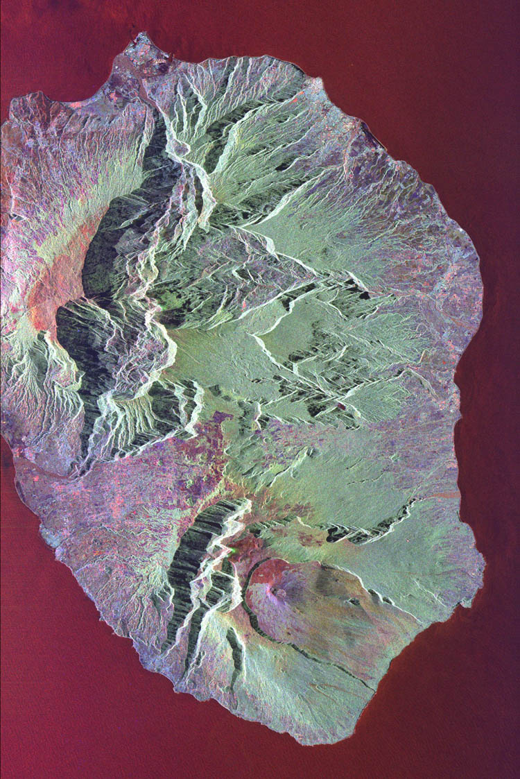
Below is the story and satellite photos from the ESA on the same wave that hit Reunion Island..

"A giant 36ft. wave was caught by a satellite imaging radar when it thrashed the southern port of Saint Pierre, Reunion Island on Saturday evening sending piers crashing down and flooding homes along the coastline. Two fishermen were still reported missing after their boat capsized.

Thought to be only legendary but now a natural ocean phenomenon, not rare, but rarely encountered. Evidence from mariners’ claimed that disappearances and damages to large ocean vessels suggests they have occurred. This evidence was confirmed following measurements of a massive wave at the oil platform in the North Sea in 1995. which caused minor damage was inflicted on the platform, confirming that the reading was valid.

Researchers from the GKSS Research Centre, using data collected by ESA satellites, identified a large number of radar signatures that may be evidence for rogue waves. Further research verifies the method that translated the radar echoes into sea surface elevation.

Freak waves or rogue waves have been cited in the media as a likely source of the sudden unexplainable disappearances of many ocean vessels.

The animated image (above link) was acquired by the Spaceborne Imaging Radar-C/X-Band Synthetic Aperture Radar (SIR-C/X-SAR) aboard the space shuttle Endeavour on October 5, 1994. The image is centered at 21.2 degrees south latitude, 55.6 degrees east longitude. The area shown is approximately 50 km by 80 km (31 miles by 50 miles).

North is toward the upper right. Colors are assigned to different frequencies and polarizations of the radar as follows: red is L-band horizontally transmitted, vertically received; green is L-band horizontally transmitted, vertically received; and blue is C-band horizontally transmitted, vertically received. SIR-C/X-SAR, a joint mission of the German, Italian and United States space agencies, is part of NASA’s Mission to Planet Earth. Envisat is equipped with an advanced version of the SAR instrument, Advanced Synthetic Aperture Radar (ASAR), flown on the ERS-1 and ERS-2 missions.

Its wave mode acquires 10 by 5 km small images, or ‘imagettes’, of the sea surface every 100 km along the satellite orbit. These small ‘imagettes’, which depict the individual wave heights, are then mathematically transformed into averaged-out breakdowns of wave energy and direction, called ocean-wave spectra, which ESA makes available to scientists and weather centres."

Resources: European Space Agency -http://www.esa.int/esaCP/index.html

NASA

Weather Note;

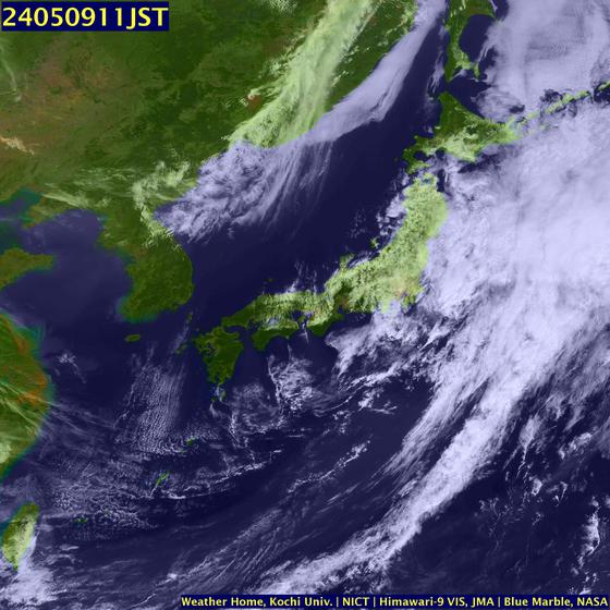
This video from the Weather Channel on Typhoon Man-Yi striking Japan.


"The typhoon sank a Chinese freighter 400 miles NW of Guam with 9 lost with the ship. Man-Yi would go on to bring Okinawa 105 mph wind gusts with major loss of power in Japan. The storm then crossed into Kyushu with 80-90 mph winds and flooding rains and more widespread power outages.

The storm's fury would injure 70 people and kill 5 on Kyushu. The typhoon weakened to a tropical storm but still brought 3-4 inches of rain to Tokyo and snarled train, plane, and car travel for several days. The system has now become extratropical and is moving rapidly away from the mainland with a threat only to shipping later today and tonight" (The Weather Channel).

We are also monitoring Tropical Storm COSME currently tracking for Hawaii.

http://www.ssd.noaa.gov/goes/flt/t7/vis.jpg


RS

Monday, July 16, 2007

M/V Ital Florida

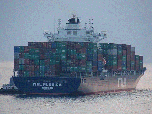
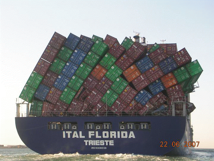
Once again mother nature can generate some powerful storms and waves. These waves can do a lot of damage to cargo and the vessel itself. As they say, pictures are worth a thousand words. Here (left) we have a picture of the container ship M/V Ital Florida on her maiden voyage departing port and below, the aftermath of mother nature at sea.

According to Cargolaw, the M/V Ital Florida made her maiden call at Hong Kong on April 20 2007. But the beginning of a busy career was interupted by a "Stack Attack" between June 16 & 19 2007.

This is the brand new Italian flaged container ship
M/V Ital Florida, particulars include: Length: 238.9 Meters (783.7 ft). Draft: 12.03 meters (39.4 ft). Gross ITC Tonnage -36,483.00 tons

The M/V Ital Florida lost at least three fully loaden containers in severe seas between June 16 & 19 in the Arabian Sea. The ship faced wave heigths of 7-10 m height (22 to 32 Ft). The M/V Ital Florida was running with almost 16 knots. The ship's deck also suffered storm damage.

=


The question that is being asked?.
Was this problem the result of improper lashing securing, bad weather or both? Many times improper lashing of the containers on deck plays a major role in loss of cargo during a storm. However this 783 foot containship is evidence that when mother nature roars "Ship Happens".

Now imagine a 44 foot sailboat like the s/v Sean Seamour II or any sailboat taking waves like this?

Weather Note:

On Saturday, 14 July 2007
Typhoon Man-yi struck southern Japan injuring 34. As reported by the AP. This powerful storm is also responsible for the sinking of a 420-foot cargo ship owned by Fuzhou Haijing Shipping, which was en route from Papua New Guinea to China when the cargo began shifting as the vessel encountered 70 mph winds and 24-foot seas from the typhoon. The number of survivors among the 22-member crew rose to 13, with eight receiving medical attention and 3 found dead in the U.S. territory about 3,700 miles southwest of Hawaii.

The Coast Guard cutter Sequoia arrived on scene Friday 13 July 2007 to coordinate operations as the air and sea search continued for the remaining six crew missing members. About 100 square miles had been searched, the AP reported.

RS


Friday, July 13, 2007

Subsea Atmospheres

We have talked about rogue and freak waves often on this blog. While these type of wave patterns are still under study, much is still unknown about them. It is my belief that these type of waves can be generated by subsea environments or storms that we still really do not know much about. We talk about chasing tornados and the hurricanes. But know anyone who chases underwater storms?

So, I am going to start a series of discussions, post articles and reports on subsea atmospheres and introduce you to a different type of storm chaser, "Oceanographers".

As I have stated before, we have a tendency to view things on a one plane thought process, namely, we process things as we "see" them. Much of what happens throughout the weather story we still do not see directly, yet. Moreover, science has been studying subsea or underwater atmospheres or storms, also known as, "
Benthic Storms" for some time now. Maybe one day we will have ocean study as a national priority.

Much of our weather I believe, actually is generated by weather patterns not just by surface atmospheres, but also by weather patterns created by subsea attmospheres and environments. Basically, the ocean has its own weather system, with winds and underwater storms that we never hear about or even see. . Oceanographer Dave Gallo from the Woods Hole Oceanographic Institute describes how much more there is going on in the ocean than we think.

According to Gallo, "
70 % of the planet, 95% of the biosphere, there are the highest mountains, the deepest valleys, the largest waterfall. There are more animals in the sea than on earth. 99% of the heat on the planet that comes from the sun is stored in the top few tens of feet of the ocean. It has everything the atmosphere has and more, it has everything that the land has and more and yet it's hardly explored, we've really seen less than 1% of what's out there.

Something oceanographers didn't expect were underwater storms. During a recent research mission to the deepest and darkest part of the ocean where things were thought to be quite stable - patterns from sediment samples showed disruptions as if a storm had ripped through.

There's a large mass of either sediments and/or water moving usually with gravity downhill or moving with currents across the sea floor. They can be fairly vicious.

An underwater storm can also cause damage on land, although indirectly. Back in the early 1900's a storm ripped across the sea floor and snapped northeastern transatlantic cables. The ocean has weather very similar to the atmosphere with high and low-pressure systems, clear days, and cloudy days:

The same kinds of things we see on the weather channel we see in the ocean and yet these things operate apart from the atmosphere.

Just like predicting the weather on land, underwater predicting is difficult as well. It's still an unfamiliar world."

Understanding subsea environments and being able to forecast subsea storms, as we do surface storms today, may not just answer many questions we do not understand about our oceans, but answer the question, where do freak or rogue waves come from? Hopefully benefiting mariners with advanced warning of dangerous SWH's or waves and more importantly save lives, cargo and ships.

Lets start with the basics, the physical and chemical make up of the oceans, with a paper titled, The Blue Planet,.

Weather Note;

Typhoon MAN-YI late yesterday became a Super Typhoon or a CAT-5 Hurricane as it struck the "Rock" and is tracking for Japan.

"The eye of Man-Yi was 189 kilometers from the city of Naha on the main island of Okinawa at 5 p.m. Japanese time today, the Japan Meteorological Agency said on its Web site. The storm is moving north across open water at 30 kilometers per hour after crossing Okinawa prefecture, which has a population of 1.4 million people.

The meteorological office said Man-Yi is ``extremely strong'' and issued warnings of gales, heavy rain, high waves and a tidal surge throughout Okinawa, the location of the biggest American airbase outside the U.S., and parts of Kyushu island to the north. National broadcaster NHK said areas of Miyazaki prefecture in Kyushu were flooded, and showed images of cars blown over and downed power lines. Bloomberg News."

Chicago weekend weather? Breath taking!

Have a really great weekend!

RS


Thursday, July 12, 2007

Okinawa braces for Typhoon 04W (Man-yi)

My second and important weather story of the day. Its been quiet in the Atlantic ( with exception of the storm at the NHC) but the Pacific is blowing a wind. That storm has been designated Typhoon Man-Yi (04W).

As of this morning, Typhoon Man-Yi (04W) was centered near 22 north and 128.5 east. Its winds were sustained at around 145 mph, and was tracking movement to the north-northwest at 15 mph, putting it at a strength very close to that of a category-4 hurricane.

The storm has the possibility of strengthening to a super typhoon (winds above 150 mph) very briefly Thursday afternoon, just before making landfall over Okinawa in the Ryukyu Islands by tonight. Waves are expected be greater than 35 feet, while a driving rainfall and strong, dangerous winds will batter the region. Mariners need to avoid this storm and all residence of Okinawa and the general area should take precautions prior to the arrival of this dangerous storm.


Here are the details from the Joint Typhoon Warning Center Typhoon 04W (Man-Yi)

RS

More on Proenza

Ok I said it would be my last. But I found two articles one from the AP and the other from ABC News on the NHC a day after Bill Proenza was replaced. I don't think I was far off in my Monday, July 9, 2007 The NHC Follies posting.

Most of the hubbub seems to have been Proenza being critical of his bosses at NOAA and some of the staff not taking to Proenza's management style and speed of decision. Some of these people on staff at the NHC have been there since the USG laid the cornerstone to the building and I believe they need to get a grip. If this was the corporate world the changes would not be in upper management but in the staff. If this is true and that staff revolted because of their own special interests and childish attitudes, then it was not Proenza who damaged public confidence, it was the staff itself. Which again if true, I find appalling.

I also find it interesting that Ed Rappaport the Deputy originally turned down the job of Director. Why? Well I guess that is evident. Between the suits at NOAA/Commerce doing the Beltway CYA line dance and the children on staff, the director must go home every night, take a shower, and blow dry his hair with a 12 gauge shot gun!

Yesterday the The US Senate Commerce Committee took up a hearing on QuikSCAT and other issues at the NHC. Here is the opening statement by Senator Daniel K. Inouye and the testimonies of Ms. Mary Ellen Kicza, Assistant Administrator for Satellite and Information Services National Oceanic and Atmospheric Administration Kizca Satellites Testimony . Dr. Michael Freilich, Director, Earth Science Division Science Mission Directorate, National Aeronautics and Space Administration. Mr. David Powner, Director, Technology Management Issues Government Accountability Office.Dr. Greg Holland, Director, Mesoscale and Microscale Meteorology Division Earth and Sun Systems Laboratory, National Center for Atmospheric Research and Dr. Antonio Busalacchi, Professor and Director, Earth System Science Interdisciplinary Center University of Maryland.

Ex-Hurricane Center Chiefs: Job's Tough

MIAMI - A day after the director of the National Hurricane Center went on leave amid leadership questions, former directors said Tuesday he should have listened more carefully to his staff and made changes more slowly.

Bill Proenza went on leave after 23 employees - about half his staff - urged his immediate removal last week. Center employees said Proenza damaged public confidence in their forecasting ability and distracted the center from its work.

"I think the bottom line is that he simply did not listen to his senior staff," said Proenza's predecessor, Max Mayfield.

A chief complaint was the way Proenza called for a replacement of an aging satellite called QuikScat, used for hurricane forecasting.

"If he would have hung in there for one season and had kept his head down for one season (without making changes), he would have been much better off," said Jerry Jarrell, director of the center from 1998 to 2000, who now lives in Oregon. "He forgot that he had to be an advocate for the forecasters. He should have waited until he had some more experience, but sort of plunged in."

Still, Proenza's "heart's in the right place," he said.

A hurricane center spokesman said its interim director, Ed Rappaport, was busy preparing for the 2007 hurricane season and would not comment. A cell phone message left for Proenza was not returned.

Proenza, the center's eighth director, had been on the job since January.

Proenza may have set himself up for removal by criticizing his bosses at the National Oceanic and Atmospheric Administration on budget shortfalls and other issues, Jarrell said.

"When you criticize your boss and when you do it publicly in the media, you're sort of inviting your subordinates to do the same thing to you," Jarrell said.

Jarrell said that he had at least one situation where he felt he had to be outspoken as director, during a threat of budget cuts in the 1990s, but that he made his comments with the support of his staff and others, including Proenza, he said.

Neil Frank, the center's head in the 1970s and 80s, said he had few controversies during his 13-year tenure, the major one being which office should directly oversee the center. Now the chief meteorologist at a Houston TV station, Frank was credited with reaching out to the media. He said he was careful to work within the system.

"Talking to the media and bypassing NOAA headquarters is fraught with some danger, as you now know," said Frank, who remembered a young Proenza helping him on his doctoral dissertation.

A Commerce Department team sent to conduct a review of the center after Proenza's comments was finishing its work Tuesday. Proenza had said the inspection was unnecessary and blamed some staff animosity on the team, which has a report due to the Commerce Department on July 20. The department oversees NOAA, the hurricane center's parent agency.

The Senate Commerce Committee planned to take up the issue of QuikScat and other weather and environmental satellites in a hearing Wednesday.

Copyright 2007 The Associated Press. All rights reserved.

And this from ABC News;

"THE U.S. HAS NEVER BEEN MORE VULNERABLE TO HURRICANES..."

July 11, 2007 10:02 AM

Former head of the National Hurricane Center Bill Proenza has company!

Greg Holland of the National Center for Atmospheric Research will tell a senate committee Wednesday that "ACCURATE FORECASTS AND WARNINGS OF HURRICANES HAS TO BE MADE A NATIONAL PRIORITY."

He will say that "investing in improved computer models and hardware is an investment that has to be made if we are to make substantive progress on predicting hurricane intensity and structure" and will add cutbacks in some of the weather satellite programs "ARE A SERIOUS STEP BACKWARD ... "

"OF GREATEST PRIORITY in my view is for there to be a coordinated, WELL-FUNDED RESEARCH and SYSTEM DEVELOPMENT approach focused on REDUCING THE IMPACTS OF HURRICANES ON VULNERABLE COMMUNITIES."

Senator Bill Nelson, democrat of Florida, who represents some of those "vulnerable communities will chair the 10:00am hearing.

Just typical of politics and it looks like Bill Proenza was right. I wonder what some of his staff has to say?. I still believe that the Department of Commerce Inspector General needs to take a serious look.

RS